-
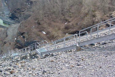
Stairs on Gathright Dam
-
Road over Gathright Dam [02]
![Road over Gathright Dam [02] (1607 visits) Road carrying traffic over Gathright Dam, an earthen and rolled rock-fill embankment dam on the Jack... Road over Gathright Dam [02]](../../../../i/upload/2024/07/14/20240714102132-396c8a23-cu_s9999x250.jpg)
-
Road over Gathright Dam [01]
![Road over Gathright Dam [01] (1659 visits) Road carrying traffic over Gathright Dam, an earthen and rolled rock-fill embankment dam on the Jack... Road over Gathright Dam [01]](../../../../i/upload/2024/07/14/20240714102138-0aa862c7-cu_s9999x250.jpg)
-
No parking sign on Gathright Dam [01]
![No parking sign on Gathright Dam [01] (1964 visits) "No parking" sign on the road over Gathright Dam. Parking is prohibited on the dam itself... No parking sign on Gathright Dam [01]](../../../../i/upload/2024/07/14/20240714102141-459f947d-cu_s9999x250.jpg)
-
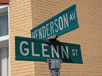
Henderson Avenue and Glenn Street
-
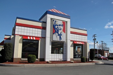
KFC in Cumberland, Maryland
-
Railroad crossbuck

-
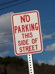
"No parking this side of street"
-
Railroad crossing lights at Baltimore Street

-
Queen City Pavement
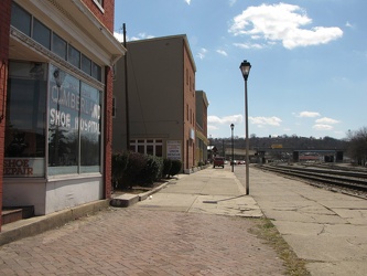
-
Baltimore and Centre Streets

-
Davidson Street and Henderson Avenue

-
Right Lane Must Turn Right
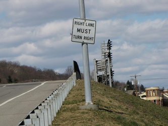
-
Highway signs
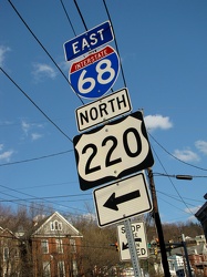
-
Town Clock Church [01]
![Town Clock Church [01] (2447 visits) Town Clock Church in Cumberland, Maryland. When built in 1848, the church housed a German Lutheran ... Town Clock Church [01]](../../../../i/upload/2024/07/17/20240717155521-7a20fd18-cu_s9999x250.jpg)
-
Town Clock Church [02]
![Town Clock Church [02] (5626 visits) Town Clock Church in Cumberland, Maryland. When built in 1848, the church housed a German Lutheran ... Town Clock Church [02]](../../../../i/upload/2024/07/17/20240717155523-f0ffe295-cu_s9999x250.jpg)
-
Town Clock Church [03]
![Town Clock Church [03] (2381 visits) Town Clock Church in Cumberland, Maryland. When built in 1848, the church housed a German Lutheran ... Town Clock Church [03]](../../../../i/upload/2024/07/17/20240717155526-21937ab9-cu_s9999x250.jpg)
-
House with deteriorated uppermost level
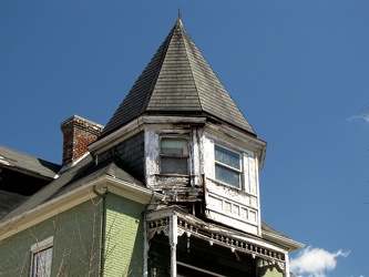
-
600 block of Elm Street
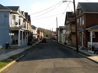
-
211 Emily Street
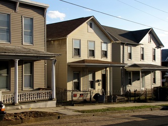
-
Painted houses on Bedford Street [01]
![Painted houses on Bedford Street [01] (1618 visits) Colorfully-painted houses north of Town Clock Church on Bedford Street, in Cumberland, Maryland.
Mo... Painted houses on Bedford Street [01]](../../../../i/upload/2024/07/17/20240717155535-b4ea2874-cu_s9999x250.jpg)
-
Painted houses on Bedford Street [02]
![Painted houses on Bedford Street [02] (1769 visits) Colorfully-painted houses north of Town Clock Church on Bedford Street, in Cumberland, Maryland.
Mo... Painted houses on Bedford Street [02]](../../../../i/upload/2024/07/17/20240717155538-19e06137-cu_s9999x250.jpg)
-
Painted houses on Bedford Street [03]
![Painted houses on Bedford Street [03] (2686 visits) Colorfully-painted houses north of Town Clock Church on Bedford Street, in Cumberland, Maryland.
Mo... Painted houses on Bedford Street [03]](../../../../i/upload/2024/07/17/20240717155540-a8ec7127-cu_s9999x250.jpg)
-
416 Park Street
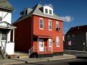
-
310 Park Street
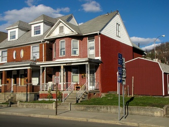
-
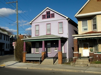
300 Park Street
-
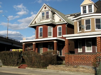
402 Park Street
-
Satellite dish on roof of home

-
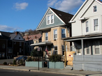
216 Park Street
-
Town Clock Church [04]
![Town Clock Church [04] (2454 visits) Town Clock Church in Cumberland, Maryland. When built in 1848, the church housed a German Lutheran c... Town Clock Church [04]](../../../../i/upload/2024/07/17/20240717155935-000292cc-cu_s9999x250.jpg)
-
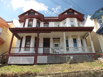
Maroon and white house on Bedford Street
-
Kia Soul on the Blue Ridge Parkway

-
"Littering is illegal" sign [01]
!["Littering is illegal" sign [01] (1665 visits) Sign on US Route 11 in Weyers Cave, Virginia reminding drivers that littering is illegal. I've alwa... "Littering is illegal" sign [01]](../../../../i/upload/2024/07/19/20240719124007-1b4f030c-cu_s9999x250.jpg)
-
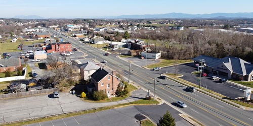
View up Route 11 from above Verona Fire Department
-
Forest Springs Drive [02]
![Forest Springs Drive [02] (3231 visits) Aerial view of Forest Springs Drive, a residential street in Stuarts Draft, Virginia. View facing n... Forest Springs Drive [02]](../../../../i/upload/2024/07/19/20240719130110-e8de25d6-cu_s9999x250.jpg)
-
Forest Springs Drive [03]
![Forest Springs Drive [03] (3353 visits) Aerial view of Forest Springs Drive, a residential street in Stuarts Draft, Virginia. View facing s... Forest Springs Drive [03]](../../../../i/upload/2024/07/19/20240719130115-cc787080-cu_s9999x250.jpg)
-
US 29 Business in Culpeper, Virginia [01]
![US 29 Business in Culpeper, Virginia [01] (3114 visits) Aerial view of US 29 Business on the north side of Culpeper, Virginia. View facing approximately ea... US 29 Business in Culpeper, Virginia [01]](../../../../i/upload/2024/07/19/20240719155959-cf1d0444-cu_s9999x250.jpg)
-
Springer Road and Sugarcamp Lane [01]
![Springer Road and Sugarcamp Lane [01] (2702 visits) Aerial view of Springer Road and Sugarcamp Lane, which together form a single residential street in ... Springer Road and Sugarcamp Lane [01]](../../../../i/upload/2024/07/19/20240719160916-bbfef2f3-cu_s9999x250.jpg)
-
Springer Road and Sugarcamp Lane [02]
![Springer Road and Sugarcamp Lane [02] (2782 visits) Aerial view of Springer Road and Sugarcamp Lane, which together form a single residential street in ... Springer Road and Sugarcamp Lane [02]](../../../../i/upload/2024/07/19/20240719160920-a73a3b63-cu_s9999x250.jpg)
-
Forest Springs Drive [04]
![Forest Springs Drive [04] (2552 visits) Aerial view of Forest Springs Drive, a residential street in Stuarts Draft, Virginia, facing north.
... Forest Springs Drive [04]](../../../../i/upload/2024/07/19/20240719160944-be5023e1-cu_s9999x250.jpg)
-
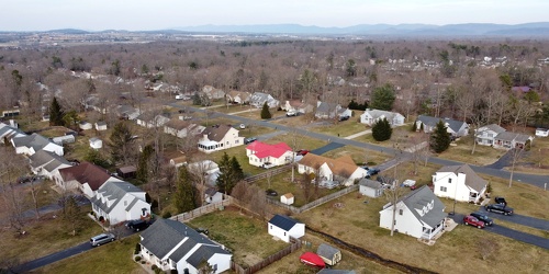
Cooper Drive
-
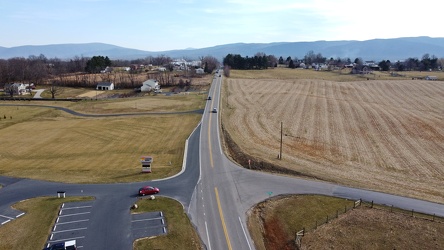
Tinkling Spring Road at Churchmans Mill Road
-
US 340 in Charles Town [03]
![US 340 in Charles Town [03] (3186 visits) US 340 in Charles Town, West Virginia, east of the interchange with West Virginia Route 9.
Ben Schu... US 340 in Charles Town [03]](../../../../i/upload/2024/07/19/20240719162153-ebf4366a-cu_s9999x250.jpg)
-
US 340 in Charles Town [02]
![US 340 in Charles Town [02] (3171 visits) US 340 in Charles Town, West Virginia, east of the interchange with West Virginia Route 9.
Ben Schu... US 340 in Charles Town [02]](../../../../i/upload/2024/07/19/20240719162156-6d3ecd1b-cu_s9999x250.jpg)
-
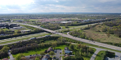
Intersection of US 340 and West Virginia Routes 9 and 51
-
US 340 in Charles Town [01]
![US 340 in Charles Town [01] (3213 visits) US 340 in Charles Town, West Virginia, east of the interchange with West Virginia Route 9.
Ben Schu... US 340 in Charles Town [01]](../../../../i/upload/2024/07/19/20240719162259-85e9531c-cu_s9999x250.jpg)
-
US 29 Business in Culpeper, Virginia [02]
![US 29 Business in Culpeper, Virginia [02] (457491 visits) Aerial view of US 29 Business on the north side of Culpeper, Virginia. View facing approximately we... US 29 Business in Culpeper, Virginia [02]](../../../../i/upload/2024/07/19/20240719165937-abc06307-cu_s9999x250.jpg)
-
Fairfield, Pennsylvania [04]
![Fairfield, Pennsylvania [04] (1386 visits) Aerial view of Fairfield, a town in Adams County, Pennsylvania. The air was a bit hazy on this part... Fairfield, Pennsylvania [04]](../../../../i/upload/2024/07/19/20240719170847-3476ba0d-cu_s9999x250.jpg)
-
Fairfield, Pennsylvania [03]
![Fairfield, Pennsylvania [03] (1387 visits) Aerial view of Fairfield, a town in Adams County, Pennsylvania. The air was a bit hazy on this part... Fairfield, Pennsylvania [03]](../../../../i/upload/2024/07/19/20240719170851-b2637bb8-cu_s9999x250.jpg)
-
Fairfield, Pennsylvania [02]
![Fairfield, Pennsylvania [02] (1438 visits) Aerial view of Fairfield, a town in Adams County, Pennsylvania. The air was a bit hazy on this part... Fairfield, Pennsylvania [02]](../../../../i/upload/2024/07/19/20240719170855-9f47cc5b-cu_s9999x250.jpg)
-
Fairfield, Pennsylvania [01]
![Fairfield, Pennsylvania [01] (1291 visits) Aerial view of Fairfield, a town in Adams County, Pennsylvania. The air was a bit hazy on this part... Fairfield, Pennsylvania [01]](../../../../i/upload/2024/07/19/20240719170859-7a4b7262-cu_s9999x250.jpg)
-
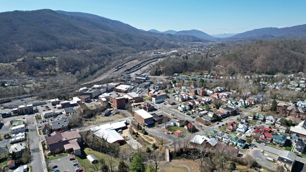
Downtown Clifton Forge, Virginia
-
Neighborhood in Clifton Forge, Virginia [01]
![Neighborhood in Clifton Forge, Virginia [01] (1156 visits) Aerial view of a neighborhood in Clifton Forge, Virginia, near downtown.
Ben Schumin is a professio... Neighborhood in Clifton Forge, Virginia [01]](../../../../i/upload/2024/07/20/20240720021719-e5828a4e-cu_s9999x250.jpg)
-
Neighborhood in Clifton Forge, Virginia [02]
![Neighborhood in Clifton Forge, Virginia [02] (1325 visits) Aerial view of a neighborhood in Clifton Forge, Virginia, near downtown.
Ben Schumin is a professio... Neighborhood in Clifton Forge, Virginia [02]](../../../../i/upload/2024/07/20/20240720021736-578bac29-cu_s9999x250.jpg)
-
View from Shenandoah Mountain [01]
![View from Shenandoah Mountain [01] (1262 visits) View of Highland County, Virginia from Shenandoah Mountain.
Ben Schumin is a professional photograp... View from Shenandoah Mountain [01]](../../../../i/upload/2024/07/20/20240720093931-b1561721-cu_s9999x250.jpg)
-
"Littering is illegal" sign [02]
!["Littering is illegal" sign [02] (2944 visits) Sign along US 250 at the border between Augusta and Highland Counties in Virginia, reminding drivers... "Littering is illegal" sign [02]](../../../../i/upload/2024/07/20/20240720094020-cdd34053-cu_s9999x250.jpg)
-
Hairpin turn on US 250 [01]
![Hairpin turn on US 250 [01] (2783 visits) Hairpin turn on US 250 in Highland County, Virginia, as it ascends Shenandoah Mountain.
Ben Schumin... Hairpin turn on US 250 [01]](../../../../i/upload/2024/07/20/20240720094126-511d5875-cu_s9999x250.jpg)
-
Hairpin turn on US 250 [02]
![Hairpin turn on US 250 [02] (2836 visits) Hairpin turn on US 250 in Highland County, Virginia, as it ascends Shenandoah Mountain.
Ben Schumin... Hairpin turn on US 250 [02]](../../../../i/upload/2024/07/20/20240720094131-dc588684-cu_s9999x250.jpg)
-
View from Shenandoah Mountain [03]
![View from Shenandoah Mountain [03] (1342 visits) View of Highland County, Virginia from Shenandoah Mountain.
Ben Schumin is a professional photograp... View from Shenandoah Mountain [03]](../../../../i/upload/2024/07/20/20240720094136-fc1446fb-cu_s9999x250.jpg)
-
View from Shenandoah Mountain [02]
![View from Shenandoah Mountain [02] (1299 visits) View of Highland County, Virginia from Shenandoah Mountain.
Ben Schumin is a professional photograp... View from Shenandoah Mountain [02]](../../../../i/upload/2024/07/20/20240720094312-c9f54fe4-cu_s9999x250.jpg)
-
Forest Springs Estates [01]
![Forest Springs Estates [01] (2202 visits) Aerial view of the Forest Springs Estates neighborhood in Stuarts Draft, Virginia, taken from approx... Forest Springs Estates [01]](../../../../i/upload/2024/07/20/20240720103408-ac9f7d40-cu_s9999x250.jpg)
-
Forest Springs Estates [02]
![Forest Springs Estates [02] (2789 visits) Aerial view of the Forest Springs Estates neighborhood in Stuarts Draft, Virginia, taken from approx... Forest Springs Estates [02]](../../../../i/upload/2024/07/20/20240720103645-80215d0c-cu_s9999x250.jpg)
-
Forest Springs Estates [03]
![Forest Springs Estates [03] (2755 visits) Aerial view of the Forest Springs Estates neighborhood in Stuarts Draft, Virginia, showing the inter... Forest Springs Estates [03]](../../../../i/upload/2024/07/20/20240720103650-60296a18-cu_s9999x250.jpg)
-
Forest Springs Estates [04]
![Forest Springs Estates [04] (2804 visits) Aerial view of the Forest Springs Estates neighborhood in Stuarts Draft, Virginia, showing Ceocia La... Forest Springs Estates [04]](../../../../i/upload/2024/07/20/20240720103655-f8465d58-cu_s9999x250.jpg)
-
Forest Springs Estates [05]
![Forest Springs Estates [05] (1741 visits) Aerial view of the Forest Springs Estates neighborhood in Stuarts Draft, Virginia, taken above the i... Forest Springs Estates [05]](../../../../i/upload/2024/07/20/20240720103700-12ed86ac-cu_s9999x250.jpg)
-
Forest Springs Estates [06]
![Forest Springs Estates [06] (1612 visits) Aerial view of the Forest Springs Estates neighborhood in Stuarts Draft, Virginia, facing south.
Be... Forest Springs Estates [06]](../../../../i/upload/2024/07/20/20240720103705-68728b22-cu_s9999x250.jpg)
-
Forest Springs Estates [07]
![Forest Springs Estates [07] (2858 visits) Aerial view of the Forest Springs Estates neighborhood in Stuarts Draft, Virginia, showing the inter... Forest Springs Estates [07]](../../../../i/upload/2024/07/20/20240720103710-4e810037-cu_s9999x250.jpg)
-
Forest Springs Estates [08]
![Forest Springs Estates [08] (2903 visits) Aerial view of the Forest Springs Estates neighborhood in Stuarts Draft, Virginia, showing Clements ... Forest Springs Estates [08]](../../../../i/upload/2024/07/20/20240720103715-d25d2920-cu_s9999x250.jpg)
-
Forest Springs Estates [09]
![Forest Springs Estates [09] (2864 visits) Aerial view of the Forest Springs Estates neighborhood in Stuarts Draft, Virginia, showing Tomahawk ... Forest Springs Estates [09]](../../../../i/upload/2024/07/20/20240720103720-56045695-cu_s9999x250.jpg)
-
Forest Springs Estates [10]
![Forest Springs Estates [10] (1686 visits) Aerial view of the Forest Springs Estates neighborhood in Stuarts Draft, Virginia, taken from above ... Forest Springs Estates [10]](../../../../i/upload/2024/07/20/20240720103726-e7eeb2c5-cu_s9999x250.jpg)
-
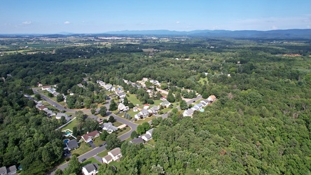
Southeastern end of Ridgeview Acres
-
Aerial view of Charles Town, West Virginia [01]
![Aerial view of Charles Town, West Virginia [01] (1678 visits) Aerial view of Charles Town, West Virginia, from above the downtown area.
Ben Schumin is a professi... Aerial view of Charles Town, West Virginia [01]](../../../../i/upload/2024/07/20/20240720103949-f4346f4c-cu_s9999x250.jpg)
-
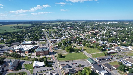
Aerial view of Charles Town and Ranson, West Virginia
-
Aerial view of Charles Town, West Virginia [03]
![Aerial view of Charles Town, West Virginia [03] (2502 visits) Aerial view of Charles Town, West Virginia, from above the downtown area.
Ben Schumin is a professi... Aerial view of Charles Town, West Virginia [03]](../../../../i/upload/2024/07/20/20240720104008-7857c00b-cu_s9999x250.jpg)
-
Aerial view of Charles Town, West Virginia [02]
![Aerial view of Charles Town, West Virginia [02] (1485 visits) Aerial view of Charles Town, West Virginia, from above the downtown area.
Ben Schumin is a professi... Aerial view of Charles Town, West Virginia [02]](../../../../i/upload/2024/07/20/20240720104018-5b8b2fcf-cu_s9999x250.jpg)
-
Aerial view of downtown Crossville, Tennessee [01]
![Aerial view of downtown Crossville, Tennessee [01] (2431 visits) Aerial view of downtown Crossville, Tennessee.
More at The Schumin Web:
www.schuminweb.com/life-and... Aerial view of downtown Crossville, Tennessee [01]](../../../../i/upload/2024/07/20/20240720113721-1bd631e7-cu_s9999x250.jpg)
-
Aerial view of downtown Crossville, Tennessee [02]
![Aerial view of downtown Crossville, Tennessee [02] (1323 visits) Aerial view of downtown Crossville, Tennessee.
More at The Schumin Web:
www.schuminweb.com/life-and... Aerial view of downtown Crossville, Tennessee [02]](../../../../i/upload/2024/07/20/20240720113738-e7992a54-cu_s9999x250.jpg)
-
Aerial view of downtown Crossville, Tennessee [03]
![Aerial view of downtown Crossville, Tennessee [03] (2456 visits) Aerial view of downtown Crossville, Tennessee.
More at The Schumin Web:
www.schuminweb.com/life-and... Aerial view of downtown Crossville, Tennessee [03]](../../../../i/upload/2024/07/20/20240720113748-d1062940-cu_s9999x250.jpg)
-
West Dumplin Valley Road [03]
![West Dumplin Valley Road [03] (2877 visits) Businesses along West Dumplin Valley Road, which runs just south of Interstate 40, in Sevierville, T... West Dumplin Valley Road [03]](../../../../i/upload/2024/07/20/20240720120238-68c626bc-cu_s9999x250.jpg)
-
West Dumplin Valley Road [02]
![West Dumplin Valley Road [02] (2848 visits) Businesses along West Dumplin Valley Road, which runs just south of Interstate 40, in Sevierville, T... West Dumplin Valley Road [02]](../../../../i/upload/2024/07/20/20240720120306-846e6bb2-cu_s9999x250.jpg)