-
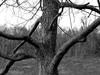
Tree at scenic overlook
-
Sunset from I-64 overlook [03]
![Sunset from I-64 overlook [03] (1753 visits) Sunset, viewed from the scenic overlook at milepost 103 on Interstate 64 eastbound in Albemarle Coun... Sunset from I-64 overlook [03]](../../../i/upload/2024/07/13/20240713234247-066d4e9b-cu_s9999x250.jpg)
-
Sunset from I-64 overlook [01]
![Sunset from I-64 overlook [01] (1733 visits) Sunset, viewed from the scenic overlook at milepost 103 on Interstate 64 eastbound in Albemarle Coun... Sunset from I-64 overlook [01]](../../../i/upload/2024/07/13/20240713234248-69674cad-cu_s9999x250.jpg)
-
Sunset from I-64 overlook [02]
![Sunset from I-64 overlook [02] (1739 visits) Sunset, viewed from the scenic overlook at milepost 103 on Interstate 64 eastbound in Albemarle Coun... Sunset from I-64 overlook [02]](../../../i/upload/2024/07/13/20240713234249-3f6e970a-cu_s9999x250.jpg)
-
Sunset from I-64 overlook [04]
![Sunset from I-64 overlook [04] (1712 visits) Sunset, viewed from the scenic overlook at milepost 103 on Interstate 64 eastbound in Albemarle Coun... Sunset from I-64 overlook [04]](../../../i/upload/2024/07/13/20240713234251-97a8e10e-cu_s9999x250.jpg)
-
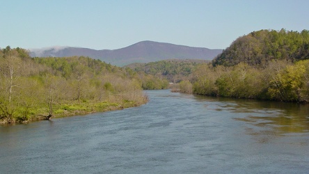
View of James River from Harry Flood Byrd Bridge
-
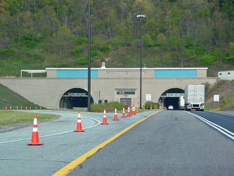
Tuscarora Mountain Tunnel western portal
-
Kittatinny Mountain Tunnel [02]
![Kittatinny Mountain Tunnel [02] (3342 visits) Western portal of the Kittatinny Mountain Tunnel, one of four tunnels on the Pennsylvania Turnpike m... Kittatinny Mountain Tunnel [02]](../../../i/upload/2024/07/15/20240715141344-fd6f497d-cu_s9999x250.jpg)
-
Kittatinny Mountain Tunnel [01]
![Kittatinny Mountain Tunnel [01] (3215 visits) Western portal of the Kittatinny Mountain Tunnel, one of four tunnels on the Pennsylvania Turnpike m... Kittatinny Mountain Tunnel [01]](../../../i/upload/2024/07/15/20240715141346-ee46943a-cu_s9999x250.jpg)
-
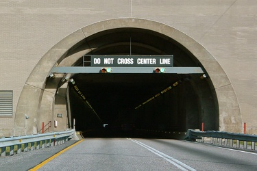
Western portal of Blue Mountain Tunnel
-
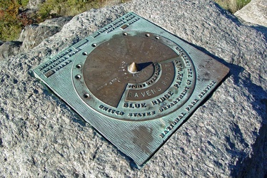
Plaque at Raven's Roost overlook
-
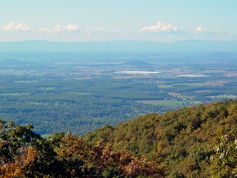
View from Raven's Roost
-
View from 20-Minute Cliff overlook [03]
![View from 20-Minute Cliff overlook [03] (1398 visits) View from 20-Minute Cliff, an overlook on the Blue Ridge Parkway near Vesuvius, Virginia.
Ben Schum... View from 20-Minute Cliff overlook [03]](../../../i/upload/2024/07/15/20240715141705-52871955-cu_s9999x250.jpg)
-
Stream at Yankee Horse Ridge [01]
![Stream at Yankee Horse Ridge [01] (1607 visits) Stream with small waterfall at the Yankee Horse Ridge overlook, on the Blue Ridge Parkway near Monte... Stream at Yankee Horse Ridge [01]](../../../i/upload/2024/07/15/20240715141706-0b231326-cu_s9999x250.jpg)
-
Stream at Yankee Horse Ridge [01]
![Stream at Yankee Horse Ridge [01] (1608 visits) Stream with small waterfall at the Yankee Horse Ridge overlook, on the Blue Ridge Parkway near Monte... Stream at Yankee Horse Ridge [01]](../../../i/upload/2024/07/15/20240715141708-6e96c46a-cu_s9999x250.jpg)
-
Stream at Yankee Horse Ridge [01]
![Stream at Yankee Horse Ridge [01] (1500 visits) Stream with small waterfall at the Yankee Horse Ridge overlook, on the Blue Ridge Parkway near Monte... Stream at Yankee Horse Ridge [01]](../../../i/upload/2024/07/15/20240715141709-62daf30c-cu_s9999x250.jpg)
-
Stream at Yankee Horse Ridge [01]
![Stream at Yankee Horse Ridge [01] (1832 visits) Stream with small waterfall at the Yankee Horse Ridge overlook, on the Blue Ridge Parkway near Monte... Stream at Yankee Horse Ridge [01]](../../../i/upload/2024/07/15/20240715141711-08c8936c-cu_s9999x250.jpg)
-
Mercury Sable with ground lighting illuminated [01]
![Mercury Sable with ground lighting illuminated [01] (3217 visits) My 2004 Mercury Sable wagon with the ground-facing lights and the interior lights illuminated on the... Mercury Sable with ground lighting illuminated [01]](../../../i/upload/2024/07/15/20240715141712-6e4690ee-cu_s9999x250.jpg)
-
Stream at Yankee Horse Ridge [01]
![Stream at Yankee Horse Ridge [01] (1709 visits) Stream with small waterfall at the Yankee Horse Ridge overlook, on the Blue Ridge Parkway near Monte... Stream at Yankee Horse Ridge [01]](../../../i/upload/2024/07/15/20240715141714-3facf0fc-cu_s9999x250.jpg)
-
Mercury Sable with ground lighting illuminated [02]
![Mercury Sable with ground lighting illuminated [02] (3236 visits) My 2004 Mercury Sable wagon with the ground-facing lights and the interior lights illuminated on the... Mercury Sable with ground lighting illuminated [02]](../../../i/upload/2024/07/15/20240715141715-42969fcc-cu_s9999x250.jpg)
-
View from 20-Minute Cliff overlook [04]
![View from 20-Minute Cliff overlook [04] (1453 visits) View from 20-Minute Cliff, an overlook on the Blue Ridge Parkway near Vesuvius, Virginia.
Ben Schum... View from 20-Minute Cliff overlook [04]](../../../i/upload/2024/07/15/20240715204738-5eb438f6-cu_s9999x250.jpg)
-
Pedestrian tunnel under Queen City Drive

-
Anarchy sign painted in Cumberland, Maryland pedestrian tunnel

-
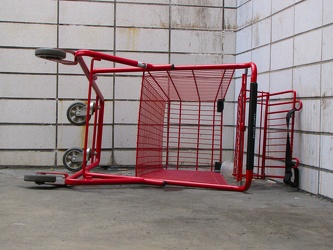
Abandoned shopping cart
-
James River [01]
![James River [01] (1186 visits) The James River, viewed from the pedestrian level of the Harry Flood Byrd Memorial Bridge (carrying ... James River [01]](../../../i/upload/2024/07/17/20240717232305-0495181a-cu_s9999x250.jpg)
-
James River [02]
![James River [02] (1322 visits) The James River, viewed from the pedestrian level of the Harry Flood Byrd Memorial Bridge (carrying ... James River [02]](../../../i/upload/2024/07/17/20240717232307-fe5f228d-cu_s9999x250.jpg)
-
Potomac River viewed from Hilltop House
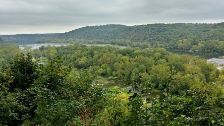
 View from Hilltop House
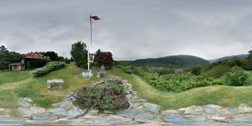
 South Mountain rest area, westbound [01]
![South Mountain rest area, westbound [01] (3192 visits) South Mountain rest area and welcome center on Interstate 70 westbound in Frederick County, Maryland... South Mountain rest area, westbound [01]](../../../i/upload/2024/07/17/20240717233435-e2f89cc0-cu_s9999x250.jpg)
 South Mountain rest area, westbound [02]
![South Mountain rest area, westbound [02] (3235 visits) South Mountain rest area and welcome center on Interstate 70 westbound in Frederick County, Maryland... South Mountain rest area, westbound [02]](../../../i/upload/2024/07/17/20240717233440-268e200a-cu_s9999x250.jpg)
 South Mountain rest area, westbound [03]
![South Mountain rest area, westbound [03] (3454 visits) South Mountain rest area and welcome center on Interstate 70 westbound in Frederick County, Maryland... South Mountain rest area, westbound [03]](../../../i/upload/2024/07/17/20240717233445-c0e160fc-cu_s9999x250.jpg)
 South Mountain rest area, westbound [04]
![South Mountain rest area, westbound [04] (3224 visits) South Mountain rest area and welcome center on Interstate 70 westbound in Frederick County, Maryland... South Mountain rest area, westbound [04]](../../../i/upload/2024/07/17/20240717233450-8d5d68a3-cu_s9999x250.jpg)
 South Mountain rest area, westbound [05]
![South Mountain rest area, westbound [05] (3278 visits) South Mountain rest area and welcome center on Interstate 70 westbound in Frederick County, Maryland... South Mountain rest area, westbound [05]](../../../i/upload/2024/07/17/20240717233455-aa6194ef-cu_s9999x250.jpg)
 Sideling Hill rest area [01]
![Sideling Hill rest area [01] (2058 visits) Eastbound side of the Sideling Hill rest area, located along Interstate 68 in Washington County, Mar... Sideling Hill rest area [01]](../../../i/upload/2024/07/17/20240717233459-e7ba195c-cu_s9999x250.jpg)
 Sideling Hill rest area [02]
![Sideling Hill rest area [02] (1895 visits) Eastbound access to the footbridge across the highway at the Sideling Hill rest area, located along ... Sideling Hill rest area [02]](../../../i/upload/2024/07/17/20240717233505-c4590774-cu_s9999x250.jpg)
 Sideling Hill rest area [03]
![Sideling Hill rest area [03] (1777 visits) Footbridge across Interstate 68, allowing views of the cut through the mountain, at the Sideling Hil... Sideling Hill rest area [03]](../../../i/upload/2024/07/17/20240717233511-e61616ff-cu_s9999x250.jpg)
 Sideling Hill rest area [04]
![Sideling Hill rest area [04] (1910 visits) Westbound access to the footbridge across the highway at the Sideling Hill rest area, located along ... Sideling Hill rest area [04]](../../../i/upload/2024/07/17/20240717233516-e5cc17b4-cu_s9999x250.jpg)
 Sideling Hill rest area [05]
![Sideling Hill rest area [05] (1827 visits) Path to the westbound parking area and restrooms at the Sideling Hill rest area, located along Inter... Sideling Hill rest area [05]](../../../i/upload/2024/07/17/20240717233521-b99b80cb-cu_s9999x250.jpg)
 Sideling Hill rest area [06]
![Sideling Hill rest area [06] (1766 visits) Stairs to a raised viewing area on the eastbound side of the Sideling Hill rest area, located along ... Sideling Hill rest area [06]](../../../i/upload/2024/07/17/20240717233527-43e4656c-cu_s9999x250.jpg)
 Sideling Hill rest area [07]
![Sideling Hill rest area [07] (1916 visits) Raised viewing area on the eastbound side of the Sideling Hill rest area, located along Interstate 6... Sideling Hill rest area [07]](../../../i/upload/2024/07/17/20240717233531-9f6ca0ea-cu_s9999x250.jpg)
 Sideling Hill rest area [08]
![Sideling Hill rest area [08] (2026 visits) Eastbound parking lot at the Sideling Hill rest area, located along Interstate 68 in Washington Coun... Sideling Hill rest area [08]](../../../i/upload/2024/07/17/20240717233537-4406b863-cu_s9999x250.jpg)
 Sideling Hill rest area [09]
![Sideling Hill rest area [09] (2077 visits) Eastbound parking lot at the Sideling Hill rest area, located along Interstate 68 in Washington Coun... Sideling Hill rest area [09]](../../../i/upload/2024/07/17/20240717233542-efb1100b-cu_s9999x250.jpg)
 Sideling Hill rest area [10]
![Sideling Hill rest area [10] (1938 visits) Eastbound side of the Sideling Hill rest area, located along Interstate 68 in Washington County, Mar... Sideling Hill rest area [10]](../../../i/upload/2024/07/17/20240717233547-516b9676-cu_s9999x250.jpg)
-
Footbridge over Interstate 68 at Sideling Hill
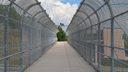
-
Rainstorm near Sideling Hill cut
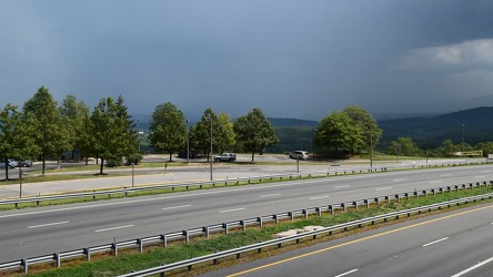
-
Interstate 68 cut through Sideling Hill [04]
![Interstate 68 cut through Sideling Hill [04] (1988 visits) Cut in Sideling Hill, carrying Interstate 68 between Washington and Allegany Counties in Maryland.
... Interstate 68 cut through Sideling Hill [04]](../../../i/upload/2024/07/18/20240718220107-eeb97b29-cu_s9999x250.jpg)
-
Interstate 68 cut through Sideling Hill [03]
![Interstate 68 cut through Sideling Hill [03] (1752 visits) Cut in Sideling Hill, carrying Interstate 68 between Washington and Allegany Counties in Maryland.
... Interstate 68 cut through Sideling Hill [03]](../../../i/upload/2024/07/18/20240718220111-2f9132e9-cu_s9999x250.jpg)
-
Interstate 68 cut through Sideling Hill [02]
![Interstate 68 cut through Sideling Hill [02] (3215 visits) Cut in Sideling Hill, carrying Interstate 68 between Washington and Allegany Counties in Maryland.
... Interstate 68 cut through Sideling Hill [02]](../../../i/upload/2024/07/18/20240718220116-e8da0915-cu_s9999x250.jpg)
-
Interstate 68 cut through Sideling Hill [01]
![Interstate 68 cut through Sideling Hill [01] (3725 visits) Cut in Sideling Hill, carrying Interstate 68 between Washington and Allegany Counties in Maryland.
... Interstate 68 cut through Sideling Hill [01]](../../../i/upload/2024/07/18/20240718220120-0789991f-cu_s9999x250.jpg)
-
Sideling Hill cut
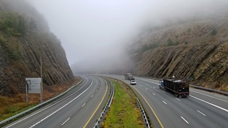
-
Potomac River from US 340 bridge [03]
![Potomac River from US 340 bridge [03] (1043 visits) The Potomac River, viewed from the US 340 bridge between Maryland and Virginia.
Ben Schumin is a pr... Potomac River from US 340 bridge [03]](../../../i/upload/2024/07/19/20240719103359-b66380e8-cu_s9999x250.jpg)
-
Potomac River from US 340 bridge [04]
![Potomac River from US 340 bridge [04] (1120 visits) The Potomac River, viewed from the US 340 bridge between Maryland and Virginia.
Ben Schumin is a pr... Potomac River from US 340 bridge [04]](../../../i/upload/2024/07/19/20240719103405-18d26a8b-cu_s9999x250.jpg)
-
Potomac River from US 340 bridge [05]
![Potomac River from US 340 bridge [05] (1138 visits) The Potomac River, viewed from the US 340 bridge between Maryland and Virginia.
Ben Schumin is a pr... Potomac River from US 340 bridge [05]](../../../i/upload/2024/07/19/20240719103412-5b42c5b9-cu_s9999x250.jpg)
-
South Mountain rest area and welcome center, westbound [02]
![South Mountain rest area and welcome center, westbound [02] (1225 visits) Restroom building at the South Mountain rest area and welcome center on Interstate 70 westbound in F... South Mountain rest area and welcome center, westbound [02]](../../../i/upload/2024/07/19/20240719104930-9f63ecbf-cu_s9999x250.jpg)
-
South Mountain rest area and welcome center, westbound [01]
![South Mountain rest area and welcome center, westbound [01] (1186 visits) Restroom building at the South Mountain rest area and welcome center on Interstate 70 westbound in F... South Mountain rest area and welcome center, westbound [01]](../../../i/upload/2024/07/19/20240719104934-09257e0d-cu_s9999x250.jpg)
-
Interstate 64 in Nelson County, Virginia [01]
![Interstate 64 in Nelson County, Virginia [01] (10553 visits) Interstate 64 in Nelson County, Virginia, near Rockfish Gap. US 250 runs adjacent to the freeway.
... Interstate 64 in Nelson County, Virginia [01]](../../../i/upload/2024/07/19/20240719115200-c8a2ce39-cu_s9999x250.jpg)
-
Interstate 64 in Nelson County, Virginia [02]
![Interstate 64 in Nelson County, Virginia [02] (10710 visits) Interstate 64 in Nelson County, Virginia, near Rockfish Gap. US 250 runs adjacent to the freeway.
... Interstate 64 in Nelson County, Virginia [02]](../../../i/upload/2024/07/19/20240719115847-184fa12a-cu_s9999x250.jpg)
-
Interstate 64 in Nelson County, Virginia [03]
![Interstate 64 in Nelson County, Virginia [03] (10894 visits) Interstate 64 in Nelson County, Virginia, near Rockfish Gap. US 250 runs adjacent to the freeway.
... Interstate 64 in Nelson County, Virginia [03]](../../../i/upload/2024/07/19/20240719115902-ff5fb9e1-cu_s9999x250.jpg)
-
Interstate 64 near Rockfish Gap [01]
![Interstate 64 near Rockfish Gap [01] (65884 visits) Interstate 64, near Rockfish Gap in Virginia.
Ben Schumin is a professional photographer who captur... Interstate 64 near Rockfish Gap [01]](../../../i/upload/2024/07/19/20240719120555-d0d3c2ce-cu_s9999x250.jpg)
-
Interstate 64 near Rockfish Gap [02]
![Interstate 64 near Rockfish Gap [02] (2909 visits) Interstate 64, near Rockfish Gap in Virginia. The bridge in the foreground carries Skyline Drive ov... Interstate 64 near Rockfish Gap [02]](../../../i/upload/2024/07/19/20240719120604-e2ad25dd-cu_s9999x250.jpg)
-
Interstate 64 near Rockfish Gap [03]
![Interstate 64 near Rockfish Gap [03] (2916 visits) Interstate 64, near Rockfish Gap in Virginia. The bridge in the foreground carries Skyline Drive ov... Interstate 64 near Rockfish Gap [03]](../../../i/upload/2024/07/19/20240719120613-6e2190f6-cu_s9999x250.jpg)
-
Interstate 64 near Rockfish Gap [04]
![Interstate 64 near Rockfish Gap [04] (2925 visits) Interstate 64, near Rockfish Gap in Virginia. The bridge in the foreground carries Skyline Drive ov... Interstate 64 near Rockfish Gap [04]](../../../i/upload/2024/07/19/20240719120620-49d9b327-cu_s9999x250.jpg)
-
Interstate 64 near Rockfish Gap [05]
![Interstate 64 near Rockfish Gap [05] (10728 visits) Interstate 64, near Rockfish Gap in Virginia. The boundary between Augusta and Nelson Counties runs... Interstate 64 near Rockfish Gap [05]](../../../i/upload/2024/07/19/20240719120629-90e00218-cu_s9999x250.jpg)
-
Exit sign at South Mountain rest area [01]
![Exit sign at South Mountain rest area [01] (1947 visits) Exit sign in a restroom at the eastbound South Mountain rest area along Interstate 70 in Frederick C... Exit sign at South Mountain rest area [01]](../../../i/upload/2024/07/19/20240719122919-930ba30b-cu_s9999x250.jpg)
-
Exit sign at South Mountain rest area [03]
![Exit sign at South Mountain rest area [03] (2130 visits) Exit sign in a restroom at the eastbound South Mountain rest area along Interstate 70 in Frederick C... Exit sign at South Mountain rest area [03]](../../../i/upload/2024/07/19/20240719122923-c26813d4-cu_s9999x250.jpg)
-
Exit sign at South Mountain rest area [02]
![Exit sign at South Mountain rest area [02] (1964 visits) Exit sign in a restroom at the eastbound South Mountain rest area along Interstate 70 in Frederick C... Exit sign at South Mountain rest area [02]](../../../i/upload/2024/07/19/20240719122928-5400c48b-cu_s9999x250.jpg)
-
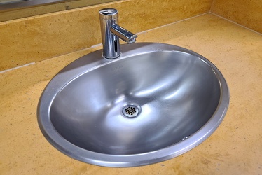
Sink at South Mountain rest area
-
Emergency lighting at South Mountain rest area [01]
![Emergency lighting at South Mountain rest area [01] (1464 visits) Emergency lighting in a restroom at the eastbound South Mountain rest area along Interstate 70 in Fr... Emergency lighting at South Mountain rest area [01]](../../../i/upload/2024/07/19/20240719122938-599d96e7-cu_s9999x250.jpg)
-
Emergency lighting at South Mountain rest area [02]
![Emergency lighting at South Mountain rest area [02] (1496 visits) Emergency lighting in a restroom at the eastbound South Mountain rest area along Interstate 70 in Fr... Emergency lighting at South Mountain rest area [02]](../../../i/upload/2024/07/19/20240719122942-cb6229f4-cu_s9999x250.jpg)
-
"Littering is illegal" sign [01]
!["Littering is illegal" sign [01] (1695 visits) Sign on US Route 11 in Weyers Cave, Virginia reminding drivers that littering is illegal. I've alwa... "Littering is illegal" sign [01]](../../../i/upload/2024/07/19/20240719124007-1b4f030c-cu_s9999x250.jpg)
-
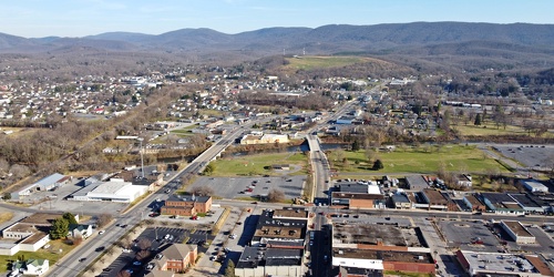
Main and Broad Streets, facing east
-
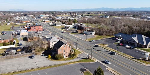
View up Route 11 from above Verona Fire Department
-
Downtown Waynesboro, Virginia, looking toward Invista [02]
![Downtown Waynesboro, Virginia, looking toward Invista [02] (4128 visits) Aerial view of downtown Waynesboro, Virginia, looking towards the Invista plant.
Ben Schumin is a p... Downtown Waynesboro, Virginia, looking toward Invista [02]](../../../i/upload/2024/07/19/20240719130254-ae1aac9d-cu_s9999x250.jpg)
-
US 29 Business in Culpeper, Virginia [01]
![US 29 Business in Culpeper, Virginia [01] (3155 visits) Aerial view of US 29 Business on the north side of Culpeper, Virginia. View facing approximately ea... US 29 Business in Culpeper, Virginia [01]](../../../i/upload/2024/07/19/20240719155959-cf1d0444-cu_s9999x250.jpg)
-
Richmond Avenue in Staunton, Virginia [01]
![Richmond Avenue in Staunton, Virginia [01] (66759 visits) Aerial view of Richmond Avenue (US 250) in Staunton, Virginia, near the intersection with Frontier D... Richmond Avenue in Staunton, Virginia [01]](../../../i/upload/2024/07/19/20240719161158-ddf9fe35-cu_s9999x250.jpg)
-
Richmond Avenue in Staunton, Virginia [02]
![Richmond Avenue in Staunton, Virginia [02] (66837 visits) Aerial view of Richmond Avenue (US 250) in Staunton, Virginia, near the intersection with Frontier D... Richmond Avenue in Staunton, Virginia [02]](../../../i/upload/2024/07/19/20240719161203-233bb776-cu_s9999x250.jpg)
-
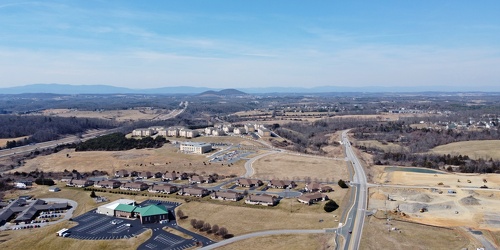
Fishersville, Virginia, near Augusta Health
-
Richmond Avenue in Staunton, Virginia [03]
![Richmond Avenue in Staunton, Virginia [03] (66662 visits) Aerial view of Richmond Avenue (US 250) in Staunton, Virginia, near the intersection with Community ... Richmond Avenue in Staunton, Virginia [03]](../../../i/upload/2024/07/19/20240719161212-297c1b53-cu_s9999x250.jpg)
-
Tinkling Spring Road at Churchmans Mill Road
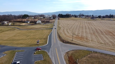
-
US 340 in Charles Town [03]
![US 340 in Charles Town [03] (3197 visits) US 340 in Charles Town, West Virginia, east of the interchange with West Virginia Route 9.
Ben Schu... US 340 in Charles Town [03]](../../../i/upload/2024/07/19/20240719162153-ebf4366a-cu_s9999x250.jpg)