-
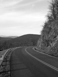
Blue Ridge Parkway at milepost 7
-
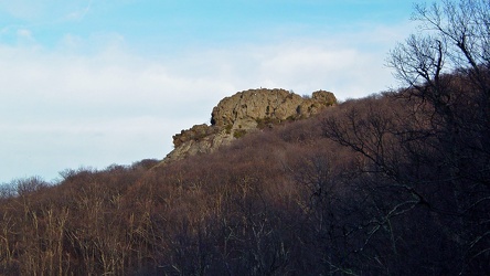
Humpback Rock, viewed from below
-
Cliff over the Blue Ridge Parkway [02]
![Cliff over the Blue Ridge Parkway [02] (2933 visits) Rock cliffs over the Blue Ridge Parkway, approximately seven miles south of Rockfish Gap.
Ben Schum... Cliff over the Blue Ridge Parkway [02]](../../../i/upload/2024/07/15/20240715141127-8869144a-cu_s9999x250.jpg)
-
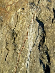
Thorns across a rock
-
Cliff over the Blue Ridge Parkway [01]
![Cliff over the Blue Ridge Parkway [01] (2778 visits) Rock cliffs over the Blue Ridge Parkway, approximately seven miles south of Rockfish Gap.
Ben Schum... Cliff over the Blue Ridge Parkway [01]](../../../i/upload/2024/07/15/20240715141130-0117e715-cu_s9999x250.jpg)
-
Sable at House Mountain overlook [03]
![Sable at House Mountain overlook [03] (44561 visits) My 2004 Mercury Sable wagon parked at the House Mountain overlook on the Blue Ridge Parkway.
Ben Sc... Sable at House Mountain overlook [03]](../../../i/upload/2024/07/15/20240715141155-0b59ff8d-cu_s9999x250.jpg)
-
Sable at Purgatory Mountain overlook [02]
![Sable at Purgatory Mountain overlook [02] (8314 visits) My 2004 Mercury Sable wagon parked at the Purgatory Mountain overlook on the Blue Ridge Parkway.
Be... Sable at Purgatory Mountain overlook [02]](../../../i/upload/2024/07/15/20240715141156-1bb2610c-cu_s9999x250.jpg)
-
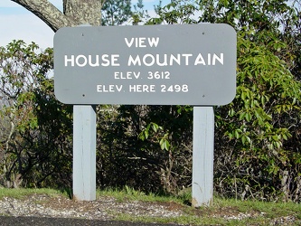
View, House Mountain
-
Sable at House Mountain overlook [01]
![Sable at House Mountain overlook [01] (46194 visits) My 2004 Mercury Sable wagon parked at the House Mountain overlook on the Blue Ridge Parkway.
Ben Sc... Sable at House Mountain overlook [01]](../../../i/upload/2024/07/15/20240715141200-4c36b7bf-cu_s9999x250.jpg)
-
View from House Mountain overlook
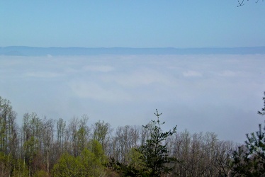
-
Sign at Otter Lake
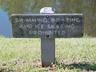
-
Sable at House Mountain overlook [02]
![Sable at House Mountain overlook [02] (43967 visits) My 2004 Mercury Sable wagon parked at the House Mountain overlook on the Blue Ridge Parkway.
Ben Sc... Sable at House Mountain overlook [02]](../../../i/upload/2024/07/15/20240715141204-5a5c8673-cu_s9999x250.jpg)
-
View from Purgatory Mountain overlook [03]
![View from Purgatory Mountain overlook [03] (2706 visits) View from the Purgatory Mountain overlook on the Blue Ridge Parkway in Botetourt County, Virginia.
... View from Purgatory Mountain overlook [03]](../../../i/upload/2024/07/15/20240715141205-a4661d8d-cu_s9999x250.jpg)
-
View of James River from Harry Flood Byrd Bridge
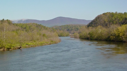
-
Harry Flood Byrd Bridge [01]
![Harry Flood Byrd Bridge [01] (2744 visits) Pedestrian level on the Harry Flood Byrd Memorial Bridge, which carries the Blue Ridge Parkway at mi... Harry Flood Byrd Bridge [01]](../../../i/upload/2024/07/15/20240715141208-c2ad5724-cu_s9999x250.jpg)
-
View from Purgatory Mountain overlook [02]
![View from Purgatory Mountain overlook [02] (2470 visits) View from the Purgatory Mountain overlook on the Blue Ridge Parkway in Botetourt County, Virginia.
... View from Purgatory Mountain overlook [02]](../../../i/upload/2024/07/15/20240715141210-1e895d02-cu_s9999x250.jpg)
-
Plants at Purgatory Mountain overlook
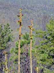
-
View, Purgatory Mountain
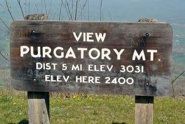
-
Sable at Purgatory Mountain overlook [01]
![Sable at Purgatory Mountain overlook [01] (7944 visits) My 2004 Mercury Sable wagon parked at the Purgatory Mountain overlook on the Blue Ridge Parkway.
Be... Sable at Purgatory Mountain overlook [01]](../../../i/upload/2024/07/15/20240715141214-668b7000-cu_s9999x250.jpg)
-
View from Purgatory Mountain overlook [01]
![View from Purgatory Mountain overlook [01] (2480 visits) View from the Purgatory Mountain overlook on the Blue Ridge Parkway in Botetourt County, Virginia.
... View from Purgatory Mountain overlook [01]](../../../i/upload/2024/07/15/20240715141215-fcceefa7-cu_s9999x250.jpg)
-
Harry Flood Byrd Bridge [02]
![Harry Flood Byrd Bridge [02] (2718 visits) Pedestrian level on the Harry Flood Byrd Memorial Bridge, which carries the Blue Ridge Parkway at mi... Harry Flood Byrd Bridge [02]](../../../i/upload/2024/07/15/20240715141217-32eb9437-cu_s9999x250.jpg)
-
Gentex auto-dimming mirror
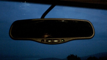
-
Plaque at Raven's Roost overlook
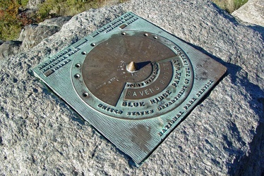
-
View from Raven's Roost
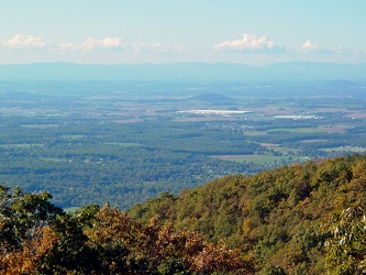
-
View from 20-Minute Cliff overlook [03]
![View from 20-Minute Cliff overlook [03] (1553 visits) View from 20-Minute Cliff, an overlook on the Blue Ridge Parkway near Vesuvius, Virginia.
Ben Schum... View from 20-Minute Cliff overlook [03]](../../../i/upload/2024/07/15/20240715141705-52871955-cu_s9999x250.jpg)
-
Stream at Yankee Horse Ridge [01]
![Stream at Yankee Horse Ridge [01] (1733 visits) Stream with small waterfall at the Yankee Horse Ridge overlook, on the Blue Ridge Parkway near Monte... Stream at Yankee Horse Ridge [01]](../../../i/upload/2024/07/15/20240715141706-0b231326-cu_s9999x250.jpg)
-
Stream at Yankee Horse Ridge [01]
![Stream at Yankee Horse Ridge [01] (1723 visits) Stream with small waterfall at the Yankee Horse Ridge overlook, on the Blue Ridge Parkway near Monte... Stream at Yankee Horse Ridge [01]](../../../i/upload/2024/07/15/20240715141708-6e96c46a-cu_s9999x250.jpg)
-
Stream at Yankee Horse Ridge [01]
![Stream at Yankee Horse Ridge [01] (1614 visits) Stream with small waterfall at the Yankee Horse Ridge overlook, on the Blue Ridge Parkway near Monte... Stream at Yankee Horse Ridge [01]](../../../i/upload/2024/07/15/20240715141709-62daf30c-cu_s9999x250.jpg)
-
Stream at Yankee Horse Ridge [01]
![Stream at Yankee Horse Ridge [01] (1960 visits) Stream with small waterfall at the Yankee Horse Ridge overlook, on the Blue Ridge Parkway near Monte... Stream at Yankee Horse Ridge [01]](../../../i/upload/2024/07/15/20240715141711-08c8936c-cu_s9999x250.jpg)
-
Mercury Sable with ground lighting illuminated [01]
![Mercury Sable with ground lighting illuminated [01] (3442 visits) My 2004 Mercury Sable wagon with the ground-facing lights and the interior lights illuminated on the... Mercury Sable with ground lighting illuminated [01]](../../../i/upload/2024/07/15/20240715141712-6e4690ee-cu_s9999x250.jpg)
-
Stream at Yankee Horse Ridge [01]
![Stream at Yankee Horse Ridge [01] (1819 visits) Stream with small waterfall at the Yankee Horse Ridge overlook, on the Blue Ridge Parkway near Monte... Stream at Yankee Horse Ridge [01]](../../../i/upload/2024/07/15/20240715141714-3facf0fc-cu_s9999x250.jpg)
-
Mercury Sable with ground lighting illuminated [02]
![Mercury Sable with ground lighting illuminated [02] (3480 visits) My 2004 Mercury Sable wagon with the ground-facing lights and the interior lights illuminated on the... Mercury Sable with ground lighting illuminated [02]](../../../i/upload/2024/07/15/20240715141715-42969fcc-cu_s9999x250.jpg)
-
View from 20-Minute Cliff overlook [04]
![View from 20-Minute Cliff overlook [04] (1615 visits) View from 20-Minute Cliff, an overlook on the Blue Ridge Parkway near Vesuvius, Virginia.
Ben Schum... View from 20-Minute Cliff overlook [04]](../../../i/upload/2024/07/15/20240715204738-5eb438f6-cu_s9999x250.jpg)
-
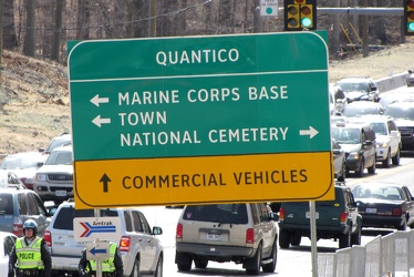
Road sign at intersection of US 1 and Joplin and Fuller Roads
-
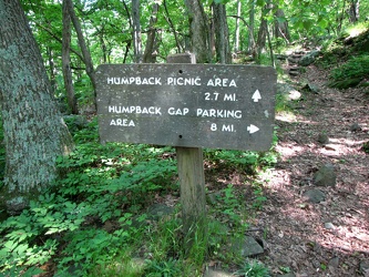
Directional sign near Humpback Rock overlook
-
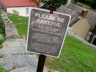
Warning sign for hand-carved steps
-
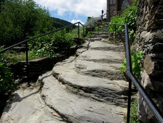
Hand-carved steps
-
Road flare on Maine Avenue SW [01]
![Road flare on Maine Avenue SW [01] (1801 visits) A road flare burns in the rightmost lane of Maine Avenue SW during the National Cherry Blossom Festi... Road flare on Maine Avenue SW [01]](../../../i/upload/2024/07/17/20240717225356-2886a729-cu_s9999x250.jpg)
-
Road flare on Maine Avenue SW [02]
![Road flare on Maine Avenue SW [02] (1800 visits) A road flare burns in the rightmost lane of Maine Avenue SW during the National Cherry Blossom Festi... Road flare on Maine Avenue SW [02]](../../../i/upload/2024/07/17/20240717225359-e216a1f4-cu_s9999x250.jpg)
-
Hatteras Island Beach Access 38 [01]
![Hatteras Island Beach Access 38 [01] (4141 visits) Hatteras Island Beach Access 38, at the south end of Avon, North Carolina. The access consists of a... Hatteras Island Beach Access 38 [01]](../../../i/upload/2024/07/17/20240717230623-ac88eb70-cu_s9999x250.jpg)
-
Hatteras Island Beach Access 38 [08]
![Hatteras Island Beach Access 38 [08] (3473 visits) Hatteras Island Beach Access 38, at the south end of Avon, North Carolina. The access consists of a... Hatteras Island Beach Access 38 [08]](../../../i/upload/2024/07/17/20240717230730-555793fb-cu_s9999x250.jpg)
-
Walkway around Bodie Island Lighthouse
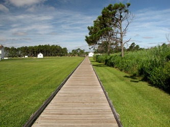
-
Ivy rest area [01]
![Ivy rest area [01] (2964 visits) Rest area on Interstate 64 westbound, near Ivy, Virginia (milepost 113).
Ben Schumin is a professio... Ivy rest area [01]](../../../i/upload/2024/07/17/20240717232803-9c60e629-cu_s9999x250.jpg)
-
Ivy rest area [02]
![Ivy rest area [02] (3024 visits) Rest area on Interstate 64 westbound, near Ivy, Virginia (milepost 113).
Ben Schumin is a professio... Ivy rest area [02]](../../../i/upload/2024/07/17/20240717232807-2e81efde-cu_s9999x250.jpg)
-
Ivy rest area [03]
![Ivy rest area [03] (3048 visits) Rest area on Interstate 64 westbound, near Ivy, Virginia (milepost 113).
Ben Schumin is a professio... Ivy rest area [03]](../../../i/upload/2024/07/17/20240717232811-236d66ef-cu_s9999x250.jpg)
-
George Washington Memorial Parkway
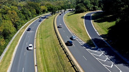
-
Melissa takes a selfie

-
Route 12 on Ocracoke Island

-
Flag in a crack in the pavement [03]
![Flag in a crack in the pavement [03] (4621 visits) An American flag, placed in a crack in the pavement of the Graffiti Highway.
The Graffiti Highway i... Flag in a crack in the pavement [03]](../../../i/upload/2024/07/18/20240718225917-de0cdf19-cu_s9999x250.jpg)
-
Flag in a crack in the pavement [02]
![Flag in a crack in the pavement [02] (4477 visits) An American flag, placed in a crack in the pavement of the Graffiti Highway.
The Graffiti Highway i... Flag in a crack in the pavement [02]](../../../i/upload/2024/07/18/20240718225922-f3938677-cu_s9999x250.jpg)
-
Flag in a crack in the pavement [01]
![Flag in a crack in the pavement [01] (4439 visits) An American flag, placed in a crack in the pavement of the Graffiti Highway.
The Graffiti Highway i... Flag in a crack in the pavement [01]](../../../i/upload/2024/07/18/20240718225926-abaf5102-cu_s9999x250.jpg)
-
Rocks in the Potomac River [01]
![Rocks in the Potomac River [01] (1315 visits) Rocks in the Potomac River near Harpers Ferry. Viewed from the US 340 bridge.
Ben Schumin is a pro... Rocks in the Potomac River [01]](../../../i/upload/2024/07/19/20240719103333-6083493b-cu_s9999x250.jpg)
-
Rocks in the Potomac River [02]
![Rocks in the Potomac River [02] (1246 visits) Rocks in the Potomac River near Harpers Ferry. Viewed from the US 340 bridge.
Ben Schumin is a pro... Rocks in the Potomac River [02]](../../../i/upload/2024/07/19/20240719103338-04e1c1e1-cu_s9999x250.jpg)
-
Rocks in the Potomac River [03]
![Rocks in the Potomac River [03] (1265 visits) Rocks in the Potomac River near Harpers Ferry. Viewed from the US 340 bridge.
Ben Schumin is a pro... Rocks in the Potomac River [03]](../../../i/upload/2024/07/19/20240719103343-404e77e5-cu_s9999x250.jpg)
-
Rocks in the Potomac River [04]
![Rocks in the Potomac River [04] (1285 visits) Rocks in the Potomac River near Harpers Ferry. Viewed from the US 340 bridge.
Ben Schumin is a pro... Rocks in the Potomac River [04]](../../../i/upload/2024/07/19/20240719103348-1a3aef78-cu_s9999x250.jpg)
-
Rocks in the Potomac River [05]
![Rocks in the Potomac River [05] (1334 visits) Rocks in the Potomac River near Harpers Ferry. Viewed from the US 340 bridge.
Ben Schumin is a pro... Rocks in the Potomac River [05]](../../../i/upload/2024/07/19/20240719103353-ea395458-cu_s9999x250.jpg)
-
Potomac River from US 340 bridge [03]
![Potomac River from US 340 bridge [03] (1340 visits) The Potomac River, viewed from the US 340 bridge between Maryland and Virginia.
Ben Schumin is a pr... Potomac River from US 340 bridge [03]](../../../i/upload/2024/07/19/20240719103359-b66380e8-cu_s9999x250.jpg)
-
Potomac River from US 340 bridge [04]
![Potomac River from US 340 bridge [04] (1422 visits) The Potomac River, viewed from the US 340 bridge between Maryland and Virginia.
Ben Schumin is a pr... Potomac River from US 340 bridge [04]](../../../i/upload/2024/07/19/20240719103405-18d26a8b-cu_s9999x250.jpg)
-
Potomac River from US 340 bridge [05]
![Potomac River from US 340 bridge [05] (1428 visits) The Potomac River, viewed from the US 340 bridge between Maryland and Virginia.
Ben Schumin is a pr... Potomac River from US 340 bridge [05]](../../../i/upload/2024/07/19/20240719103412-5b42c5b9-cu_s9999x250.jpg)
-
"WRONG WAY" sign at Devil's Den [01]
!["WRONG WAY" sign at Devil's Den [01] (1414 visits) "WRONG WAY" sign on the parking loop for Devil's Den, near Gettysburg, Pennsylvania.
Ben ... "WRONG WAY" sign at Devil's Den [01]](../../../i/upload/2024/07/19/20240719112651-9d21816c-cu_s9999x250.jpg)
-
"WRONG WAY" sign at Devil's Den [02]
!["WRONG WAY" sign at Devil's Den [02] (1465 visits) "WRONG WAY" sign on the parking loop for Devil's Den, near Gettysburg, Pennsylvania.
Ben ... "WRONG WAY" sign at Devil's Den [02]](../../../i/upload/2024/07/19/20240719112657-4e4c319d-cu_s9999x250.jpg)
-
Intersection of US 340 and VA 608 [01]
![Intersection of US 340 and VA 608 [01] (105959 visits) Intersection of US 340 and Virginia state secondary route 608 in Stuarts Draft, Virginia.
Ben Sch... Intersection of US 340 and VA 608 [01]](../../../i/upload/2024/07/19/20240719120550-1673ec68-cu_s9999x250.jpg)
-
Intersection of US 340 and VA 608 [02]
![Intersection of US 340 and VA 608 [02] (105942 visits) Intersection of US 340 and Virginia state secondary route 608 in Stuarts Draft, Virginia.
Ben Sch... Intersection of US 340 and VA 608 [02]](../../../i/upload/2024/07/19/20240719120559-2af4c901-cu_s9999x250.jpg)
-
US 340 south in Stuarts Draft
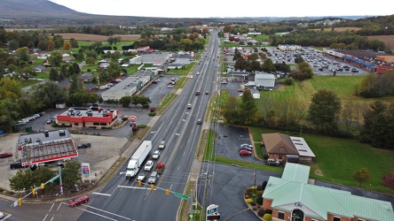
-
Mascot for National Bohemian beer at the Crab Bag

-
Former Canadian National locomotive 9177
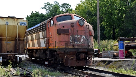
-
Cape Hatteras Lighthouse from move path [01]
![Cape Hatteras Lighthouse from move path [01] (2751 visits) The Cape Hatteras Lighthouse, viewed from the path along which the lighthouse was moved in 1999.
Mo... Cape Hatteras Lighthouse from move path [01]](../../../i/upload/2024/07/19/20240719183107-8f43796a-cu_s9999x250.jpg)
-
Base of the Cape Hatteras Lighthouse [03]
![Base of the Cape Hatteras Lighthouse [03] (2662 visits) Base of the Cape Hatteras Lighthouse, near Cape Hatteras in Buxton, North Carolina, viewed from a ne... Base of the Cape Hatteras Lighthouse [03]](../../../i/upload/2024/07/19/20240719183112-97c2882a-cu_s9999x250.jpg)
-
Cape Hatteras Lighthouse from move path [02]
![Cape Hatteras Lighthouse from move path [02] (2816 visits) The Cape Hatteras Lighthouse, viewed from the path along which the lighthouse was moved in 1999.
Mo... Cape Hatteras Lighthouse from move path [02]](../../../i/upload/2024/07/19/20240719183117-12e94939-cu_s9999x250.jpg)
-
Cape Hatteras Lighthouse from move path [03]
![Cape Hatteras Lighthouse from move path [03] (2908 visits) The Cape Hatteras Lighthouse, viewed from the path along which the lighthouse was moved in 1999.
Mo... Cape Hatteras Lighthouse from move path [03]](../../../i/upload/2024/07/19/20240719183121-622f72c2-cu_s9999x250.jpg)
-
Cape Hatteras Lighthouse from move path [04]
![Cape Hatteras Lighthouse from move path [04] (2784 visits) The Cape Hatteras Lighthouse, viewed from the path along which the lighthouse was moved in 1999.
Mo... Cape Hatteras Lighthouse from move path [04]](../../../i/upload/2024/07/19/20240719183135-c42b91b6-cu_s9999x250.jpg)
-
Cape Hatteras Lighthouse from move path [05]
![Cape Hatteras Lighthouse from move path [05] (2877 visits) The Cape Hatteras Lighthouse, viewed from the path along which the lighthouse was moved in 1999.
Mo... Cape Hatteras Lighthouse from move path [05]](../../../i/upload/2024/07/19/20240719183139-0d95f109-cu_s9999x250.jpg)
-
Lighthouse relocation path [01]
![Lighthouse relocation path [01] (3223 visits) The path along which the Cape Hatteras Lighthouse was moved in 1999, as viewed from the lighthouse's... Lighthouse relocation path [01]](../../../i/upload/2024/07/19/20240719183204-0178f7f6-cu_s9999x250.jpg)
-
Lighthouse relocation path [02]
![Lighthouse relocation path [02] (2758 visits) The path along which the Cape Hatteras Lighthouse was moved in 1999, as viewed from the lighthouse's... Lighthouse relocation path [02]](../../../i/upload/2024/07/19/20240719183211-3a56b8e6-cu_s9999x250.jpg)
-
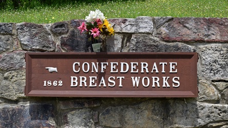
Confederate Breastworks sign
-
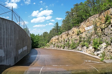
Spillway at Coles Run Reservoir
-
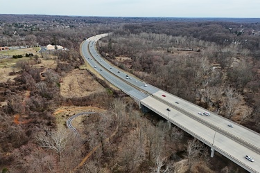
MD 200 east of Layhill Road interchange
-
Fleet of the Future Expo [16]
![Fleet of the Future Expo [16] (1204 visits) Open gangway between the two cars in a married pair on a soft mockup of a pair of 8000-Series railca... Fleet of the Future Expo [16]](../../../i/upload/2025/01/04/20250104012844-cedbf159-cu_s9999x250.jpg)
-
Fleet of the Future Expo [17]
![Fleet of the Future Expo [17] (1226 visits) Open gangway between the two cars in a married pair on a soft mockup of a pair of 8000-Series railca... Fleet of the Future Expo [17]](../../../i/upload/2025/01/04/20250104012854-e448ec40-cu_s9999x250.jpg)
-
Fleet of the Future Expo [18]
![Fleet of the Future Expo [18] (1214 visits) Open gangway between the two cars in a married pair on a soft mockup of a pair of 8000-Series railca... Fleet of the Future Expo [18]](../../../i/upload/2025/01/04/20250104012906-55521e4f-cu_s9999x250.jpg)