-
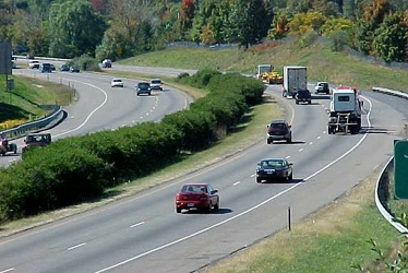
Interstate 81 through Harrisonburg, Virginia
-
Metro D Route pocket track [01]
![Metro D Route pocket track [01] (2362 visits) D Route pocket track on the Washington Metro system, showing the interlockings and the signal. This ... Metro D Route pocket track [01]](../../../../i/upload/2024/07/14/20240714235123-98bd274e-cu_s9999x250.jpg)
-
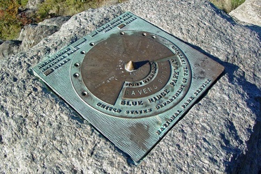
Plaque at Raven's Roost overlook
-
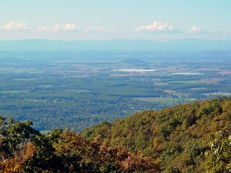
View from Raven's Roost
-
View from 20-Minute Cliff overlook [03]
![View from 20-Minute Cliff overlook [03] (1368 visits) View from 20-Minute Cliff, an overlook on the Blue Ridge Parkway near Vesuvius, Virginia.
Ben Schum... View from 20-Minute Cliff overlook [03]](../../../../i/upload/2024/07/15/20240715141705-52871955-cu_s9999x250.jpg)
-
Stream at Yankee Horse Ridge [01]
![Stream at Yankee Horse Ridge [01] (1575 visits) Stream with small waterfall at the Yankee Horse Ridge overlook, on the Blue Ridge Parkway near Monte... Stream at Yankee Horse Ridge [01]](../../../../i/upload/2024/07/15/20240715141706-0b231326-cu_s9999x250.jpg)
-
Stream at Yankee Horse Ridge [01]
![Stream at Yankee Horse Ridge [01] (1572 visits) Stream with small waterfall at the Yankee Horse Ridge overlook, on the Blue Ridge Parkway near Monte... Stream at Yankee Horse Ridge [01]](../../../../i/upload/2024/07/15/20240715141708-6e96c46a-cu_s9999x250.jpg)
-
Stream at Yankee Horse Ridge [01]
![Stream at Yankee Horse Ridge [01] (1462 visits) Stream with small waterfall at the Yankee Horse Ridge overlook, on the Blue Ridge Parkway near Monte... Stream at Yankee Horse Ridge [01]](../../../../i/upload/2024/07/15/20240715141709-62daf30c-cu_s9999x250.jpg)
-
Stream at Yankee Horse Ridge [01]
![Stream at Yankee Horse Ridge [01] (1798 visits) Stream with small waterfall at the Yankee Horse Ridge overlook, on the Blue Ridge Parkway near Monte... Stream at Yankee Horse Ridge [01]](../../../../i/upload/2024/07/15/20240715141711-08c8936c-cu_s9999x250.jpg)
-
Mercury Sable with ground lighting illuminated [01]
![Mercury Sable with ground lighting illuminated [01] (3150 visits) My 2004 Mercury Sable wagon with the ground-facing lights and the interior lights illuminated on the... Mercury Sable with ground lighting illuminated [01]](../../../../i/upload/2024/07/15/20240715141712-6e4690ee-cu_s9999x250.jpg)
-
Stream at Yankee Horse Ridge [01]
![Stream at Yankee Horse Ridge [01] (1676 visits) Stream with small waterfall at the Yankee Horse Ridge overlook, on the Blue Ridge Parkway near Monte... Stream at Yankee Horse Ridge [01]](../../../../i/upload/2024/07/15/20240715141714-3facf0fc-cu_s9999x250.jpg)
-
Mercury Sable with ground lighting illuminated [02]
![Mercury Sable with ground lighting illuminated [02] (3179 visits) My 2004 Mercury Sable wagon with the ground-facing lights and the interior lights illuminated on the... Mercury Sable with ground lighting illuminated [02]](../../../../i/upload/2024/07/15/20240715141715-42969fcc-cu_s9999x250.jpg)
 South Mountain rest area, westbound [01]
![South Mountain rest area, westbound [01] (3148 visits) South Mountain rest area and welcome center on Interstate 70 westbound in Frederick County, Maryland... South Mountain rest area, westbound [01]](../../../../i/upload/2024/07/17/20240717233435-e2f89cc0-cu_s9999x250.jpg)
 South Mountain rest area, westbound [02]
![South Mountain rest area, westbound [02] (3201 visits) South Mountain rest area and welcome center on Interstate 70 westbound in Frederick County, Maryland... South Mountain rest area, westbound [02]](../../../../i/upload/2024/07/17/20240717233440-268e200a-cu_s9999x250.jpg)
 South Mountain rest area, westbound [03]
![South Mountain rest area, westbound [03] (3401 visits) South Mountain rest area and welcome center on Interstate 70 westbound in Frederick County, Maryland... South Mountain rest area, westbound [03]](../../../../i/upload/2024/07/17/20240717233445-c0e160fc-cu_s9999x250.jpg)
 South Mountain rest area, westbound [04]
![South Mountain rest area, westbound [04] (3179 visits) South Mountain rest area and welcome center on Interstate 70 westbound in Frederick County, Maryland... South Mountain rest area, westbound [04]](../../../../i/upload/2024/07/17/20240717233450-8d5d68a3-cu_s9999x250.jpg)
 South Mountain rest area, westbound [05]
![South Mountain rest area, westbound [05] (3242 visits) South Mountain rest area and welcome center on Interstate 70 westbound in Frederick County, Maryland... South Mountain rest area, westbound [05]](../../../../i/upload/2024/07/17/20240717233455-aa6194ef-cu_s9999x250.jpg)
 Sideling Hill rest area [01]
![Sideling Hill rest area [01] (1988 visits) Eastbound side of the Sideling Hill rest area, located along Interstate 68 in Washington County, Mar... Sideling Hill rest area [01]](../../../../i/upload/2024/07/17/20240717233459-e7ba195c-cu_s9999x250.jpg)
 Sideling Hill rest area [02]
![Sideling Hill rest area [02] (1850 visits) Eastbound access to the footbridge across the highway at the Sideling Hill rest area, located along ... Sideling Hill rest area [02]](../../../../i/upload/2024/07/17/20240717233505-c4590774-cu_s9999x250.jpg)
 Sideling Hill rest area [03]
![Sideling Hill rest area [03] (1738 visits) Footbridge across Interstate 68, allowing views of the cut through the mountain, at the Sideling Hil... Sideling Hill rest area [03]](../../../../i/upload/2024/07/17/20240717233511-e61616ff-cu_s9999x250.jpg)
 Sideling Hill rest area [04]
![Sideling Hill rest area [04] (1860 visits) Westbound access to the footbridge across the highway at the Sideling Hill rest area, located along ... Sideling Hill rest area [04]](../../../../i/upload/2024/07/17/20240717233516-e5cc17b4-cu_s9999x250.jpg)
 Sideling Hill rest area [05]
![Sideling Hill rest area [05] (1785 visits) Path to the westbound parking area and restrooms at the Sideling Hill rest area, located along Inter... Sideling Hill rest area [05]](../../../../i/upload/2024/07/17/20240717233521-b99b80cb-cu_s9999x250.jpg)
 Sideling Hill rest area [06]
![Sideling Hill rest area [06] (1724 visits) Stairs to a raised viewing area on the eastbound side of the Sideling Hill rest area, located along ... Sideling Hill rest area [06]](../../../../i/upload/2024/07/17/20240717233527-43e4656c-cu_s9999x250.jpg)
 Sideling Hill rest area [07]
![Sideling Hill rest area [07] (1870 visits) Raised viewing area on the eastbound side of the Sideling Hill rest area, located along Interstate 6... Sideling Hill rest area [07]](../../../../i/upload/2024/07/17/20240717233531-9f6ca0ea-cu_s9999x250.jpg)
 Sideling Hill rest area [08]
![Sideling Hill rest area [08] (1965 visits) Eastbound parking lot at the Sideling Hill rest area, located along Interstate 68 in Washington Coun... Sideling Hill rest area [08]](../../../../i/upload/2024/07/17/20240717233537-4406b863-cu_s9999x250.jpg)
 Sideling Hill rest area [09]
![Sideling Hill rest area [09] (2017 visits) Eastbound parking lot at the Sideling Hill rest area, located along Interstate 68 in Washington Coun... Sideling Hill rest area [09]](../../../../i/upload/2024/07/17/20240717233542-efb1100b-cu_s9999x250.jpg)
 Sideling Hill rest area [10]
![Sideling Hill rest area [10] (1891 visits) Eastbound side of the Sideling Hill rest area, located along Interstate 68 in Washington County, Mar... Sideling Hill rest area [10]](../../../../i/upload/2024/07/17/20240717233547-516b9676-cu_s9999x250.jpg)
 Western Maryland Scenic Railroad station [06]
![Western Maryland Scenic Railroad station [06] (3964 visits) Station for the Western Maryland Scenic Railroad in Cumberland, Maryland.
More at The Schumin Web:
... Western Maryland Scenic Railroad station [06]](../../../../i/upload/2024/07/17/20240717233558-d030848d-cu_s9999x250.jpg)
 Western Maryland Scenic Railroad tracks [03]
![Western Maryland Scenic Railroad tracks [03] (3859 visits) Tracks for the Western Maryland Scenic Railroad in Cumberland, Maryland.
More at The Schumin Web:
w... Western Maryland Scenic Railroad tracks [03]](../../../../i/upload/2024/07/17/20240717233606-3c9ba6bb-cu_s9999x250.jpg)
-
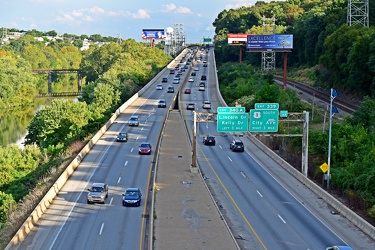
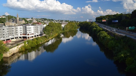
Schuylkill Expressway
-
Schuylkill River
-
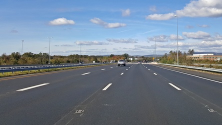
Interstate 66 westbound, near Gainesville
-
John Philip Sousa Bridge [05]
![John Philip Sousa Bridge [05] (1419 visits) The John Philip Sousa Bridge in Southeast Washington DC, which carries Pennsylvania Avenue SE over t... John Philip Sousa Bridge [05]](../../../../i/upload/2024/07/18/20240718224057-7fbb7e78-cu_s9999x250.jpg)
-
John Philip Sousa Bridge [04]
![John Philip Sousa Bridge [04] (1405 visits) The John Philip Sousa Bridge in Southeast Washington DC, which carries Pennsylvania Avenue SE over t... John Philip Sousa Bridge [04]](../../../../i/upload/2024/07/18/20240718224101-19c284b3-cu_s9999x250.jpg)
-
John Philip Sousa Bridge [03]
![John Philip Sousa Bridge [03] (1167 visits) The John Philip Sousa Bridge in Southeast Washington DC, which carries Pennsylvania Avenue SE over t... John Philip Sousa Bridge [03]](../../../../i/upload/2024/07/18/20240718224104-32c9a985-cu_s9999x250.jpg)
-
John Philip Sousa Bridge [02]
![John Philip Sousa Bridge [02] (1268 visits) The John Philip Sousa Bridge in Southeast Washington DC, which carries Pennsylvania Avenue SE over t... John Philip Sousa Bridge [02]](../../../../i/upload/2024/07/18/20240718224108-5a93287c-cu_s9999x250.jpg)
-
John Philip Sousa Bridge [01]
![John Philip Sousa Bridge [01] (1501 visits) The John Philip Sousa Bridge in Southeast Washington DC, which carries Pennsylvania Avenue SE over t... John Philip Sousa Bridge [01]](../../../../i/upload/2024/07/18/20240718224112-bb9cffd3-cu_s9999x250.jpg)
-
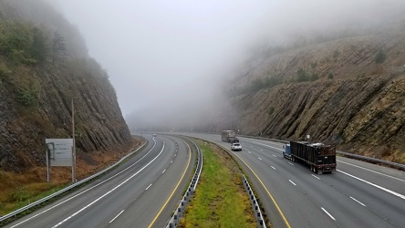
Sideling Hill cut
-
Sign assembly in Marathon, New York [03]
![Sign assembly in Marathon, New York [03] (4060 visits) Sign assembly at the intersection of Broome Street (US 11), Cortland Street (US 11) and Main Street ... Sign assembly in Marathon, New York [03]](../../../../i/upload/2024/07/18/20240718230658-c073cb2b-cu_s9999x250.jpg)
-
Sign assembly in Marathon, New York [02]
![Sign assembly in Marathon, New York [02] (2427 visits) Sign assembly at the intersection of Broome Street (US 11), Cortland Street (US 11) and Main Street ... Sign assembly in Marathon, New York [02]](../../../../i/upload/2024/07/18/20240718230702-0ea9af31-cu_s9999x250.jpg)
-
Sign assembly in Marathon, New York [01]
![Sign assembly in Marathon, New York [01] (2204 visits) Sign assembly at the intersection of Broome Street (US 11), Cortland Street (US 11) and Main Street ... Sign assembly in Marathon, New York [01]](../../../../i/upload/2024/07/18/20240718230705-2fd63957-cu_s9999x250.jpg)
-
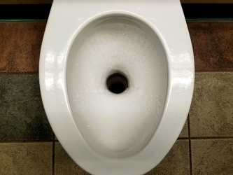
Composting toilet at a rest area
-
Elyse in Centralia
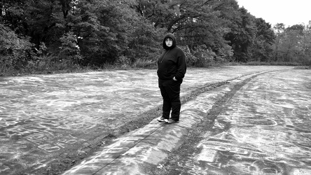
-
Tagging the Graffiti Highway

-
Elyse checks her phone

-
"Stay Out, Stay Alive" sign at Centralia
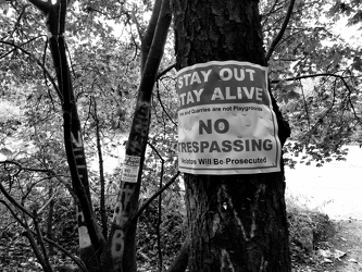
-
Intersection of Routes 64 and 418 [03]
![Intersection of Routes 64 and 418 [03] (1759 visits) Intersection of Routes 64 and 418 in Ringgold, Maryland. The two roads meet at a four-way stop, gov... Intersection of Routes 64 and 418 [03]](../../../../i/upload/2024/07/19/20240719114429-bdff0353-cu_s9999x250.jpg)
-
Intersection of Routes 64 and 418 [02]
![Intersection of Routes 64 and 418 [02] (1606 visits) Intersection of Routes 64 and 418 in Ringgold, Maryland. The two roads meet at a four-way stop, gov... Intersection of Routes 64 and 418 [02]](../../../../i/upload/2024/07/19/20240719114434-f7b1a6bf-cu_s9999x250.jpg)
-
Intersection of Routes 64 and 418 [05]
![Intersection of Routes 64 and 418 [05] (1792 visits) Intersection of Routes 64 and 418 in Ringgold, Maryland. The two roads meet at a four-way stop, gov... Intersection of Routes 64 and 418 [05]](../../../../i/upload/2024/07/19/20240719114438-ea16106f-cu_s9999x250.jpg)
-
Intersection of Routes 64 and 418 [04]
![Intersection of Routes 64 and 418 [04] (1646 visits) Intersection of Routes 64 and 418 in Ringgold, Maryland. The two roads meet at a four-way stop, gov... Intersection of Routes 64 and 418 [04]](../../../../i/upload/2024/07/19/20240719114443-599ce985-cu_s9999x250.jpg)
-
Intersection of Routes 64 and 418 [01]
![Intersection of Routes 64 and 418 [01] (1809 visits) Intersection of Routes 64 and 418 in Ringgold, Maryland. The two roads meet at a four-way stop, gov... Intersection of Routes 64 and 418 [01]](../../../../i/upload/2024/07/19/20240719114447-7f7699d7-cu_s9999x250.jpg)
-
Brink and Wightman Roads [03]
![Brink and Wightman Roads [03] (1150 visits) Street signs at the intersection of Brink and Wightman Roads near Montgomery Village, Maryland. Thi... Brink and Wightman Roads [03]](../../../../i/upload/2024/07/19/20240719114723-c9ce5756-cu_s9999x250.jpg)
-
Brink and Goshen Roads [03]
![Brink and Goshen Roads [03] (1207 visits) Street signs at the intersection of Brink and Goshen Roads near Montgomery Village, Maryland. This ... Brink and Goshen Roads [03]](../../../../i/upload/2024/07/19/20240719114729-e7321e33-cu_s9999x250.jpg)
-
Brink and Goshen Roads [01]
![Brink and Goshen Roads [01] (1177 visits) Street signs at the intersection of Brink and Goshen Roads near Montgomery Village, Maryland. This ... Brink and Goshen Roads [01]](../../../../i/upload/2024/07/19/20240719114734-e7a24e73-cu_s9999x250.jpg)
-
Brink and Goshen Roads [06]
![Brink and Goshen Roads [06] (1178 visits) Street signs at the intersection of Brink and Goshen Roads near Montgomery Village, Maryland. This ... Brink and Goshen Roads [06]](../../../../i/upload/2024/07/19/20240719114740-26c54d48-cu_s9999x250.jpg)
-
Brink and Goshen Roads [09]
![Brink and Goshen Roads [09] (1268 visits) Street signs at the intersection of Brink and Goshen Roads near Montgomery Village, Maryland. This ... Brink and Goshen Roads [09]](../../../../i/upload/2024/07/19/20240719114745-0abbecd0-cu_s9999x250.jpg)
-
Brink and Wightman Roads [02]
![Brink and Wightman Roads [02] (1102 visits) Street signs at the intersection of Brink and Wightman Roads near Montgomery Village, Maryland. Thi... Brink and Wightman Roads [02]](../../../../i/upload/2024/07/19/20240719114750-44efa94d-cu_s9999x250.jpg)
-
Brink and Goshen Roads [02]
![Brink and Goshen Roads [02] (1162 visits) Street signs at the intersection of Brink and Goshen Roads near Montgomery Village, Maryland. This ... Brink and Goshen Roads [02]](../../../../i/upload/2024/07/19/20240719114755-96e78db3-cu_s9999x250.jpg)
-
Brink and Goshen Roads [07]
![Brink and Goshen Roads [07] (1179 visits) Street signs at the intersection of Brink and Goshen Roads near Montgomery Village, Maryland. This ... Brink and Goshen Roads [07]](../../../../i/upload/2024/07/19/20240719114800-f7779954-cu_s9999x250.jpg)
-
Brink and Goshen Roads [10]
![Brink and Goshen Roads [10] (1268 visits) Street signs at the intersection of Brink and Goshen Roads near Montgomery Village, Maryland. This ... Brink and Goshen Roads [10]](../../../../i/upload/2024/07/19/20240719114805-de066605-cu_s9999x250.jpg)
-
Brink and Wightman Roads [01]
![Brink and Wightman Roads [01] (1088 visits) Street signs at the intersection of Brink and Wightman Roads near Montgomery Village, Maryland. Thi... Brink and Wightman Roads [01]](../../../../i/upload/2024/07/19/20240719114814-00630fe7-cu_s9999x250.jpg)
-
Brink and Goshen Roads [04]
![Brink and Goshen Roads [04] (1133 visits) Street signs at the intersection of Brink and Goshen Roads near Montgomery Village, Maryland. This ... Brink and Goshen Roads [04]](../../../../i/upload/2024/07/19/20240719114820-366f383a-cu_s9999x250.jpg)
-
Brink and Goshen Roads [05]
![Brink and Goshen Roads [05] (1133 visits) Street signs at the intersection of Brink and Goshen Roads near Montgomery Village, Maryland. This ... Brink and Goshen Roads [05]](../../../../i/upload/2024/07/19/20240719114825-4168906a-cu_s9999x250.jpg)
-
Brink and Goshen Roads [08]
![Brink and Goshen Roads [08] (1236 visits) Street signs at the intersection of Brink and Goshen Roads near Montgomery Village, Maryland. This ... Brink and Goshen Roads [08]](../../../../i/upload/2024/07/19/20240719114830-a81c39b1-cu_s9999x250.jpg)
-
Interstate 64 in Nelson County, Virginia [01]
![Interstate 64 in Nelson County, Virginia [01] (10530 visits) Interstate 64 in Nelson County, Virginia, near Rockfish Gap. US 250 runs adjacent to the freeway.
... Interstate 64 in Nelson County, Virginia [01]](../../../../i/upload/2024/07/19/20240719115200-c8a2ce39-cu_s9999x250.jpg)
-
Intersection of Jefferson Park Avenue, Harris Road, and Camellia Drive
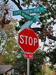
-
Interstate 64 in Nelson County, Virginia [02]
![Interstate 64 in Nelson County, Virginia [02] (10689 visits) Interstate 64 in Nelson County, Virginia, near Rockfish Gap. US 250 runs adjacent to the freeway.
... Interstate 64 in Nelson County, Virginia [02]](../../../../i/upload/2024/07/19/20240719115847-184fa12a-cu_s9999x250.jpg)
-
Interstate 64 in Nelson County, Virginia [03]
![Interstate 64 in Nelson County, Virginia [03] (10875 visits) Interstate 64 in Nelson County, Virginia, near Rockfish Gap. US 250 runs adjacent to the freeway.
... Interstate 64 in Nelson County, Virginia [03]](../../../../i/upload/2024/07/19/20240719115902-ff5fb9e1-cu_s9999x250.jpg)
-
Blue Ridge Mountains near Rockfish Gap [01]
![Blue Ridge Mountains near Rockfish Gap [01] (1468 visits) The Blue Ridge Mountains, viewed from above the Interstate 64 scenic overlook in Nelson County, Virg... Blue Ridge Mountains near Rockfish Gap [01]](../../../../i/upload/2024/07/19/20240719115911-d105cde8-cu_s9999x250.jpg)
-
Blue Ridge Mountains near Rockfish Gap [02]
![Blue Ridge Mountains near Rockfish Gap [02] (1427 visits) The Blue Ridge Mountains, viewed from above the Interstate 64 scenic overlook in Nelson County, Virg... Blue Ridge Mountains near Rockfish Gap [02]](../../../../i/upload/2024/07/19/20240719115926-47f38290-cu_s9999x250.jpg)
-
"DO NOT ENTER" sign on North Central Avenue [01]
!["DO NOT ENTER" sign on North Central Avenue [01] (968 visits) "DO NOT ENTER" sign at the intersection of North Central Avenue and West Johnson Street in... "DO NOT ENTER" sign on North Central Avenue [01]](../../../../i/upload/2024/07/19/20240719120016-255808e6-cu_s9999x250.jpg)
-
"DO NOT ENTER" sign on North Central Avenue [02]
!["DO NOT ENTER" sign on North Central Avenue [02] (957 visits) "DO NOT ENTER" sign at the intersection of North Central Avenue and West Johnson Street in... "DO NOT ENTER" sign on North Central Avenue [02]](../../../../i/upload/2024/07/19/20240719120026-21151527-cu_s9999x250.jpg)
-
Intersection of US 340 and VA 608 [01]
![Intersection of US 340 and VA 608 [01] (105682 visits) Intersection of US 340 and Virginia state secondary route 608 in Stuarts Draft, Virginia.
Ben Sch... Intersection of US 340 and VA 608 [01]](../../../../i/upload/2024/07/19/20240719120550-1673ec68-cu_s9999x250.jpg)
-
Interstate 64 near Rockfish Gap [01]
![Interstate 64 near Rockfish Gap [01] (65854 visits) Interstate 64, near Rockfish Gap in Virginia.
Ben Schumin is a professional photographer who captur... Interstate 64 near Rockfish Gap [01]](../../../../i/upload/2024/07/19/20240719120555-d0d3c2ce-cu_s9999x250.jpg)
-
Intersection of US 340 and VA 608 [02]
![Intersection of US 340 and VA 608 [02] (105634 visits) Intersection of US 340 and Virginia state secondary route 608 in Stuarts Draft, Virginia.
Ben Sch... Intersection of US 340 and VA 608 [02]](../../../../i/upload/2024/07/19/20240719120559-2af4c901-cu_s9999x250.jpg)
-
Interstate 64 near Rockfish Gap [02]
![Interstate 64 near Rockfish Gap [02] (2881 visits) Interstate 64, near Rockfish Gap in Virginia. The bridge in the foreground carries Skyline Drive ov... Interstate 64 near Rockfish Gap [02]](../../../../i/upload/2024/07/19/20240719120604-e2ad25dd-cu_s9999x250.jpg)
-
US 340 south in Stuarts Draft
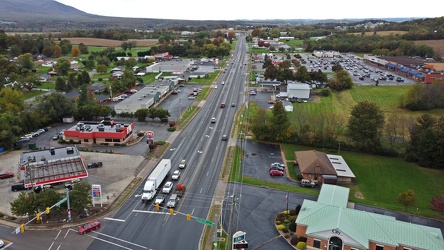
-
Interstate 64 near Rockfish Gap [03]
![Interstate 64 near Rockfish Gap [03] (2893 visits) Interstate 64, near Rockfish Gap in Virginia. The bridge in the foreground carries Skyline Drive ov... Interstate 64 near Rockfish Gap [03]](../../../../i/upload/2024/07/19/20240719120613-6e2190f6-cu_s9999x250.jpg)
-
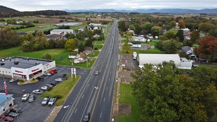
US 340 north in Stuarts Draft
-
Interstate 64 near Rockfish Gap [04]
![Interstate 64 near Rockfish Gap [04] (2902 visits) Interstate 64, near Rockfish Gap in Virginia. The bridge in the foreground carries Skyline Drive ov... Interstate 64 near Rockfish Gap [04]](../../../../i/upload/2024/07/19/20240719120620-49d9b327-cu_s9999x250.jpg)