-
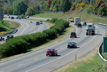
Interstate 81 through Harrisonburg, Virginia
-
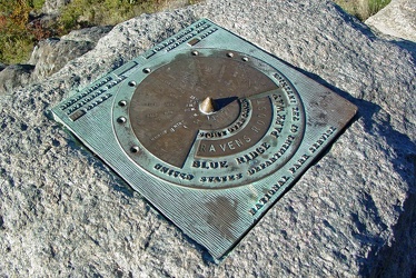
Plaque at Raven's Roost overlook
-
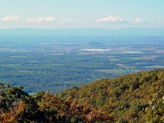
View from Raven's Roost
-
View from 20-Minute Cliff overlook [03]
![View from 20-Minute Cliff overlook [03] (1445 visits) View from 20-Minute Cliff, an overlook on the Blue Ridge Parkway near Vesuvius, Virginia.
Ben Schum... View from 20-Minute Cliff overlook [03]](../../../../i/upload/2024/07/15/20240715141705-52871955-cu_s9999x250.jpg)
-
Stream at Yankee Horse Ridge [01]
![Stream at Yankee Horse Ridge [01] (1653 visits) Stream with small waterfall at the Yankee Horse Ridge overlook, on the Blue Ridge Parkway near Monte... Stream at Yankee Horse Ridge [01]](../../../../i/upload/2024/07/15/20240715141706-0b231326-cu_s9999x250.jpg)
-
Stream at Yankee Horse Ridge [01]
![Stream at Yankee Horse Ridge [01] (1648 visits) Stream with small waterfall at the Yankee Horse Ridge overlook, on the Blue Ridge Parkway near Monte... Stream at Yankee Horse Ridge [01]](../../../../i/upload/2024/07/15/20240715141708-6e96c46a-cu_s9999x250.jpg)
-
Stream at Yankee Horse Ridge [01]
![Stream at Yankee Horse Ridge [01] (1539 visits) Stream with small waterfall at the Yankee Horse Ridge overlook, on the Blue Ridge Parkway near Monte... Stream at Yankee Horse Ridge [01]](../../../../i/upload/2024/07/15/20240715141709-62daf30c-cu_s9999x250.jpg)
-
Stream at Yankee Horse Ridge [01]
![Stream at Yankee Horse Ridge [01] (1880 visits) Stream with small waterfall at the Yankee Horse Ridge overlook, on the Blue Ridge Parkway near Monte... Stream at Yankee Horse Ridge [01]](../../../../i/upload/2024/07/15/20240715141711-08c8936c-cu_s9999x250.jpg)
-
Mercury Sable with ground lighting illuminated [01]
![Mercury Sable with ground lighting illuminated [01] (3291 visits) My 2004 Mercury Sable wagon with the ground-facing lights and the interior lights illuminated on the... Mercury Sable with ground lighting illuminated [01]](../../../../i/upload/2024/07/15/20240715141712-6e4690ee-cu_s9999x250.jpg)
-
Stream at Yankee Horse Ridge [01]
![Stream at Yankee Horse Ridge [01] (1746 visits) Stream with small waterfall at the Yankee Horse Ridge overlook, on the Blue Ridge Parkway near Monte... Stream at Yankee Horse Ridge [01]](../../../../i/upload/2024/07/15/20240715141714-3facf0fc-cu_s9999x250.jpg)
-
Mercury Sable with ground lighting illuminated [02]
![Mercury Sable with ground lighting illuminated [02] (3309 visits) My 2004 Mercury Sable wagon with the ground-facing lights and the interior lights illuminated on the... Mercury Sable with ground lighting illuminated [02]](../../../../i/upload/2024/07/15/20240715141715-42969fcc-cu_s9999x250.jpg)
-
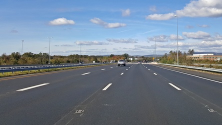
Interstate 66 westbound, near Gainesville
-
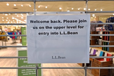
Entrance closed at L.L. Bean
-
Interstate 64 in Nelson County, Virginia [01]
![Interstate 64 in Nelson County, Virginia [01] (10605 visits) Interstate 64 in Nelson County, Virginia, near Rockfish Gap. US 250 runs adjacent to the freeway.
... Interstate 64 in Nelson County, Virginia [01]](../../../../i/upload/2024/07/19/20240719115200-c8a2ce39-cu_s9999x250.jpg)
-
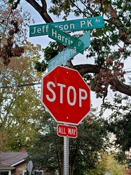
Intersection of Jefferson Park Avenue, Harris Road, and Camellia Drive
-
Interstate 64 in Nelson County, Virginia [02]
![Interstate 64 in Nelson County, Virginia [02] (10765 visits) Interstate 64 in Nelson County, Virginia, near Rockfish Gap. US 250 runs adjacent to the freeway.
... Interstate 64 in Nelson County, Virginia [02]](../../../../i/upload/2024/07/19/20240719115847-184fa12a-cu_s9999x250.jpg)
-
Interstate 64 in Nelson County, Virginia [03]
![Interstate 64 in Nelson County, Virginia [03] (10958 visits) Interstate 64 in Nelson County, Virginia, near Rockfish Gap. US 250 runs adjacent to the freeway.
... Interstate 64 in Nelson County, Virginia [03]](../../../../i/upload/2024/07/19/20240719115902-ff5fb9e1-cu_s9999x250.jpg)
-
Blue Ridge Mountains near Rockfish Gap [01]
![Blue Ridge Mountains near Rockfish Gap [01] (1513 visits) The Blue Ridge Mountains, viewed from above the Interstate 64 scenic overlook in Nelson County, Virg... Blue Ridge Mountains near Rockfish Gap [01]](../../../../i/upload/2024/07/19/20240719115911-d105cde8-cu_s9999x250.jpg)
-
Blue Ridge Mountains near Rockfish Gap [02]
![Blue Ridge Mountains near Rockfish Gap [02] (1477 visits) The Blue Ridge Mountains, viewed from above the Interstate 64 scenic overlook in Nelson County, Virg... Blue Ridge Mountains near Rockfish Gap [02]](../../../../i/upload/2024/07/19/20240719115926-47f38290-cu_s9999x250.jpg)
-
"DO NOT ENTER" sign on North Central Avenue [01]
!["DO NOT ENTER" sign on North Central Avenue [01] (1073 visits) "DO NOT ENTER" sign at the intersection of North Central Avenue and West Johnson Street in... "DO NOT ENTER" sign on North Central Avenue [01]](../../../../i/upload/2024/07/19/20240719120016-255808e6-cu_s9999x250.jpg)
-
"DO NOT ENTER" sign on North Central Avenue [02]
!["DO NOT ENTER" sign on North Central Avenue [02] (1077 visits) "DO NOT ENTER" sign at the intersection of North Central Avenue and West Johnson Street in... "DO NOT ENTER" sign on North Central Avenue [02]](../../../../i/upload/2024/07/19/20240719120026-21151527-cu_s9999x250.jpg)
-
1980s-era Walmart name badge

-
Intersection of US 340 and VA 608 [01]
![Intersection of US 340 and VA 608 [01] (105794 visits) Intersection of US 340 and Virginia state secondary route 608 in Stuarts Draft, Virginia.
Ben Sch... Intersection of US 340 and VA 608 [01]](../../../../i/upload/2024/07/19/20240719120550-1673ec68-cu_s9999x250.jpg)
-
Interstate 64 near Rockfish Gap [01]
![Interstate 64 near Rockfish Gap [01] (65945 visits) Interstate 64, near Rockfish Gap in Virginia.
Ben Schumin is a professional photographer who captur... Interstate 64 near Rockfish Gap [01]](../../../../i/upload/2024/07/19/20240719120555-d0d3c2ce-cu_s9999x250.jpg)
-
Intersection of US 340 and VA 608 [02]
![Intersection of US 340 and VA 608 [02] (105752 visits) Intersection of US 340 and Virginia state secondary route 608 in Stuarts Draft, Virginia.
Ben Sch... Intersection of US 340 and VA 608 [02]](../../../../i/upload/2024/07/19/20240719120559-2af4c901-cu_s9999x250.jpg)
-
Interstate 64 near Rockfish Gap [02]
![Interstate 64 near Rockfish Gap [02] (2965 visits) Interstate 64, near Rockfish Gap in Virginia. The bridge in the foreground carries Skyline Drive ov... Interstate 64 near Rockfish Gap [02]](../../../../i/upload/2024/07/19/20240719120604-e2ad25dd-cu_s9999x250.jpg)
-
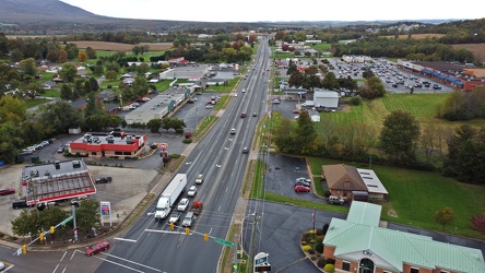
US 340 south in Stuarts Draft
-
Interstate 64 near Rockfish Gap [03]
![Interstate 64 near Rockfish Gap [03] (2972 visits) Interstate 64, near Rockfish Gap in Virginia. The bridge in the foreground carries Skyline Drive ov... Interstate 64 near Rockfish Gap [03]](../../../../i/upload/2024/07/19/20240719120613-6e2190f6-cu_s9999x250.jpg)
-
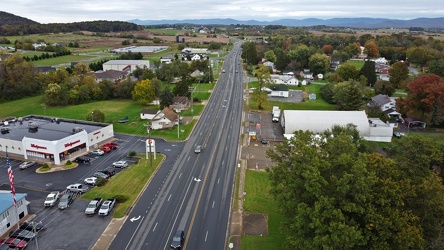
US 340 north in Stuarts Draft
-
Interstate 64 near Rockfish Gap [04]
![Interstate 64 near Rockfish Gap [04] (2974 visits) Interstate 64, near Rockfish Gap in Virginia. The bridge in the foreground carries Skyline Drive ov... Interstate 64 near Rockfish Gap [04]](../../../../i/upload/2024/07/19/20240719120620-49d9b327-cu_s9999x250.jpg)
-
Interstate 64 near Rockfish Gap [05]
![Interstate 64 near Rockfish Gap [05] (10780 visits) Interstate 64, near Rockfish Gap in Virginia. The boundary between Augusta and Nelson Counties runs... Interstate 64 near Rockfish Gap [05]](../../../../i/upload/2024/07/19/20240719120629-90e00218-cu_s9999x250.jpg)
-
Reassurance marker for US 460 Business westbound [01]
![Reassurance marker for US 460 Business westbound [01] (1472 visits) Reassurance marker for westbound US 460 Business on South Crater Road in Petersburg, Virginia.
More... Reassurance marker for US 460 Business westbound [01]](../../../../i/upload/2024/07/19/20240719195429-a75b711e-cu_s9999x250.jpg)
-
Reassurance marker for US 460 Business westbound [02]
![Reassurance marker for US 460 Business westbound [02] (1502 visits) Reassurance marker for westbound US 460 Business on South Crater Road in Petersburg, Virginia.
More... Reassurance marker for US 460 Business westbound [02]](../../../../i/upload/2024/07/19/20240719195435-3d345c43-cu_s9999x250.jpg)
-
Reassurance marker for US 301 northbound [03]
![Reassurance marker for US 301 northbound [03] (1506 visits) Reassurance marker for US 301 northbound on South Crater Road in Petersburg, Virginia.
More at The ... Reassurance marker for US 301 northbound [03]](../../../../i/upload/2024/07/19/20240719195440-449b690e-cu_s9999x250.jpg)
-
Commercial area in Colonial Heights, Virginia [01]
![Commercial area in Colonial Heights, Virginia [01] (54267 visits) A commercial area in Colonial Heights, Virginia, consisting mostly of retail, restaurants, and lodgi... Commercial area in Colonial Heights, Virginia [01]](../../../../i/upload/2024/07/19/20240719195539-0ad1d227-cu_s9999x250.jpg)
-
Reassurance marker for US 301 northbound [01]
![Reassurance marker for US 301 northbound [01] (1484 visits) Reassurance marker for US 301 northbound on South Crater Road in Petersburg, Virginia.
More at The ... Reassurance marker for US 301 northbound [01]](../../../../i/upload/2024/07/19/20240719195705-7a645bac-cu_s9999x250.jpg)
-
Reassurance marker for US 301 northbound [02]
![Reassurance marker for US 301 northbound [02] (1476 visits) Reassurance marker for US 301 northbound on South Crater Road in Petersburg, Virginia.
More at The ... Reassurance marker for US 301 northbound [02]](../../../../i/upload/2024/07/19/20240719195710-a9f10711-cu_s9999x250.jpg)
-
Signs for Interstates 95 and 85 [01]
![Signs for Interstates 95 and 85 [01] (1549 visits) Signs pointing the way to Interstate 95 and 85 on South Crater Road in Petersburg, Virginia.
More a... Signs for Interstates 95 and 85 [01]](../../../../i/upload/2024/07/19/20240719195718-f7bfccaa-cu_s9999x250.jpg)
-
Signs for Interstates 95 and 85 [02]
![Signs for Interstates 95 and 85 [02] (1550 visits) Signs pointing the way to Interstate 95 and 85 on South Crater Road in Petersburg, Virginia.
More a... Signs for Interstates 95 and 85 [02]](../../../../i/upload/2024/07/19/20240719195727-ba3b1d90-cu_s9999x250.jpg)
-
Commercial area in Colonial Heights, Virginia [02]
![Commercial area in Colonial Heights, Virginia [02] (321644 visits) A commercial area in Colonial Heights, Virginia, consisting mostly of retail, restaurants, and lodgi... Commercial area in Colonial Heights, Virginia [02]](../../../../i/upload/2024/07/19/20240719195754-22be50f4-cu_s9999x250.jpg)
-
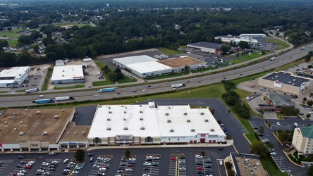
Interstate 95 through Colonial Heights
-
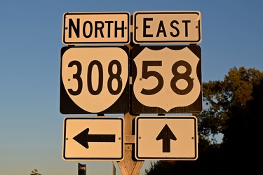
Signage at intersection of US 58 and VA 308
-
James River Bridge [04]
![James River Bridge [04] (4809 visits) The James River Bridge, carrying US 17, US 258, and VA 32 between Newport News and Isle of Wight Cou... James River Bridge [04]](../../../../i/upload/2024/07/19/20240719202325-4257c4a3-cu_s9999x250.jpg)
-
James River Bridge [05]
![James River Bridge [05] (4866 visits) The James River Bridge, carrying US 17, US 258, and VA 32 between Newport News and Isle of Wight Cou... James River Bridge [05]](../../../../i/upload/2024/07/19/20240719202330-be52e801-cu_s9999x250.jpg)
-
Windward Towers and Leeward Marina [02]
![Windward Towers and Leeward Marina [02] (3281 visits) Aerial view of the Windward Towers condominium complex, with the Leeward Marina in front of it, in N... Windward Towers and Leeward Marina [02]](../../../../i/upload/2024/07/19/20240719202335-9d3149ac-cu_s9999x250.jpg)
-
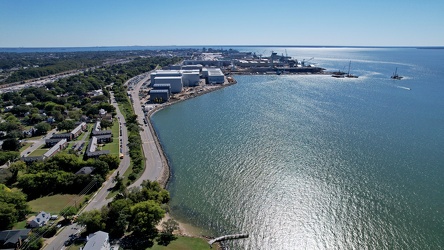
James River downstream from the JRB
-
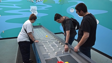
"Changing channels" exhibit at Nauticus
-
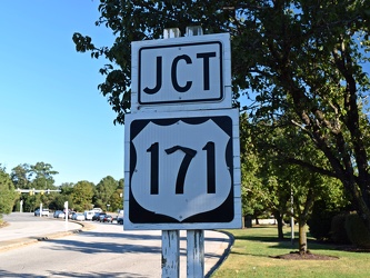
US 171 shield in Newport News, Virginia
-
James River Bridge [03]
![James River Bridge [03] (4697 visits) The James River Bridge, carrying US 17, US 258, and VA 32 between Newport News and Isle of Wight Cou... James River Bridge [03]](../../../../i/upload/2024/07/19/20240719202529-b0e807ab-cu_s9999x250.jpg)
-
James River Bridge [08]
![James River Bridge [08] (4821 visits) The James River Bridge, carrying US 17, US 258, and VA 32 between Newport News and Isle of Wight Cou... James River Bridge [08]](../../../../i/upload/2024/07/19/20240719202534-7843f0b6-cu_s9999x250.jpg)
-
James River Bridge [09]
![James River Bridge [09] (4971 visits) The James River Bridge, carrying US 17, US 258, and VA 32 between Newport News and Isle of Wight Cou... James River Bridge [09]](../../../../i/upload/2024/07/19/20240719202539-877160be-cu_s9999x250.jpg)
-
James River Bridge [06]
![James River Bridge [06] (4947 visits) The James River Bridge, carrying US 17, US 258, and VA 32 between Newport News and Isle of Wight Cou... James River Bridge [06]](../../../../i/upload/2024/07/19/20240719202642-04c26af8-cu_s9999x250.jpg)
-
James River Bridge [07]
![James River Bridge [07] (4708 visits) The James River Bridge, carrying US 17, US 258, and VA 32 between Newport News and Isle of Wight Cou... James River Bridge [07]](../../../../i/upload/2024/07/19/20240719202647-27533348-cu_s9999x250.jpg)
-
James River Bridge [11]
![James River Bridge [11] (4832 visits) The James River Bridge, carrying US 17, US 258, and VA 32 between Newport News and Isle of Wight Cou... James River Bridge [11]](../../../../i/upload/2024/07/19/20240719202653-8658db60-cu_s9999x250.jpg)
-
James River Bridge [02]
![James River Bridge [02] (4924 visits) The James River Bridge, carrying US 17, US 258, and VA 32 between Newport News and Isle of Wight Cou... James River Bridge [02]](../../../../i/upload/2024/07/19/20240719202733-9fb73a13-cu_s9999x250.jpg)
-
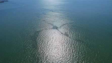
Cross pattern in the water
-
James River Bridge [10]
![James River Bridge [10] (4861 visits) The James River Bridge, carrying US 17, US 258, and VA 32 between Newport News and Isle of Wight Cou... James River Bridge [10]](../../../../i/upload/2024/07/19/20240719202742-6238cd7f-cu_s9999x250.jpg)
-
Windward Towers and Leeward Marina [01]
![Windward Towers and Leeward Marina [01] (5133 visits) Aerial view of the Windward Towers condominium complex, with the Leeward Marina in front of it, in N... Windward Towers and Leeward Marina [01]](../../../../i/upload/2024/07/19/20240719202747-251158fb-cu_s9999x250.jpg)
-
James River Bridge [01]
![James River Bridge [01] (4592 visits) The James River Bridge, carrying US 17, US 258, and VA 32 between Newport News and Isle of Wight Cou... James River Bridge [01]](../../../../i/upload/2024/07/19/20240719202759-cb89473a-cu_s9999x250.jpg)
-
Corridor on the USS Wisconsin [03]
![Corridor on the USS Wisconsin [03] (1564 visits) Corridor on board the USS Wisconsin, a former US Navy battleship turned museum ship at Nauticus in d... Corridor on the USS Wisconsin [03]](../../../../i/upload/2024/07/19/20240719202935-45cc6be5-cu_s9999x250.jpg)
-
Corridor on the USS Wisconsin [01]
![Corridor on the USS Wisconsin [01] (7057 visits) Corridor on board the USS Wisconsin, a former US Navy battleship turned museum ship at Nauticus in d... Corridor on the USS Wisconsin [01]](../../../../i/upload/2024/07/19/20240719203032-fe4db7e6-cu_s9999x250.jpg)
-
Corridor on the USS Wisconsin [02]
![Corridor on the USS Wisconsin [02] (1563 visits) Corridor on board the USS Wisconsin, a former US Navy battleship turned museum ship at Nauticus in d... Corridor on the USS Wisconsin [02]](../../../../i/upload/2024/07/19/20240719203037-1385f7fa-cu_s9999x250.jpg)
-
James River Bridge from afar [01]
![James River Bridge from afar [01] (4580 visits) The James River Bridge, carrying US 17, US 258, and VA 32 between Newport News and Isle of Wight Cou... James River Bridge from afar [01]](../../../../i/upload/2024/07/19/20240719203153-0a034e64-cu_s9999x250.jpg)
-
James River Bridge from afar [02]
![James River Bridge from afar [02] (4613 visits) The James River Bridge, carrying US 17, US 258, and VA 32 between Newport News and Isle of Wight Cou... James River Bridge from afar [02]](../../../../i/upload/2024/07/19/20240719203158-427c0626-cu_s9999x250.jpg)
-
North bank of the James River [01]
![North bank of the James River [01] (2719 visits) The north bank of the James River, about six miles from its mouth, in Newport News, Virginia.
More ... North bank of the James River [01]](../../../../i/upload/2024/07/19/20240719203203-43675d31-cu_s9999x250.jpg)
-
North bank of the James River [02]
![North bank of the James River [02] (2703 visits) The north bank of the James River, about six miles from its mouth, in Newport News, Virginia.
More ... North bank of the James River [02]](../../../../i/upload/2024/07/19/20240719203208-f0ca844f-cu_s9999x250.jpg)
-
North bank of the James River [03]
![North bank of the James River [03] (2735 visits) The north bank of the James River, about six miles from its mouth, in Newport News, Virginia.
More ... North bank of the James River [03]](../../../../i/upload/2024/07/19/20240719203213-033820a2-cu_s9999x250.jpg)
-
24 Museum Drive [01]
![24 Museum Drive [01] (2797 visits) Aerial view of 24 Museum Drive, a house fronting the James River in Newport News, Virginia.
More at... 24 Museum Drive [01]](../../../../i/upload/2024/07/19/20240719203218-370040ec-cu_s9999x250.jpg)
-
24 Museum Drive [02]
![24 Museum Drive [02] (2976 visits) Aerial view of 24 Museum Drive, a house fronting the James River in Newport News, Virginia.
More at... 24 Museum Drive [02]](../../../../i/upload/2024/07/19/20240719203223-adde7d22-cu_s9999x250.jpg)
-
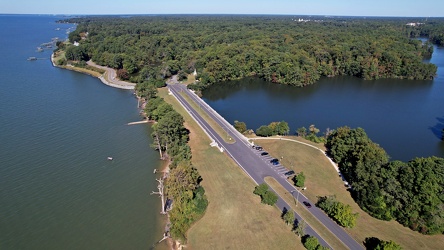
Noland Trail Head parking area
-
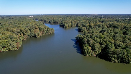
The Mariners' Lake
-
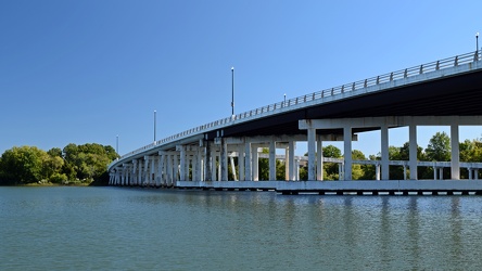
Bridge over the Hampton River
-
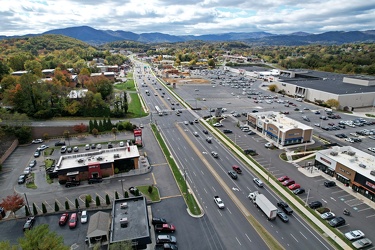
Electric Road
-
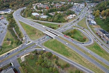
Franklin Road interchange
-
Elm Avenue interchange [02]
![Elm Avenue interchange [02] (2984 visits) Interchange between Interstate 581/US 220 and Elm Avenue (SR 24) in Roanoke, Virginia. The I-581 de... Elm Avenue interchange [02]](../../../../i/upload/2024/07/20/20240720121652-6267da79-cu_s9999x250.jpg)
-
View south on Franklin Road
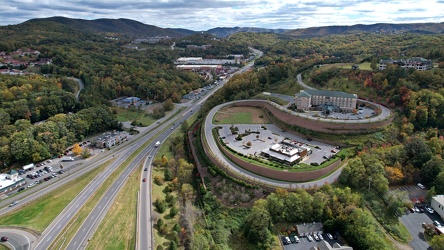
-
Aerial view of Roanoke, Virginia [01]
![Aerial view of Roanoke, Virginia [01] (1872 visits) Aerial view of Roanoke, Virginia.
More at The Schumin Web:
www.schuminweb.com/life-and-times/advent... Aerial view of Roanoke, Virginia [01]](../../../../i/upload/2024/07/20/20240720121757-bb58476c-cu_s9999x250.jpg)
-
Aerial view of Roanoke, Virginia [02]
![Aerial view of Roanoke, Virginia [02] (1776 visits) Aerial view of Roanoke, Virginia.
More at The Schumin Web:
www.schuminweb.com/life-and-times/advent... Aerial view of Roanoke, Virginia [02]](../../../../i/upload/2024/07/20/20240720121808-dccb83a0-cu_s9999x250.jpg)
-
Aerial view of Roanoke, Virginia [03]
![Aerial view of Roanoke, Virginia [03] (1817 visits) Aerial view of Roanoke, Virginia.
More at The Schumin Web:
www.schuminweb.com/life-and-times/advent... Aerial view of Roanoke, Virginia [03]](../../../../i/upload/2024/07/20/20240720121837-3c6bbb13-cu_s9999x250.jpg)
-
Aerial view of Roanoke, Virginia [04]
![Aerial view of Roanoke, Virginia [04] (1870 visits) Aerial view of Roanoke, Virginia.
More at The Schumin Web:
www.schuminweb.com/life-and-times/advent... Aerial view of Roanoke, Virginia [04]](../../../../i/upload/2024/07/20/20240720121854-34748718-cu_s9999x250.jpg)