-
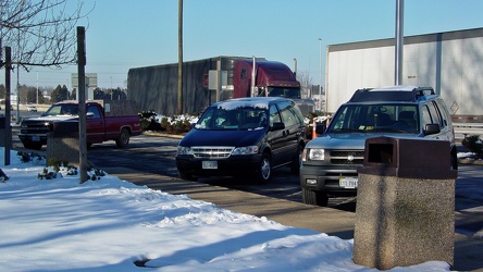
Parking lot at the Manassas rest area
-
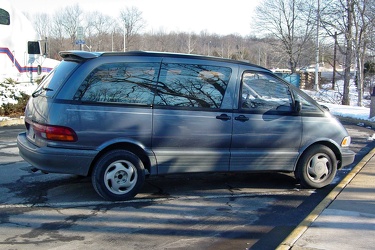
Toyota Previa at Manassas rest area
-
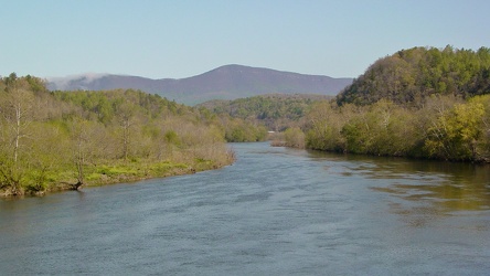
View of James River from Harry Flood Byrd Bridge
-
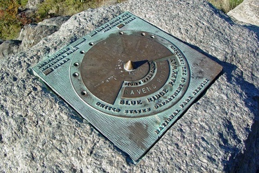
Plaque at Raven's Roost overlook
-
View from Raven's Roost
-
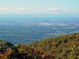
View from 20-Minute Cliff overlook [03]
![View from 20-Minute Cliff overlook [03] (1376 visits) View from 20-Minute Cliff, an overlook on the Blue Ridge Parkway near Vesuvius, Virginia.
Ben Schum... View from 20-Minute Cliff overlook [03]](../../../../i/upload/2024/07/15/20240715141705-52871955-cu_s9999x250.jpg)
-
Stream at Yankee Horse Ridge [01]
![Stream at Yankee Horse Ridge [01] (1583 visits) Stream with small waterfall at the Yankee Horse Ridge overlook, on the Blue Ridge Parkway near Monte... Stream at Yankee Horse Ridge [01]](../../../../i/upload/2024/07/15/20240715141706-0b231326-cu_s9999x250.jpg)
-
Stream at Yankee Horse Ridge [01]
![Stream at Yankee Horse Ridge [01] (1581 visits) Stream with small waterfall at the Yankee Horse Ridge overlook, on the Blue Ridge Parkway near Monte... Stream at Yankee Horse Ridge [01]](../../../../i/upload/2024/07/15/20240715141708-6e96c46a-cu_s9999x250.jpg)
-
Stream at Yankee Horse Ridge [01]
![Stream at Yankee Horse Ridge [01] (1473 visits) Stream with small waterfall at the Yankee Horse Ridge overlook, on the Blue Ridge Parkway near Monte... Stream at Yankee Horse Ridge [01]](../../../../i/upload/2024/07/15/20240715141709-62daf30c-cu_s9999x250.jpg)
-
Stream at Yankee Horse Ridge [01]
![Stream at Yankee Horse Ridge [01] (1801 visits) Stream with small waterfall at the Yankee Horse Ridge overlook, on the Blue Ridge Parkway near Monte... Stream at Yankee Horse Ridge [01]](../../../../i/upload/2024/07/15/20240715141711-08c8936c-cu_s9999x250.jpg)
-
Mercury Sable with ground lighting illuminated [01]
![Mercury Sable with ground lighting illuminated [01] (3172 visits) My 2004 Mercury Sable wagon with the ground-facing lights and the interior lights illuminated on the... Mercury Sable with ground lighting illuminated [01]](../../../../i/upload/2024/07/15/20240715141712-6e4690ee-cu_s9999x250.jpg)
-
Stream at Yankee Horse Ridge [01]
![Stream at Yankee Horse Ridge [01] (1683 visits) Stream with small waterfall at the Yankee Horse Ridge overlook, on the Blue Ridge Parkway near Monte... Stream at Yankee Horse Ridge [01]](../../../../i/upload/2024/07/15/20240715141714-3facf0fc-cu_s9999x250.jpg)
-
Mercury Sable with ground lighting illuminated [02]
![Mercury Sable with ground lighting illuminated [02] (3199 visits) My 2004 Mercury Sable wagon with the ground-facing lights and the interior lights illuminated on the... Mercury Sable with ground lighting illuminated [02]](../../../../i/upload/2024/07/15/20240715141715-42969fcc-cu_s9999x250.jpg)
-
View from 20-Minute Cliff overlook [04]
![View from 20-Minute Cliff overlook [04] (1433 visits) View from 20-Minute Cliff, an overlook on the Blue Ridge Parkway near Vesuvius, Virginia.
Ben Schum... View from 20-Minute Cliff overlook [04]](../../../../i/upload/2024/07/15/20240715204738-5eb438f6-cu_s9999x250.jpg)
-
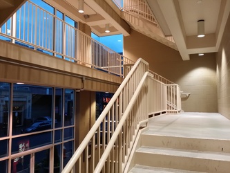
Reston Town Center parking garage stairs
-
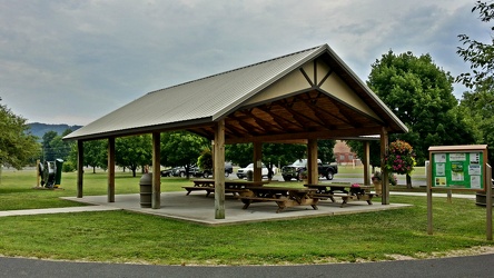
Picnic shelter at Constitution Park
-
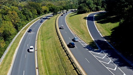
George Washington Memorial Parkway
-
South Norfolk Jordan Bridge [02]
![South Norfolk Jordan Bridge [02] (2686 visits) The South Norfolk Jordan Bridge, commonly known as simply the Jordan Bridge, is a privately owned an... South Norfolk Jordan Bridge [02]](../../../../i/upload/2024/07/19/20240719101756-29d2696c-cu_s9999x250.jpg)
-
South Norfolk Jordan Bridge [01]
![South Norfolk Jordan Bridge [01] (2893 visits) The South Norfolk Jordan Bridge, commonly known as simply the Jordan Bridge, is a privately owned an... South Norfolk Jordan Bridge [01]](../../../../i/upload/2024/07/19/20240719101801-ff660e17-cu_s9999x250.jpg)
-
South Norfolk Jordan Bridge [04]
![South Norfolk Jordan Bridge [04] (2984 visits) The South Norfolk Jordan Bridge, commonly known as simply the Jordan Bridge, is a privately owned an... South Norfolk Jordan Bridge [04]](../../../../i/upload/2024/07/19/20240719101811-3ebcdc7d-cu_s9999x250.jpg)
-
South Norfolk Jordan Bridge [03]
![South Norfolk Jordan Bridge [03] (2968 visits) The South Norfolk Jordan Bridge, commonly known as simply the Jordan Bridge, is a privately owned an... South Norfolk Jordan Bridge [03]](../../../../i/upload/2024/07/19/20240719101829-ff0de2c9-cu_s9999x250.jpg)
-
Rocks in the Potomac River [01]
![Rocks in the Potomac River [01] (983 visits) Rocks in the Potomac River near Harpers Ferry. Viewed from the US 340 bridge.
Ben Schumin is a pro... Rocks in the Potomac River [01]](../../../../i/upload/2024/07/19/20240719103333-6083493b-cu_s9999x250.jpg)
-
Rocks in the Potomac River [02]
![Rocks in the Potomac River [02] (932 visits) Rocks in the Potomac River near Harpers Ferry. Viewed from the US 340 bridge.
Ben Schumin is a pro... Rocks in the Potomac River [02]](../../../../i/upload/2024/07/19/20240719103338-04e1c1e1-cu_s9999x250.jpg)
-
Rocks in the Potomac River [03]
![Rocks in the Potomac River [03] (928 visits) Rocks in the Potomac River near Harpers Ferry. Viewed from the US 340 bridge.
Ben Schumin is a pro... Rocks in the Potomac River [03]](../../../../i/upload/2024/07/19/20240719103343-404e77e5-cu_s9999x250.jpg)
-
Rocks in the Potomac River [04]
![Rocks in the Potomac River [04] (945 visits) Rocks in the Potomac River near Harpers Ferry. Viewed from the US 340 bridge.
Ben Schumin is a pro... Rocks in the Potomac River [04]](../../../../i/upload/2024/07/19/20240719103348-1a3aef78-cu_s9999x250.jpg)
-
Rocks in the Potomac River [05]
![Rocks in the Potomac River [05] (1006 visits) Rocks in the Potomac River near Harpers Ferry. Viewed from the US 340 bridge.
Ben Schumin is a pro... Rocks in the Potomac River [05]](../../../../i/upload/2024/07/19/20240719103353-ea395458-cu_s9999x250.jpg)
-
Potomac River from US 340 bridge [03]
![Potomac River from US 340 bridge [03] (1018 visits) The Potomac River, viewed from the US 340 bridge between Maryland and Virginia.
Ben Schumin is a pr... Potomac River from US 340 bridge [03]](../../../../i/upload/2024/07/19/20240719103359-b66380e8-cu_s9999x250.jpg)
-
Potomac River from US 340 bridge [04]
![Potomac River from US 340 bridge [04] (1100 visits) The Potomac River, viewed from the US 340 bridge between Maryland and Virginia.
Ben Schumin is a pr... Potomac River from US 340 bridge [04]](../../../../i/upload/2024/07/19/20240719103405-18d26a8b-cu_s9999x250.jpg)
-
Potomac River from US 340 bridge [05]
![Potomac River from US 340 bridge [05] (1114 visits) The Potomac River, viewed from the US 340 bridge between Maryland and Virginia.
Ben Schumin is a pr... Potomac River from US 340 bridge [05]](../../../../i/upload/2024/07/19/20240719103412-5b42c5b9-cu_s9999x250.jpg)
-
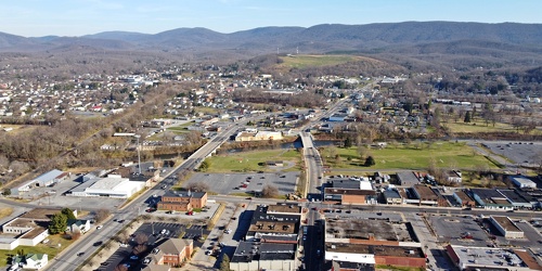
Main and Broad Streets, facing east
-
Downtown Waynesboro, Virginia, looking toward Invista [02]
![Downtown Waynesboro, Virginia, looking toward Invista [02] (4113 visits) Aerial view of downtown Waynesboro, Virginia, looking towards the Invista plant.
Ben Schumin is a p... Downtown Waynesboro, Virginia, looking toward Invista [02]](../../../../i/upload/2024/07/19/20240719130254-ae1aac9d-cu_s9999x250.jpg)
-
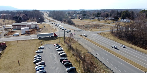
Intersection of US 340, Shenandoah Village Drive, and Gateway Drive
-
Richmond Avenue in Staunton, Virginia [01]
![Richmond Avenue in Staunton, Virginia [01] (66737 visits) Aerial view of Richmond Avenue (US 250) in Staunton, Virginia, near the intersection with Frontier D... Richmond Avenue in Staunton, Virginia [01]](../../../../i/upload/2024/07/19/20240719161158-ddf9fe35-cu_s9999x250.jpg)
-
Richmond Avenue in Staunton, Virginia [02]
![Richmond Avenue in Staunton, Virginia [02] (66816 visits) Aerial view of Richmond Avenue (US 250) in Staunton, Virginia, near the intersection with Frontier D... Richmond Avenue in Staunton, Virginia [02]](../../../../i/upload/2024/07/19/20240719161203-233bb776-cu_s9999x250.jpg)
-
Richmond Avenue in Staunton, Virginia [03]
![Richmond Avenue in Staunton, Virginia [03] (66642 visits) Aerial view of Richmond Avenue (US 250) in Staunton, Virginia, near the intersection with Community ... Richmond Avenue in Staunton, Virginia [03]](../../../../i/upload/2024/07/19/20240719161212-297c1b53-cu_s9999x250.jpg)
-
Commercial area south of Interstate 81 in Harrisonburg [01]
![Commercial area south of Interstate 81 in Harrisonburg [01] (3332 visits) Commercial area on the west side of East Market Street (US 33), facing north.
Ben Schumin is a prof... Commercial area south of Interstate 81 in Harrisonburg [01]](../../../../i/upload/2024/07/19/20240719163715-46af96f9-cu_s9999x250.jpg)
-
Harrisonburg Crossing [01]
![Harrisonburg Crossing [01] (11553 visits) Harrisonburg Crossing shopping center, built in 2003, replacing a Dunham-Bush factory on the site.
... Harrisonburg Crossing [01]](../../../../i/upload/2024/07/19/20240719163753-972e0345-cu_s9999x250.jpg)
-
Harrisonburg Crossing [02]
![Harrisonburg Crossing [02] (3836 visits) Walmart Supercenter in the Harrisonburg Crossing shopping center in Harrisonburg, Virginia. This st... Harrisonburg Crossing [02]](../../../../i/upload/2024/07/19/20240719163758-5453496b-cu_s9999x250.jpg)
-
Commercial area south of University Boulevard [01]
![Commercial area south of University Boulevard [01] (2487 visits) Commercial area south of University Boulevard in Harrisonburg, Virginia. View facing approximately ... Commercial area south of University Boulevard [01]](../../../../i/upload/2024/07/19/20240719163821-e0603027-cu_s9999x250.jpg)
-
Commercial area south of University Boulevard [02]
![Commercial area south of University Boulevard [02] (2421 visits) Commercial area south of University Boulevard in Harrisonburg, Virginia. View facing approximately ... Commercial area south of University Boulevard [02]](../../../../i/upload/2024/07/19/20240719163825-5d4964e5-cu_s9999x250.jpg)
-
Commercial area south of Interstate 81 in Harrisonburg [02]
![Commercial area south of Interstate 81 in Harrisonburg [02] (3926 visits) Commercial area on the west side of East Market Street (US 33), facing north.
Ben Schumin is a prof... Commercial area south of Interstate 81 in Harrisonburg [02]](../../../../i/upload/2024/07/19/20240719163830-45dce8e7-cu_s9999x250.jpg)
-
Churchville Volunteer Fire Department [02]
![Churchville Volunteer Fire Department [02] (1530 visits) Building for Churchville Volunteer Fire Department, on Churchville Road (US 250/SR 42) in Churchvill... Churchville Volunteer Fire Department [02]](../../../../i/upload/2024/07/19/20240719164431-2ab245f9-cu_s9999x250.jpg)
-
Buffalo Gap High School [01]
![Buffalo Gap High School [01] (3050 visits) Aerial view of Buffalo Gap High School, a public high school in Augusta County, Virginia, near Swoop... Buffalo Gap High School [01]](../../../../i/upload/2024/07/19/20240719164459-267a0d43-cu_s9999x250.jpg)
-
Buffalo Gap High School [02]
![Buffalo Gap High School [02] (3167 visits) Aerial view of Buffalo Gap High School, a public high school in Augusta County, Virginia, near Swoop... Buffalo Gap High School [02]](../../../../i/upload/2024/07/19/20240719164505-bdd29e59-cu_s9999x250.jpg)
-
Buffalo Gap High School [03]
![Buffalo Gap High School [03] (3165 visits) Aerial view of Buffalo Gap High School, a public high school in Augusta County, Virginia, near Swoop... Buffalo Gap High School [03]](../../../../i/upload/2024/07/19/20240719164509-fab8ad49-cu_s9999x250.jpg)
-
Buffalo Gap High School [04]
![Buffalo Gap High School [04] (3262 visits) Aerial view of Buffalo Gap High School, a public high school in Augusta County, Virginia, near Swoop... Buffalo Gap High School [04]](../../../../i/upload/2024/07/19/20240719164514-e0a1e82e-cu_s9999x250.jpg)
-
Buffalo Gap High School [05]
![Buffalo Gap High School [05] (3089 visits) Aerial view of Buffalo Gap High School, a public high school in Augusta County, Virginia, near Swoop... Buffalo Gap High School [05]](../../../../i/upload/2024/07/19/20240719164519-518a0909-cu_s9999x250.jpg)
-
Buffalo Gap High School [06]
![Buffalo Gap High School [06] (3130 visits) Aerial view of Buffalo Gap High School, a public high school in Augusta County, Virginia, near Swoop... Buffalo Gap High School [06]](../../../../i/upload/2024/07/19/20240719164523-e9a7db09-cu_s9999x250.jpg)
-
West Main Street in Waynesboro, Virginia [01]
![West Main Street in Waynesboro, Virginia [01] (55602 visits) View down West Main Street (US 250) in the west end of Waynesboro, Virginia, near the former Kmart b... West Main Street in Waynesboro, Virginia [01]](../../../../i/upload/2024/07/19/20240719164545-b5a50599-cu_s9999x250.jpg)
-
West Main Street in Waynesboro, Virginia [02]
![West Main Street in Waynesboro, Virginia [02] (9906 visits) View down West Main Street (US 250) in the west end of Waynesboro, Virginia, near the Sheetz conveni... West Main Street in Waynesboro, Virginia [02]](../../../../i/upload/2024/07/19/20240719164551-0b8407a8-cu_s9999x250.jpg)
-
West Main Street in Waynesboro, Virginia [03]
![West Main Street in Waynesboro, Virginia [03] (10701 visits) View down West Main Street (US 250) in the west end of Waynesboro, Virginia, near St. Mark's United ... West Main Street in Waynesboro, Virginia [03]](../../../../i/upload/2024/07/19/20240719164555-f7feeafe-cu_s9999x250.jpg)
-
West Main Street in Waynesboro, Virginia [04]
![West Main Street in Waynesboro, Virginia [04] (323173 visits) View down West Main Street (US 250) in the west end of Waynesboro, Virginia, near the Westwood Villa... West Main Street in Waynesboro, Virginia [04]](../../../../i/upload/2024/07/19/20240719164600-4379cef1-cu_s9999x250.jpg)
-
US 29 Business in Culpeper, Virginia [02]
![US 29 Business in Culpeper, Virginia [02] (457554 visits) Aerial view of US 29 Business on the north side of Culpeper, Virginia. View facing approximately we... US 29 Business in Culpeper, Virginia [02]](../../../../i/upload/2024/07/19/20240719165937-abc06307-cu_s9999x250.jpg)
-
DoubleTree Hotel in Charlottesville, Virginia [01]
![DoubleTree Hotel in Charlottesville, Virginia [01] (1782 visits) DoubleTree Hotel on Hilton Heights Road in Charlottesville, Virginia. This hotel was built in 1984,... DoubleTree Hotel in Charlottesville, Virginia [01]](../../../../i/upload/2024/07/19/20240719171742-a365fe34-cu_s9999x250.jpg)
-
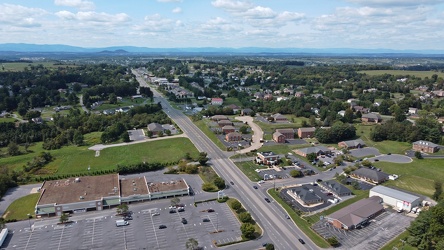
US 250 at the west end of Waynesboro, Virginia
-
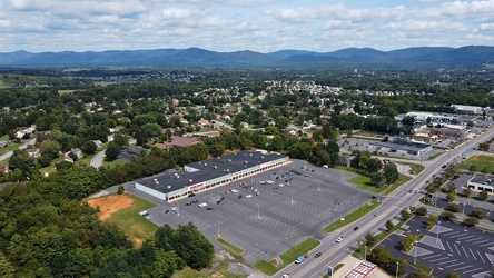
Waynesboro, Virginia, facing approximately east
-
Commercial area in Colonial Heights, Virginia [02]
![Commercial area in Colonial Heights, Virginia [02] (321543 visits) A commercial area in Colonial Heights, Virginia, consisting mostly of retail, restaurants, and lodgi... Commercial area in Colonial Heights, Virginia [02]](../../../../i/upload/2024/07/19/20240719195754-22be50f4-cu_s9999x250.jpg)
-
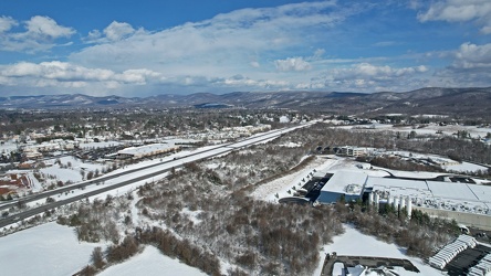
Interstate 64 corridor through Waynesboro, Virginia
-
West Broad Street at Staples Mill Road [01]
![West Broad Street at Staples Mill Road [01] (3217 visits) Aerial view of West Broad Street at the intersection with Staples Mill Road in Richmond, Virginia. ... West Broad Street at Staples Mill Road [01]](../../../../i/upload/2024/07/20/20240720091824-c8526d69-cu_s9999x250.jpg)
-
West Broad Street at Staples Mill Road [02]
![West Broad Street at Staples Mill Road [02] (69996 visits) Aerial view of West Broad Street at the intersection with Staples Mill Road in Richmond, Virginia. ... West Broad Street at Staples Mill Road [02]](../../../../i/upload/2024/07/20/20240720092012-1df12de7-cu_s9999x250.jpg)
-
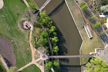
Canal next to Brown's Island
-
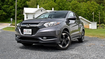
Honda HR-V in Head Waters, Virginia
-
Selfie with the Augusta County Industrial Sites sign

-
Verona, Virginia over Mill Place Commerce Park [01]
![Verona, Virginia over Mill Place Commerce Park [01] (1406 visits) Aerial view of Verona, Virginia from above the Mill Place Commerce Park. This photo shows a view fa... Verona, Virginia over Mill Place Commerce Park [01]](../../../../i/upload/2024/07/20/20240720110653-ef33b991-cu_s9999x250.jpg)
-
Verona, Virginia over Mill Place Commerce Park [02]
![Verona, Virginia over Mill Place Commerce Park [02] (1728 visits) Aerial view of Verona, Virginia from above the Mill Place Commerce Park. This view faces approximat... Verona, Virginia over Mill Place Commerce Park [02]](../../../../i/upload/2024/07/20/20240720110708-9b94d246-cu_s9999x250.jpg)
-
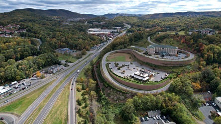
Verona, Virginia over Mill Place Commerce Park [04]
![Verona, Virginia over Mill Place Commerce Park [04] (1340 visits) Aerial view of Verona, Virginia from above the Mill Place Commerce Park. This photo shows a hairpin... Verona, Virginia over Mill Place Commerce Park [04]](../../../../i/upload/2024/07/20/20240720110729-83e0c1ca-cu_s9999x250.jpg)
-
Verona, Virginia over Mill Place Commerce Park [05]
![Verona, Virginia over Mill Place Commerce Park [05] (1513 visits) Aerial view of Verona, Virginia from above the Mill Place Commerce Park. This photo shows a view fa... Verona, Virginia over Mill Place Commerce Park [05]](../../../../i/upload/2024/07/20/20240720110734-c309d24d-cu_s9999x250.jpg)
-
Augusta County Industrial Sites sign [01]
![Augusta County Industrial Sites sign [01] (2835 visits) Sign in a field near Interstate 81 promoting industrial sites in Augusta County, Virginia, near the ... Augusta County Industrial Sites sign [01]](../../../../i/upload/2024/07/20/20240720110749-3000ee9e-cu_s9999x250.jpg)
-
Augusta County Industrial Sites sign [02]
![Augusta County Industrial Sites sign [02] (2850 visits) Sign in a field near Interstate 81 promoting industrial sites in Augusta County, Virginia, near the ... Augusta County Industrial Sites sign [02]](../../../../i/upload/2024/07/20/20240720110755-bb9979a7-cu_s9999x250.jpg)
-
Augusta County Industrial Sites sign [03]
![Augusta County Industrial Sites sign [03] (1350 visits) Sign in a field near Interstate 81 promoting industrial sites in Augusta County, Virginia, near the ... Augusta County Industrial Sites sign [03]](../../../../i/upload/2024/07/20/20240720110806-3fc5b067-cu_s9999x250.jpg)
-
Augusta County Industrial Sites sign [04]
![Augusta County Industrial Sites sign [04] (1395 visits) Sign in a field near Interstate 81 promoting industrial sites in Augusta County, Virginia, near the ... Augusta County Industrial Sites sign [04]](../../../../i/upload/2024/07/20/20240720110817-4685b8f3-cu_s9999x250.jpg)
-
Augusta County Industrial Sites sign [05]
![Augusta County Industrial Sites sign [05] (1442 visits) Sign in a field near Interstate 81 promoting industrial sites in Augusta County, Virginia, near the ... Augusta County Industrial Sites sign [05]](../../../../i/upload/2024/07/20/20240720110828-d0f587e4-cu_s9999x250.jpg)
-
Augusta County Industrial Sites sign [06]
![Augusta County Industrial Sites sign [06] (1482 visits) Sign in a field near Interstate 81 promoting industrial sites in Augusta County, Virginia, near the ... Augusta County Industrial Sites sign [06]](../../../../i/upload/2024/07/20/20240720110839-ba9d0dab-cu_s9999x250.jpg)
-
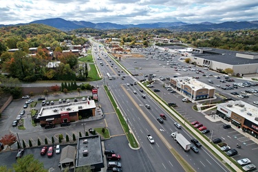
Electric Road
-
Elm Avenue interchange [02]
![Elm Avenue interchange [02] (2892 visits) Interchange between Interstate 581/US 220 and Elm Avenue (SR 24) in Roanoke, Virginia. The I-581 de... Elm Avenue interchange [02]](../../../../i/upload/2024/07/20/20240720121652-6267da79-cu_s9999x250.jpg)
-
View south on Franklin Road
-
Aerial view of Roanoke, Virginia [01]
![Aerial view of Roanoke, Virginia [01] (1810 visits) Aerial view of Roanoke, Virginia.
More at The Schumin Web:
www.schuminweb.com/life-and-times/advent... Aerial view of Roanoke, Virginia [01]](../../../../i/upload/2024/07/20/20240720121757-bb58476c-cu_s9999x250.jpg)
-
Aerial view of Roanoke, Virginia [02]
![Aerial view of Roanoke, Virginia [02] (1718 visits) Aerial view of Roanoke, Virginia.
More at The Schumin Web:
www.schuminweb.com/life-and-times/advent... Aerial view of Roanoke, Virginia [02]](../../../../i/upload/2024/07/20/20240720121808-dccb83a0-cu_s9999x250.jpg)
-
Aerial view of Roanoke, Virginia [03]
![Aerial view of Roanoke, Virginia [03] (1754 visits) Aerial view of Roanoke, Virginia.
More at The Schumin Web:
www.schuminweb.com/life-and-times/advent... Aerial view of Roanoke, Virginia [03]](../../../../i/upload/2024/07/20/20240720121837-3c6bbb13-cu_s9999x250.jpg)
-
Aerial view of Roanoke, Virginia [04]
![Aerial view of Roanoke, Virginia [04] (1807 visits) Aerial view of Roanoke, Virginia.
More at The Schumin Web:
www.schuminweb.com/life-and-times/advent... Aerial view of Roanoke, Virginia [04]](../../../../i/upload/2024/07/20/20240720121854-34748718-cu_s9999x250.jpg)