-
Aerial view of Smithsburg, Maryland [03]
![Aerial view of Smithsburg, Maryland [03] (1030 visits) Aerial view of Smithsburg, Maryland.
Ben Schumin is a professional photographer who captures the in... Aerial view of Smithsburg, Maryland [03]](../../../i/upload/2024/07/20/20240720155805-a9f3e7ed-cu_s9999x250.jpg)
-
Hagerstown Reservoir

-
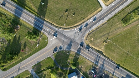
Intersection of Maryland Routes 64 and 77 in Smithsburg, Maryland
-
Aerial view of Interstate 70 Breezewood interchange [02]
![Aerial view of Interstate 70 Breezewood interchange [02] (1402 visits) Aerial view of Breezewood interchange for Interstate 70. View facing south.
More at The Schumin We... Aerial view of Interstate 70 Breezewood interchange [02]](../../../i/upload/2024/07/20/20240720155940-3bb47f5f-cu_s9999x250.jpg)
-
Aerial view of Breezewood, Pennsylvania, May 2023 [04]
![Aerial view of Breezewood, Pennsylvania, May 2023 [04] (3000 visits) Aerial view of Breezewood, Pennsylvania. View facing approximately southeast.
More at The Schumin ... Aerial view of Breezewood, Pennsylvania, May 2023 [04]](../../../i/upload/2024/07/20/20240720155944-8f8a6623-cu_s9999x250.jpg)
-
Aerial view of Breezewood, Pennsylvania, May 2023 [10]
![Aerial view of Breezewood, Pennsylvania, May 2023 [10] (11316 visits) Aerial view of Breezewood, Pennsylvania. View facing westbound along US 30.
More at The Schumin We... Aerial view of Breezewood, Pennsylvania, May 2023 [10]](../../../i/upload/2024/07/20/20240720155949-83a44091-cu_s9999x250.jpg)
-
Aerial view of Breezewood, Pennsylvania, May 2023 [08]
![Aerial view of Breezewood, Pennsylvania, May 2023 [08] (3198 visits) Aerial view of Breezewood, Pennsylvania. View facing eastbound along US 30.
More at The Schumin We... Aerial view of Breezewood, Pennsylvania, May 2023 [08]](../../../i/upload/2024/07/20/20240720155958-63b65479-cu_s9999x250.jpg)
-
Aerial view of Breezewood interchange for the Pennsylvania Turnpike [03]
![Aerial view of Breezewood interchange for the Pennsylvania Turnpike [03] (1405 visits) Aerial view of Breezewood interchange for the Pennsylvania Turnpike. North is to the right.
More a... Aerial view of Breezewood interchange for the Pennsylvania Turnpike [03]](../../../i/upload/2024/07/20/20240720160003-184a95a1-cu_s9999x250.jpg)
-
Aerial view of Breezewood, Pennsylvania, May 2023 [01]
![Aerial view of Breezewood, Pennsylvania, May 2023 [01] (3056 visits) Aerial view of Breezewood, Pennsylvania. View facing north, showing North Breezewood Road, the SAC ... Aerial view of Breezewood, Pennsylvania, May 2023 [01]](../../../i/upload/2024/07/20/20240720160008-4d52368a-cu_s9999x250.jpg)
-
Aerial view of Breezewood, Pennsylvania, May 2023 [06]
![Aerial view of Breezewood, Pennsylvania, May 2023 [06] (3021 visits) Aerial view of Breezewood, Pennsylvania. View facing approximately east.
More at The Schumin Web:
... Aerial view of Breezewood, Pennsylvania, May 2023 [06]](../../../i/upload/2024/07/20/20240720160013-ca57d708-cu_s9999x250.jpg)
-
Aerial view of Breezewood, Pennsylvania, May 2023 [02]
![Aerial view of Breezewood, Pennsylvania, May 2023 [02] (11282 visits) Aerial view of Breezewood, Pennsylvania. View facing westbound along US 30.
More at The Schumin We... Aerial view of Breezewood, Pennsylvania, May 2023 [02]](../../../i/upload/2024/07/20/20240720160018-4b6e07bf-cu_s9999x250.jpg)
-
Aerial view of Breezewood, Pennsylvania, May 2023 [09]
![Aerial view of Breezewood, Pennsylvania, May 2023 [09] (1617 visits) Aerial view of Breezewood, Pennsylvania. View facing westbound along US 30.
More at The Schumin We... Aerial view of Breezewood, Pennsylvania, May 2023 [09]](../../../i/upload/2024/07/20/20240720160022-4b37e34b-cu_s9999x250.jpg)
-
Aerial view of Breezewood interchange for the Pennsylvania Turnpike [01]
![Aerial view of Breezewood interchange for the Pennsylvania Turnpike [01] (1451 visits) Aerial view of Breezewood interchange for the Pennsylvania Turnpike. View facing approximately east... Aerial view of Breezewood interchange for the Pennsylvania Turnpike [01]](../../../i/upload/2024/07/20/20240720160031-be453ab5-cu_s9999x250.jpg)
-
Aerial view of Interstate 70 Breezewood interchange [01]
![Aerial view of Interstate 70 Breezewood interchange [01] (11029 visits) Aerial view of Breezewood interchange for Interstate 70. View facing approximately southeast.
More... Aerial view of Interstate 70 Breezewood interchange [01]](../../../i/upload/2024/07/20/20240720160036-995b00e0-cu_s9999x250.jpg)
-
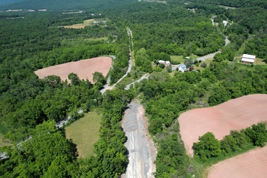
Abandoned Pennsylvania Turnpike and US 30
-
Aerial view of Breezewood, Pennsylvania, May 2023 [05]
![Aerial view of Breezewood, Pennsylvania, May 2023 [05] (11256 visits) Aerial view of Breezewood, Pennsylvania. View facing approximately west.
More at The Schumin Web:
... Aerial view of Breezewood, Pennsylvania, May 2023 [05]](../../../i/upload/2024/07/20/20240720160044-7a0b5dab-cu_s9999x250.jpg)
-
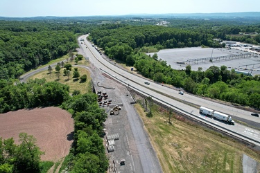
PTC-owned section of abandoned Pennsylvania Turnpike
-
Aerial view of Breezewood interchange for the Pennsylvania Turnpike [02]
![Aerial view of Breezewood interchange for the Pennsylvania Turnpike [02] (1505 visits) Aerial view of Breezewood interchange for the Pennsylvania Turnpike. View facing approximately sout... Aerial view of Breezewood interchange for the Pennsylvania Turnpike [02]](../../../i/upload/2024/07/20/20240720160211-2048dec3-cu_s9999x250.jpg)
-
Aerial view of Breezewood, Pennsylvania, May 2023 [03]
![Aerial view of Breezewood, Pennsylvania, May 2023 [03] (11383 visits) Aerial view of Breezewood, Pennsylvania. View facing approximately southeast.
More at The Schumin ... Aerial view of Breezewood, Pennsylvania, May 2023 [03]](../../../i/upload/2024/07/20/20240720160215-e2569c9a-cu_s9999x250.jpg)
-
Aerial view of Breezewood, Pennsylvania, May 2023 [07]
![Aerial view of Breezewood, Pennsylvania, May 2023 [07] (3045 visits) Aerial view of Breezewood, Pennsylvania. View facing eastbound along US 30.
More at The Schumin We... Aerial view of Breezewood, Pennsylvania, May 2023 [07]](../../../i/upload/2024/07/20/20240720160220-bc205056-cu_s9999x250.jpg)
-
Oakland neighborhood in Pittsburgh [02]
![Oakland neighborhood in Pittsburgh [02] (2835 visits) Aerial view of the Oakland neighborhood in Pittsburgh, Pennsylvania.
More at The Schumin Web:
www.s... Oakland neighborhood in Pittsburgh [02]](../../../i/upload/2024/07/20/20240720160905-e13411a5-cu_s9999x250.jpg)
-
Aerial view of East Liberty Presbyterian Church [02]
![Aerial view of East Liberty Presbyterian Church [02] (2951 visits) Aerial view of East Liberty Presbyterian Church, also known as the Cathedral of Hope, a large church... Aerial view of East Liberty Presbyterian Church [02]](../../../i/upload/2024/07/20/20240720160925-113a640a-cu_s9999x250.jpg)
-
Aerial view of East Liberty Presbyterian Church [04]
![Aerial view of East Liberty Presbyterian Church [04] (2947 visits) Aerial view of East Liberty Presbyterian Church, also known as the Cathedral of Hope, a large church... Aerial view of East Liberty Presbyterian Church [04]](../../../i/upload/2024/07/20/20240720160929-16fd7e34-cu_s9999x250.jpg)
-
Aerial view of East Liberty Presbyterian Church [06]
![Aerial view of East Liberty Presbyterian Church [06] (2927 visits) Aerial view of East Liberty Presbyterian Church, also known as the Cathedral of Hope, a large church... Aerial view of East Liberty Presbyterian Church [06]](../../../i/upload/2024/07/20/20240720160933-a6419b30-cu_s9999x250.jpg)
-
Aerial view of East Liberty Presbyterian Church [11]
![Aerial view of East Liberty Presbyterian Church [11] (2913 visits) Aerial view of East Liberty Presbyterian Church, also known as the Cathedral of Hope, a large church... Aerial view of East Liberty Presbyterian Church [11]](../../../i/upload/2024/07/20/20240720160938-8f5a529e-cu_s9999x250.jpg)
-
Aerial view of East Liberty Presbyterian Church [12]
![Aerial view of East Liberty Presbyterian Church [12] (2996 visits) Aerial view of East Liberty Presbyterian Church, also known as the Cathedral of Hope, a large church... Aerial view of East Liberty Presbyterian Church [12]](../../../i/upload/2024/07/20/20240720160942-7f513a92-cu_s9999x250.jpg)
-
Aerial view of East Liberty Presbyterian Church [20]
![Aerial view of East Liberty Presbyterian Church [20] (3001 visits) Aerial view of East Liberty Presbyterian Church, also known as the Cathedral of Hope, a large church... Aerial view of East Liberty Presbyterian Church [20]](../../../i/upload/2024/07/20/20240720160946-69e2d66b-cu_s9999x250.jpg)
-
Aerial view of East Liberty Presbyterian Church [23]
![Aerial view of East Liberty Presbyterian Church [23] (3025 visits) Aerial view of East Liberty Presbyterian Church, also known as the Cathedral of Hope, a large church... Aerial view of East Liberty Presbyterian Church [23]](../../../i/upload/2024/07/20/20240720160950-71281329-cu_s9999x250.jpg)
-
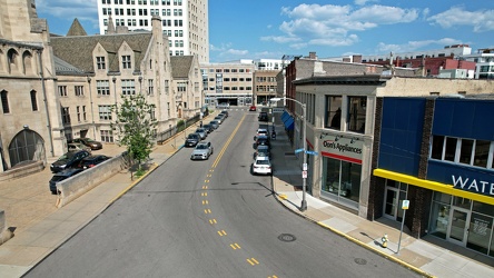
Baum Boulevard, facing east
-
Aerial view of East Liberty Presbyterian Church [10]
![Aerial view of East Liberty Presbyterian Church [10] (2945 visits) Aerial view of East Liberty Presbyterian Church, also known as the Cathedral of Hope, a large church... Aerial view of East Liberty Presbyterian Church [10]](../../../i/upload/2024/07/20/20240720161000-0209603e-cu_s9999x250.jpg)
-
Aerial view of East Liberty Presbyterian Church [13]
![Aerial view of East Liberty Presbyterian Church [13] (2907 visits) Aerial view of East Liberty Presbyterian Church, also known as the Cathedral of Hope, a large church... Aerial view of East Liberty Presbyterian Church [13]](../../../i/upload/2024/07/20/20240720161004-3f71162c-cu_s9999x250.jpg)
-
Aerial view of East Liberty Presbyterian Church [18]
![Aerial view of East Liberty Presbyterian Church [18] (2998 visits) Aerial view of East Liberty Presbyterian Church, also known as the Cathedral of Hope, a large church... Aerial view of East Liberty Presbyterian Church [18]](../../../i/upload/2024/07/20/20240720161008-f23a38fa-cu_s9999x250.jpg)
-
Aerial view of East Liberty Presbyterian Church [21]
![Aerial view of East Liberty Presbyterian Church [21] (2968 visits) Aerial view of East Liberty Presbyterian Church, also known as the Cathedral of Hope, a large church... Aerial view of East Liberty Presbyterian Church [21]](../../../i/upload/2024/07/20/20240720161013-99e0adfe-cu_s9999x250.jpg)
-
Aerial view of East Liberty Presbyterian Church [08]
![Aerial view of East Liberty Presbyterian Church [08] (2959 visits) Aerial view of East Liberty Presbyterian Church, also known as the Cathedral of Hope, a large church... Aerial view of East Liberty Presbyterian Church [08]](../../../i/upload/2024/07/20/20240720161021-d331e071-cu_s9999x250.jpg)
-
Aerial view of East Liberty Presbyterian Church [17]
![Aerial view of East Liberty Presbyterian Church [17] (2952 visits) Aerial view of East Liberty Presbyterian Church, also known as the Cathedral of Hope, a large church... Aerial view of East Liberty Presbyterian Church [17]](../../../i/upload/2024/07/20/20240720161026-6ad4630b-cu_s9999x250.jpg)
-
Aerial view of East Liberty Presbyterian Church [19]
![Aerial view of East Liberty Presbyterian Church [19] (3045 visits) Aerial view of East Liberty Presbyterian Church, also known as the Cathedral of Hope, a large church... Aerial view of East Liberty Presbyterian Church [19]](../../../i/upload/2024/07/20/20240720161030-5a181c2c-cu_s9999x250.jpg)
-
Aerial view of East Liberty Presbyterian Church [15]
![Aerial view of East Liberty Presbyterian Church [15] (2905 visits) Aerial view of East Liberty Presbyterian Church, also known as the Cathedral of Hope, a large church... Aerial view of East Liberty Presbyterian Church [15]](../../../i/upload/2024/07/20/20240720161034-6b35469d-cu_s9999x250.jpg)
-
Aerial view of the Cathedral of Learning [01]
![Aerial view of the Cathedral of Learning [01] (2563 visits) Aerial view of the Cathedral of Learning, a 42-story building on the campus of the University of Pit... Aerial view of the Cathedral of Learning [01]](../../../i/upload/2024/07/20/20240720161042-d85d5a86-cu_s9999x250.jpg)
-
Century III Mall [01]
![Century III Mall [01] (3122 visits) Aerial view of Century III Mall, a defunct shopping mall in West Mifflin, Pennsylvania that operated... Century III Mall [01]](../../../i/upload/2024/07/20/20240720161058-7f6bde94-cu_s9999x250.jpg)
-
Aerial view of East Liberty Presbyterian Church [03]
![Aerial view of East Liberty Presbyterian Church [03] (2975 visits) Aerial view of East Liberty Presbyterian Church, also known as the Cathedral of Hope, a large church... Aerial view of East Liberty Presbyterian Church [03]](../../../i/upload/2024/07/20/20240720161105-e2137cac-cu_s9999x250.jpg)
-
Aerial view of East Liberty Presbyterian Church [05]
![Aerial view of East Liberty Presbyterian Church [05] (3073 visits) Aerial view of East Liberty Presbyterian Church, also known as the Cathedral of Hope, a large church... Aerial view of East Liberty Presbyterian Church [05]](../../../i/upload/2024/07/20/20240720161109-bae1d6d3-cu_s9999x250.jpg)
-
Aerial view of East Liberty Presbyterian Church [22]
![Aerial view of East Liberty Presbyterian Church [22] (3022 visits) Aerial view of East Liberty Presbyterian Church, also known as the Cathedral of Hope, a large church... Aerial view of East Liberty Presbyterian Church [22]](../../../i/upload/2024/07/20/20240720161113-6de998b7-cu_s9999x250.jpg)
-
Aerial view of East Liberty Presbyterian Church [01]
![Aerial view of East Liberty Presbyterian Church [01] (3031 visits) Aerial view of East Liberty Presbyterian Church, also known as the Cathedral of Hope, a large church... Aerial view of East Liberty Presbyterian Church [01]](../../../i/upload/2024/07/20/20240720161117-a77350d6-cu_s9999x250.jpg)
-
Aerial view of East Liberty Presbyterian Church [14]
![Aerial view of East Liberty Presbyterian Church [14] (3003 visits) Aerial view of East Liberty Presbyterian Church, also known as the Cathedral of Hope, a large church... Aerial view of East Liberty Presbyterian Church [14]](../../../i/upload/2024/07/20/20240720161121-2f08111b-cu_s9999x250.jpg)
-
Aerial view of East Liberty Presbyterian Church [16]
![Aerial view of East Liberty Presbyterian Church [16] (2971 visits) Aerial view of East Liberty Presbyterian Church, also known as the Cathedral of Hope, a large church... Aerial view of East Liberty Presbyterian Church [16]](../../../i/upload/2024/07/20/20240720161125-66b55a4b-cu_s9999x250.jpg)
-
Aerial view of East Liberty Presbyterian Church [09]
![Aerial view of East Liberty Presbyterian Church [09] (2978 visits) Aerial view of East Liberty Presbyterian Church, also known as the Cathedral of Hope, a large church... Aerial view of East Liberty Presbyterian Church [09]](../../../i/upload/2024/07/20/20240720161129-5fb4069e-cu_s9999x250.jpg)
-
Aerial view of East Liberty Presbyterian Church [07]
![Aerial view of East Liberty Presbyterian Church [07] (2938 visits) Aerial view of East Liberty Presbyterian Church, also known as the Cathedral of Hope, a large church... Aerial view of East Liberty Presbyterian Church [07]](../../../i/upload/2024/07/20/20240720161134-5af0a002-cu_s9999x250.jpg)
-
Century III Mall [02]
![Century III Mall [02] (3068 visits) Aerial view of Century III Mall, a defunct shopping mall in West Mifflin, Pennsylvania that operated... Century III Mall [02]](../../../i/upload/2024/07/20/20240720161141-6066f100-cu_s9999x250.jpg)
-
Aerial view of the Cathedral of Learning [02]
![Aerial view of the Cathedral of Learning [02] (2695 visits) Aerial view of the Cathedral of Learning, a 42-story building on the campus of the University of Pit... Aerial view of the Cathedral of Learning [02]](../../../i/upload/2024/07/20/20240720161202-cd6b3ac5-cu_s9999x250.jpg)
-
Oakland neighborhood in Pittsburgh [01]
![Oakland neighborhood in Pittsburgh [01] (2831 visits) Aerial view of the Oakland neighborhood in Pittsburgh, Pennsylvania.
More at The Schumin Web:
www.s... Oakland neighborhood in Pittsburgh [01]](../../../i/upload/2024/07/20/20240720161207-8545eba5-cu_s9999x250.jpg)
-
Aerial view of the Cathedral of Learning [03]
![Aerial view of the Cathedral of Learning [03] (2681 visits) Aerial view of the Cathedral of Learning, a 42-story building on the campus of the University of Pit... Aerial view of the Cathedral of Learning [03]](../../../i/upload/2024/07/20/20240720161219-7d7180de-cu_s9999x250.jpg)
-
Century III Mall [03]
![Century III Mall [03] (3099 visits) Aerial view of Century III Mall, a defunct shopping mall in West Mifflin, Pennsylvania that operated... Century III Mall [03]](../../../i/upload/2024/07/20/20240720161231-2a524ea7-cu_s9999x250.jpg)
-
Century III Mall [04]
![Century III Mall [04] (3165 visits) Aerial view of Century III Mall, a defunct shopping mall in West Mifflin, Pennsylvania that operated... Century III Mall [04]](../../../i/upload/2024/07/20/20240720161248-65f75887-cu_s9999x250.jpg)
-
Aerial view of the Cathedral of Learning [04]
![Aerial view of the Cathedral of Learning [04] (2586 visits) Aerial view of the Cathedral of Learning, a 42-story building on the campus of the University of Pit... Aerial view of the Cathedral of Learning [04]](../../../i/upload/2024/07/20/20240720161311-ac0cf271-cu_s9999x250.jpg)
-
Century III Mall [05]
![Century III Mall [05] (3126 visits) Aerial view of Century III Mall, a defunct shopping mall in West Mifflin, Pennsylvania that operated... Century III Mall [05]](../../../i/upload/2024/07/20/20240720161319-452cd7ca-cu_s9999x250.jpg)
-
Aerial view of the Cathedral of Learning [05]
![Aerial view of the Cathedral of Learning [05] (2647 visits) Aerial view of the Cathedral of Learning, a 42-story building on the campus of the University of Pit... Aerial view of the Cathedral of Learning [05]](../../../i/upload/2024/07/20/20240720161336-9b38bf69-cu_s9999x250.jpg)
-
Century III Mall [06]
![Century III Mall [06] (3346 visits) Aerial view of Century III Mall, a defunct shopping mall in West Mifflin, Pennsylvania that operated... Century III Mall [06]](../../../i/upload/2024/07/20/20240720161348-da985438-cu_s9999x250.jpg)
-
Aerial view of the Cathedral of Learning [06]
![Aerial view of the Cathedral of Learning [06] (2671 visits) Aerial view of the Cathedral of Learning, a 42-story building on the campus of the University of Pit... Aerial view of the Cathedral of Learning [06]](../../../i/upload/2024/07/20/20240720161352-ef9aff34-cu_s9999x250.jpg)
-
Aerial view of the Cathedral of Learning [07]
![Aerial view of the Cathedral of Learning [07] (2754 visits) Aerial view of the Cathedral of Learning, a 42-story building on the campus of the University of Pit... Aerial view of the Cathedral of Learning [07]](../../../i/upload/2024/07/20/20240720161414-4b0c53ca-cu_s9999x250.jpg)
-
Aerial view of downtown Staunton, Virginia [01]
![Aerial view of downtown Staunton, Virginia [01] (1081 visits) Aerial view of downtown Staunton, Virginia. View facing approximately north.
Ben Schumin is a prof... Aerial view of downtown Staunton, Virginia [01]](../../../i/upload/2024/08/24/20240824104621-87f086a2-cu_s9999x250.jpg)
-
Aerial view of downtown Staunton, Virginia [02]
![Aerial view of downtown Staunton, Virginia [02] (961 visits) Aerial view of downtown Staunton, Virginia. View facing approximately northeast.
Ben Schumin is a ... Aerial view of downtown Staunton, Virginia [02]](../../../i/upload/2024/08/24/20240824104624-5fe809bd-cu_s9999x250.jpg)
-
Aerial view of downtown Staunton, Virginia [03]
![Aerial view of downtown Staunton, Virginia [03] (994 visits) Aerial view of downtown Staunton, Virginia. View facing approximately northeast.
Ben Schumin is ... Aerial view of downtown Staunton, Virginia [03]](../../../i/upload/2024/08/24/20240824104631-e5b2dd3d-cu_s9999x250.jpg)
-
Aerial view of downtown Staunton, Virginia [04]
![Aerial view of downtown Staunton, Virginia [04] (1003 visits) Aerial view of downtown Staunton, Virginia. View facing approximately west.
Ben Schumin is a profe... Aerial view of downtown Staunton, Virginia [04]](../../../i/upload/2024/08/24/20240824104635-29b54f55-cu_s9999x250.jpg)
-
Aerial view of downtown Staunton, Virginia [05]
![Aerial view of downtown Staunton, Virginia [05] (1015 visits) Aerial view of downtown Staunton, Virginia. View facing approximately southeast.
Ben Schumin is a ... Aerial view of downtown Staunton, Virginia [05]](../../../i/upload/2024/08/24/20240824104639-d3696cc9-cu_s9999x250.jpg)
-
Aerial view of downtown Staunton, Virginia [06]
![Aerial view of downtown Staunton, Virginia [06] (978 visits) Aerial view of downtown Staunton, Virginia. View facing approximately south.
Ben Schumin is a prof... Aerial view of downtown Staunton, Virginia [06]](../../../i/upload/2024/08/24/20240824104643-1e970880-cu_s9999x250.jpg)
-
Exit 225 on Interstate 81 [01]
![Exit 225 on Interstate 81 [01] (1428 visits) Exit 225 on Interstate 81 in Augusta County, Virginia, providing an interchange with Virginia State ... Exit 225 on Interstate 81 [01]](../../../i/upload/2024/08/24/20240824104647-af96033b-cu_s9999x250.jpg)
-
Exit 225 on Interstate 81 [02]
![Exit 225 on Interstate 81 [02] (1445 visits) Exit 225 on Interstate 81 in Augusta County, Virginia, providing an interchange with Virginia State ... Exit 225 on Interstate 81 [02]](../../../i/upload/2024/08/24/20240824104650-f35998e0-cu_s9999x250.jpg)
-
Exit 225 on Interstate 81 [03]
![Exit 225 on Interstate 81 [03] (1412 visits) Exit 225 on Interstate 81 in Augusta County, Virginia, providing an interchange with Virginia State ... Exit 225 on Interstate 81 [03]](../../../i/upload/2024/08/24/20240824104656-4dd28daf-cu_s9999x250.jpg)
-
Exit 225 on Interstate 81 [04]
![Exit 225 on Interstate 81 [04] (2479 visits) Exit 225 on Interstate 81 in Augusta County, Virginia, providing an interchange with Virginia State ... Exit 225 on Interstate 81 [04]](../../../i/upload/2024/08/24/20240824104700-45b5b9b6-cu_s9999x250.jpg)
-
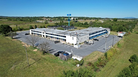
Motel 6 near Staunton, Virginia
-
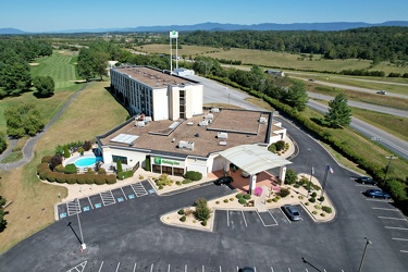
Holiday Inn near Staunton, Virginia
-
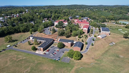
Virginia School for the Deaf and the Blind
-
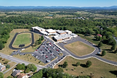
Aerial view of Staunton High School
-
Ravenglass Way [10]
![Ravenglass Way [10] (2285 visits) Overhead view of Ravenglass Way, a street in Montgomery Village, Maryland. North is to the bottom r... Ravenglass Way [10]](../../../i/upload/2024/11/20/20241120093351-250cbe61-cu_s9999x250.jpg)
-
Sunset over Montgomery Village [01]
![Sunset over Montgomery Village [01] (1194 visits) The sun sets over Montgomery Village, Maryland on the evening of November 17, 2023.
More at The Sch... Sunset over Montgomery Village [01]](../../../i/upload/2024/11/20/20241120093359-6e4a8f21-cu_s9999x250.jpg)
-
Sunset over Montgomery Village [02]
![Sunset over Montgomery Village [02] (1146 visits) The sun sets over Montgomery Village, Maryland on the evening of November 17, 2023.
More at The Sch... Sunset over Montgomery Village [02]](../../../i/upload/2024/11/20/20241120093408-5c11a279-cu_s9999x250.jpg)
-
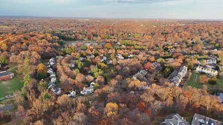
The Downs area in Montgomery Village
-
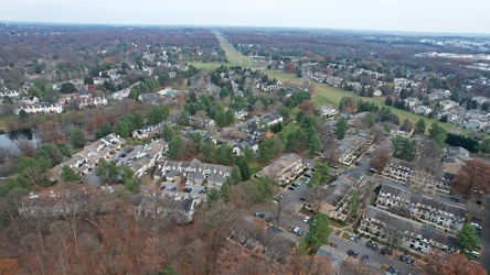
Montgomery Village, facing east
-
Ravenglass Way [11]
![Ravenglass Way [11] (2101 visits) Overhead view of Ravenglass Way, a street in Montgomery Village, Maryland.
More at The Schumin Web:... Ravenglass Way [11]](../../../i/upload/2024/11/20/20241120095538-f7c081d2-cu_s9999x250.jpg)
-
Ravenglass Way [12]
![Ravenglass Way [12] (2095 visits) Overhead view of Ravenglass Way, a street in Montgomery Village, Maryland.
More at The Schumin Web:... Ravenglass Way [12]](../../../i/upload/2024/11/20/20241120095547-36a4979e-cu_s9999x250.jpg)