-
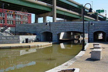
Bridge over Canal in Richmond, Virginia
-
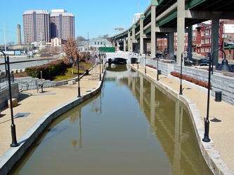
Canal Walk near Shockoe Bottom
-
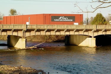
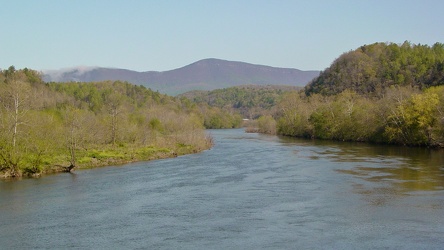
South River in Waynesboro
-
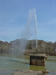
Fountain in the James River
-
View of James River from Harry Flood Byrd Bridge
-
Ramp to Downtown Expressway [02]
![Ramp to Downtown Expressway [02] (3071 visits) Highway ramp connecting northbound Interstate 95 to the Downtown Expressway over the Canal in Richmo... Ramp to Downtown Expressway [02]](../../../../i/upload/2024/07/17/20240717155008-eff88bf6-cu_s9999x250.jpg)
-
Ramp to Downtown Expressway [01]
![Ramp to Downtown Expressway [01] (3539 visits) Highway ramp connecting northbound Interstate 95 to the Downtown Expressway over the Canal in Richmo... Ramp to Downtown Expressway [01]](../../../../i/upload/2024/07/17/20240717155016-33eaba18-cu_s9999x250.jpg)
-
Canal Walk through Shockoe Bottom [05]
![Canal Walk through Shockoe Bottom [05] (2621 visits) The Canal Walk as it passes through Richmond, Virginia's Shockoe Bottom neighborhood, in the shadow ... Canal Walk through Shockoe Bottom [05]](../../../../i/upload/2024/07/17/20240717155021-9a708136-cu_s9999x250.jpg)
-
Canal Walk through Shockoe Bottom [04]
![Canal Walk through Shockoe Bottom [04] (2678 visits) The Canal Walk as it passes through Richmond, Virginia's Shockoe Bottom neighborhood, in the shadow ... Canal Walk through Shockoe Bottom [04]](../../../../i/upload/2024/07/17/20240717155024-693f8160-cu_s9999x250.jpg)
-
Robert E. Lee Memorial Bridge and Belle Isle pedestrian bridge [02]
![Robert E. Lee Memorial Bridge and Belle Isle pedestrian bridge [02] (2155 visits) The Robert E. Lee Memorial Bridge, with the Belle Isle pedestrian bridge suspended beneath by cables... Robert E. Lee Memorial Bridge and Belle Isle pedestrian bridge [02]](../../../../i/upload/2024/07/17/20240717155125-6acbde52-cu_s9999x250.jpg)
-
Robert E. Lee Memorial Bridge and Belle Isle pedestrian bridge [01]
![Robert E. Lee Memorial Bridge and Belle Isle pedestrian bridge [01] (3455 visits) The Robert E. Lee Memorial Bridge, with the Belle Isle pedestrian bridge suspended beneath by cables... Robert E. Lee Memorial Bridge and Belle Isle pedestrian bridge [01]](../../../../i/upload/2024/07/17/20240717155128-6aa706b6-cu_s9999x250.jpg)
-
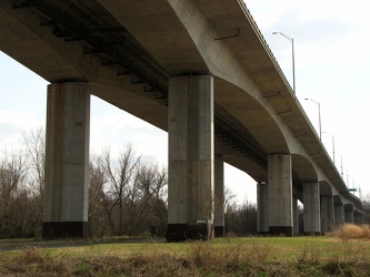
Robert E. Lee Memorial Bridge
-
Canal Walk through Shockoe Bottom [03]
![Canal Walk through Shockoe Bottom [03] (1487 visits) The Canal Walk as it passes through the Shockoe Bottom neighborhood, in the shadow of the Downtown E... Canal Walk through Shockoe Bottom [03]](../../../../i/upload/2024/07/17/20240717155332-20a25b99-cu_s9999x250.jpg)
-
Canal Walk through Shockoe Bottom [02]
![Canal Walk through Shockoe Bottom [02] (1695 visits) The Canal Walk as it passes through the Shockoe Bottom neighborhood, in the shadow of the Downtown E... Canal Walk through Shockoe Bottom [02]](../../../../i/upload/2024/07/17/20240717155340-89b9c324-cu_s9999x250.jpg)
-
Canal Walk through Shockoe Bottom [01]
![Canal Walk through Shockoe Bottom [01] (2510 visits) The Canal Walk as it passes through the Shockoe Bottom neighborhood, in the shadow of the Downtown E... Canal Walk through Shockoe Bottom [01]](../../../../i/upload/2024/07/17/20240717155345-29a96509-cu_s9999x250.jpg)
-
Triple Crossing area [02]
![Triple Crossing area [02] (4405 visits) Area around the Triple Crossing, in the Shockoe Bottom neighborhood of Richmond, Virginia.
More at ... Triple Crossing area [02]](../../../../i/upload/2024/07/17/20240717155355-a9821d17-cu_s9999x250.jpg)
-
Triple Crossing area [01]
![Triple Crossing area [01] (8290 visits) Area around the Triple Crossing, in the Shockoe Bottom neighborhood of Richmond, Virginia.
More at ... Triple Crossing area [01]](../../../../i/upload/2024/07/17/20240717155358-ef286524-cu_s9999x250.jpg)
-
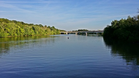
Roosevelt Bridge
-
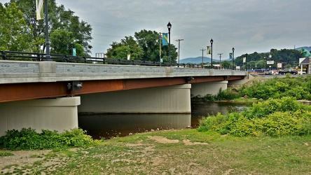
Broad Street bridge
-
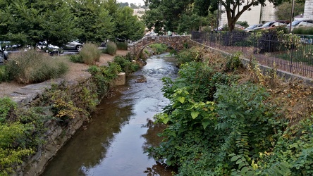
Lewis Creek
-
James River [01]
![James River [01] (1171 visits) The James River, viewed from the pedestrian level of the Harry Flood Byrd Memorial Bridge (carrying ... James River [01]](../../../../i/upload/2024/07/17/20240717232305-0495181a-cu_s9999x250.jpg)
-
James River [02]
![James River [02] (1306 visits) The James River, viewed from the pedestrian level of the Harry Flood Byrd Memorial Bridge (carrying ... James River [02]](../../../../i/upload/2024/07/17/20240717232307-fe5f228d-cu_s9999x250.jpg)
-
South Norfolk Jordan Bridge [02]
![South Norfolk Jordan Bridge [02] (2679 visits) The South Norfolk Jordan Bridge, commonly known as simply the Jordan Bridge, is a privately owned an... South Norfolk Jordan Bridge [02]](../../../../i/upload/2024/07/19/20240719101756-29d2696c-cu_s9999x250.jpg)
-
South Norfolk Jordan Bridge [01]
![South Norfolk Jordan Bridge [01] (2880 visits) The South Norfolk Jordan Bridge, commonly known as simply the Jordan Bridge, is a privately owned an... South Norfolk Jordan Bridge [01]](../../../../i/upload/2024/07/19/20240719101801-ff660e17-cu_s9999x250.jpg)
-
South Norfolk Jordan Bridge [04]
![South Norfolk Jordan Bridge [04] (2974 visits) The South Norfolk Jordan Bridge, commonly known as simply the Jordan Bridge, is a privately owned an... South Norfolk Jordan Bridge [04]](../../../../i/upload/2024/07/19/20240719101811-3ebcdc7d-cu_s9999x250.jpg)
-
South Norfolk Jordan Bridge [03]
![South Norfolk Jordan Bridge [03] (2957 visits) The South Norfolk Jordan Bridge, commonly known as simply the Jordan Bridge, is a privately owned an... South Norfolk Jordan Bridge [03]](../../../../i/upload/2024/07/19/20240719101829-ff0de2c9-cu_s9999x250.jpg)
-
Rocks in the Potomac River [01]
![Rocks in the Potomac River [01] (977 visits) Rocks in the Potomac River near Harpers Ferry. Viewed from the US 340 bridge.
Ben Schumin is a pro... Rocks in the Potomac River [01]](../../../../i/upload/2024/07/19/20240719103333-6083493b-cu_s9999x250.jpg)
-
Rocks in the Potomac River [02]
![Rocks in the Potomac River [02] (927 visits) Rocks in the Potomac River near Harpers Ferry. Viewed from the US 340 bridge.
Ben Schumin is a pro... Rocks in the Potomac River [02]](../../../../i/upload/2024/07/19/20240719103338-04e1c1e1-cu_s9999x250.jpg)
-
Rocks in the Potomac River [03]
![Rocks in the Potomac River [03] (922 visits) Rocks in the Potomac River near Harpers Ferry. Viewed from the US 340 bridge.
Ben Schumin is a pro... Rocks in the Potomac River [03]](../../../../i/upload/2024/07/19/20240719103343-404e77e5-cu_s9999x250.jpg)
-
Rocks in the Potomac River [04]
![Rocks in the Potomac River [04] (937 visits) Rocks in the Potomac River near Harpers Ferry. Viewed from the US 340 bridge.
Ben Schumin is a pro... Rocks in the Potomac River [04]](../../../../i/upload/2024/07/19/20240719103348-1a3aef78-cu_s9999x250.jpg)
-
Rocks in the Potomac River [05]
![Rocks in the Potomac River [05] (999 visits) Rocks in the Potomac River near Harpers Ferry. Viewed from the US 340 bridge.
Ben Schumin is a pro... Rocks in the Potomac River [05]](../../../../i/upload/2024/07/19/20240719103353-ea395458-cu_s9999x250.jpg)
-
Potomac River from US 340 bridge [03]
![Potomac River from US 340 bridge [03] (1010 visits) The Potomac River, viewed from the US 340 bridge between Maryland and Virginia.
Ben Schumin is a pr... Potomac River from US 340 bridge [03]](../../../../i/upload/2024/07/19/20240719103359-b66380e8-cu_s9999x250.jpg)
-
Potomac River from US 340 bridge [04]
![Potomac River from US 340 bridge [04] (1093 visits) The Potomac River, viewed from the US 340 bridge between Maryland and Virginia.
Ben Schumin is a pr... Potomac River from US 340 bridge [04]](../../../../i/upload/2024/07/19/20240719103405-18d26a8b-cu_s9999x250.jpg)
-
Potomac River from US 340 bridge [05]
![Potomac River from US 340 bridge [05] (1108 visits) The Potomac River, viewed from the US 340 bridge between Maryland and Virginia.
Ben Schumin is a pr... Potomac River from US 340 bridge [05]](../../../../i/upload/2024/07/19/20240719103412-5b42c5b9-cu_s9999x250.jpg)
-
Interstate 64 near Rockfish Gap [01]
![Interstate 64 near Rockfish Gap [01] (65855 visits) Interstate 64, near Rockfish Gap in Virginia.
Ben Schumin is a professional photographer who captur... Interstate 64 near Rockfish Gap [01]](../../../../i/upload/2024/07/19/20240719120555-d0d3c2ce-cu_s9999x250.jpg)
-
Interstate 64 near Rockfish Gap [02]
![Interstate 64 near Rockfish Gap [02] (2881 visits) Interstate 64, near Rockfish Gap in Virginia. The bridge in the foreground carries Skyline Drive ov... Interstate 64 near Rockfish Gap [02]](../../../../i/upload/2024/07/19/20240719120604-e2ad25dd-cu_s9999x250.jpg)
-
Interstate 64 near Rockfish Gap [03]
![Interstate 64 near Rockfish Gap [03] (2893 visits) Interstate 64, near Rockfish Gap in Virginia. The bridge in the foreground carries Skyline Drive ov... Interstate 64 near Rockfish Gap [03]](../../../../i/upload/2024/07/19/20240719120613-6e2190f6-cu_s9999x250.jpg)
-
Interstate 64 near Rockfish Gap [04]
![Interstate 64 near Rockfish Gap [04] (2902 visits) Interstate 64, near Rockfish Gap in Virginia. The bridge in the foreground carries Skyline Drive ov... Interstate 64 near Rockfish Gap [04]](../../../../i/upload/2024/07/19/20240719120620-49d9b327-cu_s9999x250.jpg)
-
Interstate 64 near Rockfish Gap [05]
![Interstate 64 near Rockfish Gap [05] (10704 visits) Interstate 64, near Rockfish Gap in Virginia. The boundary between Augusta and Nelson Counties runs... Interstate 64 near Rockfish Gap [05]](../../../../i/upload/2024/07/19/20240719120629-90e00218-cu_s9999x250.jpg)
-
Point of Rocks Bridge [03]
![Point of Rocks Bridge [03] (1358 visits) The Point of Rocks Bridge, which carries US Route 15 over the Potomac River between Loudoun County, ... Point of Rocks Bridge [03]](../../../../i/upload/2024/07/19/20240719121604-b7b9e112-cu_s9999x250.jpg)
-
Point of Rocks Bridge [05]
![Point of Rocks Bridge [05] (1424 visits) Overhead view of the Point of Rocks Bridge, which carries US Route 15 over the Potomac River between... Point of Rocks Bridge [05]](../../../../i/upload/2024/07/19/20240719121622-d2dfa3a8-cu_s9999x250.jpg)
-
Point of Rocks Bridge [02]
![Point of Rocks Bridge [02] (1400 visits) The Point of Rocks Bridge, which carries US Route 15 over the Potomac River between Loudoun County, ... Point of Rocks Bridge [02]](../../../../i/upload/2024/07/19/20240719121627-117c91a4-cu_s9999x250.jpg)
-
Point of Rocks Bridge [01]
![Point of Rocks Bridge [01] (1361 visits) The Point of Rocks Bridge, which carries US Route 15 over the Potomac River between Loudoun County, ... Point of Rocks Bridge [01]](../../../../i/upload/2024/07/19/20240719121631-a890c001-cu_s9999x250.jpg)
-
Point of Rocks Bridge [04]
![Point of Rocks Bridge [04] (1313 visits) The Point of Rocks Bridge, which carries US Route 15 over the Potomac River between Loudoun County, ... Point of Rocks Bridge [04]](../../../../i/upload/2024/07/19/20240719122649-6c75d4bd-cu_s9999x250.jpg)
-
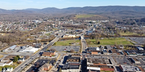
Main and Broad Streets, facing east
-
Downtown Waynesboro, Virginia, looking toward Invista [02]
![Downtown Waynesboro, Virginia, looking toward Invista [02] (4103 visits) Aerial view of downtown Waynesboro, Virginia, looking towards the Invista plant.
Ben Schumin is a p... Downtown Waynesboro, Virginia, looking toward Invista [02]](../../../../i/upload/2024/07/19/20240719130254-ae1aac9d-cu_s9999x250.jpg)
-
Point of Rocks Bridge [06]
![Point of Rocks Bridge [06] (2941 visits) The Point of Rocks Bridge, which carries US Route 15 over the Potomac River between Loudoun County, ... Point of Rocks Bridge [06]](../../../../i/upload/2024/07/19/20240719161609-122bd90b-cu_s9999x250.jpg)
-
Point of Rocks Bridge [07]
![Point of Rocks Bridge [07] (2881 visits) The Point of Rocks Bridge, which carries US Route 15 over the Potomac River between Loudoun County, ... Point of Rocks Bridge [07]](../../../../i/upload/2024/07/19/20240719161650-2c49391d-cu_s9999x250.jpg)
-
Point of Rocks Bridge [08]
![Point of Rocks Bridge [08] (2992 visits) The Point of Rocks Bridge, which carries US Route 15 over the Potomac River between Loudoun County, ... Point of Rocks Bridge [08]](../../../../i/upload/2024/07/19/20240719161700-351af3cd-cu_s9999x250.jpg)
-
Point of Rocks Bridge [09]
![Point of Rocks Bridge [09] (3038 visits) The Point of Rocks Bridge, which carries US Route 15 over the Potomac River between Loudoun County, ... Point of Rocks Bridge [09]](../../../../i/upload/2024/07/19/20240719161708-5ce37e28-cu_s9999x250.jpg)
-
Point of Rocks Bridge [10]
![Point of Rocks Bridge [10] (3098 visits) The Point of Rocks Bridge, which carries US Route 15 over the Potomac River between Loudoun County, ... Point of Rocks Bridge [10]](../../../../i/upload/2024/07/19/20240719161717-6572a682-cu_s9999x250.jpg)
-
Point of Rocks Bridge [11]
![Point of Rocks Bridge [11] (3137 visits) The Point of Rocks Bridge, which carries US Route 15 over the Potomac River between Loudoun County, ... Point of Rocks Bridge [11]](../../../../i/upload/2024/07/19/20240719161730-4f51193a-cu_s9999x250.jpg)
-
US Route 1 and CSX bridges over the Occoquan River [04]
![US Route 1 and CSX bridges over the Occoquan River [04] (3573 visits) US Route 1 and CSX bridges over the Occoquan River, between Lorton and Woodbridge, Virginia.
More a... US Route 1 and CSX bridges over the Occoquan River [04]](../../../../i/upload/2024/07/19/20240719165015-7daa0318-cu_s9999x250.jpg)
-
US Route 1 and CSX bridges over the Occoquan River [02]
![US Route 1 and CSX bridges over the Occoquan River [02] (13273 visits) US Route 1 and CSX bridges over the Occoquan River, between Lorton and Woodbridge, Virginia.
More a... US Route 1 and CSX bridges over the Occoquan River [02]](../../../../i/upload/2024/07/19/20240719165109-05002e7d-cu_s9999x250.jpg)
-
US Route 1 and CSX bridges over the Occoquan River [01]
![US Route 1 and CSX bridges over the Occoquan River [01] (13193 visits) US Route 1 and CSX bridges over the Occoquan River, between Lorton and Woodbridge, Virginia.
More a... US Route 1 and CSX bridges over the Occoquan River [01]](../../../../i/upload/2024/07/19/20240719165202-fbc052c5-cu_s9999x250.jpg)
-
US Route 1 and CSX bridges over the Occoquan River [03]
![US Route 1 and CSX bridges over the Occoquan River [03] (13365 visits) US Route 1 and CSX bridges over the Occoquan River, between Lorton and Woodbridge, Virginia.
More a... US Route 1 and CSX bridges over the Occoquan River [03]](../../../../i/upload/2024/07/19/20240719165233-1c08fb03-cu_s9999x250.jpg)
-
US 29 North, near Hilton Heights Road [01]
![US 29 North, near Hilton Heights Road [01] (2989 visits) US 29 north of Charlottesville, Virginia, near Hilton Heights Road, facing northbound.
Ben Schumin ... US 29 North, near Hilton Heights Road [01]](../../../../i/upload/2024/07/19/20240719171702-b12048d7-cu_s9999x250.jpg)
-
US 29 North, near Hilton Heights Road [02]
![US 29 North, near Hilton Heights Road [02] (2999 visits) US 29 north of Charlottesville, Virginia, near Hilton Heights Road, facing northbound.
Ben Schumin ... US 29 North, near Hilton Heights Road [02]](../../../../i/upload/2024/07/19/20240719171717-5729f873-cu_s9999x250.jpg)
-
Commercial area in Colonial Heights, Virginia [01]
![Commercial area in Colonial Heights, Virginia [01] (54187 visits) A commercial area in Colonial Heights, Virginia, consisting mostly of retail, restaurants, and lodgi... Commercial area in Colonial Heights, Virginia [01]](../../../../i/upload/2024/07/19/20240719195539-0ad1d227-cu_s9999x250.jpg)
-
James River Bridge [04]
![James River Bridge [04] (4295 visits) The James River Bridge, carrying US 17, US 258, and VA 32 between Newport News and Isle of Wight Cou... James River Bridge [04]](../../../../i/upload/2024/07/19/20240719202325-4257c4a3-cu_s9999x250.jpg)
-
James River Bridge [05]
![James River Bridge [05] (4354 visits) The James River Bridge, carrying US 17, US 258, and VA 32 between Newport News and Isle of Wight Cou... James River Bridge [05]](../../../../i/upload/2024/07/19/20240719202330-be52e801-cu_s9999x250.jpg)
-
Windward Towers and Leeward Marina [02]
![Windward Towers and Leeward Marina [02] (2929 visits) Aerial view of the Windward Towers condominium complex, with the Leeward Marina in front of it, in N... Windward Towers and Leeward Marina [02]](../../../../i/upload/2024/07/19/20240719202335-9d3149ac-cu_s9999x250.jpg)
-
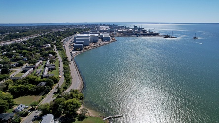
James River downstream from the JRB
-
James River Bridge [03]
![James River Bridge [03] (4203 visits) The James River Bridge, carrying US 17, US 258, and VA 32 between Newport News and Isle of Wight Cou... James River Bridge [03]](../../../../i/upload/2024/07/19/20240719202529-b0e807ab-cu_s9999x250.jpg)
-
James River Bridge [08]
![James River Bridge [08] (4315 visits) The James River Bridge, carrying US 17, US 258, and VA 32 between Newport News and Isle of Wight Cou... James River Bridge [08]](../../../../i/upload/2024/07/19/20240719202534-7843f0b6-cu_s9999x250.jpg)
-
James River Bridge [09]
![James River Bridge [09] (4431 visits) The James River Bridge, carrying US 17, US 258, and VA 32 between Newport News and Isle of Wight Cou... James River Bridge [09]](../../../../i/upload/2024/07/19/20240719202539-877160be-cu_s9999x250.jpg)
-
James River Bridge [06]
![James River Bridge [06] (4439 visits) The James River Bridge, carrying US 17, US 258, and VA 32 between Newport News and Isle of Wight Cou... James River Bridge [06]](../../../../i/upload/2024/07/19/20240719202642-04c26af8-cu_s9999x250.jpg)
-
James River Bridge [07]
![James River Bridge [07] (4215 visits) The James River Bridge, carrying US 17, US 258, and VA 32 between Newport News and Isle of Wight Cou... James River Bridge [07]](../../../../i/upload/2024/07/19/20240719202647-27533348-cu_s9999x250.jpg)
-
James River Bridge [11]
![James River Bridge [11] (4331 visits) The James River Bridge, carrying US 17, US 258, and VA 32 between Newport News and Isle of Wight Cou... James River Bridge [11]](../../../../i/upload/2024/07/19/20240719202653-8658db60-cu_s9999x250.jpg)
-
James River Bridge [02]
![James River Bridge [02] (4414 visits) The James River Bridge, carrying US 17, US 258, and VA 32 between Newport News and Isle of Wight Cou... James River Bridge [02]](../../../../i/upload/2024/07/19/20240719202733-9fb73a13-cu_s9999x250.jpg)
-
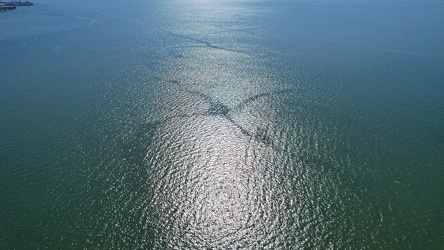
Cross pattern in the water
-
James River Bridge [10]
![James River Bridge [10] (4361 visits) The James River Bridge, carrying US 17, US 258, and VA 32 between Newport News and Isle of Wight Cou... James River Bridge [10]](../../../../i/upload/2024/07/19/20240719202742-6238cd7f-cu_s9999x250.jpg)
-
Windward Towers and Leeward Marina [01]
![Windward Towers and Leeward Marina [01] (4603 visits) Aerial view of the Windward Towers condominium complex, with the Leeward Marina in front of it, in N... Windward Towers and Leeward Marina [01]](../../../../i/upload/2024/07/19/20240719202747-251158fb-cu_s9999x250.jpg)
-
James River Bridge [01]
![James River Bridge [01] (4118 visits) The James River Bridge, carrying US 17, US 258, and VA 32 between Newport News and Isle of Wight Cou... James River Bridge [01]](../../../../i/upload/2024/07/19/20240719202759-cb89473a-cu_s9999x250.jpg)
-
James River Bridge from afar [01]
![James River Bridge from afar [01] (4099 visits) The James River Bridge, carrying US 17, US 258, and VA 32 between Newport News and Isle of Wight Cou... James River Bridge from afar [01]](../../../../i/upload/2024/07/19/20240719203153-0a034e64-cu_s9999x250.jpg)
-
James River Bridge from afar [02]
![James River Bridge from afar [02] (4129 visits) The James River Bridge, carrying US 17, US 258, and VA 32 between Newport News and Isle of Wight Cou... James River Bridge from afar [02]](../../../../i/upload/2024/07/19/20240719203158-427c0626-cu_s9999x250.jpg)
-
North bank of the James River [01]
![North bank of the James River [01] (2451 visits) The north bank of the James River, about six miles from its mouth, in Newport News, Virginia.
More ... North bank of the James River [01]](../../../../i/upload/2024/07/19/20240719203203-43675d31-cu_s9999x250.jpg)
-
North bank of the James River [02]
![North bank of the James River [02] (2437 visits) The north bank of the James River, about six miles from its mouth, in Newport News, Virginia.
More ... North bank of the James River [02]](../../../../i/upload/2024/07/19/20240719203208-f0ca844f-cu_s9999x250.jpg)
-
North bank of the James River [03]
![North bank of the James River [03] (2462 visits) The north bank of the James River, about six miles from its mouth, in Newport News, Virginia.
More ... North bank of the James River [03]](../../../../i/upload/2024/07/19/20240719203213-033820a2-cu_s9999x250.jpg)
-
24 Museum Drive [01]
![24 Museum Drive [01] (2511 visits) Aerial view of 24 Museum Drive, a house fronting the James River in Newport News, Virginia.
More at... 24 Museum Drive [01]](../../../../i/upload/2024/07/19/20240719203218-370040ec-cu_s9999x250.jpg)