-
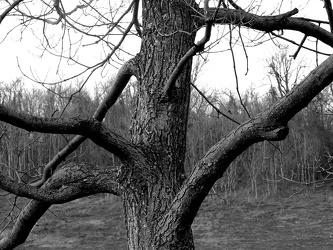
Tree at scenic overlook
-
Sunset from I-64 overlook [03]
![Sunset from I-64 overlook [03] (2209 visits) Sunset, viewed from the scenic overlook at milepost 103 on Interstate 64 eastbound in Albemarle Coun... Sunset from I-64 overlook [03]](../../../../i/upload/2024/07/13/20240713234247-066d4e9b-cu_s9999x250.jpg)
-
Sunset from I-64 overlook [01]
![Sunset from I-64 overlook [01] (2193 visits) Sunset, viewed from the scenic overlook at milepost 103 on Interstate 64 eastbound in Albemarle Coun... Sunset from I-64 overlook [01]](../../../../i/upload/2024/07/13/20240713234248-69674cad-cu_s9999x250.jpg)
-
Sunset from I-64 overlook [02]
![Sunset from I-64 overlook [02] (2194 visits) Sunset, viewed from the scenic overlook at milepost 103 on Interstate 64 eastbound in Albemarle Coun... Sunset from I-64 overlook [02]](../../../../i/upload/2024/07/13/20240713234249-3f6e970a-cu_s9999x250.jpg)
-
Sunset from I-64 overlook [04]
![Sunset from I-64 overlook [04] (2156 visits) Sunset, viewed from the scenic overlook at milepost 103 on Interstate 64 eastbound in Albemarle Coun... Sunset from I-64 overlook [04]](../../../../i/upload/2024/07/13/20240713234251-97a8e10e-cu_s9999x250.jpg)
-
View from Buena Vista overlook [01]
![View from Buena Vista overlook [01] (1696 visits) View from the Buena Vista overlook, on the Blue Ridge Parkway near the intersection with US 60.
Ben... View from Buena Vista overlook [01]](../../../../i/upload/2024/07/14/20240714235011-28c0ddbc-cu_s9999x250.jpg)
-
View from 20-Minute Cliff overlook [02]
![View from 20-Minute Cliff overlook [02] (1738 visits) View from 20-Minute Cliff, an overlook on the Blue Ridge Parkway near Vesuvius, Virginia.
Ben Schum... View from 20-Minute Cliff overlook [02]](../../../../i/upload/2024/07/14/20240714235012-88ae934f-cu_s9999x250.jpg)
-
View from Buena Vista overlook [02]
![View from Buena Vista overlook [02] (1743 visits) View from the Buena Vista overlook, on the Blue Ridge Parkway near the intersection with US 60.
Ben... View from Buena Vista overlook [02]](../../../../i/upload/2024/07/14/20240714235013-b233053d-cu_s9999x250.jpg)
-
View from 20-Minute Cliff overlook [01]
![View from 20-Minute Cliff overlook [01] (1840 visits) View from 20-Minute Cliff, an overlook on the Blue Ridge Parkway near Vesuvius, Virginia.
Ben Schum... View from 20-Minute Cliff overlook [01]](../../../../i/upload/2024/07/14/20240714235015-5d347656-cu_s9999x250.jpg)
-
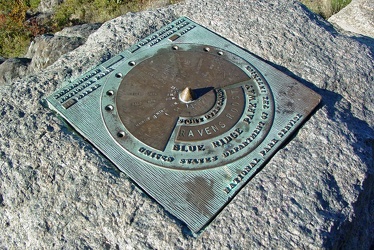
Plaque at Raven's Roost overlook
-
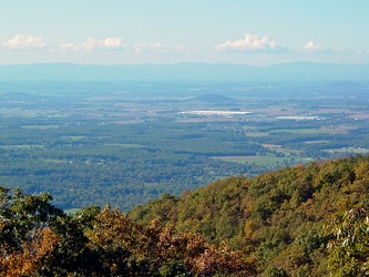
View from Raven's Roost
-
View from 20-Minute Cliff overlook [03]
![View from 20-Minute Cliff overlook [03] (1520 visits) View from 20-Minute Cliff, an overlook on the Blue Ridge Parkway near Vesuvius, Virginia.
Ben Schum... View from 20-Minute Cliff overlook [03]](../../../../i/upload/2024/07/15/20240715141705-52871955-cu_s9999x250.jpg)
-
Stream at Yankee Horse Ridge [01]
![Stream at Yankee Horse Ridge [01] (1707 visits) Stream with small waterfall at the Yankee Horse Ridge overlook, on the Blue Ridge Parkway near Monte... Stream at Yankee Horse Ridge [01]](../../../../i/upload/2024/07/15/20240715141706-0b231326-cu_s9999x250.jpg)
-
Stream at Yankee Horse Ridge [01]
![Stream at Yankee Horse Ridge [01] (1701 visits) Stream with small waterfall at the Yankee Horse Ridge overlook, on the Blue Ridge Parkway near Monte... Stream at Yankee Horse Ridge [01]](../../../../i/upload/2024/07/15/20240715141708-6e96c46a-cu_s9999x250.jpg)
-
Stream at Yankee Horse Ridge [01]
![Stream at Yankee Horse Ridge [01] (1591 visits) Stream with small waterfall at the Yankee Horse Ridge overlook, on the Blue Ridge Parkway near Monte... Stream at Yankee Horse Ridge [01]](../../../../i/upload/2024/07/15/20240715141709-62daf30c-cu_s9999x250.jpg)
-
Stream at Yankee Horse Ridge [01]
![Stream at Yankee Horse Ridge [01] (1935 visits) Stream with small waterfall at the Yankee Horse Ridge overlook, on the Blue Ridge Parkway near Monte... Stream at Yankee Horse Ridge [01]](../../../../i/upload/2024/07/15/20240715141711-08c8936c-cu_s9999x250.jpg)
-
Mercury Sable with ground lighting illuminated [01]
![Mercury Sable with ground lighting illuminated [01] (3403 visits) My 2004 Mercury Sable wagon with the ground-facing lights and the interior lights illuminated on the... Mercury Sable with ground lighting illuminated [01]](../../../../i/upload/2024/07/15/20240715141712-6e4690ee-cu_s9999x250.jpg)
-
Stream at Yankee Horse Ridge [01]
![Stream at Yankee Horse Ridge [01] (1794 visits) Stream with small waterfall at the Yankee Horse Ridge overlook, on the Blue Ridge Parkway near Monte... Stream at Yankee Horse Ridge [01]](../../../../i/upload/2024/07/15/20240715141714-3facf0fc-cu_s9999x250.jpg)
-
Mercury Sable with ground lighting illuminated [02]
![Mercury Sable with ground lighting illuminated [02] (3432 visits) My 2004 Mercury Sable wagon with the ground-facing lights and the interior lights illuminated on the... Mercury Sable with ground lighting illuminated [02]](../../../../i/upload/2024/07/15/20240715141715-42969fcc-cu_s9999x250.jpg)
-
View from 20-Minute Cliff overlook [04]
![View from 20-Minute Cliff overlook [04] (1555 visits) View from 20-Minute Cliff, an overlook on the Blue Ridge Parkway near Vesuvius, Virginia.
Ben Schum... View from 20-Minute Cliff overlook [04]](../../../../i/upload/2024/07/15/20240715204738-5eb438f6-cu_s9999x250.jpg)
-
View of the Blue Ridge Parkway from Humpback Rock
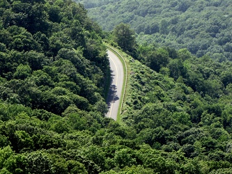
 The Quarry Overlook [03]
![The Quarry Overlook [03] (1640 visits) The Quarry Overlook, at milepost 101 on the Blue Ridge Parkway in Botetourt County, Virginia.
Ben S... The Quarry Overlook [03]](../../../../i/upload/2024/07/17/20240717233036-cf4a8757-cu_s9999x250.jpg)
 Sideling Hill rest area [01]
![Sideling Hill rest area [01] (2320 visits) Eastbound side of the Sideling Hill rest area, located along Interstate 68 in Washington County, Mar... Sideling Hill rest area [01]](../../../../i/upload/2024/07/17/20240717233459-e7ba195c-cu_s9999x250.jpg)
 Sideling Hill rest area [02]
![Sideling Hill rest area [02] (2064 visits) Eastbound access to the footbridge across the highway at the Sideling Hill rest area, located along ... Sideling Hill rest area [02]](../../../../i/upload/2024/07/17/20240717233505-c4590774-cu_s9999x250.jpg)
 Sideling Hill rest area [03]
![Sideling Hill rest area [03] (1933 visits) Footbridge across Interstate 68, allowing views of the cut through the mountain, at the Sideling Hil... Sideling Hill rest area [03]](../../../../i/upload/2024/07/17/20240717233511-e61616ff-cu_s9999x250.jpg)
 Sideling Hill rest area [04]
![Sideling Hill rest area [04] (2141 visits) Westbound access to the footbridge across the highway at the Sideling Hill rest area, located along ... Sideling Hill rest area [04]](../../../../i/upload/2024/07/17/20240717233516-e5cc17b4-cu_s9999x250.jpg)
 Sideling Hill rest area [05]
![Sideling Hill rest area [05] (2012 visits) Path to the westbound parking area and restrooms at the Sideling Hill rest area, located along Inter... Sideling Hill rest area [05]](../../../../i/upload/2024/07/17/20240717233521-b99b80cb-cu_s9999x250.jpg)
 Sideling Hill rest area [06]
![Sideling Hill rest area [06] (1926 visits) Stairs to a raised viewing area on the eastbound side of the Sideling Hill rest area, located along ... Sideling Hill rest area [06]](../../../../i/upload/2024/07/17/20240717233527-43e4656c-cu_s9999x250.jpg)
 Sideling Hill rest area [07]
![Sideling Hill rest area [07] (2093 visits) Raised viewing area on the eastbound side of the Sideling Hill rest area, located along Interstate 6... Sideling Hill rest area [07]](../../../../i/upload/2024/07/17/20240717233531-9f6ca0ea-cu_s9999x250.jpg)
 Sideling Hill rest area [08]
![Sideling Hill rest area [08] (2296 visits) Eastbound parking lot at the Sideling Hill rest area, located along Interstate 68 in Washington Coun... Sideling Hill rest area [08]](../../../../i/upload/2024/07/17/20240717233537-4406b863-cu_s9999x250.jpg)
 Sideling Hill rest area [09]
![Sideling Hill rest area [09] (2337 visits) Eastbound parking lot at the Sideling Hill rest area, located along Interstate 68 in Washington Coun... Sideling Hill rest area [09]](../../../../i/upload/2024/07/17/20240717233542-efb1100b-cu_s9999x250.jpg)
 Sideling Hill rest area [10]
![Sideling Hill rest area [10] (2148 visits) Eastbound side of the Sideling Hill rest area, located along Interstate 68 in Washington County, Mar... Sideling Hill rest area [10]](../../../../i/upload/2024/07/17/20240717233547-516b9676-cu_s9999x250.jpg)
-
Footbridge over Interstate 68 at Sideling Hill
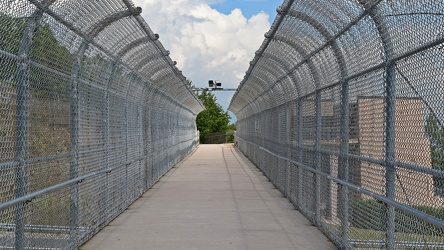
-
Rainstorm near Sideling Hill cut
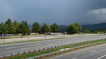
-
Interstate 68 cut through Sideling Hill [04]
![Interstate 68 cut through Sideling Hill [04] (2170 visits) Cut in Sideling Hill, carrying Interstate 68 between Washington and Allegany Counties in Maryland.
... Interstate 68 cut through Sideling Hill [04]](../../../../i/upload/2024/07/18/20240718220107-eeb97b29-cu_s9999x250.jpg)
-
Interstate 68 cut through Sideling Hill [03]
![Interstate 68 cut through Sideling Hill [03] (1947 visits) Cut in Sideling Hill, carrying Interstate 68 between Washington and Allegany Counties in Maryland.
... Interstate 68 cut through Sideling Hill [03]](../../../../i/upload/2024/07/18/20240718220111-2f9132e9-cu_s9999x250.jpg)
-
Interstate 68 cut through Sideling Hill [02]
![Interstate 68 cut through Sideling Hill [02] (3403 visits) Cut in Sideling Hill, carrying Interstate 68 between Washington and Allegany Counties in Maryland.
... Interstate 68 cut through Sideling Hill [02]](../../../../i/upload/2024/07/18/20240718220116-e8da0915-cu_s9999x250.jpg)
-
Interstate 68 cut through Sideling Hill [01]
![Interstate 68 cut through Sideling Hill [01] (3907 visits) Cut in Sideling Hill, carrying Interstate 68 between Washington and Allegany Counties in Maryland.
... Interstate 68 cut through Sideling Hill [01]](../../../../i/upload/2024/07/18/20240718220120-0789991f-cu_s9999x250.jpg)
-
Sideling Hill cut
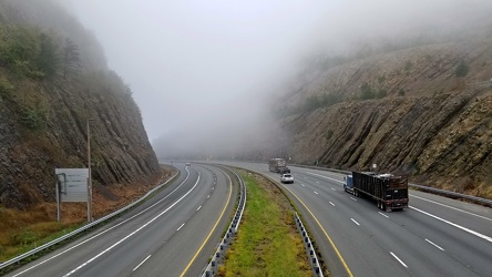
-
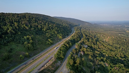
Interstate 64 in Nelson County, Virginia [01]
![Interstate 64 in Nelson County, Virginia [01] (10719 visits) Interstate 64 in Nelson County, Virginia, near Rockfish Gap. US 250 runs adjacent to the freeway.
... Interstate 64 in Nelson County, Virginia [01]](../../../../i/upload/2024/07/19/20240719115200-c8a2ce39-cu_s9999x250.jpg)
-
Interstate 64 in Nelson County, Virginia [02]
![Interstate 64 in Nelson County, Virginia [02] (10876 visits) Interstate 64 in Nelson County, Virginia, near Rockfish Gap. US 250 runs adjacent to the freeway.
... Interstate 64 in Nelson County, Virginia [02]](../../../../i/upload/2024/07/19/20240719115847-184fa12a-cu_s9999x250.jpg)
-
Interstate 64 in Nelson County, Virginia [03]
![Interstate 64 in Nelson County, Virginia [03] (11085 visits) Interstate 64 in Nelson County, Virginia, near Rockfish Gap. US 250 runs adjacent to the freeway.
... Interstate 64 in Nelson County, Virginia [03]](../../../../i/upload/2024/07/19/20240719115902-ff5fb9e1-cu_s9999x250.jpg)
-
Blue Ridge Mountains near Rockfish Gap [01]
![Blue Ridge Mountains near Rockfish Gap [01] (1558 visits) The Blue Ridge Mountains, viewed from above the Interstate 64 scenic overlook in Nelson County, Virg... Blue Ridge Mountains near Rockfish Gap [01]](../../../../i/upload/2024/07/19/20240719115911-d105cde8-cu_s9999x250.jpg)
-
Blue Ridge Mountains near Rockfish Gap [02]
![Blue Ridge Mountains near Rockfish Gap [02] (1526 visits) The Blue Ridge Mountains, viewed from above the Interstate 64 scenic overlook in Nelson County, Virg... Blue Ridge Mountains near Rockfish Gap [02]](../../../../i/upload/2024/07/19/20240719115926-47f38290-cu_s9999x250.jpg)
-
Place where a plaque used to be at Ravens Roost overlook [03]
![Place where a plaque used to be at Ravens Roost overlook [03] (1430 visits) The place where a National Park Service plaque used to be located atop a raised portion of the retai... Place where a plaque used to be at Ravens Roost overlook [03]](../../../../i/upload/2024/07/20/20240720111008-7c125d7a-cu_s9999x250.jpg)
-
View from Ravens Roost overlook [01]
![View from Ravens Roost overlook [01] (1265 visits) View from Ravens Roost overlook on the Blue Ridge Parkway in Virginia.
More at The Schumin Web:
www... View from Ravens Roost overlook [01]](../../../../i/upload/2024/07/20/20240720111047-eedd86a4-cu_s9999x250.jpg)
-
View from Ravens Roost overlook [02]
![View from Ravens Roost overlook [02] (1296 visits) View from Ravens Roost overlook on the Blue Ridge Parkway in Virginia.
More at The Schumin Web:
www... View from Ravens Roost overlook [02]](../../../../i/upload/2024/07/20/20240720111052-9d9ea25e-cu_s9999x250.jpg)
-
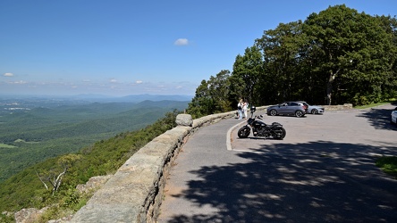
Ravens Roost overlook
-
Place where a plaque used to be at Ravens Roost overlook [01]
![Place where a plaque used to be at Ravens Roost overlook [01] (1427 visits) The place where a National Park Service plaque used to be located atop a raised portion of the retai... Place where a plaque used to be at Ravens Roost overlook [01]](../../../../i/upload/2024/07/20/20240720111142-228a886f-cu_s9999x250.jpg)
-
View from Ravens Roost overlook [03]
![View from Ravens Roost overlook [03] (1275 visits) View from Ravens Roost overlook on the Blue Ridge Parkway in Virginia.
More at The Schumin Web:
www... View from Ravens Roost overlook [03]](../../../../i/upload/2024/07/20/20240720111242-329db50f-cu_s9999x250.jpg)
-
Place where a plaque used to be at Ravens Roost overlook [02]
![Place where a plaque used to be at Ravens Roost overlook [02] (1396 visits) The place where a National Park Service plaque used to be located atop a raised portion of the retai... Place where a plaque used to be at Ravens Roost overlook [02]](../../../../i/upload/2024/07/20/20240720111248-a6c2e1fa-cu_s9999x250.jpg)
-
Interstate 64 east of Rockfish Gap
