-
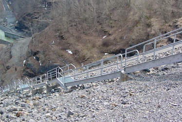
Stairs on Gathright Dam
-
Road over Gathright Dam [02]
![Road over Gathright Dam [02] (1605 visits) Road carrying traffic over Gathright Dam, an earthen and rolled rock-fill embankment dam on the Jack... Road over Gathright Dam [02]](../../../../../i/upload/2024/07/14/20240714102132-396c8a23-cu_s9999x250.jpg)
-
Road over Gathright Dam [01]
![Road over Gathright Dam [01] (1657 visits) Road carrying traffic over Gathright Dam, an earthen and rolled rock-fill embankment dam on the Jack... Road over Gathright Dam [01]](../../../../../i/upload/2024/07/14/20240714102138-0aa862c7-cu_s9999x250.jpg)
-
No parking sign on Gathright Dam [01]
![No parking sign on Gathright Dam [01] (1962 visits) "No parking" sign on the road over Gathright Dam. Parking is prohibited on the dam itself... No parking sign on Gathright Dam [01]](../../../../../i/upload/2024/07/14/20240714102141-459f947d-cu_s9999x250.jpg)
-
Market Square Walkway

-
Downtown Roanoke at the railroad tracks

-
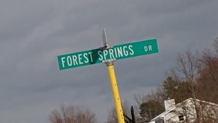
Intersection of Springer Road and Forest Springs Drive
-
Forest Springs Drive [01]
![Forest Springs Drive [01] (1262 visits) Forest Springs Drive, a residential street in Stuarts Draft, Virginia, facing north, at its intersec... Forest Springs Drive [01]](../../../../../i/upload/2024/07/17/20240717154858-173a58a4-cu_s9999x250.jpg)
-
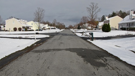
Springer Road
-
Stop sign at Warrenton Volunteer Fire Company

-
US 29 Business in Culpeper, Virginia [01]
![US 29 Business in Culpeper, Virginia [01] (3114 visits) Aerial view of US 29 Business on the north side of Culpeper, Virginia. View facing approximately ea... US 29 Business in Culpeper, Virginia [01]](../../../../../i/upload/2024/07/19/20240719155959-cf1d0444-cu_s9999x250.jpg)
-
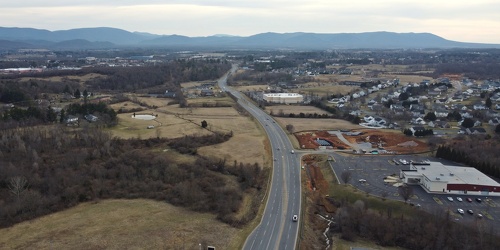
View down Lew Dewitt Boulevard
-
One way sign on West Frederick Street

-
Shield for State Route 254 [01]
![Shield for State Route 254 [01] (1271 visits) Shield for State Route 254 on West Frederick Street in downtown Staunton, Virginia. This style of s... Shield for State Route 254 [01]](../../../../../i/upload/2024/07/19/20240719160500-1fdaedc1-cu_s9999x250.jpg)
-
Shield for State Route 254 [02]
![Shield for State Route 254 [02] (1288 visits) Shield for State Route 254 on West Frederick Street in downtown Staunton, Virginia. This style of s... Shield for State Route 254 [02]](../../../../../i/upload/2024/07/19/20240719160516-e72119d6-cu_s9999x250.jpg)
-
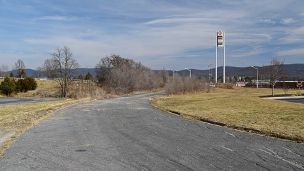
Former alignment of Shenandoah Village Drive
-
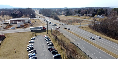
Intersection of US 340, Shenandoah Village Drive, and Gateway Drive
-
Springer Road and Sugarcamp Lane [01]
![Springer Road and Sugarcamp Lane [01] (2702 visits) Aerial view of Springer Road and Sugarcamp Lane, which together form a single residential street in ... Springer Road and Sugarcamp Lane [01]](../../../../../i/upload/2024/07/19/20240719160916-bbfef2f3-cu_s9999x250.jpg)
-
Springer Road and Sugarcamp Lane [02]
![Springer Road and Sugarcamp Lane [02] (2782 visits) Aerial view of Springer Road and Sugarcamp Lane, which together form a single residential street in ... Springer Road and Sugarcamp Lane [02]](../../../../../i/upload/2024/07/19/20240719160920-a73a3b63-cu_s9999x250.jpg)
-
Forest Springs Drive [04]
![Forest Springs Drive [04] (2551 visits) Aerial view of Forest Springs Drive, a residential street in Stuarts Draft, Virginia, facing north.
... Forest Springs Drive [04]](../../../../../i/upload/2024/07/19/20240719160944-be5023e1-cu_s9999x250.jpg)
-
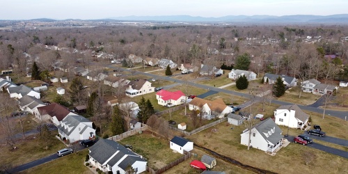
Cooper Drive
-
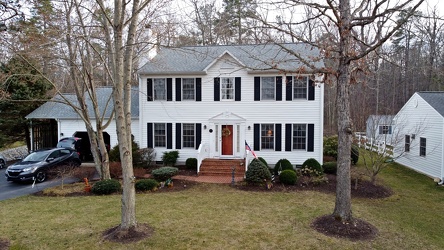
House on Springer Road
-
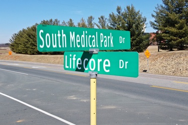
Intersection of South Medical Park Drive and Lifecore Drive
-
Richmond Avenue in Staunton, Virginia [01]
![Richmond Avenue in Staunton, Virginia [01] (66693 visits) Aerial view of Richmond Avenue (US 250) in Staunton, Virginia, near the intersection with Frontier D... Richmond Avenue in Staunton, Virginia [01]](../../../../../i/upload/2024/07/19/20240719161158-ddf9fe35-cu_s9999x250.jpg)
-
Richmond Avenue in Staunton, Virginia [02]
![Richmond Avenue in Staunton, Virginia [02] (66773 visits) Aerial view of Richmond Avenue (US 250) in Staunton, Virginia, near the intersection with Frontier D... Richmond Avenue in Staunton, Virginia [02]](../../../../../i/upload/2024/07/19/20240719161203-233bb776-cu_s9999x250.jpg)
-
Richmond Avenue in Staunton, Virginia [03]
![Richmond Avenue in Staunton, Virginia [03] (66606 visits) Aerial view of Richmond Avenue (US 250) in Staunton, Virginia, near the intersection with Community ... Richmond Avenue in Staunton, Virginia [03]](../../../../../i/upload/2024/07/19/20240719161212-297c1b53-cu_s9999x250.jpg)
-
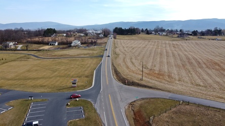
Tinkling Spring Road at Churchmans Mill Road
-
Traffic signals at US 15 and Lucketts Road [02]
![Traffic signals at US 15 and Lucketts Road [02] (1185 visits) Traffic signals at the intersection of US 15 and Lucketts Road in Loudoun County, Virginia.
Ben Sch... Traffic signals at US 15 and Lucketts Road [02]](../../../../../i/upload/2024/07/19/20240719161422-d1e94014-cu_s9999x250.jpg)
-
Traffic signals at US 15 and Lucketts Road [01]
![Traffic signals at US 15 and Lucketts Road [01] (1245 visits) Traffic signals at the intersection of US 15 and Lucketts Road in Loudoun County, Virginia.
Ben Sch... Traffic signals at US 15 and Lucketts Road [01]](../../../../../i/upload/2024/07/19/20240719161531-79fec9f3-cu_s9999x250.jpg)
-
Street signs at intersection of US 15 and Lucketts Road [01]
![Street signs at intersection of US 15 and Lucketts Road [01] (931 visits) Street signs at the intersection of US 15 and Lucketts Road in Loudoun County, Virginia.
Ben Schumi... Street signs at intersection of US 15 and Lucketts Road [01]](../../../../../i/upload/2024/07/19/20240719161537-a75c3dac-cu_s9999x250.jpg)
-
Street signs at intersection of US 15 and Lucketts Road [02]
![Street signs at intersection of US 15 and Lucketts Road [02] (942 visits) Street signs at the intersection of US 15 and Lucketts Road in Loudoun County, Virginia.
Ben Schumi... Street signs at intersection of US 15 and Lucketts Road [02]](../../../../../i/upload/2024/07/19/20240719161623-789e37f5-cu_s9999x250.jpg)
-
US 29 Business in Culpeper, Virginia [02]
![US 29 Business in Culpeper, Virginia [02] (457490 visits) Aerial view of US 29 Business on the north side of Culpeper, Virginia. View facing approximately we... US 29 Business in Culpeper, Virginia [02]](../../../../../i/upload/2024/07/19/20240719165937-abc06307-cu_s9999x250.jpg)
-
Ghost bike in Lucketts, Virginia

-
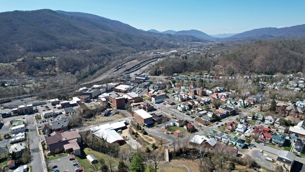
Downtown Clifton Forge, Virginia
-
Neighborhood in Clifton Forge, Virginia [01]
![Neighborhood in Clifton Forge, Virginia [01] (1156 visits) Aerial view of a neighborhood in Clifton Forge, Virginia, near downtown.
Ben Schumin is a professio... Neighborhood in Clifton Forge, Virginia [01]](../../../../../i/upload/2024/07/20/20240720021719-e5828a4e-cu_s9999x250.jpg)
-
Neighborhood in Clifton Forge, Virginia [02]
![Neighborhood in Clifton Forge, Virginia [02] (1325 visits) Aerial view of a neighborhood in Clifton Forge, Virginia, near downtown.
Ben Schumin is a professio... Neighborhood in Clifton Forge, Virginia [02]](../../../../../i/upload/2024/07/20/20240720021736-578bac29-cu_s9999x250.jpg)
-
Sign for State Route 188 [01]
![Sign for State Route 188 [01] (1187 visits) Signage pointing the way to State Route 188 at the intersection of Church Street and Commercial Aven... Sign for State Route 188 [01]](../../../../../i/upload/2024/07/20/20240720021810-3e9b4232-cu_s9999x250.jpg)
-
Sign for State Route 188 [02]
![Sign for State Route 188 [02] (1365 visits) Signage pointing the way to State Route 188 at the intersection of Church Street and Commercial Aven... Sign for State Route 188 [02]](../../../../../i/upload/2024/07/20/20240720021827-a0810db1-cu_s9999x250.jpg)
-
Sign for State Route 188 [03]
![Sign for State Route 188 [03] (1320 visits) Signage pointing the way to State Route 188 at the intersection of Church Street and Commercial Aven... Sign for State Route 188 [03]](../../../../../i/upload/2024/07/20/20240720021833-b69f59a5-cu_s9999x250.jpg)
-
Sign for State Route 188 [04]
![Sign for State Route 188 [04] (1429 visits) Signage pointing the way to State Route 188 at the intersection of Church Street and Commercial Aven... Sign for State Route 188 [04]](../../../../../i/upload/2024/07/20/20240720021852-b244dda6-cu_s9999x250.jpg)
-
Sign for State Route 188 [05]
![Sign for State Route 188 [05] (1393 visits) Signage pointing the way to State Route 188 at the intersection of Church Street and Commercial Aven... Sign for State Route 188 [05]](../../../../../i/upload/2024/07/20/20240720021903-7bd9cd82-cu_s9999x250.jpg)
-
Sign for State Route 188 [06]
![Sign for State Route 188 [06] (1390 visits) Signage pointing the way to State Route 188 at the intersection of Church Street and Commercial Aven... Sign for State Route 188 [06]](../../../../../i/upload/2024/07/20/20240720021915-40479437-cu_s9999x250.jpg)
-
Traffic signals over Church Street and Commercial Avenue

-
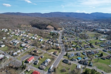
Neighborhoods in Covington, Virginia
-
Post-flight selfie in Covington, Virginia

-
Street signs at Church Street and Commercial Avenue

-
CSX Clifton Forge rail yard [10]
![CSX Clifton Forge rail yard [10] (2795 visits) CSX rail yard in Clifton Forge, Virginia. West Ridgeway Street (US 60 Business) runs alongside the ... CSX Clifton Forge rail yard [10]](../../../../../i/upload/2024/07/20/20240720022004-482675e4-cu_s9999x250.jpg)
-
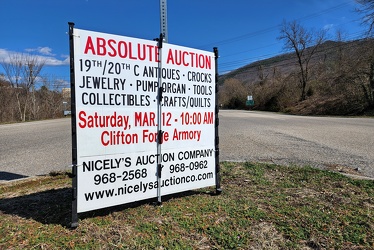
Sign advertising an auction
-
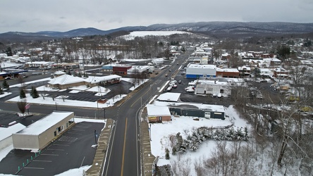
East Main Street in Waynesboro, Virginia
-
Wenonah Elementary School [01]
![Wenonah Elementary School [01] (2428 visits) Wenonah Elementary School, one of four elementary schools in the city.
Ben Schumin is a professiona... Wenonah Elementary School [01]](../../../../../i/upload/2024/07/20/20240720022130-0d6d5971-cu_s9999x250.jpg)
-
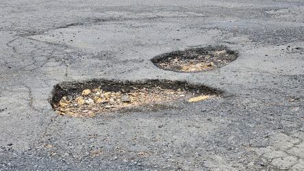
Large potholes at Staunton Mall
-
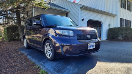
Scion parked at home
-
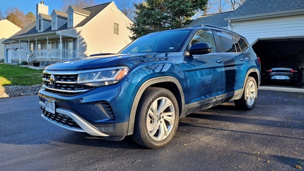
Volkswagen Atlas
-
South 10th Street and Haxall Point

-
Wildfire in Wheatfield, Virginia [01]
![Wildfire in Wheatfield, Virginia [01] (2011 visits) A wildfire burns just beyond the trees in Wheatfield, Virginia. View from Brooklee Ridge Lane.
Mor... Wildfire in Wheatfield, Virginia [01]](../../../../../i/upload/2024/12/26/20241226095723-0924c1da-cu_s9999x250.jpg)
-
Wildfire in Wheatfield, Virginia [02]
![Wildfire in Wheatfield, Virginia [02] (1983 visits) A wildfire burns just beyond the trees in Wheatfield, Virginia. View from Brooklee Ridge Lane.
Mor... Wildfire in Wheatfield, Virginia [02]](../../../../../i/upload/2024/12/26/20241226095727-426cf00c-cu_s9999x250.jpg)
-
Wildfire in Wheatfield, Virginia [03]
![Wildfire in Wheatfield, Virginia [03] (714 visits) Aerial view of a wildfire in Wheatfield, Virginia.
More at The Schumin Web:
www.schuminweb.com/2024... Wildfire in Wheatfield, Virginia [03]](../../../../../i/upload/2024/12/26/20241226113316-fc2f1e85-cu_s9999x250.jpg)
-
Wildfire in Wheatfield, Virginia [04]
![Wildfire in Wheatfield, Virginia [04] (696 visits) Aerial view of a wildfire in Wheatfield, Virginia.
More at The Schumin Web:
www.schuminweb.com/2024... Wildfire in Wheatfield, Virginia [04]](../../../../../i/upload/2024/12/26/20241226113325-158b68f2-cu_s9999x250.jpg)
-
Wildfire in Wheatfield, Virginia [05]
![Wildfire in Wheatfield, Virginia [05] (713 visits) Aerial view of a wildfire in Wheatfield, Virginia.
More at The Schumin Web:
www.schuminweb.com/2024... Wildfire in Wheatfield, Virginia [05]](../../../../../i/upload/2024/12/26/20241226113335-8685ba7b-cu_s9999x250.jpg)
-
Wildfire in Wheatfield, Virginia [06]
![Wildfire in Wheatfield, Virginia [06] (714 visits) Aerial view of a wildfire in Wheatfield, Virginia.
More at The Schumin Web:
www.schuminweb.com/2024... Wildfire in Wheatfield, Virginia [06]](../../../../../i/upload/2024/12/26/20241226113345-0e08706d-cu_s9999x250.jpg)
-
Wildfire in Wheatfield, Virginia [07]
![Wildfire in Wheatfield, Virginia [07] (745 visits) Aerial view of a wildfire in Wheatfield, Virginia.
More at The Schumin Web:
www.schuminweb.com/2024... Wildfire in Wheatfield, Virginia [07]](../../../../../i/upload/2024/12/26/20241226113355-bdc9fea6-cu_s9999x250.jpg)
-
Wildfire in Wheatfield, Virginia [08]
![Wildfire in Wheatfield, Virginia [08] (714 visits) Aerial view of a wildfire in Wheatfield, Virginia.
More at The Schumin Web:
www.schuminweb.com/2024... Wildfire in Wheatfield, Virginia [08]](../../../../../i/upload/2024/12/26/20241226113404-8540af70-cu_s9999x250.jpg)
-
Wildfire in Wheatfield, Virginia [09]
![Wildfire in Wheatfield, Virginia [09] (672 visits) Aerial view of a wildfire in Wheatfield, Virginia.
More at The Schumin Web:
www.schuminweb.com/2024... Wildfire in Wheatfield, Virginia [09]](../../../../../i/upload/2024/12/26/20241226113414-261ee473-cu_s9999x250.jpg)
-
Wildfire in Wheatfield, Virginia [10]
![Wildfire in Wheatfield, Virginia [10] (692 visits) Aerial view of a wildfire in Wheatfield, Virginia.
More at The Schumin Web:
www.schuminweb.com/2024... Wildfire in Wheatfield, Virginia [10]](../../../../../i/upload/2024/12/26/20241226113424-ef021110-cu_s9999x250.jpg)
-
Wildfire in Wheatfield, Virginia [11]
![Wildfire in Wheatfield, Virginia [11] (685 visits) Aerial view of a wildfire in Wheatfield, Virginia.
More at The Schumin Web:
www.schuminweb.com/2024... Wildfire in Wheatfield, Virginia [11]](../../../../../i/upload/2024/12/26/20241226113433-bbfde6c6-cu_s9999x250.jpg)
-
Wildfire in Wheatfield, Virginia [12]
![Wildfire in Wheatfield, Virginia [12] (758 visits) Aerial view of a wildfire in Wheatfield, Virginia.
More at The Schumin Web:
www.schuminweb.com/2024... Wildfire in Wheatfield, Virginia [12]](../../../../../i/upload/2024/12/26/20241226113443-8c6bc962-cu_s9999x250.jpg)
-
Wildfire in Wheatfield, Virginia [13]
![Wildfire in Wheatfield, Virginia [13] (694 visits) Aerial view of a wildfire in Wheatfield, Virginia.
More at The Schumin Web:
www.schuminweb.com/2024... Wildfire in Wheatfield, Virginia [13]](../../../../../i/upload/2024/12/26/20241226113455-f989b84b-cu_s9999x250.jpg)
-
Wildfire in Wheatfield, Virginia [14]
![Wildfire in Wheatfield, Virginia [14] (701 visits) Aerial view of a wildfire in Wheatfield, Virginia.
More at The Schumin Web:
www.schuminweb.com/2024... Wildfire in Wheatfield, Virginia [14]](../../../../../i/upload/2024/12/26/20241226113504-f310b6be-cu_s9999x250.jpg)
-
Wildfire in Wheatfield, Virginia [15]
![Wildfire in Wheatfield, Virginia [15] (683 visits) Aerial view of a wildfire in Wheatfield, Virginia.
More at The Schumin Web:
www.schuminweb.com/2024... Wildfire in Wheatfield, Virginia [15]](../../../../../i/upload/2024/12/26/20241226113515-58af561f-cu_s9999x250.jpg)
-
Wildfire in Wheatfield, Virginia [16]
![Wildfire in Wheatfield, Virginia [16] (659 visits) Aerial view of a wildfire in Wheatfield, Virginia.
More at The Schumin Web:
www.schuminweb.com/2024... Wildfire in Wheatfield, Virginia [16]](../../../../../i/upload/2024/12/26/20241226113524-b6ae32b2-cu_s9999x250.jpg)
-
Wildfire in Wheatfield, Virginia [17]
![Wildfire in Wheatfield, Virginia [17] (710 visits) Aerial view of a wildfire in Wheatfield, Virginia.
More at The Schumin Web:
www.schuminweb.com/2024... Wildfire in Wheatfield, Virginia [17]](../../../../../i/upload/2024/12/26/20241226113535-464ef6f3-cu_s9999x250.jpg)
-
Wildfire in Wheatfield, Virginia [18]
![Wildfire in Wheatfield, Virginia [18] (721 visits) Aerial view of a wildfire in Wheatfield, Virginia.
More at The Schumin Web:
www.schuminweb.com/2024... Wildfire in Wheatfield, Virginia [18]](../../../../../i/upload/2024/12/26/20241226113546-653ce2b4-cu_s9999x250.jpg)
-
Wildfire in Wheatfield, Virginia [19]
![Wildfire in Wheatfield, Virginia [19] (715 visits) Aerial view of a wildfire in Wheatfield, Virginia.
More at The Schumin Web:
www.schuminweb.com/2024... Wildfire in Wheatfield, Virginia [19]](../../../../../i/upload/2024/12/26/20241226113557-e900887b-cu_s9999x250.jpg)
-
Wildfire in Wheatfield, Virginia [20]
![Wildfire in Wheatfield, Virginia [20] (822 visits) Aerial view of a wildfire in Wheatfield, Virginia. Here, the house at 1429 Coal Mine Road burns to ... Wildfire in Wheatfield, Virginia [20]](../../../../../i/upload/2024/12/26/20241226113603-cc8e09d4-cu_s9999x250.jpg)
-
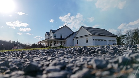
279 Brooklee Ridge Lane
-
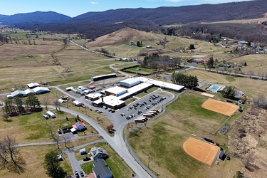
Highland County Schools
-
Aerial view of Monterey, Virginia [01]
![Aerial view of Monterey, Virginia [01] (1949 visits) Aerial view of Monterey, Virginia, a small town comprising the seat of Highland County.
More at The... Aerial view of Monterey, Virginia [01]](../../../../../i/upload/2025/01/02/20250102005918-685606f9-cu_s9999x250.jpg)
-
Aerial view of Monterey, Virginia [02]
![Aerial view of Monterey, Virginia [02] (1955 visits) Aerial view of Monterey, Virginia, a small town comprising the seat of Highland County.
More at The... Aerial view of Monterey, Virginia [02]](../../../../../i/upload/2025/01/02/20250102005923-7f7b9b83-cu_s9999x250.jpg)
-
Aerial view of Monterey, Virginia [03]
![Aerial view of Monterey, Virginia [03] (1915 visits) Aerial view of Monterey, Virginia, a small town comprising the seat of Highland County.
More at The... Aerial view of Monterey, Virginia [03]](../../../../../i/upload/2025/01/02/20250102005929-2e84a9d0-cu_s9999x250.jpg)
-
Aerial view of Monterey, Virginia [04]
![Aerial view of Monterey, Virginia [04] (1921 visits) Aerial view of Monterey, Virginia, a small town comprising the seat of Highland County.
More at The... Aerial view of Monterey, Virginia [04]](../../../../../i/upload/2025/01/02/20250102005937-281fae65-cu_s9999x250.jpg)