-
Interstate 68 cut through Sideling Hill [02]
![Interstate 68 cut through Sideling Hill [02] (3763 visits) Cut in Sideling Hill, carrying Interstate 68 between Washington and Allegany Counties in Maryland.
... Interstate 68 cut through Sideling Hill [02]](../../../../i/upload/2024/07/18/20240718220116-e8da0915-cu_s9999x250.jpg)
-
Interstate 68 cut through Sideling Hill [01]
![Interstate 68 cut through Sideling Hill [01] (4271 visits) Cut in Sideling Hill, carrying Interstate 68 between Washington and Allegany Counties in Maryland.
... Interstate 68 cut through Sideling Hill [01]](../../../../i/upload/2024/07/18/20240718220120-0789991f-cu_s9999x250.jpg)
-
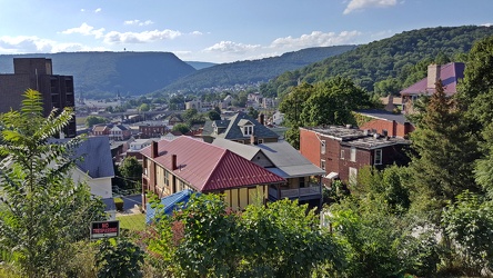
View of Cumberland, Maryland
-
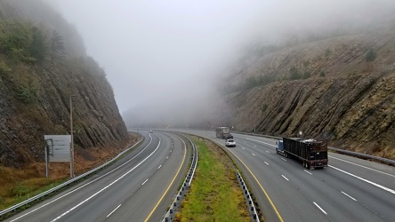
Sideling Hill cut
-
Myersville, Maryland and vicinity [01]
![Myersville, Maryland and vicinity [01] (1505 visits) Myersville, Maryland and the immediate surrounding area, viewed from above the Myersville Volunteer ... Myersville, Maryland and vicinity [01]](../../../../i/upload/2024/07/19/20240719114529-b09266dc-cu_s9999x250.jpg)
-
Myersville, Maryland and vicinity [02]
![Myersville, Maryland and vicinity [02] (1384 visits) Myersville, Maryland and the immediate surrounding area, viewed from above the Myersville Volunteer ... Myersville, Maryland and vicinity [02]](../../../../i/upload/2024/07/19/20240719114533-7da9ff27-cu_s9999x250.jpg)
-
Smithsburg, Maryland and vicinity [01]
![Smithsburg, Maryland and vicinity [01] (1532 visits) Aerial view of Smithsburg, Maryland and vicinity.
Ben Schumin is a professional photographer who ca... Smithsburg, Maryland and vicinity [01]](../../../../i/upload/2024/07/19/20240719114610-c1a5ac24-cu_s9999x250.jpg)
-
Smithsburg, Maryland and vicinity [02]
![Smithsburg, Maryland and vicinity [02] (1580 visits) Aerial view of Smithsburg, Maryland and vicinity.
Ben Schumin is a professional photographer who ca... Smithsburg, Maryland and vicinity [02]](../../../../i/upload/2024/07/19/20240719114614-27b7e477-cu_s9999x250.jpg)
-
Interstate 64 in Nelson County, Virginia [01]
![Interstate 64 in Nelson County, Virginia [01] (11328 visits) Interstate 64 in Nelson County, Virginia, near Rockfish Gap. US 250 runs adjacent to the freeway.
... Interstate 64 in Nelson County, Virginia [01]](../../../../i/upload/2024/07/19/20240719115200-c8a2ce39-cu_s9999x250.jpg)
-
Interstate 64 in Nelson County, Virginia [02]
![Interstate 64 in Nelson County, Virginia [02] (11443 visits) Interstate 64 in Nelson County, Virginia, near Rockfish Gap. US 250 runs adjacent to the freeway.
... Interstate 64 in Nelson County, Virginia [02]](../../../../i/upload/2024/07/19/20240719115847-184fa12a-cu_s9999x250.jpg)
-
Interstate 64 in Nelson County, Virginia [03]
![Interstate 64 in Nelson County, Virginia [03] (11612 visits) Interstate 64 in Nelson County, Virginia, near Rockfish Gap. US 250 runs adjacent to the freeway.
... Interstate 64 in Nelson County, Virginia [03]](../../../../i/upload/2024/07/19/20240719115902-ff5fb9e1-cu_s9999x250.jpg)
-
Blue Ridge Mountains near Rockfish Gap [01]
![Blue Ridge Mountains near Rockfish Gap [01] (1924 visits) The Blue Ridge Mountains, viewed from above the Interstate 64 scenic overlook in Nelson County, Virg... Blue Ridge Mountains near Rockfish Gap [01]](../../../../i/upload/2024/07/19/20240719115911-d105cde8-cu_s9999x250.jpg)
-
Blue Ridge Mountains near Rockfish Gap [02]
![Blue Ridge Mountains near Rockfish Gap [02] (1892 visits) The Blue Ridge Mountains, viewed from above the Interstate 64 scenic overlook in Nelson County, Virg... Blue Ridge Mountains near Rockfish Gap [02]](../../../../i/upload/2024/07/19/20240719115926-47f38290-cu_s9999x250.jpg)
-
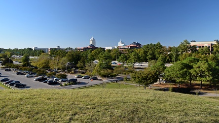
View from Mount Trashmore
-
View from Sounding Knob Fire Tower [05]
![View from Sounding Knob Fire Tower [05] (7868 visits) The view from Sounding Knob Fire Tower, a restored fire watch tower on Jack Mountain near Monterey, ... View from Sounding Knob Fire Tower [05]](../../../../i/upload/2024/07/20/20240720093912-7eeb9b2a-cu_s9999x250.jpg)
-
View from Sounding Knob Fire Tower [01]
![View from Sounding Knob Fire Tower [01] (3684 visits) The view from Sounding Knob Fire Tower, a restored fire watch tower on Jack Mountain near Monterey, ... View from Sounding Knob Fire Tower [01]](../../../../i/upload/2024/07/20/20240720094042-38692d7b-cu_s9999x250.jpg)
-
View from Sounding Knob Fire Tower [07]
![View from Sounding Knob Fire Tower [07] (3056 visits) The view from Sounding Knob Fire Tower, a restored fire watch tower on Jack Mountain near Monterey, ... View from Sounding Knob Fire Tower [07]](../../../../i/upload/2024/07/20/20240720094100-2ebefa3a-cu_s9999x250.jpg)
-
View from Sounding Knob Fire Tower [02]
![View from Sounding Knob Fire Tower [02] (3408 visits) The view from Sounding Knob Fire Tower, a restored fire watch tower on Jack Mountain near Monterey, ... View from Sounding Knob Fire Tower [02]](../../../../i/upload/2024/07/20/20240720094106-3da79801-cu_s9999x250.jpg)
-
View from Sounding Knob Fire Tower [08]
![View from Sounding Knob Fire Tower [08] (3346 visits) The view from Sounding Knob Fire Tower, a restored fire watch tower on Jack Mountain near Monterey, ... View from Sounding Knob Fire Tower [08]](../../../../i/upload/2024/07/20/20240720094146-d06641af-cu_s9999x250.jpg)
-
View from Sounding Knob Fire Tower [03]
![View from Sounding Knob Fire Tower [03] (3318 visits) The view from Sounding Knob Fire Tower, a restored fire watch tower on Jack Mountain near Monterey, ... View from Sounding Knob Fire Tower [03]](../../../../i/upload/2024/07/20/20240720094217-426249c3-cu_s9999x250.jpg)
-
View from Sounding Knob Fire Tower [04]
![View from Sounding Knob Fire Tower [04] (7395 visits) The view from Sounding Knob Fire Tower, a restored fire watch tower on Jack Mountain near Monterey, ... View from Sounding Knob Fire Tower [04]](../../../../i/upload/2024/07/20/20240720094227-c4df3b1c-cu_s9999x250.jpg)
-
View from Sounding Knob Fire Tower [09]
![View from Sounding Knob Fire Tower [09] (3097 visits) The view from Sounding Knob Fire Tower, a restored fire watch tower on Jack Mountain near Monterey, ... View from Sounding Knob Fire Tower [09]](../../../../i/upload/2024/07/20/20240720094237-fbdf1303-cu_s9999x250.jpg)
-
View from Sounding Knob Fire Tower [06]
![View from Sounding Knob Fire Tower [06] (7689 visits) The view from Sounding Knob Fire Tower, a restored fire watch tower on Jack Mountain near Monterey, ... View from Sounding Knob Fire Tower [06]](../../../../i/upload/2024/07/20/20240720094246-3a374853-cu_s9999x250.jpg)
-
Place where a plaque used to be at Ravens Roost overlook [03]
![Place where a plaque used to be at Ravens Roost overlook [03] (1941 visits) The place where a National Park Service plaque used to be located atop a raised portion of the retai... Place where a plaque used to be at Ravens Roost overlook [03]](../../../../i/upload/2024/07/20/20240720111008-7c125d7a-cu_s9999x250.jpg)
-
View from Ravens Roost overlook [01]
![View from Ravens Roost overlook [01] (1752 visits) View from Ravens Roost overlook on the Blue Ridge Parkway in Virginia.
More at The Schumin Web:
www... View from Ravens Roost overlook [01]](../../../../i/upload/2024/07/20/20240720111047-eedd86a4-cu_s9999x250.jpg)
-
View from Ravens Roost overlook [02]
![View from Ravens Roost overlook [02] (1729 visits) View from Ravens Roost overlook on the Blue Ridge Parkway in Virginia.
More at The Schumin Web:
www... View from Ravens Roost overlook [02]](../../../../i/upload/2024/07/20/20240720111052-9d9ea25e-cu_s9999x250.jpg)
-
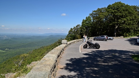
Ravens Roost overlook
-
Place where a plaque used to be at Ravens Roost overlook [01]
![Place where a plaque used to be at Ravens Roost overlook [01] (1936 visits) The place where a National Park Service plaque used to be located atop a raised portion of the retai... Place where a plaque used to be at Ravens Roost overlook [01]](../../../../i/upload/2024/07/20/20240720111142-228a886f-cu_s9999x250.jpg)
-
View from Ravens Roost overlook [03]
![View from Ravens Roost overlook [03] (1740 visits) View from Ravens Roost overlook on the Blue Ridge Parkway in Virginia.
More at The Schumin Web:
www... View from Ravens Roost overlook [03]](../../../../i/upload/2024/07/20/20240720111242-329db50f-cu_s9999x250.jpg)
-
Place where a plaque used to be at Ravens Roost overlook [02]
![Place where a plaque used to be at Ravens Roost overlook [02] (1867 visits) The place where a National Park Service plaque used to be located atop a raised portion of the retai... Place where a plaque used to be at Ravens Roost overlook [02]](../../../../i/upload/2024/07/20/20240720111248-a6c2e1fa-cu_s9999x250.jpg)
-
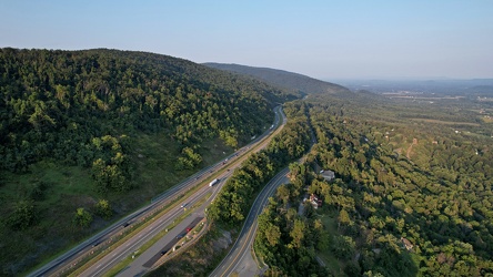
Interstate 64 east of Rockfish Gap
-
View from Sounding Knob Fire Tower [10]
![View from Sounding Knob Fire Tower [10] (1637 visits) The view from Sounding Knob Fire Tower, a restored fire watch tower on Jack Mountain near Monterey, ... View from Sounding Knob Fire Tower [10]](../../../../i/upload/2024/12/31/20241231010300-69dbc3a3-cu_s9999x250.jpg)
-
View from Sounding Knob Fire Tower [11]
![View from Sounding Knob Fire Tower [11] (1832 visits) The view from Sounding Knob Fire Tower, a restored fire watch tower on Jack Mountain near Monterey, ... View from Sounding Knob Fire Tower [11]](../../../../i/upload/2024/12/31/20241231010309-138441d9-cu_s9999x250.jpg)
-
View from Sounding Knob Fire Tower [11]
![View from Sounding Knob Fire Tower [11] (1561 visits) The view from Sounding Knob Fire Tower, a restored fire watch tower on Jack Mountain near Monterey, ... View from Sounding Knob Fire Tower [11]](../../../../i/upload/2024/12/31/20241231010304-2a3f3c22-cu_s9999x250.jpg)
-
View from Sounding Knob Fire Tower [13]
![View from Sounding Knob Fire Tower [13] (1700 visits) The view from Sounding Knob Fire Tower, a restored fire watch tower on Jack Mountain near Monterey, ... View from Sounding Knob Fire Tower [13]](../../../../i/upload/2024/12/31/20241231010313-399c7c4e-cu_s9999x250.jpg)
-
View from Sounding Knob Fire Tower [14]
![View from Sounding Knob Fire Tower [14] (1630 visits) The view from Sounding Knob Fire Tower, a restored fire watch tower on Jack Mountain near Monterey, ... View from Sounding Knob Fire Tower [14]](../../../../i/upload/2024/12/31/20241231010319-c5fd58fd-cu_s9999x250.jpg)
-
View from Sounding Knob Fire Tower [15]
![View from Sounding Knob Fire Tower [15] (1606 visits) The view from Sounding Knob Fire Tower, a restored fire watch tower on Jack Mountain near Monterey, ... View from Sounding Knob Fire Tower [15]](../../../../i/upload/2024/12/31/20241231010323-27db6902-cu_s9999x250.jpg)
-
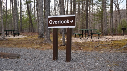
Sign for Gathright Dam overlook trail
-
Blaze on Gathright Dam overlook trail [01]
![Blaze on Gathright Dam overlook trail [01] (1408 visits) Trail blaze on a tree along the Gathright Dam overlook trail in Alleghany County, Virginia.
More at... Blaze on Gathright Dam overlook trail [01]](../../../../i/upload/2025/01/02/20250102221138-452681e6-cu_s9999x250.jpg)
-
Blaze on Gathright Dam overlook trail [02]
![Blaze on Gathright Dam overlook trail [02] (1396 visits) Trail blaze on a tree along the Gathright Dam overlook trail in Alleghany County, Virginia.
More at... Blaze on Gathright Dam overlook trail [02]](../../../../i/upload/2025/01/02/20250102221143-6e07712f-cu_s9999x250.jpg)