-
West Main Street in Waynesboro, Virginia [04]
![West Main Street in Waynesboro, Virginia [04] (324921 visits) View down West Main Street (US 250) in the west end of Waynesboro, Virginia, near the Westwood Villa... West Main Street in Waynesboro, Virginia [04]](../../../../../i/upload/2024/07/19/20240719164600-4379cef1-cu_s9999x250.jpg)
-
West Broad Street at Staples Mill Road [02]
![West Broad Street at Staples Mill Road [02] (71221 visits) Aerial view of West Broad Street at the intersection with Staples Mill Road in Richmond, Virginia. ... West Broad Street at Staples Mill Road [02]](../../../../../i/upload/2024/07/20/20240720092012-1df12de7-cu_s9999x250.jpg)
-
West Main Street in Waynesboro, Virginia [01]
![West Main Street in Waynesboro, Virginia [01] (56613 visits) View down West Main Street (US 250) in the west end of Waynesboro, Virginia, near the former Kmart b... West Main Street in Waynesboro, Virginia [01]](../../../../../i/upload/2024/07/19/20240719164545-b5a50599-cu_s9999x250.jpg)
-
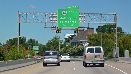
Sign for Exit 268
-
Hampton Roads Bridge-Tunnel, westbound [03]
![Hampton Roads Bridge-Tunnel, westbound [03] (49189 visits) Approach to the east portal of the Hampton Roads Bridge Tunnel on the westbound side.
More at The S... Hampton Roads Bridge-Tunnel, westbound [03]](../../../../../i/upload/2024/07/14/20240714234950-d2db0c37-cu_s9999x250.jpg)
-
Hampton Roads Bridge-Tunnel, westbound [02]
![Hampton Roads Bridge-Tunnel, westbound [02] (48690 visits) Eastbound side of the Hampton Roads Bridge-Tunnel, viewed from the westbound span.
More at The Schu... Hampton Roads Bridge-Tunnel, westbound [02]](../../../../../i/upload/2024/07/14/20240714234951-dbc0fd5f-cu_s9999x250.jpg)
-
Hampton Roads Bridge-Tunnel, westbound [01]
![Hampton Roads Bridge-Tunnel, westbound [01] (12080 visits) Sign marking the beginning of the Hampton Roads Bridge-Tunnel complex on Interstate 64 westbound, in... Hampton Roads Bridge-Tunnel, westbound [01]](../../../../../i/upload/2024/07/14/20240714234955-62e4e126-cu_s9999x250.jpg)
-
Flags at West Virginia welcome center

-
West Main Street in Waynesboro, Virginia [03]
![West Main Street in Waynesboro, Virginia [03] (11809 visits) View down West Main Street (US 250) in the west end of Waynesboro, Virginia, near St. Mark's United ... West Main Street in Waynesboro, Virginia [03]](../../../../../i/upload/2024/07/19/20240719164555-f7feeafe-cu_s9999x250.jpg)
-
Elyse photographs an I-40 shield [02]
![Elyse photographs an I-40 shield [02] (11550 visits) Elyse Horvath takes a selfie with an Interstate 40 shield on Strawberry Plains Pike in Knoxville, Te... Elyse photographs an I-40 shield [02]](../../../../../i/upload/2024/07/20/20240720113657-c61efdb7-cu_s9999x250.jpg)
-
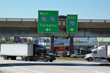
Breezewood interchange from US 30 westbound
-
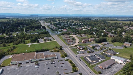
US 250 at the west end of Waynesboro, Virginia
-
West Main Street in Waynesboro, Virginia [02]
![West Main Street in Waynesboro, Virginia [02] (10866 visits) View down West Main Street (US 250) in the west end of Waynesboro, Virginia, near the Sheetz conveni... West Main Street in Waynesboro, Virginia [02]](../../../../../i/upload/2024/07/19/20240719164551-0b8407a8-cu_s9999x250.jpg)
-
Burger King in Charles Town, West Virginia [02]
![Burger King in Charles Town, West Virginia [02] (6441 visits) Burger King restaurant on US 340 in Charles Town, West Virginia, housed in a former Hardee's buildin... Burger King in Charles Town, West Virginia [02]](../../../../../i/upload/2024/07/17/20240717232558-b352d3a3-cu_s9999x250.jpg)
-
Burger King in Charles Town, West Virginia [01]
![Burger King in Charles Town, West Virginia [01] (6245 visits) Burger King restaurant on US 340 in Charles Town, West Virginia, housed in a former Hardee's buildin... Burger King in Charles Town, West Virginia [01]](../../../../../i/upload/2024/07/17/20240717232555-c1e43281-cu_s9999x250.jpg)
-
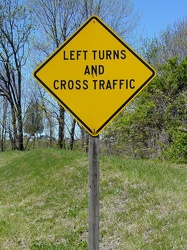
Warning sign before Breezewood
-
Traffic backup on Interstate 64
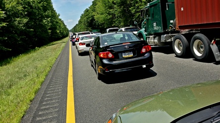
-
Overhead signage on US 30 in Breezewood
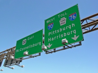
-
Child/toddler friendly stall at New Kent rest area
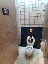
-
Hampton Roads Bridge-Tunnel, westbound [05]
![Hampton Roads Bridge-Tunnel, westbound [05] (5083 visits) Westbound traffic exits the west portal of the Hampton Roads Bridge-Tunnel.
More at The Schumin Web... Hampton Roads Bridge-Tunnel, westbound [05]](../../../../../i/upload/2024/07/14/20240714234958-245d8a80-cu_s9999x250.jpg)
-
Hampton Roads Bridge-Tunnel, westbound tube
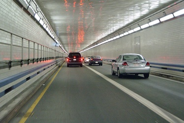
-
US 29 shield on Rhode Island Avenue NW [02]
![US 29 shield on Rhode Island Avenue NW [02] (5029 visits) Shield for southbound US 29 on a lamppost at the intersection of Rhode Island Avenue and 9th Street ... US 29 shield on Rhode Island Avenue NW [02]](../../../../../i/upload/2024/07/14/20240714234553-282ce97c-cu_s9999x250.jpg)
-
Hampton Roads Bridge-Tunnel, westbound [04]
![Hampton Roads Bridge-Tunnel, westbound [04] (5007 visits) East portal of the Hampton Roads Bridge Tunnel on the westbound side.
More at The Schumin Web:
www.... Hampton Roads Bridge-Tunnel, westbound [04]](../../../../../i/upload/2024/07/14/20240714234959-48ab2d91-cu_s9999x250.jpg)
-
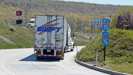
Swift truck entering turnpike
-
US 29 shield on Rhode Island Avenue NW [01]
![US 29 shield on Rhode Island Avenue NW [01] (4658 visits) Shield for southbound US 29 on a lamppost at the intersection of Rhode Island Avenue and 9th Street ... US 29 shield on Rhode Island Avenue NW [01]](../../../../../i/upload/2024/07/14/20240714234551-7fead61b-cu_s9999x250.jpg)
-
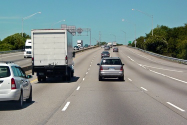
Interstate 64 westbound in Hampton, Virginia
-
Signs on US 30 outside Breezewood
-
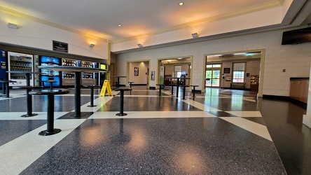
Interior of New Kent rest area, westbound
-
Waynesboro, Virginia, facing approximately east
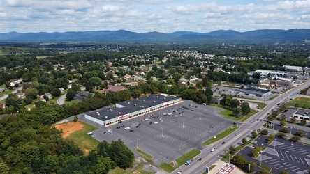
-
West Broad Street at Staples Mill Road [01]
![West Broad Street at Staples Mill Road [01] (4225 visits) Aerial view of West Broad Street at the intersection with Staples Mill Road in Richmond, Virginia. ... West Broad Street at Staples Mill Road [01]](../../../../../i/upload/2024/07/20/20240720091824-c8526d69-cu_s9999x250.jpg)
-
Reassurance markers for US 13, US 70, and NC 111 [02]
![Reassurance markers for US 13, US 70, and NC 111 [02] (4203 visits) Sign assembly containing reassurance markers for southbound US Route 13, westbound US Route 70, and ... Reassurance markers for US 13, US 70, and NC 111 [02]](../../../../../i/upload/2024/07/19/20240719202130-777f3422-cu_s9999x250.jpg)
-
"Littering is illegal" sign [02]
!["Littering is illegal" sign [02] (4176 visits) Sign along US 250 at the border between Augusta and Highland Counties in Virginia, reminding drivers... "Littering is illegal" sign [02]](../../../../../i/upload/2024/07/20/20240720094020-cdd34053-cu_s9999x250.jpg)
-
Southwest Freeway [02]
![Southwest Freeway [02] (4125 visits) Interstate 395 in Washington, DC, also known as the Southwest Freeway, viewed from 7th Street SW.
B... Southwest Freeway [02]](../../../../../i/upload/2024/07/17/20240717160347-f6eaadfd-cu_s9999x250.jpg)
-
West Dumplin Valley Road [03]
![West Dumplin Valley Road [03] (4123 visits) Businesses along West Dumplin Valley Road, which runs just south of Interstate 40, in Sevierville, T... West Dumplin Valley Road [03]](../../../../../i/upload/2024/07/20/20240720120238-68c626bc-cu_s9999x250.jpg)
-
Southwest Freeway [01]
![Southwest Freeway [01] (4044 visits) Interstate 395 in Washington, DC, also known as the Southwest Freeway, viewed from 7th Street SW.
B... Southwest Freeway [01]](../../../../../i/upload/2024/07/17/20240717160351-30a054fb-cu_s9999x250.jpg)
-
US 340 in Charles Town [01]
![US 340 in Charles Town [01] (3919 visits) US 340 in Charles Town, West Virginia, east of the interchange with West Virginia Route 9.
Ben Schu... US 340 in Charles Town [01]](../../../../../i/upload/2024/07/19/20240719162259-85e9531c-cu_s9999x250.jpg)
-
Eastgate Toll Plaza
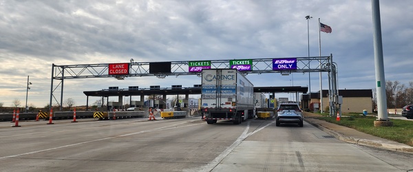
-
Ivy rest area [02]
![Ivy rest area [02] (3866 visits) Rest area on Interstate 64 westbound, near Ivy, Virginia (milepost 113).
Ben Schumin is a professio... Ivy rest area [02]](../../../../../i/upload/2024/07/17/20240717232807-2e81efde-cu_s9999x250.jpg)
-
US 340 in Charles Town [02]
![US 340 in Charles Town [02] (3866 visits) US 340 in Charles Town, West Virginia, east of the interchange with West Virginia Route 9.
Ben Schu... US 340 in Charles Town [02]](../../../../../i/upload/2024/07/19/20240719162156-6d3ecd1b-cu_s9999x250.jpg)
-
US 340 in Charles Town [03]
![US 340 in Charles Town [03] (3860 visits) US 340 in Charles Town, West Virginia, east of the interchange with West Virginia Route 9.
Ben Schu... US 340 in Charles Town [03]](../../../../../i/upload/2024/07/19/20240719162153-ebf4366a-cu_s9999x250.jpg)
-
Ivy rest area [03]
![Ivy rest area [03] (3859 visits) Rest area on Interstate 64 westbound, near Ivy, Virginia (milepost 113).
Ben Schumin is a professio... Ivy rest area [03]](../../../../../i/upload/2024/07/17/20240717232811-236d66ef-cu_s9999x250.jpg)
-
Reassurance markers for US 13, US 70, and NC 111 [03]
![Reassurance markers for US 13, US 70, and NC 111 [03] (3844 visits) Sign assembly containing reassurance markers for southbound US Route 13, westbound US Route 70, and ... Reassurance markers for US 13, US 70, and NC 111 [03]](../../../../../i/upload/2024/07/19/20240719202116-04523f40-cu_s9999x250.jpg)
-
Elyse photographs an I-40 shield [01]
![Elyse photographs an I-40 shield [01] (3832 visits) Elyse Horvath photographs an Interstate 40 shield on Strawberry Plains Pike in Knoxville, Tennessee.... Elyse photographs an I-40 shield [01]](../../../../../i/upload/2024/07/20/20240720113451-6fde2c8f-cu_s9999x250.jpg)
-
West Dumplin Valley Road [01]
![West Dumplin Valley Road [01] (3827 visits) Businesses along West Dumplin Valley Road, which runs just south of Interstate 40, in Sevierville, T... West Dumplin Valley Road [01]](../../../../../i/upload/2024/07/20/20240720120315-42535554-cu_s9999x250.jpg)
-
West Dumplin Valley Road [02]
![West Dumplin Valley Road [02] (3824 visits) Businesses along West Dumplin Valley Road, which runs just south of Interstate 40, in Sevierville, T... West Dumplin Valley Road [02]](../../../../../i/upload/2024/07/20/20240720120306-846e6bb2-cu_s9999x250.jpg)
-
Maryland 68 vs. Interstate 68 sign [01]
![Maryland 68 vs. Interstate 68 sign [01] (3790 visits) Sign on westbound Interstate 70 ahead of exit 18, indicating that the next exit is for Maryland Rout... Maryland 68 vs. Interstate 68 sign [01]](../../../../../i/upload/2024/07/19/20240719004016-a5d58dda-cu_s9999x250.jpg)
-
Ivy rest area [01]
![Ivy rest area [01] (3778 visits) Rest area on Interstate 64 westbound, near Ivy, Virginia (milepost 113).
Ben Schumin is a professio... Ivy rest area [01]](../../../../../i/upload/2024/07/17/20240717232803-9c60e629-cu_s9999x250.jpg)
-
Tourist information sign at West Virginia welcome center

-
Historic Route 66 sign
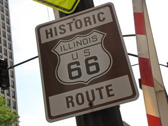
-
Somerset Village
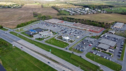
-
Farm on the Virginia-West Virginia border [01]
![Farm on the Virginia-West Virginia border [01] (3639 visits) Farm on the border between Highland County, Virginia and Pendleton County, West Virginia. The bound... Farm on the Virginia-West Virginia border [01]](../../../../../i/upload/2024/07/20/20240720094156-2b1215da-cu_s9999x250.jpg)
-
Zero Effluent Discharge sign at Ivy rest area [02]
![Zero Effluent Discharge sign at Ivy rest area [02] (3574 visits) Sign at the rest area along Interstate 64 westbound near Ivy, Virginia explaining that the rest area... Zero Effluent Discharge sign at Ivy rest area [02]](../../../../../i/upload/2024/07/19/20240719165901-5f1abe0b-cu_s9999x250.jpg)
-
Zero Effluent Discharge sign at Ivy rest area [01]
![Zero Effluent Discharge sign at Ivy rest area [01] (3449 visits) Sign at the rest area along Interstate 64 westbound near Ivy, Virginia explaining that the rest area... Zero Effluent Discharge sign at Ivy rest area [01]](../../../../../i/upload/2024/07/19/20240719165907-357f8f51-cu_s9999x250.jpg)
-
US 340 in Charles Town [04]
![US 340 in Charles Town [04] (3423 visits) US 340 in Charles Town, West Virginia, east of the interchange with West Virginia Route 9.
Ben Schu... US 340 in Charles Town [04]](../../../../../i/upload/2024/07/19/20240719162255-e1659465-cu_s9999x250.jpg)
-
Low clearance sign at West Falls Church station
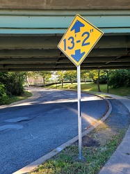
-
Westbound Interstate 66 near Nutley Street
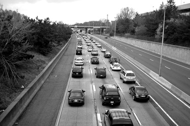
-
Shield for North Carolina Highway 55 [05]
![Shield for North Carolina Highway 55 [05] (3118 visits) Signage on Dr. Martin Luther King, Jr. Blvd. in New Bern, North Carolina indicating where to turn fo... Shield for North Carolina Highway 55 [05]](../../../../../i/upload/2024/07/19/20240719201546-d6efd3a8-cu_s9999x250.jpg)
-
K Street under Washington Circle
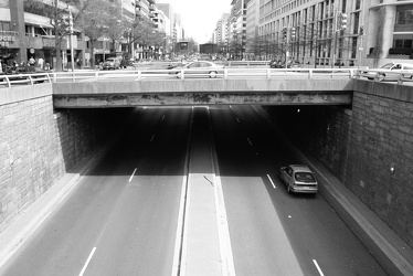
 Sideling Hill rest area [04]
![Sideling Hill rest area [04] (3112 visits) Westbound access to the footbridge across the highway at the Sideling Hill rest area, located along ... Sideling Hill rest area [04]](../../../../../i/upload/2024/07/17/20240717233516-e5cc17b4-cu_s9999x250.jpg)
-
Shield for North Carolina Highway 55 [06]
![Shield for North Carolina Highway 55 [06] (3072 visits) Signage on Dr. Martin Luther King, Jr. Blvd. in New Bern, North Carolina indicating where to turn fo... Shield for North Carolina Highway 55 [06]](../../../../../i/upload/2024/07/19/20240719201404-602a14bc-cu_s9999x250.jpg)
-
Reassurance marker for US 460 Business westbound [02]
![Reassurance marker for US 460 Business westbound [02] (3021 visits) Reassurance marker for westbound US 460 Business on South Crater Road in Petersburg, Virginia.
More... Reassurance marker for US 460 Business westbound [02]](../../../../../i/upload/2024/07/19/20240719195435-3d345c43-cu_s9999x250.jpg)
-
Reassurance marker for US 460 Business westbound [01]
![Reassurance marker for US 460 Business westbound [01] (2996 visits) Reassurance marker for westbound US 460 Business on South Crater Road in Petersburg, Virginia.
More... Reassurance marker for US 460 Business westbound [01]](../../../../../i/upload/2024/07/19/20240719195429-a75b711e-cu_s9999x250.jpg)
-
Overhead sign over South Queen Street
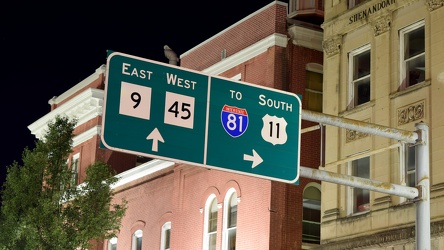
-
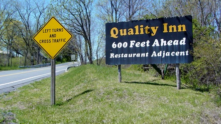
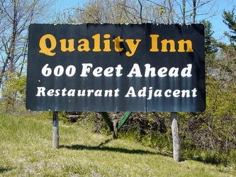
Quality Inn sign near Breezewood
 Sideling Hill rest area [05]
![Sideling Hill rest area [05] (2968 visits) Path to the westbound parking area and restrooms at the Sideling Hill rest area, located along Inter... Sideling Hill rest area [05]](../../../../../i/upload/2024/07/17/20240717233521-b99b80cb-cu_s9999x250.jpg)
-
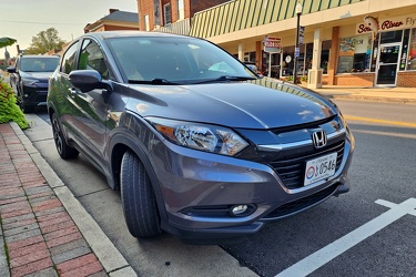
Honda HR-V in downtown Waynesboro
-
Goochland rest area, westbound [03]
![Goochland rest area, westbound [03] (2956 visits) Restroom building at the Goochland Safety Rest Area on Interstate 64 westbound in Manakin-Sabot, Vir... Goochland rest area, westbound [03]](../../../../../i/upload/2024/07/19/20240719093121-0aeca88a-cu_s9999x250.jpg)
-
Reassurance markers for US 13, US 70, and NC 111 [04]
![Reassurance markers for US 13, US 70, and NC 111 [04] (2951 visits) Sign assembly containing reassurance markers for southbound US Route 13, westbound US Route 70, and ... Reassurance markers for US 13, US 70, and NC 111 [04]](../../../../../i/upload/2024/07/19/20240719202050-eefad4c5-cu_s9999x250.jpg)
-
Reassurance markers for US 13, US 70, and NC 111 [01]
![Reassurance markers for US 13, US 70, and NC 111 [01] (2926 visits) Sign assembly containing reassurance markers for southbound US Route 13, westbound US Route 70, and ... Reassurance markers for US 13, US 70, and NC 111 [01]](../../../../../i/upload/2024/07/19/20240719202111-08757310-cu_s9999x250.jpg)
-
Maryland 68 vs. Interstate 68 sign [02]
![Maryland 68 vs. Interstate 68 sign [02] (2905 visits) Sign on westbound Interstate 70 ahead of exit 18, indicating that the next exit is for Maryland Rout... Maryland 68 vs. Interstate 68 sign [02]](../../../../../i/upload/2024/07/19/20240719004125-0cff4906-cu_s9999x250.jpg)
-
Goochland rest area, westbound [02]
![Goochland rest area, westbound [02] (2893 visits) Restroom building at the Goochland Safety Rest Area on Interstate 64 westbound in Manakin-Sabot, Vir... Goochland rest area, westbound [02]](../../../../../i/upload/2024/07/19/20240719093125-c06aafb1-cu_s9999x250.jpg)
-
Goochland rest area, westbound [01]
![Goochland rest area, westbound [01] (2893 visits) Restroom building at the Goochland Safety Rest Area on Interstate 64 westbound in Manakin-Sabot, Vir... Goochland rest area, westbound [01]](../../../../../i/upload/2024/07/19/20240719093130-dbdf3bb4-cu_s9999x250.jpg)
-
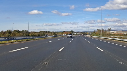
Interstate 66 westbound, near Gainesville
-
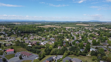
Pelham neighborhood in Waynesboro, Virginia
-
Signage for I-40 on US 321 [01]
![Signage for I-40 on US 321 [01] (2500 visits) Signage for Interstate 40 on US 321 in Lenoir City, Tennessee.
More at The Schumin Web:
www.schumin... Signage for I-40 on US 321 [01]](../../../../../i/upload/2024/07/20/20240720113534-f6b63e08-cu_s9999x250.jpg)
-
Signage for Interstate 40 on Genesis Road [03]
![Signage for Interstate 40 on Genesis Road [03] (2475 visits) Signage for Interstate 40 on Genesis Road (SR 298) in Crossville, Tennessee, on the northbound appro... Signage for Interstate 40 on Genesis Road [03]](../../../../../i/upload/2024/07/20/20240720113157-2a8f17f8-cu_s9999x250.jpg)
-
Shields for US 60 and US 220 [01]
![Shields for US 60 and US 220 [01] (2471 visits) Shields for US 60 westbound and US 220 northbound in Clifton Forge, Virginia.
Ben Schumin is a prof... Shields for US 60 and US 220 [01]](../../../../../i/upload/2024/07/19/20240719212745-19a5aed3-cu_s9999x250.jpg)
-
Road flare on Maine Avenue SW [01]
![Road flare on Maine Avenue SW [01] (2466 visits) A road flare burns in the rightmost lane of Maine Avenue SW during the National Cherry Blossom Festi... Road flare on Maine Avenue SW [01]](../../../../../i/upload/2024/07/17/20240717225356-2886a729-cu_s9999x250.jpg)
-
Road flare on Maine Avenue SW [02]
![Road flare on Maine Avenue SW [02] (2459 visits) A road flare burns in the rightmost lane of Maine Avenue SW during the National Cherry Blossom Festi... Road flare on Maine Avenue SW [02]](../../../../../i/upload/2024/07/17/20240717225359-e216a1f4-cu_s9999x250.jpg)
-
Interstate 40 signage on Strawberry Plains Pike [04]
![Interstate 40 signage on Strawberry Plains Pike [04] (2436 visits) Signage for Interstate 40 on Strawberry Plains Pike in Knoxville, Tennessee.
More at The Schumin We... Interstate 40 signage on Strawberry Plains Pike [04]](../../../../../i/upload/2024/07/20/20240720113016-e67a2d49-cu_s9999x250.jpg)