-
View from Sounding Knob Fire Tower [15]
![View from Sounding Knob Fire Tower [15] (785 visits) The view from Sounding Knob Fire Tower, a restored fire watch tower on Jack Mountain near Monterey, ... View from Sounding Knob Fire Tower [15]](../../../../i/upload/2024/12/31/20241231010323-27db6902-cu_s9999x250.jpg)
-
View from Sounding Knob Fire Tower [14]
![View from Sounding Knob Fire Tower [14] (797 visits) The view from Sounding Knob Fire Tower, a restored fire watch tower on Jack Mountain near Monterey, ... View from Sounding Knob Fire Tower [14]](../../../../i/upload/2024/12/31/20241231010319-c5fd58fd-cu_s9999x250.jpg)
-
View from Sounding Knob Fire Tower [13]
![View from Sounding Knob Fire Tower [13] (839 visits) The view from Sounding Knob Fire Tower, a restored fire watch tower on Jack Mountain near Monterey, ... View from Sounding Knob Fire Tower [13]](../../../../i/upload/2024/12/31/20241231010313-399c7c4e-cu_s9999x250.jpg)
-
View from Sounding Knob Fire Tower [11]
![View from Sounding Knob Fire Tower [11] (772 visits) The view from Sounding Knob Fire Tower, a restored fire watch tower on Jack Mountain near Monterey, ... View from Sounding Knob Fire Tower [11]](../../../../i/upload/2024/12/31/20241231010304-2a3f3c22-cu_s9999x250.jpg)
-
View from Sounding Knob Fire Tower [10]
![View from Sounding Knob Fire Tower [10] (768 visits) The view from Sounding Knob Fire Tower, a restored fire watch tower on Jack Mountain near Monterey, ... View from Sounding Knob Fire Tower [10]](../../../../i/upload/2024/12/31/20241231010300-69dbc3a3-cu_s9999x250.jpg)
-
View from Sounding Knob Fire Tower [11]
![View from Sounding Knob Fire Tower [11] (875 visits) The view from Sounding Knob Fire Tower, a restored fire watch tower on Jack Mountain near Monterey, ... View from Sounding Knob Fire Tower [11]](../../../../i/upload/2024/12/31/20241231010309-138441d9-cu_s9999x250.jpg)
-
View from Sunset Park
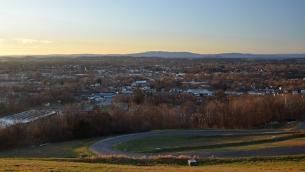
-
Elm Avenue interchange [01]
![Elm Avenue interchange [01] (2966 visits) Interchange between Interstate 581/US 220 and Elm Avenue (SR 24) in Roanoke, Virginia, viewed from M... Elm Avenue interchange [01]](../../../../i/upload/2024/07/20/20240720122015-70544823-cu_s9999x250.jpg)
-
Poff Federal Building, viewed from Mill Mountain
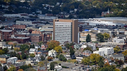
-
Valley View area, viewed from Mill Mountain
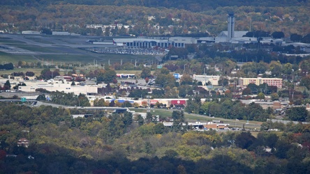
-
View from the Roanoke Star, October 2022 [04]
![View from the Roanoke Star, October 2022 [04] (1554 visits) View of Roanoke, Virginia from Mill Mountain, October 18, 2022.
More at The Schumin Web:
www.schumi... View from the Roanoke Star, October 2022 [04]](../../../../i/upload/2024/07/20/20240720121957-f438f2a3-cu_s9999x250.jpg)
-
View from the Roanoke Star, October 2022 [03]
![View from the Roanoke Star, October 2022 [03] (1564 visits) View of Roanoke, Virginia from Mill Mountain, October 18, 2022.
More at The Schumin Web:
www.schumi... View from the Roanoke Star, October 2022 [03]](../../../../i/upload/2024/07/20/20240720121951-aad25312-cu_s9999x250.jpg)
-
View from the Roanoke Star, October 2022 [02]
![View from the Roanoke Star, October 2022 [02] (1510 visits) View of Roanoke, Virginia from Mill Mountain, October 18, 2022.
More at The Schumin Web:
www.schumi... View from the Roanoke Star, October 2022 [02]](../../../../i/upload/2024/07/20/20240720121946-ef64a8e5-cu_s9999x250.jpg)
-
View from the Roanoke Star, October 2022 [01]
![View from the Roanoke Star, October 2022 [01] (2763 visits) View of Roanoke, Virginia from Mill Mountain, October 18, 2022.
More at The Schumin Web:
www.schumi... View from the Roanoke Star, October 2022 [01]](../../../../i/upload/2024/07/20/20240720121935-9c3d81cd-cu_s9999x250.jpg)
-
Aerial view of Roanoke, Virginia [06]
![Aerial view of Roanoke, Virginia [06] (1656 visits) Aerial view of Roanoke, Virginia.
More at The Schumin Web:
www.schuminweb.com/life-and-times/advent... Aerial view of Roanoke, Virginia [06]](../../../../i/upload/2024/07/20/20240720121917-3d4a6311-cu_s9999x250.jpg)
-
Aerial view of Roanoke, Virginia [05]
![Aerial view of Roanoke, Virginia [05] (1730 visits) Aerial view of Roanoke, Virginia.
More at The Schumin Web:
www.schuminweb.com/life-and-times/advent... Aerial view of Roanoke, Virginia [05]](../../../../i/upload/2024/07/20/20240720121906-5f802cee-cu_s9999x250.jpg)
-
Aerial view of Roanoke, Virginia [04]
![Aerial view of Roanoke, Virginia [04] (1832 visits) Aerial view of Roanoke, Virginia.
More at The Schumin Web:
www.schuminweb.com/life-and-times/advent... Aerial view of Roanoke, Virginia [04]](../../../../i/upload/2024/07/20/20240720121854-34748718-cu_s9999x250.jpg)
-
Aerial view of Roanoke, Virginia [03]
![Aerial view of Roanoke, Virginia [03] (1778 visits) Aerial view of Roanoke, Virginia.
More at The Schumin Web:
www.schuminweb.com/life-and-times/advent... Aerial view of Roanoke, Virginia [03]](../../../../i/upload/2024/07/20/20240720121837-3c6bbb13-cu_s9999x250.jpg)
-
Aerial view of Roanoke, Virginia [02]
![Aerial view of Roanoke, Virginia [02] (1744 visits) Aerial view of Roanoke, Virginia.
More at The Schumin Web:
www.schuminweb.com/life-and-times/advent... Aerial view of Roanoke, Virginia [02]](../../../../i/upload/2024/07/20/20240720121808-dccb83a0-cu_s9999x250.jpg)
-
Aerial view of Roanoke, Virginia [01]
![Aerial view of Roanoke, Virginia [01] (1835 visits) Aerial view of Roanoke, Virginia.
More at The Schumin Web:
www.schuminweb.com/life-and-times/advent... Aerial view of Roanoke, Virginia [01]](../../../../i/upload/2024/07/20/20240720121757-bb58476c-cu_s9999x250.jpg)
-
Elm Avenue interchange [02]
![Elm Avenue interchange [02] (2919 visits) Interchange between Interstate 581/US 220 and Elm Avenue (SR 24) in Roanoke, Virginia. The I-581 de... Elm Avenue interchange [02]](../../../../i/upload/2024/07/20/20240720121652-6267da79-cu_s9999x250.jpg)
-
Interstate 64 east of Rockfish Gap
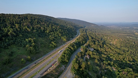
-
Place where a plaque used to be at Ravens Roost overlook [03]
![Place where a plaque used to be at Ravens Roost overlook [03] (1384 visits) The place where a National Park Service plaque used to be located atop a raised portion of the retai... Place where a plaque used to be at Ravens Roost overlook [03]](../../../../i/upload/2024/07/20/20240720111008-7c125d7a-cu_s9999x250.jpg)
-
View from Greenstone Overlook [02]
![View from Greenstone Overlook [02] (1154 visits) View from Greenstone Overlook on the Blue Ridge Parkway in Virginia. The city of Waynesboro is visi... View from Greenstone Overlook [02]](../../../../i/upload/2024/07/20/20240720111014-00eb3527-cu_s9999x250.jpg)
-
View from Greenstone Overlook [04]
![View from Greenstone Overlook [04] (1200 visits) View from Greenstone Overlook on the Blue Ridge Parkway in Virginia. The city of Waynesboro is visi... View from Greenstone Overlook [04]](../../../../i/upload/2024/07/20/20240720111020-03746e7e-cu_s9999x250.jpg)
-
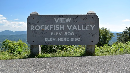
Rockfish Valley Overlook sign
-
View from Ravens Roost overlook [01]
![View from Ravens Roost overlook [01] (1212 visits) View from Ravens Roost overlook on the Blue Ridge Parkway in Virginia.
More at The Schumin Web:
www... View from Ravens Roost overlook [01]](../../../../i/upload/2024/07/20/20240720111047-eedd86a4-cu_s9999x250.jpg)
-
View from Ravens Roost overlook [02]
![View from Ravens Roost overlook [02] (1248 visits) View from Ravens Roost overlook on the Blue Ridge Parkway in Virginia.
More at The Schumin Web:
www... View from Ravens Roost overlook [02]](../../../../i/upload/2024/07/20/20240720111052-9d9ea25e-cu_s9999x250.jpg)
-
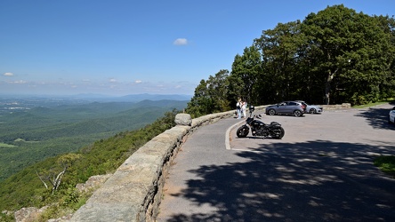
Ravens Roost overlook
-
View from Greenstone Overlook [03]
![View from Greenstone Overlook [03] (1141 visits) View from Greenstone Overlook on the Blue Ridge Parkway in Virginia. The city of Waynesboro is visi... View from Greenstone Overlook [03]](../../../../i/upload/2024/07/20/20240720111131-8fba13c3-cu_s9999x250.jpg)
-
Elyse looks out of a Honda HR-V

-
Place where a plaque used to be at Ravens Roost overlook [01]
![Place where a plaque used to be at Ravens Roost overlook [01] (1377 visits) The place where a National Park Service plaque used to be located atop a raised portion of the retai... Place where a plaque used to be at Ravens Roost overlook [01]](../../../../i/upload/2024/07/20/20240720111142-228a886f-cu_s9999x250.jpg)
-
View from Greenstone Overlook [01]
![View from Greenstone Overlook [01] (1134 visits) View from Greenstone Overlook on the Blue Ridge Parkway in Virginia. The city of Waynesboro is visi... View from Greenstone Overlook [01]](../../../../i/upload/2024/07/20/20240720111153-a1731cde-cu_s9999x250.jpg)
-
View from Ravens Roost overlook [03]
![View from Ravens Roost overlook [03] (1231 visits) View from Ravens Roost overlook on the Blue Ridge Parkway in Virginia.
More at The Schumin Web:
www... View from Ravens Roost overlook [03]](../../../../i/upload/2024/07/20/20240720111242-329db50f-cu_s9999x250.jpg)
-
Place where a plaque used to be at Ravens Roost overlook [02]
![Place where a plaque used to be at Ravens Roost overlook [02] (1346 visits) The place where a National Park Service plaque used to be located atop a raised portion of the retai... Place where a plaque used to be at Ravens Roost overlook [02]](../../../../i/upload/2024/07/20/20240720111248-a6c2e1fa-cu_s9999x250.jpg)
-
View from Afton Overlook [02]
![View from Afton Overlook [02] (10948 visits) View from Afton Overlook, the first overlook on the Blue Ridge Parkway when traveling southbound, im... View from Afton Overlook [02]](../../../../i/upload/2024/07/20/20240720111253-aaafa3ed-cu_s9999x250.jpg)
-
View from Afton Overlook [03]
![View from Afton Overlook [03] (10825 visits) View from Afton Overlook, the first overlook on the Blue Ridge Parkway when traveling southbound, im... View from Afton Overlook [03]](../../../../i/upload/2024/07/20/20240720111315-c554fd25-cu_s9999x250.jpg)
-
View from Rockfish Valley Overlook [01]
![View from Rockfish Valley Overlook [01] (1334 visits) View from the Rockfish Valley Overlook, the second overlook on the Blue Ridge Parkway when traveling... View from Rockfish Valley Overlook [01]](../../../../i/upload/2024/07/20/20240720111351-549da1ab-cu_s9999x250.jpg)
-
View from Rockfish Valley Overlook [02]
![View from Rockfish Valley Overlook [02] (1417 visits) View from the Rockfish Valley Overlook, the second overlook on the Blue Ridge Parkway when traveling... View from Rockfish Valley Overlook [02]](../../../../i/upload/2024/07/20/20240720111356-80017404-cu_s9999x250.jpg)
-
View from Afton Overlook [01]
![View from Afton Overlook [01] (10889 visits) View from Afton Overlook, the first overlook on the Blue Ridge Parkway when traveling southbound, im... View from Afton Overlook [01]](../../../../i/upload/2024/07/20/20240720111401-128c20ce-cu_s9999x250.jpg)
-
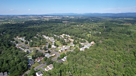
Southeastern end of Ridgeview Acres
-
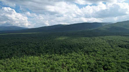
George Washington National Forest from above
-
Forest Springs Estates [10]
![Forest Springs Estates [10] (1713 visits) Aerial view of the Forest Springs Estates neighborhood in Stuarts Draft, Virginia, taken from above ... Forest Springs Estates [10]](../../../../i/upload/2024/07/20/20240720103726-e7eeb2c5-cu_s9999x250.jpg)
-
Forest Springs Estates [09]
![Forest Springs Estates [09] (2907 visits) Aerial view of the Forest Springs Estates neighborhood in Stuarts Draft, Virginia, showing Tomahawk ... Forest Springs Estates [09]](../../../../i/upload/2024/07/20/20240720103720-56045695-cu_s9999x250.jpg)
-
Forest Springs Estates [08]
![Forest Springs Estates [08] (2950 visits) Aerial view of the Forest Springs Estates neighborhood in Stuarts Draft, Virginia, showing Clements ... Forest Springs Estates [08]](../../../../i/upload/2024/07/20/20240720103715-d25d2920-cu_s9999x250.jpg)
-
Forest Springs Estates [07]
![Forest Springs Estates [07] (2906 visits) Aerial view of the Forest Springs Estates neighborhood in Stuarts Draft, Virginia, showing the inter... Forest Springs Estates [07]](../../../../i/upload/2024/07/20/20240720103710-4e810037-cu_s9999x250.jpg)
-
Forest Springs Estates [06]
![Forest Springs Estates [06] (1652 visits) Aerial view of the Forest Springs Estates neighborhood in Stuarts Draft, Virginia, facing south.
Be... Forest Springs Estates [06]](../../../../i/upload/2024/07/20/20240720103705-68728b22-cu_s9999x250.jpg)
-
Forest Springs Estates [05]
![Forest Springs Estates [05] (1782 visits) Aerial view of the Forest Springs Estates neighborhood in Stuarts Draft, Virginia, taken above the i... Forest Springs Estates [05]](../../../../i/upload/2024/07/20/20240720103700-12ed86ac-cu_s9999x250.jpg)
-
Forest Springs Estates [04]
![Forest Springs Estates [04] (2851 visits) Aerial view of the Forest Springs Estates neighborhood in Stuarts Draft, Virginia, showing Ceocia La... Forest Springs Estates [04]](../../../../i/upload/2024/07/20/20240720103655-f8465d58-cu_s9999x250.jpg)
-
Forest Springs Estates [03]
![Forest Springs Estates [03] (2804 visits) Aerial view of the Forest Springs Estates neighborhood in Stuarts Draft, Virginia, showing the inter... Forest Springs Estates [03]](../../../../i/upload/2024/07/20/20240720103650-60296a18-cu_s9999x250.jpg)
-
Forest Springs Estates [02]
![Forest Springs Estates [02] (2824 visits) Aerial view of the Forest Springs Estates neighborhood in Stuarts Draft, Virginia, taken from approx... Forest Springs Estates [02]](../../../../i/upload/2024/07/20/20240720103645-80215d0c-cu_s9999x250.jpg)
-
Forest Springs Estates [01]
![Forest Springs Estates [01] (2245 visits) Aerial view of the Forest Springs Estates neighborhood in Stuarts Draft, Virginia, taken from approx... Forest Springs Estates [01]](../../../../i/upload/2024/07/20/20240720103408-ac9f7d40-cu_s9999x250.jpg)
-
View from Sounding Knob Fire Tower [05]
![View from Sounding Knob Fire Tower [05] (6697 visits) The view from Sounding Knob Fire Tower, a restored fire watch tower on Jack Mountain near Monterey, ... View from Sounding Knob Fire Tower [05]](../../../../i/upload/2024/07/20/20240720093912-7eeb9b2a-cu_s9999x250.jpg)
-
View from Shenandoah Mountain [01]
![View from Shenandoah Mountain [01] (1329 visits) View of Highland County, Virginia from Shenandoah Mountain.
Ben Schumin is a professional photograp... View from Shenandoah Mountain [01]](../../../../i/upload/2024/07/20/20240720093931-b1561721-cu_s9999x250.jpg)
-
Sign at the border between Augusta and Highland Counties [03]
![Sign at the border between Augusta and Highland Counties [03] (2767 visits) Sign along US 250 at the border between Augusta and Highland Counties in Virginia. The sign is of t... Sign at the border between Augusta and Highland Counties [03]](../../../../i/upload/2024/07/20/20240720093939-e9041290-cu_s9999x250.jpg)
-
Sign at the border between Augusta and Highland Counties [02]
![Sign at the border between Augusta and Highland Counties [02] (2679 visits) Sign along US 250 at the border between Augusta and Highland Counties in Virginia. The sign is stan... Sign at the border between Augusta and Highland Counties [02]](../../../../i/upload/2024/07/20/20240720094001-d7689782-cu_s9999x250.jpg)
-
Sign at the border between Augusta and Highland Counties [01]
![Sign at the border between Augusta and Highland Counties [01] (2777 visits) Sign along US 250 at the border between Augusta and Highland Counties in Virginia. The sign is stan... Sign at the border between Augusta and Highland Counties [01]](../../../../i/upload/2024/07/20/20240720094015-efe93712-cu_s9999x250.jpg)
-
View from Sounding Knob Fire Tower [01]
![View from Sounding Knob Fire Tower [01] (2560 visits) The view from Sounding Knob Fire Tower, a restored fire watch tower on Jack Mountain near Monterey, ... View from Sounding Knob Fire Tower [01]](../../../../i/upload/2024/07/20/20240720094042-38692d7b-cu_s9999x250.jpg)
-
View from Sounding Knob Fire Tower [07]
![View from Sounding Knob Fire Tower [07] (2454 visits) The view from Sounding Knob Fire Tower, a restored fire watch tower on Jack Mountain near Monterey, ... View from Sounding Knob Fire Tower [07]](../../../../i/upload/2024/07/20/20240720094100-2ebefa3a-cu_s9999x250.jpg)
-
View from Sounding Knob Fire Tower [02]
![View from Sounding Knob Fire Tower [02] (2584 visits) The view from Sounding Knob Fire Tower, a restored fire watch tower on Jack Mountain near Monterey, ... View from Sounding Knob Fire Tower [02]](../../../../i/upload/2024/07/20/20240720094106-3da79801-cu_s9999x250.jpg)
-
Hairpin turn on US 250 [01]
![Hairpin turn on US 250 [01] (2926 visits) Hairpin turn on US 250 in Highland County, Virginia, as it ascends Shenandoah Mountain.
Ben Schumin... Hairpin turn on US 250 [01]](../../../../i/upload/2024/07/20/20240720094126-511d5875-cu_s9999x250.jpg)
-
Hairpin turn on US 250 [02]
![Hairpin turn on US 250 [02] (2980 visits) Hairpin turn on US 250 in Highland County, Virginia, as it ascends Shenandoah Mountain.
Ben Schumin... Hairpin turn on US 250 [02]](../../../../i/upload/2024/07/20/20240720094131-dc588684-cu_s9999x250.jpg)
-
View from Shenandoah Mountain [03]
![View from Shenandoah Mountain [03] (1413 visits) View of Highland County, Virginia from Shenandoah Mountain.
Ben Schumin is a professional photograp... View from Shenandoah Mountain [03]](../../../../i/upload/2024/07/20/20240720094136-fc1446fb-cu_s9999x250.jpg)
-
View from Sounding Knob Fire Tower [08]
![View from Sounding Knob Fire Tower [08] (2615 visits) The view from Sounding Knob Fire Tower, a restored fire watch tower on Jack Mountain near Monterey, ... View from Sounding Knob Fire Tower [08]](../../../../i/upload/2024/07/20/20240720094146-d06641af-cu_s9999x250.jpg)
-
View from Sounding Knob Fire Tower [03]
![View from Sounding Knob Fire Tower [03] (2622 visits) The view from Sounding Knob Fire Tower, a restored fire watch tower on Jack Mountain near Monterey, ... View from Sounding Knob Fire Tower [03]](../../../../i/upload/2024/07/20/20240720094217-426249c3-cu_s9999x250.jpg)
-
View from Sounding Knob Fire Tower [04]
![View from Sounding Knob Fire Tower [04] (6622 visits) The view from Sounding Knob Fire Tower, a restored fire watch tower on Jack Mountain near Monterey, ... View from Sounding Knob Fire Tower [04]](../../../../i/upload/2024/07/20/20240720094227-c4df3b1c-cu_s9999x250.jpg)
-
View from Sounding Knob Fire Tower [09]
![View from Sounding Knob Fire Tower [09] (2487 visits) The view from Sounding Knob Fire Tower, a restored fire watch tower on Jack Mountain near Monterey, ... View from Sounding Knob Fire Tower [09]](../../../../i/upload/2024/07/20/20240720094237-fbdf1303-cu_s9999x250.jpg)
-
View from Sounding Knob Fire Tower [06]
![View from Sounding Knob Fire Tower [06] (6842 visits) The view from Sounding Knob Fire Tower, a restored fire watch tower on Jack Mountain near Monterey, ... View from Sounding Knob Fire Tower [06]](../../../../i/upload/2024/07/20/20240720094246-3a374853-cu_s9999x250.jpg)
-
View from Shenandoah Mountain [02]
![View from Shenandoah Mountain [02] (1368 visits) View of Highland County, Virginia from Shenandoah Mountain.
Ben Schumin is a professional photograp... View from Shenandoah Mountain [02]](../../../../i/upload/2024/07/20/20240720094312-c9f54fe4-cu_s9999x250.jpg)
-
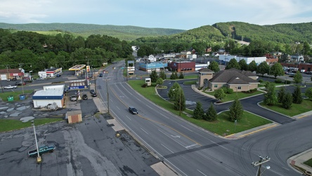
East Broad Street near East Avenue
-
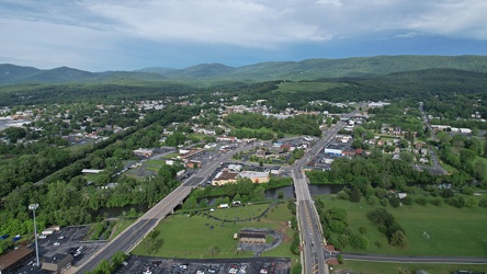
East Main and Broad Streets in Waynesboro, Virginia
-
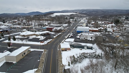
East Main Street in Waynesboro, Virginia
-
Roanoke, Virginia at night, 2021
-
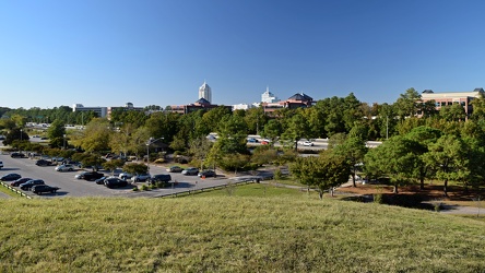
View from Mount Trashmore
-
Sky over Rio Hill
-
US 29 North, near Hilton Heights Road [02]
![US 29 North, near Hilton Heights Road [02] (3027 visits) US 29 north of Charlottesville, Virginia, near Hilton Heights Road, facing northbound.
Ben Schumin ... US 29 North, near Hilton Heights Road [02]](../../../../i/upload/2024/07/19/20240719171717-5729f873-cu_s9999x250.jpg)
-
US 29 North, near Hilton Heights Road [01]
![US 29 North, near Hilton Heights Road [01] (3014 visits) US 29 north of Charlottesville, Virginia, near Hilton Heights Road, facing northbound.
Ben Schumin ... US 29 North, near Hilton Heights Road [01]](../../../../i/upload/2024/07/19/20240719171702-b12048d7-cu_s9999x250.jpg)
-
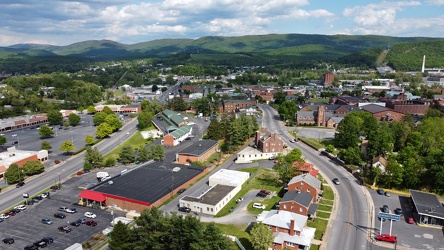
West Main and West Broad Streets in downtown Waynesboro
-
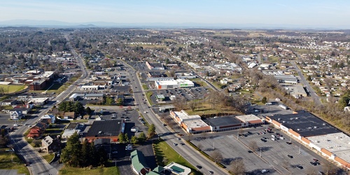
West Main and West Broad Streets, facing west
-
Downtown Waynesboro, Virginia, looking toward Invista [01]
![Downtown Waynesboro, Virginia, looking toward Invista [01] (1943 visits) Aerial view of downtown Waynesboro, Virginia, looking towards the Invista plant.
Ben Schumin is a p... Downtown Waynesboro, Virginia, looking toward Invista [01]](../../../../i/upload/2024/07/19/20240719125947-ee92c8f8-cu_s9999x250.jpg)