-
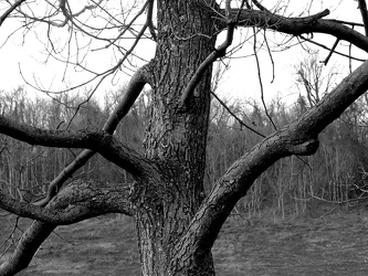
Tree at scenic overlook
-
Sunset from I-64 overlook [03]
![Sunset from I-64 overlook [03] (2357 visits) Sunset, viewed from the scenic overlook at milepost 103 on Interstate 64 eastbound in Albemarle Coun... Sunset from I-64 overlook [03]](../../../i/upload/2024/07/13/20240713234247-066d4e9b-cu_s9999x250.jpg)
-
Sunset from I-64 overlook [01]
![Sunset from I-64 overlook [01] (2328 visits) Sunset, viewed from the scenic overlook at milepost 103 on Interstate 64 eastbound in Albemarle Coun... Sunset from I-64 overlook [01]](../../../i/upload/2024/07/13/20240713234248-69674cad-cu_s9999x250.jpg)
-
Sunset from I-64 overlook [02]
![Sunset from I-64 overlook [02] (2365 visits) Sunset, viewed from the scenic overlook at milepost 103 on Interstate 64 eastbound in Albemarle Coun... Sunset from I-64 overlook [02]](../../../i/upload/2024/07/13/20240713234249-3f6e970a-cu_s9999x250.jpg)
-
Sunset from I-64 overlook [04]
![Sunset from I-64 overlook [04] (2302 visits) Sunset, viewed from the scenic overlook at milepost 103 on Interstate 64 eastbound in Albemarle Coun... Sunset from I-64 overlook [04]](../../../i/upload/2024/07/13/20240713234251-97a8e10e-cu_s9999x250.jpg)
-
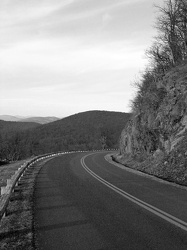
Blue Ridge Parkway at milepost 7
-
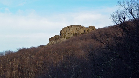
Humpback Rock, viewed from below
-
Cliff over the Blue Ridge Parkway [02]
![Cliff over the Blue Ridge Parkway [02] (2981 visits) Rock cliffs over the Blue Ridge Parkway, approximately seven miles south of Rockfish Gap.
Ben Schum... Cliff over the Blue Ridge Parkway [02]](../../../i/upload/2024/07/15/20240715141127-8869144a-cu_s9999x250.jpg)
-
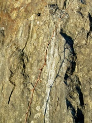
Thorns across a rock
-
Cliff over the Blue Ridge Parkway [01]
![Cliff over the Blue Ridge Parkway [01] (2833 visits) Rock cliffs over the Blue Ridge Parkway, approximately seven miles south of Rockfish Gap.
Ben Schum... Cliff over the Blue Ridge Parkway [01]](../../../i/upload/2024/07/15/20240715141130-0117e715-cu_s9999x250.jpg)
-
Sable at House Mountain overlook [03]
![Sable at House Mountain overlook [03] (44600 visits) My 2004 Mercury Sable wagon parked at the House Mountain overlook on the Blue Ridge Parkway.
Ben Sc... Sable at House Mountain overlook [03]](../../../i/upload/2024/07/15/20240715141155-0b59ff8d-cu_s9999x250.jpg)
-
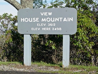
View, House Mountain
-
Sable at House Mountain overlook [01]
![Sable at House Mountain overlook [01] (46231 visits) My 2004 Mercury Sable wagon parked at the House Mountain overlook on the Blue Ridge Parkway.
Ben Sc... Sable at House Mountain overlook [01]](../../../i/upload/2024/07/15/20240715141200-4c36b7bf-cu_s9999x250.jpg)
-
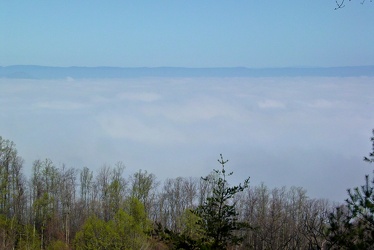
View from House Mountain overlook
-
Sable at House Mountain overlook [02]
![Sable at House Mountain overlook [02] (44000 visits) My 2004 Mercury Sable wagon parked at the House Mountain overlook on the Blue Ridge Parkway.
Ben Sc... Sable at House Mountain overlook [02]](../../../i/upload/2024/07/15/20240715141204-5a5c8673-cu_s9999x250.jpg)
-
View from Purgatory Mountain overlook [03]
![View from Purgatory Mountain overlook [03] (2735 visits) View from the Purgatory Mountain overlook on the Blue Ridge Parkway in Botetourt County, Virginia.
... View from Purgatory Mountain overlook [03]](../../../i/upload/2024/07/15/20240715141205-a4661d8d-cu_s9999x250.jpg)
-
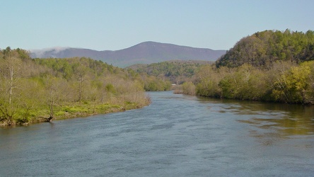
View of James River from Harry Flood Byrd Bridge
-
View from Purgatory Mountain overlook [02]
![View from Purgatory Mountain overlook [02] (2498 visits) View from the Purgatory Mountain overlook on the Blue Ridge Parkway in Botetourt County, Virginia.
... View from Purgatory Mountain overlook [02]](../../../i/upload/2024/07/15/20240715141210-1e895d02-cu_s9999x250.jpg)
-
Plants at Purgatory Mountain overlook
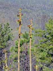
-
View, Purgatory Mountain
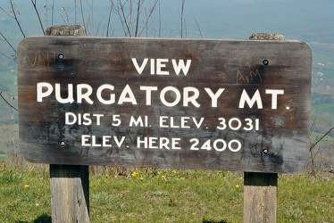
-
View from Purgatory Mountain overlook [01]
![View from Purgatory Mountain overlook [01] (2512 visits) View from the Purgatory Mountain overlook on the Blue Ridge Parkway in Botetourt County, Virginia.
... View from Purgatory Mountain overlook [01]](../../../i/upload/2024/07/15/20240715141215-fcceefa7-cu_s9999x250.jpg)
-
Gentex auto-dimming mirror

-
Plaque at Raven's Roost overlook
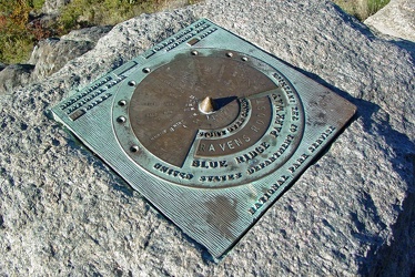
-
View from Raven's Roost
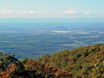
-
View from 20-Minute Cliff overlook [03]
![View from 20-Minute Cliff overlook [03] (1603 visits) View from 20-Minute Cliff, an overlook on the Blue Ridge Parkway near Vesuvius, Virginia.
Ben Schum... View from 20-Minute Cliff overlook [03]](../../../i/upload/2024/07/15/20240715141705-52871955-cu_s9999x250.jpg)
-
Stream at Yankee Horse Ridge [01]
![Stream at Yankee Horse Ridge [01] (1802 visits) Stream with small waterfall at the Yankee Horse Ridge overlook, on the Blue Ridge Parkway near Monte... Stream at Yankee Horse Ridge [01]](../../../i/upload/2024/07/15/20240715141706-0b231326-cu_s9999x250.jpg)
-
Stream at Yankee Horse Ridge [01]
![Stream at Yankee Horse Ridge [01] (1795 visits) Stream with small waterfall at the Yankee Horse Ridge overlook, on the Blue Ridge Parkway near Monte... Stream at Yankee Horse Ridge [01]](../../../i/upload/2024/07/15/20240715141708-6e96c46a-cu_s9999x250.jpg)
-
Stream at Yankee Horse Ridge [01]
![Stream at Yankee Horse Ridge [01] (1686 visits) Stream with small waterfall at the Yankee Horse Ridge overlook, on the Blue Ridge Parkway near Monte... Stream at Yankee Horse Ridge [01]](../../../i/upload/2024/07/15/20240715141709-62daf30c-cu_s9999x250.jpg)
-
Stream at Yankee Horse Ridge [01]
![Stream at Yankee Horse Ridge [01] (2056 visits) Stream with small waterfall at the Yankee Horse Ridge overlook, on the Blue Ridge Parkway near Monte... Stream at Yankee Horse Ridge [01]](../../../i/upload/2024/07/15/20240715141711-08c8936c-cu_s9999x250.jpg)
-
Mercury Sable with ground lighting illuminated [01]
![Mercury Sable with ground lighting illuminated [01] (3518 visits) My 2004 Mercury Sable wagon with the ground-facing lights and the interior lights illuminated on the... Mercury Sable with ground lighting illuminated [01]](../../../i/upload/2024/07/15/20240715141712-6e4690ee-cu_s9999x250.jpg)
-
Stream at Yankee Horse Ridge [01]
![Stream at Yankee Horse Ridge [01] (1886 visits) Stream with small waterfall at the Yankee Horse Ridge overlook, on the Blue Ridge Parkway near Monte... Stream at Yankee Horse Ridge [01]](../../../i/upload/2024/07/15/20240715141714-3facf0fc-cu_s9999x250.jpg)
-
Mercury Sable with ground lighting illuminated [02]
![Mercury Sable with ground lighting illuminated [02] (3545 visits) My 2004 Mercury Sable wagon with the ground-facing lights and the interior lights illuminated on the... Mercury Sable with ground lighting illuminated [02]](../../../i/upload/2024/07/15/20240715141715-42969fcc-cu_s9999x250.jpg)
-
View from 20-Minute Cliff overlook [04]
![View from 20-Minute Cliff overlook [04] (1658 visits) View from 20-Minute Cliff, an overlook on the Blue Ridge Parkway near Vesuvius, Virginia.
Ben Schum... View from 20-Minute Cliff overlook [04]](../../../i/upload/2024/07/15/20240715204738-5eb438f6-cu_s9999x250.jpg)
-
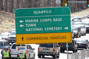
Road sign at intersection of US 1 and Joplin and Fuller Roads
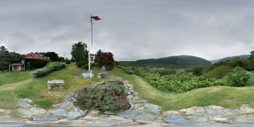
 View from Hilltop House
 Sideling Hill rest area [01]
![Sideling Hill rest area [01] (2385 visits) Eastbound side of the Sideling Hill rest area, located along Interstate 68 in Washington County, Mar... Sideling Hill rest area [01]](../../../i/upload/2024/07/17/20240717233459-e7ba195c-cu_s9999x250.jpg)
 Sideling Hill rest area [02]
![Sideling Hill rest area [02] (2107 visits) Eastbound access to the footbridge across the highway at the Sideling Hill rest area, located along ... Sideling Hill rest area [02]](../../../i/upload/2024/07/17/20240717233505-c4590774-cu_s9999x250.jpg)
 Sideling Hill rest area [03]
![Sideling Hill rest area [03] (1975 visits) Footbridge across Interstate 68, allowing views of the cut through the mountain, at the Sideling Hil... Sideling Hill rest area [03]](../../../i/upload/2024/07/17/20240717233511-e61616ff-cu_s9999x250.jpg)
 Sideling Hill rest area [04]
![Sideling Hill rest area [04] (2192 visits) Westbound access to the footbridge across the highway at the Sideling Hill rest area, located along ... Sideling Hill rest area [04]](../../../i/upload/2024/07/17/20240717233516-e5cc17b4-cu_s9999x250.jpg)
 Sideling Hill rest area [05]
![Sideling Hill rest area [05] (2053 visits) Path to the westbound parking area and restrooms at the Sideling Hill rest area, located along Inter... Sideling Hill rest area [05]](../../../i/upload/2024/07/17/20240717233521-b99b80cb-cu_s9999x250.jpg)
 Sideling Hill rest area [06]
![Sideling Hill rest area [06] (1972 visits) Stairs to a raised viewing area on the eastbound side of the Sideling Hill rest area, located along ... Sideling Hill rest area [06]](../../../i/upload/2024/07/17/20240717233527-43e4656c-cu_s9999x250.jpg)
 Sideling Hill rest area [07]
![Sideling Hill rest area [07] (2136 visits) Raised viewing area on the eastbound side of the Sideling Hill rest area, located along Interstate 6... Sideling Hill rest area [07]](../../../i/upload/2024/07/17/20240717233531-9f6ca0ea-cu_s9999x250.jpg)
 Sideling Hill rest area [08]
![Sideling Hill rest area [08] (2355 visits) Eastbound parking lot at the Sideling Hill rest area, located along Interstate 68 in Washington Coun... Sideling Hill rest area [08]](../../../i/upload/2024/07/17/20240717233537-4406b863-cu_s9999x250.jpg)
 Sideling Hill rest area [09]
![Sideling Hill rest area [09] (2395 visits) Eastbound parking lot at the Sideling Hill rest area, located along Interstate 68 in Washington Coun... Sideling Hill rest area [09]](../../../i/upload/2024/07/17/20240717233542-efb1100b-cu_s9999x250.jpg)
 Sideling Hill rest area [10]
![Sideling Hill rest area [10] (2191 visits) Eastbound side of the Sideling Hill rest area, located along Interstate 68 in Washington County, Mar... Sideling Hill rest area [10]](../../../i/upload/2024/07/17/20240717233547-516b9676-cu_s9999x250.jpg)
-
Footbridge over Interstate 68 at Sideling Hill
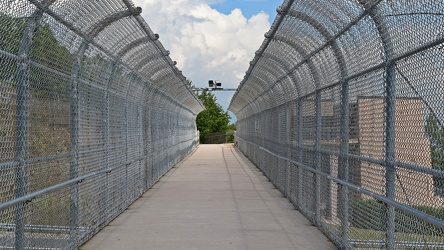
-
Rainstorm near Sideling Hill cut
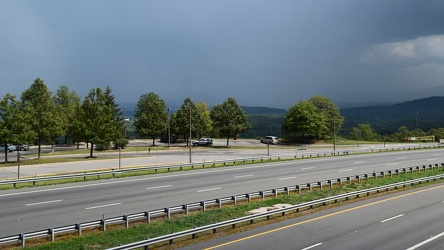
-
Interstate 68 cut through Sideling Hill [04]
![Interstate 68 cut through Sideling Hill [04] (2194 visits) Cut in Sideling Hill, carrying Interstate 68 between Washington and Allegany Counties in Maryland.
... Interstate 68 cut through Sideling Hill [04]](../../../i/upload/2024/07/18/20240718220107-eeb97b29-cu_s9999x250.jpg)
-
Interstate 68 cut through Sideling Hill [03]
![Interstate 68 cut through Sideling Hill [03] (1973 visits) Cut in Sideling Hill, carrying Interstate 68 between Washington and Allegany Counties in Maryland.
... Interstate 68 cut through Sideling Hill [03]](../../../i/upload/2024/07/18/20240718220111-2f9132e9-cu_s9999x250.jpg)
-
Interstate 68 cut through Sideling Hill [02]
![Interstate 68 cut through Sideling Hill [02] (3431 visits) Cut in Sideling Hill, carrying Interstate 68 between Washington and Allegany Counties in Maryland.
... Interstate 68 cut through Sideling Hill [02]](../../../i/upload/2024/07/18/20240718220116-e8da0915-cu_s9999x250.jpg)
-
Interstate 68 cut through Sideling Hill [01]
![Interstate 68 cut through Sideling Hill [01] (3941 visits) Cut in Sideling Hill, carrying Interstate 68 between Washington and Allegany Counties in Maryland.
... Interstate 68 cut through Sideling Hill [01]](../../../i/upload/2024/07/18/20240718220120-0789991f-cu_s9999x250.jpg)
-
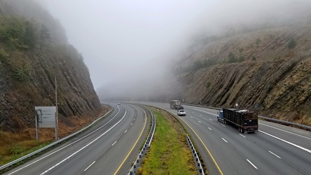
Sideling Hill cut
-
Interstate 64 in Nelson County, Virginia [01]
![Interstate 64 in Nelson County, Virginia [01] (10806 visits) Interstate 64 in Nelson County, Virginia, near Rockfish Gap. US 250 runs adjacent to the freeway.
... Interstate 64 in Nelson County, Virginia [01]](../../../i/upload/2024/07/19/20240719115200-c8a2ce39-cu_s9999x250.jpg)
-
Interstate 64 in Nelson County, Virginia [02]
![Interstate 64 in Nelson County, Virginia [02] (10954 visits) Interstate 64 in Nelson County, Virginia, near Rockfish Gap. US 250 runs adjacent to the freeway.
... Interstate 64 in Nelson County, Virginia [02]](../../../i/upload/2024/07/19/20240719115847-184fa12a-cu_s9999x250.jpg)
-
Interstate 64 in Nelson County, Virginia [03]
![Interstate 64 in Nelson County, Virginia [03] (11126 visits) Interstate 64 in Nelson County, Virginia, near Rockfish Gap. US 250 runs adjacent to the freeway.
... Interstate 64 in Nelson County, Virginia [03]](../../../i/upload/2024/07/19/20240719115902-ff5fb9e1-cu_s9999x250.jpg)
-
Blue Ridge Mountains near Rockfish Gap [01]
![Blue Ridge Mountains near Rockfish Gap [01] (1597 visits) The Blue Ridge Mountains, viewed from above the Interstate 64 scenic overlook in Nelson County, Virg... Blue Ridge Mountains near Rockfish Gap [01]](../../../i/upload/2024/07/19/20240719115911-d105cde8-cu_s9999x250.jpg)
-
Blue Ridge Mountains near Rockfish Gap [02]
![Blue Ridge Mountains near Rockfish Gap [02] (1544 visits) The Blue Ridge Mountains, viewed from above the Interstate 64 scenic overlook in Nelson County, Virg... Blue Ridge Mountains near Rockfish Gap [02]](../../../i/upload/2024/07/19/20240719115926-47f38290-cu_s9999x250.jpg)
-
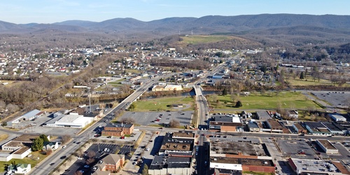
Main and Broad Streets, facing east
-
Downtown Waynesboro, Virginia, looking toward Invista [02]
![Downtown Waynesboro, Virginia, looking toward Invista [02] (4236 visits) Aerial view of downtown Waynesboro, Virginia, looking towards the Invista plant.
Ben Schumin is a p... Downtown Waynesboro, Virginia, looking toward Invista [02]](../../../i/upload/2024/07/19/20240719130254-ae1aac9d-cu_s9999x250.jpg)
-
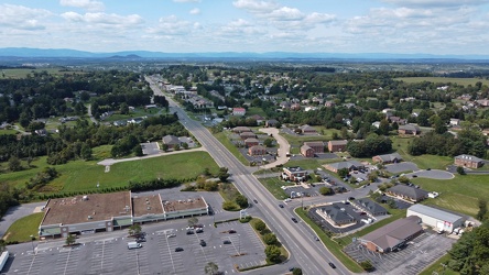
West Main Street in Waynesboro, Virginia [01]
![West Main Street in Waynesboro, Virginia [01] (55867 visits) View down West Main Street (US 250) in the west end of Waynesboro, Virginia, near the former Kmart b... West Main Street in Waynesboro, Virginia [01]](../../../i/upload/2024/07/19/20240719164545-b5a50599-cu_s9999x250.jpg)
-
West Main Street in Waynesboro, Virginia [02]
![West Main Street in Waynesboro, Virginia [02] (10148 visits) View down West Main Street (US 250) in the west end of Waynesboro, Virginia, near the Sheetz conveni... West Main Street in Waynesboro, Virginia [02]](../../../i/upload/2024/07/19/20240719164551-0b8407a8-cu_s9999x250.jpg)
-
West Main Street in Waynesboro, Virginia [03]
![West Main Street in Waynesboro, Virginia [03] (10988 visits) View down West Main Street (US 250) in the west end of Waynesboro, Virginia, near St. Mark's United ... West Main Street in Waynesboro, Virginia [03]](../../../i/upload/2024/07/19/20240719164555-f7feeafe-cu_s9999x250.jpg)
-
West Main Street in Waynesboro, Virginia [04]
![West Main Street in Waynesboro, Virginia [04] (323547 visits) View down West Main Street (US 250) in the west end of Waynesboro, Virginia, near the Westwood Villa... West Main Street in Waynesboro, Virginia [04]](../../../i/upload/2024/07/19/20240719164600-4379cef1-cu_s9999x250.jpg)
-
Essex Place, Candle Ridge, and Picton of Birlstone [02]
![Essex Place, Candle Ridge, and Picton of Birlstone [02] (2248 visits) Aerial view of the Essex Place, Candle Ridge, and Picton of Birlstone areas of Montgomery Village, M... Essex Place, Candle Ridge, and Picton of Birlstone [02]](../../../i/upload/2024/07/19/20240719165355-16cfcb21-cu_s9999x250.jpg)
-
Ravenglass Way [02]
![Ravenglass Way [02] (2382 visits) Aerial view of Ravenglass Way, a street in the Essex Place area of Montgomery Village, Maryland.
Be... Ravenglass Way [02]](../../../i/upload/2024/07/19/20240719165400-daa550de-cu_s9999x250.jpg)
-
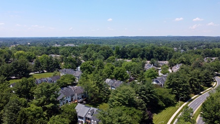
Essex Place and Candle Ridge
-
Montgomery Village, facing approximately west [01]
![Montgomery Village, facing approximately west [01] (2314 visits) View of Montgomery Village and beyond, facing approximately west, from above the Lake Marion Communi... Montgomery Village, facing approximately west [01]](../../../i/upload/2024/07/19/20240719165409-be458691-cu_s9999x250.jpg)
-
Essex Place, Candle Ridge, and Picton of Birlstone [03]
![Essex Place, Candle Ridge, and Picton of Birlstone [03] (2049 visits) Aerial view of the Essex Place, Candle Ridge, and Picton of Birlstone areas of Montgomery Village, M... Essex Place, Candle Ridge, and Picton of Birlstone [03]](../../../i/upload/2024/07/19/20240719165413-01ec57b3-cu_s9999x250.jpg)
-
Ravenglass Way [06]
![Ravenglass Way [06] (1781 visits) Aerial view of Ravenglass Way, a street in the Essex Place area of Montgomery Village, Maryland.
Be... Ravenglass Way [06]](../../../i/upload/2024/07/19/20240719165418-83524ec4-cu_s9999x250.jpg)
-
Ravenglass Way [04]
![Ravenglass Way [04] (1857 visits) Aerial view of Ravenglass Way, a street in the Essex Place area of Montgomery Village, Maryland.
Be... Ravenglass Way [04]](../../../i/upload/2024/07/19/20240719165443-3e6bc6d8-cu_s9999x250.jpg)
-
Ravenglass Way [03]
![Ravenglass Way [03] (1883 visits) Aerial view of Ravenglass Way, a street in the Essex Place area of Montgomery Village, Maryland.
Be... Ravenglass Way [03]](../../../i/upload/2024/07/19/20240719165447-3df0a484-cu_s9999x250.jpg)
-
Ravenglass Way [01]
![Ravenglass Way [01] (2098 visits) Aerial view of Ravenglass Way, a street in the Essex Place area of Montgomery Village, Maryland.
Be... Ravenglass Way [01]](../../../i/upload/2024/07/19/20240719165451-c6237496-cu_s9999x250.jpg)
-
Essex Place, Candle Ridge, and Picton of Birlstone [01]
![Essex Place, Candle Ridge, and Picton of Birlstone [01] (2091 visits) Aerial view of the Essex Place, Candle Ridge, and Picton of Birlstone areas of Montgomery Village, M... Essex Place, Candle Ridge, and Picton of Birlstone [01]](../../../i/upload/2024/07/19/20240719165455-a51c05df-cu_s9999x250.jpg)
-
Ravenglass Way [05]
![Ravenglass Way [05] (1890 visits) Aerial view of Ravenglass Way, a street in the Essex Place area of Montgomery Village, Maryland.
Be... Ravenglass Way [05]](../../../i/upload/2024/07/19/20240719165505-1a967166-cu_s9999x250.jpg)
-
US 29 North, near Hilton Heights Road [01]
![US 29 North, near Hilton Heights Road [01] (3206 visits) US 29 north of Charlottesville, Virginia, near Hilton Heights Road, facing northbound.
Ben Schumin ... US 29 North, near Hilton Heights Road [01]](../../../i/upload/2024/07/19/20240719171702-b12048d7-cu_s9999x250.jpg)
-
US 29 North, near Hilton Heights Road [02]
![US 29 North, near Hilton Heights Road [02] (3200 visits) US 29 north of Charlottesville, Virginia, near Hilton Heights Road, facing northbound.
Ben Schumin ... US 29 North, near Hilton Heights Road [02]](../../../i/upload/2024/07/19/20240719171717-5729f873-cu_s9999x250.jpg)
-
DoubleTree Hotel in Charlottesville, Virginia [01]
![DoubleTree Hotel in Charlottesville, Virginia [01] (2086 visits) DoubleTree Hotel on Hilton Heights Road in Charlottesville, Virginia. This hotel was built in 1984,... DoubleTree Hotel in Charlottesville, Virginia [01]](../../../i/upload/2024/07/19/20240719171742-a365fe34-cu_s9999x250.jpg)
-
US 29 near Woodbrook Drive [01]
![US 29 near Woodbrook Drive [01] (11603 visits) US 29 north of Charlottesville, Virginia, near Woodbrook Drive, facing northbound.
Ben Schumin is a... US 29 near Woodbrook Drive [01]](../../../i/upload/2024/07/19/20240719171851-a0a055c4-cu_s9999x250.jpg)
-
US 29 near Woodbrook Drive [02]
![US 29 near Woodbrook Drive [02] (11582 visits) US 29 north of Charlottesville, Virginia, near Woodbrook Drive, facing northbound.
Ben Schumin is a... US 29 near Woodbrook Drive [02]](../../../i/upload/2024/07/19/20240719171856-fdca65ff-cu_s9999x250.jpg)
-
US 250 at the west end of Waynesboro, Virginia
