-
Abandoned Days Inn near Warfordsburg, Pennsylvania [26]
![Abandoned Days Inn near Warfordsburg, Pennsylvania [26] (1498 visits) Main sign, facing Interstate 70, at the former Days Inn near Warfordsburg, Pennsylvania.
The 65-r... Abandoned Days Inn near Warfordsburg, Pennsylvania [26]](../../../i/upload/2024/07/19/20240719091055-4c9414dd-cu_s9999x250.jpg)
-
Abandoned Days Inn near Warfordsburg, Pennsylvania [25]
![Abandoned Days Inn near Warfordsburg, Pennsylvania [25] (2691 visits) Main sign, facing Interstate 70, at the former Days Inn near Warfordsburg, Pennsylvania.
The 65-roo... Abandoned Days Inn near Warfordsburg, Pennsylvania [25]](../../../i/upload/2024/07/19/20240719091100-5bc7dd63-cu_s9999x250.jpg)
-
Abandoned Days Inn near Warfordsburg, Pennsylvania [04]
![Abandoned Days Inn near Warfordsburg, Pennsylvania [04] (1748 visits) First floor corridor at the former Days Inn near Warfordsburg, Pennsylvania, facing west.
The 65-ro... Abandoned Days Inn near Warfordsburg, Pennsylvania [04]](../../../i/upload/2024/07/19/20240719091312-aff6646e-cu_s9999x250.jpg)
-
Signage for Exit 49 on Interstate 295 [05]
![Signage for Exit 49 on Interstate 295 [05] (1192 visits) Overhead sign for Exit 49 (US 33) on Interstate 295 eastbound in Glen Allen, Virginia.
More at The ... Signage for Exit 49 on Interstate 295 [05]](../../../i/upload/2024/07/19/20240719092857-ab204ec0-cu_s9999x250.jpg)
-
Signage for Exit 49 on Interstate 295 [06]
![Signage for Exit 49 on Interstate 295 [06] (1192 visits) Overhead sign for Exit 49 (US 33) on Interstate 295 eastbound in Glen Allen, Virginia.
More at The ... Signage for Exit 49 on Interstate 295 [06]](../../../i/upload/2024/07/19/20240719092924-a67ffbc2-cu_s9999x250.jpg)
-
Signage for Exit 49 on Interstate 295 [04]
![Signage for Exit 49 on Interstate 295 [04] (2183 visits) Overhead sign for Exit 49 (US 33) on Interstate 295 eastbound in Glen Allen, Virginia.
More at The ... Signage for Exit 49 on Interstate 295 [04]](../../../i/upload/2024/07/19/20240719092929-00e8a658-cu_s9999x250.jpg)
-
Signage for Exit 49 on Interstate 295 [03]
![Signage for Exit 49 on Interstate 295 [03] (2158 visits) Overhead sign for Exit 49 (US 33) on Interstate 295 eastbound in Glen Allen, Virginia.
More at The ... Signage for Exit 49 on Interstate 295 [03]](../../../i/upload/2024/07/19/20240719092934-ceaf9b98-cu_s9999x250.jpg)
-
Signage for Exit 49 on Interstate 295 [02]
![Signage for Exit 49 on Interstate 295 [02] (1078 visits) Overhead sign for Exit 49 (US 33) on Interstate 295 eastbound in Glen Allen, Virginia.
More at The ... Signage for Exit 49 on Interstate 295 [02]](../../../i/upload/2024/07/19/20240719092939-b220cdd7-cu_s9999x250.jpg)
-
Signage for Exit 49 on Interstate 295 [01]
![Signage for Exit 49 on Interstate 295 [01] (2149 visits) Overhead sign for Exit 49 (US 33) on Interstate 295 eastbound in Glen Allen, Virginia.
More at The ... Signage for Exit 49 on Interstate 295 [01]](../../../i/upload/2024/07/19/20240719093116-72eb08f8-cu_s9999x250.jpg)
-
Goochland rest area, westbound [03]
![Goochland rest area, westbound [03] (1217 visits) Restroom building at the Goochland Safety Rest Area on Interstate 64 westbound in Manakin-Sabot, Vir... Goochland rest area, westbound [03]](../../../i/upload/2024/07/19/20240719093121-0aeca88a-cu_s9999x250.jpg)
-
Goochland rest area, westbound [02]
![Goochland rest area, westbound [02] (1210 visits) Restroom building at the Goochland Safety Rest Area on Interstate 64 westbound in Manakin-Sabot, Vir... Goochland rest area, westbound [02]](../../../i/upload/2024/07/19/20240719093125-c06aafb1-cu_s9999x250.jpg)
-
Goochland rest area, westbound [01]
![Goochland rest area, westbound [01] (1224 visits) Restroom building at the Goochland Safety Rest Area on Interstate 64 westbound in Manakin-Sabot, Vir... Goochland rest area, westbound [01]](../../../i/upload/2024/07/19/20240719093130-dbdf3bb4-cu_s9999x250.jpg)
-
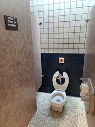
Child/toddler friendly stall at New Kent rest area
-
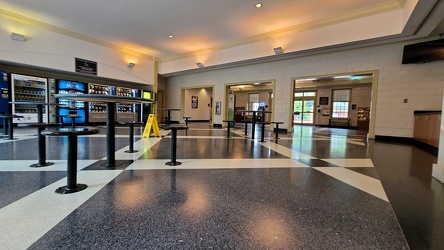
Interior of New Kent rest area, westbound
-
Mileage sign on US 1 near Fredericksburg [01]
![Mileage sign on US 1 near Fredericksburg [01] (1153 visits) Mileage sign on southbound US 1 near Fredericksburg, Virginia, giving distances to Thornburg, Ashlan... Mileage sign on US 1 near Fredericksburg [01]](../../../i/upload/2024/07/19/20240719093650-38b7882f-cu_s9999x250.jpg)
-
Mileage sign on US 1 near Fredericksburg [02]
![Mileage sign on US 1 near Fredericksburg [02] (1964 visits) Mileage sign on southbound US 1 near Fredericksburg, Virginia, giving distances to Thornburg, Ashlan... Mileage sign on US 1 near Fredericksburg [02]](../../../i/upload/2024/07/19/20240719093655-959f4e08-cu_s9999x250.jpg)
-
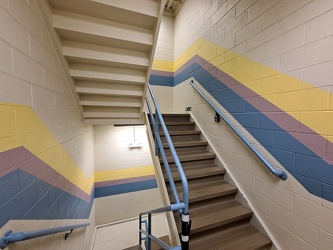
Stairs at 18111 Prince Philip Drive
-
Point of Rocks [01]
![Point of Rocks [01] (1527 visits) The Point of Rocks Bridge, which carries US 15 over the Potomac River between Loudoun County, Virgin... Point of Rocks [01]](../../../i/upload/2024/07/19/20240719101023-a2888aa2-cu_s9999x250.jpg)
-
Point of Rocks [02]
![Point of Rocks [02] (716 visits) The Potomac River at Point of Rocks, just downstream from the Point of Rocks Bridge.
More at The Sc... Point of Rocks [02]](../../../i/upload/2024/07/19/20240719101030-01aa5084-cu_s9999x250.jpg)
-
Point of Rocks [05]
![Point of Rocks [05] (718 visits) The Potomac River at Point of Rocks, just downstream from the Point of Rocks Bridge.
More at The Sc... Point of Rocks [05]](../../../i/upload/2024/07/19/20240719101046-96935d31-cu_s9999x250.jpg)
-
Point of Rocks [04]
![Point of Rocks [04] (1056 visits) The Potomac River at Point of Rocks, just downstream from the Point of Rocks Bridge.
More at The Sc... Point of Rocks [04]](../../../i/upload/2024/07/19/20240719101050-da7edd4a-cu_s9999x250.jpg)
-
Point of Rocks [03]
![Point of Rocks [03] (718 visits) The Potomac River at Point of Rocks, just downstream from the Point of Rocks Bridge.
More at The Sc... Point of Rocks [03]](../../../i/upload/2024/07/19/20240719101055-185ba3dd-cu_s9999x250.jpg)
-
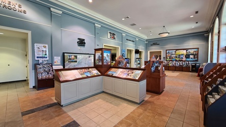
Interior of New Kent rest area, eastbound
-
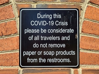
COVID-19 rest area signage
-
Eastern terminus of US 60 [01]
![Eastern terminus of US 60 [01] (1042 visits) "END" signage on a lamppost at the eastern terminus of US 60 in Virginia Beach, Virginia. ... Eastern terminus of US 60 [01]](../../../i/upload/2024/07/19/20240719101721-73bf3c40-cu_s9999x250.jpg)
-
Eastern terminus of US 60 [02]
![Eastern terminus of US 60 [02] (1070 visits) "END" signage on a lamppost at the eastern terminus of US 60 in Virginia Beach, Virginia. ... Eastern terminus of US 60 [02]](../../../i/upload/2024/07/19/20240719101751-9221fd2b-cu_s9999x250.jpg)
-
South Norfolk Jordan Bridge [02]
![South Norfolk Jordan Bridge [02] (2083 visits) The South Norfolk Jordan Bridge, commonly known as simply the Jordan Bridge, is a privately owned an... South Norfolk Jordan Bridge [02]](../../../i/upload/2024/07/19/20240719101756-29d2696c-cu_s9999x250.jpg)
-
South Norfolk Jordan Bridge [01]
![South Norfolk Jordan Bridge [01] (2298 visits) The South Norfolk Jordan Bridge, commonly known as simply the Jordan Bridge, is a privately owned an... South Norfolk Jordan Bridge [01]](../../../i/upload/2024/07/19/20240719101801-ff660e17-cu_s9999x250.jpg)
-
South Norfolk Jordan Bridge [04]
![South Norfolk Jordan Bridge [04] (2372 visits) The South Norfolk Jordan Bridge, commonly known as simply the Jordan Bridge, is a privately owned an... South Norfolk Jordan Bridge [04]](../../../i/upload/2024/07/19/20240719101811-3ebcdc7d-cu_s9999x250.jpg)
-
South Norfolk Jordan Bridge [03]
![South Norfolk Jordan Bridge [03] (2348 visits) The South Norfolk Jordan Bridge, commonly known as simply the Jordan Bridge, is a privately owned an... South Norfolk Jordan Bridge [03]](../../../i/upload/2024/07/19/20240719101829-ff0de2c9-cu_s9999x250.jpg)
-
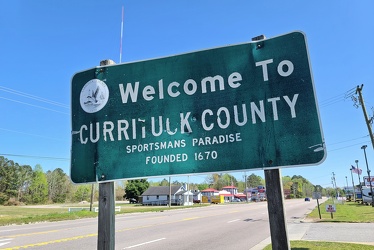
Welcome to Currituck County
-
Interstate 264 after Midtown Tunnel [01]
![Interstate 264 after Midtown Tunnel [01] (1145 visits) Interstate 264 westbound in Portsmouth, Virginia, just after traffic exits the Midtown Tunnel.
More... Interstate 264 after Midtown Tunnel [01]](../../../i/upload/2024/07/19/20240719101939-87dbaa40-cu_s9999x250.jpg)
-
Interstate 264 after Midtown Tunnel [02]
![Interstate 264 after Midtown Tunnel [02] (887 visits) Interstate 264 westbound in Portsmouth, Virginia, just after traffic exits the Midtown Tunnel.
More... Interstate 264 after Midtown Tunnel [02]](../../../i/upload/2024/07/19/20240719101945-e18e6752-cu_s9999x250.jpg)
-
Interstate 264 after Midtown Tunnel [04]
![Interstate 264 after Midtown Tunnel [04] (2323 visits) Interstate 264 westbound in Portsmouth, Virginia, just after traffic exits the Midtown Tunnel.
More... Interstate 264 after Midtown Tunnel [04]](../../../i/upload/2024/07/19/20240719102003-a91bfec6-cu_s9999x250.jpg)
-
Interstate 264 after Midtown Tunnel [03]
![Interstate 264 after Midtown Tunnel [03] (2135 visits) Interstate 264 westbound in Portsmouth, Virginia, just after traffic exits the Midtown Tunnel.
More... Interstate 264 after Midtown Tunnel [03]](../../../i/upload/2024/07/19/20240719102008-7fa5c14e-cu_s9999x250.jpg)
-
Rocks in the Potomac River [01]
![Rocks in the Potomac River [01] (706 visits) Rocks in the Potomac River near Harpers Ferry. Viewed from the US 340 bridge.
Ben Schumin is a pro... Rocks in the Potomac River [01]](../../../i/upload/2024/07/19/20240719103333-6083493b-cu_s9999x250.jpg)
-
Rocks in the Potomac River [02]
![Rocks in the Potomac River [02] (676 visits) Rocks in the Potomac River near Harpers Ferry. Viewed from the US 340 bridge.
Ben Schumin is a pro... Rocks in the Potomac River [02]](../../../i/upload/2024/07/19/20240719103338-04e1c1e1-cu_s9999x250.jpg)
-
Rocks in the Potomac River [03]
![Rocks in the Potomac River [03] (684 visits) Rocks in the Potomac River near Harpers Ferry. Viewed from the US 340 bridge.
Ben Schumin is a pro... Rocks in the Potomac River [03]](../../../i/upload/2024/07/19/20240719103343-404e77e5-cu_s9999x250.jpg)
-
Rocks in the Potomac River [04]
![Rocks in the Potomac River [04] (680 visits) Rocks in the Potomac River near Harpers Ferry. Viewed from the US 340 bridge.
Ben Schumin is a pro... Rocks in the Potomac River [04]](../../../i/upload/2024/07/19/20240719103348-1a3aef78-cu_s9999x250.jpg)
-
Rocks in the Potomac River [05]
![Rocks in the Potomac River [05] (746 visits) Rocks in the Potomac River near Harpers Ferry. Viewed from the US 340 bridge.
Ben Schumin is a pro... Rocks in the Potomac River [05]](../../../i/upload/2024/07/19/20240719103353-ea395458-cu_s9999x250.jpg)
-
Potomac River from US 340 bridge [03]
![Potomac River from US 340 bridge [03] (735 visits) The Potomac River, viewed from the US 340 bridge between Maryland and Virginia.
Ben Schumin is a pr... Potomac River from US 340 bridge [03]](../../../i/upload/2024/07/19/20240719103359-b66380e8-cu_s9999x250.jpg)
-
Potomac River from US 340 bridge [04]
![Potomac River from US 340 bridge [04] (798 visits) The Potomac River, viewed from the US 340 bridge between Maryland and Virginia.
Ben Schumin is a pr... Potomac River from US 340 bridge [04]](../../../i/upload/2024/07/19/20240719103405-18d26a8b-cu_s9999x250.jpg)
-
Potomac River from US 340 bridge [05]
![Potomac River from US 340 bridge [05] (807 visits) The Potomac River, viewed from the US 340 bridge between Maryland and Virginia.
Ben Schumin is a pr... Potomac River from US 340 bridge [05]](../../../i/upload/2024/07/19/20240719103412-5b42c5b9-cu_s9999x250.jpg)
-
Signage for Maryland Route 418 [02]
![Signage for Maryland Route 418 [02] (684 visits) Signage for Maryland Route 418 at the intersection with Maryland Route 64 in Ringgold.
Ben Schumin ... Signage for Maryland Route 418 [02]](../../../i/upload/2024/07/19/20240719104708-e45266e6-cu_s9999x250.jpg)
-
Signage for Maryland Route 64 [03]
![Signage for Maryland Route 64 [03] (859 visits) Signage for Maryland Route 64 at the intersection with Maryland Route 418 in Ringgold.
Ben Schumin ... Signage for Maryland Route 64 [03]](../../../i/upload/2024/07/19/20240719104750-3ae2140a-cu_s9999x250.jpg)
-
Blinker signals in Ringgold, Maryland [05]
![Blinker signals in Ringgold, Maryland [05] (1403 visits) Blinker signals supplementing a four-way stop at the intersection of Maryland Routes 64 and 418 in R... Blinker signals in Ringgold, Maryland [05]](../../../i/upload/2024/07/19/20240719104755-52af4492-cu_s9999x250.jpg)
-
Blinker signals in Ringgold, Maryland [04]
![Blinker signals in Ringgold, Maryland [04] (1505 visits) Blinker signals supplementing a four-way stop at the intersection of Maryland Routes 64 and 418 in R... Blinker signals in Ringgold, Maryland [04]](../../../i/upload/2024/07/19/20240719104800-95af76d6-cu_s9999x250.jpg)
-
Blinker signals in Ringgold, Maryland [03]
![Blinker signals in Ringgold, Maryland [03] (1503 visits) Blinker signals supplementing a four-way stop at the intersection of Maryland Routes 64 and 418 in R... Blinker signals in Ringgold, Maryland [03]](../../../i/upload/2024/07/19/20240719104805-6afa45cc-cu_s9999x250.jpg)
-
Signage for Maryland Route 418 [03]
![Signage for Maryland Route 418 [03] (754 visits) Signage for Maryland Route 418 at the intersection with Maryland Route 64 in Ringgold.
Ben Schumin ... Signage for Maryland Route 418 [03]](../../../i/upload/2024/07/19/20240719104810-b8c9b800-cu_s9999x250.jpg)
-
Signage for Maryland Route 418 [01]
![Signage for Maryland Route 418 [01] (718 visits) Signage for Maryland Route 418 at the intersection with Maryland Route 64 in Ringgold.
Ben Schumin ... Signage for Maryland Route 418 [01]](../../../i/upload/2024/07/19/20240719104816-bdac4667-cu_s9999x250.jpg)
-
Signage for Maryland Route 64 [02]
![Signage for Maryland Route 64 [02] (897 visits) Signage for Maryland Route 64 at the intersection with Maryland Route 418 in Ringgold.
Alternate ... Signage for Maryland Route 64 [02]](../../../i/upload/2024/07/19/20240719104820-3e6fadc3-cu_s9999x250.jpg)
-
Signage for Maryland Route 64 [01]
![Signage for Maryland Route 64 [01] (769 visits) Signage for Maryland Route 64 at the intersection with Maryland Route 418 in Ringgold.
Alternate ... Signage for Maryland Route 64 [01]](../../../i/upload/2024/07/19/20240719104825-f479389a-cu_s9999x250.jpg)
-
Blinker signals in Ringgold, Maryland [02]
![Blinker signals in Ringgold, Maryland [02] (1549 visits) Blinker signals supplementing a four-way stop at the intersection of Maryland Routes 64 and 418 in R... Blinker signals in Ringgold, Maryland [02]](../../../i/upload/2024/07/19/20240719104829-0c02a370-cu_s9999x250.jpg)
-
Blinker signals in Ringgold, Maryland [01]
![Blinker signals in Ringgold, Maryland [01] (1411 visits) Blinker signals supplementing a four-way stop at the intersection of Maryland Routes 64 and 418 in R... Blinker signals in Ringgold, Maryland [01]](../../../i/upload/2024/07/19/20240719104834-c83d81b6-cu_s9999x250.jpg)
-
South Mountain rest area and welcome center, westbound [02]
![South Mountain rest area and welcome center, westbound [02] (872 visits) Restroom building at the South Mountain rest area and welcome center on Interstate 70 westbound in F... South Mountain rest area and welcome center, westbound [02]](../../../i/upload/2024/07/19/20240719104930-9f63ecbf-cu_s9999x250.jpg)
-
South Mountain rest area and welcome center, westbound [01]
![South Mountain rest area and welcome center, westbound [01] (835 visits) Restroom building at the South Mountain rest area and welcome center on Interstate 70 westbound in F... South Mountain rest area and welcome center, westbound [01]](../../../i/upload/2024/07/19/20240719104934-09257e0d-cu_s9999x250.jpg)
-
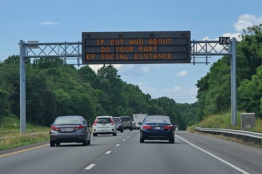
Variable message sign encouraging social distancing
-
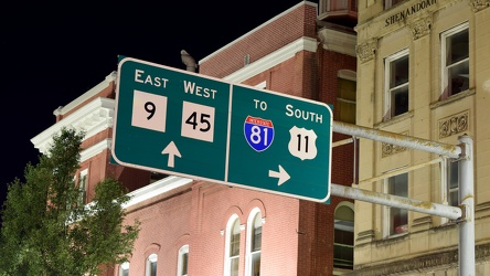
Overhead sign over South Queen Street
-
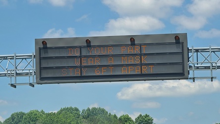
Variable message sign encouraging mask wearing and social distancing
-
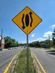
Sign indicating that traffic moves around the median
-
"WRONG WAY" sign at Devil's Den [01]
!["WRONG WAY" sign at Devil's Den [01] (987 visits) "WRONG WAY" sign on the parking loop for Devil's Den, near Gettysburg, Pennsylvania.
Ben ... "WRONG WAY" sign at Devil's Den [01]](../../../i/upload/2024/07/19/20240719112651-9d21816c-cu_s9999x250.jpg)
-
"WRONG WAY" sign at Devil's Den [02]
!["WRONG WAY" sign at Devil's Den [02] (987 visits) "WRONG WAY" sign on the parking loop for Devil's Den, near Gettysburg, Pennsylvania.
Ben ... "WRONG WAY" sign at Devil's Den [02]](../../../i/upload/2024/07/19/20240719112657-4e4c319d-cu_s9999x250.jpg)
-
Dirt graffiti
-
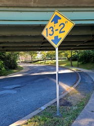
Low clearance sign at West Falls Church station
-
Intersection of Routes 64 and 418 [03]
![Intersection of Routes 64 and 418 [03] (1377 visits) Intersection of Routes 64 and 418 in Ringgold, Maryland. The two roads meet at a four-way stop, gov... Intersection of Routes 64 and 418 [03]](../../../i/upload/2024/07/19/20240719114429-bdff0353-cu_s9999x250.jpg)
-
Intersection of Routes 64 and 418 [02]
![Intersection of Routes 64 and 418 [02] (1235 visits) Intersection of Routes 64 and 418 in Ringgold, Maryland. The two roads meet at a four-way stop, gov... Intersection of Routes 64 and 418 [02]](../../../i/upload/2024/07/19/20240719114434-f7b1a6bf-cu_s9999x250.jpg)
-
Intersection of Routes 64 and 418 [05]
![Intersection of Routes 64 and 418 [05] (1450 visits) Intersection of Routes 64 and 418 in Ringgold, Maryland. The two roads meet at a four-way stop, gov... Intersection of Routes 64 and 418 [05]](../../../i/upload/2024/07/19/20240719114438-ea16106f-cu_s9999x250.jpg)
-
Intersection of Routes 64 and 418 [04]
![Intersection of Routes 64 and 418 [04] (1299 visits) Intersection of Routes 64 and 418 in Ringgold, Maryland. The two roads meet at a four-way stop, gov... Intersection of Routes 64 and 418 [04]](../../../i/upload/2024/07/19/20240719114443-599ce985-cu_s9999x250.jpg)
-
Intersection of Routes 64 and 418 [01]
![Intersection of Routes 64 and 418 [01] (1465 visits) Intersection of Routes 64 and 418 in Ringgold, Maryland. The two roads meet at a four-way stop, gov... Intersection of Routes 64 and 418 [01]](../../../i/upload/2024/07/19/20240719114447-7f7699d7-cu_s9999x250.jpg)
-
Interstate 64 in Nelson County, Virginia [01]
![Interstate 64 in Nelson County, Virginia [01] (8171 visits) Interstate 64 in Nelson County, Virginia, near Rockfish Gap. US 250 runs adjacent to the freeway.
... Interstate 64 in Nelson County, Virginia [01]](../../../i/upload/2024/07/19/20240719115200-c8a2ce39-cu_s9999x250.jpg)
-
Interstate 64 in Nelson County, Virginia [02]
![Interstate 64 in Nelson County, Virginia [02] (8277 visits) Interstate 64 in Nelson County, Virginia, near Rockfish Gap. US 250 runs adjacent to the freeway.
... Interstate 64 in Nelson County, Virginia [02]](../../../i/upload/2024/07/19/20240719115847-184fa12a-cu_s9999x250.jpg)
-
Interstate 64 in Nelson County, Virginia [03]
![Interstate 64 in Nelson County, Virginia [03] (8459 visits) Interstate 64 in Nelson County, Virginia, near Rockfish Gap. US 250 runs adjacent to the freeway.
... Interstate 64 in Nelson County, Virginia [03]](../../../i/upload/2024/07/19/20240719115902-ff5fb9e1-cu_s9999x250.jpg)
-
Blue Ridge Mountains near Rockfish Gap [01]
![Blue Ridge Mountains near Rockfish Gap [01] (1168 visits) The Blue Ridge Mountains, viewed from above the Interstate 64 scenic overlook in Nelson County, Virg... Blue Ridge Mountains near Rockfish Gap [01]](../../../i/upload/2024/07/19/20240719115911-d105cde8-cu_s9999x250.jpg)
-
Blue Ridge Mountains near Rockfish Gap [02]
![Blue Ridge Mountains near Rockfish Gap [02] (1109 visits) The Blue Ridge Mountains, viewed from above the Interstate 64 scenic overlook in Nelson County, Virg... Blue Ridge Mountains near Rockfish Gap [02]](../../../i/upload/2024/07/19/20240719115926-47f38290-cu_s9999x250.jpg)
-
Intersection of US 340 and VA 608 [01]
![Intersection of US 340 and VA 608 [01] (54883 visits) Intersection of US 340 and Virginia state secondary route 608 in Stuarts Draft, Virginia.
Ben Schum... Intersection of US 340 and VA 608 [01]](../../../i/upload/2024/07/19/20240719120550-1673ec68-cu_s9999x250.jpg)
-
Interstate 64 near Rockfish Gap [01]
![Interstate 64 near Rockfish Gap [01] (51889 visits) Interstate 64, near Rockfish Gap in Virginia.
Ben Schumin is a professional photographer who captur... Interstate 64 near Rockfish Gap [01]](../../../i/upload/2024/07/19/20240719120555-d0d3c2ce-cu_s9999x250.jpg)
-
Intersection of US 340 and VA 608 [02]
![Intersection of US 340 and VA 608 [02] (54956 visits) Intersection of US 340 and Virginia state secondary route 608 in Stuarts Draft, Virginia.
Ben Schum... Intersection of US 340 and VA 608 [02]](../../../i/upload/2024/07/19/20240719120559-2af4c901-cu_s9999x250.jpg)
-
Interstate 64 near Rockfish Gap [02]
![Interstate 64 near Rockfish Gap [02] (2205 visits) Interstate 64, near Rockfish Gap in Virginia. The bridge in the foreground carries Skyline Drive ov... Interstate 64 near Rockfish Gap [02]](../../../i/upload/2024/07/19/20240719120604-e2ad25dd-cu_s9999x250.jpg)
-
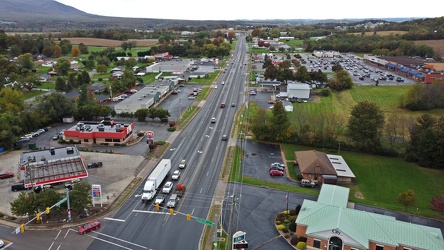
US 340 south in Stuarts Draft
-
Interstate 64 near Rockfish Gap [03]
![Interstate 64 near Rockfish Gap [03] (2226 visits) Interstate 64, near Rockfish Gap in Virginia. The bridge in the foreground carries Skyline Drive ov... Interstate 64 near Rockfish Gap [03]](../../../i/upload/2024/07/19/20240719120613-6e2190f6-cu_s9999x250.jpg)