Ben Schumin Photography Portfolio
Ben Schumin is a professional photographer who captures the intricacies of daily life.

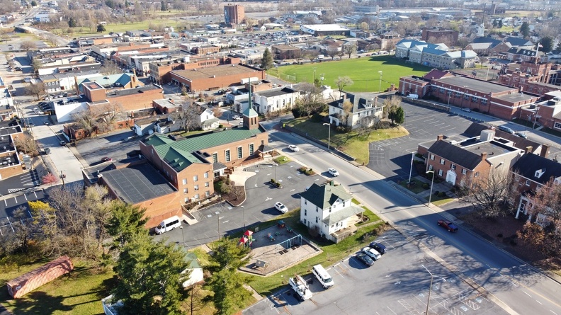
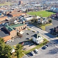
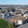
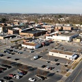
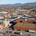
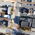
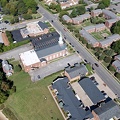
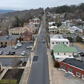
West Main Street in downtown Waynesboro, Virginia, viewed from the air.
Information
- Author
- Ben Schumin
- Copyright
- All Rights Reserved
- Created on
- Friday 11 December 2020
- Dimensions
- 4000*2250
Powered by Piwigo
![Knights Templar Room at the George Washington Masonic National Memorial [02]](../../../i/upload/2024/07/14/20240714102043-7011f1f2-sq.jpg)
![Knights Templar Room at the George Washington Masonic National Memorial [01]](../../../i/upload/2024/07/14/20240714102044-4bc1e4cc-sq.jpg)

![Million Worker March [04]](../../../i/upload/2024/07/14/20240714171322-c8550113-sq.jpg)


![West Falls Church-VT/UVA station [01]](../../../i/upload/2024/07/14/20240714234704-13199b4c-sq.jpg)
![Steeple at St. John's Episcopal Church [03]](../../../i/upload/2024/07/15/20240715141106-7edce6aa-sq.jpg)
![Steeple at St. John's Episcopal Church [02]](../../../i/upload/2024/07/15/20240715141107-9beb0dbf-sq.jpg)
![Steeple at St. John's Episcopal Church [01]](../../../i/upload/2024/07/15/20240715141108-2d9292f7-sq.jpg)


![National City Christian Church [01]](../../../i/upload/2024/07/15/20240715141621-348eea17-sq.jpg)
![National City Christian Church [02]](../../../i/upload/2024/07/15/20240715141622-779a111d-sq.jpg)
![National City Christian Church [03]](../../../i/upload/2024/07/15/20240715141624-1cf98a23-sq.jpg)
![Peace pole at Foundry United Methodist Church [01]](../../../i/upload/2024/07/15/20240715204613-ce854d41-sq.jpg)
![Peace pole at Foundry United Methodist Church [01]](../../../i/upload/2024/07/15/20240715204625-687322fa-sq.jpg)
![Operation Reconnect [04]](../../../i/upload/2024/07/15/20240715214418-074b3613-sq.jpg)
![Operation Reconnect [03]](../../../i/upload/2024/07/15/20240715214425-bcd6483b-sq.jpg)
![Operation Reconnect [02]](../../../i/upload/2024/07/15/20240715214429-73d4b6df-sq.jpg)
![Operation Reconnect [01]](../../../i/upload/2024/07/15/20240715214432-92567faa-sq.jpg)
![Operation Fail Game [01]](../../../i/upload/2024/07/15/20240715214508-bb8dc592-sq.jpg)
![Operation Fail Game [02]](../../../i/upload/2024/07/15/20240715214510-52a915b1-sq.jpg)
![Operation Fail Game [03]](../../../i/upload/2024/07/15/20240715214513-25ccbee1-sq.jpg)
![Operation Fail Game [04]](../../../i/upload/2024/07/15/20240715214515-fdc8206d-sq.jpg)
![Operation Fail Game [05]](../../../i/upload/2024/07/15/20240715214518-675dc2c6-sq.jpg)
![Operation Fail Game [16]](../../../i/upload/2024/07/15/20240715214520-5429adaf-sq.jpg)
![Operation Fail Game [15]](../../../i/upload/2024/07/15/20240715214523-62980840-sq.jpg)
![Operation Fail Game [14]](../../../i/upload/2024/07/15/20240715214525-13f2b34c-sq.jpg)
![Operation Fail Game [13]](../../../i/upload/2024/07/15/20240715214528-9703746c-sq.jpg)
![Operation Fail Game [12]](../../../i/upload/2024/07/15/20240715214530-b17af00a-sq.jpg)
![Operation Fail Game [11]](../../../i/upload/2024/07/15/20240715214533-25c58624-sq.jpg)
![Operation Fail Game [10]](../../../i/upload/2024/07/15/20240715214535-fb86839b-sq.jpg)
![Operation Fail Game [09]](../../../i/upload/2024/07/15/20240715214537-feca4285-sq.jpg)
![Operation Fail Game [08]](../../../i/upload/2024/07/15/20240715214539-7839e45c-sq.jpg)
![Operation Fail Game [07]](../../../i/upload/2024/07/15/20240715214542-1223fc77-sq.jpg)
![Operation Fail Game [06]](../../../i/upload/2024/07/15/20240715214545-a9dea4a5-sq.jpg)
![Operation Sea Arrrgh [28]](../../../i/upload/2024/07/15/20240715214727-ade9f709-sq.jpg)
![Operation Sea Arrrgh [27]](../../../i/upload/2024/07/15/20240715214730-dd0595d5-sq.jpg)
![Operation Sea Arrrgh [26]](../../../i/upload/2024/07/15/20240715214732-94a900d3-sq.jpg)
![Operation Sea Arrrgh [25]](../../../i/upload/2024/07/15/20240715214735-50a61d8e-sq.jpg)
![Operation Sea Arrrgh [24]](../../../i/upload/2024/07/15/20240715214738-b58e2557-sq.jpg)
![Operation Sea Arrrgh [23]](../../../i/upload/2024/07/15/20240715214740-1c740a7b-sq.jpg)
![Operation Sea Arrrgh [22]](../../../i/upload/2024/07/15/20240715214742-3c01ad49-sq.jpg)
![Operation Sea Arrrgh [21]](../../../i/upload/2024/07/15/20240715214744-d8bb3738-sq.jpg)
![Operation Sea Arrrgh [20]](../../../i/upload/2024/07/15/20240715214746-10546ea9-sq.jpg)
![Operation Sea Arrrgh [19]](../../../i/upload/2024/07/15/20240715214748-520c0d36-sq.jpg)
![Operation Sea Arrrgh [18]](../../../i/upload/2024/07/15/20240715214750-00dea4b1-sq.jpg)
![Operation Sea Arrrgh [17]](../../../i/upload/2024/07/15/20240715214752-00a5b0dd-sq.jpg)
![Operation Sea Arrrgh [16]](../../../i/upload/2024/07/15/20240715214755-c333503c-sq.jpg)
![Operation Sea Arrrgh [15]](../../../i/upload/2024/07/15/20240715214758-ea3cfada-sq.jpg)
![Operation Sea Arrrgh [14]](../../../i/upload/2024/07/15/20240715214800-b531fa77-sq.jpg)
![Operation Sea Arrrgh [13]](../../../i/upload/2024/07/15/20240715214803-bb4ae917-sq.jpg)
![Operation Sea Arrrgh [12]](../../../i/upload/2024/07/15/20240715214806-6d01ef77-sq.jpg)
![Operation Sea Arrrgh [11]](../../../i/upload/2024/07/15/20240715214809-a6a74c15-sq.jpg)
![Operation Sea Arrrgh [10]](../../../i/upload/2024/07/15/20240715214811-82c2296d-sq.jpg)
![Operation Sea Arrrgh [09]](../../../i/upload/2024/07/15/20240715214813-00ac325e-sq.jpg)
![Operation Sea Arrrgh [08]](../../../i/upload/2024/07/15/20240715214816-01d33e39-sq.jpg)
![Operation Sea Arrrgh [07]](../../../i/upload/2024/07/15/20240715214818-eba1b462-sq.jpg)
![Operation Sea Arrrgh [06]](../../../i/upload/2024/07/15/20240715214821-5a8445e3-sq.jpg)
![Operation Sea Arrrgh [05]](../../../i/upload/2024/07/15/20240715214823-658d5da6-sq.jpg)
![Operation Sea Arrrgh [04]](../../../i/upload/2024/07/15/20240715214825-bce6fa77-sq.jpg)
![Operation Sea Arrrgh [03]](../../../i/upload/2024/07/15/20240715214827-36ecec5d-sq.jpg)
![Operation Sea Arrrgh [02]](../../../i/upload/2024/07/15/20240715214829-79a9db6f-sq.jpg)
![Operation Sea Arrrgh [01]](../../../i/upload/2024/07/15/20240715214832-8495ac36-sq.jpg)
![Operation Sea Arrrgh [40]](../../../i/upload/2024/07/15/20240715214834-346cbb87-sq.jpg)
![Operation Sea Arrrgh [41]](../../../i/upload/2024/07/15/20240715214837-4fa59e20-sq.jpg)
![Operation Sea Arrrgh [42]](../../../i/upload/2024/07/15/20240715214839-6f42c280-sq.jpg)
![Operation Sea Arrrgh [51]](../../../i/upload/2024/07/15/20240715214842-cdd75f43-sq.jpg)
![Operation Sea Arrrgh [50]](../../../i/upload/2024/07/15/20240715214845-0ee9d3d6-sq.jpg)
![Operation Sea Arrrgh [49]](../../../i/upload/2024/07/15/20240715214847-65274926-sq.jpg)
![Operation Sea Arrrgh [48]](../../../i/upload/2024/07/15/20240715214850-e9434773-sq.jpg)
![Operation Sea Arrrgh [47]](../../../i/upload/2024/07/15/20240715214853-34800730-sq.jpg)
![Operation Sea Arrrgh [46]](../../../i/upload/2024/07/15/20240715214855-6d2317a1-sq.jpg)
![Operation Sea Arrrgh [45]](../../../i/upload/2024/07/15/20240715214858-5fa18e17-sq.jpg)
![Operation Sea Arrrgh [44]](../../../i/upload/2024/07/15/20240715214901-c592e62b-sq.jpg)
![Operation Sea Arrrgh [43]](../../../i/upload/2024/07/15/20240715214904-754d4b2a-sq.jpg)
![Operation Sea Arrrgh [39]](../../../i/upload/2024/07/15/20240715214906-3168fad0-sq.jpg)
![Operation Sea Arrrgh [38]](../../../i/upload/2024/07/15/20240715214909-310ddc76-sq.jpg)
![Operation Sea Arrrgh [37]](../../../i/upload/2024/07/15/20240715214911-3c5f7338-sq.jpg)
![Operation Sea Arrrgh [36]](../../../i/upload/2024/07/15/20240715214914-ef226c73-sq.jpg)
![Operation Sea Arrrgh [35]](../../../i/upload/2024/07/15/20240715214916-b7e68f4e-sq.jpg)
![Operation Sea Arrrgh [34]](../../../i/upload/2024/07/15/20240715214919-3b45538b-sq.jpg)
![Operation Sea Arrrgh [33]](../../../i/upload/2024/07/15/20240715214922-9ea2f6d7-sq.jpg)
![Operation Sea Arrrgh [32]](../../../i/upload/2024/07/15/20240715214924-bb8a5493-sq.jpg)
![Operation Sea Arrrgh [31]](../../../i/upload/2024/07/15/20240715214926-737900c1-sq.jpg)
![Operation Sea Arrrgh [30]](../../../i/upload/2024/07/15/20240715214929-88c9967f-sq.jpg)
![Operation Sea Arrrgh [29]](../../../i/upload/2024/07/15/20240715214931-783d7c94-sq.jpg)
![Spy vs. Sci [02]](../../../i/upload/2024/07/15/20240715214933-6ceabc86-sq.jpg)
![Spy vs. Sci [11]](../../../i/upload/2024/07/15/20240715214936-9671d859-sq.jpg)
![Spy vs. Sci [10]](../../../i/upload/2024/07/15/20240715214939-bc8e5b46-sq.jpg)
![Spy vs. Sci [09]](../../../i/upload/2024/07/15/20240715214941-947d8681-sq.jpg)
![Spy vs. Sci [08]](../../../i/upload/2024/07/15/20240715214943-a78e3591-sq.jpg)
![Spy vs. Sci [07]](../../../i/upload/2024/07/15/20240715214946-fe40b345-sq.jpg)
![Spy vs. Sci [06]](../../../i/upload/2024/07/15/20240715214948-2e87bf19-sq.jpg)
![Spy vs. Sci [05]](../../../i/upload/2024/07/15/20240715214950-199d6ac6-sq.jpg)
![Spy vs. Sci [04]](../../../i/upload/2024/07/15/20240715214955-cc68af33-sq.jpg)
![Spy vs. Sci [03]](../../../i/upload/2024/07/15/20240715214957-4f6e6fa8-sq.jpg)
![Spy vs. Sci [01]](../../../i/upload/2024/07/15/20240715214959-68f4d606-sq.jpg)
![Over 9000 Anon March [01]](../../../i/upload/2024/07/15/20240715215005-b4c3b5de-sq.jpg)
![Over 9000 Anon March [02]](../../../i/upload/2024/07/15/20240715215008-b94d6dc2-sq.jpg)
![Over 9000 Anon March [03]](../../../i/upload/2024/07/15/20240715215010-2d3a26fe-sq.jpg)
![Over 9000 Anon March [04]](../../../i/upload/2024/07/15/20240715215012-6789b1b2-sq.jpg)
![Over 9000 Anon March [20]](../../../i/upload/2024/07/15/20240715215014-d30c2cdc-sq.jpg)
![Over 9000 Anon March [19]](../../../i/upload/2024/07/15/20240715215017-3d86abb8-sq.jpg)
![Over 9000 Anon March [18]](../../../i/upload/2024/07/15/20240715215019-0d52b635-sq.jpg)
![Over 9000 Anon March [17]](../../../i/upload/2024/07/15/20240715215024-6c33f2c4-sq.jpg)
![Over 9000 Anon March [16]](../../../i/upload/2024/07/15/20240715215027-d6e5e5d1-sq.jpg)
![Over 9000 Anon March [15]](../../../i/upload/2024/07/15/20240715215029-78098c75-sq.jpg)
![Over 9000 Anon March [14]](../../../i/upload/2024/07/15/20240715215032-e9c3afd4-sq.jpg)
![Over 9000 Anon March [13]](../../../i/upload/2024/07/15/20240715215034-f7889eaf-sq.jpg)
![Over 9000 Anon March [12]](../../../i/upload/2024/07/15/20240715215036-54d4cee2-sq.jpg)
![Over 9000 Anon March [11]](../../../i/upload/2024/07/15/20240715215039-a83cca5a-sq.jpg)
![Over 9000 Anon March [10]](../../../i/upload/2024/07/15/20240715215040-894e1e46-sq.jpg)
![Over 9000 Anon March [09]](../../../i/upload/2024/07/15/20240715215043-651f9621-sq.jpg)
![Over 9000 Anon March [08]](../../../i/upload/2024/07/15/20240715215045-111751c4-sq.jpg)
![Over 9000 Anon March [07]](../../../i/upload/2024/07/15/20240715215047-0f6b5210-sq.jpg)
![Over 9000 Anon March [06]](../../../i/upload/2024/07/15/20240715215049-282909eb-sq.jpg)
![Over 9000 Anon March [05]](../../../i/upload/2024/07/15/20240715215051-3bea850e-sq.jpg)
![Anonymous DC August raid [10]](../../../i/upload/2024/07/15/20240715215116-8cf729ca-sq.jpg)
![Anonymous DC August raid [09]](../../../i/upload/2024/07/15/20240715215118-ecd7e02c-sq.jpg)
![Anonymous DC August raid [08]](../../../i/upload/2024/07/15/20240715215120-ba5c4186-sq.jpg)
![Anonymous DC August raid [07]](../../../i/upload/2024/07/15/20240715215122-1ce1ddba-sq.jpg)
![Anonymous DC August raid [06]](../../../i/upload/2024/07/15/20240715215124-bdde93d4-sq.jpg)
![Anonymous DC August raid [05]](../../../i/upload/2024/07/15/20240715215127-59e2d28f-sq.jpg)
![Anonymous DC August raid [04]](../../../i/upload/2024/07/15/20240715215129-75ef1886-sq.jpg)
![Anonymous DC August raid [03]](../../../i/upload/2024/07/15/20240715215132-d5b6aaeb-sq.jpg)
![Anonymous DC August raid [02]](../../../i/upload/2024/07/15/20240715215134-6cd5b742-sq.jpg)
![Anonymous DC August raid [01]](../../../i/upload/2024/07/15/20240715215137-a15ad9e8-sq.jpg)

![Steeple of Arlington Temple United Methodist Church [01]](../../../i/upload/2024/07/15/20240715215211-d0eada91-sq.jpg)
![Steeple of Arlington Temple United Methodist Church [02]](../../../i/upload/2024/07/15/20240715215214-33519c6c-sq.jpg)
![Anonymous DC September raid [01]](../../../i/upload/2024/07/15/20240715215230-65b9f4cd-sq.jpg)
![Anonymous DC September raid [02]](../../../i/upload/2024/07/15/20240715215232-11d4ca9c-sq.jpg)
![Anonymous DC September raid [05]](../../../i/upload/2024/07/15/20240715215234-bd1544fc-sq.jpg)
![Anonymous DC September raid [04]](../../../i/upload/2024/07/15/20240715215236-82b35078-sq.jpg)
![Anonymous DC September raid [03]](../../../i/upload/2024/07/15/20240715215238-b1c25914-sq.jpg)
![Zombie Apocalypse raid [02]](../../../i/upload/2024/07/15/20240715215405-881e9330-sq.jpg)
![Zombie Apocalypse raid [03]](../../../i/upload/2024/07/15/20240715215408-b2920f4d-sq.jpg)
![Zombie Apocalypse raid [16]](../../../i/upload/2024/07/15/20240715215410-f616ecf6-sq.jpg)
![Zombie Apocalypse raid [15]](../../../i/upload/2024/07/15/20240715215412-9ac88856-sq.jpg)
![Zombie Apocalypse raid [17]](../../../i/upload/2024/07/15/20240715215415-d1eb5ad1-sq.jpg)
![Zombie Apocalypse raid [14]](../../../i/upload/2024/07/15/20240715215417-ab6dcaf2-sq.jpg)
![Zombie Apocalypse raid [13]](../../../i/upload/2024/07/15/20240715215420-dfe33e57-sq.jpg)
![Zombie Apocalypse raid [12]](../../../i/upload/2024/07/15/20240715215422-32e49c62-sq.jpg)
![Zombie Apocalypse raid [11]](../../../i/upload/2024/07/15/20240715215424-592935d3-sq.jpg)
![Zombie Apocalypse raid [10]](../../../i/upload/2024/07/15/20240715215427-5b4d615e-sq.jpg)
![Zombie Apocalypse raid [09]](../../../i/upload/2024/07/15/20240715215429-a227c0b1-sq.jpg)
![Zombie Apocalypse raid [08]](../../../i/upload/2024/07/15/20240715215432-44682db7-sq.jpg)
![Zombie Apocalypse raid [07]](../../../i/upload/2024/07/15/20240715215434-b0013e05-sq.jpg)
![Zombie Apocalypse raid [06]](../../../i/upload/2024/07/15/20240715215436-beb20e86-sq.jpg)
![Zombie Apocalypse raid [05]](../../../i/upload/2024/07/15/20240715215439-89b7649d-sq.jpg)
![Zombie Apocalypse raid [04]](../../../i/upload/2024/07/15/20240715215441-bf21e306-sq.jpg)
![Zombie Apocalypse raid [01]](../../../i/upload/2024/07/15/20240715215444-3638eeea-sq.jpg)
![Completed demolition at 1815 North Fort Myer Drive [11]](../../../i/upload/2024/07/15/20240715215512-06908b83-sq.jpg)
![Completed demolition at 1815 North Fort Myer Drive [10]](../../../i/upload/2024/07/15/20240715215514-8f084649-sq.jpg)
![Completed demolition at 1815 North Fort Myer Drive [08]](../../../i/upload/2024/07/15/20240715215518-17832cfd-sq.jpg)
![Snow White Christmas raid [04]](../../../i/upload/2024/07/15/20240715215547-f05aa4eb-sq.jpg)
![Snow White Christmas raid [06]](../../../i/upload/2024/07/15/20240715215550-2bbe816d-sq.jpg)
![Snow White Christmas raid [15]](../../../i/upload/2024/07/15/20240715215552-bb686c50-sq.jpg)
![Snow White Christmas raid [14]](../../../i/upload/2024/07/15/20240715215555-5c884fcc-sq.jpg)
![Snow White Christmas raid [13]](../../../i/upload/2024/07/15/20240715215557-3dd3a35e-sq.jpg)
![Snow White Christmas raid [12]](../../../i/upload/2024/07/15/20240715215559-f7913f66-sq.jpg)
![Snow White Christmas raid [11]](../../../i/upload/2024/07/15/20240715215602-9784013d-sq.jpg)
![Snow White Christmas raid [10]](../../../i/upload/2024/07/15/20240715215605-2ed53d14-sq.jpg)
![Snow White Christmas raid [09]](../../../i/upload/2024/07/15/20240715215607-55d872db-sq.jpg)
![Snow White Christmas raid [08]](../../../i/upload/2024/07/15/20240715215610-767c8209-sq.jpg)
![Snow White Christmas raid [07]](../../../i/upload/2024/07/15/20240715215612-67556f1e-sq.jpg)
![Snow White Christmas raid [05]](../../../i/upload/2024/07/15/20240715215614-802e13a7-sq.jpg)
![Snow White Christmas raid [03]](../../../i/upload/2024/07/15/20240715215617-78126ea2-sq.jpg)
![Snow White Christmas raid [02]](../../../i/upload/2024/07/15/20240715215620-e4656152-sq.jpg)
![Snow White Christmas raid [01]](../../../i/upload/2024/07/15/20240715215622-f8b72b67-sq.jpg)
![Boris Korczak at Anonymous DC January raid [01]](../../../i/upload/2024/07/16/20240716001902-5cfaa452-sq.jpg)
![Boris Korczak at Anonymous DC January raid [02]](../../../i/upload/2024/07/16/20240716001906-659545c7-sq.jpg)
![Anonymous DC January raid [02]](../../../i/upload/2024/07/16/20240716001908-3f1d5085-sq.jpg)
![Anonymous DC January raid [01]](../../../i/upload/2024/07/16/20240716001910-96d27d96-sq.jpg)

![West Falls Church-VT/UVA station [02]](../../../i/upload/2024/07/16/20240716002010-ac655962-sq.jpg)


![Anonymous DC April 2009 raid [10]](../../../i/upload/2024/07/16/20240716002246-7422630c-sq.jpg)
![Anonymous DC April 2009 raid [11]](../../../i/upload/2024/07/16/20240716002249-c9ba6af6-sq.jpg)
![Anonymous DC April 2009 raid [13]](../../../i/upload/2024/07/16/20240716002251-7bb857d6-sq.jpg)
![Anonymous DC April 2009 raid [12]](../../../i/upload/2024/07/16/20240716002253-f5c8627b-sq.jpg)
![Anonymous DC April 2009 raid [09]](../../../i/upload/2024/07/16/20240716002255-ca49a756-sq.jpg)
![Anonymous DC April 2009 raid [08]](../../../i/upload/2024/07/16/20240716002257-266a79ab-sq.jpg)
![Anonymous DC April 2009 raid [07]](../../../i/upload/2024/07/16/20240716002259-6c976bf0-sq.jpg)
![Anonymous DC April 2009 raid [06]](../../../i/upload/2024/07/16/20240716002302-30f334d8-sq.jpg)
![Anonymous DC April 2009 raid [05]](../../../i/upload/2024/07/16/20240716002304-76214040-sq.jpg)
![Anonymous DC April 2009 raid [04]](../../../i/upload/2024/07/16/20240716002306-fd46ad58-sq.jpg)
![Anonymous DC April 2009 raid [03]](../../../i/upload/2024/07/16/20240716002308-8f46712b-sq.jpg)
![Anonymous DC April 2009 raid [02]](../../../i/upload/2024/07/16/20240716002311-2e4b906a-sq.jpg)
![Anonymous DC April 2009 raid [01]](../../../i/upload/2024/07/16/20240716002313-104d7a6c-sq.jpg)

![Operation Sea Arrrgh 2009 [09]](../../../i/upload/2024/07/16/20240716002457-0e99bb1d-sq.jpg)
![Operation Sea Arrrgh 2009 [10]](../../../i/upload/2024/07/16/20240716002459-3c2a82db-sq.jpg)
![Operation Sea Arrrgh 2009 [11]](../../../i/upload/2024/07/16/20240716002502-ab3afa2a-sq.jpg)
![Operation Sea Arrrgh 2009 [12]](../../../i/upload/2024/07/16/20240716002505-7d4a1519-sq.jpg)
![Operation Sea Arrrgh 2009 [17]](../../../i/upload/2024/07/16/20240716002512-69ee52b2-sq.jpg)
![Operation Sea Arrrgh 2009 [16]](../../../i/upload/2024/07/16/20240716002514-680a5d23-sq.jpg)
![Operation Sea Arrrgh 2009 [15]](../../../i/upload/2024/07/16/20240716002516-3c36ba9d-sq.jpg)
![Operation Sea Arrrgh 2009 [14]](../../../i/upload/2024/07/16/20240716002519-2c9e009c-sq.jpg)
![Operation Sea Arrrgh 2009 [13]](../../../i/upload/2024/07/16/20240716002521-817cfc26-sq.jpg)
![Operation Sea Arrrgh 2009 [08]](../../../i/upload/2024/07/16/20240716002524-d1c309b3-sq.jpg)
![Operation Sea Arrrgh 2009 [07]](../../../i/upload/2024/07/16/20240716002526-94ef93a1-sq.jpg)
![Operation Sea Arrrgh 2009 [06]](../../../i/upload/2024/07/16/20240716002528-006e93c8-sq.jpg)
![Operation Sea Arrrgh 2009 [05]](../../../i/upload/2024/07/16/20240716002531-57a5ba40-sq.jpg)
![Operation Sea Arrrgh 2009 [04]](../../../i/upload/2024/07/16/20240716002533-3baaa864-sq.jpg)
![Operation Sea Arrrgh 2009 [03]](../../../i/upload/2024/07/16/20240716002536-15076e67-sq.jpg)
![Operation Sea Arrrgh 2009 [02]](../../../i/upload/2024/07/16/20240716002538-a69c3c6d-sq.jpg)
![Operation Sea Arrrgh 2009 [01]](../../../i/upload/2024/07/16/20240716002540-031f688b-sq.jpg)
![Anonymous flash raid, October 9, 2009 [01]](../../../i/upload/2024/07/16/20240716002749-63b5cbfb-sq.jpg)
![Anonymous flash raid, October 9, 2009 [02]](../../../i/upload/2024/07/16/20240716002752-c9911edf-sq.jpg)
![Anonymous flash raid, October 9, 2009 [03]](../../../i/upload/2024/07/16/20240716002754-f0f71816-sq.jpg)
![Anonymous Ideal Org raid [33]](../../../i/upload/2024/07/16/20240716002757-7464517f-sq.jpg)
![Anonymous Ideal Org raid [32]](../../../i/upload/2024/07/16/20240716002800-9926aab3-sq.jpg)
![Anonymous Ideal Org raid [31]](../../../i/upload/2024/07/16/20240716002806-099e8f1c-sq.jpg)
![Anonymous Ideal Org raid [30]](../../../i/upload/2024/07/16/20240716002809-469c9712-sq.jpg)
![Anonymous Ideal Org raid [27]](../../../i/upload/2024/07/16/20240716002812-a6d25afb-sq.jpg)
![Anonymous Ideal Org raid [26]](../../../i/upload/2024/07/16/20240716002815-a94055d1-sq.jpg)
![Anonymous Ideal Org raid [24]](../../../i/upload/2024/07/16/20240716002819-01093859-sq.jpg)
![Anonymous Ideal Org raid [22]](../../../i/upload/2024/07/16/20240716002821-4abc81b8-sq.jpg)
![Anonymous Ideal Org raid [21]](../../../i/upload/2024/07/16/20240716002824-491b3527-sq.jpg)
![Anonymous Ideal Org raid [19]](../../../i/upload/2024/07/16/20240716002827-f8d8b86e-sq.jpg)
![Anonymous Ideal Org raid [18]](../../../i/upload/2024/07/16/20240716002829-f24a9175-sq.jpg)
![Anonymous Ideal Org raid [17]](../../../i/upload/2024/07/16/20240716002832-bd457409-sq.jpg)
![Anonymous Ideal Org raid [16]](../../../i/upload/2024/07/16/20240716002834-e619b435-sq.jpg)
![Anonymous Ideal Org raid [15]](../../../i/upload/2024/07/16/20240716002837-831bd1ca-sq.jpg)
![Anonymous Ideal Org raid [14]](../../../i/upload/2024/07/16/20240716002839-9c4fbfe9-sq.jpg)
![Anonymous Ideal Org raid [13]](../../../i/upload/2024/07/16/20240716002842-0bcd64af-sq.jpg)
![Anonymous Ideal Org raid [12]](../../../i/upload/2024/07/16/20240716002844-8354dcd7-sq.jpg)
![Anonymous Ideal Org raid [11]](../../../i/upload/2024/07/16/20240716002847-12515629-sq.jpg)
![Anonymous Ideal Org raid [10]](../../../i/upload/2024/07/16/20240716002849-12355461-sq.jpg)
![Anonymous Ideal Org raid [09]](../../../i/upload/2024/07/16/20240716002852-ee2b9824-sq.jpg)
![Anonymous Ideal Org raid [08]](../../../i/upload/2024/07/16/20240716002854-fc01de5d-sq.jpg)
![Anonymous Ideal Org raid [07]](../../../i/upload/2024/07/16/20240716002857-e834ab2d-sq.jpg)
![Anonymous Ideal Org raid [06]](../../../i/upload/2024/07/16/20240716002900-aca4afd8-sq.jpg)
![Anonymous Ideal Org raid [05]](../../../i/upload/2024/07/16/20240716002902-ab2d74ec-sq.jpg)
![Anonymous Ideal Org raid [04]](../../../i/upload/2024/07/16/20240716002905-c52fc266-sq.jpg)
![Anonymous Ideal Org raid [03]](../../../i/upload/2024/07/16/20240716002908-1408185e-sq.jpg)
![Anonymous Ideal Org raid [02]](../../../i/upload/2024/07/16/20240716002911-ee0f01c4-sq.jpg)
![Anonymous Ideal Org raid [01]](../../../i/upload/2024/07/16/20240716002913-f3096b09-sq.jpg)
![Anonymous Ideal Org raid [20]](../../../i/upload/2024/07/16/20240716002915-97d2390b-sq.jpg)
![Anonymous Ideal Org raid [25]](../../../i/upload/2024/07/16/20240716002917-7a5d5f6f-sq.jpg)
![Anonymous Ideal Org raid [28]](../../../i/upload/2024/07/16/20240716002920-87bc2e72-sq.jpg)
![Anonymous Ideal Org raid [29]](../../../i/upload/2024/07/16/20240716002922-d958369e-sq.jpg)
![Anonymous Ideal Org raid [23]](../../../i/upload/2024/07/16/20240716002925-d360d883-sq.jpg)
![Protest at opening of new Church of Scientology facility in Washington, DC [02]](../../../i/upload/2024/07/16/20240716003121-afc8c381-sq.jpg)
![Protest at opening of new Church of Scientology facility in Washington, DC [03]](../../../i/upload/2024/07/16/20240716003123-85e5d586-sq.jpg)
![Protest at opening of new Church of Scientology facility in Washington, DC [06]](../../../i/upload/2024/07/16/20240716003126-091fe7e2-sq.jpg)
![Protest at opening of new Church of Scientology facility in Washington, DC [09]](../../../i/upload/2024/07/16/20240716003128-c29bb796-sq.jpg)
![Protest at opening of new Church of Scientology facility in Washington, DC [01]](../../../i/upload/2024/07/16/20240716003131-775bc820-sq.jpg)
![Protest at opening of new Church of Scientology facility in Washington, DC [05]](../../../i/upload/2024/07/16/20240716003133-0127e1f3-sq.jpg)
![Protest at opening of new Church of Scientology facility in Washington, DC [04]](../../../i/upload/2024/07/16/20240716003135-6aa1d328-sq.jpg)
![Protest at opening of new Church of Scientology facility in Washington, DC [08]](../../../i/upload/2024/07/16/20240716003138-eb0412b4-sq.jpg)
![Protest at opening of new Church of Scientology facility in Washington, DC [10]](../../../i/upload/2024/07/16/20240716003140-7957a79f-sq.jpg)
![Protest at opening of new Church of Scientology facility in Washington, DC [12]](../../../i/upload/2024/07/16/20240716003142-3d518ebf-sq.jpg)
![Protest at opening of new Church of Scientology facility in Washington, DC [07]](../../../i/upload/2024/07/16/20240716003145-4c1123da-sq.jpg)
![Protest at opening of new Church of Scientology facility in Washington, DC [11]](../../../i/upload/2024/07/16/20240716003147-daa057bd-sq.jpg)

![Anonymous DC April 2010 raid [04]](../../../i/upload/2024/07/16/20240716010657-ee5f7c5b-sq.jpg)
![Anonymous DC April 2010 raid [05]](../../../i/upload/2024/07/16/20240716010659-b9179d1e-sq.jpg)

![Anonymous DC April 2010 raid [07]](../../../i/upload/2024/07/16/20240716010707-94f8f7ab-sq.jpg)
![Anonymous DC April 2010 raid [06]](../../../i/upload/2024/07/16/20240716010710-76f3175a-sq.jpg)
![Anonymous DC April 2010 raid [03]](../../../i/upload/2024/07/16/20240716010712-8691ad86-sq.jpg)
![Anonymous DC April 2010 raid [02]](../../../i/upload/2024/07/16/20240716010717-803a6dff-sq.jpg)
![Anonymous DC April 2010 raid [01]](../../../i/upload/2024/07/16/20240716010719-9063aad2-sq.jpg)

![Fairfax Connector bus 9742 [02]](../../../i/upload/2024/07/16/20240716010735-380c25a4-sq.jpg)
![East Falls Church station [02]](../../../i/upload/2024/07/16/20240716010740-e769f160-sq.jpg)


![East Falls Church station [01]](../../../i/upload/2024/07/16/20240716010835-38cfe922-sq.jpg)


![Fairfax Connector bus 9742 [01]](../../../i/upload/2024/07/16/20240716010922-c2506608-sq.jpg)
![Boston Megaraid [01]](../../../i/upload/2024/07/16/20240716010934-e81271bf-sq.jpg)
![Boston Megaraid [02]](../../../i/upload/2024/07/16/20240716010939-8f871e06-sq.jpg)
![Boston Megaraid [03]](../../../i/upload/2024/07/16/20240716010942-9818d969-sq.jpg)
![Boston Megaraid [04]](../../../i/upload/2024/07/16/20240716010946-937be04d-sq.jpg)
![Boston Megaraid [05]](../../../i/upload/2024/07/16/20240716010953-0981d6bf-sq.jpg)
![Boston Megaraid [06]](../../../i/upload/2024/07/16/20240716010957-60037c9d-sq.jpg)
![Boston Megaraid [07]](../../../i/upload/2024/07/16/20240716010959-899fba8b-sq.jpg)
![Boston Megaraid [08]](../../../i/upload/2024/07/16/20240716011001-d00e0002-sq.jpg)

![Boston, Massachusetts [01]](../../../i/upload/2024/07/16/20240716011031-c1272beb-sq.jpg)
![Boston, Massachusetts [02]](../../../i/upload/2024/07/16/20240716011040-f1a2baea-sq.jpg)


![Anonymous demonstration at FBI Building [01]](../../../i/upload/2024/07/16/20240716230720-6f604737-sq.jpg)
![Anonymous demonstration at FBI Building [02]](../../../i/upload/2024/07/16/20240716230728-94aa2411-sq.jpg)
![Anonymous demonstration at FBI Building [03]](../../../i/upload/2024/07/16/20240716230732-b82d458e-sq.jpg)
![Fraser Mansion [05]](../../../i/upload/2024/07/16/20240716231142-c9dd59a2-sq.jpg)
![Fraser Mansion [06]](../../../i/upload/2024/07/16/20240716231148-c4017a61-sq.jpg)
![Fraser Mansion [16]](../../../i/upload/2024/07/16/20240716231153-80f561eb-sq.jpg)
![Fraser Mansion [15]](../../../i/upload/2024/07/16/20240716231158-a8b87582-sq.jpg)
![Fraser Mansion [14]](../../../i/upload/2024/07/16/20240716231204-995d30b9-sq.jpg)
![Fraser Mansion [13]](../../../i/upload/2024/07/16/20240716231211-69010cf0-sq.jpg)
![Fraser Mansion [12]](../../../i/upload/2024/07/16/20240716231216-ea549816-sq.jpg)
![Fraser Mansion [11]](../../../i/upload/2024/07/16/20240716231220-26536de7-sq.jpg)
![Fraser Mansion [10]](../../../i/upload/2024/07/16/20240716231226-fa47ee5f-sq.jpg)
![Fraser Mansion [09]](../../../i/upload/2024/07/16/20240716231231-15dc596c-sq.jpg)
![Fraser Mansion [08]](../../../i/upload/2024/07/16/20240716231237-060e6f56-sq.jpg)
![Fraser Mansion [07]](../../../i/upload/2024/07/16/20240716231242-04d445f8-sq.jpg)
![Fraser Mansion [04]](../../../i/upload/2024/07/16/20240716231247-a62efe80-sq.jpg)
![Fraser Mansion [03]](../../../i/upload/2024/07/16/20240716231253-ed153db5-sq.jpg)
![Fraser Mansion [02]](../../../i/upload/2024/07/16/20240716231258-6b13dbe0-sq.jpg)
![Fraser Mansion [01]](../../../i/upload/2024/07/16/20240716231303-9e709f84-sq.jpg)
![Fraser Mansion [18]](../../../i/upload/2024/07/16/20240716231312-979d0729-sq.jpg)
![Fraser Mansion [21]](../../../i/upload/2024/07/16/20240716231316-0c406d67-sq.jpg)
![Fraser Mansion [20]](../../../i/upload/2024/07/16/20240716231321-22e12f2e-sq.jpg)
![Fraser Mansion [19]](../../../i/upload/2024/07/16/20240716231331-0094d1b9-sq.jpg)
![Fraser Mansion [17]](../../../i/upload/2024/07/16/20240716231341-e72627cf-sq.jpg)





![Town Clock Church [01]](../../../i/upload/2024/07/17/20240717155521-7a20fd18-sq.jpg)
![Town Clock Church [02]](../../../i/upload/2024/07/17/20240717155523-f0ffe295-sq.jpg)
![Town Clock Church [03]](../../../i/upload/2024/07/17/20240717155526-21937ab9-sq.jpg)
![Painted houses on Bedford Street [03]](../../../i/upload/2024/07/17/20240717155540-a8ec7127-sq.jpg)


![Town Clock Church [04]](../../../i/upload/2024/07/17/20240717155935-000292cc-sq.jpg)

![Silver Spring Zombie Walk 2013 [41]](../../../i/upload/2024/07/17/20240717165524-0692420b-sq.jpg)
![Silver Spring Zombie Walk 2013 [40]](../../../i/upload/2024/07/17/20240717165528-8c69c401-sq.jpg)
![Speed camera on Olney Laytonsville Road [02]](../../../i/upload/2024/07/17/20240717224948-71fb5395-sq.jpg)
![Street signs in Mount Crawford, Virginia [01]](../../../i/upload/2024/07/17/20240717230433-374aad7a-sq.jpg)
![Street signs in Mount Crawford, Virginia [02]](../../../i/upload/2024/07/17/20240717230436-08b6c2b4-sq.jpg)

![View from Glenmont West Garage [02]](../../../i/upload/2024/07/17/20240717231505-b9c562cf-sq.jpg)
![Fleetwood Church [01]](../../../i/upload/2024/07/17/20240717231652-50ddb246-sq.jpg)
![Fleetwood Church [02]](../../../i/upload/2024/07/17/20240717231656-4c53f4bf-sq.jpg)
![Fleetwood Church [03]](../../../i/upload/2024/07/17/20240717231659-564ede34-sq.jpg)
![Fleetwood Church [04]](../../../i/upload/2024/07/17/20240717231703-963b77a1-sq.jpg)
![Church of the Redeemer [01]](../../../i/upload/2024/07/18/20240718124405-253dac89-sq.jpg)
![Church of the Redeemer [02]](../../../i/upload/2024/07/18/20240718124408-46e32496-sq.jpg)


![Washington DC Temple [03]](../../../i/upload/2024/07/18/20240718215530-f3e20c4c-sq.jpg)
![Washington DC Temple [02]](../../../i/upload/2024/07/18/20240718215534-6e1ac99c-sq.jpg)
![Washington DC Temple [01]](../../../i/upload/2024/07/18/20240718215537-91cc789a-sq.jpg)
![Cathedral of Hope [01]](../../../i/upload/2024/07/18/20240718220421-692c5bf7-sq.jpg)
![Cathedral of Hope [02]](../../../i/upload/2024/07/18/20240718220426-a7346d60-sq.jpg)
![East Liberty Presbyterian Church [01]](../../../i/upload/2024/07/18/20240718220433-8605f0f2-sq.jpg)
![East Liberty Presbyterian Church [02]](../../../i/upload/2024/07/18/20240718220454-b8584ae2-sq.jpg)
![East Liberty Presbyterian Church [03]](../../../i/upload/2024/07/18/20240718220458-47d51108-sq.jpg)
![East Liberty Presbyterian Church [04]](../../../i/upload/2024/07/18/20240718220502-4a7a8670-sq.jpg)
![East Liberty Presbyterian Church [05]](../../../i/upload/2024/07/18/20240718220509-183684f8-sq.jpg)
![East Liberty Presbyterian Church [06]](../../../i/upload/2024/07/18/20240718220513-6beacbeb-sq.jpg)
![East Liberty Presbyterian Church [07]](../../../i/upload/2024/07/18/20240718220517-6b4ac9ab-sq.jpg)
![East Liberty Presbyterian Church [08]](../../../i/upload/2024/07/18/20240718220521-5a93ed20-sq.jpg)
![Honda HR-V at SS Peter & Paul Cemetery [04]](../../../i/upload/2024/07/18/20240718230206-4846ad24-sq.jpg)
![Honda HR-V at SS Peter & Paul Cemetery [03]](../../../i/upload/2024/07/18/20240718230210-359fcc85-sq.jpg)
![Honda HR-V at SS Peter & Paul Cemetery [02]](../../../i/upload/2024/07/18/20240718230214-48d3f3d8-sq.jpg)
![Honda HR-V at SS Peter & Paul Cemetery [01]](../../../i/upload/2024/07/18/20240718230217-827d6c3a-sq.jpg)


![Dome at the Cathedral of the Blessed Sacrament [07]](../../../i/upload/2024/07/19/20240719004035-9bbc3564-sq.jpg)
![Dome at the Cathedral of the Blessed Sacrament [08]](../../../i/upload/2024/07/19/20240719004038-98edbe46-sq.jpg)
![Dome at the Cathedral of the Blessed Sacrament [09]](../../../i/upload/2024/07/19/20240719004041-ac0ff1ab-sq.jpg)
![Dome at the Cathedral of the Blessed Sacrament [05]](../../../i/upload/2024/07/19/20240719004043-c08bf8d0-sq.jpg)
![Dome at the Cathedral of the Blessed Sacrament [06]](../../../i/upload/2024/07/19/20240719004046-002bdcab-sq.jpg)
![Dome at the Cathedral of the Blessed Sacrament [04]](../../../i/upload/2024/07/19/20240719004049-a81864cc-sq.jpg)
![Dome at the Cathedral of the Blessed Sacrament [02]](../../../i/upload/2024/07/19/20240719004052-384a9cc5-sq.jpg)
![Dome at the Cathedral of the Blessed Sacrament [03]](../../../i/upload/2024/07/19/20240719004055-621adb25-sq.jpg)
![Dome at the Cathedral of the Blessed Sacrament [01]](../../../i/upload/2024/07/19/20240719004058-42d8b05f-sq.jpg)
![West Falls Church escalators [01]](../../../i/upload/2024/07/19/20240719004417-88729935-sq.jpg)

![Platform pylon at West Falls Church station [01]](../../../i/upload/2024/07/19/20240719093237-32cc7f9a-sq.jpg)
![Platform pylon at West Falls Church station [02]](../../../i/upload/2024/07/19/20240719093243-8507b49e-sq.jpg)
![Platform pylon at West Falls Church station [03]](../../../i/upload/2024/07/19/20240719093249-093357b5-sq.jpg)
![Platform pylon at West Falls Church station [04]](../../../i/upload/2024/07/19/20240719093255-6bd9cf26-sq.jpg)
![Platform pylon at West Falls Church station [05]](../../../i/upload/2024/07/19/20240719093300-b3fdcc26-sq.jpg)
![Platform pylon at West Falls Church station [06]](../../../i/upload/2024/07/19/20240719093305-6be3d2bb-sq.jpg)

![Platform reconstruction at West Falls Church station [01]](../../../i/upload/2024/07/19/20240719093509-8e502a6d-sq.jpg)

![Platform reconstruction at West Falls Church station [02]](../../../i/upload/2024/07/19/20240719093612-fc476a41-sq.jpg)
![Platform reconstruction at West Falls Church station [03]](../../../i/upload/2024/07/19/20240719093617-0023087e-sq.jpg)
![Platforms at West Falls Church station [02]](../../../i/upload/2024/07/19/20240719100839-4351e6cf-sq.jpg)
![Platforms at West Falls Church station [01]](../../../i/upload/2024/07/19/20240719100843-28ea1e46-sq.jpg)
![East Falls Church station platform [01]](../../../i/upload/2024/07/19/20240719100849-dc409a01-sq.jpg)
![East Falls Church station platform [02]](../../../i/upload/2024/07/19/20240719100852-b3ac24d0-sq.jpg)
![West Falls Church escalators [02]](../../../i/upload/2024/07/19/20240719100859-ba6d59ac-sq.jpg)

![Restroom sign at West Falls Church [01]](../../../i/upload/2024/07/19/20240719103152-2bda81b4-sq.jpg)
![Restroom sign at West Falls Church [02]](../../../i/upload/2024/07/19/20240719103157-fbc66942-sq.jpg)
![Grave of Zachariah MacCubbin Waters [01]](../../../i/upload/2024/07/19/20240719105617-1fe8d42e-sq.jpg)
![Grave of Zachariah MacCubbin Waters [02]](../../../i/upload/2024/07/19/20240719105621-1b560cf1-sq.jpg)

![Face covering required [01]](../../../i/upload/2024/07/19/20240719112241-3c19cdd0-sq.jpg)
![Face covering required [02]](../../../i/upload/2024/07/19/20240719112246-2ff93de1-sq.jpg)
![Platforms at West Falls Church station [03]](../../../i/upload/2024/07/19/20240719112256-05e2c6e5-sq.jpg)
![East Falls Church station platform [03]](../../../i/upload/2024/07/19/20240719112810-ddd2e717-sq.jpg)
![East Falls Church station platform [04]](../../../i/upload/2024/07/19/20240719112814-0d0eaef5-sq.jpg)

![Fire alarm at West Falls Church station [01]](../../../i/upload/2024/07/19/20240719112933-5ab5d9a7-sq.jpg)
![Fire alarm at West Falls Church station [02]](../../../i/upload/2024/07/19/20240719112938-66e0d5c0-sq.jpg)

![Platforms at West Falls Church station [04]](../../../i/upload/2024/07/19/20240719113022-40605f51-sq.jpg)

![Interior of WMATA railcar 3035 [02]](../../../i/upload/2024/07/19/20240719113400-87f54b2e-sq.jpg)
![Interior of WMATA railcar 3035 [01]](../../../i/upload/2024/07/19/20240719113405-016c58d4-sq.jpg)
![Breakroom at East Falls Church station [01]](../../../i/upload/2024/07/19/20240719114840-775358de-sq.jpg)

![Breakroom at East Falls Church station [02]](../../../i/upload/2024/07/19/20240719114850-7b66b780-sq.jpg)
![Breakroom at East Falls Church station [03]](../../../i/upload/2024/07/19/20240719114855-9e51f1d1-sq.jpg)
![Intersection of US 340 and VA 608 [01]](../../../i/upload/2024/07/19/20240719120550-1673ec68-sq.jpg)
![Intersection of US 340 and VA 608 [02]](../../../i/upload/2024/07/19/20240719120559-2af4c901-sq.jpg)
![West Falls Church escalators [03]](../../../i/upload/2024/07/19/20240719122746-afa79aa3-sq.jpg)
![East Falls Church station platform [05]](../../../i/upload/2024/07/19/20240719122951-260b590c-sq.jpg)
![Platform pylon at East Falls Church station [03]](../../../i/upload/2024/07/19/20240719123821-7d9daea8-sq.jpg)

![Platform pylon at East Falls Church station [02]](../../../i/upload/2024/07/19/20240719123830-32f805f8-sq.jpg)
![Platform pylon at East Falls Church station [01]](../../../i/upload/2024/07/19/20240719123835-c706ee80-sq.jpg)

![Church United [01]](../../../i/upload/2024/07/19/20240719125339-5907a610-sq.jpg)
![Church United [02]](../../../i/upload/2024/07/19/20240719125609-1b74cd56-sq.jpg)
![Former News Virginian building [05]](../../../i/upload/2024/07/19/20240719130015-6a296284-sq.jpg)
![Former News Virginian building [03]](../../../i/upload/2024/07/19/20240719130147-ff7dfff7-sq.jpg)
![Former News Virginian building [04]](../../../i/upload/2024/07/19/20240719130225-0e147685-sq.jpg)
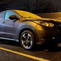
![Honda HR-V with a dusting of snow [02]](../../../i/upload/2024/07/19/20240719155214-c71a6622-sq.jpg)
![Honda HR-V with a dusting of snow [01]](../../../i/upload/2024/07/19/20240719155218-38bf57a7-sq.jpg)

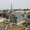
![Rejoicing Life Church [02]](../../../i/upload/2024/07/19/20240719161333-d96bd502-sq.jpg)
![Rejoicing Life Church [01]](../../../i/upload/2024/07/19/20240719161344-d4469bfa-sq.jpg)
![Interior of WMATA railcar 7169 [02]](../../../i/upload/2024/07/19/20240719162632-885053c6-sq.jpg)
![Interior of WMATA railcar 7169 [01]](../../../i/upload/2024/07/19/20240719162637-b4c3fdc7-sq.jpg)
![Interior of WMATA railcar 7190 [01]](../../../i/upload/2024/07/19/20240719163637-39c0cf7c-sq.jpg)
![Interior of WMATA railcar 7190 [02]](../../../i/upload/2024/07/19/20240719163641-00b59bdc-sq.jpg)
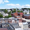
![West Main Street in Waynesboro, Virginia [02]](../../../i/upload/2024/07/19/20240719164551-0b8407a8-sq.jpg)
![West Main Street in Waynesboro, Virginia [03]](../../../i/upload/2024/07/19/20240719164555-f7feeafe-sq.jpg)

![Fairfax Water utility cover [02]](../../../i/upload/2024/07/19/20240719165645-f4ab2efc-sq.jpg)
![Fairfax Water utility cover [01]](../../../i/upload/2024/07/19/20240719165650-11e15496-sq.jpg)
![Staunton, Virginia from above Sears Hill [01]](../../../i/upload/2024/07/19/20240719170157-81396bfe-sq.jpg)
![Staunton, Virginia from above Sears Hill [04]](../../../i/upload/2024/07/19/20240719170206-26a0cea4-sq.jpg)
![Staunton, Virginia from above Sears Hill [03]](../../../i/upload/2024/07/19/20240719170210-52003e52-sq.jpg)
![Staunton, Virginia from above Sears Hill [02]](../../../i/upload/2024/07/19/20240719170215-6698e5b6-sq.jpg)

![Platforms at West Falls Church station [05]](../../../i/upload/2024/07/19/20240719171624-d7c971dd-sq.jpg)
![St. Joseph's Roman Catholic Church [10]](../../../i/upload/2024/07/19/20240719174701-2f117064-sq.jpg)
![St. Joseph's Roman Catholic Church [11]](../../../i/upload/2024/07/19/20240719174706-1c4a5e2c-sq.jpg)
![St. Joseph's Roman Catholic Church [05]](../../../i/upload/2024/07/19/20240719174741-74872ff4-sq.jpg)
![St. Joseph's Roman Catholic Church [06]](../../../i/upload/2024/07/19/20240719174817-e0a967ab-sq.jpg)
![St. Joseph's Roman Catholic Church [07]](../../../i/upload/2024/07/19/20240719174823-9907493d-sq.jpg)
![St. Joseph's Roman Catholic Church [08]](../../../i/upload/2024/07/19/20240719174828-9a0d19bd-sq.jpg)
![St. Joseph's Roman Catholic Church [01]](../../../i/upload/2024/07/19/20240719174833-64b3edd8-sq.jpg)
![St. Joseph's Roman Catholic Church [04]](../../../i/upload/2024/07/19/20240719174839-7a6269a3-sq.jpg)
![St. Joseph's Roman Catholic Church [02]](../../../i/upload/2024/07/19/20240719174844-1f08e9bd-sq.jpg)
![St. Joseph's Roman Catholic Church [03]](../../../i/upload/2024/07/19/20240719174947-271db845-sq.jpg)
![St. Joseph's Roman Catholic Church [09]](../../../i/upload/2024/07/19/20240719174953-9c7e9416-sq.jpg)
![St. Joseph's Roman Catholic Church [12]](../../../i/upload/2024/07/19/20240719174958-804ea995-sq.jpg)

![Trinity United Methodist Church [01]](../../../i/upload/2024/07/19/20240719195653-0b011d32-sq.jpg)
![Trinity United Methodist Church [02]](../../../i/upload/2024/07/19/20240719195714-8b37cce5-sq.jpg)
![Trinity United Methodist Church [03]](../../../i/upload/2024/07/19/20240719195722-aee12481-sq.jpg)
![Flashing signal at North Church Street and East College Street [02]](../../../i/upload/2024/07/19/20240719200320-41127889-sq.jpg)
![Flashing signal at North Church Street and East College Street [01]](../../../i/upload/2024/07/19/20240719200719-6b0da471-sq.jpg)
![Reese Sign Services facility [03]](../../../i/upload/2024/07/19/20240719200838-e550858b-sq.jpg)
![Reese Sign Services facility [06]](../../../i/upload/2024/07/19/20240719200921-e47a27cf-sq.jpg)
![Victory Baptist Church [01]](../../../i/upload/2024/07/19/20240719212729-66733e93-sq.jpg)
![Victory Baptist Church [02]](../../../i/upload/2024/07/19/20240719212859-801499fe-sq.jpg)

![Sign at Chelsea Baptist Church [03]](../../../i/upload/2024/07/20/20240720015326-258262a4-sq.jpg)
![Sign at Chelsea Baptist Church [01]](../../../i/upload/2024/07/20/20240720015406-262235f2-sq.jpg)
![Sign at Chelsea Baptist Church [02]](../../../i/upload/2024/07/20/20240720015433-45d9a346-sq.jpg)
![Sign at Chelsea Baptist Church [04]](../../../i/upload/2024/07/20/20240720015455-b3ea86e6-sq.jpg)
![Sign at Chelsea Baptist Church [05]](../../../i/upload/2024/07/20/20240720015501-1587bd68-sq.jpg)
![Abandoned breakfast at East Falls Church station [02]](../../../i/upload/2024/07/20/20240720020023-822dae36-sq.jpg)
![Abandoned breakfast at East Falls Church station [01]](../../../i/upload/2024/07/20/20240720020030-1de5105d-sq.jpg)

![Cross and flag display at Restoration Fellowship Church [02]](../../../i/upload/2024/07/20/20240720020929-806bba05-sq.jpg)
![Cross and flag display at Restoration Fellowship Church [01]](../../../i/upload/2024/07/20/20240720020957-62ef4c67-sq.jpg)

![Neighborhood in Clifton Forge, Virginia [02]](../../../i/upload/2024/07/20/20240720021736-578bac29-sq.jpg)
![Sign for State Route 188 [01]](../../../i/upload/2024/07/20/20240720021810-3e9b4232-sq.jpg)
![Sign for State Route 188 [02]](../../../i/upload/2024/07/20/20240720021827-a0810db1-sq.jpg)
![Sign for State Route 188 [03]](../../../i/upload/2024/07/20/20240720021833-b69f59a5-sq.jpg)
![Sign for State Route 188 [04]](../../../i/upload/2024/07/20/20240720021852-b244dda6-sq.jpg)
![Sign for State Route 188 [05]](../../../i/upload/2024/07/20/20240720021903-7bd9cd82-sq.jpg)
![Sign for State Route 188 [06]](../../../i/upload/2024/07/20/20240720021915-40479437-sq.jpg)


![Train at East Falls Church station [01]](../../../i/upload/2024/07/20/20240720022340-77f6c236-sq.jpg)
![Train at East Falls Church station [02]](../../../i/upload/2024/07/20/20240720091710-edc54923-sq.jpg)

![Church Hill neighborhood [01]](../../../i/upload/2024/07/20/20240720092724-5ad8079d-sq.jpg)
![Church Hill neighborhood [02]](../../../i/upload/2024/07/20/20240720092729-c1c95489-sq.jpg)
![Elyse photographs in the Mormon Temple [01]](../../../i/upload/2024/07/20/20240720093404-82648ff0-sq.jpg)
![Elyse photographs in the Mormon Temple [02]](../../../i/upload/2024/07/20/20240720093408-192d18ee-sq.jpg)
![Sink at the Mormon Temple [01]](../../../i/upload/2024/07/20/20240720093412-b31dccfb-sq.jpg)
![Sink at the Mormon Temple [02]](../../../i/upload/2024/07/20/20240720093417-bc639286-sq.jpg)
![Fire alarm strobe at the Mormon Temple [01]](../../../i/upload/2024/07/20/20240720093421-587a7952-sq.jpg)
![Fire alarm strobe at the Mormon Temple [02]](../../../i/upload/2024/07/20/20240720093425-bf72e0ad-sq.jpg)
![Fire alarm strobe at the Mormon Temple [03]](../../../i/upload/2024/07/20/20240720093430-272588d1-sq.jpg)
![Fire alarm strobe at the Mormon Temple [04]](../../../i/upload/2024/07/20/20240720093434-b53f3b9b-sq.jpg)


![Sherando United Methodist Church, following a fire [01]](../../../i/upload/2024/07/20/20240720094423-6a2bafc0-sq.jpg)
![Sherando United Methodist Church, following a fire [02]](../../../i/upload/2024/07/20/20240720094822-17dc7fd0-sq.jpg)
![Sherando United Methodist Church, following a fire [03]](../../../i/upload/2024/07/20/20240720094841-1ed3b84f-sq.jpg)
![Sherando United Methodist Church, following a fire [04]](../../../i/upload/2024/07/20/20240720094916-01f321b0-sq.jpg)
![Sherando United Methodist Church, following a fire [05]](../../../i/upload/2024/07/20/20240720094921-15446b89-sq.jpg)
![Sherando United Methodist Church, following a fire [06]](../../../i/upload/2024/07/20/20240720094932-ca2189e3-sq.jpg)
![Sherando United Methodist Church, following a fire [07]](../../../i/upload/2024/07/20/20240720094942-56bcc1c4-sq.jpg)
![Sherando United Methodist Church, following a fire [08]](../../../i/upload/2024/07/20/20240720094953-8884fe91-sq.jpg)
![Sherando United Methodist Church, following a fire [09]](../../../i/upload/2024/07/20/20240720095003-6759c0ac-sq.jpg)

![Delaware Memorial Bridge [02]](../../../i/upload/2024/07/20/20240720103217-3fb25edf-sq.jpg)
![Delaware Memorial Bridge [01]](../../../i/upload/2024/07/20/20240720103224-46feaa3e-sq.jpg)


![Texas Tavern [03]](../../../i/upload/2024/07/20/20240720112456-6aeb0331-sq.jpg)
![Texas Tavern [04]](../../../i/upload/2024/07/20/20240720112634-4b391b1c-sq.jpg)
![Texas Tavern [05]](../../../i/upload/2024/07/20/20240720112649-88333804-sq.jpg)
![Texas Tavern [06]](../../../i/upload/2024/07/20/20240720112659-9395345a-sq.jpg)
![Texas Tavern [07]](../../../i/upload/2024/07/20/20240720112715-fbb47478-sq.jpg)
![Texas Tavern [08]](../../../i/upload/2024/07/20/20240720112746-c542c0e1-sq.jpg)


![Aerial view of Breezewood, Pennsylvania, May 2023 [04]](../../../i/upload/2024/07/20/20240720155944-8f8a6623-sq.jpg)
![Oakland neighborhood in Pittsburgh [02]](../../../i/upload/2024/07/20/20240720160905-e13411a5-sq.jpg)
![Aerial view of East Liberty Presbyterian Church [02]](../../../i/upload/2024/07/20/20240720160925-113a640a-sq.jpg)
![Aerial view of East Liberty Presbyterian Church [04]](../../../i/upload/2024/07/20/20240720160929-16fd7e34-sq.jpg)
![Aerial view of East Liberty Presbyterian Church [06]](../../../i/upload/2024/07/20/20240720160933-a6419b30-sq.jpg)
![Aerial view of East Liberty Presbyterian Church [11]](../../../i/upload/2024/07/20/20240720160938-8f5a529e-sq.jpg)
![Aerial view of East Liberty Presbyterian Church [12]](../../../i/upload/2024/07/20/20240720160942-7f513a92-sq.jpg)
![Aerial view of East Liberty Presbyterian Church [20]](../../../i/upload/2024/07/20/20240720160946-69e2d66b-sq.jpg)
![Aerial view of East Liberty Presbyterian Church [23]](../../../i/upload/2024/07/20/20240720160950-71281329-sq.jpg)
![Aerial view of East Liberty Presbyterian Church [10]](../../../i/upload/2024/07/20/20240720161000-0209603e-sq.jpg)
![Aerial view of East Liberty Presbyterian Church [13]](../../../i/upload/2024/07/20/20240720161004-3f71162c-sq.jpg)
![Aerial view of East Liberty Presbyterian Church [18]](../../../i/upload/2024/07/20/20240720161008-f23a38fa-sq.jpg)
![Aerial view of East Liberty Presbyterian Church [21]](../../../i/upload/2024/07/20/20240720161013-99e0adfe-sq.jpg)
![Aerial view of East Liberty Presbyterian Church [08]](../../../i/upload/2024/07/20/20240720161021-d331e071-sq.jpg)
![Aerial view of East Liberty Presbyterian Church [17]](../../../i/upload/2024/07/20/20240720161026-6ad4630b-sq.jpg)
![Aerial view of East Liberty Presbyterian Church [19]](../../../i/upload/2024/07/20/20240720161030-5a181c2c-sq.jpg)
![Aerial view of East Liberty Presbyterian Church [15]](../../../i/upload/2024/07/20/20240720161034-6b35469d-sq.jpg)
![Aerial view of East Liberty Presbyterian Church [03]](../../../i/upload/2024/07/20/20240720161105-e2137cac-sq.jpg)
![Aerial view of East Liberty Presbyterian Church [05]](../../../i/upload/2024/07/20/20240720161109-bae1d6d3-sq.jpg)
![Aerial view of East Liberty Presbyterian Church [22]](../../../i/upload/2024/07/20/20240720161113-6de998b7-sq.jpg)
![Aerial view of East Liberty Presbyterian Church [01]](../../../i/upload/2024/07/20/20240720161117-a77350d6-sq.jpg)
![Aerial view of East Liberty Presbyterian Church [14]](../../../i/upload/2024/07/20/20240720161121-2f08111b-sq.jpg)
![Aerial view of East Liberty Presbyterian Church [16]](../../../i/upload/2024/07/20/20240720161125-66b55a4b-sq.jpg)
![Aerial view of East Liberty Presbyterian Church [09]](../../../i/upload/2024/07/20/20240720161129-5fb4069e-sq.jpg)
![Aerial view of East Liberty Presbyterian Church [07]](../../../i/upload/2024/07/20/20240720161134-5af0a002-sq.jpg)
![Oakland neighborhood in Pittsburgh [01]](../../../i/upload/2024/07/20/20240720161207-8545eba5-sq.jpg)
![Lynchburg Public Elevator [01]](../../../i/upload/2024/07/31/20240731131343-56cad301-sq.jpg)
![Lynchburg Public Elevator [02]](../../../i/upload/2024/07/31/20240731131348-e8577cca-sq.jpg)
![Lynchburg Public Elevator [03]](../../../i/upload/2024/07/31/20240731131352-16d64327-sq.jpg)
![Lynchburg Public Elevator [04]](../../../i/upload/2024/07/31/20240731131356-5c6860ed-sq.jpg)

![Aerial view of downtown Staunton, Virginia [01]](../../../i/upload/2024/08/24/20240824104621-87f086a2-sq.jpg)
![Aerial view of downtown Staunton, Virginia [02]](../../../i/upload/2024/08/24/20240824104624-5fe809bd-sq.jpg)
![Aerial view of downtown Staunton, Virginia [03]](../../../i/upload/2024/08/24/20240824104631-e5b2dd3d-sq.jpg)
![Aerial view of downtown Staunton, Virginia [04]](../../../i/upload/2024/08/24/20240824104635-29b54f55-sq.jpg)
![Aerial view of downtown Staunton, Virginia [05]](../../../i/upload/2024/08/24/20240824104639-d3696cc9-sq.jpg)
![Aerial view of downtown Staunton, Virginia [06]](../../../i/upload/2024/08/24/20240824104643-1e970880-sq.jpg)
![Men's restroom at The Henry Ford [03]](../../../i/upload/2024/11/02/20241102003035-8261ad4c-sq.jpg)