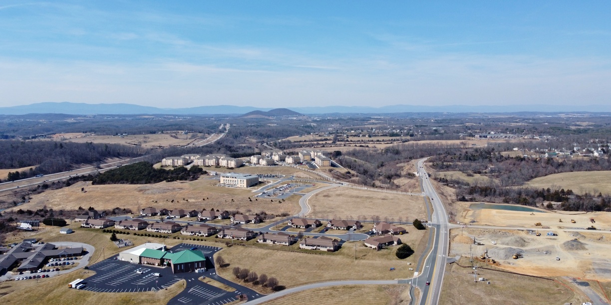
Aerial view of Fishersville, Virginia, facing approximately northwest, from just south of Augusta Health. Lifecore Drive (formerly Goose Creek Road) is visible in the right of the photo, while Interstate 64 is visible to the left. A church, housing, and Mary Baldwin University satellite campus are located in this area. The Betsy Bell and Mary Gray mountains in Staunton are visible in the distance.
Ben Schumin is a professional photographer who captures the intricacies of daily life. This image is all rights reserved. Contact me directly for licensing information.
Ben Schumin is a professional photographer who captures the intricacies of daily life. This image is all rights reserved. Contact me directly for licensing information.
- Information
- Copyright
- All Rights Reserved
- Author
- Ben Schumin
- Created on
- Wednesday 10 March 2021
- Dimensions
- 4000*2000
- Location
- View on OpenStreetMap
Location : 38.092282, -78.989253 - Keywords
- 2021, 64, apartment, apartments, Augusta, Augusta Health, Augusta Medical Center, baldwin, bell, ben, Betsy, Betsy Bell, center, church, churches, college, core, County, dr, drive, duplex, duplexes, fishersville, free, freeway, freeways, gray, health, high, highway, highways, hospital, house, houses, housing, I-64, interstate, Life, lifecore, march, mary, Mary Baldwin, Mary Gray, Medical, mountain, mountains, road, roads, schumin, schuminweb, staunton, university, va, virginia, way, ways, web
- Albums
- Photos by date / 2021
- Photos by date / 2021 / Virginia, March 8-10, 2021
- Photos by location / Virginia / Augusta County / Fishersville
- Photos by location / Virginia / Staunton
- Photos by subject / Churches
- Photos by subject / Drone photography
- Photos by subject / Hospitals
- Photos by subject / Transportation / Roads