
Ben Schumin Photography Portfolio
Ben Schumin is a professional photographer who captures the intricacies of daily life.

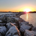
The Patapsco River, which forms the boundary between Howard and Baltimore Counties, viewerd from the Grist Mill Walking Bridge.
Information
- Author
- Ben Schumin
- Copyright
- All Rights Reserved
- Created on
- Wednesday 25 August 2021
- Dimensions
- 6000*4000
Powered by Piwigo

![Payphone at Mill Mountain Park [01]](../../../i/upload/2024/07/14/20240714102157-6c95386c-sq.jpg)
![Payphone at Mill Mountain Park [02]](../../../i/upload/2024/07/14/20240714102158-50a1c88a-sq.jpg)

![Cliff over the Blue Ridge Parkway [02]](../../../i/upload/2024/07/15/20240715141127-8869144a-sq.jpg)
![Cliff over the Blue Ridge Parkway [01]](../../../i/upload/2024/07/15/20240715141130-0117e715-sq.jpg)

![Fountain at Crandal Mackey Park [01]](../../../i/upload/2024/07/15/20240715204614-f11b24f0-sq.jpg)
![Fountain at Crandal Mackey Park [01]](../../../i/upload/2024/07/15/20240715204617-9a99a574-sq.jpg)
![Fountain at Crandal Mackey Park [01]](../../../i/upload/2024/07/15/20240715204618-bb25afa6-sq.jpg)
![Fountain at Crandal Mackey Park [01]](../../../i/upload/2024/07/15/20240715204620-d358487b-sq.jpg)
![Fountain at Crandal Mackey Park [01]](../../../i/upload/2024/07/15/20240715204623-77e13f16-sq.jpg)
![Shenandoah River tubing [03]](../../../i/upload/2024/07/16/20240716002604-d0a14ec0-sq.jpg)
![Shenandoah River tubing [02]](../../../i/upload/2024/07/16/20240716002606-4131b2d1-sq.jpg)
![View from Humpback Rock [05]](../../../i/upload/2024/07/17/20240717101753-ca2418a2-sq.jpg)
![Hikers on Humpback Rock [01]](../../../i/upload/2024/07/17/20240717101756-e2366123-sq.jpg)

![View from Humpback Rock [07]](../../../i/upload/2024/07/17/20240717101807-4ac3388b-sq.jpg)

![View from Humpback Rock [08]](../../../i/upload/2024/07/17/20240717101813-428c6b93-sq.jpg)
![Millipede [02]](../../../i/upload/2024/07/17/20240717101816-2b96da1d-sq.jpg)
![Carving on Humpback Rock [04]](../../../i/upload/2024/07/17/20240717101823-11f81d51-sq.jpg)
![View from Humpback Rock [06]](../../../i/upload/2024/07/17/20240717101826-175efd70-sq.jpg)
![Hikers on Humpback Rock [02]](../../../i/upload/2024/07/17/20240717101829-23d3d3cb-sq.jpg)

![Carving on Humpback Rock [05]](../../../i/upload/2024/07/17/20240717101840-127e4ec6-sq.jpg)

![Millipede [03]](../../../i/upload/2024/07/17/20240717101852-cd10e3ce-sq.jpg)
![Carving on Humpback Rock [03]](../../../i/upload/2024/07/17/20240717102042-7ec11b97-sq.jpg)
![Tree lichen [03]](../../../i/upload/2024/07/17/20240717102045-ab0af3da-sq.jpg)
![Tree lichen [02]](../../../i/upload/2024/07/17/20240717102049-e1470411-sq.jpg)

![Millipede [01]](../../../i/upload/2024/07/17/20240717102106-38141ff0-sq.jpg)
![Tree lichen [01]](../../../i/upload/2024/07/17/20240717102109-9bbdff0a-sq.jpg)
![Carving on Humpback Rock [01]](../../../i/upload/2024/07/17/20240717102112-6ac490ca-sq.jpg)

![Carving on Humpback Rock [02]](../../../i/upload/2024/07/17/20240717102117-a2a35c2e-sq.jpg)

![View from Humpback Rock [01]](../../../i/upload/2024/07/17/20240717102123-a6703547-sq.jpg)
![View from Humpback Rock [02]](../../../i/upload/2024/07/17/20240717102125-36661549-sq.jpg)
![View from Humpback Rock [03]](../../../i/upload/2024/07/17/20240717102128-98d75dee-sq.jpg)
![View from Humpback Rock [04]](../../../i/upload/2024/07/17/20240717102130-fd4ad5b7-sq.jpg)
![Great Falls, viewed from Virginia side [02]](../../../i/upload/2024/07/17/20240717103519-50ba95de-sq.jpg)
![Great Falls, viewed from Virginia side [03]](../../../i/upload/2024/07/17/20240717103523-a2a304a5-sq.jpg)
![Great Falls, viewed from Virginia side [04]](../../../i/upload/2024/07/17/20240717103525-f48915a5-sq.jpg)
![Great Falls, viewed from Virginia side [08]](../../../i/upload/2024/07/17/20240717103529-348c9bd6-sq.jpg)
![Great Falls, viewed from Virginia side [07]](../../../i/upload/2024/07/17/20240717103532-a22cb243-sq.jpg)
![Great Falls, viewed from Virginia side [06]](../../../i/upload/2024/07/17/20240717103536-0fc4772b-sq.jpg)
![Great Falls, viewed from Virginia side [05]](../../../i/upload/2024/07/17/20240717103539-a1edd7ea-sq.jpg)
![Great Falls, viewed from Virginia side [01]](../../../i/upload/2024/07/17/20240717103542-fb2cc0f2-sq.jpg)
![Sandy Point State Park [17]](../../../i/upload/2024/07/17/20240717154014-be41eb94-sq.jpg)
![Sandy Point State Park [18]](../../../i/upload/2024/07/17/20240717154017-ca30a51c-sq.jpg)
![Sandy Point State Park [20]](../../../i/upload/2024/07/17/20240717154034-68af9714-sq.jpg)
![Sandy Point State Park [21]](../../../i/upload/2024/07/17/20240717154038-08e83126-sq.jpg)
![Sandy Point State Park [22]](../../../i/upload/2024/07/17/20240717154040-7e275d80-sq.jpg)
![Sandy Point State Park [23]](../../../i/upload/2024/07/17/20240717154043-4dc7ea44-sq.jpg)
![Sandy Point State Park [24]](../../../i/upload/2024/07/17/20240717154045-1afae40e-sq.jpg)
![Sandy Point State Park [25]](../../../i/upload/2024/07/17/20240717154048-8e13e657-sq.jpg)
![Sandy Point State Park [26]](../../../i/upload/2024/07/17/20240717154051-2d01ed85-sq.jpg)
![Sandy Point State Park [29]](../../../i/upload/2024/07/17/20240717154058-28dd221e-sq.jpg)
![Sandy Point State Park [32]](../../../i/upload/2024/07/17/20240717154107-ae095df9-sq.jpg)
![Sandy Point State Park [37]](../../../i/upload/2024/07/17/20240717154119-d4d32e67-sq.jpg)
![Sandy Point State Park [46]](../../../i/upload/2024/07/17/20240717154143-90c031b6-sq.jpg)
![Rocks in the James River [01]](../../../i/upload/2024/07/17/20240717155206-4845495c-sq.jpg)
![Christopher Newport Cross [03]](../../../i/upload/2024/07/17/20240717155317-ddd5fda2-sq.jpg)
![Christopher Newport Cross [02]](../../../i/upload/2024/07/17/20240717155319-ab06b102-sq.jpg)
![Christopher Newport Cross [01]](../../../i/upload/2024/07/17/20240717155321-0396ca1f-sq.jpg)
![Sedimentary rock cliff [03]](../../../i/upload/2024/07/17/20240717160256-d5a25b7b-sq.jpg)
![Sedimentary rock cliff [02]](../../../i/upload/2024/07/17/20240717160259-70a77081-sq.jpg)
![Sedimentary rock cliff [01]](../../../i/upload/2024/07/17/20240717160302-4ce59086-sq.jpg)
![Potomac River from US 340 bridge [01]](../../../i/upload/2024/07/17/20240717160356-3d771bff-sq.jpg)
![Potomac River from US 340 bridge [02]](../../../i/upload/2024/07/17/20240717160407-a08a06a9-sq.jpg)
![Humpback Rock [01]](../../../i/upload/2024/07/17/20240717165812-b6c0e5d7-sq.jpg)
![Humpback Rock [02]](../../../i/upload/2024/07/17/20240717165815-d1fc9f8f-sq.jpg)


![The Quarry Overlook [01]](../../../i/upload/2024/07/17/20240717232310-42f3b6f0-sq.jpg)
![The Quarry Overlook [02]](../../../i/upload/2024/07/17/20240717232313-152237d9-sq.jpg)
![The Quarry Overlook [03]](../../../i/upload/2024/07/17/20240717233036-cf4a8757-sq.jpg)


![Sideling Hill rest area [01]](../../../i/upload/2024/07/17/20240717233459-e7ba195c-sq.jpg)
![Sideling Hill rest area [02]](../../../i/upload/2024/07/17/20240717233505-c4590774-sq.jpg)
![Sideling Hill rest area [03]](../../../i/upload/2024/07/17/20240717233511-e61616ff-sq.jpg)
![Sideling Hill rest area [04]](../../../i/upload/2024/07/17/20240717233516-e5cc17b4-sq.jpg)
![Sideling Hill rest area [05]](../../../i/upload/2024/07/17/20240717233521-b99b80cb-sq.jpg)
![Sideling Hill rest area [06]](../../../i/upload/2024/07/17/20240717233527-43e4656c-sq.jpg)
![Sideling Hill rest area [07]](../../../i/upload/2024/07/17/20240717233531-9f6ca0ea-sq.jpg)
![Sideling Hill rest area [08]](../../../i/upload/2024/07/17/20240717233537-4406b863-sq.jpg)
![Sideling Hill rest area [09]](../../../i/upload/2024/07/17/20240717233542-efb1100b-sq.jpg)
![Sideling Hill rest area [10]](../../../i/upload/2024/07/17/20240717233547-516b9676-sq.jpg)
![Downtown Cumberland, Maryland [01]](../../../i/upload/2024/07/17/20240717233615-1f03e747-sq.jpg)

![View from High Rock around sunset [01]](../../../i/upload/2024/07/18/20240718125414-4cca566c-sq.jpg)
![View from High Rock around sunset [02]](../../../i/upload/2024/07/18/20240718125419-06cd22f4-sq.jpg)
![View from High Rock around sunset [03]](../../../i/upload/2024/07/18/20240718125422-7938edf7-sq.jpg)

![People standing on High Rock [01]](../../../i/upload/2024/07/18/20240718125430-49f5c2ff-sq.jpg)
![View from High Rock around sunset [04]](../../../i/upload/2024/07/18/20240718125433-8a060ae7-sq.jpg)
![Graffiti-covered stone at High Rock [01]](../../../i/upload/2024/07/18/20240718125437-b92b052f-sq.jpg)

![View from High Rock around sunset [05]](../../../i/upload/2024/07/18/20240718125445-9b7d8206-sq.jpg)
![View from High Rock around sunset [06]](../../../i/upload/2024/07/18/20240718125449-9904b382-sq.jpg)
![View from High Rock around sunset [07]](../../../i/upload/2024/07/18/20240718125452-a060fd82-sq.jpg)
![Graffiti-covered stone at High Rock [02]](../../../i/upload/2024/07/18/20240718125456-e62dc4ce-sq.jpg)
![Graffiti-covered stone at High Rock [03]](../../../i/upload/2024/07/18/20240718125500-5ab7b0f5-sq.jpg)
![Graffiti-covered stone at High Rock [04]](../../../i/upload/2024/07/18/20240718125505-6e88d549-sq.jpg)
![People standing on High Rock [02]](../../../i/upload/2024/07/18/20240718125509-fb973c54-sq.jpg)


![View from High Rock around sunset [08]](../../../i/upload/2024/07/18/20240718125539-68d743dd-sq.jpg)
![View from High Rock around sunset [09]](../../../i/upload/2024/07/18/20240718125542-d5f04008-sq.jpg)
![View from High Rock around sunset [10]](../../../i/upload/2024/07/18/20240718125546-0de77111-sq.jpg)
![View from High Rock around sunset [11]](../../../i/upload/2024/07/18/20240718125550-f940cb2a-sq.jpg)
![View of the sunset from High Rock [01]](../../../i/upload/2024/07/18/20240718125553-1df4c653-sq.jpg)
![View of the sunset from High Rock [02]](../../../i/upload/2024/07/18/20240718125557-d168466e-sq.jpg)
![View of the sunset from High Rock [03]](../../../i/upload/2024/07/18/20240718125601-a2d71104-sq.jpg)
![Waves crashing on the rocks [04]](../../../i/upload/2024/07/18/20240718220333-3c00da95-sq.jpg)
![Waves crashing on the rocks [03]](../../../i/upload/2024/07/18/20240718220336-326825de-sq.jpg)
![Waves crashing on the rocks [02]](../../../i/upload/2024/07/18/20240718220340-85a54f39-sq.jpg)
![Waves crashing on the rocks [01]](../../../i/upload/2024/07/18/20240718220344-65c834c3-sq.jpg)
![Mound of sand on the beach [02]](../../../i/upload/2024/07/18/20240718220347-74bbfa54-sq.jpg)
![Mound of sand on the beach [01]](../../../i/upload/2024/07/18/20240718220351-606b42a3-sq.jpg)
![Piney Point Bar [02]](../../../i/upload/2024/07/18/20240718221309-9589b2dc-sq.jpg)
![Piney Point Bar [03]](../../../i/upload/2024/07/18/20240718221313-e8ed9fe0-sq.jpg)
![Piney Point Bar [04]](../../../i/upload/2024/07/18/20240718221318-f34d3c47-sq.jpg)
![Piney Point Bar [01]](../../../i/upload/2024/07/18/20240718221433-473f9ece-sq.jpg)


![Point of Rocks [01]](../../../i/upload/2024/07/19/20240719101023-a2888aa2-sq.jpg)
![Point of Rocks [02]](../../../i/upload/2024/07/19/20240719101030-01aa5084-sq.jpg)
![Point of Rocks [05]](../../../i/upload/2024/07/19/20240719101046-96935d31-sq.jpg)
![Point of Rocks [04]](../../../i/upload/2024/07/19/20240719101050-da7edd4a-sq.jpg)
![Point of Rocks [03]](../../../i/upload/2024/07/19/20240719101055-185ba3dd-sq.jpg)
![Rocks in the Potomac River [01]](../../../i/upload/2024/07/19/20240719103333-6083493b-sq.jpg)
![Rocks in the Potomac River [02]](../../../i/upload/2024/07/19/20240719103338-04e1c1e1-sq.jpg)
![Rocks in the Potomac River [03]](../../../i/upload/2024/07/19/20240719103343-404e77e5-sq.jpg)
![Rocks in the Potomac River [04]](../../../i/upload/2024/07/19/20240719103348-1a3aef78-sq.jpg)
![Rocks in the Potomac River [05]](../../../i/upload/2024/07/19/20240719103353-ea395458-sq.jpg)
![Potomac River from US 340 bridge [03]](../../../i/upload/2024/07/19/20240719103359-b66380e8-sq.jpg)
![Potomac River from US 340 bridge [04]](../../../i/upload/2024/07/19/20240719103405-18d26a8b-sq.jpg)
![Potomac River from US 340 bridge [05]](../../../i/upload/2024/07/19/20240719103412-5b42c5b9-sq.jpg)
![Elyse sits on a rock [01]](../../../i/upload/2024/07/19/20240719112629-5a0b8f94-sq.jpg)
![Elyse sits on a rock [02]](../../../i/upload/2024/07/19/20240719112635-c8739272-sq.jpg)

![Visulite marquee [02]](../../../i/upload/2024/07/19/20240719120305-ef5ba2f3-sq.jpg)
![Visulite marquee [01]](../../../i/upload/2024/07/19/20240719120351-f97470bb-sq.jpg)
![Fire department training exercise at Point of Rocks [01]](../../../i/upload/2024/07/19/20240719121522-00c26bcd-sq.jpg)
![Point of Rocks Bridge [03]](../../../i/upload/2024/07/19/20240719121604-b7b9e112-sq.jpg)
![Point of Rocks Bridge [05]](../../../i/upload/2024/07/19/20240719121622-d2dfa3a8-sq.jpg)
![Point of Rocks Bridge [02]](../../../i/upload/2024/07/19/20240719121627-117c91a4-sq.jpg)
![Point of Rocks Bridge [01]](../../../i/upload/2024/07/19/20240719121631-a890c001-sq.jpg)
![Fire department training exercise at Point of Rocks [03]](../../../i/upload/2024/07/19/20240719121636-fddf3da7-sq.jpg)
![Point of Rocks Bridge [04]](../../../i/upload/2024/07/19/20240719122649-6c75d4bd-sq.jpg)
![Fire department training exercise at Point of Rocks [02]](../../../i/upload/2024/07/19/20240719122705-766d07f4-sq.jpg)
![Fire department training exercise at Point of Rocks [04]](../../../i/upload/2024/07/19/20240719122724-b038dca1-sq.jpg)

![Point of Rocks Bridge [06]](../../../i/upload/2024/07/19/20240719161609-122bd90b-sq.jpg)
![Point of Rocks Bridge [07]](../../../i/upload/2024/07/19/20240719161650-2c49391d-sq.jpg)
![Point of Rocks Bridge [08]](../../../i/upload/2024/07/19/20240719161700-351af3cd-sq.jpg)
![Point of Rocks Bridge [09]](../../../i/upload/2024/07/19/20240719161708-5ce37e28-sq.jpg)
![Point of Rocks Bridge [10]](../../../i/upload/2024/07/19/20240719161717-6572a682-sq.jpg)
![Point of Rocks Bridge [11]](../../../i/upload/2024/07/19/20240719161730-4f51193a-sq.jpg)

![Rocks in the Hampton River [01]](../../../i/upload/2024/07/19/20240719210422-44c6aa32-sq.jpg)
![Rocks in the Hampton River [02]](../../../i/upload/2024/07/19/20240719210620-d6ff2523-sq.jpg)
![Eastern end of Atlantic City, New Jersey [01]](../../../i/upload/2024/07/20/20240720015049-cd1829c2-sq.jpg)
![Jetty in the Absecon Inlet [01]](../../../i/upload/2024/07/20/20240720015214-49471561-sq.jpg)
![Eastern end of Atlantic City, New Jersey [03]](../../../i/upload/2024/07/20/20240720015220-f67a54df-sq.jpg)
![Eastern end of Atlantic City, New Jersey [02]](../../../i/upload/2024/07/20/20240720015254-8d967d9d-sq.jpg)
![Jetty in the Absecon Inlet [02]](../../../i/upload/2024/07/20/20240720015259-77520d58-sq.jpg)


![Rapids on the James River [01]](../../../i/upload/2024/07/20/20240720093011-a767724e-sq.jpg)
![Rapids on the James River [02]](../../../i/upload/2024/07/20/20240720093135-219eaaa3-sq.jpg)

![Southern end of Ocean City, Maryland [01]](../../../i/upload/2024/07/20/20240720104249-e7bc02d7-sq.jpg)
![Sign at Humpback Rocks visitor center [02]](../../../i/upload/2024/07/20/20240720111337-c065ec36-sq.jpg)
![Sign at Humpback Rocks visitor center [01]](../../../i/upload/2024/07/20/20240720111346-65ae0dba-sq.jpg)


![Christopher Newport Cross [04]](../../../i/upload/2024/07/20/20240720145311-da3906e8-sq.jpg)
![Rocks in the James River [02]](../../../i/upload/2024/07/20/20240720145702-c9b17644-sq.jpg)


![Former City View Center [20]](../../../i/upload/2024/11/16/20241116120259-fa6de2c4-sq.jpg)
![Former City View Center [21]](../../../i/upload/2024/11/16/20241116120303-f3d017e2-sq.jpg)
![Former City View Center [22]](../../../i/upload/2024/11/16/20241116120754-984c1d02-sq.jpg)
![Former City View Center [23]](../../../i/upload/2024/11/16/20241116120802-d96a0939-sq.jpg)