
Ben Schumin Photography Portfolio
Ben Schumin is a professional photographer who captures the intricacies of daily life.
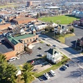
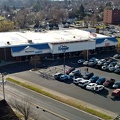
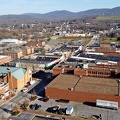
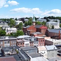
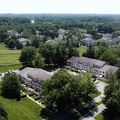
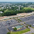
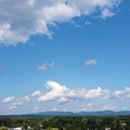
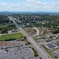
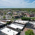
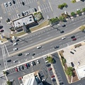
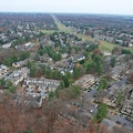
The sky above the Rio Hill shopping center, near Charlottesville, Virginia.


![Flying over the house [01]](../../../i/upload/2024/07/19/20240719113251-2a1445f2-sq.jpg)
![Flying over the house [02]](../../../i/upload/2024/07/19/20240719113256-094cde6b-sq.jpg)
![Flying over the house [06]](../../../i/upload/2024/07/19/20240719113300-4c86d964-sq.jpg)
![Flying over the house [05]](../../../i/upload/2024/07/19/20240719113305-b3c0f788-sq.jpg)
![Flying over the house [04]](../../../i/upload/2024/07/19/20240719113309-11215bef-sq.jpg)
![Flying over the house [03]](../../../i/upload/2024/07/19/20240719113314-4d3d3923-sq.jpg)
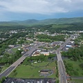
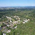
![Myersville, Maryland and vicinity [01]](../../../i/upload/2024/07/19/20240719114529-b09266dc-sq.jpg)
![Myersville, Maryland and vicinity [02]](../../../i/upload/2024/07/19/20240719114533-7da9ff27-sq.jpg)
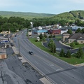
![Smithsburg, Maryland and vicinity [01]](../../../i/upload/2024/07/19/20240719114610-c1a5ac24-sq.jpg)
![Smithsburg, Maryland and vicinity [02]](../../../i/upload/2024/07/19/20240719114614-27b7e477-sq.jpg)
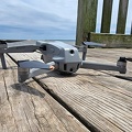
![DJI Mavic Mini in flight [03]](../../../i/upload/2024/07/19/20240719121547-49872032-sq.jpg)
![DJI Mavic Mini in flight [02]](../../../i/upload/2024/07/19/20240719121551-d201d997-sq.jpg)
![DJI Mavic Mini in flight [01]](../../../i/upload/2024/07/19/20240719122720-492d4c09-sq.jpg)
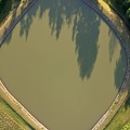
![Demolition of North Creek pool [01]](../../../i/upload/2024/07/19/20240719123658-1110a1d6-sq.jpg)
![Demolition of North Creek pool [02]](../../../i/upload/2024/07/19/20240719123702-423a7a28-sq.jpg)
![Demolition of North Creek pool [03]](../../../i/upload/2024/07/19/20240719123707-916ced30-sq.jpg)
![Demolition of North Creek pool [04]](../../../i/upload/2024/07/19/20240719123712-8542f958-sq.jpg)
![Demolition of North Creek pool [05]](../../../i/upload/2024/07/19/20240719123716-2a313fab-sq.jpg)
![Demolition of North Creek pool [06]](../../../i/upload/2024/07/19/20240719123720-2e9b9ec5-sq.jpg)
![Demolition of North Creek pool [07]](../../../i/upload/2024/07/19/20240719123725-ffd9b078-sq.jpg)
![Demolition of North Creek pool [08]](../../../i/upload/2024/07/19/20240719123730-e6ffe7ad-sq.jpg)
![Demolition of North Creek pool [09]](../../../i/upload/2024/07/19/20240719123734-edad4a9e-sq.jpg)
![Demolition of North Creek pool [10]](../../../i/upload/2024/07/19/20240719123739-f3fbb25a-sq.jpg)
![Demolition of North Creek pool [11]](../../../i/upload/2024/07/19/20240719123744-589c5d88-sq.jpg)
![Demolition of North Creek pool [12]](../../../i/upload/2024/07/19/20240719123749-11dc1d8c-sq.jpg)
![Demolition of North Creek pool [13]](../../../i/upload/2024/07/19/20240719123754-356fd50e-sq.jpg)
![Demolition of North Creek pool [14]](../../../i/upload/2024/07/19/20240719123758-bba1b619-sq.jpg)
![Demolition of North Creek pool [15]](../../../i/upload/2024/07/19/20240719123802-03a1e00b-sq.jpg)
![Demolition of North Creek pool [16]](../../../i/upload/2024/07/19/20240719123807-dd1e3496-sq.jpg)
![Demolition of North Creek pool [17]](../../../i/upload/2024/07/19/20240719123811-c3253c43-sq.jpg)
![Demolition of North Creek pool [18]](../../../i/upload/2024/07/19/20240719123816-ecf6c784-sq.jpg)
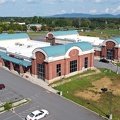
![Overview of Staunton Mall [01]](../../../i/upload/2024/07/19/20240719124017-203cea14-sq.jpg)
![Overview of Staunton Mall [02]](../../../i/upload/2024/07/19/20240719124750-d49e7113-sq.jpg)
![Overview of Staunton Mall [03]](../../../i/upload/2024/07/19/20240719124758-ba09a41c-sq.jpg)
![Overview of Staunton Mall [04]](../../../i/upload/2024/07/19/20240719124825-c74d9ac3-sq.jpg)
![Overview of Staunton Mall [05]](../../../i/upload/2024/07/19/20240719124843-79d37b24-sq.jpg)
![Overview of Staunton Mall [06]](../../../i/upload/2024/07/19/20240719124847-c9190ea0-sq.jpg)
![Overview of Staunton Mall [07]](../../../i/upload/2024/07/19/20240719124919-69f05f6e-sq.jpg)
![Overview of Staunton Mall [08]](../../../i/upload/2024/07/19/20240719124938-c489a2d8-sq.jpg)
![Overview of Staunton Mall [09]](../../../i/upload/2024/07/19/20240719124955-aac3343f-sq.jpg)
![Former JCPenney in Staunton, Virginia [01]](../../../i/upload/2024/07/19/20240719125012-82cd5b4e-sq.jpg)
![Former JCPenney in Staunton, Virginia [02]](../../../i/upload/2024/07/19/20240719125026-450ce4ee-sq.jpg)
![Former JCPenney in Staunton, Virginia [03]](../../../i/upload/2024/07/19/20240719125041-b852c092-sq.jpg)
![Former JCPenney in Staunton, Virginia [04]](../../../i/upload/2024/07/19/20240719125055-45f0898f-sq.jpg)
![Former JCPenney in Staunton, Virginia [05]](../../../i/upload/2024/07/19/20240719125109-c1602ad5-sq.jpg)
![Former JCPenney in Staunton, Virginia [06]](../../../i/upload/2024/07/19/20240719125124-fb4fa96f-sq.jpg)
![Former JCPenney in Staunton, Virginia [07]](../../../i/upload/2024/07/19/20240719125139-16e0a016-sq.jpg)
![Former JCPenney in Staunton, Virginia [08]](../../../i/upload/2024/07/19/20240719125152-82a06331-sq.jpg)
![Former JCPenney in Staunton, Virginia [09]](../../../i/upload/2024/07/19/20240719125206-c56207b0-sq.jpg)
![Former JCPenney in Staunton, Virginia [10]](../../../i/upload/2024/07/19/20240719125216-9b209f6c-sq.jpg)
![Former JCPenney in Staunton, Virginia [11]](../../../i/upload/2024/07/19/20240719125225-86e26aa0-sq.jpg)
![Center entrance to Staunton Mall [01]](../../../i/upload/2024/07/19/20240719125235-d1287ce8-sq.jpg)
![Center entrance to Staunton Mall [02]](../../../i/upload/2024/07/19/20240719125245-03e5e5c2-sq.jpg)
![Center entrance to Staunton Mall [03]](../../../i/upload/2024/07/19/20240719125254-b4afcc64-sq.jpg)
![Center entrance to Staunton Mall [04]](../../../i/upload/2024/07/19/20240719125303-642b3ce0-sq.jpg)

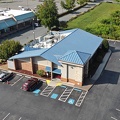
![Former Peebles building at Staunton Mall [01]](../../../i/upload/2024/07/19/20240719125322-33fa3f98-sq.jpg)
![Movie theater and food court entrance at Staunton Mall [01]](../../../i/upload/2024/07/19/20240719125330-cf877cfc-sq.jpg)
![Church United [01]](../../../i/upload/2024/07/19/20240719125339-5907a610-sq.jpg)

![Belk in Staunton, Virginia [01]](../../../i/upload/2024/07/19/20240719125356-d4c258e2-sq.jpg)
![Belk in Staunton, Virginia [02]](../../../i/upload/2024/07/19/20240719125401-41210126-sq.jpg)
![Belk in Staunton, Virginia [03]](../../../i/upload/2024/07/19/20240719125406-61f46a37-sq.jpg)
![Belk in Staunton, Virginia [04]](../../../i/upload/2024/07/19/20240719125410-69c0e629-sq.jpg)
![Belk in Staunton, Virginia [05]](../../../i/upload/2024/07/19/20240719125415-50502005-sq.jpg)
![Parking lot lighting at Staunton Mall [01]](../../../i/upload/2024/07/19/20240719125419-32617a39-sq.jpg)
![Parking lot lighting at Staunton Mall [02]](../../../i/upload/2024/07/19/20240719125424-405d5e82-sq.jpg)
![McDonald's at Staunton Mall [01]](../../../i/upload/2024/07/19/20240719125429-406243e2-sq.jpg)
![McDonald's at Staunton Mall [02]](../../../i/upload/2024/07/19/20240719125434-41482cf8-sq.jpg)
![McDonald's at Staunton Mall [03]](../../../i/upload/2024/07/19/20240719125438-29b090cf-sq.jpg)
![Hampton Inn in Staunton, Virginia [01]](../../../i/upload/2024/07/19/20240719125444-5f0a8769-sq.jpg)
![Hampton Inn in Staunton, Virginia [02]](../../../i/upload/2024/07/19/20240719125448-63aa7278-sq.jpg)
![Hampton Inn in Staunton, Virginia [03]](../../../i/upload/2024/07/19/20240719125452-b68a26eb-sq.jpg)
![Dollar Tree at Staunton Mall [01]](../../../i/upload/2024/07/19/20240719125703-dc328ae1-sq.jpg)
![DJI Mavic Mini in flight [04]](../../../i/upload/2024/07/19/20240719125911-061a6320-sq.jpg)
![Downtown Waynesboro, Virginia, looking toward Invista [01]](../../../i/upload/2024/07/19/20240719125947-ee92c8f8-sq.jpg)
![DJI Mavic Mini in flight [05]](../../../i/upload/2024/07/19/20240719130021-fd4ddf25-sq.jpg)
![DJI Mavic Mini in flight [06]](../../../i/upload/2024/07/19/20240719130055-0da0bbd4-sq.jpg)

![Satellite dish on former News Virginian building [03]](../../../i/upload/2024/07/19/20240719130207-0d430d13-sq.jpg)
![Satellite dish on former News Virginian building [02]](../../../i/upload/2024/07/19/20240719130212-08c06a14-sq.jpg)
![West Main Street in Waynesboro, Virginia [03]](../../../i/upload/2024/07/19/20240719130237-f1099710-sq.jpg)
![Satellite dish on former News Virginian building [04]](../../../i/upload/2024/07/19/20240719130246-90d2803d-sq.jpg)
![Downtown Waynesboro, Virginia, looking toward Invista [02]](../../../i/upload/2024/07/19/20240719130254-ae1aac9d-sq.jpg)
![DJI Mavic Mini in flight [07]](../../../i/upload/2024/07/19/20240719130304-3628ae17-sq.jpg)
![Staunton Clock Tower [10]](../../../i/upload/2024/07/19/20240719160058-dd43b1e1-sq.jpg)

![Staunton Clock Tower [04]](../../../i/upload/2024/07/19/20240719160116-c9540996-sq.jpg)
![Masonic Building [05]](../../../i/upload/2024/07/19/20240719160120-458e9cfe-sq.jpg)
![Staunton Clock Tower [13]](../../../i/upload/2024/07/19/20240719160124-669a56d5-sq.jpg)
![Staunton Clock Tower [09]](../../../i/upload/2024/07/19/20240719160128-bed95bb6-sq.jpg)
![Staunton Clock Tower [05]](../../../i/upload/2024/07/19/20240719160137-3608ac98-sq.jpg)
![Masonic Building [03]](../../../i/upload/2024/07/19/20240719160141-ce3fe26d-sq.jpg)
![Staunton Clock Tower [11]](../../../i/upload/2024/07/19/20240719160145-6b3f0140-sq.jpg)
![Staunton Clock Tower [08]](../../../i/upload/2024/07/19/20240719160150-5519befb-sq.jpg)
![Staunton Clock Tower [06]](../../../i/upload/2024/07/19/20240719160154-c78fc755-sq.jpg)
![Masonic Building [04]](../../../i/upload/2024/07/19/20240719160158-09811827-sq.jpg)
![Staunton Clock Tower [07]](../../../i/upload/2024/07/19/20240719160232-5fccc12c-sq.jpg)

![Masonic Building [02]](../../../i/upload/2024/07/19/20240719160240-ade51368-sq.jpg)
![Staunton Clock Tower [12]](../../../i/upload/2024/07/19/20240719160244-284b4f43-sq.jpg)
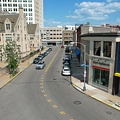
![Richmond Avenue in Staunton, Virginia [01]](../../../i/upload/2024/07/19/20240719161158-ddf9fe35-sq.jpg)
![Richmond Avenue in Staunton, Virginia [02]](../../../i/upload/2024/07/19/20240719161203-233bb776-sq.jpg)
![Richmond Avenue in Staunton, Virginia [03]](../../../i/upload/2024/07/19/20240719161212-297c1b53-sq.jpg)
![The Cheese Shop [01]](../../../i/upload/2024/07/19/20240719161301-a4fea2d4-sq.jpg)
![The Cheese Shop [02]](../../../i/upload/2024/07/19/20240719161306-36cfe9c4-sq.jpg)
![The Cheese Shop [07]](../../../i/upload/2024/07/19/20240719161313-a3ac7c57-sq.jpg)
![The Cheese Shop [06]](../../../i/upload/2024/07/19/20240719161317-08ae1eea-sq.jpg)
![The Cheese Shop [05]](../../../i/upload/2024/07/19/20240719161321-75da31a1-sq.jpg)
![The Cheese Shop [04]](../../../i/upload/2024/07/19/20240719161325-683c43ec-sq.jpg)
![The Cheese Shop [03]](../../../i/upload/2024/07/19/20240719161329-0bcf8617-sq.jpg)
![Courtyard by Marriott at Dulles Town Center [01]](../../../i/upload/2024/07/19/20240719161810-a57de312-sq.jpg)
![Courtyard by Marriott at Dulles Town Center [02]](../../../i/upload/2024/07/19/20240719161814-21a9fcdb-sq.jpg)
![Courtyard by Marriott at Dulles Town Center [03]](../../../i/upload/2024/07/19/20240719161818-bdc6acb8-sq.jpg)
![Sandy Point Shoal Light [04]](../../../i/upload/2024/07/19/20240719162323-73076452-sq.jpg)
![Sandy Point Shoal Light [03]](../../../i/upload/2024/07/19/20240719162328-0e1a4ebd-sq.jpg)
![Sandy Point Shoal Light [05]](../../../i/upload/2024/07/19/20240719162406-267c63db-sq.jpg)
![Sandy Point Shoal Light [01]](../../../i/upload/2024/07/19/20240719162410-1250af50-sq.jpg)
![Sandy Point Shoal Light [09]](../../../i/upload/2024/07/19/20240719162414-8ba70891-sq.jpg)
![Sandy Point Shoal Light [10]](../../../i/upload/2024/07/19/20240719162418-d1e29a27-sq.jpg)
![Sandy Point Shoal Light [06]](../../../i/upload/2024/07/19/20240719162450-71d7a4db-sq.jpg)
![Sandy Point Shoal Light [08]](../../../i/upload/2024/07/19/20240719162459-4d01b2a8-sq.jpg)
![Sandy Point Shoal Light [07]](../../../i/upload/2024/07/19/20240719162531-badec1f6-sq.jpg)
![Sandy Point Shoal Light [02]](../../../i/upload/2024/07/19/20240719162535-d27a11a8-sq.jpg)
![West Main Street in Waynesboro, Virginia [01]](../../../i/upload/2024/07/19/20240719164545-b5a50599-sq.jpg)
![West Main Street in Waynesboro, Virginia [02]](../../../i/upload/2024/07/19/20240719164551-0b8407a8-sq.jpg)
![West Main Street in Waynesboro, Virginia [03]](../../../i/upload/2024/07/19/20240719164555-f7feeafe-sq.jpg)
![West Main Street in Waynesboro, Virginia [04]](../../../i/upload/2024/07/19/20240719164600-4379cef1-sq.jpg)
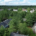
![Essex Place, Candle Ridge, and Picton of Birlstone [02]](../../../i/upload/2024/07/19/20240719165355-16cfcb21-sq.jpg)
![Ravenglass Way [02]](../../../i/upload/2024/07/19/20240719165400-daa550de-sq.jpg)
![Montgomery Village, facing approximately west [01]](../../../i/upload/2024/07/19/20240719165409-be458691-sq.jpg)
![Essex Place, Candle Ridge, and Picton of Birlstone [03]](../../../i/upload/2024/07/19/20240719165413-01ec57b3-sq.jpg)
![Ravenglass Way [06]](../../../i/upload/2024/07/19/20240719165418-83524ec4-sq.jpg)
![Lake Marion Community Center pool [06]](../../../i/upload/2024/07/19/20240719165432-05e5d3a1-sq.jpg)
![Lake Marion Community Center pool [05]](../../../i/upload/2024/07/19/20240719165437-13657538-sq.jpg)
![Ravenglass Way [04]](../../../i/upload/2024/07/19/20240719165443-3e6bc6d8-sq.jpg)
![Ravenglass Way [03]](../../../i/upload/2024/07/19/20240719165447-3df0a484-sq.jpg)
![Ravenglass Way [01]](../../../i/upload/2024/07/19/20240719165451-c6237496-sq.jpg)
![Essex Place, Candle Ridge, and Picton of Birlstone [01]](../../../i/upload/2024/07/19/20240719165455-a51c05df-sq.jpg)
![Montgomery Village, facing approximately west [02]](../../../i/upload/2024/07/19/20240719165500-7c01f836-sq.jpg)
![Ravenglass Way [05]](../../../i/upload/2024/07/19/20240719165505-1a967166-sq.jpg)
![Water tower off of Highview Court [03]](../../../i/upload/2024/07/19/20240719165926-2140749f-sq.jpg)
![Water tower off of Highview Court [04]](../../../i/upload/2024/07/19/20240719165929-ea38ce5a-sq.jpg)
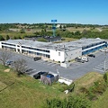
![CFC Farm & Home Center [02]](../../../i/upload/2024/07/19/20240719165952-c550dba5-sq.jpg)
![CFC Farm & Home Center [01]](../../../i/upload/2024/07/19/20240719165956-d2c57e84-sq.jpg)
![Water tower off of Highview Court [05]](../../../i/upload/2024/07/19/20240719170010-e6966844-sq.jpg)
![Water tower off of Highview Court [02]](../../../i/upload/2024/07/19/20240719170014-68ef8ad3-sq.jpg)
![Staunton, Virginia from above Sears Hill [01]](../../../i/upload/2024/07/19/20240719170157-81396bfe-sq.jpg)
![Staunton, Virginia from above Sears Hill [04]](../../../i/upload/2024/07/19/20240719170206-26a0cea4-sq.jpg)
![Staunton, Virginia from above Sears Hill [03]](../../../i/upload/2024/07/19/20240719170210-52003e52-sq.jpg)
![Staunton, Virginia from above Sears Hill [02]](../../../i/upload/2024/07/19/20240719170215-6698e5b6-sq.jpg)
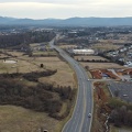
![US 29 North, near Hilton Heights Road [01]](../../../i/upload/2024/07/19/20240719171702-b12048d7-sq.jpg)
![US 29 North, near Hilton Heights Road [02]](../../../i/upload/2024/07/19/20240719171717-5729f873-sq.jpg)
![Walmart in Charlottesville, Virginia [01]](../../../i/upload/2024/07/19/20240719171721-a49eed32-sq.jpg)
![Walmart in Charlottesville, Virginia [02]](../../../i/upload/2024/07/19/20240719171727-b2b4e13b-sq.jpg)
![Walmart in Charlottesville, Virginia [03]](../../../i/upload/2024/07/19/20240719171732-3e186d60-sq.jpg)
![DoubleTree Hotel in Charlottesville, Virginia [01]](../../../i/upload/2024/07/19/20240719171742-a365fe34-sq.jpg)
![DoubleTree Hotel in Charlottesville, Virginia [02]](../../../i/upload/2024/07/19/20240719171749-9f868a46-sq.jpg)
![DoubleTree Hotel in Charlottesville, Virginia [03]](../../../i/upload/2024/07/19/20240719171753-fc1ed3d6-sq.jpg)
![DoubleTree Hotel in Charlottesville, Virginia [04]](../../../i/upload/2024/07/19/20240719171757-64e1daac-sq.jpg)
![Target store in Charlottesville, Virginia [01]](../../../i/upload/2024/07/19/20240719171802-835ecd5d-sq.jpg)
![Target store in Charlottesville, Virginia [02]](../../../i/upload/2024/07/19/20240719171806-68aab29f-sq.jpg)
![Target store in Charlottesville, Virginia [03]](../../../i/upload/2024/07/19/20240719171811-38643741-sq.jpg)
![Target store in Charlottesville, Virginia [04]](../../../i/upload/2024/07/19/20240719171816-b51f57c3-sq.jpg)
![Target store in Charlottesville, Virginia [05]](../../../i/upload/2024/07/19/20240719171821-bb115ea4-sq.jpg)
![Target store in Charlottesville, Virginia [06]](../../../i/upload/2024/07/19/20240719171825-2e99a175-sq.jpg)
![Target store in Charlottesville, Virginia [07]](../../../i/upload/2024/07/19/20240719171830-24661400-sq.jpg)
![US 29 near Woodbrook Drive [01]](../../../i/upload/2024/07/19/20240719171851-a0a055c4-sq.jpg)
![US 29 near Woodbrook Drive [02]](../../../i/upload/2024/07/19/20240719171856-fdca65ff-sq.jpg)

![Aerial view of Charlottesville Fashion Square [01]](../../../i/upload/2024/07/19/20240719171910-85e681d3-sq.jpg)
![Aerial view of Charlottesville Fashion Square [02]](../../../i/upload/2024/07/19/20240719171915-8ceb2f3e-sq.jpg)
![Aerial view of Charlottesville Fashion Square [03]](../../../i/upload/2024/07/19/20240719171919-5be63922-sq.jpg)
![Aerial view of Charlottesville Fashion Square [04]](../../../i/upload/2024/07/19/20240719171924-7ae1ffc4-sq.jpg)
![29th Place [01]](../../../i/upload/2024/07/19/20240719171929-2a93e060-sq.jpg)
![29th Place [02]](../../../i/upload/2024/07/19/20240719171933-744ac912-sq.jpg)
![29th Place [03]](../../../i/upload/2024/07/19/20240719171937-e631984c-sq.jpg)
![29th Place [04]](../../../i/upload/2024/07/19/20240719171941-ce1c4658-sq.jpg)
![Big Lots in Charlottesville, Virginia [01]](../../../i/upload/2024/07/19/20240719171950-f232590f-sq.jpg)
![Industrial waterfront in Camden, New Jersey [01]](../../../i/upload/2024/07/19/20240719174524-f25fe5ac-sq.jpg)
![Delaware River between Camden and Philadelphia [04]](../../../i/upload/2024/07/19/20240719174528-d9bfa370-sq.jpg)
![Industrial waterfront in Camden, New Jersey [04]](../../../i/upload/2024/07/19/20240719174533-7b9410c9-sq.jpg)
![Philadelphia waterfront [04]](../../../i/upload/2024/07/19/20240719174537-031ee3fb-sq.jpg)
![Industrial waterfront in Camden, New Jersey [03]](../../../i/upload/2024/07/19/20240719174542-ae316f93-sq.jpg)
![Philadelphia waterfront [02]](../../../i/upload/2024/07/19/20240719174557-47b0ba7e-sq.jpg)

![Philadelphia waterfront [01]](../../../i/upload/2024/07/19/20240719174617-09388151-sq.jpg)
![Philadelphia waterfront [03]](../../../i/upload/2024/07/19/20240719174621-83fb4ac1-sq.jpg)
![EMR Metal Recycling facility [06]](../../../i/upload/2024/07/19/20240719174626-98ec08f4-sq.jpg)
![Michael J. Doyle Fishing Pier [02]](../../../i/upload/2024/07/19/20240719174631-bf2403da-sq.jpg)
![Delaware River between Camden and Philadelphia [03]](../../../i/upload/2024/07/19/20240719174711-0286240d-sq.jpg)
![EMR Metal Recycling facility [05]](../../../i/upload/2024/07/19/20240719174746-6f4e378f-sq.jpg)
![Industrial waterfront in Camden, New Jersey [05]](../../../i/upload/2024/07/19/20240719174750-f22c4df0-sq.jpg)
![Streetlight over Michael J. Doyle Fishing Pier [01]](../../../i/upload/2024/07/19/20240719174754-f39fbe24-sq.jpg)
![Delaware River between Camden and Philadelphia [01]](../../../i/upload/2024/07/19/20240719174758-2ba1e8cc-sq.jpg)

![Streetlight over Michael J. Doyle Fishing Pier [02]](../../../i/upload/2024/07/19/20240719174854-4bdb50c4-sq.jpg)
![EMR Metal Recycling facility [01]](../../../i/upload/2024/07/19/20240719174859-4276da73-sq.jpg)
![EMR Metal Recycling facility [04]](../../../i/upload/2024/07/19/20240719174903-e0c5d94c-sq.jpg)
![Michael J. Doyle Fishing Pier [01]](../../../i/upload/2024/07/19/20240719174907-5727f868-sq.jpg)
![Industrial waterfront in Camden, New Jersey [02]](../../../i/upload/2024/07/19/20240719175008-c02bd1f1-sq.jpg)
![EMR Metal Recycling facility [02]](../../../i/upload/2024/07/19/20240719175012-f06644ca-sq.jpg)
![EMR Metal Recycling facility [03]](../../../i/upload/2024/07/19/20240719175016-8297b2ce-sq.jpg)

![Delaware River between Camden and Philadelphia [02]](../../../i/upload/2024/07/19/20240719175026-266821c7-sq.jpg)
![Walmart in Colonial Heights, Virginia [04]](../../../i/upload/2024/07/19/20240719195409-5c26d32b-sq.jpg)
![Aerial view of downtown Petersburg, Virginia [03]](../../../i/upload/2024/07/19/20240719195444-cebbe66d-sq.jpg)
![Walmart in Colonial Heights, Virginia [08]](../../../i/upload/2024/07/19/20240719195505-7fa4ae35-sq.jpg)
![Walmart in Colonial Heights, Virginia [01]](../../../i/upload/2024/07/19/20240719195509-23c44419-sq.jpg)
![Parking lot at the Walmart in Colonial Heights, Virginia [01]](../../../i/upload/2024/07/19/20240719195513-cab88e8e-sq.jpg)
![Parking lot at the Walmart in Colonial Heights, Virginia [02]](../../../i/upload/2024/07/19/20240719195527-4987b9fc-sq.jpg)
![Walmart in Colonial Heights, Virginia [07]](../../../i/upload/2024/07/19/20240719195531-48a3b6a6-sq.jpg)
![Walmart in Colonial Heights, Virginia [03]](../../../i/upload/2024/07/19/20240719195535-e675a4d2-sq.jpg)
![Walmart in Colonial Heights, Virginia [02]](../../../i/upload/2024/07/19/20240719195543-b4080683-sq.jpg)
![Walmart in Colonial Heights, Virginia [09]](../../../i/upload/2024/07/19/20240719195548-b3941f26-sq.jpg)
![Walmart in Colonial Heights, Virginia [06]](../../../i/upload/2024/07/19/20240719195552-09ce3fe2-sq.jpg)
![Walmart in Colonial Heights, Virginia [05]](../../../i/upload/2024/07/19/20240719195600-e6ec06cc-sq.jpg)
![Aerial view of downtown Petersburg, Virginia [02]](../../../i/upload/2024/07/19/20240719195644-d8ed4c09-sq.jpg)
![Aerial view of downtown Petersburg, Virginia [01]](../../../i/upload/2024/07/19/20240719195657-18bb1adc-sq.jpg)
![Water tower in Pikeville, North Carolina [04]](../../../i/upload/2024/07/19/20240719200126-788ccf5f-sq.jpg)
![Water tower in Pikeville, North Carolina [06]](../../../i/upload/2024/07/19/20240719200131-b45463e1-sq.jpg)
![Water tower in Pikeville, North Carolina [07]](../../../i/upload/2024/07/19/20240719200135-4697c2b3-sq.jpg)
![Water tower in Pikeville, North Carolina [03]](../../../i/upload/2024/07/19/20240719200206-9eb01b24-sq.jpg)
![Water tower in Pikeville, North Carolina [02]](../../../i/upload/2024/07/19/20240719200520-76b62b70-sq.jpg)
![Water tower in Pikeville, North Carolina [05]](../../../i/upload/2024/07/19/20240719200524-f03174ed-sq.jpg)
![Target in Goldsboro, North Carolina [03]](../../../i/upload/2024/07/19/20240719201054-07003c14-sq.jpg)
![Target in Goldsboro, North Carolina [05]](../../../i/upload/2024/07/19/20240719201155-471f04d6-sq.jpg)
![Target in Goldsboro, North Carolina [04]](../../../i/upload/2024/07/19/20240719201326-e9152456-sq.jpg)
![Target in Goldsboro, North Carolina [06]](../../../i/upload/2024/07/19/20240719201331-ee554d9a-sq.jpg)
![Walmart in New Bern, North Carolina [01]](../../../i/upload/2024/07/19/20240719201457-873838c6-sq.jpg)
![Walmart in New Bern, North Carolina [02]](../../../i/upload/2024/07/19/20240719201502-49c92fa3-sq.jpg)
![Downtown New Bern, North Carolina [02]](../../../i/upload/2024/07/19/20240719201611-56d89dc5-sq.jpg)
![Downtown New Bern, North Carolina [01]](../../../i/upload/2024/07/19/20240719201644-2d1819d2-sq.jpg)
![Overhead view of Virginia Beach boardwalk [01]](../../../i/upload/2024/07/19/20240719210712-6cff7cb4-sq.jpg)
![Overhead view of Virginia Beach boardwalk [02]](../../../i/upload/2024/07/19/20240719210810-63eca44b-sq.jpg)
![Downtown Hanover, Pennsylvania [01]](../../../i/upload/2024/07/19/20240719213105-c92011ae-sq.jpg)
![Downtown Hanover, Pennsylvania [02]](../../../i/upload/2024/07/19/20240719213110-fff7a7be-sq.jpg)
![Downtown Hanover, Pennsylvania [03]](../../../i/upload/2024/07/19/20240719213115-8f1f8f22-sq.jpg)
![Downtown Hanover, Pennsylvania [04]](../../../i/upload/2024/07/19/20240719213120-b3b4d956-sq.jpg)
![Downtown Hanover, Pennsylvania [05]](../../../i/upload/2024/07/19/20240719213125-57d5bf88-sq.jpg)
![Downtown Hanover, Pennsylvania [06]](../../../i/upload/2024/07/19/20240719213129-ab6a43cb-sq.jpg)
![Downtown Hanover, Pennsylvania [07]](../../../i/upload/2024/07/19/20240719213134-d147a455-sq.jpg)
![Downtown Hanover, Pennsylvania [08]](../../../i/upload/2024/07/19/20240719213139-8a18ebeb-sq.jpg)
![Water tower near downtown Hanover, Pennsylvania [01]](../../../i/upload/2024/07/19/20240719213144-22ebed6a-sq.jpg)
![Water tower near downtown Hanover, Pennsylvania [02]](../../../i/upload/2024/07/19/20240719213150-ff679c95-sq.jpg)
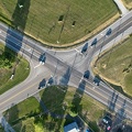
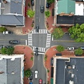
![Intersection of Baltimore Street, Frederick Street, Carlisle Street, and Broadway [01]](../../../i/upload/2024/07/19/20240719213155-1e21226a-sq.jpg)
![Intersection of Baltimore Street, Frederick Street, Carlisle Street, and Broadway [02]](../../../i/upload/2024/07/19/20240719213200-60dd65d6-sq.jpg)


![Downtown Lititz, Pennsylvania [01]](../../../i/upload/2024/07/19/20240719213351-5903babd-sq.jpg)
![Downtown Lititz, Pennsylvania [02]](../../../i/upload/2024/07/19/20240719213356-2c31fa17-sq.jpg)
![Downtown Lititz, Pennsylvania [03]](../../../i/upload/2024/07/19/20240719213401-26c489c3-sq.jpg)
![Montgomery Village, facing approximately west [03]](../../../i/upload/2024/07/20/20240720014535-43915a8f-sq.jpg)
![Montgomery Village, facing approximately west [04]](../../../i/upload/2024/07/20/20240720014545-c32fb66e-sq.jpg)
![Picton of Birlstone [01]](../../../i/upload/2024/07/20/20240720014557-458fdd1e-sq.jpg)
![Picton of Birlstone [02]](../../../i/upload/2024/07/20/20240720014602-7b63dd35-sq.jpg)
![Madison Hotel [01]](../../../i/upload/2024/07/20/20240720014902-ccc903c3-sq.jpg)
![Madison Hotel [02]](../../../i/upload/2024/07/20/20240720015507-3572d677-sq.jpg)
![Atlantic City from Pacific and MLK, facing east [01]](../../../i/upload/2024/07/20/20240720015517-fbb883e1-sq.jpg)
![Atlantic City from Pacific and MLK, facing east [02]](../../../i/upload/2024/07/20/20240720015522-ed55cdc5-sq.jpg)
![Downtown Chambersburg, Pennsylvania [01]](../../../i/upload/2024/07/20/20240720015745-02a849ae-sq.jpg)
![Downtown Chambersburg, Pennsylvania [02]](../../../i/upload/2024/07/20/20240720015750-22acaec9-sq.jpg)
![Downtown Chambersburg, Pennsylvania [03]](../../../i/upload/2024/07/20/20240720015754-907ba1e7-sq.jpg)

![Aerial view of Lakeforest Mall [01]](../../../i/upload/2024/07/20/20240720020321-c52f2b0e-sq.jpg)
![Aerial view of Lakeforest Mall [13]](../../../i/upload/2024/07/20/20240720020326-a6c28365-sq.jpg)
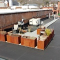
![Roof of 100 Lakeforest Boulevard [01]](../../../i/upload/2024/07/20/20240720020331-daa31706-sq.jpg)
![Roof of 100 Lakeforest Boulevard [02]](../../../i/upload/2024/07/20/20240720020337-a2fc18d7-sq.jpg)
![Aerial view of Lakeforest Mall [10]](../../../i/upload/2024/07/20/20240720020409-e964a5c4-sq.jpg)
![Parking lot lighting at Lakeforest Mall [02]](../../../i/upload/2024/07/20/20240720020415-311abe47-sq.jpg)
![Aerial view of Lakeforest Mall [16]](../../../i/upload/2024/07/20/20240720020421-b78f47aa-sq.jpg)

![Montgomery Village Plaza [02]](../../../i/upload/2024/07/20/20240720020443-a6afdd82-sq.jpg)
![Aerial view of Lakeforest Mall [09]](../../../i/upload/2024/07/20/20240720020448-83319013-sq.jpg)
![Aerial view of Lakeforest Mall [04]](../../../i/upload/2024/07/20/20240720020453-e2e1fa3a-sq.jpg)
![Aerial view of Lakeforest Mall [06]](../../../i/upload/2024/07/20/20240720020459-46207601-sq.jpg)
![Aerial view of Lakeforest Mall [11]](../../../i/upload/2024/07/20/20240720020515-36e119ea-sq.jpg)
![Roof of 100 Lakeforest Boulevard [03]](../../../i/upload/2024/07/20/20240720020519-c7df3877-sq.jpg)
![Montgomery Village Plaza [01]](../../../i/upload/2024/07/20/20240720020525-e4e1aea0-sq.jpg)
![Aerial view of Lakeforest Mall [02]](../../../i/upload/2024/07/20/20240720020539-01b5b3df-sq.jpg)
![Aerial view of Lakeforest Mall [05]](../../../i/upload/2024/07/20/20240720020545-b03d2ee4-sq.jpg)
![Aerial view of Lakeforest Mall [07]](../../../i/upload/2024/07/20/20240720020550-95246adb-sq.jpg)
![Aerial view of Lakeforest Mall [12]](../../../i/upload/2024/07/20/20240720020557-4e4a8288-sq.jpg)
![Parking lot lighting at Lakeforest Mall [01]](../../../i/upload/2024/07/20/20240720020602-5bbac3ec-sq.jpg)
![Aerial view of Lakeforest Mall [17]](../../../i/upload/2024/07/20/20240720020607-2a6dfa0e-sq.jpg)
![Aerial view of Lakeforest Mall [15]](../../../i/upload/2024/07/20/20240720020614-c41761c6-sq.jpg)
![Aerial view of Lakeforest Mall [03]](../../../i/upload/2024/07/20/20240720020645-9ef16a83-sq.jpg)
![Aerial view of Lakeforest Mall [08]](../../../i/upload/2024/07/20/20240720020651-932f7b96-sq.jpg)

![Aerial view of Lakeforest Mall [14]](../../../i/upload/2024/07/20/20240720020702-8ebc2d0a-sq.jpg)

![Former Waynesboro landfill [05]](../../../i/upload/2024/07/20/20240720022052-404098bb-sq.jpg)
![Former Waynesboro landfill [06]](../../../i/upload/2024/07/20/20240720022103-94f9d9c0-sq.jpg)

![View from the former Waynesboro landfill site [01]](../../../i/upload/2024/07/20/20240720022125-9939a1e4-sq.jpg)
![View of Waynesboro, Virginia from above Waynesboro Town Center shopping center [03]](../../../i/upload/2024/07/20/20240720022141-14db0e51-sq.jpg)
![Former Waynesboro landfill [01]](../../../i/upload/2024/07/20/20240720022152-d28a5b47-sq.jpg)
![Former Waynesboro landfill [02]](../../../i/upload/2024/07/20/20240720022157-bd554d77-sq.jpg)
![View from the former Waynesboro landfill site [02]](../../../i/upload/2024/07/20/20240720022202-6dbdc9cd-sq.jpg)
![View of Waynesboro, Virginia from above Waynesboro Town Center shopping center [01]](../../../i/upload/2024/07/20/20240720022218-a2b43c3a-sq.jpg)
![View of Waynesboro, Virginia from above Waynesboro Town Center shopping center [04]](../../../i/upload/2024/07/20/20240720022223-952ce9d3-sq.jpg)
![Former Waynesboro landfill [07]](../../../i/upload/2024/07/20/20240720022235-0b076c4d-sq.jpg)
![Former Waynesboro landfill [04]](../../../i/upload/2024/07/20/20240720022246-d1709cd4-sq.jpg)
![Former Waynesboro landfill [03]](../../../i/upload/2024/07/20/20240720022301-95eea6ae-sq.jpg)
![View of Waynesboro, Virginia from above Waynesboro Town Center shopping center [02]](../../../i/upload/2024/07/20/20240720022311-1d27171b-sq.jpg)
![Aerial view of downtown Petersburg, Virginia [04]](../../../i/upload/2024/07/20/20240720091856-35107304-sq.jpg)
![Sam's Club in Colonial Heights, Virginia [01]](../../../i/upload/2024/07/20/20240720092154-32514302-sq.jpg)
![Sam's Club in Colonial Heights, Virginia [02]](../../../i/upload/2024/07/20/20240720092234-97ed2aed-sq.jpg)
![Church Hill neighborhood [01]](../../../i/upload/2024/07/20/20240720092724-5ad8079d-sq.jpg)
![Church Hill neighborhood [02]](../../../i/upload/2024/07/20/20240720092729-c1c95489-sq.jpg)

![Former Waynesboro landfill [14]](../../../i/upload/2024/07/20/20240720093828-02ad7faf-sq.jpg)
![Former Waynesboro landfill [13]](../../../i/upload/2024/07/20/20240720093833-a61587fb-sq.jpg)
![Former Waynesboro landfill [12]](../../../i/upload/2024/07/20/20240720093837-0bdc45c2-sq.jpg)
![Former Waynesboro landfill [11]](../../../i/upload/2024/07/20/20240720093841-016077c0-sq.jpg)
![Former Waynesboro landfill [10]](../../../i/upload/2024/07/20/20240720093846-8d8a5d2f-sq.jpg)
![View from the former Waynesboro landfill site [03]](../../../i/upload/2024/07/20/20240720093850-16fb4945-sq.jpg)
![Former Waynesboro landfill [09]](../../../i/upload/2024/07/20/20240720093855-fe2b3370-sq.jpg)
![Former Waynesboro landfill [08]](../../../i/upload/2024/07/20/20240720093859-e02bc883-sq.jpg)
![Stuarts Draft, Virginia above Wayne Avenue [02]](../../../i/upload/2024/07/20/20240720094514-88dd2f1e-sq.jpg)
![Stuarts Draft, Virginia above Wayne Avenue [01]](../../../i/upload/2024/07/20/20240720094536-55029349-sq.jpg)
![Stuarts Draft, Virginia above Wayne Avenue [03]](../../../i/upload/2024/07/20/20240720094705-d02b94dc-sq.jpg)
![Stuarts Draft, Virginia above Wayne Avenue [05]](../../../i/upload/2024/07/20/20240720094711-10b1bf16-sq.jpg)
![Staunton Mall demolition progress [01]](../../../i/upload/2024/07/20/20240720094721-3ee75140-sq.jpg)
![Stuarts Draft, Virginia above Wayne Avenue [04]](../../../i/upload/2024/07/20/20240720094817-ef62e5b8-sq.jpg)
![Staunton Mall demolition progress [02]](../../../i/upload/2024/07/20/20240720094834-10815454-sq.jpg)
![Staunton Mall demolition progress [03]](../../../i/upload/2024/07/20/20240720094856-469c8a58-sq.jpg)
![Staunton Mall demolition progress [04]](../../../i/upload/2024/07/20/20240720094910-4d40fd8d-sq.jpg)
![Staunton Mall demolition progress [05]](../../../i/upload/2024/07/20/20240720094926-e55c77ac-sq.jpg)
![Staunton Mall demolition progress [06]](../../../i/upload/2024/07/20/20240720094937-ecc4de7d-sq.jpg)
![Staunton Mall demolition progress [07]](../../../i/upload/2024/07/20/20240720094948-1bc034f4-sq.jpg)
![Staunton Mall demolition progress [08]](../../../i/upload/2024/07/20/20240720094958-ee15f940-sq.jpg)
![Staunton Mall demolition progress [09]](../../../i/upload/2024/07/20/20240720095008-f0672151-sq.jpg)
![Staunton Mall demolition progress [10]](../../../i/upload/2024/07/20/20240720095013-6a523428-sq.jpg)
![Staunton Mall demolition progress [11]](../../../i/upload/2024/07/20/20240720095020-69c6479f-sq.jpg)
![Staunton Mall demolition progress [12]](../../../i/upload/2024/07/20/20240720095025-0e8f8a28-sq.jpg)
![Staunton Mall demolition progress [13]](../../../i/upload/2024/07/20/20240720095030-36861678-sq.jpg)
![Staunton Mall demolition progress [14]](../../../i/upload/2024/07/20/20240720095035-5b83b77b-sq.jpg)
![Staunton Mall demolition progress [15]](../../../i/upload/2024/07/20/20240720095041-5d83cc15-sq.jpg)
![Staunton Mall demolition progress [16]](../../../i/upload/2024/07/20/20240720095045-65b25eae-sq.jpg)
![Staunton Mall demolition progress [17]](../../../i/upload/2024/07/20/20240720095051-cb7a3ea4-sq.jpg)
![Staunton Mall demolition progress [18]](../../../i/upload/2024/07/20/20240720095056-3de94bf3-sq.jpg)
![Staunton Mall demolition progress [19]](../../../i/upload/2024/07/20/20240720095101-dff03ab4-sq.jpg)
![Ravenglass Way [07]](../../../i/upload/2024/07/20/20240720095503-d67a39a0-sq.jpg)
![Ravenglass Way [09]](../../../i/upload/2024/07/20/20240720095518-d5c71399-sq.jpg)
![Ravenglass Way [08]](../../../i/upload/2024/07/20/20240720095523-39780d00-sq.jpg)

![Delaware River between Camden and Philadelphia [05]](../../../i/upload/2024/07/20/20240720102512-379be749-sq.jpg)
![Aerial view of Pennsville Township, New Jersey [02]](../../../i/upload/2024/07/20/20240720103102-6366e404-sq.jpg)
![Aerial view of Pennsville Township, New Jersey [01]](../../../i/upload/2024/07/20/20240720103107-bd3ed35a-sq.jpg)
![Staunton Mall demolition progress, August 2022 [02]](../../../i/upload/2024/07/20/20240720103356-b27f4101-sq.jpg)
![Staunton Mall demolition progress, August 2022 [01]](../../../i/upload/2024/07/20/20240720103402-3a23c639-sq.jpg)
![Forest Springs Estates [01]](../../../i/upload/2024/07/20/20240720103408-ac9f7d40-sq.jpg)
![Staunton Mall demolition progress, August 2022 [05]](../../../i/upload/2024/07/20/20240720103413-006b5b9d-sq.jpg)
![Staunton Mall demolition progress, August 2022 [04]](../../../i/upload/2024/07/20/20240720103520-fc836ca1-sq.jpg)
![Staunton Mall demolition progress, August 2022 [10]](../../../i/upload/2024/07/20/20240720103526-de4ba6ec-sq.jpg)
![Staunton Mall demolition progress, August 2022 [03]](../../../i/upload/2024/07/20/20240720103548-fa9fb8c0-sq.jpg)
![Staunton Mall demolition progress, August 2022 [06]](../../../i/upload/2024/07/20/20240720103554-5a2e0531-sq.jpg)
![Staunton Mall demolition progress, August 2022 [07]](../../../i/upload/2024/07/20/20240720103559-6ec9e6b4-sq.jpg)
![Staunton Mall demolition progress, August 2022 [08]](../../../i/upload/2024/07/20/20240720103605-44fc1f1f-sq.jpg)
![Staunton Mall demolition progress, August 2022 [09]](../../../i/upload/2024/07/20/20240720103611-1ec0bd0b-sq.jpg)
![Staunton Mall demolition progress, August 2022 [11]](../../../i/upload/2024/07/20/20240720103617-604bf858-sq.jpg)
![Forest Springs Estates [02]](../../../i/upload/2024/07/20/20240720103645-80215d0c-sq.jpg)
![Forest Springs Estates [03]](../../../i/upload/2024/07/20/20240720103650-60296a18-sq.jpg)
![Forest Springs Estates [04]](../../../i/upload/2024/07/20/20240720103655-f8465d58-sq.jpg)
![Forest Springs Estates [05]](../../../i/upload/2024/07/20/20240720103700-12ed86ac-sq.jpg)
![Forest Springs Estates [06]](../../../i/upload/2024/07/20/20240720103705-68728b22-sq.jpg)
![Forest Springs Estates [07]](../../../i/upload/2024/07/20/20240720103710-4e810037-sq.jpg)
![Forest Springs Estates [08]](../../../i/upload/2024/07/20/20240720103715-d25d2920-sq.jpg)
![Forest Springs Estates [09]](../../../i/upload/2024/07/20/20240720103720-56045695-sq.jpg)
![Forest Springs Estates [10]](../../../i/upload/2024/07/20/20240720103726-e7eeb2c5-sq.jpg)

![Aerial view of Shenandoah Acres [01]](../../../i/upload/2024/07/20/20240720103740-ebc9c8eb-sq.jpg)
![Aerial view of Shenandoah Acres [02]](../../../i/upload/2024/07/20/20240720103746-be0c8296-sq.jpg)
![Aerial view of Edge Hill Cemetery [02]](../../../i/upload/2024/07/20/20240720103934-2000c9d8-sq.jpg)
![Aerial view of Edge Hill Cemetery [01]](../../../i/upload/2024/07/20/20240720104003-b256f486-sq.jpg)
![Southern end of Ocean City, Maryland [02]](../../../i/upload/2024/07/20/20240720104233-1cb3b6b7-sq.jpg)
![Southern end of Ocean City, Maryland [01]](../../../i/upload/2024/07/20/20240720104249-e7bc02d7-sq.jpg)

![Ocean City from 94th Street, facing north [01]](../../../i/upload/2024/07/20/20240720104406-80df0a79-sq.jpg)
![Ocean City from 94th Street, facing north [02]](../../../i/upload/2024/07/20/20240720104427-c73095ad-sq.jpg)
![DJI Air 2S in a parking area in Ocean City, Maryland [02]](../../../i/upload/2024/07/20/20240720104432-22a10827-sq.jpg)
![Ocean City from 94th Street, facing north [03]](../../../i/upload/2024/07/20/20240720104448-80806e9c-sq.jpg)
![DJI Air 2S in a parking area in Ocean City, Maryland [01]](../../../i/upload/2024/07/20/20240720104453-dcac5ae8-sq.jpg)
![Ocean City from 94th Street, facing south [01]](../../../i/upload/2024/07/20/20240720104509-718c78fb-sq.jpg)
![Ocean City from 94th Street, facing south [02]](../../../i/upload/2024/07/20/20240720104525-1dff6c8d-sq.jpg)
![Verona, Virginia over Mill Place Commerce Park [01]](../../../i/upload/2024/07/20/20240720110653-ef33b991-sq.jpg)
![Verona, Virginia over Mill Place Commerce Park [02]](../../../i/upload/2024/07/20/20240720110708-9b94d246-sq.jpg)
![Verona, Virginia over Mill Place Commerce Park [03]](../../../i/upload/2024/07/20/20240720110718-2e216a1d-sq.jpg)
![Verona, Virginia over Mill Place Commerce Park [04]](../../../i/upload/2024/07/20/20240720110729-83e0c1ca-sq.jpg)
![Verona, Virginia over Mill Place Commerce Park [05]](../../../i/upload/2024/07/20/20240720110734-c309d24d-sq.jpg)

![Aerial view of downtown Crossville, Tennessee [01]](../../../i/upload/2024/07/20/20240720113721-1bd631e7-sq.jpg)
![Aerial view of downtown Crossville, Tennessee [02]](../../../i/upload/2024/07/20/20240720113738-e7992a54-sq.jpg)
![Aerial view of downtown Crossville, Tennessee [03]](../../../i/upload/2024/07/20/20240720113748-d1062940-sq.jpg)
![Aerial view of the Sunsphere [01]](../../../i/upload/2024/07/20/20240720114014-b8be4381-sq.jpg)
![Aerial view of the Sunsphere [02]](../../../i/upload/2024/07/20/20240720114245-bc9c2b75-sq.jpg)
![Aerial view of the Sunsphere [03]](../../../i/upload/2024/07/20/20240720114300-c561f446-sq.jpg)
![Aerial view of the Sunsphere [04]](../../../i/upload/2024/07/20/20240720114327-e4081c64-sq.jpg)
![Aerial view of the Sunsphere [05]](../../../i/upload/2024/07/20/20240720114353-c0fa4eaf-sq.jpg)
![Aerial view of the Sunsphere [06]](../../../i/upload/2024/07/20/20240720114415-c4319760-sq.jpg)
![Aerial view of the Sunsphere [07]](../../../i/upload/2024/07/20/20240720114455-4f8f5fb4-sq.jpg)
![Aerial view of downtown Knoxville [01]](../../../i/upload/2024/07/20/20240720114522-2fed5282-sq.jpg)
![Aerial view of downtown Knoxville [02]](../../../i/upload/2024/07/20/20240720114531-474df7df-sq.jpg)
![Aerial view of downtown Knoxville [03]](../../../i/upload/2024/07/20/20240720114541-1d95d752-sq.jpg)
![Aerial view of downtown Knoxville [04]](../../../i/upload/2024/07/20/20240720114552-9e0ead0f-sq.jpg)
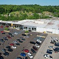
![Aerial view of Tanglewood Mall [04]](../../../i/upload/2024/07/20/20240720121557-c1e4d0fd-sq.jpg)
![House in Belmont [01]](../../../i/upload/2024/07/20/20240720121631-c3e23ae1-sq.jpg)
![Aerial view of Tanglewood Mall [02]](../../../i/upload/2024/07/20/20240720121659-95a61a41-sq.jpg)
![Aerial view of Tanglewood Mall [03]](../../../i/upload/2024/07/20/20240720121705-b1d8817c-sq.jpg)
![Aerial view of Tanglewood Mall [01]](../../../i/upload/2024/07/20/20240720121710-b91105e0-sq.jpg)
![House in Belmont [02]](../../../i/upload/2024/07/20/20240720121752-e4abc76f-sq.jpg)
![House in Belmont [03]](../../../i/upload/2024/07/20/20240720121814-c2af82f0-sq.jpg)
![House in Belmont [04]](../../../i/upload/2024/07/20/20240720121849-d834dd26-sq.jpg)
![DoubleTree Hotel in Gaithersburg, Maryland [01]](../../../i/upload/2024/07/20/20240720122704-5183aec2-sq.jpg)
![DoubleTree Hotel in Gaithersburg, Maryland [02]](../../../i/upload/2024/07/20/20240720122710-90dd60cf-sq.jpg)
![DoubleTree Hotel in Gaithersburg, Maryland [03]](../../../i/upload/2024/07/20/20240720122715-3ca675b9-sq.jpg)
![Mountains near Cashtown, Pennsylvania [01]](../../../i/upload/2024/07/20/20240720151845-6b49a240-sq.jpg)
![Mountains near Cashtown, Pennsylvania [02]](../../../i/upload/2024/07/20/20240720151852-1fb730a3-sq.jpg)

![Field off of Buchanan Valley Road [01]](../../../i/upload/2024/07/20/20240720151904-0d791d12-sq.jpg)
![Field off of Buchanan Valley Road [02]](../../../i/upload/2024/07/20/20240720151916-e473a17f-sq.jpg)
![SS United States, May 2023 [17]](../../../i/upload/2024/07/20/20240720152203-fc9628ef-sq.jpg)
![SS United States, May 2023 [16]](../../../i/upload/2024/07/20/20240720152239-391eed06-sq.jpg)

![Snowy Mountain Lookout [02]](../../../i/upload/2024/07/20/20240720152552-b679c9e9-sq.jpg)
![Snowy Mountain Lookout [03]](../../../i/upload/2024/07/20/20240720152556-87abac54-sq.jpg)
![Snowy Mountain Lookout [04]](../../../i/upload/2024/07/20/20240720152559-85f0a643-sq.jpg)
![Snowy Mountain Lookout [05]](../../../i/upload/2024/07/20/20240720152603-975fe683-sq.jpg)
![Aerial view of Smithsburg, Maryland [01]](../../../i/upload/2024/07/20/20240720155756-7d354d6c-sq.jpg)
![Aerial view of Smithsburg, Maryland [02]](../../../i/upload/2024/07/20/20240720155800-cb15da92-sq.jpg)
![Aerial view of Smithsburg, Maryland [03]](../../../i/upload/2024/07/20/20240720155805-a9f3e7ed-sq.jpg)
![Aerial view of Interstate 70 Breezewood interchange [02]](../../../i/upload/2024/07/20/20240720155940-3bb47f5f-sq.jpg)
![Aerial view of Breezewood, Pennsylvania, May 2023 [04]](../../../i/upload/2024/07/20/20240720155944-8f8a6623-sq.jpg)
![Aerial view of Breezewood, Pennsylvania, May 2023 [10]](../../../i/upload/2024/07/20/20240720155949-83a44091-sq.jpg)
![Aerial view of Breezewood, Pennsylvania, May 2023 [08]](../../../i/upload/2024/07/20/20240720155958-63b65479-sq.jpg)
![Aerial view of Breezewood interchange for the Pennsylvania Turnpike [03]](../../../i/upload/2024/07/20/20240720160003-184a95a1-sq.jpg)
![Aerial view of Breezewood, Pennsylvania, May 2023 [01]](../../../i/upload/2024/07/20/20240720160008-4d52368a-sq.jpg)
![Aerial view of Breezewood, Pennsylvania, May 2023 [06]](../../../i/upload/2024/07/20/20240720160013-ca57d708-sq.jpg)
![Aerial view of Breezewood, Pennsylvania, May 2023 [02]](../../../i/upload/2024/07/20/20240720160018-4b6e07bf-sq.jpg)
![Aerial view of Breezewood, Pennsylvania, May 2023 [09]](../../../i/upload/2024/07/20/20240720160022-4b37e34b-sq.jpg)
![Aerial view of Breezewood interchange for the Pennsylvania Turnpike [01]](../../../i/upload/2024/07/20/20240720160031-be453ab5-sq.jpg)
![Aerial view of Interstate 70 Breezewood interchange [01]](../../../i/upload/2024/07/20/20240720160036-995b00e0-sq.jpg)

![Aerial view of Breezewood, Pennsylvania, May 2023 [05]](../../../i/upload/2024/07/20/20240720160044-7a0b5dab-sq.jpg)
![Rural King at Washington Crown Center [02]](../../../i/upload/2024/07/20/20240720160049-eb452523-sq.jpg)
![Main entrance to Washington Crown Center [01]](../../../i/upload/2024/07/20/20240720160126-680e5d61-sq.jpg)

![Former Kaufmann's/Macy's at Washington Crown Center [01]](../../../i/upload/2024/07/20/20240720160202-f4cbc7e9-sq.jpg)
![Rural King at Washington Crown Center [01]](../../../i/upload/2024/07/20/20240720160206-fcb0f10c-sq.jpg)
![Aerial view of Breezewood interchange for the Pennsylvania Turnpike [02]](../../../i/upload/2024/07/20/20240720160211-2048dec3-sq.jpg)
![Aerial view of Breezewood, Pennsylvania, May 2023 [03]](../../../i/upload/2024/07/20/20240720160215-e2569c9a-sq.jpg)
![Aerial view of Breezewood, Pennsylvania, May 2023 [07]](../../../i/upload/2024/07/20/20240720160220-bc205056-sq.jpg)
![Main entrance to Washington Crown Center [02]](../../../i/upload/2024/07/20/20240720160253-35d6a588-sq.jpg)
![Former Kaufmann's/Macy's at Washington Crown Center [02]](../../../i/upload/2024/07/20/20240720160308-f5621a57-sq.jpg)
![Aerial view of Washington Crown Center [02]](../../../i/upload/2024/07/20/20240720160405-d2a90c79-sq.jpg)
![Aerial view of Washington Crown Center [01]](../../../i/upload/2024/07/20/20240720160409-64b36ab7-sq.jpg)
![Aerial view of Washington Crown Center [03]](../../../i/upload/2024/07/20/20240720160414-2f9471d0-sq.jpg)
![Aerial view of Washington Crown Center [04]](../../../i/upload/2024/07/20/20240720160418-08aa016b-sq.jpg)
![Aerial view of Washington Crown Center [05]](../../../i/upload/2024/07/20/20240720160423-c93958b0-sq.jpg)
![Aerial view of Washington Crown Center [06]](../../../i/upload/2024/07/20/20240720160427-e5b6d800-sq.jpg)
![Aerial view of Washington Crown Center [08]](../../../i/upload/2024/07/20/20240720160431-1e79fd3f-sq.jpg)
![Aerial view of Washington Crown Center [07]](../../../i/upload/2024/07/20/20240720160435-a3768c01-sq.jpg)
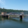
![Point State Park [03]](../../../i/upload/2024/07/20/20240720160819-8b6d68d8-sq.jpg)
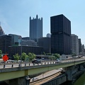
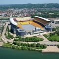
![Aerial view of downtown Pittsburgh [02]](../../../i/upload/2024/07/20/20240720160827-b3b76350-sq.jpg)
![Point State Park [02]](../../../i/upload/2024/07/20/20240720160835-290aa4ba-sq.jpg)

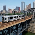
![Fort Pitt Bridge [01]](../../../i/upload/2024/07/20/20240720160848-94f396df-sq.jpg)
![Aerial view of downtown Pittsburgh [01]](../../../i/upload/2024/07/20/20240720160852-35325d56-sq.jpg)
![Fort Pitt Bridge [02]](../../../i/upload/2024/07/20/20240720160856-8c4cf883-sq.jpg)
![Oakland neighborhood in Pittsburgh [02]](../../../i/upload/2024/07/20/20240720160905-e13411a5-sq.jpg)
![Point State Park [01]](../../../i/upload/2024/07/20/20240720160921-2109340f-sq.jpg)
![Aerial view of East Liberty Presbyterian Church [02]](../../../i/upload/2024/07/20/20240720160925-113a640a-sq.jpg)
![Aerial view of East Liberty Presbyterian Church [04]](../../../i/upload/2024/07/20/20240720160929-16fd7e34-sq.jpg)
![Aerial view of East Liberty Presbyterian Church [06]](../../../i/upload/2024/07/20/20240720160933-a6419b30-sq.jpg)
![Aerial view of East Liberty Presbyterian Church [11]](../../../i/upload/2024/07/20/20240720160938-8f5a529e-sq.jpg)
![Aerial view of East Liberty Presbyterian Church [12]](../../../i/upload/2024/07/20/20240720160942-7f513a92-sq.jpg)
![Aerial view of East Liberty Presbyterian Church [20]](../../../i/upload/2024/07/20/20240720160946-69e2d66b-sq.jpg)
![Aerial view of East Liberty Presbyterian Church [23]](../../../i/upload/2024/07/20/20240720160950-71281329-sq.jpg)
![Aerial view of East Liberty Presbyterian Church [10]](../../../i/upload/2024/07/20/20240720161000-0209603e-sq.jpg)
![Aerial view of East Liberty Presbyterian Church [13]](../../../i/upload/2024/07/20/20240720161004-3f71162c-sq.jpg)
![Aerial view of East Liberty Presbyterian Church [18]](../../../i/upload/2024/07/20/20240720161008-f23a38fa-sq.jpg)
![Aerial view of East Liberty Presbyterian Church [21]](../../../i/upload/2024/07/20/20240720161013-99e0adfe-sq.jpg)
![Aerial view of East Liberty Presbyterian Church [08]](../../../i/upload/2024/07/20/20240720161021-d331e071-sq.jpg)
![Aerial view of East Liberty Presbyterian Church [17]](../../../i/upload/2024/07/20/20240720161026-6ad4630b-sq.jpg)
![Aerial view of East Liberty Presbyterian Church [19]](../../../i/upload/2024/07/20/20240720161030-5a181c2c-sq.jpg)
![Aerial view of East Liberty Presbyterian Church [15]](../../../i/upload/2024/07/20/20240720161034-6b35469d-sq.jpg)
![Aerial view of the Cathedral of Learning [01]](../../../i/upload/2024/07/20/20240720161042-d85d5a86-sq.jpg)
![Fort Duquesne Bridge [01]](../../../i/upload/2024/07/20/20240720161050-098d3868-sq.jpg)
![Century III Mall [01]](../../../i/upload/2024/07/20/20240720161058-7f6bde94-sq.jpg)
![Aerial view of East Liberty Presbyterian Church [03]](../../../i/upload/2024/07/20/20240720161105-e2137cac-sq.jpg)
![Aerial view of East Liberty Presbyterian Church [05]](../../../i/upload/2024/07/20/20240720161109-bae1d6d3-sq.jpg)
![Aerial view of East Liberty Presbyterian Church [22]](../../../i/upload/2024/07/20/20240720161113-6de998b7-sq.jpg)
![Aerial view of East Liberty Presbyterian Church [01]](../../../i/upload/2024/07/20/20240720161117-a77350d6-sq.jpg)
![Aerial view of East Liberty Presbyterian Church [14]](../../../i/upload/2024/07/20/20240720161121-2f08111b-sq.jpg)
![Aerial view of East Liberty Presbyterian Church [16]](../../../i/upload/2024/07/20/20240720161125-66b55a4b-sq.jpg)
![Aerial view of East Liberty Presbyterian Church [09]](../../../i/upload/2024/07/20/20240720161129-5fb4069e-sq.jpg)
![Aerial view of East Liberty Presbyterian Church [07]](../../../i/upload/2024/07/20/20240720161134-5af0a002-sq.jpg)
![Century III Mall [02]](../../../i/upload/2024/07/20/20240720161141-6066f100-sq.jpg)
![Aerial view of the Cathedral of Learning [02]](../../../i/upload/2024/07/20/20240720161202-cd6b3ac5-sq.jpg)
![Oakland neighborhood in Pittsburgh [01]](../../../i/upload/2024/07/20/20240720161207-8545eba5-sq.jpg)
![Aerial view of the Cathedral of Learning [03]](../../../i/upload/2024/07/20/20240720161219-7d7180de-sq.jpg)
![Century III Mall [03]](../../../i/upload/2024/07/20/20240720161231-2a524ea7-sq.jpg)
![Century III Mall [04]](../../../i/upload/2024/07/20/20240720161248-65f75887-sq.jpg)
![Aerial view of the Cathedral of Learning [04]](../../../i/upload/2024/07/20/20240720161311-ac0cf271-sq.jpg)
![Century III Mall [05]](../../../i/upload/2024/07/20/20240720161319-452cd7ca-sq.jpg)
![Aerial view of the Cathedral of Learning [05]](../../../i/upload/2024/07/20/20240720161336-9b38bf69-sq.jpg)
![Century III Mall [06]](../../../i/upload/2024/07/20/20240720161348-da985438-sq.jpg)
![Aerial view of the Cathedral of Learning [06]](../../../i/upload/2024/07/20/20240720161352-ef9aff34-sq.jpg)
![Aerial view of the Cathedral of Learning [07]](../../../i/upload/2024/07/20/20240720161414-4b0c53ca-sq.jpg)

![Smoky conditions along I-95 [03]](../../../i/upload/2024/07/29/20240729110726-ebbb4d73-sq.jpg)
![Smoke over Baltimore [01]](../../../i/upload/2024/07/31/20240731143828-95bd632b-sq.jpg)
![Smoke over Baltimore [02]](../../../i/upload/2024/07/31/20240731143832-19f77318-sq.jpg)
![Smoke over Baltimore [03]](../../../i/upload/2024/07/31/20240731143837-692f8dc6-sq.jpg)
![Smoke over Baltimore [04]](../../../i/upload/2024/07/31/20240731143842-0834b574-sq.jpg)
![Smoke over Baltimore [05]](../../../i/upload/2024/07/31/20240731143848-1ea91103-sq.jpg)
![Smoke over Baltimore [06]](../../../i/upload/2024/07/31/20240731143853-8c09f298-sq.jpg)
![Smoke over Baltimore [07]](../../../i/upload/2024/07/31/20240731143858-b87324cb-sq.jpg)
![Smoke over Baltimore [08]](../../../i/upload/2024/07/31/20240731143904-d8053015-sq.jpg)
![Smoke over Baltimore [09]](../../../i/upload/2024/07/31/20240731143908-394c9c7a-sq.jpg)
![Smoke over Baltimore [10]](../../../i/upload/2024/07/31/20240731143913-c0023f80-sq.jpg)
![Smoke over Baltimore [11]](../../../i/upload/2024/07/31/20240731143917-72a4d164-sq.jpg)
![Smoke over Baltimore [12]](../../../i/upload/2024/07/31/20240731143922-f169836f-sq.jpg)
![Smoke over Baltimore [13]](../../../i/upload/2024/07/31/20240731143928-e8d821c4-sq.jpg)
![Smoke over Baltimore [14]](../../../i/upload/2024/07/31/20240731143932-d92eaa05-sq.jpg)
![Smoke over Baltimore [15]](../../../i/upload/2024/07/31/20240731143937-f18aaf4e-sq.jpg)
![Smoke over Baltimore [16]](../../../i/upload/2024/07/31/20240731143941-0ca37e1b-sq.jpg)
![Smoke over Baltimore [17]](../../../i/upload/2024/07/31/20240731143948-4f6c4ad2-sq.jpg)
![Smoke over Baltimore [18]](../../../i/upload/2024/07/31/20240731143952-bc67a7cf-sq.jpg)
![Smoke over Baltimore [19]](../../../i/upload/2024/07/31/20240731143956-ca74623b-sq.jpg)
![Smoke over Baltimore [20]](../../../i/upload/2024/07/31/20240731144000-b5aebcca-sq.jpg)
![Smoke over Baltimore [21]](../../../i/upload/2024/07/31/20240731144005-50aa3739-sq.jpg)
![Smoke over Baltimore [22]](../../../i/upload/2024/07/31/20240731144009-b0c2f0be-sq.jpg)
![Smoke over Baltimore [23]](../../../i/upload/2024/07/31/20240731144016-6e284cb4-sq.jpg)
![Smoke over Baltimore [24]](../../../i/upload/2024/07/31/20240731144020-ea42a34e-sq.jpg)
![Smoke over Baltimore [25]](../../../i/upload/2024/07/31/20240731144024-5ebedc8b-sq.jpg)
![Smoke over Baltimore [26]](../../../i/upload/2024/07/31/20240731144028-a95c3a02-sq.jpg)
![Smoke over Baltimore [27]](../../../i/upload/2024/07/31/20240731144032-a64f54e6-sq.jpg)
![Smoke over Baltimore [28]](../../../i/upload/2024/07/31/20240731144036-c150486b-sq.jpg)
![Smoke over Baltimore [29]](../../../i/upload/2024/07/31/20240731144043-53057fbc-sq.jpg)
![Smoke over Baltimore [30]](../../../i/upload/2024/07/31/20240731144047-51ca49f4-sq.jpg)
![Smoke over Baltimore [31]](../../../i/upload/2024/07/31/20240731144052-0effad86-sq.jpg)
![Smoke over Baltimore [32]](../../../i/upload/2024/07/31/20240731144057-7af6a721-sq.jpg)
![Smoke over Baltimore [33]](../../../i/upload/2024/07/31/20240731144101-4f4f83f2-sq.jpg)
![Smoke over Baltimore [34]](../../../i/upload/2024/07/31/20240731144105-253d3079-sq.jpg)
![Smoke over Baltimore [35]](../../../i/upload/2024/07/31/20240731144112-ff880802-sq.jpg)
![Smoke over Baltimore [36]](../../../i/upload/2024/07/31/20240731144116-1af825a7-sq.jpg)
![Smoke over Baltimore [37]](../../../i/upload/2024/07/31/20240731144120-6170e412-sq.jpg)
![Smoke over Baltimore [38]](../../../i/upload/2024/07/31/20240731144124-ca548be9-sq.jpg)
![Smoke over Baltimore [39]](../../../i/upload/2024/07/31/20240731144129-a90dbf61-sq.jpg)
![Smoke over Baltimore [40]](../../../i/upload/2024/07/31/20240731144133-8073fcc5-sq.jpg)
![Smoke over Baltimore [41]](../../../i/upload/2024/07/31/20240731144136-d3d8a3d8-sq.jpg)
![Smoke over Baltimore [42]](../../../i/upload/2024/07/31/20240731144140-fb7de82f-sq.jpg)
![Smoke over Baltimore [43]](../../../i/upload/2024/07/31/20240731144144-363848be-sq.jpg)
![Smoke over Baltimore [44]](../../../i/upload/2024/07/31/20240731144148-9c7c4db8-sq.jpg)
![Smoke over Baltimore [45]](../../../i/upload/2024/07/31/20240731144154-669c2fa8-sq.jpg)
![Smoke over Baltimore [46]](../../../i/upload/2024/07/31/20240731144200-b5669e2f-sq.jpg)
![Smoke over Baltimore [47]](../../../i/upload/2024/07/31/20240731144204-fe012b89-sq.jpg)
![Smoke over Baltimore [48]](../../../i/upload/2024/07/31/20240731144208-5c1a33e4-sq.jpg)
![Smoke over Baltimore [49]](../../../i/upload/2024/07/31/20240731144213-20085a76-sq.jpg)
![Smoke over Baltimore [50]](../../../i/upload/2024/07/31/20240731144220-547045ec-sq.jpg)
![Smoke over Baltimore [51]](../../../i/upload/2024/07/31/20240731144224-9113799c-sq.jpg)
![Smoke over Baltimore [52]](../../../i/upload/2024/07/31/20240731144229-7ab5fbb7-sq.jpg)
![Smoke over Baltimore [53]](../../../i/upload/2024/07/31/20240731144235-1111827e-sq.jpg)
![Smoke over Baltimore [54]](../../../i/upload/2024/07/31/20240731144243-fbffb542-sq.jpg)
![Smoke over Baltimore [55]](../../../i/upload/2024/07/31/20240731144250-206889fa-sq.jpg)
![Aerial view of downtown Fredericksburg [01]](../../../i/upload/2024/08/10/20240810113605-aeeec139-sq.jpg)
![Aerial view of downtown Fredericksburg [02]](../../../i/upload/2024/08/10/20240810113610-a8d79889-sq.jpg)
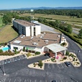
![Grand opening of Sheetz in Gaithersburg, Maryland [01]](../../../i/upload/2024/08/11/20240811100644-5ef825cb-sq.jpg)
![Grand opening of Sheetz in Gaithersburg, Maryland [02]](../../../i/upload/2024/08/11/20240811100652-c4a0afe2-sq.jpg)
![Grand opening of Sheetz in Gaithersburg, Maryland [03]](../../../i/upload/2024/08/11/20240811100659-3957865e-sq.jpg)
![Grand opening of Sheetz in Gaithersburg, Maryland [04]](../../../i/upload/2024/08/11/20240811100706-f9ce460e-sq.jpg)
![Grand opening of Sheetz in Gaithersburg, Maryland [05]](../../../i/upload/2024/08/11/20240811100712-5b1f8616-sq.jpg)
![Grand opening of Sheetz in Gaithersburg, Maryland [06]](../../../i/upload/2024/08/11/20240811100718-2671a2fc-sq.jpg)
![Grand opening of Sheetz in Gaithersburg, Maryland [07]](../../../i/upload/2024/08/11/20240811100725-640f2881-sq.jpg)
![Grand opening of Sheetz in Gaithersburg, Maryland [08]](../../../i/upload/2024/08/11/20240811100732-a7468fef-sq.jpg)
![Grand opening of Sheetz in Gaithersburg, Maryland [09]](../../../i/upload/2024/08/11/20240811100738-c9d46767-sq.jpg)
![Grand opening of Sheetz in Gaithersburg, Maryland [10]](../../../i/upload/2024/08/11/20240811100742-23c0000b-sq.jpg)
![Grand opening of Sheetz in Gaithersburg, Maryland [11]](../../../i/upload/2024/08/11/20240811100746-5cefa9c3-sq.jpg)
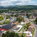
![Aerial view of downtown Staunton, Virginia [01]](../../../i/upload/2024/08/24/20240824104621-87f086a2-sq.jpg)
![Aerial view of downtown Staunton, Virginia [02]](../../../i/upload/2024/08/24/20240824104624-5fe809bd-sq.jpg)
![Aerial view of downtown Staunton, Virginia [03]](../../../i/upload/2024/08/24/20240824104631-e5b2dd3d-sq.jpg)
![Aerial view of downtown Staunton, Virginia [04]](../../../i/upload/2024/08/24/20240824104635-29b54f55-sq.jpg)
![Aerial view of downtown Staunton, Virginia [05]](../../../i/upload/2024/08/24/20240824104639-d3696cc9-sq.jpg)
![Aerial view of downtown Staunton, Virginia [06]](../../../i/upload/2024/08/24/20240824104643-1e970880-sq.jpg)
![Exit 225 on Interstate 81 [01]](../../../i/upload/2024/08/24/20240824104647-af96033b-sq.jpg)
![Exit 225 on Interstate 81 [02]](../../../i/upload/2024/08/24/20240824104650-f35998e0-sq.jpg)
![Exit 225 on Interstate 81 [03]](../../../i/upload/2024/08/24/20240824104656-4dd28daf-sq.jpg)
![Exit 225 on Interstate 81 [04]](../../../i/upload/2024/08/24/20240824104700-45b5b9b6-sq.jpg)


![Aerial view from Clark Street Beach, facing south [01]](../../../i/upload/2024/11/09/20241109111014-d364cdbf-sq.jpg)
![Aerial view from Clark Street Beach, facing south [02]](../../../i/upload/2024/11/09/20241109111017-9276cd78-sq.jpg)
![Aerial view from Clark Street Beach, facing south [03]](../../../i/upload/2024/11/09/20241109111021-2a94ef25-sq.jpg)
![Aerial view from Clark Street Beach, facing south [04]](../../../i/upload/2024/11/09/20241109111026-85a83874-sq.jpg)
![Aerial view from Clark Street Beach, facing south [05]](../../../i/upload/2024/11/09/20241109111030-e05630ba-sq.jpg)
![Evanston, Illinois from over Lake Michigan [01]](../../../i/upload/2024/11/09/20241109111034-667fc1be-sq.jpg)
![Evanston, Illinois from over Lake Michigan [02]](../../../i/upload/2024/11/09/20241109111037-b22de27b-sq.jpg)
![Evanston, Illinois from over Lake Michigan [03]](../../../i/upload/2024/11/09/20241109111043-a48d7f52-sq.jpg)

![Clark Street Beach [01]](../../../i/upload/2024/11/09/20241109111108-ba883fe6-sq.jpg)
![Clark Street Beach [02]](../../../i/upload/2024/11/09/20241109111115-aca79503-sq.jpg)
![Ravenglass Way [10]](../../../i/upload/2024/11/20/20241120093351-250cbe61-sq.jpg)
![Sunset over Montgomery Village [01]](../../../i/upload/2024/11/20/20241120093359-6e4a8f21-sq.jpg)
![Sunset over Montgomery Village [02]](../../../i/upload/2024/11/20/20241120093408-5c11a279-sq.jpg)
![Ravenglass Way [11]](../../../i/upload/2024/11/20/20241120095538-f7c081d2-sq.jpg)
![Ravenglass Way [12]](../../../i/upload/2024/11/20/20241120095547-36a4979e-sq.jpg)

![Interstate 81 near Verona, Virginia [01]](../../../i/upload/2024/11/28/20241128103749-b97fb29f-sq.jpg)
![Interstate 81 near Verona, Virginia [02]](../../../i/upload/2024/11/28/20241128103753-ff030609-sq.jpg)
![Interstate 81 near Verona, Virginia [03]](../../../i/upload/2024/11/28/20241128103757-213af6d5-sq.jpg)
![Interstate 81 near Verona, Virginia [04]](../../../i/upload/2024/11/28/20241128103802-c0bab98c-sq.jpg)
![Interstate 81 near Verona, Virginia [05]](../../../i/upload/2024/11/28/20241128103806-21947d95-sq.jpg)
![Wildfire in Wheatfield, Virginia [03]](../../../i/upload/2024/12/26/20241226113316-fc2f1e85-sq.jpg)
![Wildfire in Wheatfield, Virginia [04]](../../../i/upload/2024/12/26/20241226113325-158b68f2-sq.jpg)
![Wildfire in Wheatfield, Virginia [05]](../../../i/upload/2024/12/26/20241226113335-8685ba7b-sq.jpg)
![Wildfire in Wheatfield, Virginia [06]](../../../i/upload/2024/12/26/20241226113345-0e08706d-sq.jpg)
![Wildfire in Wheatfield, Virginia [07]](../../../i/upload/2024/12/26/20241226113355-bdc9fea6-sq.jpg)
![Wildfire in Wheatfield, Virginia [08]](../../../i/upload/2024/12/26/20241226113404-8540af70-sq.jpg)
![Wildfire in Wheatfield, Virginia [09]](../../../i/upload/2024/12/26/20241226113414-261ee473-sq.jpg)
![Wildfire in Wheatfield, Virginia [10]](../../../i/upload/2024/12/26/20241226113424-ef021110-sq.jpg)
![Wildfire in Wheatfield, Virginia [11]](../../../i/upload/2024/12/26/20241226113433-bbfde6c6-sq.jpg)
![Wildfire in Wheatfield, Virginia [12]](../../../i/upload/2024/12/26/20241226113443-8c6bc962-sq.jpg)
![Wildfire in Wheatfield, Virginia [13]](../../../i/upload/2024/12/26/20241226113455-f989b84b-sq.jpg)
![Wildfire in Wheatfield, Virginia [14]](../../../i/upload/2024/12/26/20241226113504-f310b6be-sq.jpg)
![Wildfire in Wheatfield, Virginia [15]](../../../i/upload/2024/12/26/20241226113515-58af561f-sq.jpg)
![Wildfire in Wheatfield, Virginia [16]](../../../i/upload/2024/12/26/20241226113524-b6ae32b2-sq.jpg)
![Wildfire in Wheatfield, Virginia [17]](../../../i/upload/2024/12/26/20241226113535-464ef6f3-sq.jpg)
![Wildfire in Wheatfield, Virginia [18]](../../../i/upload/2024/12/26/20241226113546-653ce2b4-sq.jpg)
![Wildfire in Wheatfield, Virginia [19]](../../../i/upload/2024/12/26/20241226113557-e900887b-sq.jpg)
![Wildfire in Wheatfield, Virginia [20]](../../../i/upload/2024/12/26/20241226113603-cc8e09d4-sq.jpg)
![Aerial view of Citadel Mall [01]](../../../i/upload/2025/01/12/20250112230817-79c4cc0e-sq.jpg)
![Aerial view of Citadel Mall [02]](../../../i/upload/2025/01/12/20250112230823-7e3c9721-sq.jpg)
![Aerial view of Citadel Mall [03]](../../../i/upload/2025/01/12/20250112230829-2055baff-sq.jpg)
![Aerial view of Citadel Mall [04]](../../../i/upload/2025/01/12/20250112230834-e1a63612-sq.jpg)
![Controlled burn at Awendaw Savanna [01]](../../../i/upload/2025/01/15/20250115001851-ef0bbae9-sq.jpg)
![Controlled burn at Awendaw Savanna [02]](../../../i/upload/2025/01/15/20250115001904-4206ce4c-sq.jpg)
![Controlled burn at Awendaw Savanna [03]](../../../i/upload/2025/01/15/20250115001911-3cf2c7e5-sq.jpg)
![Controlled burn at Awendaw Savanna [04]](../../../i/upload/2025/01/15/20250115001917-b4d868ee-sq.jpg)
![Controlled burn at Awendaw Savanna [05]](../../../i/upload/2025/01/15/20250115001923-4d921d31-sq.jpg)
![Controlled burn at Awendaw Savanna [06]](../../../i/upload/2025/01/15/20250115001930-f2a0840d-sq.jpg)
![Controlled burn at Awendaw Savanna [07]](../../../i/upload/2025/01/15/20250115001936-68b82844-sq.jpg)
![Aerial view of Myrtle Beach, South Carolina [01]](../../../i/upload/2025/01/16/20250116011517-f8bb6ab8-sq.jpg)
![Aerial view of Myrtle Beach, South Carolina [02]](../../../i/upload/2025/01/16/20250116011527-f000c002-sq.jpg)
![Aerial view of Myrtle Beach, South Carolina [03]](../../../i/upload/2025/01/16/20250116011535-e4909d01-sq.jpg)
![Aerial view of Myrtle Beach, South Carolina [04]](../../../i/upload/2025/01/16/20250116011543-c0352f82-sq.jpg)
![Aerial view of Myrtle Beach, South Carolina [05]](../../../i/upload/2025/01/16/20250116011549-fb2ac6b0-sq.jpg)
![Aerial view of Myrtle Beach, South Carolina [06]](../../../i/upload/2025/01/16/20250116011556-58eeb392-sq.jpg)
![Aerial view of Myrtle Beach, South Carolina [07]](../../../i/upload/2025/01/16/20250116011602-0271fcdd-sq.jpg)
![Aerial view of Myrtle Beach, South Carolina [08]](../../../i/upload/2025/01/16/20250116011610-80555640-sq.jpg)
![Aerial view of Myrtle Beach, South Carolina [09]](../../../i/upload/2025/01/16/20250116011616-86a3a1ed-sq.jpg)
![Aerial view of Myrtle Beach, South Carolina [10]](../../../i/upload/2025/01/16/20250116011622-c227f7d2-sq.jpg)
![Aerial view of Myrtle Beach, South Carolina [11]](../../../i/upload/2025/01/16/20250116011628-3f5529d7-sq.jpg)
![Aerial view of Myrtle Beach, South Carolina [12]](../../../i/upload/2025/01/16/20250116011635-e2f59869-sq.jpg)
![Aerial view of Myrtle Beach, South Carolina [13]](../../../i/upload/2025/01/16/20250116011642-eaad0007-sq.jpg)
![Aerial view of Myrtle Beach, South Carolina [14]](../../../i/upload/2025/01/16/20250116011649-2b82761b-sq.jpg)
![Aerial view of Myrtle Beach, South Carolina [15]](../../../i/upload/2025/01/16/20250116011655-ed58c149-sq.jpg)
![Aerial view of Myrtle Beach, South Carolina [16]](../../../i/upload/2025/01/16/20250116011701-1e30b28a-sq.jpg)
![Aerial view of Myrtle Beach, South Carolina [17]](../../../i/upload/2025/01/16/20250116011708-700a2aeb-sq.jpg)
![Aerial view of Myrtle Beach, South Carolina [18]](../../../i/upload/2025/01/16/20250116011716-7718fc67-sq.jpg)
![Aerial view of Myrtle Beach, South Carolina [19]](../../../i/upload/2025/01/16/20250116011723-729e4cea-sq.jpg)
![Aerial view of Myrtle Beach, South Carolina [20]](../../../i/upload/2025/01/16/20250116011730-cd564b26-sq.jpg)
![View over the ocean from Myrtle Beach, South Carolina [01]](../../../i/upload/2025/01/16/20250116011737-32868b23-sq.jpg)
![View over the ocean from Myrtle Beach, South Carolina [02]](../../../i/upload/2025/01/16/20250116011743-6fa086ad-sq.jpg)
![Birdsnest Lookout [01]](../../../i/upload/2025/02/17/20250217005755-4434f494-sq.jpg)
![Birdsnest Lookout [02]](../../../i/upload/2025/02/17/20250217005759-caf88839-sq.jpg)
![Birdsnest Lookout [03]](../../../i/upload/2025/02/17/20250217005804-343b9ffb-sq.jpg)
![Birdsnest Lookout [04]](../../../i/upload/2025/02/17/20250217005810-218c7f41-sq.jpg)
![Birdsnest Lookout [05]](../../../i/upload/2025/02/17/20250217005817-b3e6d468-sq.jpg)
![Birdsnest Lookout [06]](../../../i/upload/2025/02/17/20250217005823-259e9098-sq.jpg)
![DJI Air 3 in flight [01]](../../../i/upload/2025/02/18/20250218095302-6d80f3ec-sq.jpg)
![DJI Air 3 in flight [02]](../../../i/upload/2025/02/18/20250218095305-d9f6b829-sq.jpg)
Information
- Author
- Ben Schumin
- Copyright
- All Rights Reserved
- Created on
- Thursday 9 September 2021
- Dimensions
- 4000*2250
Powered by Piwigo