
Ben Schumin Photography Portfolio
Ben Schumin is a professional photographer who captures the intricacies of daily life.
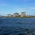
Hatteras Inlet, an estuary formed during a storm in 1846, which separates Hatteras and Ocracoke Islands.
![M/V Roanoke and M/V Floyd J. Lupton [02]](../../../../../i/upload/2024/07/17/20240717230519-2c47cb7c-sq.jpg)
![M/V Floyd J. Lupton approaching Hatteras Village [01]](../../../../../i/upload/2024/07/17/20240717230524-f2832a76-sq.jpg)
![M/V Floyd J. Lupton approaching Hatteras Village [02]](../../../../../i/upload/2024/07/17/20240717230527-65315b5f-sq.jpg)

![M/V Floyd J. Lupton approaching Hatteras ferry terminal [03]](../../../../../i/upload/2024/07/17/20240717230538-5be573eb-sq.jpg)
![M/V Floyd J. Lupton approaching Hatteras ferry terminal [04]](../../../../../i/upload/2024/07/17/20240717230542-edb2b71c-sq.jpg)
![Hatteras Inlet [01]](../../../../../i/upload/2024/07/19/20240719183319-792ed5eb-sq.jpg)
![Hatteras Inlet [02]](../../../../../i/upload/2024/07/19/20240719183323-85967645-sq.jpg)
![Hatteras Inlet [03]](../../../../../i/upload/2024/07/19/20240719183326-04a541a1-sq.jpg)
![Hatteras Inlet [04]](../../../../../i/upload/2024/07/19/20240719183330-8aed7ea3-sq.jpg)
![Hatteras Inlet [05]](../../../../../i/upload/2024/07/19/20240719183334-33da2c92-sq.jpg)
![Hatteras Inlet [06]](../../../../../i/upload/2024/07/19/20240719183338-27417fbb-sq.jpg)
![Hatteras Inlet [07]](../../../../../i/upload/2024/07/19/20240719183341-39404a98-sq.jpg)
![Hatteras Inlet [08]](../../../../../i/upload/2024/07/19/20240719183345-57383cae-sq.jpg)
![Hatteras Inlet [09]](../../../../../i/upload/2024/07/19/20240719183349-e2202944-sq.jpg)

![Family feeding sea gulls [01]](../../../../../i/upload/2024/07/19/20240719183356-bd7e8eae-sq.jpg)
![Wake of M/V W. Stanford White [01]](../../../../../i/upload/2024/07/19/20240719183400-13fae78c-sq.jpg)
![M/V Croatoan [01]](../../../../../i/upload/2024/07/19/20240719183405-0567e5a0-sq.jpg)
![M/V Croatoan [02]](../../../../../i/upload/2024/07/19/20240719183409-f5873914-sq.jpg)
![M/V Croatoan [03]](../../../../../i/upload/2024/07/19/20240719183412-d3f078d7-sq.jpg)
![Hatteras Inlet [10]](../../../../../i/upload/2024/07/19/20240719183417-ec449c1f-sq.jpg)

![Family feeding sea gulls [02]](../../../../../i/upload/2024/07/19/20240719183424-6e3fac8e-sq.jpg)
![Family feeding sea gulls [03]](../../../../../i/upload/2024/07/19/20240719183429-01d40e9a-sq.jpg)
![Hatteras Inlet [11]](../../../../../i/upload/2024/07/19/20240719183433-fe2db843-sq.jpg)

![Wake of M/V W. Stanford White [02]](../../../../../i/upload/2024/07/19/20240719183441-688897a2-sq.jpg)
![Hatteras Inlet [12]](../../../../../i/upload/2024/07/19/20240719183444-d6e175a3-sq.jpg)
![M/V Roanoke [01]](../../../../../i/upload/2024/07/19/20240719183448-591735fd-sq.jpg)
![M/V Roanoke [02]](../../../../../i/upload/2024/07/19/20240719183452-d215af49-sq.jpg)
![Hatteras Inlet [13]](../../../../../i/upload/2024/07/19/20240719183456-ac0e4b0b-sq.jpg)

![Ocracoke ferry terminal [01]](../../../../../i/upload/2024/07/19/20240719183550-74a32fa5-sq.jpg)
![Ocracoke ferry terminal [02]](../../../../../i/upload/2024/07/19/20240719183554-1e09fa8d-sq.jpg)
![Ocracoke ferry terminal [03]](../../../../../i/upload/2024/07/19/20240719183558-66a6ed43-sq.jpg)
![Ocracoke ferry terminal [04]](../../../../../i/upload/2024/07/19/20240719183603-aaa7b9fc-sq.jpg)
![Covered portion of main deck of the M/V W. Stanford White [01]](../../../../../i/upload/2024/07/19/20240719183607-e7b376e6-sq.jpg)
![Covered portion of main deck of the M/V W. Stanford White [02]](../../../../../i/upload/2024/07/19/20240719183611-c4c56e96-sq.jpg)
![Hatteras Inlet [14]](../../../../../i/upload/2024/07/19/20240719183615-1fe4af13-sq.jpg)
![Hatteras Inlet [15]](../../../../../i/upload/2024/07/19/20240719183619-6b867281-sq.jpg)
![Hatteras Inlet [16]](../../../../../i/upload/2024/07/19/20240719183623-06cce53f-sq.jpg)
![Wake of M/V W. Stanford White [03]](../../../../../i/upload/2024/07/19/20240719183627-d379105c-sq.jpg)

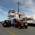
![Kia Soul on W. Stanford White [01]](../../../../../i/upload/2024/07/19/20240719183636-8f9193a2-sq.jpg)
![Kia Soul on W. Stanford White [02]](../../../../../i/upload/2024/07/19/20240719183640-638da5ba-sq.jpg)
![M/V Neuse [01]](../../../../../i/upload/2024/07/19/20240719183649-73b884d8-sq.jpg)
![M/V Neuse [02]](../../../../../i/upload/2024/07/19/20240719183653-052d6947-sq.jpg)
![M/V Roanoke and M/V Floyd J. Lupton [01]](../../../../../i/upload/2024/07/19/20240719183658-4e1410fe-sq.jpg)
Information
- Author
- Ben Schumin
- Copyright
- All Rights Reserved
- Created on
- Saturday 28 June 2014
- Dimensions
- 4000*3000
Powered by Piwigo