Ben Schumin Photography Portfolio
Ben Schumin is a professional photographer who captures the intricacies of daily life.

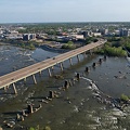
Aerial view of the James River and Kanawha Canal as it passes next to Brown's Island in Richmond, Virginia.
Information
- Author
- Ben Schumin
- Copyright
- All Rights Reserved
- Created on
- Saturday 16 April 2022
- Dimensions
- 5472*3648
Powered by Piwigo
![Markel Building [01]](../../../i/upload/2024/07/20/20240720092621-73af7da9-sq.jpg)
![Marquee at the Byrd Theatre [01]](../../../i/upload/2024/07/20/20240720092625-e9fff3f4-sq.jpg)
![Pyramid at Hollywood Cemetery [05]](../../../i/upload/2024/07/20/20240720092632-7942cc5a-sq.jpg)
![Markel Building [03]](../../../i/upload/2024/07/20/20240720092637-ebf5d627-sq.jpg)
![Sign for Krispy Kreme in Richmond, Virginia [01]](../../../i/upload/2024/07/20/20240720092641-f7684be0-sq.jpg)
![Sign for Krispy Kreme in Richmond, Virginia [02]](../../../i/upload/2024/07/20/20240720092647-7853f848-sq.jpg)
![Sign for Krispy Kreme in Richmond, Virginia [03]](../../../i/upload/2024/07/20/20240720092652-9fcb1a77-sq.jpg)
![Federal Reserve Bank building [03]](../../../i/upload/2024/07/20/20240720092657-131d1c93-sq.jpg)
![Federal Reserve Bank building [05]](../../../i/upload/2024/07/20/20240720092702-4d325559-sq.jpg)
![Skyline of Richmond, Virginia from over the James River [05]](../../../i/upload/2024/07/20/20240720092707-f5afb553-sq.jpg)
![CoStar Richmond office [02]](../../../i/upload/2024/07/20/20240720092713-e39a0b00-sq.jpg)
![MCV West Hospital [03]](../../../i/upload/2024/07/20/20240720092718-5ac4072d-sq.jpg)
![Church Hill neighborhood [01]](../../../i/upload/2024/07/20/20240720092724-5ad8079d-sq.jpg)
![Church Hill neighborhood [02]](../../../i/upload/2024/07/20/20240720092729-c1c95489-sq.jpg)
![Virginia State Capitol [04]](../../../i/upload/2024/07/20/20240720092734-346b0b61-sq.jpg)
![Virginia State Capitol [05]](../../../i/upload/2024/07/20/20240720092738-ec559eed-sq.jpg)
![Virginia State Capitol [06]](../../../i/upload/2024/07/20/20240720092743-da56c31f-sq.jpg)
![Virginia State Capitol [01]](../../../i/upload/2024/07/20/20240720092748-d810e51c-sq.jpg)
![James Monroe Building [03]](../../../i/upload/2024/07/20/20240720092752-9ab27160-sq.jpg)
![James Monroe Building [05]](../../../i/upload/2024/07/20/20240720092757-53c7f8ab-sq.jpg)
![Interstate 95 through downtown Richmond [04]](../../../i/upload/2024/07/20/20240720092805-0fe0379c-sq.jpg)


![Pyramid at Hollywood Cemetery [04]](../../../i/upload/2024/07/20/20240720092820-4c879a86-sq.jpg)
![Pyramid at Hollywood Cemetery [02]](../../../i/upload/2024/07/20/20240720092826-da5457d7-sq.jpg)
![Nissan Maxima with booted wheel [04]](../../../i/upload/2024/07/20/20240720092832-41ca2def-sq.jpg)
![Marquee at the Byrd Theatre [02]](../../../i/upload/2024/07/20/20240720092838-f92c4aed-sq.jpg)
![Pyramid at Hollywood Cemetery [01]](../../../i/upload/2024/07/20/20240720092844-2ebcec4c-sq.jpg)
![Pyramid at Hollywood Cemetery [03]](../../../i/upload/2024/07/20/20240720092849-3239bb0d-sq.jpg)
![CoStar Richmond office [01]](../../../i/upload/2024/07/20/20240720092854-506a1cc9-sq.jpg)
![MCV West Hospital [04]](../../../i/upload/2024/07/20/20240720092911-01e5e2db-sq.jpg)
![MCV West Hospital [05]](../../../i/upload/2024/07/20/20240720092917-ab4186f6-sq.jpg)
![Markel Building [05]](../../../i/upload/2024/07/20/20240720092922-7acf0459-sq.jpg)
![Markel Building [02]](../../../i/upload/2024/07/20/20240720092926-73b6d139-sq.jpg)
![Virginia State Capitol [02]](../../../i/upload/2024/07/20/20240720092932-4a0d9fff-sq.jpg)
![Clock tower on Richmond Main Street Station [03]](../../../i/upload/2024/07/20/20240720092936-746da014-sq.jpg)
![James Monroe Building [04]](../../../i/upload/2024/07/20/20240720092941-0cff135f-sq.jpg)
![Clock tower on Richmond Main Street Station [01]](../../../i/upload/2024/07/20/20240720092945-196e9f26-sq.jpg)


![Remains of Richmond and Petersburg Railroad Bridge [01]](../../../i/upload/2024/07/20/20240720093002-8c94d1f5-sq.jpg)
![Remains of Richmond and Petersburg Railroad Bridge [02]](../../../i/upload/2024/07/20/20240720093007-71c83e39-sq.jpg)
![Rapids on the James River [01]](../../../i/upload/2024/07/20/20240720093011-a767724e-sq.jpg)
![Interstate 95 through downtown Richmond [02]](../../../i/upload/2024/07/20/20240720093017-3f2bee68-sq.jpg)

![Markel Building [04]](../../../i/upload/2024/07/20/20240720093028-f1fe4b33-sq.jpg)
![Markel Building [06]](../../../i/upload/2024/07/20/20240720093033-899b433e-sq.jpg)
![Nissan Maxima with booted wheel [02]](../../../i/upload/2024/07/20/20240720093038-41040e0c-sq.jpg)
![Richmond skyline from the James River [02]](../../../i/upload/2024/07/20/20240720093043-34fedc56-sq.jpg)


![Richmond skyline from the James River [01]](../../../i/upload/2024/07/20/20240720093109-1fb6414b-sq.jpg)

![Nissan Maxima with booted wheel [01]](../../../i/upload/2024/07/20/20240720093119-16a6fd77-sq.jpg)
![Nissan Maxima with booted wheel [03]](../../../i/upload/2024/07/20/20240720093125-9bfc42b3-sq.jpg)

![Rapids on the James River [02]](../../../i/upload/2024/07/20/20240720093135-219eaaa3-sq.jpg)

![Skyline of Richmond, Virginia from over the James River [06]](../../../i/upload/2024/07/20/20240720093145-04645085-sq.jpg)
![MCV West Hospital [02]](../../../i/upload/2024/07/20/20240720093150-fbc67e6d-sq.jpg)
![Clock tower on Richmond Main Street Station [02]](../../../i/upload/2024/07/20/20240720093156-e35dc707-sq.jpg)
![Federal Reserve and Riverfront Plaza [02]](../../../i/upload/2024/07/20/20240720093206-5733a975-sq.jpg)
![Interstate 95 through downtown Richmond [03]](../../../i/upload/2024/07/20/20240720093212-fa09ec51-sq.jpg)
![Skyline of Richmond, Virginia from over the James River [01]](../../../i/upload/2024/07/20/20240720093217-566c68d2-sq.jpg)
![Skyline of Richmond, Virginia from over the James River [04]](../../../i/upload/2024/07/20/20240720093223-e807486f-sq.jpg)
![Skyline of Richmond, Virginia from over the James River [03]](../../../i/upload/2024/07/20/20240720093228-9fe867a4-sq.jpg)
![CoStar Richmond office [03]](../../../i/upload/2024/07/20/20240720093234-91d038ef-sq.jpg)
![CoStar Richmond office [04]](../../../i/upload/2024/07/20/20240720093239-a22e968a-sq.jpg)
![CoStar Richmond office [05]](../../../i/upload/2024/07/20/20240720093244-45f5b31e-sq.jpg)
![MCV West Hospital [01]](../../../i/upload/2024/07/20/20240720093249-fbf85dca-sq.jpg)
![Virginia State Capitol [03]](../../../i/upload/2024/07/20/20240720093254-debd9f67-sq.jpg)
![Virginia State Capitol [07]](../../../i/upload/2024/07/20/20240720093259-b6000969-sq.jpg)
![Federal Reserve Bank building [04]](../../../i/upload/2024/07/20/20240720093303-e8935b84-sq.jpg)

![James Monroe Building [02]](../../../i/upload/2024/07/20/20240720093314-e2c8ccea-sq.jpg)
![Interstate 95 through downtown Richmond [01]](../../../i/upload/2024/07/20/20240720093319-14a1e75d-sq.jpg)

![Skyline of Richmond, Virginia from over the James River [02]](../../../i/upload/2024/07/20/20240720093329-b8ae5a03-sq.jpg)
![Townhouses in Montgomery Village, Maryland [02]](../../../i/upload/2024/07/19/20240719093455-06b2935a-sq.jpg)
![Historical plaque at the Gladstone Hotel [02]](../../../i/upload/2024/07/19/20240719003548-597309b1-sq.jpg)
![Former Playhouse Theatre [01]](../../../i/upload/2024/07/19/20240719003551-0fd52cdc-sq.jpg)
![Sheetz in Altoona, Pennsylvania [02]](../../../i/upload/2024/07/19/20240719003539-23960571-sq.jpg)
![Sheetz in Altoona, Pennsylvania [01]](../../../i/upload/2024/07/19/20240719003542-822fb004-sq.jpg)
![Weis in Philipsburg, Pennsylvania [02]](../../../i/upload/2024/07/19/20240719003545-9f732e2c-sq.jpg)
![Former Playhouse Theatre [03]](../../../i/upload/2024/07/19/20240719003529-3c1b8cf9-sq.jpg)
![Weis in Philipsburg, Pennsylvania [01]](../../../i/upload/2024/07/19/20240719003533-20bee2c2-sq.jpg)

![Former Playhouse Theatre [02]](../../../i/upload/2024/07/19/20240719003521-c2861ee1-sq.jpg)
![Former Playhouse Theatre [04]](../../../i/upload/2024/07/19/20240719003525-6873daaa-sq.jpg)
![Historical plaque at the Gladstone Hotel [01]](../../../i/upload/2024/07/19/20240719003518-634ad7f0-sq.jpg)
![Broad Street Subway train at Fern Rock [01]](../../../i/upload/2024/07/18/20240718225449-3a4843f8-sq.jpg)
![Broad Street Subway train at Fern Rock [02]](../../../i/upload/2024/07/18/20240718225452-b953d195-sq.jpg)
![System Sensor L-Series horn/strobe [01]](../../../i/upload/2024/07/18/20240718225443-56d246aa-sq.jpg)
![System Sensor L-Series horn/strobe [02]](../../../i/upload/2024/07/18/20240718225446-25a81a44-sq.jpg)
![System Sensor L-Series horn/strobe [03]](../../../i/upload/2024/07/18/20240718225437-1e6a6121-sq.jpg)
![System Sensor L-Series horn/strobe [04]](../../../i/upload/2024/07/18/20240718225440-1e36db3b-sq.jpg)


![A16 World Bank protest [05]](../../../i/upload/2024/07/14/20240714234648-19bdc6db-sq.jpg)
![A16 World Bank protest [06]](../../../i/upload/2024/07/14/20240714234645-e24c742c-sq.jpg)
![A16 World Bank protest [08]](../../../i/upload/2024/07/14/20240714234644-9531d736-sq.jpg)


![Fountain behind Pentagon City Mall [03]](../../../i/upload/2024/07/14/20240714234635-d8fd14f4-sq.jpg)
![Fountain behind Pentagon City Mall [02]](../../../i/upload/2024/07/14/20240714234636-b9c55603-sq.jpg)
![A16 World Bank protest [07]](../../../i/upload/2024/07/14/20240714234638-50d6f710-sq.jpg)
![Fountain behind Pentagon City Mall [01]](../../../i/upload/2024/07/14/20240714234639-81220719-sq.jpg)
![A16 World Bank protest [04]](../../../i/upload/2024/07/14/20240714234634-221f679d-sq.jpg)
![A16 World Bank protest [02]](../../../i/upload/2024/07/14/20240714234629-0f4ef588-sq.jpg)
![A16 World Bank protest [01]](../../../i/upload/2024/07/14/20240714234631-2c13337d-sq.jpg)
![A16 World Bank protest [03]](../../../i/upload/2024/07/14/20240714234632-ff622b76-sq.jpg)
![Rosslyn station entrance pylon [02]](../../../i/upload/2024/07/14/20240714234627-17a65536-sq.jpg)
![Journalists' Memorial in Freedom Park [01]](../../../i/upload/2024/07/14/20240714234623-47c41b5f-sq.jpg)
![1801 North Lynn Street, viewed from close by [04]](../../../i/upload/2024/07/14/20240714234624-7d012224-sq.jpg)
![Journalists' Memorial in Freedom Park [01]](../../../i/upload/2024/07/14/20240714234626-47b59aa8-sq.jpg)