Ben Schumin Photography Portfolio
Ben Schumin is a professional photographer who captures the intricacies of daily life.

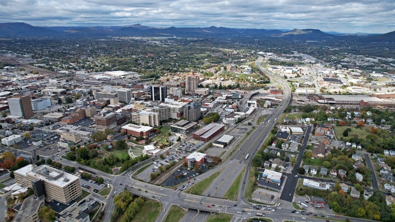
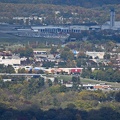
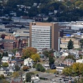
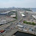
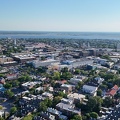
Aerial view of Roanoke, Virginia.
Information
- Author
- Ben Schumin
- Copyright
- All Rights Reserved
- Created on
- Tuesday 18 October 2022
- Dimensions
- 5472*3078
Powered by Piwigo


![Glory of the Chinese Descendants [01]](../../../i/upload/2024/07/13/20240713234217-5ca0060a-sq.jpg)
![Roanoke from the star, January 2003 [04]](../../../i/upload/2024/07/14/20240714101746-72386e76-sq.jpg)
![Roanoke from the star, January 2003 [03]](../../../i/upload/2024/07/14/20240714101748-2add7d74-sq.jpg)
![Roanoke from the star, January 2003 [02]](../../../i/upload/2024/07/14/20240714101749-5603d0ac-sq.jpg)
![Roanoke from the star, January 2003 [01]](../../../i/upload/2024/07/14/20240714101750-8166e277-sq.jpg)


![Glory of the Chinese Descendants [02]](../../../i/upload/2024/07/14/20240714102018-b521fb2d-sq.jpg)


![Fort Totten lower level [01]](../../../i/upload/2024/07/14/20240714102311-a9fcf28e-sq.jpg)

![Foggy Bottom-GWU station [01]](../../../i/upload/2024/07/14/20240714170822-4636d7c5-sq.jpg)


![Interior of WMATA railcar 2075 [05]](../../../i/upload/2024/07/14/20240714170835-8985d9ef-sq.jpg)

![Arlington Cemetery station [01]](../../../i/upload/2024/07/14/20240714170844-39ee5ee3-sq.jpg)

![Pentagon City station, viewed from a low angle [02]](../../../i/upload/2024/07/14/20240714171229-b12ff35d-sq.jpg)
![Pentagon City station, viewed from a low angle [01]](../../../i/upload/2024/07/14/20240714171231-146268a7-sq.jpg)


![New York Avenue station entrance pylon [01]](../../../i/upload/2024/07/14/20240714171347-820dc8d4-sq.jpg)
![New York Avenue station entrance pylon [02]](../../../i/upload/2024/07/14/20240714234552-cb48d842-sq.jpg)



![Jersey barriers on turnpike stub [01]](../../../i/upload/2024/07/15/20240715141343-6bc4f0ac-sq.jpg)
![New York Avenue station entrance pylon [03]](../../../i/upload/2024/07/15/20240715141658-5278307f-sq.jpg)

![Pentagon City station, November 2006 [04]](../../../i/upload/2024/07/15/20240715141819-14d1b91f-sq.jpg)
![Pentagon City station, November 2006 [03]](../../../i/upload/2024/07/15/20240715141821-197d96a2-sq.jpg)
![Pentagon City station, November 2006 [02]](../../../i/upload/2024/07/15/20240715141823-d61393c6-sq.jpg)
![Pentagon City station, November 2006 [01]](../../../i/upload/2024/07/15/20240715141824-f26a7a08-sq.jpg)
![Pentagon City station, November 2006 [05]](../../../i/upload/2024/07/15/20240715141829-09ed0263-sq.jpg)
![Pentagon City station, November 2006 [06]](../../../i/upload/2024/07/15/20240715141832-78ac5b3c-sq.jpg)
![Pentagon City station, November 2006 [07]](../../../i/upload/2024/07/15/20240715141834-0531d187-sq.jpg)
![Pentagon City station, November 2006 [08]](../../../i/upload/2024/07/15/20240715141835-2daefcc2-sq.jpg)


![Anonymous DC September raid [04]](../../../i/upload/2024/07/15/20240715215236-82b35078-sq.jpg)


![Baltimore-area traffic on Interstate 95 southbound [03]](../../../i/upload/2024/07/16/20240716002653-32a0e8e5-sq.jpg)
![Baltimore-area traffic on Interstate 95 southbound [01]](../../../i/upload/2024/07/16/20240716002655-05b94d1e-sq.jpg)
![Baltimore-area traffic on Interstate 95 southbound [02]](../../../i/upload/2024/07/16/20240716002700-59eb8782-sq.jpg)
![Arlington Cemetery station [02]](../../../i/upload/2024/07/16/20240716003119-dddf5e88-sq.jpg)


![SlutWalk DC 2011 [10]](../../../i/upload/2024/07/16/20240716232914-8d84331b-sq.jpg)
![Olney Indoor Swim Center [02]](../../../i/upload/2024/07/17/20240717101317-b902e2d4-sq.jpg)


![Richmond skyline [12]](../../../i/upload/2024/07/17/20240717155057-1b70ebec-sq.jpg)
![Richmond skyline [11]](../../../i/upload/2024/07/17/20240717155100-1121e622-sq.jpg)
![Richmond skyline [10]](../../../i/upload/2024/07/17/20240717155103-0850cb89-sq.jpg)
![Richmond skyline [09]](../../../i/upload/2024/07/17/20240717155106-9423a503-sq.jpg)
![Richmond skyline [08]](../../../i/upload/2024/07/17/20240717155110-33b853b1-sq.jpg)
![Richmond skyline [07]](../../../i/upload/2024/07/17/20240717155113-cec25ff6-sq.jpg)
![Richmond skyline [06]](../../../i/upload/2024/07/17/20240717155116-d4983983-sq.jpg)
![Richmond skyline [05]](../../../i/upload/2024/07/17/20240717155118-d2e7b5b2-sq.jpg)
![Richmond skyline [04]](../../../i/upload/2024/07/17/20240717155122-17d9c4b8-sq.jpg)
![Richmond skyline [03]](../../../i/upload/2024/07/17/20240717155130-cfb4a095-sq.jpg)
![Richmond skyline [02]](../../../i/upload/2024/07/17/20240717155153-fa296849-sq.jpg)


![Southwest Freeway [02]](../../../i/upload/2024/07/17/20240717160347-f6eaadfd-sq.jpg)
![Southwest Freeway [01]](../../../i/upload/2024/07/17/20240717160351-30a054fb-sq.jpg)
![Interstate 94 westbound [02]](../../../i/upload/2024/07/17/20240717161211-25917077-sq.jpg)
![Interstate 94 westbound [01]](../../../i/upload/2024/07/17/20240717161215-d073d806-sq.jpg)
![Interior of Washington National Airport [01]](../../../i/upload/2024/07/17/20240717161339-57faa7c1-sq.jpg)
![Brighton Dam Road [01]](../../../i/upload/2024/07/17/20240717225049-0f96c3b6-sq.jpg)
![Brighton Dam Road [02]](../../../i/upload/2024/07/17/20240717225052-1b323317-sq.jpg)
![Brighton Dam Road [03]](../../../i/upload/2024/07/17/20240717225056-ac7d70e4-sq.jpg)
![Brighton Dam Road [04]](../../../i/upload/2024/07/17/20240717225100-7f927d75-sq.jpg)
![Power transmission lines in Germantown [01]](../../../i/upload/2024/07/17/20240717225114-40c6c2af-sq.jpg)
![Power transmission lines in Germantown [02]](../../../i/upload/2024/07/17/20240717225117-fae3d047-sq.jpg)
![Power transmission lines in Germantown [03]](../../../i/upload/2024/07/17/20240717225120-841bafe5-sq.jpg)
![Power transmission lines in Germantown [04]](../../../i/upload/2024/07/17/20240717225123-5e98802e-sq.jpg)
![Power transmission lines in Germantown [05]](../../../i/upload/2024/07/17/20240717225127-41e5bb25-sq.jpg)
![Power transmission lines in Germantown [06]](../../../i/upload/2024/07/17/20240717225130-189c0f10-sq.jpg)
![Power transmission lines in Germantown [07]](../../../i/upload/2024/07/17/20240717225133-5b5cec73-sq.jpg)
![Power transmission lines in Germantown [08]](../../../i/upload/2024/07/17/20240717225139-bb5ff0d6-sq.jpg)
![Power transmission lines in Germantown [09]](../../../i/upload/2024/07/17/20240717225143-bd72b33e-sq.jpg)
![Power transmission lines in Germantown [10]](../../../i/upload/2024/07/17/20240717225146-7a42bd11-sq.jpg)
![Power transmission lines in Germantown [11]](../../../i/upload/2024/07/17/20240717225149-2db00737-sq.jpg)
![Power transmission lines in Germantown [12]](../../../i/upload/2024/07/17/20240717225152-4a7801c4-sq.jpg)
![Power transmission lines in Germantown [13]](../../../i/upload/2024/07/17/20240717225155-35b6ce1e-sq.jpg)

![Rosslyn skyline [01]](../../../i/upload/2024/07/17/20240717230300-9294fc8d-sq.jpg)
![Rosslyn skyline [02]](../../../i/upload/2024/07/17/20240717230304-8f412681-sq.jpg)
![Rosslyn skyline [03]](../../../i/upload/2024/07/17/20240717230307-ad97916d-sq.jpg)

![Fort Totten lower level [02]](../../../i/upload/2024/07/17/20240717230915-ba5698d7-sq.jpg)

![Target in Westminster, Maryland [01]](../../../i/upload/2024/07/17/20240717231113-6f0f47c0-sq.jpg)
![Roanoke, Virginia [01]](../../../i/upload/2024/07/17/20240717232316-4004d589-sq.jpg)
![Roanoke, Virginia [02]](../../../i/upload/2024/07/17/20240717232320-e7ffa9b7-sq.jpg)
![Freight train at Martinsburg [01]](../../../i/upload/2024/07/17/20240717232610-81a62610-sq.jpg)
![Freight train at Martinsburg [02]](../../../i/upload/2024/07/17/20240717232613-f7f5e72e-sq.jpg)
![Freight train at Martinsburg [03]](../../../i/upload/2024/07/17/20240717232616-07f3a02b-sq.jpg)


![M. Carl Andrews Overlook [01]](../../../i/upload/2024/07/17/20240717233104-18c6ba6a-sq.jpg)
![M. Carl Andrews Overlook [02]](../../../i/upload/2024/07/17/20240717233109-73899e0e-sq.jpg)
![M. Carl Andrews Overlook at night [01]](../../../i/upload/2024/07/17/20240717233141-45aa31b5-sq.jpg)
![M. Carl Andrews Overlook at night [02]](../../../i/upload/2024/07/17/20240717233145-af6ef7ac-sq.jpg)
![Platform at Martinsburg train station [01]](../../../i/upload/2024/07/17/20240717233304-50cead62-sq.jpg)
![Platform at Martinsburg train station [02]](../../../i/upload/2024/07/17/20240717233309-2cd8e130-sq.jpg)

![Interior of car 7033 [01]](../../../i/upload/2024/07/18/20240718125007-3aea3150-sq.jpg)
![Interior of car 7033 [02]](../../../i/upload/2024/07/18/20240718125010-ba6e6e48-sq.jpg)


![N128HQ departing Washington National Airport [01]](../../../i/upload/2024/07/18/20240718220930-7a13660c-sq.jpg)
![N128HQ departing Washington National Airport [02]](../../../i/upload/2024/07/18/20240718220935-f8b94e75-sq.jpg)
![N128HQ departing Washington National Airport [03]](../../../i/upload/2024/07/18/20240718220940-1138744a-sq.jpg)
![N131HQ departing Washington National Airport [01]](../../../i/upload/2024/07/18/20240718220944-692659f7-sq.jpg)
![N131HQ departing Washington National Airport [02]](../../../i/upload/2024/07/18/20240718220948-7bbdfa71-sq.jpg)


![N302DN departing Washington National Airport [01]](../../../i/upload/2024/07/18/20240718221000-f2a2ed74-sq.jpg)
![N302DN departing Washington National Airport [02]](../../../i/upload/2024/07/18/20240718221004-36c6c73e-sq.jpg)
![N302DN departing Washington National Airport [03]](../../../i/upload/2024/07/18/20240718221008-745c7469-sq.jpg)


![N512AE departing Washington National Airport [01]](../../../i/upload/2024/07/18/20240718221032-6479a512-sq.jpg)
![N512AE departing Washington National Airport [02]](../../../i/upload/2024/07/18/20240718221036-255ff340-sq.jpg)
![N591NN departing Washington National Airport [01]](../../../i/upload/2024/07/18/20240718221040-78bbc1a1-sq.jpg)
![N591NN departing Washington National Airport [02]](../../../i/upload/2024/07/18/20240718221043-9c17816d-sq.jpg)


![N720PS departing Washington National Airport [01]](../../../i/upload/2024/07/18/20240718221057-6b1a04d8-sq.jpg)
![N720PS departing Washington National Airport [02]](../../../i/upload/2024/07/18/20240718221101-89067315-sq.jpg)
![N720PS departing Washington National Airport [03]](../../../i/upload/2024/07/18/20240718221106-76b801f0-sq.jpg)

![N858RW departing Washington National Airport [01]](../../../i/upload/2024/07/18/20240718221115-4597fb98-sq.jpg)
![N858RW departing Washington National Airport [02]](../../../i/upload/2024/07/18/20240718221119-a750bfb7-sq.jpg)
![N858RW departing Washington National Airport [03]](../../../i/upload/2024/07/18/20240718221123-c76705cf-sq.jpg)
![N932AN departing Washington National Airport [01]](../../../i/upload/2024/07/18/20240718221127-493ec2c4-sq.jpg)
![N932AN departing Washington National Airport [02]](../../../i/upload/2024/07/18/20240718221131-2f1cf9b5-sq.jpg)
![N932AN departing Washington National Airport [03]](../../../i/upload/2024/07/18/20240718221135-f680b3a4-sq.jpg)
![N932AN departing Washington National Airport [04]](../../../i/upload/2024/07/18/20240718221138-960bda66-sq.jpg)
![N7812G departing Washington National Airport [01]](../../../i/upload/2024/07/18/20240718221142-abe21590-sq.jpg)
![N7812G departing Washington National Airport [02]](../../../i/upload/2024/07/18/20240718221146-6bf0df8c-sq.jpg)
![N74856 departing Washington National Airport [01]](../../../i/upload/2024/07/18/20240718221150-5f244a3f-sq.jpg)
![N74856 departing Washington National Airport [02]](../../../i/upload/2024/07/18/20240718221153-39aa250f-sq.jpg)
![Delta Connection airliner departs Washington National Airport [02]](../../../i/upload/2024/07/18/20240718221157-eb219915-sq.jpg)
![Delta Connection airliner departs Washington National Airport [01]](../../../i/upload/2024/07/18/20240718221201-f12d7569-sq.jpg)
![Delta Connection airliner departs Washington National Airport [03]](../../../i/upload/2024/07/18/20240718221204-ec4dd28c-sq.jpg)
![Tanker terminal at Piney Point [04]](../../../i/upload/2024/07/18/20240718221327-fb4cc568-sq.jpg)
![Tanker terminal at Piney Point [05]](../../../i/upload/2024/07/18/20240718221333-96a734b9-sq.jpg)
![Tanker terminal at Piney Point [01]](../../../i/upload/2024/07/18/20240718221352-3b64b9f2-sq.jpg)
![Tanker terminal at Piney Point [02]](../../../i/upload/2024/07/18/20240718221356-44b766b4-sq.jpg)
![Tanker terminal at Piney Point [03]](../../../i/upload/2024/07/18/20240718221359-fd14cb99-sq.jpg)


![Reading Company 903 [01]](../../../i/upload/2024/07/18/20240718230800-ec7f88e8-sq.jpg)
![Reading Company 903 [02]](../../../i/upload/2024/07/18/20240718230803-8daa633c-sq.jpg)

![Power transmission lines in Montgomery Village [06]](../../../i/upload/2024/07/19/20240719002542-992b6062-sq.jpg)
![Power transmission lines in Montgomery Village [05]](../../../i/upload/2024/07/19/20240719002545-bbd1ae24-sq.jpg)

![Power transmission lines in Montgomery Village [04]](../../../i/upload/2024/07/19/20240719002552-1698394d-sq.jpg)
![Power transmission lines in Montgomery Village [03]](../../../i/upload/2024/07/19/20240719002555-701edc67-sq.jpg)
![Power transmission lines in Montgomery Village [02]](../../../i/upload/2024/07/19/20240719002558-88e3b55e-sq.jpg)
![Power transmission lines in Montgomery Village [01]](../../../i/upload/2024/07/19/20240719002602-f6056c42-sq.jpg)

![Weis in Philipsburg, Pennsylvania [02]](../../../i/upload/2024/07/19/20240719003545-9f732e2c-sq.jpg)
![Benning Road station [02]](../../../i/upload/2024/07/19/20240719004339-b5088b52-sq.jpg)

![Foggy Bottom-GWU station [02]](../../../i/upload/2024/07/19/20240719004359-19c95c75-sq.jpg)
![Metro Center station [10]](../../../i/upload/2024/07/19/20240719004403-91718ce1-sq.jpg)
![Federal Center SW station [01]](../../../i/upload/2024/07/19/20240719004406-3aecc9ea-sq.jpg)
![Federal Center SW station [03]](../../../i/upload/2024/07/19/20240719004410-2551c6af-sq.jpg)
![Federal Center SW station [02]](../../../i/upload/2024/07/19/20240719004413-a36124b5-sq.jpg)

![Money train at L'Enfant Plaza [01]](../../../i/upload/2024/07/19/20240719004444-11865ef9-sq.jpg)
![Money train at L'Enfant Plaza [02]](../../../i/upload/2024/07/19/20240719004447-c9265cca-sq.jpg)
![L'Enfant Plaza station [03]](../../../i/upload/2024/07/19/20240719004458-d281b637-sq.jpg)
![L'Enfant Plaza station [04]](../../../i/upload/2024/07/19/20240719004502-ca5e76e0-sq.jpg)

![Blue Line train at Pentagon City [03]](../../../i/upload/2024/07/19/20240719004513-27753b1f-sq.jpg)
![Yellow Line train at Pentagon City [02]](../../../i/upload/2024/07/19/20240719004521-6bfabb57-sq.jpg)
![Pentagon City station [08]](../../../i/upload/2024/07/19/20240719004525-369319ca-sq.jpg)
![Blue Line train at Pentagon City [02]](../../../i/upload/2024/07/19/20240719004528-ca1207c0-sq.jpg)
![Yellow Line train at Pentagon City [01]](../../../i/upload/2024/07/19/20240719004531-e57d0b79-sq.jpg)
![Pentagon City station [06]](../../../i/upload/2024/07/19/20240719004535-1ad09f16-sq.jpg)
![Blue Line train at Pentagon City [01]](../../../i/upload/2024/07/19/20240719004538-391cbe40-sq.jpg)
![Pentagon City station [07]](../../../i/upload/2024/07/19/20240719004549-da1e3b34-sq.jpg)
![N625AE landing at Baltimore-Washington International Airport (BWI) [04]](../../../i/upload/2024/07/19/20240719004632-30644c1d-sq.jpg)
![N625AE landing at Baltimore-Washington International Airport (BWI) [05]](../../../i/upload/2024/07/19/20240719004637-f7feb219-sq.jpg)
![N625AE landing at Baltimore-Washington International Airport (BWI) [01]](../../../i/upload/2024/07/19/20240719004641-7b3441a3-sq.jpg)
![N625AE landing at Baltimore-Washington International Airport (BWI) [02]](../../../i/upload/2024/07/19/20240719004644-4b407337-sq.jpg)
![N625AE landing at Baltimore-Washington International Airport (BWI) [03]](../../../i/upload/2024/07/19/20240719004648-5aaa641d-sq.jpg)

![N929VA landing at Baltimore-Washington International Airport (BWI) [05]](../../../i/upload/2024/07/19/20240719004656-dc247f96-sq.jpg)
![N929VA landing at Baltimore-Washington International Airport (BWI) [06]](../../../i/upload/2024/07/19/20240719004700-1d74ccf4-sq.jpg)
![N929VA landing at Baltimore-Washington International Airport (BWI) [05 Alternate 1]](../../../i/upload/2024/07/19/20240719004703-bc080e2c-sq.jpg)
![N929VA landing at Baltimore-Washington International Airport (BWI) [05 Alternate 2]](../../../i/upload/2024/07/19/20240719004707-5ed55e59-sq.jpg)
![N929VA landing at Baltimore-Washington International Airport (BWI) [03]](../../../i/upload/2024/07/19/20240719004710-489e7188-sq.jpg)
![N929VA landing at Baltimore-Washington International Airport (BWI) [04]](../../../i/upload/2024/07/19/20240719004714-837975d7-sq.jpg)
![N929VA landing at Baltimore-Washington International Airport (BWI) [02]](../../../i/upload/2024/07/19/20240719004718-c0e519b4-sq.jpg)
![N929VA landing at Baltimore-Washington International Airport (BWI) [01]](../../../i/upload/2024/07/19/20240719004722-2fda1b26-sq.jpg)

![N376DA landing at Baltimore-Washington International Airport (BWI) [03]](../../../i/upload/2024/07/19/20240719004729-1ef79e50-sq.jpg)
![N376DA landing at Baltimore-Washington International Airport (BWI) [01]](../../../i/upload/2024/07/19/20240719004733-02ee2b1f-sq.jpg)
![N376DA landing at Baltimore-Washington International Airport (BWI) [02]](../../../i/upload/2024/07/19/20240719004735-308b0d76-sq.jpg)
![N147AA landing at Baltimore-Washington International Airport (BWI) [08]](../../../i/upload/2024/07/19/20240719004739-0e9087d1-sq.jpg)
![N147AA landing at Baltimore-Washington International Airport (BWI) [06]](../../../i/upload/2024/07/19/20240719004743-3ec161fb-sq.jpg)
![N147AA landing at Baltimore-Washington International Airport (BWI) [04]](../../../i/upload/2024/07/19/20240719004747-1feb83ae-sq.jpg)
![N147AA landing at Baltimore-Washington International Airport (BWI) [05]](../../../i/upload/2024/07/19/20240719004751-81626296-sq.jpg)
![N147AA landing at Baltimore-Washington International Airport (BWI) [07]](../../../i/upload/2024/07/19/20240719004755-be6b6792-sq.jpg)
![N147AA landing at Baltimore-Washington International Airport (BWI) [01]](../../../i/upload/2024/07/19/20240719004758-99c9a7a4-sq.jpg)
![N147AA landing at Baltimore-Washington International Airport (BWI) [02]](../../../i/upload/2024/07/19/20240719004802-a12876f5-sq.jpg)
![N147AA landing at Baltimore-Washington International Airport (BWI) [03]](../../../i/upload/2024/07/19/20240719004806-344f01f6-sq.jpg)
![N750AX landing at Baltimore-Washington International Airport (BWI) [07]](../../../i/upload/2024/07/19/20240719004809-a92a311d-sq.jpg)
![N750AX landing at Baltimore-Washington International Airport (BWI) [08]](../../../i/upload/2024/07/19/20240719004814-4a3db417-sq.jpg)
![N750AX landing at Baltimore-Washington International Airport (BWI) [04]](../../../i/upload/2024/07/19/20240719004818-bb88f8bb-sq.jpg)
![N750AX landing at Baltimore-Washington International Airport (BWI) [02]](../../../i/upload/2024/07/19/20240719004822-74ae5001-sq.jpg)
![N750AX landing at Baltimore-Washington International Airport (BWI) [05]](../../../i/upload/2024/07/19/20240719004826-4091e292-sq.jpg)
![N750AX landing at Baltimore-Washington International Airport (BWI) [06]](../../../i/upload/2024/07/19/20240719004829-a0964964-sq.jpg)
![N750AX landing at Baltimore-Washington International Airport (BWI) [03]](../../../i/upload/2024/07/19/20240719004833-d0476c0f-sq.jpg)
![N750AX landing at Baltimore-Washington International Airport (BWI) [01]](../../../i/upload/2024/07/19/20240719004837-02303443-sq.jpg)
![N509NK landing at Baltimore-Washington International Airport (BWI) [01]](../../../i/upload/2024/07/19/20240719004841-6ac5e33a-sq.jpg)
![N509NK landing at Baltimore-Washington International Airport (BWI) [03]](../../../i/upload/2024/07/19/20240719004845-3e0a03b9-sq.jpg)
![N509NK landing at Baltimore-Washington International Airport (BWI) [02]](../../../i/upload/2024/07/19/20240719004849-3be8bc51-sq.jpg)
![N744AX landing at Baltimore-Washington International Airport (BWI) [02]](../../../i/upload/2024/07/19/20240719004854-e07ebddc-sq.jpg)
![N744AX landing at Baltimore-Washington International Airport (BWI) [01]](../../../i/upload/2024/07/19/20240719004901-47e5e223-sq.jpg)
![N744AX landing at Baltimore-Washington International Airport (BWI) [03]](../../../i/upload/2024/07/19/20240719004905-501eb0ad-sq.jpg)
![N744AX landing at Baltimore-Washington International Airport (BWI) [04]](../../../i/upload/2024/07/19/20240719004909-9e2d9a83-sq.jpg)
![N921DN landing at Baltimore-Washington International Airport (BWI) [01]](../../../i/upload/2024/07/19/20240719004914-a261c79e-sq.jpg)
![N921DN landing at Baltimore-Washington International Airport (BWI) [02]](../../../i/upload/2024/07/19/20240719004919-072e14f1-sq.jpg)
![N665AW landing at Baltimore-Washington International Airport (BWI) [05]](../../../i/upload/2024/07/19/20240719004923-226c3b4f-sq.jpg)
![N665AW landing at Baltimore-Washington International Airport (BWI) [06]](../../../i/upload/2024/07/19/20240719004927-9e602cb6-sq.jpg)
![N665AW landing at Baltimore-Washington International Airport (BWI) [04]](../../../i/upload/2024/07/19/20240719004931-764f9ee7-sq.jpg)
![N665AW landing at Baltimore-Washington International Airport (BWI) [01]](../../../i/upload/2024/07/19/20240719004936-3500dbdb-sq.jpg)
![N665AW landing at Baltimore-Washington International Airport (BWI) [02]](../../../i/upload/2024/07/19/20240719005004-30f386a1-sq.jpg)
![N665AW landing at Baltimore-Washington International Airport (BWI) [03]](../../../i/upload/2024/07/19/20240719005043-f70e4532-sq.jpg)
![N8682B landing at Baltimore-Washington International Airport [04]](../../../i/upload/2024/07/19/20240719005057-df1222fe-sq.jpg)
![N8682B landing at Baltimore-Washington International Airport [05]](../../../i/upload/2024/07/19/20240719005102-584d702c-sq.jpg)
![N8682B landing at Baltimore-Washington International Airport [01]](../../../i/upload/2024/07/19/20240719005109-a028f720-sq.jpg)
![N8682B landing at Baltimore-Washington International Airport [02]](../../../i/upload/2024/07/19/20240719005116-69fcf7e6-sq.jpg)
![N8682B landing at Baltimore-Washington International Airport [03]](../../../i/upload/2024/07/19/20240719005121-2877d98e-sq.jpg)
![N8605E landing at Baltimore-Washington International Airport (BWI) [03]](../../../i/upload/2024/07/19/20240719005125-8a189de5-sq.jpg)
![N8605E landing at Baltimore-Washington International Airport (BWI) [01]](../../../i/upload/2024/07/19/20240719005128-0d097308-sq.jpg)
![N8605E landing at Baltimore-Washington International Airport (BWI) [02]](../../../i/upload/2024/07/19/20240719005132-80dbc750-sq.jpg)
![N665NK landing at Baltimore-Washington International Airport (BWI) [07]](../../../i/upload/2024/07/19/20240719005137-3934affa-sq.jpg)
![N665NK landing at Baltimore-Washington International Airport (BWI) [06]](../../../i/upload/2024/07/19/20240719005142-34c323c7-sq.jpg)
![N665NK landing at Baltimore-Washington International Airport (BWI) [03]](../../../i/upload/2024/07/19/20240719005147-b72fb857-sq.jpg)
![N665NK landing at Baltimore-Washington International Airport (BWI) [04]](../../../i/upload/2024/07/19/20240719005151-2ddac118-sq.jpg)
![N665NK landing at Baltimore-Washington International Airport (BWI) [05]](../../../i/upload/2024/07/19/20240719005155-b180bb3b-sq.jpg)
![N665NK landing at Baltimore-Washington International Airport (BWI) [01]](../../../i/upload/2024/07/19/20240719005159-e9067931-sq.jpg)
![N665NK landing at Baltimore-Washington International Airport (BWI) [02]](../../../i/upload/2024/07/19/20240719005203-5bd1afd0-sq.jpg)
![N8538V landing at Baltimore-Washington International Airport (BWI) [05]](../../../i/upload/2024/07/19/20240719005207-f7a24a72-sq.jpg)
![N8538V landing at Baltimore-Washington International Airport (BWI) [03]](../../../i/upload/2024/07/19/20240719005211-40f3b560-sq.jpg)
![N8538V landing at Baltimore-Washington International Airport (BWI) [04]](../../../i/upload/2024/07/19/20240719005217-facd3f9a-sq.jpg)
![N8538V landing at Baltimore-Washington International Airport (BWI) [06]](../../../i/upload/2024/07/19/20240719005222-c2008f95-sq.jpg)
![N8538V landing at Baltimore-Washington International Airport (BWI) [01]](../../../i/upload/2024/07/19/20240719005226-12601521-sq.jpg)
![N8538V landing at Baltimore-Washington International Airport (BWI) [02]](../../../i/upload/2024/07/19/20240719005230-b779c7a7-sq.jpg)
![N931NN landing at Baltimore-Washington International Airport (BWI) [01]](../../../i/upload/2024/07/19/20240719005234-8d19a78b-sq.jpg)
![N931NN landing at Baltimore-Washington International Airport (BWI) [01 Alternate]](../../../i/upload/2024/07/19/20240719005239-147e2953-sq.jpg)
![N931NN landing at Baltimore-Washington International Airport (BWI) [03]](../../../i/upload/2024/07/19/20240719005243-2074d963-sq.jpg)
![N931NN landing at Baltimore-Washington International Airport (BWI) [05]](../../../i/upload/2024/07/19/20240719005247-e74dbc19-sq.jpg)
![N931NN landing at Baltimore-Washington International Airport (BWI) [05 Alternate]](../../../i/upload/2024/07/19/20240719005252-11eb6dac-sq.jpg)
![N931NN landing at Baltimore-Washington International Airport (BWI) [04]](../../../i/upload/2024/07/19/20240719005256-fed8fd38-sq.jpg)
![N931NN landing at Baltimore-Washington International Airport (BWI) [02]](../../../i/upload/2024/07/19/20240719005300-20a22c40-sq.jpg)

![N8545V landing at Baltimore-Washington International Airport (BWI) [01]](../../../i/upload/2024/07/19/20240719005313-82303d38-sq.jpg)
![N8545V landing at Baltimore-Washington International Airport (BWI) [02]](../../../i/upload/2024/07/19/20240719005318-5330f805-sq.jpg)
![N745VJ landing at Baltimore-Washington International Airport (BWI) [06]](../../../i/upload/2024/07/19/20240719005322-6eb3691d-sq.jpg)
![N745VJ landing at Baltimore-Washington International Airport (BWI) [05]](../../../i/upload/2024/07/19/20240719005326-00518cf6-sq.jpg)
![N745VJ landing at Baltimore-Washington International Airport (BWI) [03]](../../../i/upload/2024/07/19/20240719005331-7c19ea36-sq.jpg)
![N745VJ landing at Baltimore-Washington International Airport (BWI) [01]](../../../i/upload/2024/07/19/20240719005336-e44e2d8c-sq.jpg)
![N745VJ landing at Baltimore-Washington International Airport (BWI) [04]](../../../i/upload/2024/07/19/20240719005341-02bdc6e0-sq.jpg)
![N745VJ landing at Baltimore-Washington International Airport (BWI) [02]](../../../i/upload/2024/07/19/20240719005346-0546db24-sq.jpg)
![N443WN landing at Baltimore-Washington International Airport (BWI) [03]](../../../i/upload/2024/07/19/20240719005350-a5d9a680-sq.jpg)
![N443WN landing at Baltimore-Washington International Airport (BWI) [01]](../../../i/upload/2024/07/19/20240719005355-4ae460e2-sq.jpg)
![N443WN landing at Baltimore-Washington International Airport (BWI) [02]](../../../i/upload/2024/07/19/20240719005359-0b4f3eff-sq.jpg)
![N768SW landing at Baltimore-Washington International Airport (BWI) [08]](../../../i/upload/2024/07/19/20240719005404-92822ccd-sq.jpg)
![N768SW landing at Baltimore-Washington International Airport (BWI) [09]](../../../i/upload/2024/07/19/20240719005408-80410da9-sq.jpg)
![N768SW landing at Baltimore-Washington International Airport (BWI) [06]](../../../i/upload/2024/07/19/20240719005412-f550325f-sq.jpg)
![N768SW landing at Baltimore-Washington International Airport (BWI) [07]](../../../i/upload/2024/07/19/20240719005417-9fe8d406-sq.jpg)
![N768SW landing at Baltimore-Washington International Airport (BWI) [05]](../../../i/upload/2024/07/19/20240719005421-66de4adc-sq.jpg)
![N768SW landing at Baltimore-Washington International Airport (BWI) [03]](../../../i/upload/2024/07/19/20240719005428-43366bdd-sq.jpg)
![N768SW landing at Baltimore-Washington International Airport (BWI) [01]](../../../i/upload/2024/07/19/20240719005433-baf4008d-sq.jpg)
![N768SW landing at Baltimore-Washington International Airport (BWI) [02]](../../../i/upload/2024/07/19/20240719005437-cf3bee7c-sq.jpg)
![N768SW landing at Baltimore-Washington International Airport (BWI) [04]](../../../i/upload/2024/07/19/20240719005442-9121fbc7-sq.jpg)
![N8582Z landing at Baltimore-Washington International Airport (BWI) [02]](../../../i/upload/2024/07/19/20240719005445-742eb9bf-sq.jpg)
![N8582Z landing at Baltimore-Washington International Airport (BWI) [04]](../../../i/upload/2024/07/19/20240719005449-dc373e51-sq.jpg)
![N8582Z landing at Baltimore-Washington International Airport (BWI) [03]](../../../i/upload/2024/07/19/20240719005453-9586251b-sq.jpg)
![N8582Z landing at Baltimore-Washington International Airport (BWI) [07]](../../../i/upload/2024/07/19/20240719005457-730f3e23-sq.jpg)
![N8582Z landing at Baltimore-Washington International Airport (BWI) [06]](../../../i/upload/2024/07/19/20240719005501-59f3e29d-sq.jpg)
![N8582Z landing at Baltimore-Washington International Airport (BWI) [05]](../../../i/upload/2024/07/19/20240719005506-d74e73de-sq.jpg)
![N8582Z landing at Baltimore-Washington International Airport (BWI) [01]](../../../i/upload/2024/07/19/20240719005510-a84fb854-sq.jpg)
![N8582Z landing at Baltimore-Washington International Airport (BWI) [08]](../../../i/upload/2024/07/19/20240719005514-be653cd1-sq.jpg)
![N8688J landing at Baltimore-Washington International Airport (BWI) [04]](../../../i/upload/2024/07/19/20240719005518-4db7051a-sq.jpg)
![N8688J landing at Baltimore-Washington International Airport (BWI) [03]](../../../i/upload/2024/07/19/20240719005522-033b5560-sq.jpg)
![N8688J landing at Baltimore-Washington International Airport (BWI) [05]](../../../i/upload/2024/07/19/20240719005527-e328c91d-sq.jpg)
![N8688J landing at Baltimore-Washington International Airport (BWI) [01]](../../../i/upload/2024/07/19/20240719005531-9c36e6f0-sq.jpg)
![N8688J landing at Baltimore-Washington International Airport (BWI) [02]](../../../i/upload/2024/07/19/20240719005535-17a93397-sq.jpg)
![N346PR landing at Baltimore-Washington International Airport (BWI) [06]](../../../i/upload/2024/07/19/20240719005539-cc7a3f08-sq.jpg)
![N346PR landing at Baltimore-Washington International Airport (BWI) [07]](../../../i/upload/2024/07/19/20240719005543-53766730-sq.jpg)
![N346PR landing at Baltimore-Washington International Airport (BWI) [05]](../../../i/upload/2024/07/19/20240719005547-c369fae2-sq.jpg)
![N346PR landing at Baltimore-Washington International Airport (BWI) [03]](../../../i/upload/2024/07/19/20240719005552-da8400c0-sq.jpg)
![N346PR landing at Baltimore-Washington International Airport (BWI) [02]](../../../i/upload/2024/07/19/20240719005556-f016582d-sq.jpg)
![N346PR landing at Baltimore-Washington International Airport (BWI) [04]](../../../i/upload/2024/07/19/20240719005600-97c2555c-sq.jpg)
![N346PR landing at Baltimore-Washington International Airport (BWI) [01]](../../../i/upload/2024/07/19/20240719005605-bc72d6a7-sq.jpg)
![N237WN landing at Baltimore-Washington International Airport (BWI) [04]](../../../i/upload/2024/07/19/20240719005609-da7cb736-sq.jpg)
![N237WN landing at Baltimore-Washington International Airport (BWI) [03]](../../../i/upload/2024/07/19/20240719005614-89baeee7-sq.jpg)
![N237WN landing at Baltimore-Washington International Airport (BWI) [05]](../../../i/upload/2024/07/19/20240719005618-dfda934c-sq.jpg)
![N237WN landing at Baltimore-Washington International Airport (BWI) [01]](../../../i/upload/2024/07/19/20240719005623-d73bd6df-sq.jpg)
![N237WN landing at Baltimore-Washington International Airport (BWI) [02]](../../../i/upload/2024/07/19/20240719005628-00398962-sq.jpg)
![N7856A landing at Baltimore-Washington International Airport (BWI) [07]](../../../i/upload/2024/07/19/20240719005632-50e13847-sq.jpg)
![N7856A landing at Baltimore-Washington International Airport (BWI) [05]](../../../i/upload/2024/07/19/20240719005637-6798e806-sq.jpg)
![N7856A landing at Baltimore-Washington International Airport (BWI) [02]](../../../i/upload/2024/07/19/20240719005641-500dad88-sq.jpg)
![N7856A landing at Baltimore-Washington International Airport (BWI) [03]](../../../i/upload/2024/07/19/20240719005646-7bfa87f1-sq.jpg)
![N7856A landing at Baltimore-Washington International Airport (BWI) [06]](../../../i/upload/2024/07/19/20240719005650-cbc8c6a6-sq.jpg)
![N7856A landing at Baltimore-Washington International Airport (BWI) [04]](../../../i/upload/2024/07/19/20240719005655-5f28c67a-sq.jpg)
![N7856A landing at Baltimore-Washington International Airport (BWI) [01]](../../../i/upload/2024/07/19/20240719005659-5d28ea26-sq.jpg)
![Blue Line train at Stadium-Armory station [01]](../../../i/upload/2024/07/19/20240719090655-f8b9d958-sq.jpg)

![Blue Line train at Stadium-Armory station [02]](../../../i/upload/2024/07/19/20240719090836-d83a5f4c-sq.jpg)
![AT&T Long Lines tower in Glen Allen, Virginia [01]](../../../i/upload/2024/07/19/20240719092852-ff726dfb-sq.jpg)
![AT&T Long Lines tower in Glen Allen, Virginia [04]](../../../i/upload/2024/07/19/20240719092909-29e1bab7-sq.jpg)
![AT&T Long Lines tower in Glen Allen, Virginia [03]](../../../i/upload/2024/07/19/20240719092914-bc92cd1d-sq.jpg)
![AT&T Long Lines tower in Glen Allen, Virginia [02]](../../../i/upload/2024/07/19/20240719092919-7579d766-sq.jpg)
![AT&T Long Lines tower near Williamsburg, Virginia [08]](../../../i/upload/2024/07/19/20240719093022-680378a6-sq.jpg)
![AT&T Long Lines tower near Williamsburg, Virginia [07]](../../../i/upload/2024/07/19/20240719093027-294258f8-sq.jpg)
![AT&T Long Lines tower near Williamsburg, Virginia [06]](../../../i/upload/2024/07/19/20240719093032-bb00ade3-sq.jpg)
![AT&T Long Lines tower near Williamsburg, Virginia [05]](../../../i/upload/2024/07/19/20240719093037-ece70e81-sq.jpg)
![AT&T Long Lines tower near Williamsburg, Virginia [04]](../../../i/upload/2024/07/19/20240719093041-e9611c2a-sq.jpg)
![AT&T Long Lines tower near Williamsburg, Virginia [03]](../../../i/upload/2024/07/19/20240719093046-dda5bc61-sq.jpg)
![AT&T Long Lines tower near Williamsburg, Virginia [02]](../../../i/upload/2024/07/19/20240719093052-38df7168-sq.jpg)
![Power transmission lines in Frederick County [02]](../../../i/upload/2024/07/19/20240719093429-9f31f834-sq.jpg)
![Power transmission lines in Frederick County [01]](../../../i/upload/2024/07/19/20240719093435-6cd9373f-sq.jpg)
![Platform at Federal Center SW station [02]](../../../i/upload/2024/07/19/20240719100829-46db5ff5-sq.jpg)
![Platform at Federal Center SW station [01]](../../../i/upload/2024/07/19/20240719100836-4e0fb327-sq.jpg)
![Interior of WMATA railcar 3243 [02]](../../../i/upload/2024/07/19/20240719100902-60bf8c91-sq.jpg)
![Interior of WMATA railcar 3243 [01]](../../../i/upload/2024/07/19/20240719100907-584a2d91-sq.jpg)
![AT&T Long Lines tower near Williamsburg, Virginia [01]](../../../i/upload/2024/07/19/20240719101637-49b22eb1-sq.jpg)
![Adirondack chair at Border Station [02]](../../../i/upload/2024/07/19/20240719101843-840bebb6-sq.jpg)

![Norfolk, Virginia at night [01]](../../../i/upload/2024/07/19/20240719101930-588b26d8-sq.jpg)
![Norfolk, Virginia at night [02]](../../../i/upload/2024/07/19/20240719101934-44552460-sq.jpg)
![RA-82042 landing at BWI [10]](../../../i/upload/2024/07/19/20240719103608-267aac20-sq.jpg)
![RA-82042 landing at BWI [09]](../../../i/upload/2024/07/19/20240719103613-07f5e6e3-sq.jpg)
![RA-82042 landing at BWI [11]](../../../i/upload/2024/07/19/20240719103619-5b401af8-sq.jpg)

![RA-82042 landing at BWI [12]](../../../i/upload/2024/07/19/20240719103629-a6a65f8c-sq.jpg)
![RA-82042 landing at BWI [08]](../../../i/upload/2024/07/19/20240719103633-3b4ac03c-sq.jpg)
![RA-82042 landing at BWI [07]](../../../i/upload/2024/07/19/20240719103639-bd3f288e-sq.jpg)
![RA-82042 landing at BWI [06]](../../../i/upload/2024/07/19/20240719103645-739971d9-sq.jpg)
![RA-82042 landing at BWI [05]](../../../i/upload/2024/07/19/20240719103651-9f8cc4e3-sq.jpg)
![RA-82042 landing at BWI [04]](../../../i/upload/2024/07/19/20240719103657-2d0a2a40-sq.jpg)
![RA-82042 landing at BWI [03]](../../../i/upload/2024/07/19/20240719103703-5336fe53-sq.jpg)
![RA-82042 landing at BWI [02]](../../../i/upload/2024/07/19/20240719103709-eff6137c-sq.jpg)
![RA-82042 landing at BWI [01]](../../../i/upload/2024/07/19/20240719103713-0c49f92c-sq.jpg)
![N7862A departs from Baltimore-Washington International Airport (BWI) [01]](../../../i/upload/2024/07/19/20240719110403-f67e30bb-sq.jpg)
![N7862A departs from Baltimore-Washington International Airport (BWI) [02]](../../../i/upload/2024/07/19/20240719110408-46157dac-sq.jpg)


![Steamer trunk at Habitat ReStore [06]](../../../i/upload/2024/07/19/20240719111746-57cc9acd-sq.jpg)
![Steamer trunk at Habitat ReStore [05]](../../../i/upload/2024/07/19/20240719111751-f2182041-sq.jpg)
![Steamer trunk at Habitat ReStore [04]](../../../i/upload/2024/07/19/20240719111756-261f1f6b-sq.jpg)
![Steamer trunk at Habitat ReStore [03]](../../../i/upload/2024/07/19/20240719111800-6c6d3e72-sq.jpg)
![Steamer trunk at Habitat ReStore [02]](../../../i/upload/2024/07/19/20240719111805-15fe2dc9-sq.jpg)
![Steamer trunk at Habitat ReStore [01]](../../../i/upload/2024/07/19/20240719111811-27dbb49d-sq.jpg)
![Remodel of Walmart Supercenter in Martinsburg, West Virginia [02]](../../../i/upload/2024/07/19/20240719113327-76a9bbe3-sq.jpg)
![Clothing area at Walmart in Waynesboro, Pennsylvania [01]](../../../i/upload/2024/07/19/20240719114451-5593364e-sq.jpg)
![Clothing area at Walmart in Waynesboro, Pennsylvania [02]](../../../i/upload/2024/07/19/20240719114621-407ddf42-sq.jpg)


![East Village Avenue [01]](../../../i/upload/2024/07/19/20240719122833-bc6ea083-sq.jpg)
![East Village Avenue [02]](../../../i/upload/2024/07/19/20240719122836-3d056d6c-sq.jpg)
![Lake Marion Community Center pool [01]](../../../i/upload/2024/07/19/20240719122840-4a4f2348-sq.jpg)
![Lake Marion Community Center pool [02]](../../../i/upload/2024/07/19/20240719122844-861bf93b-sq.jpg)
![Lake Marion Community Center pool [03]](../../../i/upload/2024/07/19/20240719122848-aec9a0dc-sq.jpg)
![Lake Marion Community Center pool [04]](../../../i/upload/2024/07/19/20240719122852-e7a00446-sq.jpg)

![Handwritten notes on paper [01]](../../../i/upload/2024/07/19/20240719154550-c35e4981-sq.jpg)
![Handwritten notes on paper [02]](../../../i/upload/2024/07/19/20240719154555-0eae8553-sq.jpg)
![Handwritten notes on paper [03]](../../../i/upload/2024/07/19/20240719154600-07f2685b-sq.jpg)
![Train at Potomac Avenue station [01]](../../../i/upload/2024/07/19/20240719155222-b3c10033-sq.jpg)
![Train at Potomac Avenue station [02]](../../../i/upload/2024/07/19/20240719155226-9b4b9aca-sq.jpg)

![Train at Potomac Avenue station [03]](../../../i/upload/2024/07/19/20240719155236-e4bc9b29-sq.jpg)
![AT&T Long Lines tower in Finksburg, Maryland [04]](../../../i/upload/2024/07/19/20240719162015-18d88d0a-sq.jpg)
![AT&T Long Lines tower in Finksburg, Maryland [02]](../../../i/upload/2024/07/19/20240719162027-8757c57d-sq.jpg)
![AT&T Long Lines tower in Finksburg, Maryland [03]](../../../i/upload/2024/07/19/20240719162031-ca91496d-sq.jpg)
![AT&T Long Lines tower in Finksburg, Maryland [01]](../../../i/upload/2024/07/19/20240719162102-ca3a1ec2-sq.jpg)
![AT&T Long Lines tower in Finksburg, Maryland [05]](../../../i/upload/2024/07/19/20240719162107-912e4c89-sq.jpg)
![Faded stop sign [01]](../../../i/upload/2024/07/19/20240719164633-3746ed7c-sq.jpg)
![Faded stop sign [02]](../../../i/upload/2024/07/19/20240719164638-c40f7dea-sq.jpg)
![AT&T Long Lines tower in Dumfries, Virginia [01]](../../../i/upload/2024/07/19/20240719165018-181b846f-sq.jpg)
![AT&T Long Lines tower in Dumfries, Virginia [11]](../../../i/upload/2024/07/19/20240719165024-3f54a696-sq.jpg)
![AT&T Long Lines tower in Dumfries, Virginia [12]](../../../i/upload/2024/07/19/20240719165028-a8de306f-sq.jpg)
![AT&T Long Lines tower in Dumfries, Virginia [18]](../../../i/upload/2024/07/19/20240719165033-46ecd2ea-sq.jpg)
![AT&T Long Lines tower in Dumfries, Virginia [19]](../../../i/upload/2024/07/19/20240719165037-6aedec05-sq.jpg)
![AT&T Long Lines tower in Dumfries, Virginia [26]](../../../i/upload/2024/07/19/20240719165042-05809431-sq.jpg)
![AT&T Long Lines tower in Dumfries, Virginia [28]](../../../i/upload/2024/07/19/20240719165046-236b9515-sq.jpg)
![AT&T Long Lines tower in Dumfries, Virginia [32]](../../../i/upload/2024/07/19/20240719165051-b8547ba1-sq.jpg)
![Former AT&T Long Lines tower in Bristow, Virginia [04]](../../../i/upload/2024/07/19/20240719165055-d665bba0-sq.jpg)
![AT&T Long Lines tower in Dumfries, Virginia [08]](../../../i/upload/2024/07/19/20240719165100-70693200-sq.jpg)
![AT&T Long Lines tower in Dumfries, Virginia [15]](../../../i/upload/2024/07/19/20240719165113-dd2b92c6-sq.jpg)
![AT&T Long Lines tower in Dumfries, Virginia [17]](../../../i/upload/2024/07/19/20240719165117-9cc4e109-sq.jpg)
![AT&T Long Lines tower in Dumfries, Virginia [27]](../../../i/upload/2024/07/19/20240719165122-4f0c71b5-sq.jpg)
![AT&T Long Lines tower in Dumfries, Virginia [02]](../../../i/upload/2024/07/19/20240719165130-484d2461-sq.jpg)
![AT&T Long Lines tower in Dumfries, Virginia [05]](../../../i/upload/2024/07/19/20240719165135-b79f8f02-sq.jpg)
![AT&T Long Lines tower in Dumfries, Virginia [06]](../../../i/upload/2024/07/19/20240719165140-2a22b342-sq.jpg)
![AT&T Long Lines tower in Dumfries, Virginia [30]](../../../i/upload/2024/07/19/20240719165144-01db27aa-sq.jpg)
![Former AT&T Long Lines tower in Bristow, Virginia [02]](../../../i/upload/2024/07/19/20240719165149-e1fb8735-sq.jpg)
![AT&T Long Lines tower in Dumfries, Virginia [04]](../../../i/upload/2024/07/19/20240719165206-0661e0b6-sq.jpg)
![AT&T Long Lines tower in Dumfries, Virginia [14]](../../../i/upload/2024/07/19/20240719165211-2717f6ed-sq.jpg)
![AT&T Long Lines tower in Dumfries, Virginia [24]](../../../i/upload/2024/07/19/20240719165215-4b689ca2-sq.jpg)
![AT&T Long Lines tower in Dumfries, Virginia [25]](../../../i/upload/2024/07/19/20240719165220-7414049f-sq.jpg)
![Former AT&T Long Lines tower in Bristow, Virginia [03]](../../../i/upload/2024/07/19/20240719165225-eb8d0303-sq.jpg)
![AT&T Long Lines tower in Dumfries, Virginia [03]](../../../i/upload/2024/07/19/20240719165243-ff40438f-sq.jpg)
![AT&T Long Lines tower in Dumfries, Virginia [07]](../../../i/upload/2024/07/19/20240719165247-05d912d2-sq.jpg)
![AT&T Long Lines tower in Dumfries, Virginia [09]](../../../i/upload/2024/07/19/20240719165252-71e4c207-sq.jpg)
![AT&T Long Lines tower in Dumfries, Virginia [10]](../../../i/upload/2024/07/19/20240719165256-4dd53aad-sq.jpg)
![AT&T Long Lines tower in Dumfries, Virginia [13]](../../../i/upload/2024/07/19/20240719165300-ab24e332-sq.jpg)
![AT&T Long Lines tower in Dumfries, Virginia [16]](../../../i/upload/2024/07/19/20240719165305-96fece69-sq.jpg)
![AT&T Long Lines tower in Dumfries, Virginia [20]](../../../i/upload/2024/07/19/20240719165309-3fcea68b-sq.jpg)
![AT&T Long Lines tower in Dumfries, Virginia [21]](../../../i/upload/2024/07/19/20240719165314-ee2dc38f-sq.jpg)
![AT&T Long Lines tower in Dumfries, Virginia [22]](../../../i/upload/2024/07/19/20240719165319-4f23c361-sq.jpg)
![AT&T Long Lines tower in Dumfries, Virginia [23]](../../../i/upload/2024/07/19/20240719165323-e69e47be-sq.jpg)
![AT&T Long Lines tower in Dumfries, Virginia [29]](../../../i/upload/2024/07/19/20240719165327-5e6a211e-sq.jpg)
![AT&T Long Lines tower in Dumfries, Virginia [31]](../../../i/upload/2024/07/19/20240719165332-7037db10-sq.jpg)
![Former AT&T Long Lines tower in Bristow, Virginia [01]](../../../i/upload/2024/07/19/20240719165338-8bed4197-sq.jpg)
![Former AT&T Long Lines tower in Bristow, Virginia [05]](../../../i/upload/2024/07/19/20240719165342-f81b9206-sq.jpg)
![Lake Marion Community Center pool [06]](../../../i/upload/2024/07/19/20240719165432-05e5d3a1-sq.jpg)
![Lake Marion Community Center pool [05]](../../../i/upload/2024/07/19/20240719165437-13657538-sq.jpg)
![Shoes on a power line [01]](../../../i/upload/2024/07/19/20240719165654-4ce50545-sq.jpg)
![Shoes on a power line [02]](../../../i/upload/2024/07/19/20240719165659-84bc17e9-sq.jpg)
![Downtown Gettysburg, Pennsylvania [02]](../../../i/upload/2024/07/19/20240719170259-27d78ed8-sq.jpg)
![Downtown Gettysburg, Pennsylvania [01]](../../../i/upload/2024/07/19/20240719170318-2077237a-sq.jpg)
![Gaithersburg, Maryland near Summit and Diamond Avenues [01]](../../../i/upload/2024/07/19/20240719170939-b6228236-sq.jpg)
![Gaithersburg, Maryland near Summit and Diamond Avenues [02]](../../../i/upload/2024/07/19/20240719170943-06a2a87f-sq.jpg)
![Industrial waterfront in Camden, New Jersey [01]](../../../i/upload/2024/07/19/20240719174524-f25fe5ac-sq.jpg)
![Delaware River between Camden and Philadelphia [04]](../../../i/upload/2024/07/19/20240719174528-d9bfa370-sq.jpg)
![Industrial waterfront in Camden, New Jersey [04]](../../../i/upload/2024/07/19/20240719174533-7b9410c9-sq.jpg)
![Philadelphia waterfront [04]](../../../i/upload/2024/07/19/20240719174537-031ee3fb-sq.jpg)
![Industrial waterfront in Camden, New Jersey [03]](../../../i/upload/2024/07/19/20240719174542-ae316f93-sq.jpg)
![Philadelphia waterfront [02]](../../../i/upload/2024/07/19/20240719174557-47b0ba7e-sq.jpg)

![Philadelphia waterfront [01]](../../../i/upload/2024/07/19/20240719174617-09388151-sq.jpg)
![Philadelphia waterfront [03]](../../../i/upload/2024/07/19/20240719174621-83fb4ac1-sq.jpg)
![Delaware River between Camden and Philadelphia [03]](../../../i/upload/2024/07/19/20240719174711-0286240d-sq.jpg)
![Industrial waterfront in Camden, New Jersey [05]](../../../i/upload/2024/07/19/20240719174750-f22c4df0-sq.jpg)
![Delaware River between Camden and Philadelphia [01]](../../../i/upload/2024/07/19/20240719174758-2ba1e8cc-sq.jpg)

![Industrial waterfront in Camden, New Jersey [02]](../../../i/upload/2024/07/19/20240719175008-c02bd1f1-sq.jpg)

![Delaware River between Camden and Philadelphia [02]](../../../i/upload/2024/07/19/20240719175026-266821c7-sq.jpg)

![Aerial view of downtown Petersburg, Virginia [03]](../../../i/upload/2024/07/19/20240719195444-cebbe66d-sq.jpg)
![Aerial view of downtown Petersburg, Virginia [02]](../../../i/upload/2024/07/19/20240719195644-d8ed4c09-sq.jpg)
![Aerial view of downtown Petersburg, Virginia [01]](../../../i/upload/2024/07/19/20240719195657-18bb1adc-sq.jpg)
![Sunset near Enfield, North Carolina [01]](../../../i/upload/2024/07/19/20240719200004-755a08c5-sq.jpg)
![Sunset near Enfield, North Carolina [02]](../../../i/upload/2024/07/19/20240719200013-a94fdb0a-sq.jpg)

![AT&T Long Lines tower in New Bern, North Carolina [01]](../../../i/upload/2024/07/19/20240719201307-68dd0ef5-sq.jpg)
![AT&T Long Lines tower in New Bern, North Carolina [06]](../../../i/upload/2024/07/19/20240719201311-9efeea4e-sq.jpg)
![AT&T Long Lines tower in New Bern, North Carolina [05]](../../../i/upload/2024/07/19/20240719201346-f67a1b3c-sq.jpg)
![AT&T Long Lines tower in New Bern, North Carolina [03]](../../../i/upload/2024/07/19/20240719201350-797a9d60-sq.jpg)
![AT&T Long Lines tower in New Bern, North Carolina [02]](../../../i/upload/2024/07/19/20240719201354-d6ed70aa-sq.jpg)
![AT&T Long Lines tower in New Bern, North Carolina [07]](../../../i/upload/2024/07/19/20240719201358-437a6de4-sq.jpg)
![AT&T Long Lines tower in New Bern, North Carolina [04]](../../../i/upload/2024/07/19/20240719201542-307b2690-sq.jpg)
![Carnival at Lawson Creek Park [09]](../../../i/upload/2024/07/19/20240719201832-c32847da-sq.jpg)
![Carnival at Lawson Creek Park [10]](../../../i/upload/2024/07/19/20240719201837-c829f840-sq.jpg)

![AT&T Long Lines tower in Newport News, Virginia [02]](../../../i/upload/2024/07/19/20240719210406-9caf575b-sq.jpg)
![AT&T Long Lines tower in Newport News, Virginia [04]](../../../i/upload/2024/07/19/20240719210411-7f7a45fa-sq.jpg)
![AT&T Long Lines tower in Newport News, Virginia [01]](../../../i/upload/2024/07/19/20240719210416-a89ad0a5-sq.jpg)
![AT&T Long Lines tower in Newport News, Virginia [05]](../../../i/upload/2024/07/19/20240719210431-f9f052e9-sq.jpg)
![AT&T Long Lines tower in Newport News, Virginia [06]](../../../i/upload/2024/07/19/20240719210509-234d70d6-sq.jpg)
![AT&T Long Lines tower in Newport News, Virginia [07]](../../../i/upload/2024/07/19/20240719210515-075be9b2-sq.jpg)
![AT&T Long Lines tower in Newport News, Virginia [03]](../../../i/upload/2024/07/19/20240719210630-403c2908-sq.jpg)
![AT&T Long Lines tower near Williamsburg, Virginia [15]](../../../i/upload/2024/07/19/20240719211023-ceaaa1ed-sq.jpg)
![AT&T Long Lines tower near Williamsburg, Virginia [16]](../../../i/upload/2024/07/19/20240719211029-77a474f4-sq.jpg)
![AT&T Long Lines tower near Williamsburg, Virginia [26]](../../../i/upload/2024/07/19/20240719211035-e3e03692-sq.jpg)
![AT&T Long Lines tower near Williamsburg, Virginia [30]](../../../i/upload/2024/07/19/20240719211041-d49a0e88-sq.jpg)
![AT&T Long Lines tower near Williamsburg, Virginia [13]](../../../i/upload/2024/07/19/20240719211052-e3a86187-sq.jpg)
![AT&T Long Lines tower near Williamsburg, Virginia [18]](../../../i/upload/2024/07/19/20240719211058-5d301284-sq.jpg)
![AT&T Long Lines tower near Williamsburg, Virginia [21]](../../../i/upload/2024/07/19/20240719211104-1dbf902b-sq.jpg)
![AT&T Long Lines tower near Williamsburg, Virginia [20]](../../../i/upload/2024/07/19/20240719211202-0f7fa8d3-sq.jpg)
![AT&T Long Lines tower near Williamsburg, Virginia [24]](../../../i/upload/2024/07/19/20240719211208-49476d1f-sq.jpg)
![AT&T Long Lines tower near Williamsburg, Virginia [25]](../../../i/upload/2024/07/19/20240719211215-71075064-sq.jpg)
![AT&T Long Lines tower near Williamsburg, Virginia [28]](../../../i/upload/2024/07/19/20240719211221-2590b4d2-sq.jpg)
![AT&T Long Lines tower near Williamsburg, Virginia [32]](../../../i/upload/2024/07/19/20240719211226-df5b79dd-sq.jpg)
![AT&T Long Lines tower near Williamsburg, Virginia [10]](../../../i/upload/2024/07/19/20240719211232-e5962849-sq.jpg)
![AT&T Long Lines tower near Williamsburg, Virginia [17]](../../../i/upload/2024/07/19/20240719211238-f8033fa8-sq.jpg)
![AT&T Long Lines tower near Williamsburg, Virginia [22]](../../../i/upload/2024/07/19/20240719211244-1ab46e31-sq.jpg)
![AT&T Long Lines tower near Williamsburg, Virginia [29]](../../../i/upload/2024/07/19/20240719211250-47f74950-sq.jpg)
![AT&T Long Lines tower near Williamsburg, Virginia [27]](../../../i/upload/2024/07/19/20240719211257-e31868cf-sq.jpg)
![AT&T Long Lines tower near Williamsburg, Virginia [11]](../../../i/upload/2024/07/19/20240719211409-5fff4a70-sq.jpg)
![AT&T Long Lines tower near Williamsburg, Virginia [12]](../../../i/upload/2024/07/19/20240719211415-55738a2f-sq.jpg)
![AT&T Long Lines tower near Williamsburg, Virginia [14]](../../../i/upload/2024/07/19/20240719211420-f3d50a45-sq.jpg)
![AT&T Long Lines tower near Williamsburg, Virginia [19]](../../../i/upload/2024/07/19/20240719211426-e1a060fb-sq.jpg)
![AT&T Long Lines tower near Williamsburg, Virginia [31]](../../../i/upload/2024/07/19/20240719211432-9d27cd13-sq.jpg)
![AT&T Long Lines tower near Williamsburg, Virginia [09]](../../../i/upload/2024/07/19/20240719211437-82f93340-sq.jpg)
![AT&T Long Lines tower near Williamsburg, Virginia [23]](../../../i/upload/2024/07/19/20240719211507-ae09a182-sq.jpg)


![Downtown Hanover, Pennsylvania [01]](../../../i/upload/2024/07/19/20240719213105-c92011ae-sq.jpg)
![Downtown Hanover, Pennsylvania [02]](../../../i/upload/2024/07/19/20240719213110-fff7a7be-sq.jpg)
![Downtown Hanover, Pennsylvania [03]](../../../i/upload/2024/07/19/20240719213115-8f1f8f22-sq.jpg)
![Downtown Hanover, Pennsylvania [04]](../../../i/upload/2024/07/19/20240719213120-b3b4d956-sq.jpg)
![Downtown Hanover, Pennsylvania [05]](../../../i/upload/2024/07/19/20240719213125-57d5bf88-sq.jpg)
![Downtown Hanover, Pennsylvania [06]](../../../i/upload/2024/07/19/20240719213129-ab6a43cb-sq.jpg)
![Downtown Hanover, Pennsylvania [07]](../../../i/upload/2024/07/19/20240719213134-d147a455-sq.jpg)
![Downtown Hanover, Pennsylvania [08]](../../../i/upload/2024/07/19/20240719213139-8a18ebeb-sq.jpg)


![Downtown Lititz, Pennsylvania [01]](../../../i/upload/2024/07/19/20240719213351-5903babd-sq.jpg)
![Downtown Lititz, Pennsylvania [02]](../../../i/upload/2024/07/19/20240719213356-2c31fa17-sq.jpg)
![Downtown Lititz, Pennsylvania [03]](../../../i/upload/2024/07/19/20240719213401-26c489c3-sq.jpg)

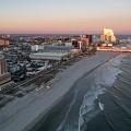


![Atlantic City from near the Tropicana, facing west [01]](../../../i/upload/2024/07/20/20240720015355-cd8667e5-sq.jpg)
![Atlantic City from near the Tropicana, facing west [02]](../../../i/upload/2024/07/20/20240720015401-830b3097-sq.jpg)

![Downtown Chambersburg, Pennsylvania [01]](../../../i/upload/2024/07/20/20240720015745-02a849ae-sq.jpg)
![Downtown Chambersburg, Pennsylvania [02]](../../../i/upload/2024/07/20/20240720015750-22acaec9-sq.jpg)
![Downtown Chambersburg, Pennsylvania [03]](../../../i/upload/2024/07/20/20240720015754-907ba1e7-sq.jpg)
![Interstate 81 at Route 796 [02]](../../../i/upload/2024/07/20/20240720020830-706bf71d-sq.jpg)
![Interstate 81 at Route 796 [01]](../../../i/upload/2024/07/20/20240720020902-02c4ce7b-sq.jpg)
![Train at East Falls Church station [01]](../../../i/upload/2024/07/20/20240720022340-77f6c236-sq.jpg)
![Train at Potomac Avenue station [04]](../../../i/upload/2024/07/20/20240720091606-be0d86de-sq.jpg)
![Train at Potomac Avenue station [05]](../../../i/upload/2024/07/20/20240720091611-acd402a9-sq.jpg)
![Train at East Falls Church station [02]](../../../i/upload/2024/07/20/20240720091710-edc54923-sq.jpg)
![Aerial view of downtown Petersburg, Virginia [04]](../../../i/upload/2024/07/20/20240720091856-35107304-sq.jpg)
![Interstate 85 split [01]](../../../i/upload/2024/07/20/20240720091907-16be82a7-sq.jpg)
![Interstate 85 split [02]](../../../i/upload/2024/07/20/20240720091956-f8385ec8-sq.jpg)
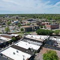

![Skyline of Richmond, Virginia from over the James River [05]](../../../i/upload/2024/07/20/20240720092707-f5afb553-sq.jpg)
![Rapids on the James River [01]](../../../i/upload/2024/07/20/20240720093011-a767724e-sq.jpg)
![Rapids on the James River [02]](../../../i/upload/2024/07/20/20240720093135-219eaaa3-sq.jpg)
![Skyline of Richmond, Virginia from over the James River [06]](../../../i/upload/2024/07/20/20240720093145-04645085-sq.jpg)
![Skyline of Richmond, Virginia from over the James River [01]](../../../i/upload/2024/07/20/20240720093217-566c68d2-sq.jpg)
![Skyline of Richmond, Virginia from over the James River [04]](../../../i/upload/2024/07/20/20240720093223-e807486f-sq.jpg)
![Skyline of Richmond, Virginia from over the James River [03]](../../../i/upload/2024/07/20/20240720093228-9fe867a4-sq.jpg)
![Skyline of Richmond, Virginia from over the James River [02]](../../../i/upload/2024/07/20/20240720093329-b8ae5a03-sq.jpg)
![Parking lot at former Kmart in Charlottesville, Virginia [01]](../../../i/upload/2024/07/20/20240720093751-baf22fc8-sq.jpg)
![Sign at the border between Augusta and Highland Counties [03]](../../../i/upload/2024/07/20/20240720093939-e9041290-sq.jpg)
![Sign at the border between Augusta and Highland Counties [02]](../../../i/upload/2024/07/20/20240720094001-d7689782-sq.jpg)
![Sign at the border between Augusta and Highland Counties [01]](../../../i/upload/2024/07/20/20240720094015-efe93712-sq.jpg)


![Delaware River between Camden and Philadelphia [05]](../../../i/upload/2024/07/20/20240720102512-379be749-sq.jpg)
![Sunset over Sterling, Virginia [01]](../../../i/upload/2024/07/20/20240720103300-a3e8d662-sq.jpg)
![Sunset over Sterling, Virginia [02]](../../../i/upload/2024/07/20/20240720103305-c0323525-sq.jpg)
![Sunset over Sterling, Virginia [03]](../../../i/upload/2024/07/20/20240720103310-9c2855e8-sq.jpg)
![Sunset over Sterling, Virginia [04]](../../../i/upload/2024/07/20/20240720103316-027f54cd-sq.jpg)

![Isolated Metro railcar [01]](../../../i/upload/2024/07/20/20240720103916-a4a17119-sq.jpg)
![Isolated Metro railcar [02]](../../../i/upload/2024/07/20/20240720103921-971b4889-sq.jpg)

![Train at Stadium-Armory [02]](../../../i/upload/2024/07/20/20240720110613-c55a85fb-sq.jpg)


![Power line reservations in Waynesboro, Virginia [01]](../../../i/upload/2024/07/20/20240720111946-5d40f04d-sq.jpg)
![Power line reservations in Waynesboro, Virginia [02]](../../../i/upload/2024/07/20/20240720111952-53ee5258-sq.jpg)
![Selfie with Central Time sign [01]](../../../i/upload/2024/07/20/20240720112806-1fa071a1-sq.jpg)
![Entering Central Time on I-40 [04]](../../../i/upload/2024/07/20/20240720112812-72d9f120-sq.jpg)
![Selfie with Central Time sign [02]](../../../i/upload/2024/07/20/20240720112826-ea7f25a2-sq.jpg)
![Entering Central Time on I-40 [02]](../../../i/upload/2024/07/20/20240720112832-022d61a4-sq.jpg)
![Jeep Renegade at Central Time sign [02]](../../../i/upload/2024/07/20/20240720112904-8f97d519-sq.jpg)
![Entering Central Time on I-40 [05]](../../../i/upload/2024/07/20/20240720112910-643569be-sq.jpg)
![Jeep Renegade at Central Time sign [01]](../../../i/upload/2024/07/20/20240720112916-5207f8cb-sq.jpg)
![Entering Central Time on I-40 [03]](../../../i/upload/2024/07/20/20240720112921-ba9091eb-sq.jpg)
![Jeep Renegade at Central Time sign [03]](../../../i/upload/2024/07/20/20240720113009-ef9ef6f8-sq.jpg)
![Buc-ee's in Crossville, Tennessee [24]](../../../i/upload/2024/07/20/20240720113234-92e3a2db-sq.jpg)
![Entering Central Time on I-40 [01]](../../../i/upload/2024/07/20/20240720113304-bb9ab18c-sq.jpg)
![Elm Avenue interchange [02]](../../../i/upload/2024/07/20/20240720121652-6267da79-sq.jpg)
![Aerial view of Roanoke, Virginia [01]](../../../i/upload/2024/07/20/20240720121757-bb58476c-sq.jpg)
![Aerial view of Roanoke, Virginia [02]](../../../i/upload/2024/07/20/20240720121808-dccb83a0-sq.jpg)
![Aerial view of Roanoke, Virginia [03]](../../../i/upload/2024/07/20/20240720121837-3c6bbb13-sq.jpg)
![Aerial view of Roanoke, Virginia [04]](../../../i/upload/2024/07/20/20240720121854-34748718-sq.jpg)
![Aerial view of Roanoke, Virginia [05]](../../../i/upload/2024/07/20/20240720121906-5f802cee-sq.jpg)
![Aerial view of Roanoke, Virginia [06]](../../../i/upload/2024/07/20/20240720121917-3d4a6311-sq.jpg)
![View from the Roanoke Star, October 2022 [01]](../../../i/upload/2024/07/20/20240720121935-9c3d81cd-sq.jpg)
![View from the Roanoke Star, October 2022 [02]](../../../i/upload/2024/07/20/20240720121946-ef64a8e5-sq.jpg)
![View from the Roanoke Star, October 2022 [03]](../../../i/upload/2024/07/20/20240720121951-aad25312-sq.jpg)
![View from the Roanoke Star, October 2022 [04]](../../../i/upload/2024/07/20/20240720121957-f438f2a3-sq.jpg)
![Elm Avenue interchange [01]](../../../i/upload/2024/07/20/20240720122015-70544823-sq.jpg)

![Wilkes Street Tunnel [01]](../../../i/upload/2024/07/20/20240720123636-36813fe8-sq.jpg)
![Wilkes Street Tunnel [02]](../../../i/upload/2024/07/20/20240720123641-bf49c8ee-sq.jpg)
![Wilkes Street Tunnel [03]](../../../i/upload/2024/07/20/20240720123646-a6b594ca-sq.jpg)
![Wilkes Street Tunnel [04]](../../../i/upload/2024/07/20/20240720123651-dace2839-sq.jpg)
![Wilkes Street Tunnel [05]](../../../i/upload/2024/07/20/20240720123656-19239647-sq.jpg)
![Wilkes Street Tunnel [06]](../../../i/upload/2024/07/20/20240720123701-ec858293-sq.jpg)
![Wilkes Street Tunnel [07]](../../../i/upload/2024/07/20/20240720123706-2138b8e8-sq.jpg)


![Parking lot at Penn's Landing [02]](../../../i/upload/2024/07/20/20240720143132-43a6f1c8-sq.jpg)
![Parking lot at Penn's Landing [01]](../../../i/upload/2024/07/20/20240720143217-921b557b-sq.jpg)


![Wilkes Street Tunnel [11]](../../../i/upload/2024/07/20/20240720144306-d5f8426e-sq.jpg)


![Wilkes Street Tunnel [15]](../../../i/upload/2024/07/20/20240720144340-d1f55bb8-sq.jpg)
![Wilkes Street Tunnel [13]](../../../i/upload/2024/07/20/20240720144346-ea938883-sq.jpg)
![Wilkes Street Tunnel [14]](../../../i/upload/2024/07/20/20240720144352-b8aed1e3-sq.jpg)
![Wilkes Street Tunnel [12]](../../../i/upload/2024/07/20/20240720144420-81ccf027-sq.jpg)
![Wilkes Street Tunnel [10]](../../../i/upload/2024/07/20/20240720144428-4df30985-sq.jpg)
![Wilkes Street Tunnel [08]](../../../i/upload/2024/07/20/20240720144434-13d339f6-sq.jpg)


![N604EC arriving at Washington National Airport [01]](../../../i/upload/2024/07/20/20240720144514-577b1635-sq.jpg)


![N604EC arriving at Washington National Airport [02]](../../../i/upload/2024/07/20/20240720144529-cb792d59-sq.jpg)
![Wilkes Street Tunnel [09]](../../../i/upload/2024/07/20/20240720144535-55b665b6-sq.jpg)


![Column at 28th Street station [01]](../../../i/upload/2024/07/20/20240720150821-d42078ef-sq.jpg)
![Column at 28th Street station [02]](../../../i/upload/2024/07/20/20240720150831-6a96a0da-sq.jpg)
![AT&T Long Lines Cashtown site [01]](../../../i/upload/2024/07/20/20240720151841-adf004f6-sq.jpg)
![AT&T Long Lines Cashtown site [02]](../../../i/upload/2024/07/20/20240720151848-d6fb18c3-sq.jpg)
![AT&T Long Lines Cashtown site [03]](../../../i/upload/2024/07/20/20240720151900-95fd2b3d-sq.jpg)
![AT&T Long Lines Cashtown site [04]](../../../i/upload/2024/07/20/20240720151908-87f5dc57-sq.jpg)
![AT&T Long Lines Cashtown site [05]](../../../i/upload/2024/07/20/20240720151912-32e02595-sq.jpg)
![AT&T Long Lines Cashtown site [06]](../../../i/upload/2024/07/20/20240720151920-9c0ff089-sq.jpg)
![AT&T Long Lines Cashtown site [07]](../../../i/upload/2024/07/20/20240720151924-0825fe88-sq.jpg)
![AT&T Long Lines Cashtown site [08]](../../../i/upload/2024/07/20/20240720151928-7d03f8f5-sq.jpg)
![AT&T Long Lines Cashtown site [09]](../../../i/upload/2024/07/20/20240720151932-8ce49a24-sq.jpg)
![AT&T Long Lines Cashtown site [10]](../../../i/upload/2024/07/20/20240720151936-369c0752-sq.jpg)
![AT&T Long Lines Cashtown site [11]](../../../i/upload/2024/07/20/20240720151941-f9e34b72-sq.jpg)
![AT&T Long Lines Cashtown site [12]](../../../i/upload/2024/07/20/20240720151945-924e64a1-sq.jpg)
![AT&T Long Lines Cashtown site [13]](../../../i/upload/2024/07/20/20240720151949-d75ffe62-sq.jpg)
![AT&T Long Lines Cashtown site [14]](../../../i/upload/2024/07/20/20240720151955-583442f2-sq.jpg)
![AT&T Long Lines Cashtown site [15]](../../../i/upload/2024/07/20/20240720151959-262203ef-sq.jpg)
![AT&T Long Lines Cashtown site [16]](../../../i/upload/2024/07/20/20240720152003-77422ef0-sq.jpg)
![AT&T Long Lines Cashtown site [17]](../../../i/upload/2024/07/20/20240720152007-78e47308-sq.jpg)
![AT&T Long Lines Cashtown site [18]](../../../i/upload/2024/07/20/20240720152012-111d8d46-sq.jpg)
![AT&T Long Lines Cashtown site [19]](../../../i/upload/2024/07/20/20240720152016-1b1f325c-sq.jpg)

![WMATA Pride train 2023 [02]](../../../i/upload/2024/07/29/20240729110801-0b0e2d08-sq.jpg)
![WMATA Pride train 2023 [01]](../../../i/upload/2024/07/29/20240729110806-c4db88b8-sq.jpg)
![Ballston terminal [02]](../../../i/upload/2024/07/29/20240729110813-f21c2925-sq.jpg)
![Ballston terminal [01]](../../../i/upload/2024/07/29/20240729110821-9a18dcbb-sq.jpg)
![Farragut West station [02]](../../../i/upload/2024/08/02/20240802123924-6c99bbe9-sq.jpg)
![Farragut West station [03]](../../../i/upload/2024/08/02/20240802123929-06eb750f-sq.jpg)


![Takeoff from Dulles Airport aboard N88327 [01]](../../../i/upload/2024/08/02/20240802124011-65b187c3-sq.jpg)
![Takeoff from Dulles Airport aboard N88327 [02]](../../../i/upload/2024/08/02/20240802124015-b4c67f91-sq.jpg)

![N88327 travels over the Niagara Falls region of Ontario [01]](../../../i/upload/2024/08/02/20240802124024-64d7728d-sq.jpg)
![N88327 travels over the Niagara Falls region of Ontario [02]](../../../i/upload/2024/08/02/20240802124028-0b03154a-sq.jpg)
![N88327 travels over the Niagara Falls region of Ontario [03]](../../../i/upload/2024/08/02/20240802124031-6fdd8921-sq.jpg)



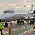

![Selfie aboard N538EG [01]](../../../i/upload/2024/08/09/20240809183405-57d058b6-sq.jpg)
![Selfie aboard N538EG [02]](../../../i/upload/2024/08/09/20240809183412-495c3be7-sq.jpg)
![Selfie aboard N538EG [03]](../../../i/upload/2024/08/09/20240809183420-197c6505-sq.jpg)

![Interior of Washington National Airport [02]](../../../i/upload/2024/08/09/20240809183430-653eae0b-sq.jpg)
![Audi Q7 at Branch Avenue [01]](../../../i/upload/2024/08/09/20240809191942-33ec3a73-sq.jpg)
![Audi Q7 at Branch Avenue [02]](../../../i/upload/2024/08/10/20240810104438-4c420da1-sq.jpg)

![Aerial view of downtown Fredericksburg [01]](../../../i/upload/2024/08/10/20240810113605-aeeec139-sq.jpg)
![Aerial view of downtown Fredericksburg [02]](../../../i/upload/2024/08/10/20240810113610-a8d79889-sq.jpg)

![Exit 225 on Interstate 81 [01]](../../../i/upload/2024/08/24/20240824104647-af96033b-sq.jpg)
![Exit 225 on Interstate 81 [02]](../../../i/upload/2024/08/24/20240824104650-f35998e0-sq.jpg)
![Exit 225 on Interstate 81 [03]](../../../i/upload/2024/08/24/20240824104656-4dd28daf-sq.jpg)
![Exit 225 on Interstate 81 [04]](../../../i/upload/2024/08/24/20240824104700-45b5b9b6-sq.jpg)

![Pipeline across Meander Creek Reservoir [01]](../../../i/upload/2024/10/26/20241026123847-77dd0c8c-sq.jpg)
![Pipeline across Meander Creek Reservoir [02]](../../../i/upload/2024/10/26/20241026123906-6b77f90f-sq.jpg)
![Pipeline across Meander Creek Reservoir [03]](../../../i/upload/2024/10/26/20241026123920-1cf2f16d-sq.jpg)
![Pipeline across Meander Creek Reservoir [04]](../../../i/upload/2024/10/26/20241026123937-7909e450-sq.jpg)
![Pipeline across Meander Creek Reservoir [05]](../../../i/upload/2024/10/26/20241026123951-1510be5f-sq.jpg)
![Pipeline across Meander Creek Reservoir [06]](../../../i/upload/2024/10/26/20241026124000-b2e8c282-sq.jpg)
![Pipeline across Meander Creek Reservoir [07]](../../../i/upload/2024/10/26/20241026124007-b2ccbf65-sq.jpg)
![Pipeline across Meander Creek Reservoir [08]](../../../i/upload/2024/10/26/20241026124015-669976bd-sq.jpg)
![Pipeline across Meander Creek Reservoir [09]](../../../i/upload/2024/10/26/20241026124022-a0effe1c-sq.jpg)


![Detroit People Mover token [01]](../../../i/upload/2024/11/02/20241102124444-4d078caf-sq.jpg)
![Detroit People Mover token [02]](../../../i/upload/2024/11/02/20241102124451-cfaa8b51-sq.jpg)

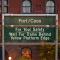

![Alley between North Claremont and North Oakley Avenues [03]](../../../i/upload/2024/11/05/20241105003005-82016820-sq.jpg)


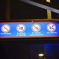


![Woodrow Wilson Parkway at Churchville Avenue [01]](../../../i/upload/2024/11/26/20241126004148-6fb2b2e4-sq.jpg)
![Woodrow Wilson Parkway at Churchville Avenue [02]](../../../i/upload/2024/11/26/20241126004154-6decce28-sq.jpg)
![Woodrow Wilson Parkway at Churchville Avenue [03]](../../../i/upload/2024/11/26/20241126004159-ac6ca342-sq.jpg)
![Woodrow Wilson Parkway at Churchville Avenue [04]](../../../i/upload/2024/11/26/20241126004205-1752c829-sq.jpg)
![Woodrow Wilson Parkway at Churchville Avenue [05]](../../../i/upload/2024/11/26/20241126004211-954cdd71-sq.jpg)
![Woodrow Wilson Parkway at Churchville Avenue [06]](../../../i/upload/2024/11/26/20241126004217-db5f3f5c-sq.jpg)
![Interstate 81 near Verona, Virginia [01]](../../../i/upload/2024/11/28/20241128103749-b97fb29f-sq.jpg)
![Interstate 81 near Verona, Virginia [02]](../../../i/upload/2024/11/28/20241128103753-ff030609-sq.jpg)
![Interstate 81 near Verona, Virginia [03]](../../../i/upload/2024/11/28/20241128103757-213af6d5-sq.jpg)
![Interstate 81 near Verona, Virginia [04]](../../../i/upload/2024/11/28/20241128103802-c0bab98c-sq.jpg)
![Interstate 81 near Verona, Virginia [05]](../../../i/upload/2024/11/28/20241128103806-21947d95-sq.jpg)
![Staunton Walmart following 2023 remodeling [02]](../../../i/upload/2024/11/28/20241128155238-4bc4693c-sq.jpg)
![Staunton Walmart following 2023 remodeling [03]](../../../i/upload/2024/11/28/20241128155337-3d93f0d4-sq.jpg)


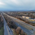


![Aerial view of Myrtle Beach, South Carolina [01]](../../../i/upload/2025/01/16/20250116011517-f8bb6ab8-sq.jpg)
![Aerial view of Myrtle Beach, South Carolina [02]](../../../i/upload/2025/01/16/20250116011527-f000c002-sq.jpg)
![Aerial view of Myrtle Beach, South Carolina [03]](../../../i/upload/2025/01/16/20250116011535-e4909d01-sq.jpg)
![Aerial view of Myrtle Beach, South Carolina [04]](../../../i/upload/2025/01/16/20250116011543-c0352f82-sq.jpg)
![Aerial view of Myrtle Beach, South Carolina [05]](../../../i/upload/2025/01/16/20250116011549-fb2ac6b0-sq.jpg)
![Aerial view of Myrtle Beach, South Carolina [06]](../../../i/upload/2025/01/16/20250116011556-58eeb392-sq.jpg)
![Aerial view of Myrtle Beach, South Carolina [07]](../../../i/upload/2025/01/16/20250116011602-0271fcdd-sq.jpg)
![Aerial view of Myrtle Beach, South Carolina [08]](../../../i/upload/2025/01/16/20250116011610-80555640-sq.jpg)
![Aerial view of Myrtle Beach, South Carolina [09]](../../../i/upload/2025/01/16/20250116011616-86a3a1ed-sq.jpg)
![Aerial view of Myrtle Beach, South Carolina [10]](../../../i/upload/2025/01/16/20250116011622-c227f7d2-sq.jpg)
![Aerial view of Myrtle Beach, South Carolina [11]](../../../i/upload/2025/01/16/20250116011628-3f5529d7-sq.jpg)
![Aerial view of Myrtle Beach, South Carolina [12]](../../../i/upload/2025/01/16/20250116011635-e2f59869-sq.jpg)
![Aerial view of Myrtle Beach, South Carolina [13]](../../../i/upload/2025/01/16/20250116011642-eaad0007-sq.jpg)
![Aerial view of Myrtle Beach, South Carolina [14]](../../../i/upload/2025/01/16/20250116011649-2b82761b-sq.jpg)
![Aerial view of Myrtle Beach, South Carolina [15]](../../../i/upload/2025/01/16/20250116011655-ed58c149-sq.jpg)
![Aerial view of Myrtle Beach, South Carolina [16]](../../../i/upload/2025/01/16/20250116011701-1e30b28a-sq.jpg)
![Aerial view of Myrtle Beach, South Carolina [17]](../../../i/upload/2025/01/16/20250116011708-700a2aeb-sq.jpg)
![Aerial view of Myrtle Beach, South Carolina [18]](../../../i/upload/2025/01/16/20250116011716-7718fc67-sq.jpg)
![Aerial view of Myrtle Beach, South Carolina [19]](../../../i/upload/2025/01/16/20250116011723-729e4cea-sq.jpg)
![Aerial view of Myrtle Beach, South Carolina [20]](../../../i/upload/2025/01/16/20250116011730-cd564b26-sq.jpg)
![View over the ocean from Myrtle Beach, South Carolina [01]](../../../i/upload/2025/01/16/20250116011737-32868b23-sq.jpg)
![View over the ocean from Myrtle Beach, South Carolina [02]](../../../i/upload/2025/01/16/20250116011743-6fa086ad-sq.jpg)
![AT&T Long Lines Cashtown site [20]](../../../i/upload/2025/02/05/20250205002828-20fe292b-sq.jpg)
![AT&T Long Lines Cashtown site [21]](../../../i/upload/2025/02/05/20250205002831-542375bc-sq.jpg)
![AT&T Long Lines Wye Mills site [01]](../../../i/upload/2025/02/16/20250216005632-3276ba44-sq.jpg)
![AT&T Long Lines Wye Mills site [02]](../../../i/upload/2025/02/16/20250216005637-21345428-sq.jpg)
![AT&T Long Lines Wye Mills site [03]](../../../i/upload/2025/02/16/20250216005642-9dfa25f7-sq.jpg)
![AT&T Long Lines Wye Mills site [04]](../../../i/upload/2025/02/16/20250216005647-5d170521-sq.jpg)
![AT&T Long Lines Wye Mills site [05]](../../../i/upload/2025/02/16/20250216005653-96b21c6d-sq.jpg)
![AT&T Long Lines Wye Mills site [06]](../../../i/upload/2025/02/16/20250216005658-f86e877e-sq.jpg)

