
Ben Schumin Photography Portfolio
Ben Schumin is a professional photographer who captures the intricacies of daily life.
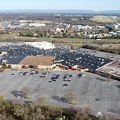
Aerial view of an area around US 13 in Pocomoke City, Maryland in late afternoon.
![Hampton Roads Bridge-Tunnel, westbound [02]](../../../i/upload/2025/02/17/20250217012521-81ed217b-sq.jpg)
![Hampton Roads Bridge-Tunnel, westbound [01]](../../../i/upload/2025/02/17/20250217012510-5b2ab7ac-sq.jpg)
![Birdsnest Lookout [04]](../../../i/upload/2025/02/17/20250217005810-218c7f41-sq.jpg)
![Birdsnest Lookout [03]](../../../i/upload/2025/02/17/20250217005804-343b9ffb-sq.jpg)
![Birdsnest Lookout [02]](../../../i/upload/2025/02/17/20250217005759-caf88839-sq.jpg)
![Birdsnest Lookout [06]](../../../i/upload/2025/02/17/20250217005823-259e9098-sq.jpg)
![Birdsnest Lookout [05]](../../../i/upload/2025/02/17/20250217005817-b3e6d468-sq.jpg)
![Birdsnest Lookout [01]](../../../i/upload/2025/02/17/20250217005755-4434f494-sq.jpg)

![Honda HR-V along US 13 [02]](../../../i/upload/2025/02/16/20250216105404-a22075b0-sq.jpg)
![Honda HR-V along US 13 [01]](../../../i/upload/2025/02/16/20250216105309-52b06bb0-sq.jpg)
![Junction with US 13 Business [02]](../../../i/upload/2025/02/16/20250216105236-6f438cfb-sq.jpg)
![Junction with US 13 Business [01]](../../../i/upload/2025/02/16/20250216105227-05f505b7-sq.jpg)
![Area around US 13 in Pocomoke City, Maryland [02]](../../../i/upload/2025/02/16/20250216105020-45970493-sq.jpg)
![Area around US 13 in Pocomoke City, Maryland [01]](../../../i/upload/2025/02/16/20250216104958-9cfd679e-sq.jpg)
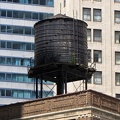
![Water tower at Eastern Shore Forest Products [02]](../../../i/upload/2025/02/16/20250216104851-53db0227-sq.jpg)
![Water tower at Eastern Shore Forest Products [01]](../../../i/upload/2025/02/16/20250216104828-1da2e8f2-sq.jpg)
![Choptank River Bridge [03]](../../../i/upload/2025/02/16/20250216101126-5e453b53-sq.jpg)
![Choptank River Bridge [02]](../../../i/upload/2025/02/16/20250216101120-5c3d2aaf-sq.jpg)
![Choptank River Bridge [08]](../../../i/upload/2025/02/16/20250216101153-3a9fcb7d-sq.jpg)
![Choptank River Bridge [07]](../../../i/upload/2025/02/16/20250216101147-f4d3c81d-sq.jpg)
![Choptank River Bridge [06]](../../../i/upload/2025/02/16/20250216101141-257983d7-sq.jpg)
![Choptank River Bridge [05]](../../../i/upload/2025/02/16/20250216101136-cbe956a7-sq.jpg)
![Choptank River Bridge [04]](../../../i/upload/2025/02/16/20250216101131-08475973-sq.jpg)
![Choptank River Bridge [01]](../../../i/upload/2025/02/16/20250216101115-1f995023-sq.jpg)
![Sirens at Easton Volunteer Fire Department [03]](../../../i/upload/2025/02/16/20250216092258-17226c32-sq.jpg)
![Sirens at Easton Volunteer Fire Department [02]](../../../i/upload/2025/02/16/20250216092246-6e4740d5-sq.jpg)
![Sirens at Easton Volunteer Fire Department [01]](../../../i/upload/2025/02/16/20250216092233-42eae054-sq.jpg)
![AT&T Long Lines Wye Mills site [06]](../../../i/upload/2025/02/16/20250216005658-f86e877e-sq.jpg)
![AT&T Long Lines Wye Mills site [05]](../../../i/upload/2025/02/16/20250216005653-96b21c6d-sq.jpg)
![AT&T Long Lines Wye Mills site [04]](../../../i/upload/2025/02/16/20250216005647-5d170521-sq.jpg)
![AT&T Long Lines Wye Mills site [03]](../../../i/upload/2025/02/16/20250216005642-9dfa25f7-sq.jpg)
![AT&T Long Lines Wye Mills site [02]](../../../i/upload/2025/02/16/20250216005637-21345428-sq.jpg)
![AT&T Long Lines Wye Mills site [01]](../../../i/upload/2025/02/16/20250216005632-3276ba44-sq.jpg)
![Intersection of US 50 and MD 213 [02]](../../../i/upload/2025/02/16/20250216003338-82427ee4-sq.jpg)
![Intersection of US 50 and MD 213 [01]](../../../i/upload/2025/02/16/20250216003332-e7ac1a6b-sq.jpg)

![Signage for eastern US 50/US 301 split [02]](../../../i/upload/2025/02/07/20250207212412-a7ff650a-sq.jpg)
![Signage for eastern US 50/US 301 split [01]](../../../i/upload/2025/02/07/20250207212407-b5a2955a-sq.jpg)
![Drone selfie at Terrapin Nature Park [03]](../../../i/upload/2025/02/07/20250207143425-6d37f384-sq.jpg)
![Drone selfie at Terrapin Nature Park [02]](../../../i/upload/2025/02/07/20250207143421-5873969c-sq.jpg)
![Drone selfie at Terrapin Nature Park [01]](../../../i/upload/2025/02/07/20250207143416-fd1da95f-sq.jpg)
![Water tower off of Bateau Drive [02]](../../../i/upload/2025/02/07/20250207143410-f2a4ee8a-sq.jpg)
![Water tower off of Bateau Drive [01]](../../../i/upload/2025/02/07/20250207143405-d60bbf88-sq.jpg)
![Eastern end of the Chesapeake Bay Bridge [04]](../../../i/upload/2025/02/07/20250207140003-1549325d-sq.jpg)
![Eastern end of the Chesapeake Bay Bridge [02]](../../../i/upload/2025/02/07/20250207135805-4b074040-sq.jpg)
![Eastern end of the Chesapeake Bay Bridge [03]](../../../i/upload/2025/02/07/20250207135903-c1f151c4-sq.jpg)
![Eastern end of the Chesapeake Bay Bridge [01]](../../../i/upload/2025/02/07/20250207135752-9d02b521-sq.jpg)

![Room 414 at the Moxy in Richmond [02]](../../../i/upload/2024/07/20/20240720145148-3919e96d-sq.jpg)
![Room 414 at the Moxy in Richmond [01]](../../../i/upload/2024/07/20/20240720145143-51c39a91-sq.jpg)


![Fueling the Scion [03]](../../../i/upload/2024/07/20/20240720145123-88dd181b-sq.jpg)
![Fueling the Scion [02]](../../../i/upload/2024/07/20/20240720145118-7084401d-sq.jpg)
![Fueling the Scion [01]](../../../i/upload/2024/07/20/20240720145114-3e7e3edb-sq.jpg)


![Elyse films trains at Brunswick [02]](../../../i/upload/2024/07/19/20240719172432-af267b04-sq.jpg)
![Rail crossing at South Maple Avenue [02]](../../../i/upload/2024/07/19/20240719172427-b3f8d752-sq.jpg)

![Rail crossing at South Maple Avenue [05]](../../../i/upload/2024/07/19/20240719172417-b0a76d64-sq.jpg)
![Rail crossing at South Maple Avenue [01]](../../../i/upload/2024/07/19/20240719172412-544e2058-sq.jpg)
![Waiting room at Brunswick MARC station [01]](../../../i/upload/2024/07/19/20240719172406-4aad5ab8-sq.jpg)
![Rail crossing at South Maple Avenue [04]](../../../i/upload/2024/07/19/20240719172401-b57189bc-sq.jpg)
![Rail crossing at South Maple Avenue [03]](../../../i/upload/2024/07/19/20240719172356-3faabeb3-sq.jpg)
![Elyse films trains at Brunswick [01]](../../../i/upload/2024/07/19/20240719172351-0c967d86-sq.jpg)

![Waiting room at Brunswick MARC station [02]](../../../i/upload/2024/07/19/20240719172342-b89fa7c4-sq.jpg)
![Ollie's Bargain Outlet in Winchester, Virginia [03]](../../../i/upload/2024/07/19/20240719162010-4c37460a-sq.jpg)
![Discarded face mask at Walmart [02]](../../../i/upload/2024/07/19/20240719162005-fd511d6e-sq.jpg)
![Marty robot wearing a mask [02]](../../../i/upload/2024/07/19/20240719162002-09258239-sq.jpg)
![Ollie's Bargain Outlet in Winchester, Virginia [02]](../../../i/upload/2024/07/19/20240719161957-e10c14c1-sq.jpg)
![Ollie's Bargain Outlet in Winchester, Virginia [01]](../../../i/upload/2024/07/19/20240719161953-d49fafed-sq.jpg)
![Discarded face mask at Walmart [01]](../../../i/upload/2024/07/19/20240719161934-e67414e1-sq.jpg)
![Discarded face mask at Walmart [03]](../../../i/upload/2024/07/19/20240719161924-fe334bba-sq.jpg)
![Cans of Mountain Dew Rise [02]](../../../i/upload/2024/07/19/20240719161919-5b8cdde6-sq.jpg)
![Marty robot wearing a mask [01]](../../../i/upload/2024/07/19/20240719161916-6b77823d-sq.jpg)
![Cans of Mountain Dew Rise [03]](../../../i/upload/2024/07/19/20240719161911-06faadc4-sq.jpg)
![Cans of Mountain Dew Rise [01]](../../../i/upload/2024/07/19/20240719161906-9213508c-sq.jpg)
![Individually packaged bagels at Shoppers Food [02]](../../../i/upload/2024/07/19/20240719121045-f31001ae-sq.jpg)
![Individually packaged bagels at Shoppers Food [01]](../../../i/upload/2024/07/19/20240719121040-cb1d173b-sq.jpg)
![Individually packaged donuts at Shoppers Food [02]](../../../i/upload/2024/07/19/20240719121034-c3c1b4a2-sq.jpg)
![Individually packaged donuts at Shoppers Food [01]](../../../i/upload/2024/07/19/20240719121028-372ba163-sq.jpg)


![Ride On bus 46006D at Burtonsville Park & Ride [05]](../../../i/upload/2024/07/19/20240719120956-93c246e5-sq.jpg)
![Ride On bus 46006D at Burtonsville Park & Ride [04]](../../../i/upload/2024/07/19/20240719120951-102672ed-sq.jpg)
![Ride On bus 46006D at Burtonsville Park & Ride [03]](../../../i/upload/2024/07/19/20240719120946-b6bbc269-sq.jpg)
![Ride On bus 46006D at Burtonsville Park & Ride [02]](../../../i/upload/2024/07/19/20240719120941-c16cc7dd-sq.jpg)
![Ride On bus 46006D at Burtonsville Park & Ride [01]](../../../i/upload/2024/07/19/20240719120936-2027c321-sq.jpg)
![Ride On bus 46001D at Burtonsville Park & Ride [02]](../../../i/upload/2024/07/19/20240719120931-1745472e-sq.jpg)
![Ride On bus 46001D at Burtonsville Park & Ride [01]](../../../i/upload/2024/07/19/20240719120926-5605ab7c-sq.jpg)
![Vintage Toys "R" Us sign [06]](../../../i/upload/2024/07/18/20240718230556-b88b9e55-sq.jpg)
![Vintage Toys "R" Us sign [05]](../../../i/upload/2024/07/18/20240718230552-395a6bd2-sq.jpg)
![Vintage Toys "R" Us sign [04]](../../../i/upload/2024/07/18/20240718230545-2dc0d0d3-sq.jpg)
![Vintage Toys "R" Us sign [03]](../../../i/upload/2024/07/18/20240718230549-69813141-sq.jpg)
![Vintage Toys "R" Us sign [02]](../../../i/upload/2024/07/18/20240718230541-08c14b23-sq.jpg)
![Vintage Toys "R" Us sign [01]](../../../i/upload/2024/07/18/20240718230537-425fa115-sq.jpg)
![Bodie Island Lighthouse [13]](../../../i/upload/2024/07/18/20240718223143-61ba8525-sq.jpg)
![Bodie Island Lighthouse [12]](../../../i/upload/2024/07/18/20240718223146-5cc497a8-sq.jpg)
![Bodie Island Lighthouse [11]](../../../i/upload/2024/07/18/20240718223136-d6cee7ff-sq.jpg)
![Bodie Island Lighthouse [10]](../../../i/upload/2024/07/18/20240718223139-01f9e27a-sq.jpg)
![Bodie Island Lighthouse [09]](../../../i/upload/2024/07/18/20240718223125-a59ec680-sq.jpg)
![Bodie Island Lighthouse [08]](../../../i/upload/2024/07/18/20240718223129-b84209db-sq.jpg)
![Bodie Island Lighthouse [07]](../../../i/upload/2024/07/18/20240718223132-9a76022b-sq.jpg)
![Bodie Island Lighthouse [06]](../../../i/upload/2024/07/18/20240718223118-1479928d-sq.jpg)

![Bodie Island Lighthouse [05]](../../../i/upload/2024/07/18/20240718223107-e29c5477-sq.jpg)
![Bodie Island Lighthouse [03]](../../../i/upload/2024/07/18/20240718223111-cf8e150b-sq.jpg)
![Bodie Island Lighthouse [04]](../../../i/upload/2024/07/18/20240718223115-c7801f27-sq.jpg)
![Bodie Island Lighthouse [02]](../../../i/upload/2024/07/18/20240718223054-4260931f-sq.jpg)
![Park Place [02]](../../../i/upload/2024/07/18/20240718223058-9b18502e-sq.jpg)
![Bodie Island Lighthouse [01]](../../../i/upload/2024/07/18/20240718223104-a0430892-sq.jpg)


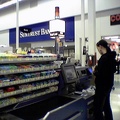
![Walmart Supercenter in Staunton, Virginia during Project Impact remodel [03]](../../../i/upload/2024/07/17/20240717231803-c7081bc1-sq.jpg)
![Walmart Supercenter in Staunton, Virginia during Project Impact remodel [01]](../../../i/upload/2024/07/17/20240717231755-52e41065-sq.jpg)
![Walmart Supercenter in Staunton, Virginia during Project Impact remodel [02]](../../../i/upload/2024/07/17/20240717231759-bfeec597-sq.jpg)
![Sears Hill footbridge [02]](../../../i/upload/2024/07/17/20240717232851-f88f72c3-sq.jpg)
![Sears Hill footbridge [01]](../../../i/upload/2024/07/17/20240717232847-199d583d-sq.jpg)
![Staunton Amtrak station [06]](../../../i/upload/2024/07/17/20240717232843-b8074491-sq.jpg)
![Staunton Amtrak station [05]](../../../i/upload/2024/07/17/20240717232839-c34d7ef7-sq.jpg)
![Staunton Amtrak station [04]](../../../i/upload/2024/07/17/20240717232835-e4be1f69-sq.jpg)
![Staunton Amtrak station [03]](../../../i/upload/2024/07/17/20240717232831-0c23b932-sq.jpg)

![Fire alarm pull station at New Street parking garage [01]](../../../i/upload/2024/07/17/20240717231752-468f336b-sq.jpg)
![Buckingham Branch Railroad [07]](../../../i/upload/2024/07/17/20240717231749-82360330-sq.jpg)
![Buckingham Branch Railroad [06]](../../../i/upload/2024/07/17/20240717231746-a3c437a7-sq.jpg)
![Buckingham Branch Railroad [05]](../../../i/upload/2024/07/17/20240717231743-45a72407-sq.jpg)
![Buckingham Branch Railroad [04]](../../../i/upload/2024/07/17/20240717231740-950fdbf2-sq.jpg)
![Buckingham Branch Railroad [03]](../../../i/upload/2024/07/17/20240717231737-32fb0e41-sq.jpg)
![Buckingham Branch Railroad [02]](../../../i/upload/2024/07/17/20240717231735-238e1b9f-sq.jpg)
![Buckingham Branch Railroad [01]](../../../i/upload/2024/07/17/20240717231732-9c898446-sq.jpg)


![Augusta County Courthouse [01]](../../../i/upload/2024/07/17/20240717231723-0daee6ca-sq.jpg)

![Fire-Lite BG-12 with key [02]](../../../i/upload/2024/07/17/20240717170120-dbf897ca-sq.jpg)
![Fire-Lite BG-12 with key [01]](../../../i/upload/2024/07/17/20240717170117-7089a5b8-sq.jpg)

![Railroad bridge [01]](../../../i/upload/2024/07/17/20240717155406-0a79de93-sq.jpg)
![Richmond floodwall opening for Canal [01]](../../../i/upload/2024/07/17/20240717155403-a5e9d787-sq.jpg)

![Triple Crossing area [01]](../../../i/upload/2024/07/17/20240717155358-ef286524-sq.jpg)
![Triple Crossing area [02]](../../../i/upload/2024/07/17/20240717155355-a9821d17-sq.jpg)
![Richmond floodwall opening for Canal [02]](../../../i/upload/2024/07/17/20240717155353-68a5409e-sq.jpg)


![Canal Walk through Shockoe Bottom [01]](../../../i/upload/2024/07/17/20240717155345-29a96509-sq.jpg)

![Canal Walk through Shockoe Bottom [02]](../../../i/upload/2024/07/17/20240717155340-89b9c324-sq.jpg)
![Vistas on the James [01]](../../../i/upload/2024/07/17/20240717155337-72f312c6-sq.jpg)
![Canal Walk through Shockoe Bottom [03]](../../../i/upload/2024/07/17/20240717155332-20a25b99-sq.jpg)

![Archway and gate at Reynolds Wrap building [02]](../../../i/upload/2024/07/17/20240717155328-f893e4c7-sq.jpg)

![Christopher Newport Cross [01]](../../../i/upload/2024/07/17/20240717155321-0396ca1f-sq.jpg)
![Christopher Newport Cross [02]](../../../i/upload/2024/07/17/20240717155319-ab06b102-sq.jpg)
![Christopher Newport Cross [03]](../../../i/upload/2024/07/17/20240717155317-ddd5fda2-sq.jpg)


![Art space in former power plant [01]](../../../i/upload/2024/07/17/20240717155310-26d9c2c2-sq.jpg)
![The Italianate [01]](../../../i/upload/2024/07/17/20240717155308-be9db301-sq.jpg)
![The Italianate [02]](../../../i/upload/2024/07/17/20240717155305-c94f993b-sq.jpg)
![The Italianate [03]](../../../i/upload/2024/07/17/20240717155303-b342a3c2-sq.jpg)

![Riverfront Plaza [01]](../../../i/upload/2024/07/17/20240717155257-df9acddd-sq.jpg)
![Riverfront Plaza [02]](../../../i/upload/2024/07/17/20240717155254-7c67002b-sq.jpg)
![Footbridge over the Canal [01]](../../../i/upload/2024/07/17/20240717155252-e5d3b57e-sq.jpg)

![Federal Reserve Bank building [01]](../../../i/upload/2024/07/17/20240717155248-28f48be3-sq.jpg)
![Federal Reserve and Riverfront Plaza [01]](../../../i/upload/2024/07/17/20240717155245-6d3ce1d0-sq.jpg)
![Footbridge over the Canal [02]](../../../i/upload/2024/07/17/20240717155243-a3a02ded-sq.jpg)
![Footbridge over the Canal [03]](../../../i/upload/2024/07/17/20240717155240-726059d3-sq.jpg)
![Riverfront Plaza [03]](../../../i/upload/2024/07/17/20240717155238-713af7c7-sq.jpg)
![Footbridge over the Canal [04]](../../../i/upload/2024/07/17/20240717155235-711c5134-sq.jpg)
![Riverfront Plaza west tower [01]](../../../i/upload/2024/07/17/20240717155233-ad04bce9-sq.jpg)
![Tree in bloom [01]](../../../i/upload/2024/07/17/20240717155231-c2a7d5f6-sq.jpg)
![Tree in bloom [02]](../../../i/upload/2024/07/17/20240717155228-7317b22e-sq.jpg)
![Tree in bloom [03]](../../../i/upload/2024/07/17/20240717155226-e1fd686c-sq.jpg)
![Tree in bloom [04]](../../../i/upload/2024/07/17/20240717155224-a6ad9256-sq.jpg)
![MeadWestvaco, Federal Reserve, and Riverfront Plaza buildings [01]](../../../i/upload/2024/07/17/20240717155221-cdc74f24-sq.jpg)

![MeadWestvaco, Federal Reserve, and Riverfront Plaza buildings [02]](../../../i/upload/2024/07/17/20240717155216-92d538fb-sq.jpg)
![MeadWestvaco building [01]](../../../i/upload/2024/07/17/20240717155214-97c95e28-sq.jpg)
![MeadWestvaco building [02]](../../../i/upload/2024/07/17/20240717155211-1f809fb5-sq.jpg)

![Rocks in the James River [01]](../../../i/upload/2024/07/17/20240717155206-4845495c-sq.jpg)
![Richmond skyline [01]](../../../i/upload/2024/07/17/20240717155204-034e37ba-sq.jpg)

![Railroad bridge [02]](../../../i/upload/2024/07/17/20240717155159-48af8847-sq.jpg)
![Railroad bridge [03]](../../../i/upload/2024/07/17/20240717155156-fb77e508-sq.jpg)
![Richmond skyline [02]](../../../i/upload/2024/07/17/20240717155153-fa296849-sq.jpg)

![Shoes hanging from bridge cable [01]](../../../i/upload/2024/07/17/20240717155148-beab5354-sq.jpg)


![Richmond skyline [03]](../../../i/upload/2024/07/17/20240717155130-cfb4a095-sq.jpg)
![Robert E. Lee Memorial Bridge and Belle Isle pedestrian bridge [01]](../../../i/upload/2024/07/17/20240717155128-6aa706b6-sq.jpg)
![Robert E. Lee Memorial Bridge and Belle Isle pedestrian bridge [02]](../../../i/upload/2024/07/17/20240717155125-6acbde52-sq.jpg)
![Richmond skyline [04]](../../../i/upload/2024/07/17/20240717155122-17d9c4b8-sq.jpg)
![Richmond skyline [05]](../../../i/upload/2024/07/17/20240717155118-d2e7b5b2-sq.jpg)
![Richmond skyline [06]](../../../i/upload/2024/07/17/20240717155116-d4983983-sq.jpg)
![Richmond skyline [07]](../../../i/upload/2024/07/17/20240717155113-cec25ff6-sq.jpg)
![Richmond skyline [08]](../../../i/upload/2024/07/17/20240717155110-33b853b1-sq.jpg)
![Richmond skyline [09]](../../../i/upload/2024/07/17/20240717155106-9423a503-sq.jpg)
![Richmond skyline [10]](../../../i/upload/2024/07/17/20240717155103-0850cb89-sq.jpg)
![Richmond skyline [11]](../../../i/upload/2024/07/17/20240717155100-1121e622-sq.jpg)
![Richmond skyline [12]](../../../i/upload/2024/07/17/20240717155057-1b70ebec-sq.jpg)
![Shoes hanging from bridge cable [02]](../../../i/upload/2024/07/17/20240717155055-e9aa5fd7-sq.jpg)

![Riverfront Plaza west tower [02]](../../../i/upload/2024/07/17/20240717155050-78f1d3cf-sq.jpg)
![Federal Reserve Bank building [02]](../../../i/upload/2024/07/17/20240717155047-038586d8-sq.jpg)

![Riverfront Plaza [04]](../../../i/upload/2024/07/17/20240717155043-f1f22937-sq.jpg)
![The Italianate [04]](../../../i/upload/2024/07/17/20240717155040-20d20eb5-sq.jpg)
![The Italianate [05]](../../../i/upload/2024/07/17/20240717155038-4d2f4d7b-sq.jpg)
![The Italianate [06]](../../../i/upload/2024/07/17/20240717155036-84d4da7f-sq.jpg)

![Curve in the Canal [01]](../../../i/upload/2024/07/17/20240717155032-9c996cde-sq.jpg)
![Curve in the Canal [02]](../../../i/upload/2024/07/17/20240717155029-38d7ccbe-sq.jpg)

![Canal Walk through Shockoe Bottom [04]](../../../i/upload/2024/07/17/20240717155024-693f8160-sq.jpg)
![Canal Walk through Shockoe Bottom [05]](../../../i/upload/2024/07/17/20240717155021-9a708136-sq.jpg)
![Richmond floodwall opening for Canal [03]](../../../i/upload/2024/07/17/20240717155019-c4b734ef-sq.jpg)
![Ramp to Downtown Expressway [01]](../../../i/upload/2024/07/17/20240717155016-33eaba18-sq.jpg)
![Railroad bridge [04]](../../../i/upload/2024/07/17/20240717155013-784d7c58-sq.jpg)
![Railroad bridge [05]](../../../i/upload/2024/07/17/20240717155011-55bc146d-sq.jpg)
![Ramp to Downtown Expressway [02]](../../../i/upload/2024/07/17/20240717155008-eff88bf6-sq.jpg)
![Kia Soul in Shockoe Bottom parking lot [01]](../../../i/upload/2024/07/17/20240717155005-a2d38bbe-sq.jpg)
![Kia Soul in Shockoe Bottom parking lot [02]](../../../i/upload/2024/07/17/20240717155003-dcef5bbc-sq.jpg)
![Kia Soul in Shockoe Bottom parking lot [03]](../../../i/upload/2024/07/17/20240717155001-43a19547-sq.jpg)
![Fire alarm photo shoot [05]](../../../i/upload/2024/07/17/20240717102133-d3dc56c3-sq.jpg)
![Rally to Restore Sanity and/or Fear [20]](../../../i/upload/2024/07/16/20240716011455-fb4c81f7-sq.jpg)
![Rally to Restore Sanity and/or Fear [21]](../../../i/upload/2024/07/16/20240716011453-34396f97-sq.jpg)
![Rally to Restore Sanity and/or Fear [22]](../../../i/upload/2024/07/16/20240716011451-b2603d5e-sq.jpg)
![Rally to Restore Sanity and/or Fear [23]](../../../i/upload/2024/07/16/20240716011449-d393b26b-sq.jpg)
![Rally to Restore Sanity and/or Fear [24]](../../../i/upload/2024/07/16/20240716011446-34aea68f-sq.jpg)
![Rally to Restore Sanity and/or Fear [26]](../../../i/upload/2024/07/16/20240716011441-0d6da240-sq.jpg)
![Rally to Restore Sanity and/or Fear [27]](../../../i/upload/2024/07/16/20240716011438-a2379513-sq.jpg)
![Rally to Restore Sanity and/or Fear [28]](../../../i/upload/2024/07/16/20240716011436-f9155ac0-sq.jpg)
![Rally to Restore Sanity and/or Fear [29]](../../../i/upload/2024/07/16/20240716011433-609a98e4-sq.jpg)
![Rally to Restore Sanity and/or Fear [30]](../../../i/upload/2024/07/16/20240716011431-a96f3b37-sq.jpg)
![Rally to Restore Sanity and/or Fear [25]](../../../i/upload/2024/07/16/20240716011428-fad97702-sq.jpg)
![Rally to Restore Sanity and/or Fear [01]](../../../i/upload/2024/07/16/20240716011427-74ebaeb0-sq.jpg)
![Rally to Restore Sanity and/or Fear [02]](../../../i/upload/2024/07/16/20240716011425-30eb9381-sq.jpg)
![Rally to Restore Sanity and/or Fear [03]](../../../i/upload/2024/07/16/20240716011423-43a39b19-sq.jpg)
![Rally to Restore Sanity and/or Fear [04]](../../../i/upload/2024/07/16/20240716011422-0f91d98b-sq.jpg)
![Rally to Restore Sanity and/or Fear [05]](../../../i/upload/2024/07/16/20240716011420-f58bd465-sq.jpg)
![Rally to Restore Sanity and/or Fear [06]](../../../i/upload/2024/07/16/20240716011418-d5b2545b-sq.jpg)
![Rally to Restore Sanity and/or Fear [07]](../../../i/upload/2024/07/16/20240716011416-7c3fa509-sq.jpg)
![Rally to Restore Sanity and/or Fear [08]](../../../i/upload/2024/07/16/20240716011414-3abacc15-sq.jpg)
![Rally to Restore Sanity and/or Fear [09]](../../../i/upload/2024/07/16/20240716011412-4978f714-sq.jpg)
![Rally to Restore Sanity and/or Fear [10]](../../../i/upload/2024/07/16/20240716011411-b76e5375-sq.jpg)
![Rally to Restore Sanity and/or Fear [11]](../../../i/upload/2024/07/16/20240716011409-eaa81b49-sq.jpg)
![Rally to Restore Sanity and/or Fear [12]](../../../i/upload/2024/07/16/20240716011407-3f50089e-sq.jpg)
![Rally to Restore Sanity and/or Fear [13]](../../../i/upload/2024/07/16/20240716011405-97243827-sq.jpg)
![Rally to Restore Sanity and/or Fear [14]](../../../i/upload/2024/07/16/20240716011403-f21edd2d-sq.jpg)
![Rally to Restore Sanity and/or Fear [15]](../../../i/upload/2024/07/16/20240716011400-7228d951-sq.jpg)
![Rally to Restore Sanity and/or Fear [16]](../../../i/upload/2024/07/16/20240716011358-691597c7-sq.jpg)
![Rally to Restore Sanity and/or Fear [17]](../../../i/upload/2024/07/16/20240716011356-2a5eb02e-sq.jpg)
![Rally to Restore Sanity and/or Fear [18]](../../../i/upload/2024/07/16/20240716011354-852ad8dc-sq.jpg)
![Rally to Restore Sanity and/or Fear [19]](../../../i/upload/2024/07/16/20240716011352-fce0e046-sq.jpg)

![Boston fire alarm street box [03]](../../../i/upload/2024/07/16/20240716011051-013dc8a4-sq.jpg)
![Boston fire alarm street box [02]](../../../i/upload/2024/07/16/20240716011049-b6762f39-sq.jpg)

![Boston, Massachusetts [02]](../../../i/upload/2024/07/16/20240716011040-f1a2baea-sq.jpg)

![Boston fire alarm street box [01]](../../../i/upload/2024/07/16/20240716011039-e4d4ca06-sq.jpg)


![Amtrak Superliner II fire alarms [01]](../../../i/upload/2024/07/16/20240716011026-85b1ea61-sq.jpg)

![Boston, Massachusetts [01]](../../../i/upload/2024/07/16/20240716011031-c1272beb-sq.jpg)


![Maryland Polar Bear Plunge 2010 [15]](../../../i/upload/2024/07/16/20240716010315-850ae65a-sq.jpg)
![Maryland Polar Bear Plunge 2010 [16]](../../../i/upload/2024/07/16/20240716010311-3e4f676e-sq.jpg)
![Maryland Polar Bear Plunge 2010 [17]](../../../i/upload/2024/07/16/20240716010309-90e30bef-sq.jpg)
![Maryland Polar Bear Plunge 2010 [18]](../../../i/upload/2024/07/16/20240716010306-d1808e19-sq.jpg)
![Maryland Polar Bear Plunge 2010 [19]](../../../i/upload/2024/07/16/20240716010304-017f1cc4-sq.jpg)
![Maryland Polar Bear Plunge 2010 [20]](../../../i/upload/2024/07/16/20240716010302-ecbf555e-sq.jpg)
![Maryland Polar Bear Plunge 2010 [22]](../../../i/upload/2024/07/16/20240716010300-77ba9235-sq.jpg)
![Maryland Polar Bear Plunge 2010 [21]](../../../i/upload/2024/07/16/20240716010258-585dc004-sq.jpg)
![Maryland Polar Bear Plunge 2010 [01]](../../../i/upload/2024/07/16/20240716010256-5eba4f9d-sq.jpg)
![Maryland Polar Bear Plunge 2010 [02]](../../../i/upload/2024/07/16/20240716010254-3e174acb-sq.jpg)
![Maryland Polar Bear Plunge 2010 [03]](../../../i/upload/2024/07/16/20240716010252-122a955b-sq.jpg)
![Maryland Polar Bear Plunge 2010 [04]](../../../i/upload/2024/07/16/20240716010251-1cadbe51-sq.jpg)
![Maryland Polar Bear Plunge 2010 [05]](../../../i/upload/2024/07/16/20240716010249-b98fa3ca-sq.jpg)
![Maryland Polar Bear Plunge 2010 [06]](../../../i/upload/2024/07/16/20240716010247-fb3bc6c1-sq.jpg)
![Maryland Polar Bear Plunge 2010 [07]](../../../i/upload/2024/07/16/20240716010246-d29b4224-sq.jpg)
![Maryland Polar Bear Plunge 2010 [08]](../../../i/upload/2024/07/16/20240716010244-69ca81f1-sq.jpg)
![Maryland Polar Bear Plunge 2010 [09]](../../../i/upload/2024/07/16/20240716010243-c68f7fa9-sq.jpg)
![Maryland Polar Bear Plunge 2010 [10]](../../../i/upload/2024/07/16/20240716010241-b4a3e87b-sq.jpg)
![Maryland Polar Bear Plunge 2010 [11]](../../../i/upload/2024/07/16/20240716010240-9d3c676b-sq.jpg)
![Maryland Polar Bear Plunge 2010 [12]](../../../i/upload/2024/07/16/20240716010238-4f1dfa45-sq.jpg)
![Maryland Polar Bear Plunge 2010 [14]](../../../i/upload/2024/07/16/20240716010234-5786eba0-sq.jpg)
![Maryland Polar Bear Plunge 2010 [13]](../../../i/upload/2024/07/16/20240716010236-9a97260b-sq.jpg)
![Single tracking at Eisenhower Avenue [02]](../../../i/upload/2024/07/15/20240715141644-fef5fb3f-sq.jpg)
![Single tracking at Eisenhower Avenue [01]](../../../i/upload/2024/07/15/20240715141642-a688bbe8-sq.jpg)

![Signage over entrance to Pentagon City Mall [02]](../../../i/upload/2024/07/15/20240715141637-eafc56a6-sq.jpg)

![Walmart in Madison Heights, Virginia [03]](../../../i/upload/2024/07/14/20240714235136-774eda8d-sq.jpg)
![Walmart in Madison Heights, Virginia [04]](../../../i/upload/2024/07/14/20240714235135-ec5dbe6e-sq.jpg)
![Walmart in Madison Heights, Virginia [02]](../../../i/upload/2024/07/14/20240714235132-16f985dc-sq.jpg)
![Walmart in Madison Heights, Virginia [01]](../../../i/upload/2024/07/14/20240714235133-701d9b73-sq.jpg)
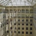
![Interior of the Old Post Office Pavilion [01]](../../../i/upload/2024/07/14/20240714234607-28d40b90-sq.jpg)
![Interior of the Old Post Office Pavilion [02]](../../../i/upload/2024/07/14/20240714234604-cc2845cd-sq.jpg)


![Rosslyn station entrance pylon [01]](../../../i/upload/2024/07/14/20240714234557-b3ee6029-sq.jpg)
Information
- Author
- Ben Schumin
- Copyright
- All Rights Reserved
- Created on
- Thursday 30 May 2024
- Dimensions
- 8064*4536
EXIF Metadata
DJI FC8282
f/170/100
1/8000
200
0/10
0
- DateTimeOriginal
- 2024:05:30 19:04:33
- DateTimeDigitized
- 2024:05:30 19:04:33
- Make
- DJI
- Model
- FC8282
- ExposureProgram
- 2
- FocalLengthIn35mmFilm
- 24
- FNumber
- 170/100
- ExposureTime
- 1/8000
- ISOSpeedRatings
- 200
- Flash
- 0
- WhiteBalance
- 0
- XResolution
- 720000/10000
- YResolution
- 720000/10000
- ImageWidth
- 8064
- ImageLength
- 4536
- Orientation
- 1
- SamplesPerPixel
- 3
- ExposureBiasValue
- 0/10
- MaxApertureValue
- 153/100
- MeteringMode
- 1
- LightSource
- 1
Powered by Piwigo