
Ben Schumin Photography Portfolio
Ben Schumin is a professional photographer who captures the intricacies of daily life.
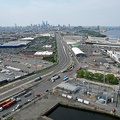
Aerial view of an area around US 13 in Pocomoke City, Maryland in late afternoon.


![Mileage sign on US 30 in Breezewood [01]](../../../../../i/upload/2024/07/15/20240715141320-6d6dc511-sq.jpg)


![Mileage sign on US 30 in Breezewood [02]](../../../../../i/upload/2024/07/15/20240715141339-54b593b4-sq.jpg)
![Jersey barriers on turnpike stub [01]](../../../../../i/upload/2024/07/15/20240715141343-6bc4f0ac-sq.jpg)
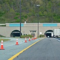
![Kittatinny Mountain Tunnel [02]](../../../../../i/upload/2024/07/15/20240715141344-fd6f497d-sq.jpg)
![Kittatinny Mountain Tunnel [01]](../../../../../i/upload/2024/07/15/20240715141346-ee46943a-sq.jpg)

![Jersey barriers on turnpike stub [02]](../../../../../i/upload/2024/07/15/20240715141358-eeb3fbaa-sq.jpg)
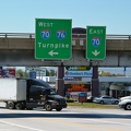
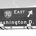
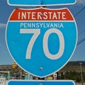
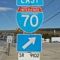
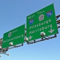
![Sign at the entrance to the Pennsylvania Turnpike in Breezewood [01]](../../../../../i/upload/2024/07/15/20240715141400-ac020f78-sq.jpg)
![Sign at the entrance to the Pennsylvania Turnpike in Breezewood [02]](../../../../../i/upload/2024/07/15/20240715141401-dc122a77-sq.jpg)
![Sign at the entrance to the Pennsylvania Turnpike in Breezewood [03]](../../../../../i/upload/2024/07/15/20240715141402-b008bc0a-sq.jpg)

![Picnic table at New Market rest area, I-81 northbound [02]](../../../../../i/upload/2024/07/15/20240715214459-0df29e63-sq.jpg)
![Bench at New Market rest area [02]](../../../../../i/upload/2024/07/15/20240715214500-d6effc3b-sq.jpg)
![Bench at New Market rest area [01]](../../../../../i/upload/2024/07/15/20240715214502-89d88a56-sq.jpg)
![Picnic table at New Market rest area, I-81 northbound [01]](../../../../../i/upload/2024/07/15/20240715214504-0bd029bd-sq.jpg)
![Excavation for office building construction [01]](../../../../../i/upload/2024/07/15/20240715214611-917a296d-sq.jpg)
![Excavation for office building construction [02]](../../../../../i/upload/2024/07/15/20240715214614-ef1a850b-sq.jpg)
![Excavation for office building construction [03]](../../../../../i/upload/2024/07/15/20240715214632-98087919-sq.jpg)
![Boston, Massachusetts [01]](../../../../../i/upload/2024/07/16/20240716011031-c1272beb-sq.jpg)
![Boston, Massachusetts [02]](../../../../../i/upload/2024/07/16/20240716011040-f1a2baea-sq.jpg)


![Rosslyn skyline [01]](../../../../../i/upload/2024/07/17/20240717230300-9294fc8d-sq.jpg)
![Rosslyn skyline [02]](../../../../../i/upload/2024/07/17/20240717230304-8f412681-sq.jpg)
![Rosslyn skyline [03]](../../../../../i/upload/2024/07/17/20240717230307-ad97916d-sq.jpg)

![Hitachi excavator at Wheaton High School [01]](../../../../../i/upload/2024/07/18/20240718124528-909c60ff-sq.jpg)
![Hitachi excavator at Wheaton High School [02]](../../../../../i/upload/2024/07/18/20240718124530-482f93f8-sq.jpg)
![Hitachi excavator at Wheaton High School [03]](../../../../../i/upload/2024/07/18/20240718124534-a2d949cd-sq.jpg)
![M/V Floyd J. Lupton [02]](../../../../../i/upload/2024/07/18/20240718223150-c9990792-sq.jpg)


![Street signs at Irvin Garrish Highway and Pilot Town Circle [01]](../../../../../i/upload/2024/07/18/20240718223200-d9d0a287-sq.jpg)
![Street signs at Irvin Garrish Highway and Pilot Town Circle [02]](../../../../../i/upload/2024/07/18/20240718223207-c0909eb1-sq.jpg)
![M/V Floyd J. Lupton [01]](../../../../../i/upload/2024/07/18/20240718223211-9b4aca12-sq.jpg)
![Navigational beacon on Hatteras-Ocracoke ferry route [02]](../../../../../i/upload/2024/07/18/20240718223225-99e881c7-sq.jpg)
![M/V Hatteras [02]](../../../../../i/upload/2024/07/18/20240718223229-ead55f05-sq.jpg)
![Navigational buoy on Hatteras-Ocracoke ferry route [02]](../../../../../i/upload/2024/07/18/20240718223233-470e27f0-sq.jpg)
![M/V Floyd J. Lupton [04]](../../../../../i/upload/2024/07/18/20240718223312-d8c5af99-sq.jpg)
![Navigational buoy on Hatteras-Ocracoke ferry route [01]](../../../../../i/upload/2024/07/18/20240718223316-553a9a3c-sq.jpg)
![M/V Floyd J. Lupton [03]](../../../../../i/upload/2024/07/18/20240718223320-d885ef91-sq.jpg)
![M/V Croatoan [04]](../../../../../i/upload/2024/07/18/20240718223324-d66d8325-sq.jpg)
![M/V Croatoan [03]](../../../../../i/upload/2024/07/18/20240718223328-3c678b70-sq.jpg)
![M/V Croatoan [02]](../../../../../i/upload/2024/07/18/20240718223332-b1f815de-sq.jpg)
![M/V Croatoan [01]](../../../../../i/upload/2024/07/18/20240718223336-a9a3dee9-sq.jpg)
![M/V Frisco [05]](../../../../../i/upload/2024/07/18/20240718223340-d956766a-sq.jpg)

![M/V Frisco [03]](../../../../../i/upload/2024/07/18/20240718223348-198e6ecd-sq.jpg)
![M/V Frisco [04]](../../../../../i/upload/2024/07/18/20240718223352-1801171b-sq.jpg)
![M/V Frisco [01]](../../../../../i/upload/2024/07/18/20240718223356-8e54985a-sq.jpg)
![M/V Frisco [02]](../../../../../i/upload/2024/07/18/20240718223400-036a1908-sq.jpg)
![Navigational beacon on Hatteras-Ocracoke ferry route [01]](../../../../../i/upload/2024/07/18/20240718223404-0ec7accd-sq.jpg)
![M/V Hatteras [01]](../../../../../i/upload/2024/07/18/20240718223408-ed56ea87-sq.jpg)

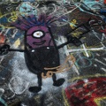
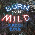
![Graffiti Highway, facing north [01]](../../../../../i/upload/2024/07/18/20240718225558-c6e9a1b0-sq.jpg)
![Graffiti Highway, facing north [02]](../../../../../i/upload/2024/07/18/20240718225602-ab6789e9-sq.jpg)


![Abandoned couch on the Graffiti Highway [01]](../../../../../i/upload/2024/07/18/20240718225620-48e1e837-sq.jpg)

![Graffiti Highway, facing north [03]](../../../../../i/upload/2024/07/18/20240718225628-4b07e821-sq.jpg)
![Graffiti Highway, facing north [04]](../../../../../i/upload/2024/07/18/20240718225632-bf35d5b7-sq.jpg)
![Discarded spray paint can [01]](../../../../../i/upload/2024/07/18/20240718225636-aa2c3309-sq.jpg)
![Discarded spray paint can [02]](../../../../../i/upload/2024/07/18/20240718225641-34818498-sq.jpg)
![Discarded spray paint can [03]](../../../../../i/upload/2024/07/18/20240718225645-3a06728f-sq.jpg)
![Discarded spray paint can [04]](../../../../../i/upload/2024/07/18/20240718225649-1bbd1d03-sq.jpg)
![Discarded spray paint can [05]](../../../../../i/upload/2024/07/18/20240718225653-7a6d2dca-sq.jpg)
![Discarded spray paint can [06]](../../../../../i/upload/2024/07/18/20240718225658-641e6183-sq.jpg)
![Discarded spray paint can [07]](../../../../../i/upload/2024/07/18/20240718225703-187d89a8-sq.jpg)
![Discarded spray paint can [08]](../../../../../i/upload/2024/07/18/20240718225707-984f96a6-sq.jpg)
![Discarded spray paint can [09]](../../../../../i/upload/2024/07/18/20240718225711-81f404b9-sq.jpg)
![Discarded spray paint can [10]](../../../../../i/upload/2024/07/18/20240718225715-cb6bcbc7-sq.jpg)
![Southern end of Graffiti Highway [01]](../../../../../i/upload/2024/07/18/20240718225724-3e8c1137-sq.jpg)
![Southern end of Graffiti Highway [02]](../../../../../i/upload/2024/07/18/20240718225728-609ba646-sq.jpg)

![Graffiti Highway, facing north [05]](../../../../../i/upload/2024/07/18/20240718225737-7169f5fc-sq.jpg)

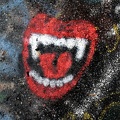

![Graffiti Highway, facing north [06]](../../../../../i/upload/2024/07/18/20240718225754-579e69e2-sq.jpg)
![Discarded spray paint can [11]](../../../../../i/upload/2024/07/18/20240718225758-e72a0020-sq.jpg)


![Graffiti Highway, facing north [07]](../../../../../i/upload/2024/07/18/20240718225819-1aefe767-sq.jpg)
![Discarded spray paint can [12]](../../../../../i/upload/2024/07/18/20240718225827-06efaa69-sq.jpg)
![Discarded spray paint can [13]](../../../../../i/upload/2024/07/18/20240718225833-07a91c25-sq.jpg)
![Discarded spray paint can [14]](../../../../../i/upload/2024/07/18/20240718225839-c4c2a4ba-sq.jpg)
![Discarded spray paint can [15]](../../../../../i/upload/2024/07/18/20240718225843-21462d12-sq.jpg)
![Discarded spray paint can [16]](../../../../../i/upload/2024/07/18/20240718225847-cfa75596-sq.jpg)
![Discarded spray paint can [17]](../../../../../i/upload/2024/07/18/20240718225852-a306f2f2-sq.jpg)


![Abandoned couch on the Graffiti Highway [02]](../../../../../i/upload/2024/07/18/20240718225907-1ef187b6-sq.jpg)
![Abandoned couch on the Graffiti Highway [03]](../../../../../i/upload/2024/07/18/20240718225912-067b9cb0-sq.jpg)
![Flag in a crack in the pavement [03]](../../../../../i/upload/2024/07/18/20240718225917-de0cdf19-sq.jpg)
![Flag in a crack in the pavement [02]](../../../../../i/upload/2024/07/18/20240718225922-f3938677-sq.jpg)
![Flag in a crack in the pavement [01]](../../../../../i/upload/2024/07/18/20240718225926-abaf5102-sq.jpg)
![Abandoned couch on the Graffiti Highway [04]](../../../../../i/upload/2024/07/18/20240718225930-2688196a-sq.jpg)
![Abandoned couch on the Graffiti Highway [05]](../../../../../i/upload/2024/07/18/20240718225934-01f6631d-sq.jpg)
![Graffiti Highway, facing south [01]](../../../../../i/upload/2024/07/18/20240718225939-ffe02c6c-sq.jpg)
![Graffiti Highway, facing south [02]](../../../../../i/upload/2024/07/18/20240718225943-e55125b5-sq.jpg)
![Graffiti Highway, facing north [08]](../../../../../i/upload/2024/07/18/20240718225947-44e2fb69-sq.jpg)
![Abandoned couch on the roadside [01]](../../../../../i/upload/2024/07/18/20240718225951-3c3189cf-sq.jpg)
![Abandoned couch on the roadside [02]](../../../../../i/upload/2024/07/18/20240718225955-c0a51e89-sq.jpg)
![Rift in the former Route 61 [03]](../../../../../i/upload/2024/07/18/20240718225959-fff57211-sq.jpg)
![Rift in the former Route 61 [02]](../../../../../i/upload/2024/07/18/20240718230003-4ef764d7-sq.jpg)
![Rift in the former Route 61 [01]](../../../../../i/upload/2024/07/18/20240718230008-295c1e8f-sq.jpg)

![Graffiti Highway, facing north [09]](../../../../../i/upload/2024/07/18/20240718230018-9f76d664-sq.jpg)


![Graffiti Highway, facing south [03]](../../../../../i/upload/2024/07/18/20240718230031-1484ae1e-sq.jpg)
![Graffiti Highway, facing south [04]](../../../../../i/upload/2024/07/18/20240718230035-f2f31187-sq.jpg)

![Graffiti Highway, facing north [10]](../../../../../i/upload/2024/07/18/20240718230044-cba65c9e-sq.jpg)
![Graffiti Highway, facing south [05]](../../../../../i/upload/2024/07/18/20240718230048-93f5de9a-sq.jpg)
![Graffiti Highway, facing north [11]](../../../../../i/upload/2024/07/18/20240718230052-b88efaef-sq.jpg)

![Discarded spray paint can [18]](../../../../../i/upload/2024/07/18/20240718230100-ae49da6c-sq.jpg)


![Graffiti Highway, facing south [06]](../../../../../i/upload/2024/07/18/20240718230114-5b0682ab-sq.jpg)


![Graffiti Highway, facing south [07]](../../../../../i/upload/2024/07/18/20240718230139-fd091e0c-sq.jpg)

![Graffiti-covered tree [01]](../../../../../i/upload/2024/07/18/20240718230148-527a7844-sq.jpg)

![Graffiti-covered tree [02]](../../../../../i/upload/2024/07/18/20240718230157-b273d8a3-sq.jpg)

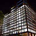
![Rosslyn Center [02]](../../../../../i/upload/2024/07/19/20240719103223-e4c5c1f0-sq.jpg)
![Rocks in the Potomac River [01]](../../../../../i/upload/2024/07/19/20240719103333-6083493b-sq.jpg)
![Rocks in the Potomac River [02]](../../../../../i/upload/2024/07/19/20240719103338-04e1c1e1-sq.jpg)
![Rocks in the Potomac River [03]](../../../../../i/upload/2024/07/19/20240719103343-404e77e5-sq.jpg)
![Rocks in the Potomac River [04]](../../../../../i/upload/2024/07/19/20240719103348-1a3aef78-sq.jpg)
![Rocks in the Potomac River [05]](../../../../../i/upload/2024/07/19/20240719103353-ea395458-sq.jpg)
![Potomac River from US 340 bridge [03]](../../../../../i/upload/2024/07/19/20240719103359-b66380e8-sq.jpg)
![Potomac River from US 340 bridge [04]](../../../../../i/upload/2024/07/19/20240719103405-18d26a8b-sq.jpg)
![Potomac River from US 340 bridge [05]](../../../../../i/upload/2024/07/19/20240719103412-5b42c5b9-sq.jpg)
![Photographing 1750 Crystal Drive [02]](../../../../../i/upload/2024/07/19/20240719104132-158c0089-sq.jpg)
![Photographing 1750 Crystal Drive [01]](../../../../../i/upload/2024/07/19/20240719104135-a21ab6ce-sq.jpg)
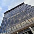
![3101 Wilson Boulevard [02]](../../../../../i/upload/2024/07/19/20240719104351-2ba8b934-sq.jpg)
![3101 Wilson Boulevard [01]](../../../../../i/upload/2024/07/19/20240719104355-bee57a4b-sq.jpg)

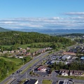
![Commercial area south of Interstate 81 in Harrisonburg [01]](../../../../../i/upload/2024/07/19/20240719163715-46af96f9-sq.jpg)
![Harrisonburg Crossing [01]](../../../../../i/upload/2024/07/19/20240719163753-972e0345-sq.jpg)
![Harrisonburg Crossing [02]](../../../../../i/upload/2024/07/19/20240719163758-5453496b-sq.jpg)
![Commercial area south of University Boulevard [01]](../../../../../i/upload/2024/07/19/20240719163821-e0603027-sq.jpg)
![Commercial area south of University Boulevard [02]](../../../../../i/upload/2024/07/19/20240719163825-5d4964e5-sq.jpg)
![Commercial area south of Interstate 81 in Harrisonburg [02]](../../../../../i/upload/2024/07/19/20240719163830-45dce8e7-sq.jpg)
![Waynesboro High School [06]](../../../../../i/upload/2024/07/19/20240719164001-6ba5469d-sq.jpg)
![Waynesboro High School [03]](../../../../../i/upload/2024/07/19/20240719164024-af4e2222-sq.jpg)
![Waynesboro High School [02]](../../../../../i/upload/2024/07/19/20240719164053-84203644-sq.jpg)
![Waynesboro High School [05]](../../../../../i/upload/2024/07/19/20240719164057-d9c746fc-sq.jpg)
![Waynesboro High School [04]](../../../../../i/upload/2024/07/19/20240719164123-23d6ecf4-sq.jpg)
![Vintage Seagrave fire truck at Churchville Volunteer Fire Department [01]](../../../../../i/upload/2024/07/19/20240719164407-74f7e276-sq.jpg)
![Vintage Seagrave fire truck at Churchville Volunteer Fire Department [02]](../../../../../i/upload/2024/07/19/20240719164413-0b8113ea-sq.jpg)
![Vintage Seagrave fire truck at Churchville Volunteer Fire Department [03]](../../../../../i/upload/2024/07/19/20240719164419-a2eacc42-sq.jpg)
![Churchville Volunteer Fire Department [01]](../../../../../i/upload/2024/07/19/20240719164426-c1be3535-sq.jpg)
![Churchville Volunteer Fire Department [02]](../../../../../i/upload/2024/07/19/20240719164431-2ab245f9-sq.jpg)
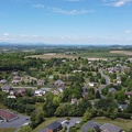
![Buffalo Gap [01]](../../../../../i/upload/2024/07/19/20240719164455-62064f1c-sq.jpg)
![Buffalo Gap High School [01]](../../../../../i/upload/2024/07/19/20240719164459-267a0d43-sq.jpg)
![Buffalo Gap High School [02]](../../../../../i/upload/2024/07/19/20240719164505-bdd29e59-sq.jpg)
![Buffalo Gap High School [03]](../../../../../i/upload/2024/07/19/20240719164509-fab8ad49-sq.jpg)
![Buffalo Gap High School [04]](../../../../../i/upload/2024/07/19/20240719164514-e0a1e82e-sq.jpg)
![Buffalo Gap High School [05]](../../../../../i/upload/2024/07/19/20240719164519-518a0909-sq.jpg)
![Buffalo Gap High School [06]](../../../../../i/upload/2024/07/19/20240719164523-e9a7db09-sq.jpg)
![West Main Street in Waynesboro, Virginia [01]](../../../../../i/upload/2024/07/19/20240719164545-b5a50599-sq.jpg)
![West Main Street in Waynesboro, Virginia [02]](../../../../../i/upload/2024/07/19/20240719164551-0b8407a8-sq.jpg)
![West Main Street in Waynesboro, Virginia [03]](../../../../../i/upload/2024/07/19/20240719164555-f7feeafe-sq.jpg)
![West Main Street in Waynesboro, Virginia [04]](../../../../../i/upload/2024/07/19/20240719164600-4379cef1-sq.jpg)
![Clarksburg Road bridge over Little Seneca Lake [04]](../../../../../i/upload/2024/07/19/20240719164909-eab2208d-sq.jpg)
![Clarksburg Road bridge over Little Seneca Lake [03]](../../../../../i/upload/2024/07/19/20240719164913-53b65146-sq.jpg)
![Clarksburg Road bridge over Little Seneca Lake [01]](../../../../../i/upload/2024/07/19/20240719164917-35ced0ed-sq.jpg)
![Clarksburg Road bridge over Little Seneca Lake [02]](../../../../../i/upload/2024/07/19/20240719164928-43aa6e0f-sq.jpg)
![Clarksburg Road bridge over Little Seneca Lake [05]](../../../../../i/upload/2024/07/19/20240719164946-4e860e8a-sq.jpg)
![Zero Effluent Discharge sign at Ivy rest area [02]](../../../../../i/upload/2024/07/19/20240719165901-5f1abe0b-sq.jpg)
![Zero Effluent Discharge sign at Ivy rest area [01]](../../../../../i/upload/2024/07/19/20240719165907-357f8f51-sq.jpg)
![Work vehicles at High Street-Brooklyn Bridge station [01]](../../../../../i/upload/2024/07/20/20240720151216-e596f93d-sq.jpg)

![Traffic signal at Boulevard de la Cité and Boulevard de la Gappe [06]](../../../../../i/upload/2024/07/20/20240720153136-a9955bbf-sq.jpg)
![Traffic signal at Boulevard de la Cité and Boulevard de la Gappe [05]](../../../../../i/upload/2024/07/20/20240720153141-f42d2e0d-sq.jpg)
![Traffic signal at Boulevard de la Cité and Boulevard de la Gappe [01]](../../../../../i/upload/2024/07/20/20240720153209-1f4780bb-sq.jpg)
![Traffic signal at Boulevard de la Cité and Boulevard de la Gappe [03]](../../../../../i/upload/2024/07/20/20240720153221-488249fb-sq.jpg)
![Traffic signal at Boulevard de la Cité and Boulevard de la Gappe [02]](../../../../../i/upload/2024/07/20/20240720153225-69ff59dd-sq.jpg)
![Traffic signal at Boulevard Maloney and Boulevard de la Cité [01]](../../../../../i/upload/2024/07/20/20240720153259-ed6dfdaf-sq.jpg)
![Traffic signal at Boulevard de la Cité and Boulevard de la Gappe [04]](../../../../../i/upload/2024/07/20/20240720153323-aa18f3a4-sq.jpg)
![Traffic signal at Boulevard de la Cité and Boulevard de la Gappe [07]](../../../../../i/upload/2024/07/20/20240720153327-01fc98b0-sq.jpg)

![Traffic signal at Boulevard Maloney and Boulevard de la Cité [02]](../../../../../i/upload/2024/07/20/20240720153725-ed7699e1-sq.jpg)
![Traffic signal at Boulevard Maloney and Boulevard de la Cité [03]](../../../../../i/upload/2024/07/20/20240720153737-14374ec3-sq.jpg)
![Traffic signal at Boulevard Maloney and Boulevard de la Cité [04]](../../../../../i/upload/2024/07/20/20240720153748-78bc5df8-sq.jpg)
![Traffic signal at Boulevard Maloney and Boulevard de la Cité [05]](../../../../../i/upload/2024/07/20/20240720153752-69faea16-sq.jpg)
![Traffic signal at Boulevard Maloney and Boulevard de la Cité [06]](../../../../../i/upload/2024/07/20/20240720153756-fb0bfe6b-sq.jpg)
![Intersection of Boulevard Maloney and Boulevard de la Cité [01]](../../../../../i/upload/2024/07/20/20240720153801-12f281c8-sq.jpg)
![Intersection of Boulevard Maloney and Boulevard de la Cité [02]](../../../../../i/upload/2024/07/20/20240720153805-9d68e107-sq.jpg)
![Intersection of Boulevard Maloney and Boulevard de la Cité [03]](../../../../../i/upload/2024/07/20/20240720153809-9b3a3828-sq.jpg)

![Crossbuck on Boulevard de la Cité [01]](../../../../../i/upload/2024/07/20/20240720154129-310cccd4-sq.jpg)
![Crossbuck on Boulevard de la Cité [02]](../../../../../i/upload/2024/07/20/20240720154132-05742b39-sq.jpg)
![Quebec-style three-way stop [02]](../../../../../i/upload/2024/07/20/20240720154139-4ff6ab0b-sq.jpg)
![Quebec-style three-way stop [01]](../../../../../i/upload/2024/07/20/20240720154143-9a24d793-sq.jpg)
![French-language stop sign [01]](../../../../../i/upload/2024/07/20/20240720154158-376dfc8e-sq.jpg)

![French-language stop sign [02]](../../../../../i/upload/2024/07/20/20240720154205-0cd4f0e5-sq.jpg)
![French-language stop sign [03]](../../../../../i/upload/2024/07/20/20240720154209-254e5a85-sq.jpg)

![Canadian flag flying outside of West Block [01]](../../../../../i/upload/2024/07/20/20240720154220-028ac190-sq.jpg)
![West Block of Parliament [03]](../../../../../i/upload/2024/07/20/20240720154228-81bbf525-sq.jpg)
![Canadian flag flying outside of West Block [03]](../../../../../i/upload/2024/07/20/20240720154232-5c39213e-sq.jpg)
![West Block of Parliament [01]](../../../../../i/upload/2024/07/20/20240720154328-a76d0c11-sq.jpg)

![West Block of Parliament [04]](../../../../../i/upload/2024/07/20/20240720154336-221f8ded-sq.jpg)
![Selfie in front of the West Block [01]](../../../../../i/upload/2024/07/20/20240720154416-ff764482-sq.jpg)
![Selfie in front of the West Block [03]](../../../../../i/upload/2024/07/20/20240720154420-27b7b42e-sq.jpg)
![Selfie in front of the West Block [02]](../../../../../i/upload/2024/07/20/20240720154424-433a842d-sq.jpg)
![West Block of Parliament [02]](../../../../../i/upload/2024/07/20/20240720154432-a2496331-sq.jpg)
![Canadian flag flying outside of West Block [02]](../../../../../i/upload/2024/07/20/20240720154436-c9f30687-sq.jpg)
![West Block of Parliament [05]](../../../../../i/upload/2024/07/20/20240720154440-4cceb125-sq.jpg)
![View of Gatineau from Parliament Hill [01]](../../../../../i/upload/2024/07/20/20240720154444-6c14154c-sq.jpg)
![View of Gatineau from Parliament Hill [02]](../../../../../i/upload/2024/07/20/20240720154447-8a6b0258-sq.jpg)


![View from Ottawa Marriott Hotel [02]](../../../../../i/upload/2024/07/20/20240720155445-93b88b51-sq.jpg)
![View from Ottawa Marriott Hotel [03]](../../../../../i/upload/2024/07/20/20240720155518-c87f6b57-sq.jpg)
![View from Ottawa Marriott Hotel [01]](../../../../../i/upload/2024/07/20/20240720155522-d1cb6c07-sq.jpg)
![Composting toilet at Whitney Point rest area [02]](../../../../../i/upload/2024/07/20/20240720155544-1b6ccee9-sq.jpg)
![Composting toilet at Whitney Point rest area [01]](../../../../../i/upload/2024/07/20/20240720155548-d9419fd3-sq.jpg)
![Rest area and welcome center in Great Bend, Pennsylvania [01]](../../../../../i/upload/2024/07/20/20240720155552-25c72733-sq.jpg)
![Rest area and welcome center in Great Bend, Pennsylvania [05]](../../../../../i/upload/2024/07/20/20240720155633-92c6c0f9-sq.jpg)
![Rest area and welcome center in Great Bend, Pennsylvania [03]](../../../../../i/upload/2024/07/20/20240720155638-02dd5b3a-sq.jpg)
![Rest area and welcome center in Great Bend, Pennsylvania [06]](../../../../../i/upload/2024/07/20/20240720155641-22a6a46c-sq.jpg)
![Rest area and welcome center in Great Bend, Pennsylvania [04]](../../../../../i/upload/2024/07/20/20240720155650-668f815e-sq.jpg)
![Rest area and welcome center in Great Bend, Pennsylvania [02]](../../../../../i/upload/2024/07/20/20240720155707-77d4dc52-sq.jpg)

![Aerial view of Interstate 70 Breezewood interchange [02]](../../../../../i/upload/2024/07/20/20240720155940-3bb47f5f-sq.jpg)
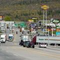
![Aerial view of Breezewood, Pennsylvania, May 2023 [04]](../../../../../i/upload/2024/07/20/20240720155944-8f8a6623-sq.jpg)
![Aerial view of Breezewood, Pennsylvania, May 2023 [10]](../../../../../i/upload/2024/07/20/20240720155949-83a44091-sq.jpg)
![Aerial view of Breezewood, Pennsylvania, May 2023 [08]](../../../../../i/upload/2024/07/20/20240720155958-63b65479-sq.jpg)
![Aerial view of Breezewood interchange for the Pennsylvania Turnpike [03]](../../../../../i/upload/2024/07/20/20240720160003-184a95a1-sq.jpg)
![Aerial view of Breezewood, Pennsylvania, May 2023 [01]](../../../../../i/upload/2024/07/20/20240720160008-4d52368a-sq.jpg)
![Aerial view of Breezewood, Pennsylvania, May 2023 [06]](../../../../../i/upload/2024/07/20/20240720160013-ca57d708-sq.jpg)
![Aerial view of Breezewood, Pennsylvania, May 2023 [02]](../../../../../i/upload/2024/07/20/20240720160018-4b6e07bf-sq.jpg)
![Aerial view of Breezewood, Pennsylvania, May 2023 [09]](../../../../../i/upload/2024/07/20/20240720160022-4b37e34b-sq.jpg)
![Aerial view of Breezewood interchange for the Pennsylvania Turnpike [01]](../../../../../i/upload/2024/07/20/20240720160031-be453ab5-sq.jpg)
![Aerial view of Interstate 70 Breezewood interchange [01]](../../../../../i/upload/2024/07/20/20240720160036-995b00e0-sq.jpg)

![Aerial view of Breezewood, Pennsylvania, May 2023 [05]](../../../../../i/upload/2024/07/20/20240720160044-7a0b5dab-sq.jpg)
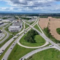
![Interchange between Interstate 70 and US 40 in Washington, Pennsylvania [02]](../../../../../i/upload/2024/07/20/20240720160114-12b7ff6f-sq.jpg)
![Interchange between Interstate 70 and US 40 in Washington, Pennsylvania [01]](../../../../../i/upload/2024/07/20/20240720160118-a74d7e8b-sq.jpg)

![Gateway Travel Plaza [02]](../../../../../i/upload/2024/07/20/20240720160133-c4620cf7-sq.jpg)

![View of Pittsburgh from Grandview Overlook [07]](../../../../../i/upload/2024/07/20/20240720160150-2c7a27b9-sq.jpg)
![Aerial view of Breezewood interchange for the Pennsylvania Turnpike [02]](../../../../../i/upload/2024/07/20/20240720160211-2048dec3-sq.jpg)
![Aerial view of Breezewood, Pennsylvania, May 2023 [03]](../../../../../i/upload/2024/07/20/20240720160215-e2569c9a-sq.jpg)
![Aerial view of Breezewood, Pennsylvania, May 2023 [07]](../../../../../i/upload/2024/07/20/20240720160220-bc205056-sq.jpg)
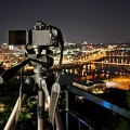
![View of Pittsburgh from Grandview Overlook [08]](../../../../../i/upload/2024/07/20/20240720160229-d64f9362-sq.jpg)
![View of Pittsburgh from Grandview Overlook [09]](../../../../../i/upload/2024/07/20/20240720160233-9a441bc8-sq.jpg)
![View of Pittsburgh from Grandview Overlook [10]](../../../../../i/upload/2024/07/20/20240720160238-4e7e7991-sq.jpg)
![View of Pittsburgh from Grandview Overlook [06]](../../../../../i/upload/2024/07/20/20240720160246-04cd0b60-sq.jpg)
![Gateway Travel Plaza [03]](../../../../../i/upload/2024/07/20/20240720160316-218c013b-sq.jpg)

![Gateway Travel Plaza [04]](../../../../../i/upload/2024/07/20/20240720160328-010553ee-sq.jpg)


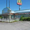
![Former Sheetz in Breezewood, Pennsylvania [01]](../../../../../i/upload/2024/07/20/20240720160346-f11b208a-sq.jpg)
![Former Sheetz in Breezewood, Pennsylvania [02]](../../../../../i/upload/2024/07/20/20240720160350-f6114387-sq.jpg)
![Former Sheetz in Breezewood, Pennsylvania [03]](../../../../../i/upload/2024/07/20/20240720160354-d9dbba2c-sq.jpg)
![Former Sheetz in Breezewood, Pennsylvania [04]](../../../../../i/upload/2024/07/20/20240720160358-1ea0a294-sq.jpg)
![Former Sheetz in Breezewood, Pennsylvania [05]](../../../../../i/upload/2024/07/20/20240720160401-a24651d2-sq.jpg)
![Garden State Parkway milepost 10 southbound [01]](../../../../../i/upload/2025/01/09/20250109192431-f1398b04-sq.jpg)
![Garden State Parkway milepost 10 southbound [02]](../../../../../i/upload/2025/01/09/20250109192436-7167312f-sq.jpg)
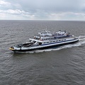
![Aerial view of the MV Cape Henlopen [01]](../../../../../i/upload/2025/01/10/20250110002205-6da272ba-sq.jpg)
![Aerial view of the MV Cape Henlopen [02]](../../../../../i/upload/2025/01/10/20250110002211-f7a54773-sq.jpg)
![Aerial view of the MV Cape Henlopen [03]](../../../../../i/upload/2025/01/10/20250110002216-2ad66249-sq.jpg)
![Aerial view of the MV Cape Henlopen [04]](../../../../../i/upload/2025/01/10/20250110002222-759c7d56-sq.jpg)


![Honda HR-V on the MV New Jersey [01]](../../../../../i/upload/2025/01/10/20250110200230-4ef3242a-sq.jpg)
![Honda HR-V on the MV New Jersey [02]](../../../../../i/upload/2025/01/10/20250110200305-f76d8d28-sq.jpg)


![Lewes pilot boat [01]](../../../../../i/upload/2025/01/10/20250110223048-4f37d1ac-sq.jpg)
![Lewes pilot boat [02]](../../../../../i/upload/2025/01/10/20250110223106-f9b6367a-sq.jpg)
![Sunset over the Delaware Bay [01]](../../../../../i/upload/2025/01/10/20250110223154-eadac849-sq.jpg)
![Sunset over the Delaware Bay [02]](../../../../../i/upload/2025/01/10/20250110223300-3c549975-sq.jpg)
![Sunset over the Delaware Bay [03]](../../../../../i/upload/2025/01/10/20250110223358-aafe77b6-sq.jpg)
![Sunset over the Delaware Bay [04]](../../../../../i/upload/2025/01/10/20250110223500-173ccd0f-sq.jpg)
![Sunset over the Delaware Bay [05]](../../../../../i/upload/2025/01/10/20250110223536-a69b79d5-sq.jpg)
![Walmart distribution center in Greencastle, Pennsylvania [01]](../../../../../i/upload/2025/02/06/20250206012522-6053edf8-sq.jpg)
![Walmart distribution center in Greencastle, Pennsylvania [02]](../../../../../i/upload/2025/02/06/20250206012528-da6072b3-sq.jpg)
![Walmart distribution center in Greencastle, Pennsylvania [03]](../../../../../i/upload/2025/02/06/20250206012533-e29666ff-sq.jpg)
![Eastern end of the Chesapeake Bay Bridge [01]](../../../../../i/upload/2025/02/07/20250207135752-9d02b521-sq.jpg)
![Eastern end of the Chesapeake Bay Bridge [02]](../../../../../i/upload/2025/02/07/20250207135805-4b074040-sq.jpg)
![Eastern end of the Chesapeake Bay Bridge [03]](../../../../../i/upload/2025/02/07/20250207135903-c1f151c4-sq.jpg)
![Eastern end of the Chesapeake Bay Bridge [04]](../../../../../i/upload/2025/02/07/20250207140003-1549325d-sq.jpg)
![Signage for eastern US 50/US 301 split [01]](../../../../../i/upload/2025/02/07/20250207212407-b5a2955a-sq.jpg)
![Signage for eastern US 50/US 301 split [02]](../../../../../i/upload/2025/02/07/20250207212412-a7ff650a-sq.jpg)

![Intersection of US 50 and MD 213 [01]](../../../../../i/upload/2025/02/16/20250216003332-e7ac1a6b-sq.jpg)
![Intersection of US 50 and MD 213 [02]](../../../../../i/upload/2025/02/16/20250216003338-82427ee4-sq.jpg)
![Choptank River Bridge [01]](../../../../../i/upload/2025/02/16/20250216101115-1f995023-sq.jpg)
![Choptank River Bridge [02]](../../../../../i/upload/2025/02/16/20250216101120-5c3d2aaf-sq.jpg)
![Choptank River Bridge [03]](../../../../../i/upload/2025/02/16/20250216101126-5e453b53-sq.jpg)
![Choptank River Bridge [04]](../../../../../i/upload/2025/02/16/20250216101131-08475973-sq.jpg)
![Choptank River Bridge [05]](../../../../../i/upload/2025/02/16/20250216101136-cbe956a7-sq.jpg)
![Choptank River Bridge [06]](../../../../../i/upload/2025/02/16/20250216101141-257983d7-sq.jpg)
![Choptank River Bridge [07]](../../../../../i/upload/2025/02/16/20250216101147-f4d3c81d-sq.jpg)
![Choptank River Bridge [08]](../../../../../i/upload/2025/02/16/20250216101153-3a9fcb7d-sq.jpg)
![Area around US 13 in Pocomoke City, Maryland [01]](../../../../../i/upload/2025/02/16/20250216104958-9cfd679e-sq.jpg)
![Area around US 13 in Pocomoke City, Maryland [02]](../../../../../i/upload/2025/02/16/20250216105020-45970493-sq.jpg)
![Junction with US 13 Business [01]](../../../../../i/upload/2025/02/16/20250216105227-05f505b7-sq.jpg)
![Junction with US 13 Business [02]](../../../../../i/upload/2025/02/16/20250216105236-6f438cfb-sq.jpg)
![Honda HR-V along US 13 [01]](../../../../../i/upload/2025/02/16/20250216105309-52b06bb0-sq.jpg)
![Honda HR-V along US 13 [02]](../../../../../i/upload/2025/02/16/20250216105404-a22075b0-sq.jpg)
![Hampton Roads Bridge-Tunnel, westbound [01]](../../../../../i/upload/2025/02/17/20250217012510-5b2ab7ac-sq.jpg)
![Hampton Roads Bridge-Tunnel, westbound [02]](../../../../../i/upload/2025/02/17/20250217012521-81ed217b-sq.jpg)
![Interstate 64 in Hampton, Virginia [04]](../../../../../i/upload/2025/02/17/20250217085415-4cb12081-sq.jpg)
![Interstate 64 in Hampton, Virginia [03]](../../../../../i/upload/2025/02/17/20250217085436-66a19491-sq.jpg)
![Interstate 64 in Hampton, Virginia [02]](../../../../../i/upload/2025/02/17/20250217085501-e9021d57-sq.jpg)
![Interstate 64 in Hampton, Virginia [01]](../../../../../i/upload/2025/02/17/20250217090951-2400e489-sq.jpg)
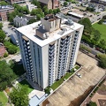
![River Park Tower Apartments [02]](../../../../../i/upload/2025/02/18/20250218102157-99fbbb4b-sq.jpg)

![Monitor-Merrimac Memorial Bridge-Tunnel [01]](../../../../../i/upload/2025/02/18/20250218235632-5aef878d-sq.jpg)
![Monitor-Merrimac Memorial Bridge-Tunnel [02]](../../../../../i/upload/2025/02/18/20250218235637-581fbcca-sq.jpg)
![Monitor-Merrimac Memorial Bridge-Tunnel [03]](../../../../../i/upload/2025/02/18/20250218235642-270961d8-sq.jpg)
![Monitor-Merrimac Memorial Bridge-Tunnel [04]](../../../../../i/upload/2025/02/18/20250218235648-fca8ade5-sq.jpg)
![Monitor-Merrimac Memorial Bridge-Tunnel [05]](../../../../../i/upload/2025/02/18/20250218235653-19c3fdef-sq.jpg)
![Monitor-Merrimac Memorial Bridge-Tunnel [06]](../../../../../i/upload/2025/02/18/20250218235658-5bb810e5-sq.jpg)
![Monitor-Merrimac Memorial Bridge-Tunnel [07]](../../../../../i/upload/2025/02/18/20250218235704-55afa576-sq.jpg)
![Monitor-Merrimac Memorial Bridge-Tunnel [08]](../../../../../i/upload/2025/02/18/20250218235709-560750da-sq.jpg)
![Monitor-Merrimac Memorial Bridge-Tunnel [09]](../../../../../i/upload/2025/02/18/20250218235714-45502513-sq.jpg)
![Monitor-Merrimac Memorial Bridge-Tunnel [10]](../../../../../i/upload/2025/02/18/20250218235719-11c76977-sq.jpg)
![Monitor-Merrimac Memorial Bridge-Tunnel [11]](../../../../../i/upload/2025/02/18/20250218235725-ef9b2fb8-sq.jpg)
![Monitor-Merrimac Memorial Bridge-Tunnel [12]](../../../../../i/upload/2025/02/18/20250218235731-5172cc89-sq.jpg)
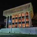
![Dollar Tree Corporate Office [01]](../../../../../i/upload/2025/02/19/20250219212847-eeb88fc3-sq.jpg)
![Dollar Tree Corporate Office [02]](../../../../../i/upload/2025/02/19/20250219212859-e02df95f-sq.jpg)
![Dollar Tree Corporate Office [03]](../../../../../i/upload/2025/02/19/20250219213004-a8f5a593-sq.jpg)
![Dollar Tree Corporate Office [04]](../../../../../i/upload/2025/02/19/20250219213027-6b87d89c-sq.jpg)
![Dollar Tree Corporate Office [05]](../../../../../i/upload/2025/02/19/20250219213153-7311378c-sq.jpg)
Information
- Author
- Ben Schumin
- Copyright
- All Rights Reserved
- Created on
- Thursday 30 May 2024
- Dimensions
- 8064*4536
EXIF Metadata
DJI FC8282
f/170/100
1/8000
200
0/10
0
- DateTimeOriginal
- 2024:05:30 19:04:33
- DateTimeDigitized
- 2024:05:30 19:04:33
- Make
- DJI
- Model
- FC8282
- ExposureProgram
- 2
- FocalLengthIn35mmFilm
- 24
- FNumber
- 170/100
- ExposureTime
- 1/8000
- ISOSpeedRatings
- 200
- Flash
- 0
- WhiteBalance
- 0
- XResolution
- 720000/10000
- YResolution
- 720000/10000
- ImageWidth
- 8064
- ImageLength
- 4536
- Orientation
- 1
- SamplesPerPixel
- 3
- ExposureBiasValue
- 0/10
- MaxApertureValue
- 153/100
- MeteringMode
- 1
- LightSource
- 1
Powered by Piwigo