-
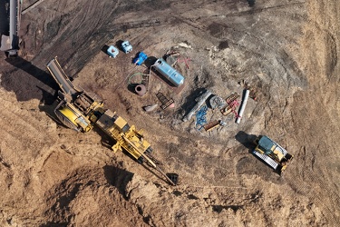
Equipment at the Hampton Roads Materials Resource Recovery Center
-
Sky above Croaker Road

-
Aerial view of Hampton Coliseum [01]
![Aerial view of Hampton Coliseum [01] (1078 visits) Aerial view of the Hampton Coliseum, a multi-purpose arena in Hampton, Virginia, completed in 1969.
... Aerial view of Hampton Coliseum [01]](../../../../../../../../i/upload/2025/02/17/20250217085721-26ccc815-cu_s9999x250.jpg)
-
Aerial view of Hampton Coliseum [02]
![Aerial view of Hampton Coliseum [02] (1089 visits) Overhead view of the Hampton Coliseum, a multi-purpose arena in Hampton, Virginia, completed in 1969... Aerial view of Hampton Coliseum [02]](../../../../../../../../i/upload/2025/02/17/20250217085700-fbcac1cc-cu_s9999x250.jpg)
-
Liberty Executive Park [04]
![Liberty Executive Park [04] (1122 visits) Liberty Executive Park, a complex of low-rise office buildings surrounding a small manmade lake in C... Liberty Executive Park [04]](../../../../../../../../i/upload/2025/02/19/20250219223057-320de988-cu_s9999x250.jpg)
-
Liberty Executive Park [05]
![Liberty Executive Park [05] (1122 visits) Liberty Executive Park, a complex of low-rise office buildings surrounding a small manmade lake in C... Liberty Executive Park [05]](../../../../../../../../i/upload/2025/02/19/20250219223144-7357dda8-cu_s9999x250.jpg)
-
Liberty Executive Park [03]
![Liberty Executive Park [03] (1125 visits) Liberty Executive Park, a complex of low-rise office buildings surrounding a small manmade lake in C... Liberty Executive Park [03]](../../../../../../../../i/upload/2025/02/19/20250219223009-037b6ca0-cu_s9999x250.jpg)
-
President Heads [01]
![President Heads [01] (1140 visits) The President Heads, a collection of busts of United States presidents, on the property of the Hampt... President Heads [01]](../../../../../../../../i/upload/2025/02/22/20250222004408-ae6b4ea2-cu_s9999x250.jpg)
-
Liberty Executive Park [02]
![Liberty Executive Park [02] (1142 visits) Liberty Executive Park, a complex of low-rise office buildings surrounding a small manmade lake in C... Liberty Executive Park [02]](../../../../../../../../i/upload/2025/02/19/20250219222906-b05ca734-cu_s9999x250.jpg)
-
President Heads [04]
![President Heads [04] (1144 visits) The President Heads, a collection of busts of United States presidents, on the property of the Hampt... President Heads [04]](../../../../../../../../i/upload/2025/02/22/20250222004427-8a077a64-cu_s9999x250.jpg)
-
Liberty Executive Park [06]
![Liberty Executive Park [06] (1150 visits) Liberty Executive Park, a complex of low-rise office buildings surrounding a small manmade lake in C... Liberty Executive Park [06]](../../../../../../../../i/upload/2025/02/19/20250219223234-b286ccff-cu_s9999x250.jpg)
-
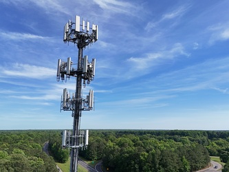
Cell tower above Interstate 64
-
Liberty Executive Park [01]
![Liberty Executive Park [01] (1163 visits) Liberty Executive Park, a complex of low-rise office buildings surrounding a small manmade lake in C... Liberty Executive Park [01]](../../../../../../../../i/upload/2025/02/19/20250219222850-50fd69b0-cu_s9999x250.jpg)
-
Storm near Poolesville, Maryland [07]
![Storm near Poolesville, Maryland [07] (1170 visits) Thunderstorm near Poolesville, Maryland.
Ben Schumin is a professional photographer who captures ... Storm near Poolesville, Maryland [07]](../../../../../../../../i/upload/2025/02/28/20250228153844-2249fb45-cu_s9999x250.jpg)
-
President Heads [02]
![President Heads [02] (1172 visits) The President Heads, a collection of busts of United States presidents, on the property of the Hampt... President Heads [02]](../../../../../../../../i/upload/2025/02/22/20250222004415-62d5dbbd-cu_s9999x250.jpg)
-
Storm near Poolesville, Maryland [09]
![Storm near Poolesville, Maryland [09] (1173 visits) Thunderstorm near Poolesville, Maryland.
Ben Schumin is a professional photographer who captures ... Storm near Poolesville, Maryland [09]](../../../../../../../../i/upload/2025/02/28/20250228153911-3dad6484-cu_s9999x250.jpg)
-
Storm near Poolesville, Maryland [04]
![Storm near Poolesville, Maryland [04] (1174 visits) Thunderstorm near Poolesville, Maryland.
Ben Schumin is a professional photographer who captures ... Storm near Poolesville, Maryland [04]](../../../../../../../../i/upload/2025/02/28/20250228153808-e077176b-cu_s9999x250.jpg)
-
Storm near Poolesville, Maryland [01]
![Storm near Poolesville, Maryland [01] (1177 visits) Thunderstorm near Poolesville, Maryland.
Ben Schumin is a professional photographer who captures ... Storm near Poolesville, Maryland [01]](../../../../../../../../i/upload/2025/02/28/20250228153603-4f5f8d84-cu_s9999x250.jpg)
-
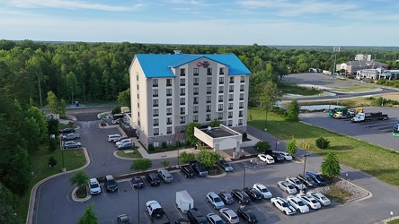
Best Western Plus in Thornburg, Virginia
-
Storm near Poolesville, Maryland [02]
![Storm near Poolesville, Maryland [02] (1188 visits) Thunderstorm near Poolesville, Maryland.
Ben Schumin is a professional photographer who captures ... Storm near Poolesville, Maryland [02]](../../../../../../../../i/upload/2025/02/28/20250228153657-fd5e55c4-cu_s9999x250.jpg)
-
Storm near Poolesville, Maryland [06]
![Storm near Poolesville, Maryland [06] (1188 visits) Thunderstorm near Poolesville, Maryland.
Ben Schumin is a professional photographer who captures ... Storm near Poolesville, Maryland [06]](../../../../../../../../i/upload/2025/02/28/20250228153832-7a1b0103-cu_s9999x250.jpg)
-
Storm near Poolesville, Maryland [08]
![Storm near Poolesville, Maryland [08] (1191 visits) Thunderstorm near Poolesville, Maryland.
Ben Schumin is a professional photographer who captures ... Storm near Poolesville, Maryland [08]](../../../../../../../../i/upload/2025/02/28/20250228153859-de442d45-cu_s9999x250.jpg)
-
Storm near Poolesville, Maryland [05]
![Storm near Poolesville, Maryland [05] (1193 visits) Thunderstorm near Poolesville, Maryland.
Ben Schumin is a professional photographer who captures ... Storm near Poolesville, Maryland [05]](../../../../../../../../i/upload/2025/02/28/20250228153821-6695d99b-cu_s9999x250.jpg)
-
Storm near Poolesville, Maryland [10]
![Storm near Poolesville, Maryland [10] (1210 visits) Thunderstorm near Poolesville, Maryland.
Ben Schumin is a professional photographer who captures ... Storm near Poolesville, Maryland [10]](../../../../../../../../i/upload/2025/02/28/20250228153926-7c08236b-cu_s9999x250.jpg)
-
Aerial view of downtown Lynchburg [02]
![Aerial view of downtown Lynchburg [02] (1211 visits) Aerial view of downtown Lynchburg, Virginia, an independent city in central Virginia.
Ben Schumin i... Aerial view of downtown Lynchburg [02]](../../../../../../../../i/upload/2025/02/28/20250228215213-a5dd2779-cu_s9999x250.jpg)
-
Sunset over Thornburg, Virginia
-
President Heads [03]
![President Heads [03] (1214 visits) The President Heads, a collection of busts of United States presidents, on the property of the Hampt... President Heads [03]](../../../../../../../../i/upload/2025/02/22/20250222004421-19c6797b-cu_s9999x250.jpg)
-
Aerial view of downtown Lynchburg [03]
![Aerial view of downtown Lynchburg [03] (1215 visits) Aerial view of downtown Lynchburg, Virginia, an independent city in central Virginia.
Ben Schumin i... Aerial view of downtown Lynchburg [03]](../../../../../../../../i/upload/2025/02/28/20250228215218-ffa5d68d-cu_s9999x250.jpg)
-
Storm near Poolesville, Maryland [03]
![Storm near Poolesville, Maryland [03] (1220 visits) Thunderstorm near Poolesville, Maryland.
Ben Schumin is a professional photographer who captures ... Storm near Poolesville, Maryland [03]](../../../../../../../../i/upload/2025/02/28/20250228153757-ee5d80e8-cu_s9999x250.jpg)
-
Aerial view of downtown Lynchburg [01]
![Aerial view of downtown Lynchburg [01] (1224 visits) Aerial view of downtown Lynchburg, Virginia, an independent city in central Virginia.
Ben Schumin i... Aerial view of downtown Lynchburg [01]](../../../../../../../../i/upload/2025/02/28/20250228215207-816965cd-cu_s9999x250.jpg)
-
Bank of the James building [03]
![Bank of the James building [03] (1229 visits) Aerial view of the Bank of the James building, an office building in downtown Lynchburg, Virginia.
... Bank of the James building [03]](../../../../../../../../i/upload/2025/02/28/20250228215224-5dade886-cu_s9999x250.jpg)
-
Former Bon Secours DePaul Medical Center [02]
![Former Bon Secours DePaul Medical Center [02] (1246 visits) Former Bon Secours DePaul Medical Center, at 150 Kingsley Lane in Norfolk, Virginia. The hospital w... Former Bon Secours DePaul Medical Center [02]](../../../../../../../../i/upload/2025/02/20/20250220205019-b7263634-cu_s9999x250.jpg)
-
Former Bon Secours DePaul Medical Center [01]
![Former Bon Secours DePaul Medical Center [01] (1249 visits) Former Bon Secours DePaul Medical Center, at 150 Kingsley Lane in Norfolk, Virginia. The hospital w... Former Bon Secours DePaul Medical Center [01]](../../../../../../../../i/upload/2025/02/20/20250220205014-215296f7-cu_s9999x250.jpg)
-
Water tower at Eastern Shore Forest Products [01]
![Water tower at Eastern Shore Forest Products [01] (1259 visits) Water tower at the Eastern Shore Forest Products facility in Pocomoke City, Maryland.
More at The S... Water tower at Eastern Shore Forest Products [01]](../../../../../../../../i/upload/2025/02/16/20250216104828-1da2e8f2-cu_s9999x250.jpg)
-
Storm near Poolesville, Maryland [11]
![Storm near Poolesville, Maryland [11] (1260 visits) Thunderstorm near Poolesville, Maryland.
Ben Schumin is a professional photographer who captures ... Storm near Poolesville, Maryland [11]](../../../../../../../../i/upload/2025/02/28/20250228153940-bb1d26ce-cu_s9999x250.jpg)
-
Area around US 13 in Pocomoke City, Maryland [02]
![Area around US 13 in Pocomoke City, Maryland [02] (1264 visits) Aerial view of an area around US 13 in Pocomoke City, Maryland in late afternoon.
More at The Schum... Area around US 13 in Pocomoke City, Maryland [02]](../../../../../../../../i/upload/2025/02/16/20250216105020-45970493-cu_s9999x250.jpg)
-
Area around US 13 in Pocomoke City, Maryland [01]
![Area around US 13 in Pocomoke City, Maryland [01] (1275 visits) Aerial view of an area around US 13 in Pocomoke City, Maryland in late afternoon.
More at The Schum... Area around US 13 in Pocomoke City, Maryland [01]](../../../../../../../../i/upload/2025/02/16/20250216104958-9cfd679e-cu_s9999x250.jpg)
-
881 Pennsylvania Avenue [02]
![881 Pennsylvania Avenue [02] (1293 visits) Former industrial building, now abandoned, at 881 Pennsylvania Avenue in Hagerstown, Maryland.
Ben ... 881 Pennsylvania Avenue [02]](../../../../../../../../i/upload/2025/02/05/20250205103641-3b7670fa-cu_s9999x250.jpg)
-
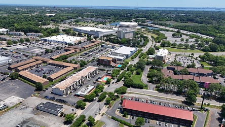
View towards the Hampton Coliseum
-
881 Pennsylvania Avenue [01]
![881 Pennsylvania Avenue [01] (1312 visits) Former industrial building, now abandoned, at 881 Pennsylvania Avenue in Hagerstown, Maryland.
Ben ... 881 Pennsylvania Avenue [01]](../../../../../../../../i/upload/2025/02/05/20250205103634-d84fe2df-cu_s9999x250.jpg)
-
881 Pennsylvania Avenue [05]
![881 Pennsylvania Avenue [05] (1320 visits) Former industrial building, now abandoned, at 881 Pennsylvania Avenue in Hagerstown, Maryland.
Ben ... 881 Pennsylvania Avenue [05]](../../../../../../../../i/upload/2025/02/05/20250205103716-dc19f7d1-cu_s9999x250.jpg)
-
881 Pennsylvania Avenue [04]
![881 Pennsylvania Avenue [04] (1328 visits) Former industrial building, now abandoned, at 881 Pennsylvania Avenue in Hagerstown, Maryland.
Ben ... 881 Pennsylvania Avenue [04]](../../../../../../../../i/upload/2025/02/05/20250205103705-70ad90ac-cu_s9999x250.jpg)
-
Water tower at Eastern Shore Forest Products [02]
![Water tower at Eastern Shore Forest Products [02] (1331 visits) Water tower at the Eastern Shore Forest Products facility in Pocomoke City, Maryland.
More at The S... Water tower at Eastern Shore Forest Products [02]](../../../../../../../../i/upload/2025/02/16/20250216104851-53db0227-cu_s9999x250.jpg)
-
Smokestacks at Chambersburg Power Plant [03]
![Smokestacks at Chambersburg Power Plant [03] (1349 visits) Smokestacks at the Borough of Chambersburg Power Plant at 160 North Second Street in Chambersburg, P... Smokestacks at Chambersburg Power Plant [03]](../../../../../../../../i/upload/2025/02/06/20250206191752-4c59592f-cu_s9999x250.jpg)
-
Smokestacks at Chambersburg Power Plant [02]
![Smokestacks at Chambersburg Power Plant [02] (1353 visits) Smokestacks at the Borough of Chambersburg Power Plant at 160 North Second Street in Chambersburg, P... Smokestacks at Chambersburg Power Plant [02]](../../../../../../../../i/upload/2025/02/06/20250206191742-69a0a809-cu_s9999x250.jpg)
-
881 Pennsylvania Avenue [03]
![881 Pennsylvania Avenue [03] (1356 visits) Former industrial building, now abandoned, at 881 Pennsylvania Avenue in Hagerstown, Maryland.
Ben ... 881 Pennsylvania Avenue [03]](../../../../../../../../i/upload/2025/02/05/20250205103655-835a309c-cu_s9999x250.jpg)
-
Tornado damage at 405 Dogwood Drive [01]
![Tornado damage at 405 Dogwood Drive [01] (1395 visits) Damage to a neighborhood in Gaithersburg, Maryland following a tornado that passed through the area ... Tornado damage at 405 Dogwood Drive [01]](../../../../../../../../i/upload/2025/02/28/20250228153528-e1f0d46c-cu_s9999x250.jpg)
-
Allied Arts Building [02]
![Allied Arts Building [02] (1427 visits) Aerial view of the Allied Arts Building, a high-rise building in downtown Lynchburg, Virginia, built... Allied Arts Building [02]](../../../../../../../../i/upload/2025/02/28/20250228215231-6b669c5e-cu_s9999x250.jpg)
-
Smokestacks at Chambersburg Power Plant [01]
![Smokestacks at Chambersburg Power Plant [01] (1429 visits) Smokestacks at the Borough of Chambersburg Power Plant at 160 North Second Street in Chambersburg, P... Smokestacks at Chambersburg Power Plant [01]](../../../../../../../../i/upload/2025/02/06/20250206191729-b1f1e00a-cu_s9999x250.jpg)
-
AT&T Long Lines Wye Mills site [04]
![AT&T Long Lines Wye Mills site [04] (1436 visits) Former AT&T Long Lines tower in Wye Mills, Maryland.
More at The Schumin Web:
www.schuminweb.co... AT&T Long Lines Wye Mills site [04]](../../../../../../../../i/upload/2025/02/16/20250216005647-5d170521-cu_s9999x250.jpg)
-
AT&T Long Lines Wye Mills site [01]
![AT&T Long Lines Wye Mills site [01] (1445 visits) Former AT&T Long Lines tower in Wye Mills, Maryland.
More at The Schumin Web:
www.schuminweb.co... AT&T Long Lines Wye Mills site [01]](../../../../../../../../i/upload/2025/02/16/20250216005632-3276ba44-cu_s9999x250.jpg)
-
AT&T Long Lines Wye Mills site [03]
![AT&T Long Lines Wye Mills site [03] (1456 visits) Former AT&T Long Lines tower in Wye Mills, Maryland.
More at The Schumin Web:
www.schuminweb.co... AT&T Long Lines Wye Mills site [03]](../../../../../../../../i/upload/2025/02/16/20250216005642-9dfa25f7-cu_s9999x250.jpg)
-
AT&T Long Lines Wye Mills site [02]
![AT&T Long Lines Wye Mills site [02] (1457 visits) Former AT&T Long Lines tower in Wye Mills, Maryland.
More at The Schumin Web:
www.schuminweb.co... AT&T Long Lines Wye Mills site [02]](../../../../../../../../i/upload/2025/02/16/20250216005637-21345428-cu_s9999x250.jpg)
-
Williamsburg Baptist Church [01]
![Williamsburg Baptist Church [01] (1468 visits) Williamsburg Baptist Church, home to an independent congregation that describes itself as, "An ... Williamsburg Baptist Church [01]](../../../../../../../../i/upload/2025/02/21/20250221225338-fdc4a6eb-cu_s9999x250.jpg)
-
AT&T Long Lines Wye Mills site [06]
![AT&T Long Lines Wye Mills site [06] (1469 visits) Former AT&T Long Lines tower in Wye Mills, Maryland.
More at The Schumin Web:
www.schuminweb.co... AT&T Long Lines Wye Mills site [06]](../../../../../../../../i/upload/2025/02/16/20250216005658-f86e877e-cu_s9999x250.jpg)
-
AT&T Long Lines Wye Mills site [05]
![AT&T Long Lines Wye Mills site [05] (1473 visits) Former AT&T Long Lines tower in Wye Mills, Maryland.
More at The Schumin Web:
www.schuminweb.co... AT&T Long Lines Wye Mills site [05]](../../../../../../../../i/upload/2025/02/16/20250216005653-96b21c6d-cu_s9999x250.jpg)
-
Tornado damage at 405 Dogwood Drive [02]
![Tornado damage at 405 Dogwood Drive [02] (1488 visits) Damage to a neighborhood in Gaithersburg, Maryland following a tornado that passed through the area ... Tornado damage at 405 Dogwood Drive [02]](../../../../../../../../i/upload/2025/02/28/20250228153544-95d52742-cu_s9999x250.jpg)
-
Allied Arts Building [03]
![Allied Arts Building [03] (1489 visits) Aerial view of the Allied Arts Building, a high-rise building in downtown Lynchburg, Virginia, built... Allied Arts Building [03]](../../../../../../../../i/upload/2025/02/28/20250228215236-7f0b55fb-cu_s9999x250.jpg)
-
R-VAN in Hampton, Virginia

-
Gaithersburg High School [01]
![Gaithersburg High School [01] (1555 visits) Aerial view of Gaithersburg High School, a public high school off of Route 355 in Gaithersburg, Mary... Gaithersburg High School [01]](../../../../../../../../i/upload/2025/02/28/20250228153447-f7fb6a22-cu_s9999x250.jpg)
-
Birdsnest Lookout [06]
![Birdsnest Lookout [06] (1557 visits) Birdsnest Lookout, a fire watch tower just off of US 13 in Northampton County, Virginia.
More at Th... Birdsnest Lookout [06]](../../../../../../../../i/upload/2025/02/17/20250217005823-259e9098-cu_s9999x250.jpg)
-
Clouds over Waynesboro, Virginia [01]
![Clouds over Waynesboro, Virginia [01] (1564 visits) Clouds in the sky over Waynesboro, Virginia.
More at The Schumin Web:
www.schuminweb.com/2022/10/06... Clouds over Waynesboro, Virginia [01]](../../../../../../../../i/upload/2024/07/20/20240720111926-e95c8b35-cu_s9999x250.jpg)
-
Gaithersburg High School [02]
![Gaithersburg High School [02] (1564 visits) Aerial view of Gaithersburg High School, a public high school off of Route 355 in Gaithersburg, Mary... Gaithersburg High School [02]](../../../../../../../../i/upload/2025/02/28/20250228153500-0a2adc58-cu_s9999x250.jpg)
-
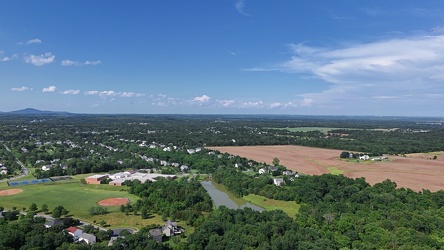
Aerial view of Poolesville, Maryland
-
Dollar Tree Corporate Office [03]
![Dollar Tree Corporate Office [03] (1573 visits) Corporate offices for Dollar Tree, located at 500 Volvo Parkway in Chesapeake, Virginia.
More at Th... Dollar Tree Corporate Office [03]](../../../../../../../../i/upload/2025/02/19/20250219213004-a8f5a593-cu_s9999x250.jpg)
-
Zable Stadium and Cary Field [01]
![Zable Stadium and Cary Field [01] (1576 visits) Aerial view of Zable Stadium and Cary Field, which together comprise the football venue at the Colle... Zable Stadium and Cary Field [01]](../../../../../../../../i/upload/2025/02/22/20250222000929-3373536a-cu_s9999x250.jpg)
-
Dollar Tree Corporate Office [01]
![Dollar Tree Corporate Office [01] (1583 visits) Corporate offices for Dollar Tree, located at 500 Volvo Parkway in Chesapeake, Virginia.
More at Th... Dollar Tree Corporate Office [01]](../../../../../../../../i/upload/2025/02/19/20250219212847-eeb88fc3-cu_s9999x250.jpg)
-
Dollar Tree Corporate Office [02]
![Dollar Tree Corporate Office [02] (1590 visits) Corporate offices for Dollar Tree, located at 500 Volvo Parkway in Chesapeake, Virginia.
More at Th... Dollar Tree Corporate Office [02]](../../../../../../../../i/upload/2025/02/19/20250219212859-e02df95f-cu_s9999x250.jpg)
-
Birdsnest Lookout [05]
![Birdsnest Lookout [05] (1593 visits) Birdsnest Lookout, a fire watch tower just off of US 13 in Northampton County, Virginia.
More at Th... Birdsnest Lookout [05]](../../../../../../../../i/upload/2025/02/17/20250217005817-b3e6d468-cu_s9999x250.jpg)
-
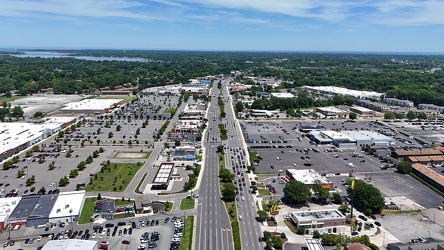
View east along Mercury Boulevard
-
Water tower off of Bateau Drive [01]
![Water tower off of Bateau Drive [01] (1610 visits) Water tower off of Bateau Drive in Stevensville, Maryland.
More at The Schumin Web:
www.schuminweb.... Water tower off of Bateau Drive [01]](../../../../../../../../i/upload/2025/02/07/20250207143405-d60bbf88-cu_s9999x250.jpg)
-
Interstate 64 in Hampton, Virginia [03]
![Interstate 64 in Hampton, Virginia [03] (1622 visits) Aerial view of Interstate 64, a major highway that runs through Hampton, Virginia.
More at The Schu... Interstate 64 in Hampton, Virginia [03]](../../../../../../../../i/upload/2025/02/17/20250217085436-66a19491-cu_s9999x250.jpg)
-
Zable Stadium and Cary Field [02]
![Zable Stadium and Cary Field [02] (1629 visits) Aerial view of Zable Stadium and Cary Field, which together comprise the football venue at the Colle... Zable Stadium and Cary Field [02]](../../../../../../../../i/upload/2025/02/22/20250222000936-370ac2e6-cu_s9999x250.jpg)
-
Birdsnest Lookout [03]
![Birdsnest Lookout [03] (1632 visits) Birdsnest Lookout, a fire watch tower just off of US 13 in Northampton County, Virginia.
More at Th... Birdsnest Lookout [03]](../../../../../../../../i/upload/2025/02/17/20250217005804-343b9ffb-cu_s9999x250.jpg)
-
Birdsnest Lookout [02]
![Birdsnest Lookout [02] (1640 visits) Birdsnest Lookout, a fire watch tower just off of US 13 in Northampton County, Virginia.
More at Th... Birdsnest Lookout [02]](../../../../../../../../i/upload/2025/02/17/20250217005759-caf88839-cu_s9999x250.jpg)
-
Clouds over Waynesboro, Virginia [02]
![Clouds over Waynesboro, Virginia [02] (1642 visits) Clouds in the sky over Waynesboro, Virginia.
More at The Schumin Web:
www.schuminweb.com/2022/10/06... Clouds over Waynesboro, Virginia [02]](../../../../../../../../i/upload/2024/07/20/20240720111930-78edff55-cu_s9999x250.jpg)
-
Birdsnest Lookout [04]
![Birdsnest Lookout [04] (1642 visits) Birdsnest Lookout, a fire watch tower just off of US 13 in Northampton County, Virginia.
More at Th... Birdsnest Lookout [04]](../../../../../../../../i/upload/2025/02/17/20250217005810-218c7f41-cu_s9999x250.jpg)
-
Water tower off of Bateau Drive [02]
![Water tower off of Bateau Drive [02] (1659 visits) Water tower off of Bateau Drive in Stevensville, Maryland.
More at The Schumin Web:
www.schuminweb.... Water tower off of Bateau Drive [02]](../../../../../../../../i/upload/2025/02/07/20250207143410-f2a4ee8a-cu_s9999x250.jpg)
-
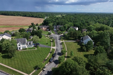
Tom Fox Court
-
Croaker Road and Interstate 64
