-
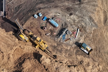
Equipment at the Hampton Roads Materials Resource Recovery Center
-
Site of former P. Buckley Moss Museum [01]
![Site of former P. Buckley Moss Museum [01] (1026 visits) Site of the former P. Buckley Moss Museum in Waynesboro, Virginia. The museum, which featured works... Site of former P. Buckley Moss Museum [01]](../../../../../../../i/upload/2025/03/03/20250303185841-9c77b6ab-cu_s9999x250.jpg)
-
Sky above Croaker Road

-
Site of former P. Buckley Moss Museum [02]
![Site of former P. Buckley Moss Museum [02] (1046 visits) Site of the former P. Buckley Moss Museum in Waynesboro, Virginia. The museum, which featured works... Site of former P. Buckley Moss Museum [02]](../../../../../../../i/upload/2025/03/03/20250303185847-e161c5f3-cu_s9999x250.jpg)
-
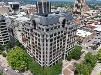
110 Franklin Road SE
-
Site of former P. Buckley Moss Museum [03]
![Site of former P. Buckley Moss Museum [03] (1057 visits) Site of the former P. Buckley Moss Museum in Waynesboro, Virginia. The museum, which featured works... Site of former P. Buckley Moss Museum [03]](../../../../../../../i/upload/2025/03/03/20250303185852-c9c1e69f-cu_s9999x250.jpg)
-
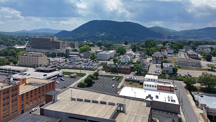
Downtown Roanoke facing Mill Mountain
-
Poff Federal Building [02]
![Poff Federal Building [02] (1071 visits) The Richard H. Poff Federal Building, a government office building at 210 Franklin Road SW in downto... Poff Federal Building [02]](../../../../../../../i/upload/2025/03/02/20250302134720-6d41525c-cu_s9999x250.jpg)
-
Poff Federal Building [01]
![Poff Federal Building [01] (1087 visits) The Richard H. Poff Federal Building, a government office building at 210 Franklin Road SW in downto... Poff Federal Building [01]](../../../../../../../i/upload/2025/03/02/20250302134711-675ab6c7-cu_s9999x250.jpg)
-
Wells Fargo Tower [02]
![Wells Fargo Tower [02] (1105 visits) The Wells Fargo Tower, an office building in downtown Roanoke, Virginia. The building, completed in... Wells Fargo Tower [02]](../../../../../../../i/upload/2025/03/02/20250302134831-92a15775-cu_s9999x250.jpg)
-
Hampton Inn in downtown Roanoke [02]
![Hampton Inn in downtown Roanoke [02] (1113 visits) Hampton Inn hotel in downtown Roanoke, Virginia. This Hampton Inn is unusual in that it was built o... Hampton Inn in downtown Roanoke [02]](../../../../../../../i/upload/2025/03/02/20250302134750-3bedaef7-cu_s9999x250.jpg)
-
Hampton Inn in downtown Roanoke [01]
![Hampton Inn in downtown Roanoke [01] (1115 visits) Hampton Inn hotel in downtown Roanoke, Virginia. This Hampton Inn is unusual in that it was built o... Hampton Inn in downtown Roanoke [01]](../../../../../../../i/upload/2025/03/02/20250302134739-3fb23c16-cu_s9999x250.jpg)
-
Carilion Administrative Services Building [02]
![Carilion Administrative Services Building [02] (1122 visits) The Carilion Administrative Services Building, at 213 South Jefferson Street in downtown Roanoke, Vi... Carilion Administrative Services Building [02]](../../../../../../../i/upload/2025/03/02/20250302134813-241abfec-cu_s9999x250.jpg)
-
Carilion Administrative Services Building [01]
![Carilion Administrative Services Building [01] (1126 visits) The Carilion Administrative Services Building, at 213 South Jefferson Street in downtown Roanoke, Vi... Carilion Administrative Services Building [01]](../../../../../../../i/upload/2025/03/02/20250302134801-6477a7f8-cu_s9999x250.jpg)
-
President Heads [01]
![President Heads [01] (1135 visits) The President Heads, a collection of busts of United States presidents, on the property of the Hampt... President Heads [01]](../../../../../../../i/upload/2025/02/22/20250222004408-ae6b4ea2-cu_s9999x250.jpg)
-
President Heads [04]
![President Heads [04] (1140 visits) The President Heads, a collection of busts of United States presidents, on the property of the Hampt... President Heads [04]](../../../../../../../i/upload/2025/02/22/20250222004427-8a077a64-cu_s9999x250.jpg)
-
Cell tower above Interstate 64

-
Former Waynesboro District Home [05]
![Former Waynesboro District Home [05] (1150 visits) Former Waynesboro District Home building at 1400 Duke Road in Waynesboro, Virginia. The facility, k... Former Waynesboro District Home [05]](../../../../../../../i/upload/2025/03/03/20250303192359-c00a5a36-cu_s9999x250.jpg)
-
Former Waynesboro District Home [06]
![Former Waynesboro District Home [06] (1152 visits) Former Waynesboro District Home building at 1400 Duke Road in Waynesboro, Virginia. The facility, k... Former Waynesboro District Home [06]](../../../../../../../i/upload/2025/03/03/20250303192406-eccb2fd6-cu_s9999x250.jpg)
-
Storm near Poolesville, Maryland [07]
![Storm near Poolesville, Maryland [07] (1166 visits) Thunderstorm near Poolesville, Maryland.
Ben Schumin is a professional photographer who captures ... Storm near Poolesville, Maryland [07]](../../../../../../../i/upload/2025/02/28/20250228153844-2249fb45-cu_s9999x250.jpg)
-
President Heads [02]
![President Heads [02] (1168 visits) The President Heads, a collection of busts of United States presidents, on the property of the Hampt... President Heads [02]](../../../../../../../i/upload/2025/02/22/20250222004415-62d5dbbd-cu_s9999x250.jpg)
-
Storm near Poolesville, Maryland [04]
![Storm near Poolesville, Maryland [04] (1171 visits) Thunderstorm near Poolesville, Maryland.
Ben Schumin is a professional photographer who captures ... Storm near Poolesville, Maryland [04]](../../../../../../../i/upload/2025/02/28/20250228153808-e077176b-cu_s9999x250.jpg)
-
Storm near Poolesville, Maryland [09]
![Storm near Poolesville, Maryland [09] (1171 visits) Thunderstorm near Poolesville, Maryland.
Ben Schumin is a professional photographer who captures ... Storm near Poolesville, Maryland [09]](../../../../../../../i/upload/2025/02/28/20250228153911-3dad6484-cu_s9999x250.jpg)
-
Storm near Poolesville, Maryland [01]
![Storm near Poolesville, Maryland [01] (1174 visits) Thunderstorm near Poolesville, Maryland.
Ben Schumin is a professional photographer who captures ... Storm near Poolesville, Maryland [01]](../../../../../../../i/upload/2025/02/28/20250228153603-4f5f8d84-cu_s9999x250.jpg)
-
Roanoke Industrial Center [01]
![Roanoke Industrial Center [01] (1177 visits) Aerial view of the Roanoke Industrial Center, an industrial park in southeast Roanoke, Virginia.
... Roanoke Industrial Center [01]](../../../../../../../i/upload/2025/03/03/20250303061242-c4450e31-cu_s9999x250.jpg)
-
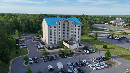
Best Western Plus in Thornburg, Virginia
-
Storm near Poolesville, Maryland [02]
![Storm near Poolesville, Maryland [02] (1185 visits) Thunderstorm near Poolesville, Maryland.
Ben Schumin is a professional photographer who captures ... Storm near Poolesville, Maryland [02]](../../../../../../../i/upload/2025/02/28/20250228153657-fd5e55c4-cu_s9999x250.jpg)
-
Storm near Poolesville, Maryland [06]
![Storm near Poolesville, Maryland [06] (1187 visits) Thunderstorm near Poolesville, Maryland.
Ben Schumin is a professional photographer who captures ... Storm near Poolesville, Maryland [06]](../../../../../../../i/upload/2025/02/28/20250228153832-7a1b0103-cu_s9999x250.jpg)
-
Storm near Poolesville, Maryland [08]
![Storm near Poolesville, Maryland [08] (1189 visits) Thunderstorm near Poolesville, Maryland.
Ben Schumin is a professional photographer who captures ... Storm near Poolesville, Maryland [08]](../../../../../../../i/upload/2025/02/28/20250228153859-de442d45-cu_s9999x250.jpg)
-
Storm near Poolesville, Maryland [05]
![Storm near Poolesville, Maryland [05] (1190 visits) Thunderstorm near Poolesville, Maryland.
Ben Schumin is a professional photographer who captures ... Storm near Poolesville, Maryland [05]](../../../../../../../i/upload/2025/02/28/20250228153821-6695d99b-cu_s9999x250.jpg)
-
Former Waynesboro District Home [07]
![Former Waynesboro District Home [07] (1190 visits) Former Waynesboro District Home building at 1400 Duke Road in Waynesboro, Virginia. The facility, k... Former Waynesboro District Home [07]](../../../../../../../i/upload/2025/03/03/20250303192413-64732026-cu_s9999x250.jpg)
-
Former Waynesboro District Home [02]
![Former Waynesboro District Home [02] (1191 visits) Former Waynesboro District Home building at 1400 Duke Road in Waynesboro, Virginia. The facility, k... Former Waynesboro District Home [02]](../../../../../../../i/upload/2025/03/03/20250303192336-a1b1067a-cu_s9999x250.jpg)
-
Former Waynesboro District Home [04]
![Former Waynesboro District Home [04] (1191 visits) Former Waynesboro District Home building at 1400 Duke Road in Waynesboro, Virginia. The facility, k... Former Waynesboro District Home [04]](../../../../../../../i/upload/2025/03/03/20250303192352-274cd5c8-cu_s9999x250.jpg)
-
Former Waynesboro District Home [03]
![Former Waynesboro District Home [03] (1194 visits) Former Waynesboro District Home building at 1400 Duke Road in Waynesboro, Virginia. The facility, k... Former Waynesboro District Home [03]](../../../../../../../i/upload/2025/03/03/20250303192345-2775731c-cu_s9999x250.jpg)
-
Former Waynesboro District Home [08]
![Former Waynesboro District Home [08] (1198 visits) Former Waynesboro District Home building at 1400 Duke Road in Waynesboro, Virginia. The facility, k... Former Waynesboro District Home [08]](../../../../../../../i/upload/2025/03/03/20250303192421-d1941783-cu_s9999x250.jpg)
-
Former Waynesboro District Home [01]
![Former Waynesboro District Home [01] (1200 visits) Former Waynesboro District Home building at 1400 Duke Road in Waynesboro, Virginia. The facility, k... Former Waynesboro District Home [01]](../../../../../../../i/upload/2025/03/03/20250303192318-40de21a3-cu_s9999x250.jpg)
-
Storm near Poolesville, Maryland [10]
![Storm near Poolesville, Maryland [10] (1207 visits) Thunderstorm near Poolesville, Maryland.
Ben Schumin is a professional photographer who captures ... Storm near Poolesville, Maryland [10]](../../../../../../../i/upload/2025/02/28/20250228153926-7c08236b-cu_s9999x250.jpg)
-
President Heads [03]
![President Heads [03] (1209 visits) The President Heads, a collection of busts of United States presidents, on the property of the Hampt... President Heads [03]](../../../../../../../i/upload/2025/02/22/20250222004421-19c6797b-cu_s9999x250.jpg)
-
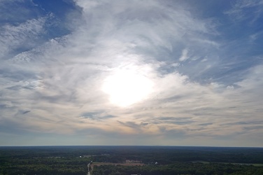
Sunset over Thornburg, Virginia
-
Aerial view of downtown Lynchburg [02]
![Aerial view of downtown Lynchburg [02] (1211 visits) Aerial view of downtown Lynchburg, Virginia, an independent city in central Virginia.
Ben Schumin i... Aerial view of downtown Lynchburg [02]](../../../../../../../i/upload/2025/02/28/20250228215213-a5dd2779-cu_s9999x250.jpg)
-
Aerial view of downtown Lynchburg [03]
![Aerial view of downtown Lynchburg [03] (1214 visits) Aerial view of downtown Lynchburg, Virginia, an independent city in central Virginia.
Ben Schumin i... Aerial view of downtown Lynchburg [03]](../../../../../../../i/upload/2025/02/28/20250228215218-ffa5d68d-cu_s9999x250.jpg)
-
Wells Fargo Tower [01]
![Wells Fargo Tower [01] (1214 visits) The Wells Fargo Tower, an office building in downtown Roanoke, Virginia. The building, completed in... Wells Fargo Tower [01]](../../../../../../../i/upload/2025/03/02/20250302134825-e3412be2-cu_s9999x250.jpg)
-
Storm near Poolesville, Maryland [03]
![Storm near Poolesville, Maryland [03] (1216 visits) Thunderstorm near Poolesville, Maryland.
Ben Schumin is a professional photographer who captures ... Storm near Poolesville, Maryland [03]](../../../../../../../i/upload/2025/02/28/20250228153757-ee5d80e8-cu_s9999x250.jpg)
-
Aerial view of downtown Lynchburg [01]
![Aerial view of downtown Lynchburg [01] (1222 visits) Aerial view of downtown Lynchburg, Virginia, an independent city in central Virginia.
Ben Schumin i... Aerial view of downtown Lynchburg [01]](../../../../../../../i/upload/2025/02/28/20250228215207-816965cd-cu_s9999x250.jpg)
-
Bank of the James building [03]
![Bank of the James building [03] (1228 visits) Aerial view of the Bank of the James building, an office building in downtown Lynchburg, Virginia.
... Bank of the James building [03]](../../../../../../../i/upload/2025/02/28/20250228215224-5dade886-cu_s9999x250.jpg)
-
Roanoke Industrial Center [02]
![Roanoke Industrial Center [02] (1240 visits) Aerial view of the Roanoke Industrial Center, an industrial park in southeast Roanoke, Virginia.
... Roanoke Industrial Center [02]](../../../../../../../i/upload/2025/03/03/20250303105736-0686e504-cu_s9999x250.jpg)
-
Storm near Poolesville, Maryland [11]
![Storm near Poolesville, Maryland [11] (1257 visits) Thunderstorm near Poolesville, Maryland.
Ben Schumin is a professional photographer who captures ... Storm near Poolesville, Maryland [11]](../../../../../../../i/upload/2025/02/28/20250228153940-bb1d26ce-cu_s9999x250.jpg)
-
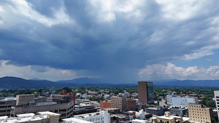
Storm cloud approaching Roanoke, Virginia
-
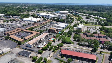
View towards the Hampton Coliseum
-
Wells Fargo Tower [06]
![Wells Fargo Tower [06] (1341 visits) The Wells Fargo Tower, an office building in downtown Roanoke, Virginia. The building, completed in... Wells Fargo Tower [06]](../../../../../../../i/upload/2025/03/03/20250303171038-5db0edf1-cu_s9999x250.jpg)
-
Wells Fargo Tower [04]
![Wells Fargo Tower [04] (1342 visits) The Wells Fargo Tower, an office building in downtown Roanoke, Virginia. The building, completed in... Wells Fargo Tower [04]](../../../../../../../i/upload/2025/03/03/20250303170817-77f8c38e-cu_s9999x250.jpg)
-
Wells Fargo Tower [05]
![Wells Fargo Tower [05] (1365 visits) The Wells Fargo Tower, an office building in downtown Roanoke, Virginia. The building, completed in... Wells Fargo Tower [05]](../../../../../../../i/upload/2025/03/03/20250303170920-70ca29f8-cu_s9999x250.jpg)
-
Mountain with a bare patch [02]
![Mountain with a bare patch [02] (1368 visits) A mountain with a bare patch along US 220 at the Virginia-West Virginia line in Pendleton County, We... Mountain with a bare patch [02]](../../../../../../../i/upload/2024/07/20/20240720094112-5450497c-cu_s9999x250.jpg)
-
Wells Fargo Tower [03]
![Wells Fargo Tower [03] (1385 visits) The Wells Fargo Tower, an office building in downtown Roanoke, Virginia. The building, completed in... Wells Fargo Tower [03]](../../../../../../../i/upload/2025/03/03/20250303170735-d26842f9-cu_s9999x250.jpg)
-
Mountain with a bare patch [01]
![Mountain with a bare patch [01] (1389 visits) A mountain with a bare patch along US 220 at the Virginia-West Virginia line in Pendleton County, We... Mountain with a bare patch [01]](../../../../../../../i/upload/2024/07/20/20240720094201-2326a710-cu_s9999x250.jpg)
-
Tornado damage at 405 Dogwood Drive [01]
![Tornado damage at 405 Dogwood Drive [01] (1390 visits) Damage to a neighborhood in Gaithersburg, Maryland following a tornado that passed through the area ... Tornado damage at 405 Dogwood Drive [01]](../../../../../../../i/upload/2025/02/28/20250228153528-e1f0d46c-cu_s9999x250.jpg)
-
Allied Arts Building [02]
![Allied Arts Building [02] (1425 visits) Aerial view of the Allied Arts Building, a high-rise building in downtown Lynchburg, Virginia, built... Allied Arts Building [02]](../../../../../../../i/upload/2025/02/28/20250228215231-6b669c5e-cu_s9999x250.jpg)
-
Williamsburg Baptist Church [01]
![Williamsburg Baptist Church [01] (1464 visits) Williamsburg Baptist Church, home to an independent congregation that describes itself as, "An ... Williamsburg Baptist Church [01]](../../../../../../../i/upload/2025/02/21/20250221225338-fdc4a6eb-cu_s9999x250.jpg)
-
Tornado damage at 405 Dogwood Drive [02]
![Tornado damage at 405 Dogwood Drive [02] (1485 visits) Damage to a neighborhood in Gaithersburg, Maryland following a tornado that passed through the area ... Tornado damage at 405 Dogwood Drive [02]](../../../../../../../i/upload/2025/02/28/20250228153544-95d52742-cu_s9999x250.jpg)
-
Allied Arts Building [03]
![Allied Arts Building [03] (1488 visits) Aerial view of the Allied Arts Building, a high-rise building in downtown Lynchburg, Virginia, built... Allied Arts Building [03]](../../../../../../../i/upload/2025/02/28/20250228215236-7f0b55fb-cu_s9999x250.jpg)
-
R-VAN in Hampton, Virginia

-
Gaithersburg High School [01]
![Gaithersburg High School [01] (1554 visits) Aerial view of Gaithersburg High School, a public high school off of Route 355 in Gaithersburg, Mary... Gaithersburg High School [01]](../../../../../../../i/upload/2025/02/28/20250228153447-f7fb6a22-cu_s9999x250.jpg)
-
Gaithersburg High School [02]
![Gaithersburg High School [02] (1563 visits) Aerial view of Gaithersburg High School, a public high school off of Route 355 in Gaithersburg, Mary... Gaithersburg High School [02]](../../../../../../../i/upload/2025/02/28/20250228153500-0a2adc58-cu_s9999x250.jpg)
-
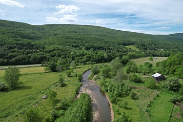
South Branch of the Potomac River
-
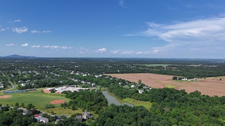
Aerial view of Poolesville, Maryland
-
Zable Stadium and Cary Field [01]
![Zable Stadium and Cary Field [01] (1571 visits) Aerial view of Zable Stadium and Cary Field, which together comprise the football venue at the Colle... Zable Stadium and Cary Field [01]](../../../../../../../i/upload/2025/02/22/20250222000929-3373536a-cu_s9999x250.jpg)
-
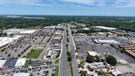
View east along Mercury Boulevard
-
Zable Stadium and Cary Field [02]
![Zable Stadium and Cary Field [02] (1618 visits) Aerial view of Zable Stadium and Cary Field, which together comprise the football venue at the Colle... Zable Stadium and Cary Field [02]](../../../../../../../i/upload/2025/02/22/20250222000936-370ac2e6-cu_s9999x250.jpg)
-
Croaker Road and Interstate 64

-
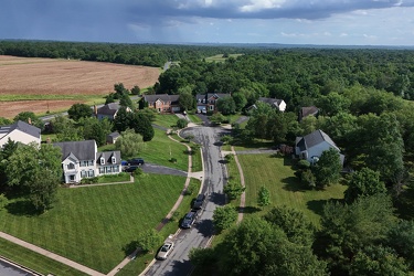
Tom Fox Court
-
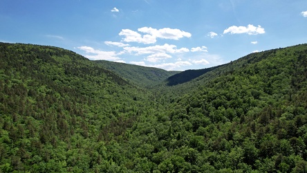
Mountains around Coles Run Reservoir
-
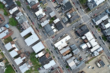
Central Oakland
-
Aerial view of Commonwealth Coach & Trolley lot

-
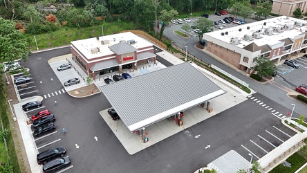
Wawa in Gaithersburg, Maryland
-
Farm on the Virginia-West Virginia border [02]
![Farm on the Virginia-West Virginia border [02] (1756 visits) Farm on the border between Highland County, Virginia and Pendleton County, West Virginia. The bound... Farm on the Virginia-West Virginia border [02]](../../../../../../../i/upload/2024/07/20/20240720094251-b9fab9db-cu_s9999x250.jpg)
-
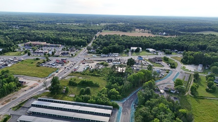
Aerial view of Thornburg, Virginia
-
Thornburg interchange on Interstate 95 [01]
![Thornburg interchange on Interstate 95 [01] (1819 visits) Thornburg interchange (exit 118) on Interstate 95 in Virginia. This interchange interacts with Mudd... Thornburg interchange on Interstate 95 [01]](../../../../../../../i/upload/2025/02/22/20250222022415-31ccb499-cu_s9999x250.jpg)
-
Traffic circle under construction [03]
![Traffic circle under construction [03] (1865 visits) Traffic circle under construction north of Mudd Tavern Road (VA 606) in Thornburg, Virginia.
More a... Traffic circle under construction [03]](../../../../../../../i/upload/2025/02/22/20250222022342-e895dd00-cu_s9999x250.jpg)
-
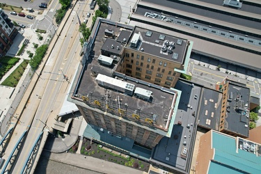
Landmarks Building
-
Thornburg interchange on Interstate 95 [02]
![Thornburg interchange on Interstate 95 [02] (1877 visits) Thornburg interchange (exit 118) on Interstate 95 in Virginia. This interchange interacts with Mudd... Thornburg interchange on Interstate 95 [02]](../../../../../../../i/upload/2025/02/22/20250222022420-229d3507-cu_s9999x250.jpg)