-
Interstate 64 at State Route F182 [04]
![Interstate 64 at State Route F182 [04] (9 visits) Interstate 64 at the State Route F182 overpass, just east of Rockfish Gap in Nelson County, Virginia... Interstate 64 at State Route F182 [04]](../../../../../../i/upload/2025/07/10/20250710145527-79133bcd-cu_s9999x250.jpg)
-
Interstate 64 at State Route F182 [01]
![Interstate 64 at State Route F182 [01] (6 visits) Interstate 64 at the State Route F182 overpass, just east of Rockfish Gap in Nelson County, Virginia... Interstate 64 at State Route F182 [01]](../../../../../../i/upload/2025/07/10/20250710145453-bbc92c0e-cu_s9999x250.jpg)
-
Walking path underneath the Capital Beltway

-
Sudley Road just south of I-66

-
Traffic circle at intersection of Drs. Bruce and Lee Foundation Blvd and Dr. Johnny Bruce Road

-
Former CARTA bus 3426 on Interstate 26

-
Intersections of King Street with Tobacco and Vanderhorst Streets

-
Traffic signals at King and Cannon Streets [02]
![Traffic signals at King and Cannon Streets [02] (468 visits) Traffic signals at the intersection of King and Cannon Streets in downtown Charleston, South Carolin... Traffic signals at King and Cannon Streets [02]](../../../../../../i/upload/2025/05/23/20250523224859-225bcebc-cu_s9999x250.jpg)
-
Eastern terminus of Interstate 26 [02]
![Eastern terminus of Interstate 26 [02] (506 visits) The eastern terminus of Interstate 26 in Charleston, South Carolina. I-26 ends at a signalized inte... Eastern terminus of Interstate 26 [02]](../../../../../../i/upload/2025/05/23/20250523172431-321f5bc1-cu_s9999x250.jpg)
-
Eastern terminus of Interstate 26 [03]
![Eastern terminus of Interstate 26 [03] (878 visits) The eastern terminus of Interstate 26 in Charleston, South Carolina. I-26 ends at a signalized inte... Eastern terminus of Interstate 26 [03]](../../../../../../i/upload/2025/05/23/20250523172453-291afe72-cu_s9999x250.jpg)
-
Eastern terminus of Interstate 26 [01]
![Eastern terminus of Interstate 26 [01] (1022 visits) The eastern terminus of Interstate 26 in Charleston, South Carolina. I-26 ends at a signalized inte... Eastern terminus of Interstate 26 [01]](../../../../../../i/upload/2025/05/23/20250523172345-9b22a449-cu_s9999x250.jpg)
-
King Street between Reid and Woolfe Streets

-
View down King Street in downtown Charleston

-
Traffic signals at King and Cannon Streets [01]
![Traffic signals at King and Cannon Streets [01] (318 visits) Traffic signals at the intersection of King and Cannon Streets in downtown Charleston, South Carolin... Traffic signals at King and Cannon Streets [01]](../../../../../../i/upload/2025/05/23/20250523134012-59105e2a-cu_s9999x250.jpg)
-
Signage at the corner of Spring and King Streets

-
Folly Road bridge over a waterway [05]
![Folly Road bridge over a waterway [05] (543 visits) Bridge carrying South Carolina Highway 171 (Folly Road) across a waterway between Charleston and Fol... Folly Road bridge over a waterway [05]](../../../../../../i/upload/2025/05/23/20250523015734-a60eb9cc-cu_s9999x250.jpg)
-
Folly Road bridge over a waterway [03]
![Folly Road bridge over a waterway [03] (571 visits) Bridge carrying South Carolina Highway 171 (Folly Road) across a waterway between Charleston and Fol... Folly Road bridge over a waterway [03]](../../../../../../i/upload/2025/05/23/20250523015655-f9e58897-cu_s9999x250.jpg)
-
Folly Road bridge over a waterway [04]
![Folly Road bridge over a waterway [04] (402 visits) Bridge carrying South Carolina Highway 171 (Folly Road) across a waterway between Charleston and Fol... Folly Road bridge over a waterway [04]](../../../../../../i/upload/2025/05/23/20250523015708-37d71c5a-cu_s9999x250.jpg)
-
Folly Road bridge over a waterway [01]
![Folly Road bridge over a waterway [01] (553 visits) Bridge carrying South Carolina Highway 171 (Folly Road) across a waterway between Charleston and Fol... Folly Road bridge over a waterway [01]](../../../../../../i/upload/2025/05/23/20250523015608-7dd97814-cu_s9999x250.jpg)
-
Folly Road bridge over a waterway [02]
![Folly Road bridge over a waterway [02] (694 visits) Bridge carrying South Carolina Highway 171 (Folly Road) across a waterway between Charleston and Fol... Folly Road bridge over a waterway [02]](../../../../../../i/upload/2025/05/23/20250523015618-d369d849-cu_s9999x250.jpg)
-
Traffic signal at Center Street and Ashley Avenue [03]
![Traffic signal at Center Street and Ashley Avenue [03] (300 visits) Traffic signal mounted above the intersection of Center Street and Ashley Avenue in Folly Beach, Sou... Traffic signal at Center Street and Ashley Avenue [03]](../../../../../../i/upload/2025/05/23/20250523011935-5f3c6de5-cu_s9999x250.jpg)
-
Pedestrian call button at Center Street and Ashley Avenue

-
Traffic signal at Center Street and Ashley Avenue [02]
![Traffic signal at Center Street and Ashley Avenue [02] (260 visits) Traffic signal mounted above the intersection of Center Street and Ashley Avenue in Folly Beach, Sou... Traffic signal at Center Street and Ashley Avenue [02]](../../../../../../i/upload/2025/05/23/20250523011915-ec459398-cu_s9999x250.jpg)
-
Traffic signal at Center Street and Ashley Avenue [01]
![Traffic signal at Center Street and Ashley Avenue [01] (239 visits) Traffic signal mounted above the intersection of Center Street and Ashley Avenue in Folly Beach, Sou... Traffic signal at Center Street and Ashley Avenue [01]](../../../../../../i/upload/2025/05/23/20250523011856-4e7c16b7-cu_s9999x250.jpg)
-
Aerial view of Folly Beach, South Carolina [04]
![Aerial view of Folly Beach, South Carolina [04] (491 visits) Aerial view of Folly Beach, South Carolina, roughly centered on Center Street, facing approximately ... Aerial view of Folly Beach, South Carolina [04]](../../../../../../i/upload/2025/05/14/20250514110319-69d4f7ad-cu_s9999x250.jpg)
-
Intersection of Center Street and Hudson Avenue

-
Aerial view of Folly Beach, South Carolina [03]
![Aerial view of Folly Beach, South Carolina [03] (428 visits) Aerial view of Folly Beach, South Carolina, roughly centered on Center Street, facing approximately ... Aerial view of Folly Beach, South Carolina [03]](../../../../../../i/upload/2025/05/14/20250514110312-219b9712-cu_s9999x250.jpg)
-
Aerial view of Folly Beach, South Carolina [02]
![Aerial view of Folly Beach, South Carolina [02] (299 visits) Aerial view of Folly Beach, South Carolina, roughly centered on Center Street, facing approximately ... Aerial view of Folly Beach, South Carolina [02]](../../../../../../i/upload/2025/05/14/20250514110306-1f7c3170-cu_s9999x250.jpg)
-
Aerial view of Folly Beach, South Carolina [01]
![Aerial view of Folly Beach, South Carolina [01] (336 visits) Aerial view of Folly Beach, South Carolina, roughly centered on Center Street, facing approximately ... Aerial view of Folly Beach, South Carolina [01]](../../../../../../i/upload/2025/05/14/20250514110300-74440381-cu_s9999x250.jpg)
-
Jughandle in Willingboro, New Jersey [02]
![Jughandle in Willingboro, New Jersey [02] (1191 visits) Jughandle ramp at the intersection of Beverly-Rancocas Road (CR 626) and John F. Kennedy Way (CR 633... Jughandle in Willingboro, New Jersey [02]](../../../../../../i/upload/2025/03/20/20250320182358-18c299be-cu_s9999x250.jpg)
-
Jughandle in Willingboro, New Jersey [01]
![Jughandle in Willingboro, New Jersey [01] (1221 visits) Jughandle ramp at the intersection of Beverly-Rancocas Road (CR 626) and John F. Kennedy Way (CR 633... Jughandle in Willingboro, New Jersey [01]](../../../../../../i/upload/2025/03/20/20250320182337-89516673-cu_s9999x250.jpg)
-
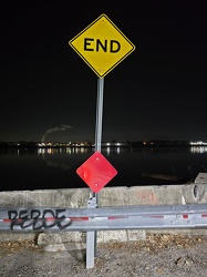
"END" sign on Bentley Street
-
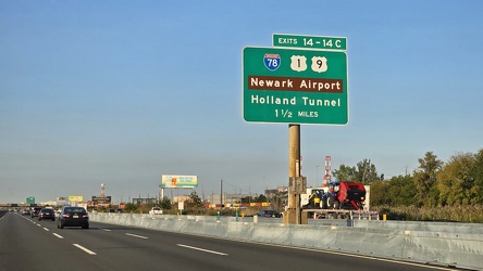
Sign for Newark Airport and the Holland Tunnel
-
Tunnel under Roanoke-Blacksburg Regional Airport [04]
![Tunnel under Roanoke-Blacksburg Regional Airport [04] (1240 visits) Tunnel under the northeastern end of runway 06/24 at Roanoke-Blacksburg Regional Airport, helping ca... Tunnel under Roanoke-Blacksburg Regional Airport [04]](../../../../../../i/upload/2025/03/07/20250307082705-95dbd6b4-cu_s9999x250.jpg)
-
Photographing the tunnel under Roanoke-Blacksburg Regional Airport

-
Tunnel under Roanoke-Blacksburg Regional Airport [03]
![Tunnel under Roanoke-Blacksburg Regional Airport [03] (1223 visits) Tunnel under the northeastern end of runway 06/24 at Roanoke-Blacksburg Regional Airport, helping ca... Tunnel under Roanoke-Blacksburg Regional Airport [03]](../../../../../../i/upload/2025/03/07/20250307082655-ed6dde73-cu_s9999x250.jpg)
-
Tunnel under Roanoke-Blacksburg Regional Airport [01]
![Tunnel under Roanoke-Blacksburg Regional Airport [01] (1158 visits) Tunnel under the northeastern end of runway 06/24 at Roanoke-Blacksburg Regional Airport, helping ca... Tunnel under Roanoke-Blacksburg Regional Airport [01]](../../../../../../i/upload/2025/03/07/20250307082638-881970da-cu_s9999x250.jpg)
-
Tunnel under Roanoke-Blacksburg Regional Airport [02]
![Tunnel under Roanoke-Blacksburg Regional Airport [02] (1174 visits) Tunnel under the northeastern end of runway 06/24 at Roanoke-Blacksburg Regional Airport, helping ca... Tunnel under Roanoke-Blacksburg Regional Airport [02]](../../../../../../i/upload/2025/03/07/20250307082646-1ee32362-cu_s9999x250.jpg)
-
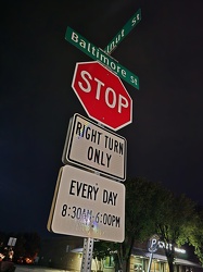
Signage at East Walnut and Baltimore Streets
-
View above Locust Street [01]
![View above Locust Street [01] (1165 visits) View above the 100 block of Locust Street in downtown Harrisburg, Pennsylvania.
More at The Schumin... View above Locust Street [01]](../../../../../../i/upload/2025/03/06/20250306092215-56587593-cu_s9999x250.jpg)
-
View above Locust Street [02]
![View above Locust Street [02] (1191 visits) View above the 100 block of Locust Street in downtown Harrisburg, Pennsylvania.
More at The Schumin... View above Locust Street [02]](../../../../../../i/upload/2025/03/06/20250306092222-32925c3b-cu_s9999x250.jpg)
-
Pennsylvania State Capitol fron across the State Street Bridge [03]
![Pennsylvania State Capitol fron across the State Street Bridge [03] (3439 visits) Aerial view of the Pennsylvania State Capitol from across the State Street Bridge.
More at The Schu... Pennsylvania State Capitol fron across the State Street Bridge [03]](../../../../../../i/upload/2025/03/06/20250306075501-3ad69b4f-cu_s9999x250.jpg)
-
Pennsylvania State Capitol fron across the State Street Bridge [01]
![Pennsylvania State Capitol fron across the State Street Bridge [01] (1274 visits) Aerial view of the Pennsylvania State Capitol from across the State Street Bridge.
More at The Schu... Pennsylvania State Capitol fron across the State Street Bridge [01]](../../../../../../i/upload/2025/03/06/20250306075448-73fb0fbb-cu_s9999x250.jpg)
-
Pennsylvania State Capitol fron across the State Street Bridge [02]
![Pennsylvania State Capitol fron across the State Street Bridge [02] (3323 visits) Aerial view of the Pennsylvania State Capitol from across the State Street Bridge.
More at The Schu... Pennsylvania State Capitol fron across the State Street Bridge [02]](../../../../../../i/upload/2025/03/06/20250306075454-a96514ba-cu_s9999x250.jpg)
-
Highway through Dauphin, Pennsylvania [02]
![Highway through Dauphin, Pennsylvania [02] (3105 visits) Highway carrying US 22 and US 322 through Dauphin, Pennsylvania.
More at The Schumin Web:
www.schum... Highway through Dauphin, Pennsylvania [02]](../../../../../../i/upload/2025/03/06/20250306064534-81e15f4d-cu_s9999x250.jpg)
-
Highway through Dauphin, Pennsylvania [03]
![Highway through Dauphin, Pennsylvania [03] (1334 visits) Highway carrying US 22 and US 322 through Dauphin, Pennsylvania.
More at The Schumin Web:
www.sc... Highway through Dauphin, Pennsylvania [03]](../../../../../../i/upload/2025/03/06/20250306064541-8f72e3c6-cu_s9999x250.jpg)
-
Highway through Dauphin, Pennsylvania [01]
![Highway through Dauphin, Pennsylvania [01] (3116 visits) Highway carrying US 22 and US 322 through Dauphin, Pennsylvania. An interchange with Pennsylvania R... Highway through Dauphin, Pennsylvania [01]](../../../../../../i/upload/2025/03/06/20250306064528-820644f1-cu_s9999x250.jpg)
-
Signage at river access in Dauphin, Pennsylvania [02]
![Signage at river access in Dauphin, Pennsylvania [02] (726 visits) Signage at the river access point at the intersection of River Road and Market Street in Dauphin, Pe... Signage at river access in Dauphin, Pennsylvania [02]](../../../../../../i/upload/2025/03/06/20250306042508-3cf9486c-cu_s9999x250.jpg)
-
Signage at river access in Dauphin, Pennsylvania [01]
![Signage at river access in Dauphin, Pennsylvania [01] (807 visits) Signage at the river access point at the intersection of River Road and Market Street in Dauphin, Pe... Signage at river access in Dauphin, Pennsylvania [01]](../../../../../../i/upload/2025/03/06/20250306042504-9368dbe5-cu_s9999x250.jpg)
-
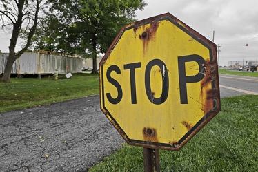
Rusted yellow stop sign
-
Elm Avenue interchange [03]
![Elm Avenue interchange [03] (2291 visits) Interchange between Interstate 581/US 220 and Elm Avenue (SR 24) in Roanoke, Virginia. The I-581 de... Elm Avenue interchange [03]](../../../../../../i/upload/2025/03/03/20250303170720-a5bd3de6-cu_s9999x250.jpg)
-
Elm Avenue interchange [04]
![Elm Avenue interchange [04] (1947 visits) Interchange between Interstate 581/US 220 and Elm Avenue (SR 24) in Roanoke, Virginia. The I-581 de... Elm Avenue interchange [04]](../../../../../../i/upload/2025/03/03/20250303170729-c4512aea-cu_s9999x250.jpg)
-
Tom Fox Court
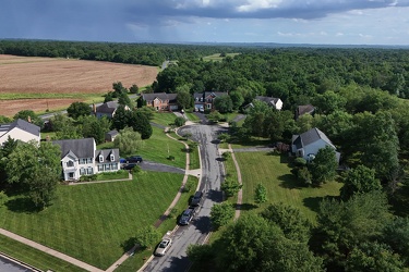
-
Thornburg interchange on Interstate 95 [02]
![Thornburg interchange on Interstate 95 [02] (1765 visits) Thornburg interchange (exit 118) on Interstate 95 in Virginia. This interchange interacts with Mudd... Thornburg interchange on Interstate 95 [02]](../../../../../../i/upload/2025/02/22/20250222022420-229d3507-cu_s9999x250.jpg)
-
Thornburg interchange on Interstate 95 [01]
![Thornburg interchange on Interstate 95 [01] (1714 visits) Thornburg interchange (exit 118) on Interstate 95 in Virginia. This interchange interacts with Mudd... Thornburg interchange on Interstate 95 [01]](../../../../../../i/upload/2025/02/22/20250222022415-31ccb499-cu_s9999x250.jpg)
-
Traffic circle under construction [03]
![Traffic circle under construction [03] (1761 visits) Traffic circle under construction north of Mudd Tavern Road (VA 606) in Thornburg, Virginia.
More a... Traffic circle under construction [03]](../../../../../../i/upload/2025/02/22/20250222022342-e895dd00-cu_s9999x250.jpg)
-
Aerial view of Thornburg, Virginia
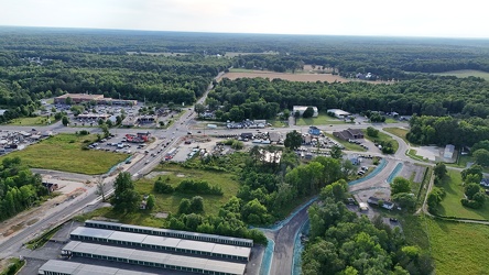
-
Traffic circle under construction [02]
![Traffic circle under construction [02] (1869 visits) Traffic circle under construction north of Mudd Tavern Road (VA 606) in Thornburg, Virginia.
More a... Traffic circle under construction [02]](../../../../../../i/upload/2025/02/22/20250222022336-e9f87960-cu_s9999x250.jpg)
-
Traffic circle under construction [01]
![Traffic circle under construction [01] (1772 visits) Traffic circle under construction north of Mudd Tavern Road (VA 606) in Thornburg, Virginia.
More a... Traffic circle under construction [01]](../../../../../../i/upload/2025/02/22/20250222022330-4bbf063c-cu_s9999x250.jpg)
-
Croaker Road and Interstate 64
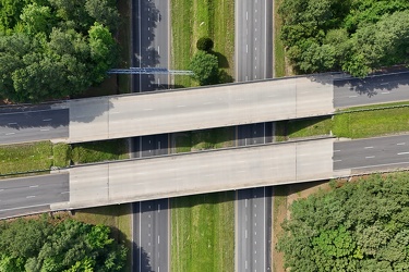
-
View east along Mercury Boulevard
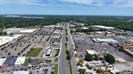
-
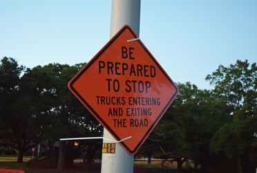
Orange warning sign zip-tied to a lamppost
-
Monitor-Merrimac Memorial Bridge-Tunnel [10]
![Monitor-Merrimac Memorial Bridge-Tunnel [10] (3303 visits) South portal island of the Monitor-Merrimac Memorial Bridge-Tunnel, a 4.6 mile long crossing of Hamp... Monitor-Merrimac Memorial Bridge-Tunnel [10]](../../../../../../i/upload/2025/02/18/20250218235719-11c76977-cu_s9999x250.jpg)
-
Monitor-Merrimac Memorial Bridge-Tunnel [11]
![Monitor-Merrimac Memorial Bridge-Tunnel [11] (3293 visits) South portal island of the Monitor-Merrimac Memorial Bridge-Tunnel, a 4.6 mile long crossing of Hamp... Monitor-Merrimac Memorial Bridge-Tunnel [11]](../../../../../../i/upload/2025/02/18/20250218235725-ef9b2fb8-cu_s9999x250.jpg)
-
Monitor-Merrimac Memorial Bridge-Tunnel [12]
![Monitor-Merrimac Memorial Bridge-Tunnel [12] (3290 visits) South portal island of the Monitor-Merrimac Memorial Bridge-Tunnel, a 4.6 mile long crossing of Hamp... Monitor-Merrimac Memorial Bridge-Tunnel [12]](../../../../../../i/upload/2025/02/18/20250218235731-5172cc89-cu_s9999x250.jpg)
-
Monitor-Merrimac Memorial Bridge-Tunnel [09]
![Monitor-Merrimac Memorial Bridge-Tunnel [09] (3259 visits) South portal island of the Monitor-Merrimac Memorial Bridge-Tunnel, a 4.6 mile long crossing of Hamp... Monitor-Merrimac Memorial Bridge-Tunnel [09]](../../../../../../i/upload/2025/02/18/20250218235714-45502513-cu_s9999x250.jpg)
-
Monitor-Merrimac Memorial Bridge-Tunnel [08]
![Monitor-Merrimac Memorial Bridge-Tunnel [08] (3253 visits) South portal island of the Monitor-Merrimac Memorial Bridge-Tunnel, a 4.6 mile long crossing of Hamp... Monitor-Merrimac Memorial Bridge-Tunnel [08]](../../../../../../i/upload/2025/02/18/20250218235709-560750da-cu_s9999x250.jpg)
-
Monitor-Merrimac Memorial Bridge-Tunnel [05]
![Monitor-Merrimac Memorial Bridge-Tunnel [05] (3377 visits) North portal island of the Monitor-Merrimac Memorial Bridge-Tunnel, a 4.6 mile long crossing of Hamp... Monitor-Merrimac Memorial Bridge-Tunnel [05]](../../../../../../i/upload/2025/02/18/20250218235653-19c3fdef-cu_s9999x250.jpg)
-
Monitor-Merrimac Memorial Bridge-Tunnel [06]
![Monitor-Merrimac Memorial Bridge-Tunnel [06] (3308 visits) South portal island of the Monitor-Merrimac Memorial Bridge-Tunnel, a 4.6 mile long crossing of Hamp... Monitor-Merrimac Memorial Bridge-Tunnel [06]](../../../../../../i/upload/2025/02/18/20250218235658-5bb810e5-cu_s9999x250.jpg)
-
Monitor-Merrimac Memorial Bridge-Tunnel [07]
![Monitor-Merrimac Memorial Bridge-Tunnel [07] (3377 visits) South portal island of the Monitor-Merrimac Memorial Bridge-Tunnel, a 4.6 mile long crossing of Hamp... Monitor-Merrimac Memorial Bridge-Tunnel [07]](../../../../../../i/upload/2025/02/18/20250218235704-55afa576-cu_s9999x250.jpg)
-
Monitor-Merrimac Memorial Bridge-Tunnel [02]
![Monitor-Merrimac Memorial Bridge-Tunnel [02] (3267 visits) North portal island of the Monitor-Merrimac Memorial Bridge-Tunnel, a 4.6 mile long crossing of Hamp... Monitor-Merrimac Memorial Bridge-Tunnel [02]](../../../../../../i/upload/2025/02/18/20250218235637-581fbcca-cu_s9999x250.jpg)
-
Monitor-Merrimac Memorial Bridge-Tunnel [03]
![Monitor-Merrimac Memorial Bridge-Tunnel [03] (3268 visits) North portal island of the Monitor-Merrimac Memorial Bridge-Tunnel, a 4.6 mile long crossing of Hamp... Monitor-Merrimac Memorial Bridge-Tunnel [03]](../../../../../../i/upload/2025/02/18/20250218235642-270961d8-cu_s9999x250.jpg)
-
Monitor-Merrimac Memorial Bridge-Tunnel [04]
![Monitor-Merrimac Memorial Bridge-Tunnel [04] (3383 visits) North portal island of the Monitor-Merrimac Memorial Bridge-Tunnel, a 4.6 mile long crossing of Hamp... Monitor-Merrimac Memorial Bridge-Tunnel [04]](../../../../../../i/upload/2025/02/18/20250218235648-fca8ade5-cu_s9999x250.jpg)
-
Monitor-Merrimac Memorial Bridge-Tunnel [01]
![Monitor-Merrimac Memorial Bridge-Tunnel [01] (3393 visits) North portal island of the Monitor-Merrimac Memorial Bridge-Tunnel, a 4.6 mile long crossing of Hamp... Monitor-Merrimac Memorial Bridge-Tunnel [01]](../../../../../../i/upload/2025/02/18/20250218235632-5aef878d-cu_s9999x250.jpg)
-
Interstate 64 in Hampton, Virginia [04]
![Interstate 64 in Hampton, Virginia [04] (1565 visits) Aerial view of Interstate 64, a major highway that runs through Hampton, Virginia.
More at The Schu... Interstate 64 in Hampton, Virginia [04]](../../../../../../i/upload/2025/02/17/20250217085415-4cb12081-cu_s9999x250.jpg)
-
Interstate 64 in Hampton, Virginia [03]
![Interstate 64 in Hampton, Virginia [03] (1496 visits) Aerial view of Interstate 64, a major highway that runs through Hampton, Virginia.
More at The Schu... Interstate 64 in Hampton, Virginia [03]](../../../../../../i/upload/2025/02/17/20250217085436-66a19491-cu_s9999x250.jpg)
-
Interstate 64 in Hampton, Virginia [02]
![Interstate 64 in Hampton, Virginia [02] (1586 visits) Aerial view of Interstate 64, a major highway that runs through Hampton, Virginia.
More at The Schu... Interstate 64 in Hampton, Virginia [02]](../../../../../../i/upload/2025/02/17/20250217085501-e9021d57-cu_s9999x250.jpg)
-
Interstate 64 in Hampton, Virginia [01]
![Interstate 64 in Hampton, Virginia [01] (1949 visits) Aerial view of Interstate 64, a major highway that runs through Hampton, Virginia. The Hampton Coli... Interstate 64 in Hampton, Virginia [01]](../../../../../../i/upload/2025/02/17/20250217090951-2400e489-cu_s9999x250.jpg)
-
Hampton Roads Bridge-Tunnel, westbound [02]
![Hampton Roads Bridge-Tunnel, westbound [02] (1348 visits) The westbound tube of the Hampton Roads Bridge-Tunnel, a tunnel that carries Interstate 64 between N... Hampton Roads Bridge-Tunnel, westbound [02]](../../../../../../i/upload/2025/02/17/20250217012521-81ed217b-cu_s9999x250.jpg)
-
Hampton Roads Bridge-Tunnel, westbound [01]
![Hampton Roads Bridge-Tunnel, westbound [01] (1331 visits) The westbound tube of the Hampton Roads Bridge-Tunnel, a tunnel that carries Interstate 64 between N... Hampton Roads Bridge-Tunnel, westbound [01]](../../../../../../i/upload/2025/02/17/20250217012510-5b2ab7ac-cu_s9999x250.jpg)