-
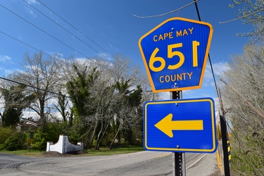
Shield for Cape May County Route 651
-
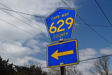
Shield for Cape May County Route 629
-
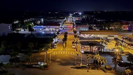
View down Center Street in Folly Beach
-
Garden State Parkway milepost 10 southbound [02]
![Garden State Parkway milepost 10 southbound [02] (1511 visits) Sign assembly for milepost 10 southbound on the Garden State Parkway in Middle Township, New Jersey.... Garden State Parkway milepost 10 southbound [02]](../../../../../../../../i/upload/2025/01/09/20250109192436-7167312f-cu_s9999x250.jpg)
-
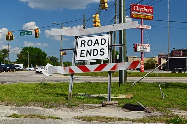
End of Dorsey Avenue
-
Garden State Parkway milepost 10 southbound [01]
![Garden State Parkway milepost 10 southbound [01] (1542 visits) Sign assembly for milepost 10 southbound on the Garden State Parkway in Middle Township, New Jersey.... Garden State Parkway milepost 10 southbound [01]](../../../../../../../../i/upload/2025/01/09/20250109192431-f1398b04-cu_s9999x250.jpg)
-
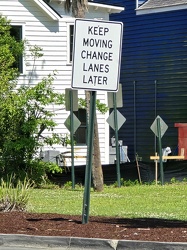
Sign advising motorists to change lanes later
-
No parking sign on Gathright Dam [02]
![No parking sign on Gathright Dam [02] (1816 visits) No parking sign on the road across Gathright Dam, an embankment dam in Alleghany County, Virginia th... No parking sign on Gathright Dam [02]](../../../../../../../../i/upload/2025/01/02/20250102213928-b14b8899-cu_s9999x250.jpg)
-
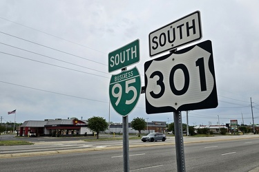
Reassurance markers for Interstate 95 business loop and US 301
-
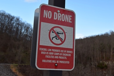
Anti-drone sign at Gathright Dam
-
Springer Road and Forest Springs Drive [05]
![Springer Road and Forest Springs Drive [05] (1953 visits) Street signs for Springer Road and Forest Springs Drive in Stuarts Draft, Virginia, following the re... Springer Road and Forest Springs Drive [05]](../../../../../../../../i/upload/2024/07/17/20240717161703-a98a0f92-cu_s9999x250.jpg)
-
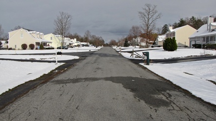
Springer Road
-
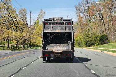
Garbage truck on Muncaster Mill Road
-
Springer Road and Forest Springs Drive [02]
![Springer Road and Forest Springs Drive [02] (2030 visits) Street signs for Springer Road and Forest Springs Drive in Stuarts Draft, Virginia, following the re... Springer Road and Forest Springs Drive [02]](../../../../../../../../i/upload/2024/07/17/20240717161642-b483b881-cu_s9999x250.jpg)
-
Springer Road and Forest Springs Drive [03]
![Springer Road and Forest Springs Drive [03] (2087 visits) Street signs for Springer Road and Forest Springs Drive in Stuarts Draft, Virginia, following the re... Springer Road and Forest Springs Drive [03]](../../../../../../../../i/upload/2024/07/17/20240717161639-d3eaf32c-cu_s9999x250.jpg)
-
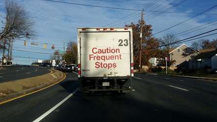
Truck on Randolph Road
-
Forest Springs Drive [01]
![Forest Springs Drive [01] (2127 visits) Forest Springs Drive, a residential street in Stuarts Draft, Virginia, facing north, at its intersec... Forest Springs Drive [01]](../../../../../../../../i/upload/2024/07/17/20240717154858-173a58a4-cu_s9999x250.jpg)
-
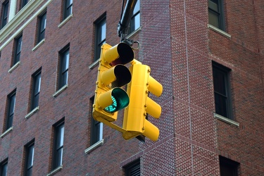
Traffic signal at Willoughby and Bridge Streets
-
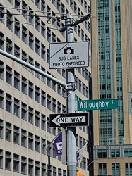
Signage on a mast arm at Willoughby and Jay Streets
-
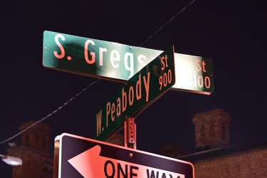
Street signs for South Gregson Street and West Peabody Street
-
"DANGER: OBSTRUCTION" sign [02]
!["DANGER: OBSTRUCTION" sign [02] (2380 visits) One of several signs warning boaters of a nearby obstruction at Piney Point Bar, a sandbar with a ro... "DANGER: OBSTRUCTION" sign [02]](../../../../../../../../i/upload/2024/07/18/20240718221338-f2f1fb30-cu_s9999x250.jpg)
-
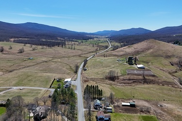
US 220 south of Monterey, Virginia
-
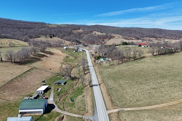
US 250 west of Monterey, Virginia
-
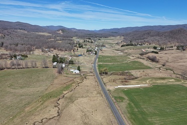
US 220 north of Monterey, Virginia
-
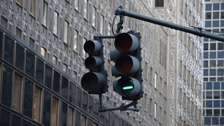
Traffic signal at Lexington Avenue and East 41st Street
-
Traffic signal at Boerum Place and Livingston Street [02]
![Traffic signal at Boerum Place and Livingston Street [02] (2481 visits) Traffic signal at the intersection of Boerum Place and Livingston Street in Downtown Brooklyn.
More... Traffic signal at Boerum Place and Livingston Street [02]](../../../../../../../../i/upload/2024/07/20/20240720150240-1baeb678-cu_s9999x250.jpg)
-
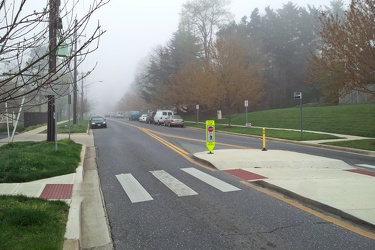
Fog on Hewitt Avenue
-
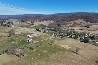
North end of Monterey, Virginia
-
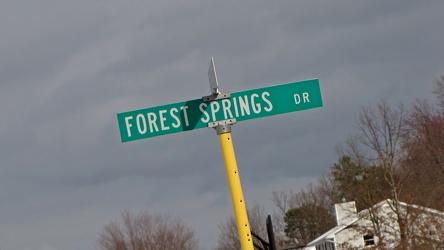
Intersection of Springer Road and Forest Springs Drive
-
Traffic signal at Boerum Place and Livingston Street [01]
![Traffic signal at Boerum Place and Livingston Street [01] (2541 visits) Traffic signal at the intersection of Boerum Place and Livingston Street in Downtown Brooklyn.
More... Traffic signal at Boerum Place and Livingston Street [01]](../../../../../../../../i/upload/2024/07/20/20240720150346-ef720a55-cu_s9999x250.jpg)
-
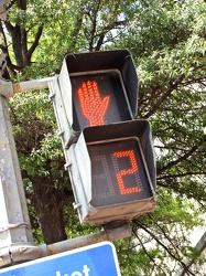
Pedestrian signal at 7th Street and Pennsylvania Avenue SE
-
Traffic signal at Boerum Place and Livingston Street [03]
![Traffic signal at Boerum Place and Livingston Street [03] (2602 visits) Traffic signal at the intersection of Boerum Place and Livingston Street in Downtown Brooklyn.
More... Traffic signal at Boerum Place and Livingston Street [03]](../../../../../../../../i/upload/2024/07/20/20240720150904-e9060717-cu_s9999x250.jpg)
-
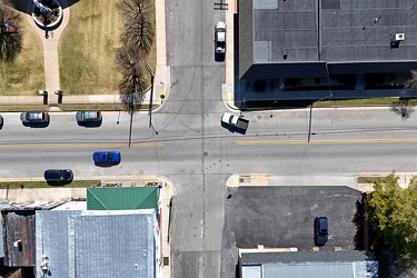
Intersection of US 250 and Spruce Street
-
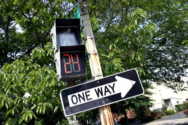
Pedestrian signal at 15th and P Streets NW
-
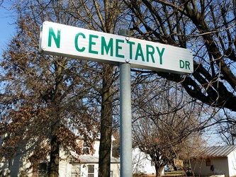
North "Cemetary" Drive
-
Aerial view of Monterey, Virginia [06]
![Aerial view of Monterey, Virginia [06] (2724 visits) Aerial view of Monterey, Virginia, a small town comprising the seat of Highland County.
More at The... Aerial view of Monterey, Virginia [06]](../../../../../../../../i/upload/2025/01/02/20250102005956-29786301-cu_s9999x250.jpg)
-
Aerial view of Monterey, Virginia [03]
![Aerial view of Monterey, Virginia [03] (2749 visits) Aerial view of Monterey, Virginia, a small town comprising the seat of Highland County.
More at The... Aerial view of Monterey, Virginia [03]](../../../../../../../../i/upload/2025/01/02/20250102005929-2e84a9d0-cu_s9999x250.jpg)
-
Routes 220 and 39 in Warm Springs, Virginia [01]
![Routes 220 and 39 in Warm Springs, Virginia [01] (2768 visits) US 220 and VA 39 in Warm Springs, Virginia, facing southwest. In this shot, US 220 runs top to bott... Routes 220 and 39 in Warm Springs, Virginia [01]](../../../../../../../../i/upload/2025/01/02/20250102141310-79aa8afd-cu_s9999x250.jpg)
-
Aerial view of Monterey, Virginia [04]
![Aerial view of Monterey, Virginia [04] (2788 visits) Aerial view of Monterey, Virginia, a small town comprising the seat of Highland County.
More at The... Aerial view of Monterey, Virginia [04]](../../../../../../../../i/upload/2025/01/02/20250102005937-281fae65-cu_s9999x250.jpg)
-
Aerial view of Monterey, Virginia [02]
![Aerial view of Monterey, Virginia [02] (2801 visits) Aerial view of Monterey, Virginia, a small town comprising the seat of Highland County.
More at The... Aerial view of Monterey, Virginia [02]](../../../../../../../../i/upload/2025/01/02/20250102005923-7f7b9b83-cu_s9999x250.jpg)
-
Aerial view of Monterey, Virginia [01]
![Aerial view of Monterey, Virginia [01] (2814 visits) Aerial view of Monterey, Virginia, a small town comprising the seat of Highland County.
More at The... Aerial view of Monterey, Virginia [01]](../../../../../../../../i/upload/2025/01/02/20250102005918-685606f9-cu_s9999x250.jpg)
-
Routes 220 and 39 in Warm Springs, Virginia [02]
![Routes 220 and 39 in Warm Springs, Virginia [02] (2835 visits) US 220 and VA 39 in Warm Springs, Virginia, facing southwest. In this shot, US 220 is the road to t... Routes 220 and 39 in Warm Springs, Virginia [02]](../../../../../../../../i/upload/2025/01/02/20250102141319-a5501ace-cu_s9999x250.jpg)
-
Interchange between VA 262 and Old Greenville Road [01]
![Interchange between VA 262 and Old Greenville Road [01] (2858 visits) Cloverleaf interchange between Virginia State Route 262 and Old Greenville Road (VA 613) near Staunt... Interchange between VA 262 and Old Greenville Road [01]](../../../../../../../../i/upload/2025/01/03/20250103172609-68b43692-cu_s9999x250.jpg)
-
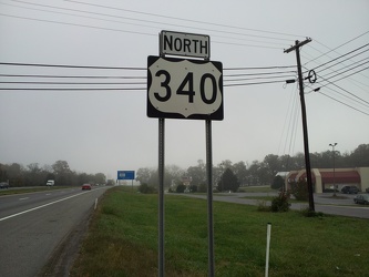
Sign for northbound US 340
-
Aerial view of Monterey, Virginia [05]
![Aerial view of Monterey, Virginia [05] (2870 visits) Aerial view of Monterey, Virginia, a small town comprising the seat of Highland County.
More at The... Aerial view of Monterey, Virginia [05]](../../../../../../../../i/upload/2025/01/02/20250102005946-79efaa38-cu_s9999x250.jpg)
-
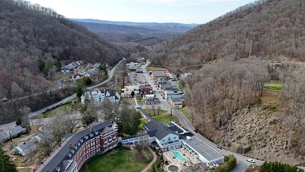
Aerial view of Hot Springs, Virginia
-
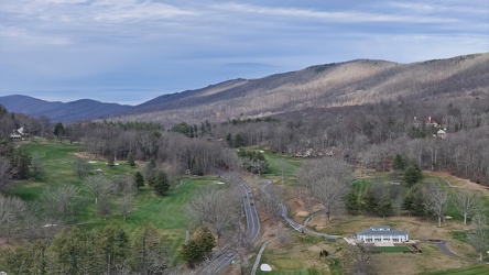
View along US 220 northbound in Hot Springs, Virginia
-
Traffic signal at Fulton and Jay Streets [03]
![Traffic signal at Fulton and Jay Streets [03] (2920 visits) Traffic signal at the intersection of Fulton and Jay Streets in Downtown Brooklyn.
More at The Schu... Traffic signal at Fulton and Jay Streets [03]](../../../../../../../../i/upload/2024/07/20/20240720150355-5c55585e-cu_s9999x250.jpg)
-
Interchange between VA 262 and Old Greenville Road [02]
![Interchange between VA 262 and Old Greenville Road [02] (2957 visits) Cloverleaf interchange between Virginia State Route 262 and Old Greenville Road (VA 613) near Staunt... Interchange between VA 262 and Old Greenville Road [02]](../../../../../../../../i/upload/2025/01/03/20250103172620-c2bd2a46-cu_s9999x250.jpg)
-
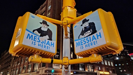
"Messiah is here!"
-
Holiday Inn Charleston-Riverview [05]
![Holiday Inn Charleston-Riverview [05] (2992 visits) The Holiday Inn Charleston-Riverview, a 14-story hotel located between the two sides of US 17 across... Holiday Inn Charleston-Riverview [05]](../../../../../../../../i/upload/2025/01/13/20250113161108-548ee18e-cu_s9999x250.jpg)
-
Holiday Inn Charleston-Riverview [02]
![Holiday Inn Charleston-Riverview [02] (3007 visits) The Holiday Inn Charleston-Riverview, a 14-story hotel located between the two sides of US 17 across... Holiday Inn Charleston-Riverview [02]](../../../../../../../../i/upload/2025/01/13/20250113161036-e6190fc3-cu_s9999x250.jpg)
-
Holiday Inn Charleston-Riverview [08]
![Holiday Inn Charleston-Riverview [08] (3011 visits) The Holiday Inn Charleston-Riverview, a 14-story hotel located between the two sides of US 17 across... Holiday Inn Charleston-Riverview [08]](../../../../../../../../i/upload/2025/01/13/20250113161143-a756fbce-cu_s9999x250.jpg)
-
Interchange between US 17 and SC 703 [02]
![Interchange between US 17 and SC 703 [02] (3026 visits) Interchange between US Route 17 and South Carolina Highway 703 in Mount Pleasant, South Carolina, ju... Interchange between US 17 and SC 703 [02]](../../../../../../../../i/upload/2025/01/14/20250114144626-3f25bd82-cu_s9999x250.jpg)
-
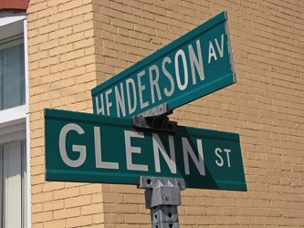
Henderson Avenue and Glenn Street
-
Interchange between US 17 and SC 703 [01]
![Interchange between US 17 and SC 703 [01] (3053 visits) Interchange between US Route 17 and South Carolina Highway 703 in Mount Pleasant, South Carolina, ju... Interchange between US 17 and SC 703 [01]](../../../../../../../../i/upload/2025/01/14/20250114144620-bfc59b91-cu_s9999x250.jpg)
-
Holiday Inn Charleston-Riverview [07]
![Holiday Inn Charleston-Riverview [07] (3055 visits) The Holiday Inn Charleston-Riverview, a 14-story hotel located between the two sides of US 17 across... Holiday Inn Charleston-Riverview [07]](../../../../../../../../i/upload/2025/01/13/20250113161136-79ac2225-cu_s9999x250.jpg)
-
Holiday Inn Charleston-Riverview [03]
![Holiday Inn Charleston-Riverview [03] (3087 visits) The Holiday Inn Charleston-Riverview, a 14-story hotel located between the two sides of US 17 across... Holiday Inn Charleston-Riverview [03]](../../../../../../../../i/upload/2025/01/13/20250113161047-d90cb4c4-cu_s9999x250.jpg)
-
Holiday Inn Charleston-Riverview [06]
![Holiday Inn Charleston-Riverview [06] (3091 visits) The Holiday Inn Charleston-Riverview, a 14-story hotel located between the two sides of US 17 across... Holiday Inn Charleston-Riverview [06]](../../../../../../../../i/upload/2025/01/13/20250113161122-eb862ee6-cu_s9999x250.jpg)
-
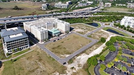
Undeveloped land in Mount Pleasant
-
Wesley Lake Drive and Cookman Avenue [01]
![Wesley Lake Drive and Cookman Avenue [01] (3127 visits) Street signs for Wesley Lake Drive and Cookman Avenue in Asbury Park, New Jersey. Wesley Lake Drive... Wesley Lake Drive and Cookman Avenue [01]](../../../../../../../../i/upload/2024/07/17/20240717165151-967f28c2-cu_s9999x250.jpg)
-
Holiday Inn Charleston-Riverview [04]
![Holiday Inn Charleston-Riverview [04] (3131 visits) The Holiday Inn Charleston-Riverview, a 14-story hotel located between the two sides of US 17 across... Holiday Inn Charleston-Riverview [04]](../../../../../../../../i/upload/2025/01/13/20250113161101-968baa6c-cu_s9999x250.jpg)
-
Robert B. Scarborough Bridge [01]
![Robert B. Scarborough Bridge [01] (3142 visits) The Robert B. Scarborough Bridge, which carries South Carolina Highway 30 (James Island Expressway) ... Robert B. Scarborough Bridge [01]](../../../../../../../../i/upload/2025/01/13/20250113163905-15e6b872-cu_s9999x250.jpg)
-
Ashley River Memorial Bridge [04]
![Ashley River Memorial Bridge [04] (3149 visits) The Ashley River Memorial Bridge, a drawbridge that carries southbound US 17 across the Ashley River... Ashley River Memorial Bridge [04]](../../../../../../../../i/upload/2025/01/13/20250113131121-529aadcc-cu_s9999x250.jpg)
-
Ashley River Memorial Bridge [01]
![Ashley River Memorial Bridge [01] (3156 visits) The Ashley River Memorial Bridge, a drawbridge that carries southbound US 17 across the Ashley River... Ashley River Memorial Bridge [01]](../../../../../../../../i/upload/2025/01/13/20250113131052-6a290a68-cu_s9999x250.jpg)
-
Robert B. Scarborough Bridge [03]
![Robert B. Scarborough Bridge [03] (3211 visits) The Robert B. Scarborough Bridge, which carries South Carolina Highway 30 (James Island Expressway) ... Robert B. Scarborough Bridge [03]](../../../../../../../../i/upload/2025/01/13/20250113163925-e06c07ca-cu_s9999x250.jpg)
-
Ashley River Memorial Bridge [03]
![Ashley River Memorial Bridge [03] (3215 visits) The Ashley River Memorial Bridge, a drawbridge that carries southbound US 17 across the Ashley River... Ashley River Memorial Bridge [03]](../../../../../../../../i/upload/2025/01/13/20250113131114-a540a428-cu_s9999x250.jpg)
-
T. Allen Legare Bridge [02]
![T. Allen Legare Bridge [02] (3215 visits) The T. Allen Legare Bridge, a drawbridge that carries northbound US 17 across the Ashley River in Ch... T. Allen Legare Bridge [02]](../../../../../../../../i/upload/2025/01/13/20250113131136-219b63e5-cu_s9999x250.jpg)
-
Robert B. Scarborough Bridge [02]
![Robert B. Scarborough Bridge [02] (3248 visits) The Robert B. Scarborough Bridge, which carries South Carolina Highway 30 (James Island Expressway) ... Robert B. Scarborough Bridge [02]](../../../../../../../../i/upload/2025/01/13/20250113163918-5b7c57a3-cu_s9999x250.jpg)
-
US 17 bridges over the Ashley River [01]
![US 17 bridges over the Ashley River [01] (3265 visits) The Ashley River Memorial Bridge (left) and the T. Allen Legare Bridge (right), two drawbridges whic... US 17 bridges over the Ashley River [01]](../../../../../../../../i/upload/2025/01/13/20250113131022-ab9773de-cu_s9999x250.jpg)
-
Holiday Inn Charleston-Riverview [01]
![Holiday Inn Charleston-Riverview [01] (3274 visits) The Holiday Inn Charleston-Riverview, a 14-story hotel located between the two sides of US 17 across... Holiday Inn Charleston-Riverview [01]](../../../../../../../../i/upload/2025/01/13/20250113161001-43ff4d1c-cu_s9999x250.jpg)
-
US 17 bridges over the Ashley River [02]
![US 17 bridges over the Ashley River [02] (3280 visits) The T. Allen Legare Bridge (left) and the Ashley River Memorial Bridge (right), two drawbridges whic... US 17 bridges over the Ashley River [02]](../../../../../../../../i/upload/2025/01/13/20250113131029-e37a9c74-cu_s9999x250.jpg)
-
12'4" low clearance warning sign [01]
![12'4" low clearance warning sign [01] (3339 visits) Low clearance sign warning drivers of the bridge's low height of only 12'4". Until 2019, this ... 12'4" low clearance warning sign [01]](../../../../../../../../i/upload/2025/01/16/20250116015525-4456e6dc-cu_s9999x250.jpg)
-
US 17 bridges over the Ashley River [03]
![US 17 bridges over the Ashley River [03] (3356 visits) The T. Allen Legare Bridge (left) and the Ashley River Memorial Bridge (right), two drawbridges whic... US 17 bridges over the Ashley River [03]](../../../../../../../../i/upload/2025/01/13/20250113131039-9361e07f-cu_s9999x250.jpg)
-
Ashley River Memorial Bridge [02]
![Ashley River Memorial Bridge [02] (3368 visits) The Ashley River Memorial Bridge, a drawbridge that carries southbound US 17 across the Ashley River... Ashley River Memorial Bridge [02]](../../../../../../../../i/upload/2025/01/13/20250113131103-3bac4b09-cu_s9999x250.jpg)
-
Honda Prelude destroyed by falling tree [02]
![Honda Prelude destroyed by falling tree [02] (3371 visits) A Honda Prelude is destroyed on the 1400 block of 17th Street NW after a tree fell on its roof, crus... Honda Prelude destroyed by falling tree [02]](../../../../../../../../i/upload/2024/07/17/20240717103449-480dc4d8-cu_s9999x250.jpg)
-
Interchange between SC 30 and Lockwood Drive [01]
![Interchange between SC 30 and Lockwood Drive [01] (3379 visits) Interchange between South Carolina Highway 30 (James Island Expressway) and Lockwood Drive in downto... Interchange between SC 30 and Lockwood Drive [01]](../../../../../../../../i/upload/2025/01/13/20250113164013-5d467e2e-cu_s9999x250.jpg)
-
Arthur Ravenel Jr. Bridge [06]
![Arthur Ravenel Jr. Bridge [06] (3387 visits) The Arthur Ravenel Jr. Bridge, a cable-stayed bridge that carries traffic on US 17 across the Cooper... Arthur Ravenel Jr. Bridge [06]](../../../../../../../../i/upload/2025/01/13/20250113223932-ded7a7d6-cu_s9999x250.jpg)
-
Interchange between SC 30 and Lockwood Drive [02]
![Interchange between SC 30 and Lockwood Drive [02] (3394 visits) Interchange between South Carolina Highway 30 (James Island Expressway) and Lockwood Drive in downto... Interchange between SC 30 and Lockwood Drive [02]](../../../../../../../../i/upload/2025/01/13/20250113164020-33f31887-cu_s9999x250.jpg)
-
Arthur Ravenel Jr. Bridge [14]
![Arthur Ravenel Jr. Bridge [14] (3396 visits) The Arthur Ravenel Jr. Bridge, a cable-stayed bridge that carries traffic on US 17 across the Cooper... Arthur Ravenel Jr. Bridge [14]](../../../../../../../../i/upload/2025/01/13/20250113224020-826a9db9-cu_s9999x250.jpg)