-
Sudley Road just south of I-66

-
Traffic circle at intersection of Drs. Bruce and Lee Foundation Blvd and Dr. Johnny Bruce Road

-
Former CARTA bus 3426 on Interstate 26

-
Intersections of King Street with Tobacco and Vanderhorst Streets

-
Eastern terminus of Interstate 26 [03]
![Eastern terminus of Interstate 26 [03] (878 visits) The eastern terminus of Interstate 26 in Charleston, South Carolina. I-26 ends at a signalized inte... Eastern terminus of Interstate 26 [03]](../../../../../i/upload/2025/05/23/20250523172453-291afe72-cu_s9999x250.jpg)
-
Eastern terminus of Interstate 26 [02]
![Eastern terminus of Interstate 26 [02] (506 visits) The eastern terminus of Interstate 26 in Charleston, South Carolina. I-26 ends at a signalized inte... Eastern terminus of Interstate 26 [02]](../../../../../i/upload/2025/05/23/20250523172431-321f5bc1-cu_s9999x250.jpg)
-
Eastern terminus of Interstate 26 [01]
![Eastern terminus of Interstate 26 [01] (1022 visits) The eastern terminus of Interstate 26 in Charleston, South Carolina. I-26 ends at a signalized inte... Eastern terminus of Interstate 26 [01]](../../../../../i/upload/2025/05/23/20250523172345-9b22a449-cu_s9999x250.jpg)
-
View down King Street in downtown Charleston

-
King Street between Reid and Woolfe Streets

-
Traffic signals at King and Cannon Streets [02]
![Traffic signals at King and Cannon Streets [02] (468 visits) Traffic signals at the intersection of King and Cannon Streets in downtown Charleston, South Carolin... Traffic signals at King and Cannon Streets [02]](../../../../../i/upload/2025/05/23/20250523224859-225bcebc-cu_s9999x250.jpg)
-
Traffic signals at King and Cannon Streets [01]
![Traffic signals at King and Cannon Streets [01] (318 visits) Traffic signals at the intersection of King and Cannon Streets in downtown Charleston, South Carolin... Traffic signals at King and Cannon Streets [01]](../../../../../i/upload/2025/05/23/20250523134012-59105e2a-cu_s9999x250.jpg)
-
Signage at the corner of Spring and King Streets

-
Folly Road bridge over a waterway [05]
![Folly Road bridge over a waterway [05] (543 visits) Bridge carrying South Carolina Highway 171 (Folly Road) across a waterway between Charleston and Fol... Folly Road bridge over a waterway [05]](../../../../../i/upload/2025/05/23/20250523015734-a60eb9cc-cu_s9999x250.jpg)
-
Folly Road bridge over a waterway [04]
![Folly Road bridge over a waterway [04] (402 visits) Bridge carrying South Carolina Highway 171 (Folly Road) across a waterway between Charleston and Fol... Folly Road bridge over a waterway [04]](../../../../../i/upload/2025/05/23/20250523015708-37d71c5a-cu_s9999x250.jpg)
-
Folly Road bridge over a waterway [03]
![Folly Road bridge over a waterway [03] (571 visits) Bridge carrying South Carolina Highway 171 (Folly Road) across a waterway between Charleston and Fol... Folly Road bridge over a waterway [03]](../../../../../i/upload/2025/05/23/20250523015655-f9e58897-cu_s9999x250.jpg)
-
Folly Road bridge over a waterway [02]
![Folly Road bridge over a waterway [02] (694 visits) Bridge carrying South Carolina Highway 171 (Folly Road) across a waterway between Charleston and Fol... Folly Road bridge over a waterway [02]](../../../../../i/upload/2025/05/23/20250523015618-d369d849-cu_s9999x250.jpg)
-
Folly Road bridge over a waterway [01]
![Folly Road bridge over a waterway [01] (553 visits) Bridge carrying South Carolina Highway 171 (Folly Road) across a waterway between Charleston and Fol... Folly Road bridge over a waterway [01]](../../../../../i/upload/2025/05/23/20250523015608-7dd97814-cu_s9999x250.jpg)
-
Pedestrian call button at Center Street and Ashley Avenue

-
Traffic signal at Center Street and Ashley Avenue [03]
![Traffic signal at Center Street and Ashley Avenue [03] (300 visits) Traffic signal mounted above the intersection of Center Street and Ashley Avenue in Folly Beach, Sou... Traffic signal at Center Street and Ashley Avenue [03]](../../../../../i/upload/2025/05/23/20250523011935-5f3c6de5-cu_s9999x250.jpg)
-
Traffic signal at Center Street and Ashley Avenue [02]
![Traffic signal at Center Street and Ashley Avenue [02] (260 visits) Traffic signal mounted above the intersection of Center Street and Ashley Avenue in Folly Beach, Sou... Traffic signal at Center Street and Ashley Avenue [02]](../../../../../i/upload/2025/05/23/20250523011915-ec459398-cu_s9999x250.jpg)
-
Traffic signal at Center Street and Ashley Avenue [01]
![Traffic signal at Center Street and Ashley Avenue [01] (239 visits) Traffic signal mounted above the intersection of Center Street and Ashley Avenue in Folly Beach, Sou... Traffic signal at Center Street and Ashley Avenue [01]](../../../../../i/upload/2025/05/23/20250523011856-4e7c16b7-cu_s9999x250.jpg)
-
Aerial view of Folly Beach, South Carolina [03]
![Aerial view of Folly Beach, South Carolina [03] (428 visits) Aerial view of Folly Beach, South Carolina, roughly centered on Center Street, facing approximately ... Aerial view of Folly Beach, South Carolina [03]](../../../../../i/upload/2025/05/14/20250514110312-219b9712-cu_s9999x250.jpg)
-
Intersection of Center Street and Hudson Avenue

-
Aerial view of Folly Beach, South Carolina [04]
![Aerial view of Folly Beach, South Carolina [04] (491 visits) Aerial view of Folly Beach, South Carolina, roughly centered on Center Street, facing approximately ... Aerial view of Folly Beach, South Carolina [04]](../../../../../i/upload/2025/05/14/20250514110319-69d4f7ad-cu_s9999x250.jpg)
-
Aerial view of Folly Beach, South Carolina [02]
![Aerial view of Folly Beach, South Carolina [02] (299 visits) Aerial view of Folly Beach, South Carolina, roughly centered on Center Street, facing approximately ... Aerial view of Folly Beach, South Carolina [02]](../../../../../i/upload/2025/05/14/20250514110306-1f7c3170-cu_s9999x250.jpg)
-
Aerial view of Folly Beach, South Carolina [01]
![Aerial view of Folly Beach, South Carolina [01] (336 visits) Aerial view of Folly Beach, South Carolina, roughly centered on Center Street, facing approximately ... Aerial view of Folly Beach, South Carolina [01]](../../../../../i/upload/2025/05/14/20250514110300-74440381-cu_s9999x250.jpg)
-
Elm Avenue interchange [01]
![Elm Avenue interchange [01] (4270 visits) Interchange between Interstate 581/US 220 and Elm Avenue (SR 24) in Roanoke, Virginia, viewed from M... Elm Avenue interchange [01]](../../../../../i/upload/2024/07/20/20240720122015-70544823-cu_s9999x250.jpg)
-
Neighborhood watch sign on Montrose Avenue SE

-
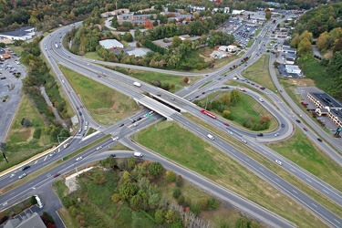
Franklin Road interchange
-
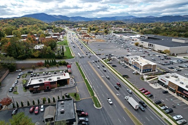
Electric Road
-
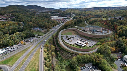
View south on Franklin Road
-
Elm Avenue interchange [02]
![Elm Avenue interchange [02] (4172 visits) Interchange between Interstate 581/US 220 and Elm Avenue (SR 24) in Roanoke, Virginia. The I-581 de... Elm Avenue interchange [02]](../../../../../i/upload/2024/07/20/20240720121652-6267da79-cu_s9999x250.jpg)
-
Bristol sign [03]
![Bristol sign [03] (10275 visits) Sign over State Street in Bristol, which straddles the border between Virginia and Tennessee.
More ... Bristol sign [03]](../../../../../i/upload/2024/07/20/20240720121545-f24f5478-cu_s9999x250.jpg)
-
Bristol sign [02]
![Bristol sign [02] (10113 visits) Sign over State Street in Bristol, which straddles the border between Virginia and Tennessee.
More ... Bristol sign [02]](../../../../../i/upload/2024/07/20/20240720121538-801acaf1-cu_s9999x250.jpg)
-
Bristol sign [01]
![Bristol sign [01] (10047 visits) Sign over State Street in Bristol, which straddles the border between Virginia and Tennessee.
More ... Bristol sign [01]](../../../../../i/upload/2024/07/20/20240720121533-067b0659-cu_s9999x250.jpg)
-
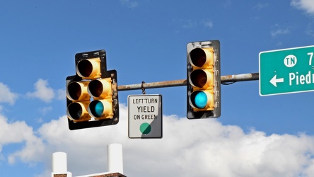
Traffic signals on State Street
-
Stop sign embedded in concrete

-
Sevierville interchange on I-40 [10]
![Sevierville interchange on I-40 [10] (3548 visits) Exit 407 on Interstate 40 in Sevierville, Tennessee, which serves State Route 66 via a diverging dia... Sevierville interchange on I-40 [10]](../../../../../i/upload/2024/07/20/20240720120752-d23a6ab4-cu_s9999x250.jpg)
-
Sevierville interchange on I-40 [09]
![Sevierville interchange on I-40 [09] (3499 visits) Exit 407 on Interstate 40 in Sevierville, Tennessee, which serves State Route 66 via a diverging dia... Sevierville interchange on I-40 [09]](../../../../../i/upload/2024/07/20/20240720120738-ef566a00-cu_s9999x250.jpg)
-
Sevierville interchange on I-40 [08]
![Sevierville interchange on I-40 [08] (3639 visits) Exit 407 on Interstate 40 in Sevierville, Tennessee, which serves State Route 66 via a diverging dia... Sevierville interchange on I-40 [08]](../../../../../i/upload/2024/07/20/20240720120724-702a7a27-cu_s9999x250.jpg)
-
Sevierville interchange on I-40 [07]
![Sevierville interchange on I-40 [07] (3436 visits) Exit 407 on Interstate 40 in Sevierville, Tennessee, which serves State Route 66 via a diverging dia... Sevierville interchange on I-40 [07]](../../../../../i/upload/2024/07/20/20240720120710-59444977-cu_s9999x250.jpg)
-
Sevierville interchange on I-40 [06]
![Sevierville interchange on I-40 [06] (3470 visits) Exit 407 on Interstate 40 in Sevierville, Tennessee, which serves State Route 66 via a diverging dia... Sevierville interchange on I-40 [06]](../../../../../i/upload/2024/07/20/20240720120655-3bce0910-cu_s9999x250.jpg)
-
Sevierville interchange on I-40 [05]
![Sevierville interchange on I-40 [05] (3425 visits) Exit 407 on Interstate 40 in Sevierville, Tennessee, which serves State Route 66 via a diverging dia... Sevierville interchange on I-40 [05]](../../../../../i/upload/2024/07/20/20240720120640-6a74e50b-cu_s9999x250.jpg)
-
Sevierville interchange on I-40 [04]
![Sevierville interchange on I-40 [04] (3370 visits) Exit 407 on Interstate 40 in Sevierville, Tennessee, which serves State Route 66 via a diverging dia... Sevierville interchange on I-40 [04]](../../../../../i/upload/2024/07/20/20240720120625-f4320cb9-cu_s9999x250.jpg)
-
Sign for US Route 11E northbound [03]
![Sign for US Route 11E northbound [03] (2410 visits) Reassurance marker for northbound US 11E in Hawkins County, Tennessee. US Route 11 is split into tw... Sign for US Route 11E northbound [03]](../../../../../i/upload/2024/07/20/20240720120558-0519ccde-cu_s9999x250.jpg)
-
Sevierville interchange on I-40 [03]
![Sevierville interchange on I-40 [03] (3685 visits) Exit 407 on Interstate 40 in Sevierville, Tennessee, which serves State Route 66 via a diverging dia... Sevierville interchange on I-40 [03]](../../../../../i/upload/2024/07/20/20240720120542-b2b4f0ef-cu_s9999x250.jpg)
-
Sign for US Route 11E northbound [02]
![Sign for US Route 11E northbound [02] (2314 visits) Reassurance marker for northbound US 11E in Hawkins County, Tennessee. US Route 11 is split into tw... Sign for US Route 11E northbound [02]](../../../../../i/upload/2024/07/20/20240720120527-a89e4f34-cu_s9999x250.jpg)
-
Sevierville interchange on I-40 [02]
![Sevierville interchange on I-40 [02] (3585 visits) Exit 407 on Interstate 40 in Sevierville, Tennessee, which serves State Route 66 via a diverging dia... Sevierville interchange on I-40 [02]](../../../../../i/upload/2024/07/20/20240720120537-6016faa3-cu_s9999x250.jpg)
-
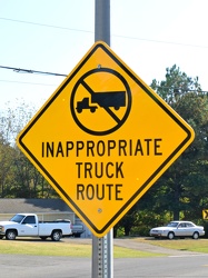
"Inappropriate truck route"
-
Sign for US Route 11E northbound [01]
![Sign for US Route 11E northbound [01] (2354 visits) Reassurance marker for northbound US 11E in Hawkins County, Tennessee. US Route 11 is split into tw... Sign for US Route 11E northbound [01]](../../../../../i/upload/2024/07/20/20240720120411-d39e2633-cu_s9999x250.jpg)
-
Sevierville interchange on I-40 [01]
![Sevierville interchange on I-40 [01] (3484 visits) Exit 407 on Interstate 40 in Sevierville, Tennessee, which serves State Route 66 via a diverging dia... Sevierville interchange on I-40 [01]](../../../../../i/upload/2024/07/20/20240720120331-6d702981-cu_s9999x250.jpg)
-
West Dumplin Valley Road [03]
![West Dumplin Valley Road [03] (4140 visits) Businesses along West Dumplin Valley Road, which runs just south of Interstate 40, in Sevierville, T... West Dumplin Valley Road [03]](../../../../../i/upload/2024/07/20/20240720120238-68c626bc-cu_s9999x250.jpg)
-
West Dumplin Valley Road [02]
![West Dumplin Valley Road [02] (3851 visits) Businesses along West Dumplin Valley Road, which runs just south of Interstate 40, in Sevierville, T... West Dumplin Valley Road [02]](../../../../../i/upload/2024/07/20/20240720120306-846e6bb2-cu_s9999x250.jpg)
-
West Dumplin Valley Road [01]
![West Dumplin Valley Road [01] (3851 visits) Businesses along West Dumplin Valley Road, which runs just south of Interstate 40, in Sevierville, T... West Dumplin Valley Road [01]](../../../../../i/upload/2024/07/20/20240720120315-42535554-cu_s9999x250.jpg)
-
Douglas Lake [01]
![Douglas Lake [01] (6788 visits) Douglas Lake, a manmade reservoir in east Tennessee, which is operated by the Tennessee Valley Autho... Douglas Lake [01]](../../../../../i/upload/2024/07/20/20240720120446-06709267-cu_s9999x250.jpg)
-
Douglas Lake [03]
![Douglas Lake [03] (7223 visits) Douglas Lake, a manmade reservoir in east Tennessee, which is operated by the Tennessee Valley Autho... Douglas Lake [03]](../../../../../i/upload/2024/07/20/20240720120440-4ae673b8-cu_s9999x250.jpg)
-
Douglas Lake [02]
![Douglas Lake [02] (6863 visits) Douglas Lake, a manmade reservoir in east Tennessee, which is operated by the Tennessee Valley Autho... Douglas Lake [02]](../../../../../i/upload/2024/07/20/20240720120452-7c1a4915-cu_s9999x250.jpg)
-
Douglas Lake [05]
![Douglas Lake [05] (7110 visits) Douglas Lake, a manmade reservoir in east Tennessee, which is operated by the Tennessee Valley Autho... Douglas Lake [05]](../../../../../i/upload/2024/07/20/20240720120359-cbebbc4a-cu_s9999x250.jpg)
-
Douglas Lake [06]
![Douglas Lake [06] (7323 visits) Douglas Lake, a manmade reservoir in east Tennessee, which is operated by the Tennessee Valley Autho... Douglas Lake [06]](../../../../../i/upload/2024/07/20/20240720120405-67e59e34-cu_s9999x250.jpg)
-
Douglas Lake [08]
![Douglas Lake [08] (7256 visits) Douglas Lake, a manmade reservoir in east Tennessee, which is operated by the Tennessee Valley Autho... Douglas Lake [08]](../../../../../i/upload/2024/07/20/20240720120417-8d600905-cu_s9999x250.jpg)
-
Douglas Lake [07]
![Douglas Lake [07] (7143 visits) Douglas Lake, a manmade reservoir in east Tennessee, which is operated by the Tennessee Valley Autho... Douglas Lake [07]](../../../../../i/upload/2024/07/20/20240720120434-49f9d1b9-cu_s9999x250.jpg)
-
Aerial view of downtown Knoxville [02]
![Aerial view of downtown Knoxville [02] (4027 visits) Aerial view of downtown Knoxville, Tennessee, facing the interchange between Interstate 40, Intersta... Aerial view of downtown Knoxville [02]](../../../../../i/upload/2024/07/20/20240720114531-474df7df-cu_s9999x250.jpg)
-
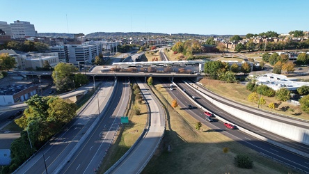
Neyland Drive and James White Parkway
-
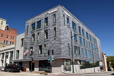
620 South Gay Street
-
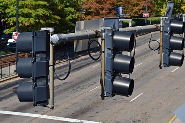
Traffic signals at Clinch Avenue and Henley Street
-
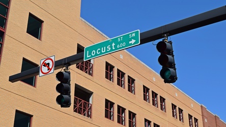
Traffic signal at Locust Street and Clinch Avenue
-
Intersection of Western Avenue, West Summit Hill Drive, Henley Street, and Broadway [03]
![Intersection of Western Avenue, West Summit Hill Drive, Henley Street, and Broadway [03] (1845 visits) The intersection of Western Avenue, West Summit Hill Drive, Henley Street, and Broadway, viewed from... Intersection of Western Avenue, West Summit Hill Drive, Henley Street, and Broadway [03]](../../../../../i/upload/2024/07/20/20240720114058-5a0ed76f-cu_s9999x250.jpg)
-
Buc-ee's in Crossville, Tennessee [37]
![Buc-ee's in Crossville, Tennessee [37] (10855 visits) Buc-ee's store in Crossville, Tennessee. Buc-ee's is a Texas-based chain of travel centers that was... Buc-ee's in Crossville, Tennessee [37]](../../../../../i/upload/2024/07/20/20240720113805-81a2af50-cu_s9999x250.jpg)
-
Aerial view of downtown Crossville, Tennessee [03]
![Aerial view of downtown Crossville, Tennessee [03] (3273 visits) Aerial view of downtown Crossville, Tennessee.
More at The Schumin Web:
www.schuminweb.com/life-and... Aerial view of downtown Crossville, Tennessee [03]](../../../../../i/upload/2024/07/20/20240720113748-d1062940-cu_s9999x250.jpg)
-
Aerial view of downtown Crossville, Tennessee [01]
![Aerial view of downtown Crossville, Tennessee [01] (3954 visits) Aerial view of downtown Crossville, Tennessee.
More at The Schumin Web:
www.schuminweb.com/life-and... Aerial view of downtown Crossville, Tennessee [01]](../../../../../i/upload/2024/07/20/20240720113721-1bd631e7-cu_s9999x250.jpg)
-
Height warning sign on US 321

-
Elyse photographs an I-40 shield [02]
![Elyse photographs an I-40 shield [02] (11603 visits) Elyse Horvath takes a selfie with an Interstate 40 shield on Strawberry Plains Pike in Knoxville, Te... Elyse photographs an I-40 shield [02]](../../../../../i/upload/2024/07/20/20240720113657-c61efdb7-cu_s9999x250.jpg)
-
Signage for I-40 on US 321 [04]
![Signage for I-40 on US 321 [04] (2359 visits) Signage for westbound Interstate 40 on US 321 in Lenoir City, Tennessee.
Alternate treatment of s... Signage for I-40 on US 321 [04]](../../../../../i/upload/2024/07/20/20240720113639-59f19d46-cu_s9999x250.jpg)
-
Interstate 40 signage on Strawberry Plains Pike [06]
![Interstate 40 signage on Strawberry Plains Pike [06] (2447 visits) Signage for Interstate 40 on Strawberry Plains Pike in Knoxville, Tennessee.
More at The Schumin We... Interstate 40 signage on Strawberry Plains Pike [06]](../../../../../i/upload/2024/07/20/20240720113634-417d2fb0-cu_s9999x250.jpg)
-
Signage for I-40 on US 321 [03]
![Signage for I-40 on US 321 [03] (2360 visits) Signage for westbound Interstate 40 on US 321 in Lenoir City, Tennessee.
Alternate treatment of s... Signage for I-40 on US 321 [03]](../../../../../i/upload/2024/07/20/20240720113623-c53233ee-cu_s9999x250.jpg)
-
Interstate 40 signage on Strawberry Plains Pike [03]
![Interstate 40 signage on Strawberry Plains Pike [03] (2338 visits) Signage for Interstate 40 on Strawberry Plains Pike in Knoxville, Tennessee.
More at The Schumin We... Interstate 40 signage on Strawberry Plains Pike [03]](../../../../../i/upload/2024/07/20/20240720113612-f39ffa17-cu_s9999x250.jpg)
-
Signage for I-40 on US 321 [02]
![Signage for I-40 on US 321 [02] (2296 visits) Signage for westbound Interstate 40 on US 321 in Lenoir City, Tennessee.
More at The Schumin Web:
w... Signage for I-40 on US 321 [02]](../../../../../i/upload/2024/07/20/20240720113601-2fc22be3-cu_s9999x250.jpg)
-
Interstate 40 signage on Strawberry Plains Pike [02]
![Interstate 40 signage on Strawberry Plains Pike [02] (2464 visits) Signage for Interstate 40 on Strawberry Plains Pike in Knoxville, Tennessee.
More at The Schumin We... Interstate 40 signage on Strawberry Plains Pike [02]](../../../../../i/upload/2024/07/20/20240720113550-7381a8d9-cu_s9999x250.jpg)
-
Signage for I-40 on US 321 [01]
![Signage for I-40 on US 321 [01] (2527 visits) Signage for Interstate 40 on US 321 in Lenoir City, Tennessee.
More at The Schumin Web:
www.schumin... Signage for I-40 on US 321 [01]](../../../../../i/upload/2024/07/20/20240720113534-f6b63e08-cu_s9999x250.jpg)
-
Signage for Interstate 40 on Genesis Road [05]
![Signage for Interstate 40 on Genesis Road [05] (2238 visits) Signage for Interstate 40 on Genesis Road (SR 298) in Crossville, Tennessee, on the northbound appro... Signage for Interstate 40 on Genesis Road [05]](../../../../../i/upload/2024/07/20/20240720113518-ecc295f7-cu_s9999x250.jpg)