-
Downtown Waynesboro, Virginia [01]
![Downtown Waynesboro, Virginia [01] (5118 visits) Downtown Waynesboro, Virginia, looking east down West Main Street, viewed from near Augusta Cleaners... Downtown Waynesboro, Virginia [01]](../../../../../i/upload/2024/07/14/20240714171043-04dcc319-cu_s9999x250.jpg)
-
Interstate 68 cut through Sideling Hill [01]
![Interstate 68 cut through Sideling Hill [01] (4335 visits) Cut in Sideling Hill, carrying Interstate 68 between Washington and Allegany Counties in Maryland.
... Interstate 68 cut through Sideling Hill [01]](../../../../../i/upload/2024/07/18/20240718220120-0789991f-cu_s9999x250.jpg)
-
Interstate 68 cut through Sideling Hill [02]
![Interstate 68 cut through Sideling Hill [02] (4176 visits) Cut in Sideling Hill, carrying Interstate 68 between Washington and Allegany Counties in Maryland.
... Interstate 68 cut through Sideling Hill [02]](../../../../../i/upload/2024/07/18/20240718220116-e8da0915-cu_s9999x250.jpg)
-
Interstate 68 cut through Sideling Hill [03]
![Interstate 68 cut through Sideling Hill [03] (2360 visits) Cut in Sideling Hill, carrying Interstate 68 between Washington and Allegany Counties in Maryland.
... Interstate 68 cut through Sideling Hill [03]](../../../../../i/upload/2024/07/18/20240718220111-2f9132e9-cu_s9999x250.jpg)
-
Interstate 68 cut through Sideling Hill [04]
![Interstate 68 cut through Sideling Hill [04] (2560 visits) Cut in Sideling Hill, carrying Interstate 68 between Washington and Allegany Counties in Maryland.
... Interstate 68 cut through Sideling Hill [04]](../../../../../i/upload/2024/07/18/20240718220107-eeb97b29-cu_s9999x250.jpg)
-
Rainstorm near Sideling Hill cut
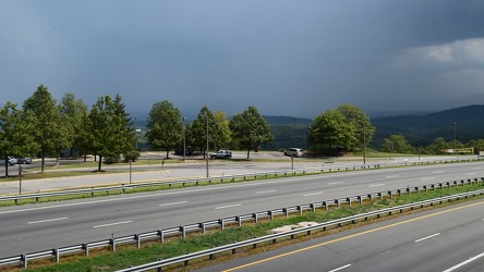
-
View from Sideling Hill Welcome Center
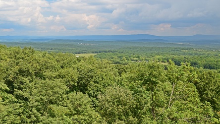
-
Footbridge over Interstate 68 at Sideling Hill
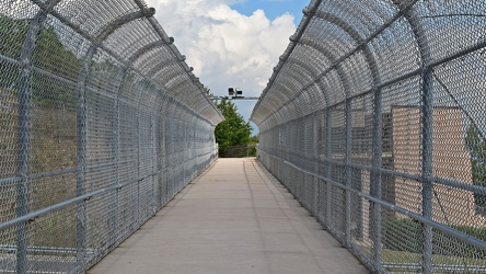
-
Picnic table at Sideling Hill Welcome Center
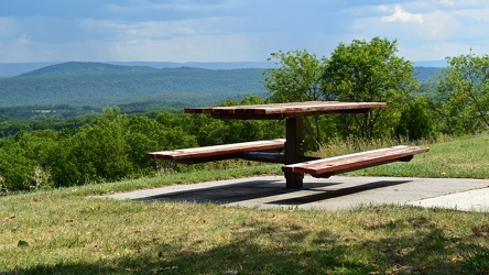
-
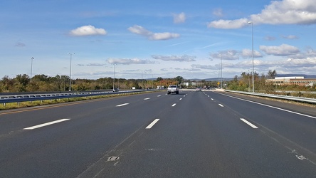
Interstate 66 westbound, near Gainesville
-
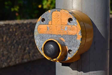
Pedestrian signal call button
-
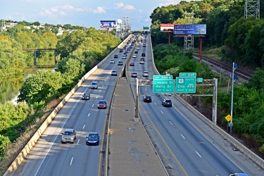
Schuylkill Expressway
-
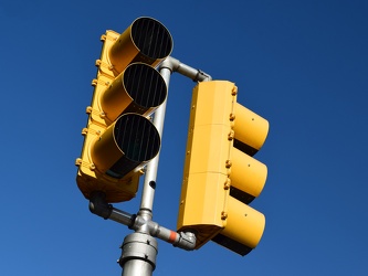
Traffic light in Bala Cynwyd
-
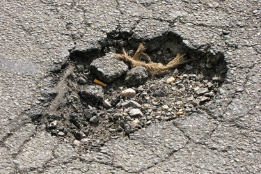
Pothole on 20th Street NW
-
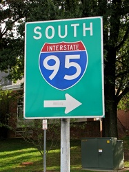
Interstate 95 sign at Maryland House
-
Baltimore-area traffic on Interstate 95 southbound [01]
![Baltimore-area traffic on Interstate 95 southbound [01] (4406 visits) Rush hour traffic on Interstate 95 southbound in Baltimore, Maryland.
Ben Schumin is a professional... Baltimore-area traffic on Interstate 95 southbound [01]](../../../../../i/upload/2024/07/16/20240716002655-05b94d1e-cu_s9999x250.jpg)
-
Baltimore-area traffic on Interstate 95 southbound [02]
![Baltimore-area traffic on Interstate 95 southbound [02] (4194 visits) Rush hour traffic on Interstate 95 southbound in Baltimore, Maryland.
Ben Schumin is a professional... Baltimore-area traffic on Interstate 95 southbound [02]](../../../../../i/upload/2024/07/16/20240716002700-59eb8782-cu_s9999x250.jpg)
-
Baltimore-area traffic on Interstate 95 southbound [03]
![Baltimore-area traffic on Interstate 95 southbound [03] (7851 visits) Rush hour traffic on Interstate 95 southbound in Baltimore, Maryland.
Ben Schumin is a professional... Baltimore-area traffic on Interstate 95 southbound [03]](../../../../../i/upload/2024/07/16/20240716002653-32a0e8e5-cu_s9999x250.jpg)
-
Boston Megaraid [07]
![Boston Megaraid [07] (8287 visits) "Social Reject Quarantine Zone" sign attached to a signpost during the Boston Megaraid, a ... Boston Megaraid [07]](../../../../../i/upload/2024/07/16/20240716010959-899fba8b-cu_s9999x250.jpg)
-
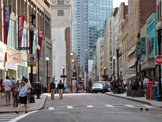
Intersection of Washington and Milk Streets
-
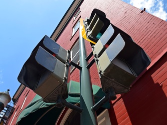
Traffic and pedestrian signals at East Johnson Street and South New Street
-
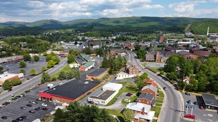
West Main and West Broad Streets in downtown Waynesboro
-
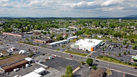
West Broad Street in Waynesboro, Virginia
-
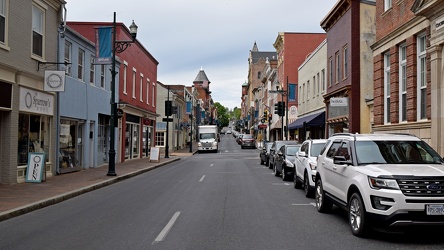
View down East Beverley Street
-
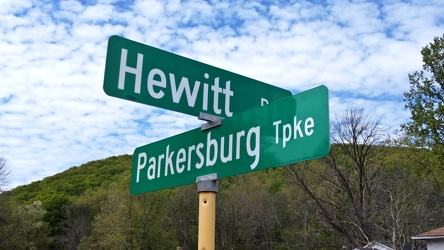
Hewitt Road and Parkersburg Turnpike
-
West Main Street in Waynesboro, Virginia [01]
![West Main Street in Waynesboro, Virginia [01] (56687 visits) View down West Main Street (US 250) in the west end of Waynesboro, Virginia, near the former Kmart b... West Main Street in Waynesboro, Virginia [01]](../../../../../i/upload/2024/07/19/20240719164545-b5a50599-cu_s9999x250.jpg)
-
West Main Street in Waynesboro, Virginia [02]
![West Main Street in Waynesboro, Virginia [02] (10906 visits) View down West Main Street (US 250) in the west end of Waynesboro, Virginia, near the Sheetz conveni... West Main Street in Waynesboro, Virginia [02]](../../../../../i/upload/2024/07/19/20240719164551-0b8407a8-cu_s9999x250.jpg)
-
West Main Street in Waynesboro, Virginia [03]
![West Main Street in Waynesboro, Virginia [03] (11854 visits) View down West Main Street (US 250) in the west end of Waynesboro, Virginia, near St. Mark's United ... West Main Street in Waynesboro, Virginia [03]](../../../../../i/upload/2024/07/19/20240719164555-f7feeafe-cu_s9999x250.jpg)
-
West Main Street in Waynesboro, Virginia [04]
![West Main Street in Waynesboro, Virginia [04] (324998 visits) View down West Main Street (US 250) in the west end of Waynesboro, Virginia, near the Westwood Villa... West Main Street in Waynesboro, Virginia [04]](../../../../../i/upload/2024/07/19/20240719164600-4379cef1-cu_s9999x250.jpg)
-
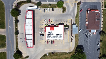
Sheetz in Waynesboro, Virginia
-
Faded stop sign [01]
![Faded stop sign [01] (2241 visits) A very faded stop sign at the end of an access road for several businesses at the intersection with ... Faded stop sign [01]](../../../../../i/upload/2024/07/19/20240719164633-3746ed7c-cu_s9999x250.jpg)
-
Faded stop sign [02]
![Faded stop sign [02] (2245 visits) A very faded stop sign at the end of an access road for several businesses at the intersection with ... Faded stop sign [02]](../../../../../i/upload/2024/07/19/20240719164638-c40f7dea-cu_s9999x250.jpg)
-
US Route 1 and CSX bridges over the Occoquan River [01]
![US Route 1 and CSX bridges over the Occoquan River [01] (14388 visits) US Route 1 and CSX bridges over the Occoquan River, between Lorton and Woodbridge, Virginia.
More a... US Route 1 and CSX bridges over the Occoquan River [01]](../../../../../i/upload/2024/07/19/20240719165202-fbc052c5-cu_s9999x250.jpg)
-
US Route 1 and CSX bridges over the Occoquan River [02]
![US Route 1 and CSX bridges over the Occoquan River [02] (14538 visits) US Route 1 and CSX bridges over the Occoquan River, between Lorton and Woodbridge, Virginia.
More a... US Route 1 and CSX bridges over the Occoquan River [02]](../../../../../i/upload/2024/07/19/20240719165109-05002e7d-cu_s9999x250.jpg)
-
US Route 1 and CSX bridges over the Occoquan River [03]
![US Route 1 and CSX bridges over the Occoquan River [03] (14681 visits) US Route 1 and CSX bridges over the Occoquan River, between Lorton and Woodbridge, Virginia.
More a... US Route 1 and CSX bridges over the Occoquan River [03]](../../../../../i/upload/2024/07/19/20240719165233-1c08fb03-cu_s9999x250.jpg)
-
US 29 Business in Culpeper, Virginia [02]
![US 29 Business in Culpeper, Virginia [02] (459140 visits) Aerial view of US 29 Business on the north side of Culpeper, Virginia. View facing approximately we... US 29 Business in Culpeper, Virginia [02]](../../../../../i/upload/2024/07/19/20240719165937-abc06307-cu_s9999x250.jpg)
-
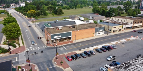
Tim Spears' Music City
-
Zero Effluent Discharge sign at Ivy rest area [01]
![Zero Effluent Discharge sign at Ivy rest area [01] (3708 visits) Sign at the rest area along Interstate 64 westbound near Ivy, Virginia explaining that the rest area... Zero Effluent Discharge sign at Ivy rest area [01]](../../../../../i/upload/2024/07/19/20240719165907-357f8f51-cu_s9999x250.jpg)
-
Zero Effluent Discharge sign at Ivy rest area [02]
![Zero Effluent Discharge sign at Ivy rest area [02] (4034 visits) Sign at the rest area along Interstate 64 westbound near Ivy, Virginia explaining that the rest area... Zero Effluent Discharge sign at Ivy rest area [02]](../../../../../i/upload/2024/07/19/20240719165901-5f1abe0b-cu_s9999x250.jpg)
-
"THRU TRAFFIC PROHIBITED" sign at an alley entrance [01]
!["THRU TRAFFIC PROHIBITED" sign at an alley entrance [01] (4924 visits) Sign indicating a prohibition on through traffic at the entrance to an alley between North Claremont... "THRU TRAFFIC PROHIBITED" sign at an alley entrance [01]](../../../../../i/upload/2024/11/05/20241105002937-256e1b60-cu_s9999x250.jpg)
-
"THRU TRAFFIC PROHIBITED" sign at an alley entrance [02]
!["THRU TRAFFIC PROHIBITED" sign at an alley entrance [02] (4983 visits) Sign indicating a prohibition on through traffic at the entrance to an alley between North Claremont... "THRU TRAFFIC PROHIBITED" sign at an alley entrance [02]](../../../../../i/upload/2024/11/05/20241105002941-0c98cc0b-cu_s9999x250.jpg)
-
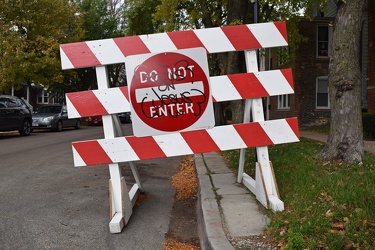
"DO NOT ENTER" sign with religious graffiti
-
Two-way traffic sign on North Oakley Avenue [01]
![Two-way traffic sign on North Oakley Avenue [01] (4292 visits) Two-way traffic sign on North Oakley Avenue in Chicago, Illinois.
More at The Schumin Web:
www.schu... Two-way traffic sign on North Oakley Avenue [01]](../../../../../i/upload/2024/11/05/20241105093345-e147e727-cu_s9999x250.jpg)
-
Two-way traffic sign on North Oakley Avenue [02]
![Two-way traffic sign on North Oakley Avenue [02] (4251 visits) Two-way traffic sign on North Oakley Avenue in Chicago, Illinois.
More at The Schumin Web:
www.schu... Two-way traffic sign on North Oakley Avenue [02]](../../../../../i/upload/2024/11/05/20241105093354-f4465fc5-cu_s9999x250.jpg)
-
Pedestrian call button at West Lawrence Avenue and North Oakley Avenue [01]
![Pedestrian call button at West Lawrence Avenue and North Oakley Avenue [01] (3762 visits) Call button to activate the pedestrian crossing signals at the northwest corner of West Lawrence Ave... Pedestrian call button at West Lawrence Avenue and North Oakley Avenue [01]](../../../../../i/upload/2024/11/07/20241107233148-96dd4169-cu_s9999x250.jpg)
-
Traffic signal at West Lawrence Avenue and North Oakley Avenue [01]
![Traffic signal at West Lawrence Avenue and North Oakley Avenue [01] (3851 visits) Traffic signal governing vehicles traveling eastbound on West Lawrence Avenue at its intersection wi... Traffic signal at West Lawrence Avenue and North Oakley Avenue [01]](../../../../../i/upload/2024/11/07/20241107233202-f96b28e8-cu_s9999x250.jpg)
-
Traffic signal at West Lawrence Avenue and North Oakley Avenue [02]
![Traffic signal at West Lawrence Avenue and North Oakley Avenue [02] (4063 visits) Traffic signal governing vehicles traveling eastbound on West Lawrence Avenue at its intersection wi... Traffic signal at West Lawrence Avenue and North Oakley Avenue [02]](../../../../../i/upload/2024/11/07/20241107233209-80193129-cu_s9999x250.jpg)
-
Traffic signal at West Lawrence Avenue and North Oakley Avenue [03]
![Traffic signal at West Lawrence Avenue and North Oakley Avenue [03] (3958 visits) Traffic signal governing vehicles traveling eastbound on West Lawrence Avenue at its intersection wi... Traffic signal at West Lawrence Avenue and North Oakley Avenue [03]](../../../../../i/upload/2024/11/07/20241107233214-b83a7688-cu_s9999x250.jpg)
-
Pedestrian call button at West Lawrence Avenue and North Oakley Avenue [02]
![Pedestrian call button at West Lawrence Avenue and North Oakley Avenue [02] (3687 visits) Call button to activate the pedestrian crossing signals at the southeast corner of West Lawrence Ave... Pedestrian call button at West Lawrence Avenue and North Oakley Avenue [02]](../../../../../i/upload/2024/11/07/20241107233219-0a1e8b2d-cu_s9999x250.jpg)
-
"SPEED HUMP AHEAD" sign [01]
!["SPEED HUMP AHEAD" sign [01] (4513 visits) Warning sign denoting a speed hump in an alley west of North Oakley Avenue in Chicago, Illinois.
Mo... "SPEED HUMP AHEAD" sign [01]](../../../../../i/upload/2024/11/07/20241107233301-a2ef4f73-cu_s9999x250.jpg)
-
"SPEED HUMP AHEAD" sign [02]
!["SPEED HUMP AHEAD" sign [02] (4423 visits) Warning sign denoting a speed hump in an alley west of North Oakley Avenue in Chicago, Illinois.
Mo... "SPEED HUMP AHEAD" sign [02]](../../../../../i/upload/2024/11/07/20241107233527-74a318ca-cu_s9999x250.jpg)
-
Turn signage at the intersection of two alleys [01]
![Turn signage at the intersection of two alleys [01] (4185 visits) Turn signage at the intersection of two alleys in the Lincoln Square neighborhood in Chicago, Illino... Turn signage at the intersection of two alleys [01]](../../../../../i/upload/2024/11/07/20241107234226-3596729d-cu_s9999x250.jpg)
-
Turn signage at the intersection of two alleys [02]
![Turn signage at the intersection of two alleys [02] (4274 visits) Turn signage at the intersection of two alleys in the Lincoln Square neighborhood in Chicago, Illino... Turn signage at the intersection of two alleys [02]](../../../../../i/upload/2024/11/07/20241107233549-d8a84f30-cu_s9999x250.jpg)
-
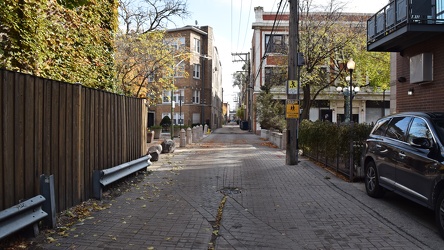
Alley parallel to North Lincoln Avenue
-
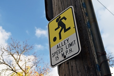
Alley speed limit sign
-
"DO NOT FEED PIGEONS" sign [01]
!["DO NOT FEED PIGEONS" sign [01] (4722 visits) Sign reminding passers-by of the city’s ban on feeding pigeons and related fines, in an alley that... "DO NOT FEED PIGEONS" sign [01]](../../../../../i/upload/2024/11/08/20241108234559-fae674f8-cu_s9999x250.jpg)
-
"DO NOT FEED PIGEONS" sign [02]
!["DO NOT FEED PIGEONS" sign [02] (4812 visits) Sign reminding passers-by of the city’s ban on feeding pigeons and related fines, in an alley that... "DO NOT FEED PIGEONS" sign [02]](../../../../../i/upload/2024/11/08/20241108234607-386e56d1-cu_s9999x250.jpg)
-
Rusted no parking sign in an alley [01]
![Rusted no parking sign in an alley [01] (11076 visits) Graffiti covers the lower half of a rusted no-parking sign attached to a utility pole in an alley th... Rusted no parking sign in an alley [01]](../../../../../i/upload/2024/11/08/20241108234615-b297a76b-cu_s9999x250.jpg)
-
Rusted no parking sign in an alley [02]
![Rusted no parking sign in an alley [02] (4368 visits) A rusted no parking sign is attached to a utility pole in an alley that runs east of and parallel to... Rusted no parking sign in an alley [02]](../../../../../i/upload/2024/11/08/20241108234621-9b234ba3-cu_s9999x250.jpg)
-
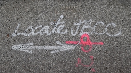
Pavement markings for utility work
-
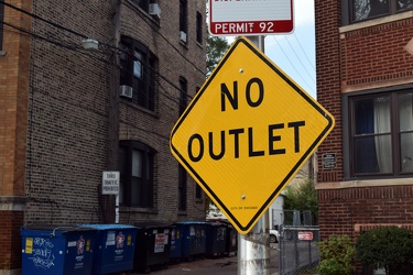
"NO OUTLET" sign at alley entrance
-
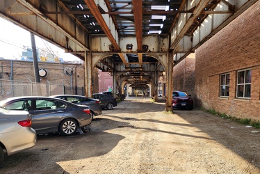
Parking lot beneath the CTA tracks
-
"NO TURN ON RED" sign at North Lincoln and West Wilson Avenues [01]
!["NO TURN ON RED" sign at North Lincoln and West Wilson Avenues [01] (4450 visits) “NO TURN ON RED” sign at the intersection of North Lincoln Avenue and West Wilson Avenue in Chic... "NO TURN ON RED" sign at North Lincoln and West Wilson Avenues [01]](../../../../../i/upload/2024/11/08/20241108234711-cc750f31-cu_s9999x250.jpg)
-
"NO TURN ON RED" sign at North Lincoln and West Wilson Avenues [02]
!["NO TURN ON RED" sign at North Lincoln and West Wilson Avenues [02] (4375 visits) “NO TURN ON RED” sign at the intersection of North Lincoln Avenue and West Wilson Avenue in Chic... "NO TURN ON RED" sign at North Lincoln and West Wilson Avenues [02]](../../../../../i/upload/2024/11/08/20241108234716-f6a67dc8-cu_s9999x250.jpg)
-
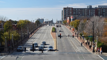
View west from Roosevelt platform
-
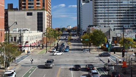
View east from Roosevelt platform
-
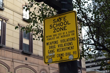
"SAFE SCHOOL ZONE" sign at Chicago and Wabash
-
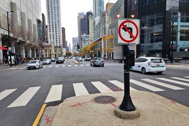
Turn restriction at North Michigan Avenue and East Chestnut Street
-
View from observation deck at 875 North Michigan Avenue [10]
![View from observation deck at 875 North Michigan Avenue [10] (5367 visits) View of Chicago, Illinois from the observation deck at 875 North Michigan Avenue, formerly known as ... View from observation deck at 875 North Michigan Avenue [10]](../../../../../i/upload/2024/11/14/20241114220957-46c835bd-cu_s9999x250.jpg)
-
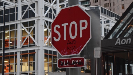
"Stop and kiss"
-
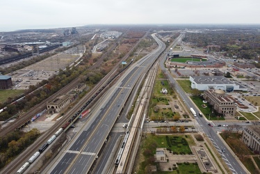
Interstate 90 in Gary, Indiana
-
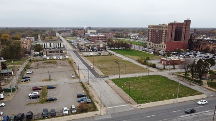
View down Massachusetts Street
-
Former City View Center [19]
![Former City View Center [19] (384969 visits) Barricaded parking lot adjacent to an Applebee’s restaurant, intended to serve retail space that w... Former City View Center [19]](../../../../../i/upload/2024/11/16/20241116120237-5d414617-cu_s9999x250.jpg)
-
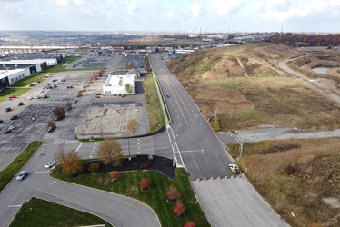
Transportation Boulevard
-
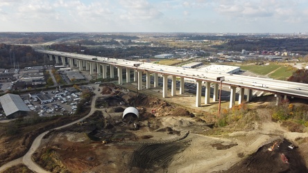
Interstate 480 in Garfield Heights
-
Ravenglass Way [10]
![Ravenglass Way [10] (3029 visits) Overhead view of Ravenglass Way, a street in Montgomery Village, Maryland. North is to the bottom r... Ravenglass Way [10]](../../../../../i/upload/2024/11/20/20241120093351-250cbe61-cu_s9999x250.jpg)
-
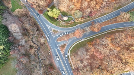
Intersection of East Village Avenue and Goshen Road
-
Ravenglass Way [11]
![Ravenglass Way [11] (2816 visits) Overhead view of Ravenglass Way, a street in Montgomery Village, Maryland.
More at The Schumin Web:... Ravenglass Way [11]](../../../../../i/upload/2024/11/20/20241120095538-f7c081d2-cu_s9999x250.jpg)
-
Ravenglass Way [12]
![Ravenglass Way [12] (2846 visits) Overhead view of Ravenglass Way, a street in Montgomery Village, Maryland.
More at The Schumin Web:... Ravenglass Way [12]](../../../../../i/upload/2024/11/20/20241120095547-36a4979e-cu_s9999x250.jpg)
-
US 29 in Bealeton, Virginia [01]
![US 29 in Bealeton, Virginia [01] (2681 visits) US 29 as it passes through Bealeton, Virginia. View facing northbound.
More at The Schumin Web:
ww... US 29 in Bealeton, Virginia [01]](../../../../../i/upload/2024/11/23/20241123123538-63213966-cu_s9999x250.jpg)