-
Intersection of US 340 and VA 608 [02]
![Intersection of US 340 and VA 608 [02] (106739 visits) Intersection of US 340 and Virginia state secondary route 608 in Stuarts Draft, Virginia.
Ben Sch... Intersection of US 340 and VA 608 [02]](../../../../../i/upload/2024/07/19/20240719120559-2af4c901-cu_s9999x250.jpg)
-
Intersection of US 340 and VA 608 [01]
![Intersection of US 340 and VA 608 [01] (106690 visits) Intersection of US 340 and Virginia state secondary route 608 in Stuarts Draft, Virginia.
Ben Sch... Intersection of US 340 and VA 608 [01]](../../../../../i/upload/2024/07/19/20240719120550-1673ec68-cu_s9999x250.jpg)
-
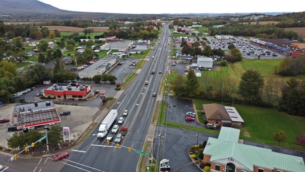
US 340 south in Stuarts Draft
-
Interstate 64 near Rockfish Gap [01]
![Interstate 64 near Rockfish Gap [01] (66833 visits) Interstate 64, near Rockfish Gap in Virginia.
Ben Schumin is a professional photographer who captur... Interstate 64 near Rockfish Gap [01]](../../../../../i/upload/2024/07/19/20240719120555-d0d3c2ce-cu_s9999x250.jpg)
-
West Main Street in Waynesboro, Virginia [03]
![West Main Street in Waynesboro, Virginia [03] (14222 visits) Downtown Waynesboro, Virginia, looking east down West Main Street, near the intersection with Church... West Main Street in Waynesboro, Virginia [03]](../../../../../i/upload/2024/07/19/20240719130237-f1099710-cu_s9999x250.jpg)
-
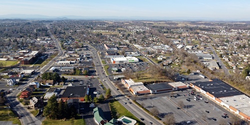
West Main and West Broad Streets, facing west
-
Interstate 64 in Nelson County, Virginia [03]
![Interstate 64 in Nelson County, Virginia [03] (11695 visits) Interstate 64 in Nelson County, Virginia, near Rockfish Gap. US 250 runs adjacent to the freeway.
... Interstate 64 in Nelson County, Virginia [03]](../../../../../i/upload/2024/07/19/20240719115902-ff5fb9e1-cu_s9999x250.jpg)
-
Interstate 64 in Nelson County, Virginia [02]
![Interstate 64 in Nelson County, Virginia [02] (11530 visits) Interstate 64 in Nelson County, Virginia, near Rockfish Gap. US 250 runs adjacent to the freeway.
... Interstate 64 in Nelson County, Virginia [02]](../../../../../i/upload/2024/07/19/20240719115847-184fa12a-cu_s9999x250.jpg)
-
Interstate 64 near Rockfish Gap [05]
![Interstate 64 near Rockfish Gap [05] (11508 visits) Interstate 64, near Rockfish Gap in Virginia. The boundary between Augusta and Nelson Counties runs... Interstate 64 near Rockfish Gap [05]](../../../../../i/upload/2024/07/19/20240719120629-90e00218-cu_s9999x250.jpg)
-
Interstate 64 in Nelson County, Virginia [01]
![Interstate 64 in Nelson County, Virginia [01] (11419 visits) Interstate 64 in Nelson County, Virginia, near Rockfish Gap. US 250 runs adjacent to the freeway.
... Interstate 64 in Nelson County, Virginia [01]](../../../../../i/upload/2024/07/19/20240719115200-c8a2ce39-cu_s9999x250.jpg)
-
East Washington Street and Allawilla Drive [02]
![East Washington Street and Allawilla Drive [02] (10983 visits) Street sign assembly at the intersection of East Washington Street and Allawilla Drive in Charles To... East Washington Street and Allawilla Drive [02]](../../../../../i/upload/2024/07/19/20240719105556-79e2b58f-cu_s9999x250.jpg)
-
Camera on tripod photographing Benning Road NE [01]
![Camera on tripod photographing Benning Road NE [01] (7084 visits) Nikon D5300 SLR on a tripod in the median of Benning Road NE as it traverses the Ethel Kennedy Bridg... Camera on tripod photographing Benning Road NE [01]](../../../../../i/upload/2024/07/19/20240719090721-696b3e26-cu_s9999x250.jpg)
-
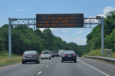
Variable message sign encouraging social distancing
-
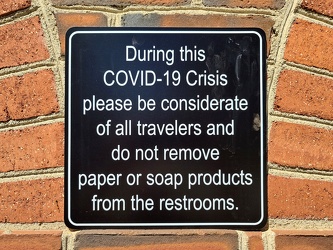
COVID-19 rest area signage
-
Urinal bee

-
Child/toddler friendly stall at New Kent rest area
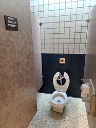
-
Sloan waterless urinal
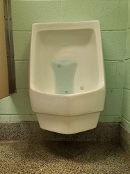
-
No water fountain due to COVID
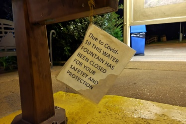
-
Downtown Waynesboro, Virginia, looking toward Invista [02]
![Downtown Waynesboro, Virginia, looking toward Invista [02] (4963 visits) Aerial view of downtown Waynesboro, Virginia, looking towards the Invista plant.
Ben Schumin is a p... Downtown Waynesboro, Virginia, looking toward Invista [02]](../../../../../i/upload/2024/07/19/20240719130254-ae1aac9d-cu_s9999x250.jpg)
-
Interior of New Kent rest area, westbound
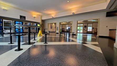
-
Men's restroom at Mason Dixon Welcome Center [01]
![Men's restroom at Mason Dixon Welcome Center [01] (4866 visits) Urinals in the men's restroom at the Mason Dixon Welcome Center off of US 15 in Emmitsburg, Maryland... Men's restroom at Mason Dixon Welcome Center [01]](../../../../../i/upload/2024/07/19/20240719120817-58bfd1d6-cu_s9999x250.jpg)
-
Variable message sign discouraging travel and encouraging mask wearing [01]
![Variable message sign discouraging travel and encouraging mask wearing [01] (4399 visits) Variable message sign displaying a message discouraging travel and encouraging mask wearing, ostensi... Variable message sign discouraging travel and encouraging mask wearing [01]](../../../../../i/upload/2024/07/19/20240719123453-94f55986-cu_s9999x250.jpg)
-
Variable message sign encouraging mask wearing and social distancing
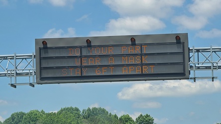
-
Main and Broad Streets, facing east
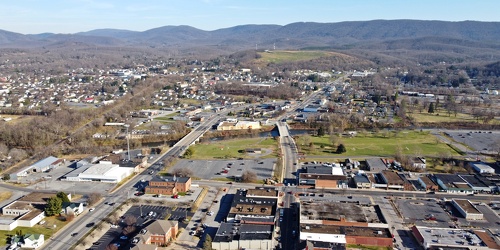
-
Variable message sign discouraging travel and encouraging mask wearing [02]
![Variable message sign discouraging travel and encouraging mask wearing [02] (4332 visits) Variable message sign displaying a message discouraging travel and encouraging mask wearing, ostensi... Variable message sign discouraging travel and encouraging mask wearing [02]](../../../../../i/upload/2024/07/19/20240719123458-c21fd7cf-cu_s9999x250.jpg)
-
Downtown Waynesboro, Virginia, facing west
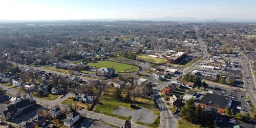
-
Downtown Waynesboro, Virginia near South Wayne Avenue and Federal Street
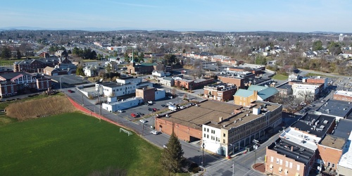
-
West Main Street in Waynesboro, Virginia [01]
![West Main Street in Waynesboro, Virginia [01] (4196 visits) Downtown Waynesboro, Virginia, looking east down West Main Street, near the intersection with Church... West Main Street in Waynesboro, Virginia [01]](../../../../../i/upload/2024/07/19/20240719130232-6088860d-cu_s9999x250.jpg)
-
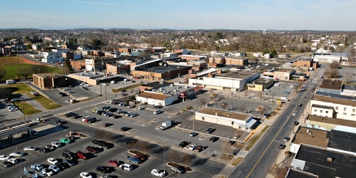
Downtown Waynesboro, Virginia, near Kroger store
-
Signage for Exit 49 on Interstate 295 [04]
![Signage for Exit 49 on Interstate 295 [04] (4128 visits) Overhead sign for Exit 49 (US 33) on Interstate 295 eastbound in Glen Allen, Virginia.
More at The ... Signage for Exit 49 on Interstate 295 [04]](../../../../../i/upload/2024/07/19/20240719092929-00e8a658-cu_s9999x250.jpg)
-
Camera on tripod photographing Benning Road NE [02]
![Camera on tripod photographing Benning Road NE [02] (4125 visits) Nikon D5300 SLR on a tripod in the median of Benning Road NE.
Ben Schumin is a professional photogr... Camera on tripod photographing Benning Road NE [02]](../../../../../i/upload/2024/07/19/20240719090725-359408fa-cu_s9999x250.jpg)
-
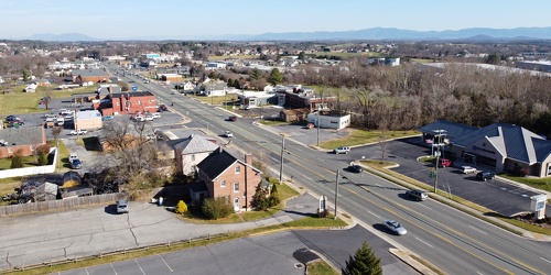
View up Route 11 from above Verona Fire Department
-
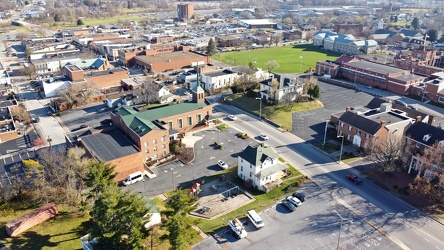
West Main Street in downtown Waynesboro
-
Signage for Exit 49 on Interstate 295 [01]
![Signage for Exit 49 on Interstate 295 [01] (4111 visits) Overhead sign for Exit 49 (US 33) on Interstate 295 eastbound in Glen Allen, Virginia.
More at The ... Signage for Exit 49 on Interstate 295 [01]](../../../../../i/upload/2024/07/19/20240719093116-72eb08f8-cu_s9999x250.jpg)
-
South Norfolk Jordan Bridge [03]
![South Norfolk Jordan Bridge [03] (4097 visits) The South Norfolk Jordan Bridge, commonly known as simply the Jordan Bridge, is a privately owned an... South Norfolk Jordan Bridge [03]](../../../../../i/upload/2024/07/19/20240719101829-ff0de2c9-cu_s9999x250.jpg)
-
South Norfolk Jordan Bridge [04]
![South Norfolk Jordan Bridge [04] (4091 visits) The South Norfolk Jordan Bridge, commonly known as simply the Jordan Bridge, is a privately owned an... South Norfolk Jordan Bridge [04]](../../../../../i/upload/2024/07/19/20240719101811-3ebcdc7d-cu_s9999x250.jpg)
-
Signage for Exit 49 on Interstate 295 [03]
![Signage for Exit 49 on Interstate 295 [03] (4060 visits) Overhead sign for Exit 49 (US 33) on Interstate 295 eastbound in Glen Allen, Virginia.
More at The ... Signage for Exit 49 on Interstate 295 [03]](../../../../../i/upload/2024/07/19/20240719092934-ceaf9b98-cu_s9999x250.jpg)
-
West Main Street in Waynesboro, Virginia [02]
![West Main Street in Waynesboro, Virginia [02] (4038 visits) Downtown Waynesboro, Virginia, looking east down West Main Street, near the intersection with Church... West Main Street in Waynesboro, Virginia [02]](../../../../../i/upload/2024/07/19/20240719130153-2ee52d33-cu_s9999x250.jpg)
-
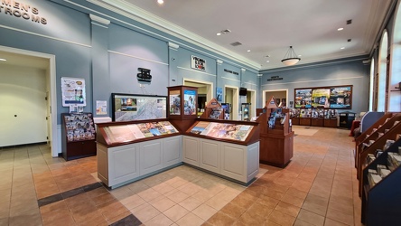
Interior of New Kent rest area, eastbound
-
South Norfolk Jordan Bridge [01]
![South Norfolk Jordan Bridge [01] (3999 visits) The South Norfolk Jordan Bridge, commonly known as simply the Jordan Bridge, is a privately owned an... South Norfolk Jordan Bridge [01]](../../../../../i/upload/2024/07/19/20240719101801-ff660e17-cu_s9999x250.jpg)
-
Interstate 264 after Midtown Tunnel [04]
![Interstate 264 after Midtown Tunnel [04] (3957 visits) Interstate 264 westbound in Portsmouth, Virginia, just after traffic exits the Midtown Tunnel.
More... Interstate 264 after Midtown Tunnel [04]](../../../../../i/upload/2024/07/19/20240719102003-a91bfec6-cu_s9999x250.jpg)
-
Forest Springs Drive [03]
![Forest Springs Drive [03] (3954 visits) Aerial view of Forest Springs Drive, a residential street in Stuarts Draft, Virginia. View facing s... Forest Springs Drive [03]](../../../../../i/upload/2024/07/19/20240719130115-cc787080-cu_s9999x250.jpg)
-
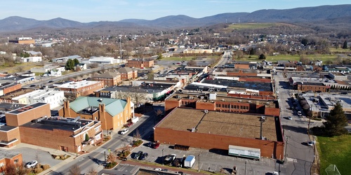
Downtown Waynesboro, Virginia above Church Street and Federal Street
-
Men's restroom at Mason Dixon Welcome Center [02]
![Men's restroom at Mason Dixon Welcome Center [02] (3876 visits) Men's restroom at the Mason Dixon Welcome Center off of US 15 in Emmitsburg, Maryland.
Ben Schumin ... Men's restroom at Mason Dixon Welcome Center [02]](../../../../../i/upload/2024/07/19/20240719120914-461a9dad-cu_s9999x250.jpg)
-
Forest Springs Drive [02]
![Forest Springs Drive [02] (3843 visits) Aerial view of Forest Springs Drive, a residential street in Stuarts Draft, Virginia. View facing n... Forest Springs Drive [02]](../../../../../i/upload/2024/07/19/20240719130110-e8de25d6-cu_s9999x250.jpg)
-
South Norfolk Jordan Bridge [02]
![South Norfolk Jordan Bridge [02] (3830 visits) The South Norfolk Jordan Bridge, commonly known as simply the Jordan Bridge, is a privately owned an... South Norfolk Jordan Bridge [02]](../../../../../i/upload/2024/07/19/20240719101756-29d2696c-cu_s9999x250.jpg)
-
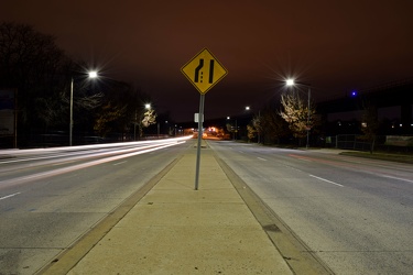
Lane ending sign on Benning Road NE
-
Mileage sign on US 1 near Fredericksburg [02]
![Mileage sign on US 1 near Fredericksburg [02] (3765 visits) Mileage sign on southbound US 1 near Fredericksburg, Virginia, giving distances to Thornburg, Ashlan... Mileage sign on US 1 near Fredericksburg [02]](../../../../../i/upload/2024/07/19/20240719093655-959f4e08-cu_s9999x250.jpg)
-
Interstate 264 after Midtown Tunnel [03]
![Interstate 264 after Midtown Tunnel [03] (3744 visits) Interstate 264 westbound in Portsmouth, Virginia, just after traffic exits the Midtown Tunnel.
More... Interstate 264 after Midtown Tunnel [03]](../../../../../i/upload/2024/07/19/20240719102008-7fa5c14e-cu_s9999x250.jpg)
-
Interstate 64 near Rockfish Gap [04]
![Interstate 64 near Rockfish Gap [04] (3731 visits) Interstate 64, near Rockfish Gap in Virginia. The bridge in the foreground carries Skyline Drive ov... Interstate 64 near Rockfish Gap [04]](../../../../../i/upload/2024/07/19/20240719120620-49d9b327-cu_s9999x250.jpg)
-
Interstate 64 near Rockfish Gap [03]
![Interstate 64 near Rockfish Gap [03] (3730 visits) Interstate 64, near Rockfish Gap in Virginia. The bridge in the foreground carries Skyline Drive ov... Interstate 64 near Rockfish Gap [03]](../../../../../i/upload/2024/07/19/20240719120613-6e2190f6-cu_s9999x250.jpg)
-
Interstate 64 near Rockfish Gap [02]
![Interstate 64 near Rockfish Gap [02] (3698 visits) Interstate 64, near Rockfish Gap in Virginia. The bridge in the foreground carries Skyline Drive ov... Interstate 64 near Rockfish Gap [02]](../../../../../i/upload/2024/07/19/20240719120604-e2ad25dd-cu_s9999x250.jpg)
-
Exit sign at South Mountain rest area [01]
![Exit sign at South Mountain rest area [01] (3516 visits) Exit sign in a restroom at the eastbound South Mountain rest area along Interstate 70 in Frederick C... Exit sign at South Mountain rest area [01]](../../../../../i/upload/2024/07/19/20240719122919-930ba30b-cu_s9999x250.jpg)
-
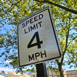
Speed limit 4 mph
-
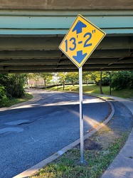
Low clearance sign at West Falls Church station
-
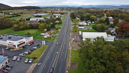
US 340 north in Stuarts Draft
-
Exit sign at South Mountain rest area [03]
![Exit sign at South Mountain rest area [03] (3223 visits) Exit sign in a restroom at the eastbound South Mountain rest area along Interstate 70 in Frederick C... Exit sign at South Mountain rest area [03]](../../../../../i/upload/2024/07/19/20240719122923-c26813d4-cu_s9999x250.jpg)
-
Speed camera on Benning Road NE [01]
![Speed camera on Benning Road NE [01] (3199 visits) Box-style speed camera monitoring eastbound traffic on Benning Road NE.
Ben Schumin is a profession... Speed camera on Benning Road NE [01]](../../../../../i/upload/2024/07/19/20240719090737-595ded57-cu_s9999x250.jpg)
-
Goochland rest area, westbound [02]
![Goochland rest area, westbound [02] (3187 visits) Restroom building at the Goochland Safety Rest Area on Interstate 64 westbound in Manakin-Sabot, Vir... Goochland rest area, westbound [02]](../../../../../i/upload/2024/07/19/20240719093125-c06aafb1-cu_s9999x250.jpg)
-
Goochland rest area, westbound [01]
![Goochland rest area, westbound [01] (3170 visits) Restroom building at the Goochland Safety Rest Area on Interstate 64 westbound in Manakin-Sabot, Vir... Goochland rest area, westbound [01]](../../../../../i/upload/2024/07/19/20240719093130-dbdf3bb4-cu_s9999x250.jpg)
-
Speed camera on Benning Road NE [02]
![Speed camera on Benning Road NE [02] (3161 visits) Box-style speed camera monitoring eastbound traffic on Benning Road NE.
Ben Schumin is a profession... Speed camera on Benning Road NE [02]](../../../../../i/upload/2024/07/19/20240719090749-91cc6b64-cu_s9999x250.jpg)
-
Intersection of Routes 64 and 418 [05]
![Intersection of Routes 64 and 418 [05] (3157 visits) Intersection of Routes 64 and 418 in Ringgold, Maryland. The two roads meet at a four-way stop, gov... Intersection of Routes 64 and 418 [05]](../../../../../i/upload/2024/07/19/20240719114438-ea16106f-cu_s9999x250.jpg)
-
Goochland rest area, westbound [03]
![Goochland rest area, westbound [03] (3151 visits) Restroom building at the Goochland Safety Rest Area on Interstate 64 westbound in Manakin-Sabot, Vir... Goochland rest area, westbound [03]](../../../../../i/upload/2024/07/19/20240719093121-0aeca88a-cu_s9999x250.jpg)
-
Intersection of Routes 64 and 418 [01]
![Intersection of Routes 64 and 418 [01] (3137 visits) Intersection of Routes 64 and 418 in Ringgold, Maryland. The two roads meet at a four-way stop, gov... Intersection of Routes 64 and 418 [01]](../../../../../i/upload/2024/07/19/20240719114447-7f7699d7-cu_s9999x250.jpg)
-
Ghost shoes [02]
![Ghost shoes [02] (3129 visits) White "ghost shoes" attached to a utility pole in memory of Douglas Perez Martinez in fron... Ghost shoes [02]](../../../../../i/upload/2024/07/19/20240719111643-33096b03-cu_s9999x250.jpg)
-
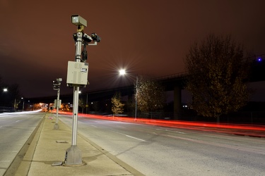
Speed cameras on Benning Road NE
-
Intersection of Routes 64 and 418 [03]
![Intersection of Routes 64 and 418 [03] (3028 visits) Intersection of Routes 64 and 418 in Ringgold, Maryland. The two roads meet at a four-way stop, gov... Intersection of Routes 64 and 418 [03]](../../../../../i/upload/2024/07/19/20240719114429-bdff0353-cu_s9999x250.jpg)
-
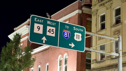
Overhead sign over South Queen Street
-
Exit sign at South Mountain rest area [02]
![Exit sign at South Mountain rest area [02] (2988 visits) Exit sign in a restroom at the eastbound South Mountain rest area along Interstate 70 in Frederick C... Exit sign at South Mountain rest area [02]](../../../../../i/upload/2024/07/19/20240719122928-5400c48b-cu_s9999x250.jpg)
-
Ghost shoes [01]
![Ghost shoes [01] (2979 visits) White "ghost shoes" attached to a utility pole in memory of Douglas Perez Martinez in fron... Ghost shoes [01]](../../../../../i/upload/2024/07/19/20240719111639-88b3ad34-cu_s9999x250.jpg)
-
Blinker signals in Ringgold, Maryland [02]
![Blinker signals in Ringgold, Maryland [02] (2971 visits) Blinker signals supplementing a four-way stop at the intersection of Maryland Routes 64 and 418 in R... Blinker signals in Ringgold, Maryland [02]](../../../../../i/upload/2024/07/19/20240719104829-0c02a370-cu_s9999x250.jpg)
-
Blinker signals in Ringgold, Maryland [03]
![Blinker signals in Ringgold, Maryland [03] (2918 visits) Blinker signals supplementing a four-way stop at the intersection of Maryland Routes 64 and 418 in R... Blinker signals in Ringgold, Maryland [03]](../../../../../i/upload/2024/07/19/20240719104805-6afa45cc-cu_s9999x250.jpg)
-
Blinker signals in Ringgold, Maryland [04]
![Blinker signals in Ringgold, Maryland [04] (2883 visits) Blinker signals supplementing a four-way stop at the intersection of Maryland Routes 64 and 418 in R... Blinker signals in Ringgold, Maryland [04]](../../../../../i/upload/2024/07/19/20240719104800-95af76d6-cu_s9999x250.jpg)
-
Intersection of Routes 64 and 418 [04]
![Intersection of Routes 64 and 418 [04] (2883 visits) Intersection of Routes 64 and 418 in Ringgold, Maryland. The two roads meet at a four-way stop, gov... Intersection of Routes 64 and 418 [04]](../../../../../i/upload/2024/07/19/20240719114443-599ce985-cu_s9999x250.jpg)
-
East Washington Street and Allawilla Drive [01]
![East Washington Street and Allawilla Drive [01] (2859 visits) Street sign assembly at the intersection of East Washington Street and Allawilla Drive in Charles To... East Washington Street and Allawilla Drive [01]](../../../../../i/upload/2024/07/19/20240719105551-a08e131e-cu_s9999x250.jpg)
-
Blinker signals in Ringgold, Maryland [01]
![Blinker signals in Ringgold, Maryland [01] (2854 visits) Blinker signals supplementing a four-way stop at the intersection of Maryland Routes 64 and 418 in R... Blinker signals in Ringgold, Maryland [01]](../../../../../i/upload/2024/07/19/20240719104834-c83d81b6-cu_s9999x250.jpg)
-
Intersection of Routes 64 and 418 [02]
![Intersection of Routes 64 and 418 [02] (2850 visits) Intersection of Routes 64 and 418 in Ringgold, Maryland. The two roads meet at a four-way stop, gov... Intersection of Routes 64 and 418 [02]](../../../../../i/upload/2024/07/19/20240719114434-f7b1a6bf-cu_s9999x250.jpg)
-
Blinker signals in Ringgold, Maryland [05]
![Blinker signals in Ringgold, Maryland [05] (2837 visits) Blinker signals supplementing a four-way stop at the intersection of Maryland Routes 64 and 418 in R... Blinker signals in Ringgold, Maryland [05]](../../../../../i/upload/2024/07/19/20240719104755-52af4492-cu_s9999x250.jpg)
-
Signage for Exit 49 on Interstate 295 [06]
![Signage for Exit 49 on Interstate 295 [06] (2816 visits) Overhead sign for Exit 49 (US 33) on Interstate 295 eastbound in Glen Allen, Virginia.
More at The ... Signage for Exit 49 on Interstate 295 [06]](../../../../../i/upload/2024/07/19/20240719092924-a67ffbc2-cu_s9999x250.jpg)
-
Signage for Exit 49 on Interstate 295 [05]
![Signage for Exit 49 on Interstate 295 [05] (2814 visits) Overhead sign for Exit 49 (US 33) on Interstate 295 eastbound in Glen Allen, Virginia.
More at The ... Signage for Exit 49 on Interstate 295 [05]](../../../../../i/upload/2024/07/19/20240719092857-ab204ec0-cu_s9999x250.jpg)