-
Arthur Ravenel Jr. Bridge [18]
![Arthur Ravenel Jr. Bridge [18] (2159 visits) The Arthur Ravenel Jr. Bridge, a cable-stayed bridge that carries traffic on US 17 across the Cooper... Arthur Ravenel Jr. Bridge [18]](../../../i/upload/2025/01/13/20250113224045-40fc6230-cu_s9999x250.jpg)
-
Highway through Dauphin, Pennsylvania [02]
![Highway through Dauphin, Pennsylvania [02] (2159 visits) Highway carrying US 22 and US 322 through Dauphin, Pennsylvania.
More at The Schumin Web:
www.schum... Highway through Dauphin, Pennsylvania [02]](../../../i/upload/2025/03/06/20250306064534-81e15f4d-cu_s9999x250.jpg)
-
Arthur Ravenel Jr. Bridge [07]
![Arthur Ravenel Jr. Bridge [07] (2163 visits) The Arthur Ravenel Jr. Bridge, a cable-stayed bridge that carries traffic on US 17 across the Cooper... Arthur Ravenel Jr. Bridge [07]](../../../i/upload/2025/01/13/20250113223938-6a50cb21-cu_s9999x250.jpg)
-
K Street under Washington Circle
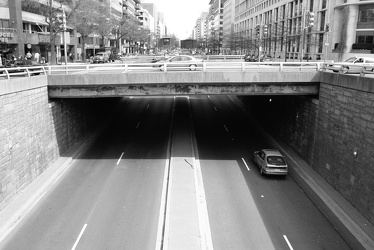
-
Arthur Ravenel Jr. Bridge [08]
![Arthur Ravenel Jr. Bridge [08] (2177 visits) The Arthur Ravenel Jr. Bridge, a cable-stayed bridge that carries traffic on US 17 across the Cooper... Arthur Ravenel Jr. Bridge [08]](../../../i/upload/2025/01/13/20250113223944-e84570e8-cu_s9999x250.jpg)
-
Interstate 90 in Gary, Indiana
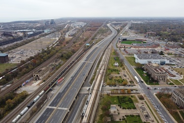
-
Arthur Ravenel Jr. Bridge [01]
![Arthur Ravenel Jr. Bridge [01] (2179 visits) The Arthur Ravenel Jr. Bridge, a cable-stayed bridge that carries traffic on US 17 across the Cooper... Arthur Ravenel Jr. Bridge [01]](../../../i/upload/2025/01/13/20250113223859-782dd8f9-cu_s9999x250.jpg)
-
Arthur Ravenel Jr. Bridge [02]
![Arthur Ravenel Jr. Bridge [02] (2181 visits) The Arthur Ravenel Jr. Bridge, a cable-stayed bridge that carries traffic on US 17 across the Cooper... Arthur Ravenel Jr. Bridge [02]](../../../i/upload/2025/01/13/20250113223905-b4a3ff53-cu_s9999x250.jpg)
-
500 block of 13th Street NW
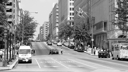
-
Arthur Ravenel Jr. Bridge [15]
![Arthur Ravenel Jr. Bridge [15] (2190 visits) The Arthur Ravenel Jr. Bridge, a cable-stayed bridge that carries traffic on US 17 across the Cooper... Arthur Ravenel Jr. Bridge [15]](../../../i/upload/2025/01/13/20250113224026-45f378cd-cu_s9999x250.jpg)
-
Arthur Ravenel Jr. Bridge [04]
![Arthur Ravenel Jr. Bridge [04] (2197 visits) The Arthur Ravenel Jr. Bridge, a cable-stayed bridge that carries traffic on US 17 across the Cooper... Arthur Ravenel Jr. Bridge [04]](../../../i/upload/2025/01/13/20250113223919-703aafc1-cu_s9999x250.jpg)
-
Ravenglass Way [10]
![Ravenglass Way [10] (2206 visits) Overhead view of Ravenglass Way, a street in Montgomery Village, Maryland. North is to the bottom r... Ravenglass Way [10]](../../../i/upload/2024/11/20/20241120093351-250cbe61-cu_s9999x250.jpg)
-
Arthur Ravenel Jr. Bridge [16]
![Arthur Ravenel Jr. Bridge [16] (2206 visits) The Arthur Ravenel Jr. Bridge, a cable-stayed bridge that carries traffic on US 17 across the Cooper... Arthur Ravenel Jr. Bridge [16]](../../../i/upload/2025/01/13/20250113224033-db7d4d20-cu_s9999x250.jpg)
-
Interstate 95 near Fredericksburg
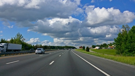
-
Speed camera on Olney Laytonsville Road [01]
![Speed camera on Olney Laytonsville Road [01] (2222 visits) Speed camera box, one of several styles used for revenue collection in the name of "speed enfor... Speed camera on Olney Laytonsville Road [01]](../../../i/upload/2024/07/17/20240717224945-b0f121a5-cu_s9999x250.jpg)
-
Tagging the Graffiti Highway

-
Arthur Ravenel Jr. Bridge [09]
![Arthur Ravenel Jr. Bridge [09] (2229 visits) The Arthur Ravenel Jr. Bridge, a cable-stayed bridge that carries traffic on US 17 across the Cooper... Arthur Ravenel Jr. Bridge [09]](../../../i/upload/2025/01/13/20250113223950-ed5592f2-cu_s9999x250.jpg)
-
Graffiti Highway, facing south [03]
![Graffiti Highway, facing south [03] (2232 visits) Graffiti Highway in Centralia, Pennsylvania, near the northern end of the road, facing approximately... Graffiti Highway, facing south [03]](../../../i/upload/2024/07/18/20240718230031-1484ae1e-cu_s9999x250.jpg)
-
"MEOW" tag

-
"CHZ" graffiti tag

-
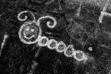
Caterpillar
-
Holiday Inn Charleston-Riverview [09]
![Holiday Inn Charleston-Riverview [09] (2263 visits) The Holiday Inn Charleston-Riverview, a 14-story hotel located between the two sides of US 17 across... Holiday Inn Charleston-Riverview [09]](../../../i/upload/2025/01/13/20250113161157-aad75f46-cu_s9999x250.jpg)
-
Arthur Ravenel Jr. Bridge [13]
![Arthur Ravenel Jr. Bridge [13] (2264 visits) The Arthur Ravenel Jr. Bridge, a cable-stayed bridge that carries traffic on US 17 across the Cooper... Arthur Ravenel Jr. Bridge [13]](../../../i/upload/2025/01/13/20250113224015-6f646f10-cu_s9999x250.jpg)
-
Purple streetlight at Jennings Chapel Road and Route 97 [01]
![Purple streetlight at Jennings Chapel Road and Route 97 [01] (2272 visits) Streetlight at the intersection of Jennings Chapel Road and Maryland Route 97 in Howard County, Mary... Purple streetlight at Jennings Chapel Road and Route 97 [01]](../../../i/upload/2024/07/20/20240720091721-aca69960-cu_s9999x250.jpg)
-
"Ben" from 215

-
Interstate 64 at Rockfish Gap [02]
![Interstate 64 at Rockfish Gap [02] (2276 visits) Interstate 64 at Rockfish Gap, viewed from the bridge to Skyline Drive at milepost 99, facing west.
... Interstate 64 at Rockfish Gap [02]](../../../i/upload/2024/07/17/20240717224221-105e5513-cu_s9999x250.jpg)
-
Graffiti Highway, facing north [05]
![Graffiti Highway, facing north [05] (2277 visits) Graffiti Highway in Centralia, Pennsylvania, near the middle of the road, facing approximately north... Graffiti Highway, facing north [05]](../../../i/upload/2024/07/18/20240718225737-7169f5fc-cu_s9999x250.jpg)
-
Ringed planet

-
Whale

-
"Super S"

-
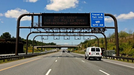
Intercounty Connector toll gantry
-
Southern end of Graffiti Highway [02]
![Southern end of Graffiti Highway [02] (2286 visits) Earthen barrier marking the southern end of the Graffiti Highway. The active roadway is located bey... Southern end of Graffiti Highway [02]](../../../i/upload/2024/07/18/20240718225728-609ba646-cu_s9999x250.jpg)
-
Purple face

-
@televisioneheaven

-
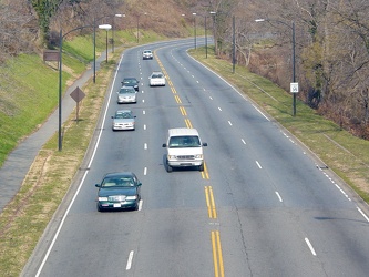
Rock Creek and Potomac Parkway
-
Interstate 64 at Rockfish Gap [02]
![Interstate 64 at Rockfish Gap [02] (2297 visits) Interstate 64 at Rockfish Gap, viewed from the bridge to Skyline Drive at milepost 99, facing east.
... Interstate 64 at Rockfish Gap [02]](../../../i/upload/2024/07/17/20240717224209-142db162-cu_s9999x250.jpg)
-
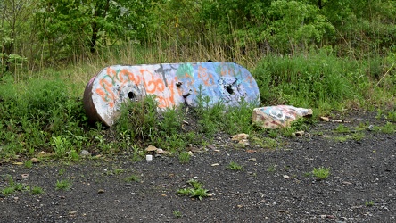
Concrete object on Graffiti Highway
-
Aerial view of downtown Petersburg, Virginia [03]
![Aerial view of downtown Petersburg, Virginia [03] (2301 visits) Aerial view of downtown Petersburg, Virginia.
More at The Schumin Web:
www.schuminweb.com/life-and-... Aerial view of downtown Petersburg, Virginia [03]](../../../i/upload/2024/07/19/20240719195444-cebbe66d-cu_s9999x250.jpg)
-
Graffiti Highway, facing north [09]
![Graffiti Highway, facing north [09] (2304 visits) Graffiti Highway in Centralia, Pennsylvania, near the northern end of the road, facing approximately... Graffiti Highway, facing north [09]](../../../i/upload/2024/07/18/20240718230018-9f76d664-cu_s9999x250.jpg)
-
Southern end of Graffiti Highway [01]
![Southern end of Graffiti Highway [01] (2306 visits) Earthen barrier marking the southern end of the Graffiti Highway, viewed from outside of the abandon... Southern end of Graffiti Highway [01]](../../../i/upload/2024/07/18/20240718225724-3e8c1137-cu_s9999x250.jpg)
-
Interchange between SC 30 and SC 61
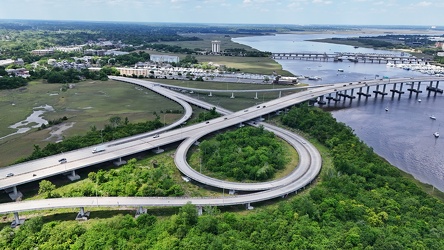
-
Aerial view of downtown Petersburg, Virginia [01]
![Aerial view of downtown Petersburg, Virginia [01] (2324 visits) Aerial view of downtown Petersburg, Virginia.
More at The Schumin Web:
www.schuminweb.com/life-and-... Aerial view of downtown Petersburg, Virginia [01]](../../../i/upload/2024/07/19/20240719195657-18bb1adc-cu_s9999x250.jpg)
-
"BORN TO BE MILD"
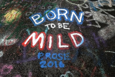
-
Graffiti-covered guardrail

-
North end of the Graffiti Highway
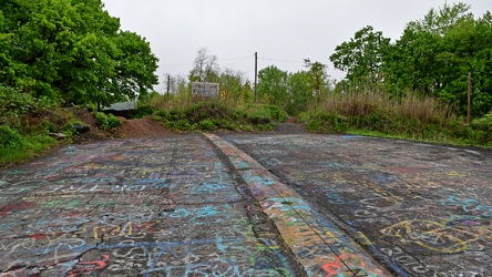
-
Graffiti Highway, facing north [03]
![Graffiti Highway, facing north [03] (2376 visits) Graffiti Highway in Centralia, Pennsylvania, near the southern end of the road, facing approximately... Graffiti Highway, facing north [03]](../../../i/upload/2024/07/18/20240718225628-4b07e821-cu_s9999x250.jpg)
-
Elyse in Centralia
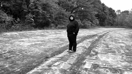
-
Snoopy

-
Graffiti Highway, facing north [04]
![Graffiti Highway, facing north [04] (2404 visits) Graffiti Highway in Centralia, Pennsylvania, near the middle of the road, facing approximately north... Graffiti Highway, facing north [04]](../../../i/upload/2024/07/18/20240718225632-bf35d5b7-cu_s9999x250.jpg)
-
Rift in the former Route 61 [01]
![Rift in the former Route 61 [01] (2404 visits) A rift in the pavement of the former Route 61 in Centralia, Pennsylvania, now known as the Graffiti ... Rift in the former Route 61 [01]](../../../i/upload/2024/07/18/20240718230008-295c1e8f-cu_s9999x250.jpg)
-
Interstate 64 at Rockfish Gap [01]
![Interstate 64 at Rockfish Gap [01] (2420 visits) Interstate 64 at Rockfish Gap, viewed from the bridge to Skyline Drive at milepost 99, facing east.
... Interstate 64 at Rockfish Gap [01]](../../../i/upload/2024/07/17/20240717224207-b7307f80-cu_s9999x250.jpg)
-
Arthur Ravenel Jr. Bridge [17]
![Arthur Ravenel Jr. Bridge [17] (2420 visits) The Arthur Ravenel Jr. Bridge, a cable-stayed bridge that carries traffic on US 17 across the Cooper... Arthur Ravenel Jr. Bridge [17]](../../../i/upload/2025/01/13/20250113224039-32054008-cu_s9999x250.jpg)
-
Rift in the former Route 61 [03]
![Rift in the former Route 61 [03] (2423 visits) A rift in the pavement of the former Route 61 in Centralia, Pennsylvania, now known as the Graffiti ... Rift in the former Route 61 [03]](../../../i/upload/2024/07/18/20240718225959-fff57211-cu_s9999x250.jpg)
-
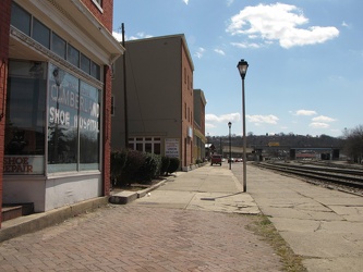
Queen City Pavement
-
Exit 225 on Interstate 81 [04]
![Exit 225 on Interstate 81 [04] (2424 visits) Exit 225 on Interstate 81 in Augusta County, Virginia, providing an interchange with Virginia State ... Exit 225 on Interstate 81 [04]](../../../i/upload/2024/08/24/20240824104700-45b5b9b6-cu_s9999x250.jpg)
-
Alien giving two middle fingers

-
Discarded spray paint can [14]
![Discarded spray paint can [14] (2443 visits) Discarded spray paint can on the Graffiti Highway, likely used for tagging the road.
The Graffiti H... Discarded spray paint can [14]](../../../i/upload/2024/07/18/20240718225839-c4c2a4ba-cu_s9999x250.jpg)
-
Aerial view of downtown Crossville, Tennessee [01]
![Aerial view of downtown Crossville, Tennessee [01] (2444 visits) Aerial view of downtown Crossville, Tennessee.
More at The Schumin Web:
www.schuminweb.com/life-and... Aerial view of downtown Crossville, Tennessee [01]](../../../i/upload/2024/07/20/20240720113721-1bd631e7-cu_s9999x250.jpg)
-
Mr. Yuk

-
Honda Prelude destroyed by falling tree [01]
![Honda Prelude destroyed by falling tree [01] (2455 visits) A Honda Prelude is destroyed on the 1400 block of 17th Street NW after a tree fell on its roof, crus... Honda Prelude destroyed by falling tree [01]](../../../i/upload/2024/07/17/20240717103453-f1dd312a-cu_s9999x250.jpg)
-
Aerial view of downtown Petersburg, Virginia [02]
![Aerial view of downtown Petersburg, Virginia [02] (2457 visits) Aerial view of downtown Petersburg, Virginia. Colonial Heights is visible in the distance.
More at... Aerial view of downtown Petersburg, Virginia [02]](../../../i/upload/2024/07/19/20240719195644-d8ed4c09-cu_s9999x250.jpg)
-
Discarded spray paint can [15]
![Discarded spray paint can [15] (2458 visits) Discarded spray paint can on the Graffiti Highway, likely used for tagging the road.
The Graffiti H... Discarded spray paint can [15]](../../../i/upload/2024/07/18/20240718225843-21462d12-cu_s9999x250.jpg)
-
Mahoning Avenue at Meander Creek Reservoir [02]
![Mahoning Avenue at Meander Creek Reservoir [02] (2458 visits) Mahoning Avenue as it crosses Meander Creek Reservoir, near Austintown, Ohio. View facing approxima... Mahoning Avenue at Meander Creek Reservoir [02]](../../../i/upload/2024/10/26/20241026123810-fb0c700b-cu_s9999x250.jpg)
-
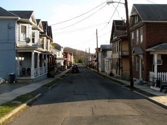
600 block of Elm Street
-
Aerial view of downtown Crossville, Tennessee [03]
![Aerial view of downtown Crossville, Tennessee [03] (2472 visits) Aerial view of downtown Crossville, Tennessee.
More at The Schumin Web:
www.schuminweb.com/life-and... Aerial view of downtown Crossville, Tennessee [03]](../../../i/upload/2024/07/20/20240720113748-d1062940-cu_s9999x250.jpg)
-
Discarded spray paint can [16]
![Discarded spray paint can [16] (2475 visits) Discarded spray paint can on the Graffiti Highway, likely used for tagging the road.
The Graffiti H... Discarded spray paint can [16]](../../../i/upload/2024/07/18/20240718225847-cfa75596-cu_s9999x250.jpg)
-
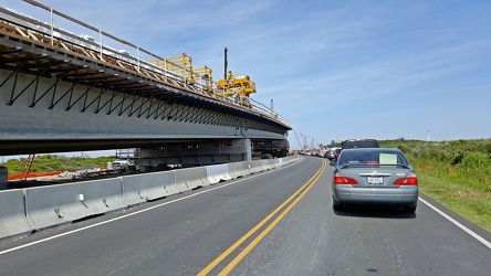
Construction of new Herbert C. Bonner Bridge
-
Crying heart

-
Graffiti Highway, facing north [01]
![Graffiti Highway, facing north [01] (2485 visits) Graffiti Highway in Centralia, Pennsylvania, near the northern end of the road, facing approximately... Graffiti Highway, facing north [01]](../../../i/upload/2024/07/18/20240718225558-c6e9a1b0-cu_s9999x250.jpg)
-
Rusted wire

-
Mahoning Avenue at Meander Creek Reservoir [01]
![Mahoning Avenue at Meander Creek Reservoir [01] (2494 visits) Mahoning Avenue as it crosses Meander Creek Reservoir, near Austintown, Ohio. View facing approxima... Mahoning Avenue at Meander Creek Reservoir [01]](../../../i/upload/2024/10/26/20241026123754-3727f55c-cu_s9999x250.jpg)
-
Interstate 94 westbound [01]
![Interstate 94 westbound [01] (2500 visits) Westbound Interstate 94 in Northfield, Illinois, just south of the interchange with Willow Road.
Be... Interstate 94 westbound [01]](../../../i/upload/2024/07/17/20240717161215-d073d806-cu_s9999x250.jpg)
-
Discarded spray paint can [11]
![Discarded spray paint can [11] (2504 visits) Discarded spray paint can on the Graffiti Highway, likely used for tagging the road.
The Graffiti H... Discarded spray paint can [11]](../../../i/upload/2024/07/18/20240718225758-e72a0020-cu_s9999x250.jpg)
-
Canal Walk through Shockoe Bottom [01]
![Canal Walk through Shockoe Bottom [01] (2509 visits) The Canal Walk as it passes through the Shockoe Bottom neighborhood, in the shadow of the Downtown E... Canal Walk through Shockoe Bottom [01]](../../../i/upload/2024/07/17/20240717155345-29a96509-cu_s9999x250.jpg)
-
Mouth with fangs

-
Discarded spray paint can [18]
![Discarded spray paint can [18] (2514 visits) Discarded spray paint can on the Graffiti Highway, likely used for tagging the road.
The Graffiti H... Discarded spray paint can [18]](../../../i/upload/2024/07/18/20240718230100-ae49da6c-cu_s9999x250.jpg)
-
Aerial view of Charles Town, West Virginia [03]
![Aerial view of Charles Town, West Virginia [03] (2515 visits) Aerial view of Charles Town, West Virginia, from above the downtown area.
Ben Schumin is a professi... Aerial view of Charles Town, West Virginia [03]](../../../i/upload/2024/07/20/20240720104008-7857c00b-cu_s9999x250.jpg)
-
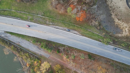
Mahoning Avenue near Austintown
-
Discarded spray paint can [12]
![Discarded spray paint can [12] (2526 visits) Discarded spray paint can on the Graffiti Highway, likely used for tagging the road.
The Graffiti H... Discarded spray paint can [12]](../../../i/upload/2024/07/18/20240718225827-06efaa69-cu_s9999x250.jpg)
-
US 340 in Charles Town [04]
![US 340 in Charles Town [04] (2528 visits) US 340 in Charles Town, West Virginia, east of the interchange with West Virginia Route 9.
Ben Schu... US 340 in Charles Town [04]](../../../i/upload/2024/07/19/20240719162255-e1659465-cu_s9999x250.jpg)