-
Interstate 70 Park and Ride [18]
![Interstate 70 Park and Ride [18] (1985 visits) Park and Ride lot at the eastern terminus of Interstate 70, just inside the city limits of Baltimore... Interstate 70 Park and Ride [18]](../../../i/upload/2024/07/17/20240717101449-12511c6d-cu_s9999x250.jpg)
-
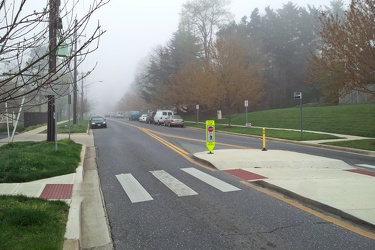
Fog on Hewitt Avenue
-
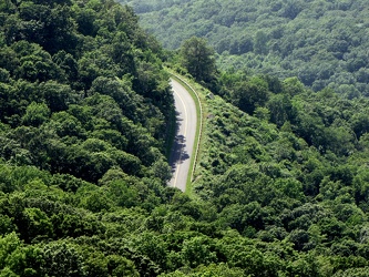
View of the Blue Ridge Parkway from Humpback Rock
-
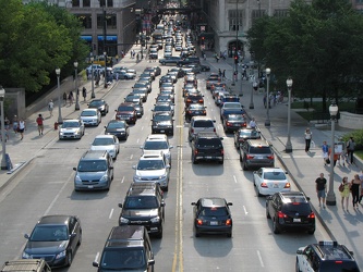
Traffic on East Monroe Street
-
Honda Prelude destroyed by falling tree [02]
![Honda Prelude destroyed by falling tree [02] (1356 visits) A Honda Prelude is destroyed on the 1400 block of 17th Street NW after a tree fell on its roof, crus... Honda Prelude destroyed by falling tree [02]](../../../i/upload/2024/07/17/20240717103449-480dc4d8-cu_s9999x250.jpg)
-
Honda Prelude destroyed by falling tree [01]
![Honda Prelude destroyed by falling tree [01] (1782 visits) A Honda Prelude is destroyed on the 1400 block of 17th Street NW after a tree fell on its roof, crus... Honda Prelude destroyed by falling tree [01]](../../../i/upload/2024/07/17/20240717103453-f1dd312a-cu_s9999x250.jpg)
-
Triple Crossing area [01]
![Triple Crossing area [01] (3908 visits) Area around the Triple Crossing, in the Shockoe Bottom neighborhood of Richmond, Virginia.
More at ... Triple Crossing area [01]](../../../i/upload/2024/07/17/20240717155358-ef286524-cu_s9999x250.jpg)
-
Canal Walk through Shockoe Bottom [01]
![Canal Walk through Shockoe Bottom [01] (1402 visits) The Canal Walk as it passes through the Shockoe Bottom neighborhood, in the shadow of the Downtown E... Canal Walk through Shockoe Bottom [01]](../../../i/upload/2024/07/17/20240717155345-29a96509-cu_s9999x250.jpg)
-
Canal Walk through Shockoe Bottom [04]
![Canal Walk through Shockoe Bottom [04] (1531 visits) The Canal Walk as it passes through Richmond, Virginia's Shockoe Bottom neighborhood, in the shadow ... Canal Walk through Shockoe Bottom [04]](../../../i/upload/2024/07/17/20240717155024-693f8160-cu_s9999x250.jpg)
-
Ramp to Downtown Expressway [02]
![Ramp to Downtown Expressway [02] (1859 visits) Highway ramp connecting northbound Interstate 95 to the Downtown Expressway over the Canal in Richmo... Ramp to Downtown Expressway [02]](../../../i/upload/2024/07/17/20240717155008-eff88bf6-cu_s9999x250.jpg)
-
Ramp to Downtown Expressway [01]
![Ramp to Downtown Expressway [01] (2320 visits) Highway ramp connecting northbound Interstate 95 to the Downtown Expressway over the Canal in Richmo... Ramp to Downtown Expressway [01]](../../../i/upload/2024/07/17/20240717155016-33eaba18-cu_s9999x250.jpg)
-
Canal Walk through Shockoe Bottom [05]
![Canal Walk through Shockoe Bottom [05] (1452 visits) The Canal Walk as it passes through Richmond, Virginia's Shockoe Bottom neighborhood, in the shadow ... Canal Walk through Shockoe Bottom [05]](../../../i/upload/2024/07/17/20240717155021-9a708136-cu_s9999x250.jpg)
-
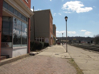
Queen City Pavement
-
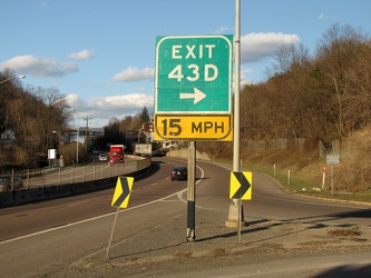
Interstate 68, Exit 43D
-
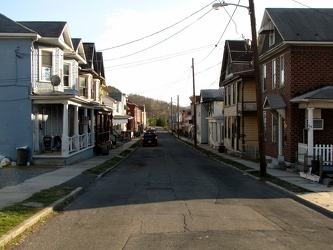
600 block of Elm Street
-
Forest Springs Drive [01]
![Forest Springs Drive [01] (744 visits) Forest Springs Drive, a residential street in Stuarts Draft, Virginia, facing north, at its intersec... Forest Springs Drive [01]](../../../i/upload/2024/07/17/20240717154858-173a58a4-cu_s9999x250.jpg)
-
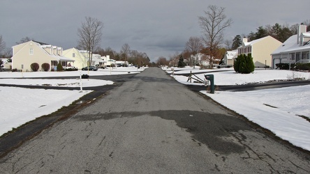
Springer Road
-
Storm clouds at Georgia Avenue and Norbeck Road
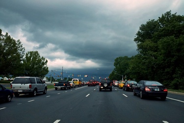
-
Southwest Freeway [01]
![Southwest Freeway [01] (1382 visits) Interstate 395 in Washington, DC, also known as the Southwest Freeway, viewed from 7th Street SW.
B... Southwest Freeway [01]](../../../i/upload/2024/07/17/20240717160351-30a054fb-cu_s9999x250.jpg)
-
Southwest Freeway [02]
![Southwest Freeway [02] (1433 visits) Interstate 395 in Washington, DC, also known as the Southwest Freeway, viewed from 7th Street SW.
B... Southwest Freeway [02]](../../../i/upload/2024/07/17/20240717160347-f6eaadfd-cu_s9999x250.jpg)
-
Interstate 94 westbound [01]
![Interstate 94 westbound [01] (1392 visits) Westbound Interstate 94 in Northfield, Illinois, just south of the interchange with Willow Road.
Be... Interstate 94 westbound [01]](../../../i/upload/2024/07/17/20240717161215-d073d806-cu_s9999x250.jpg)
-
Interstate 94 westbound [02]
![Interstate 94 westbound [02] (3529 visits) Westbound Interstate 94 in Libertyville, Illinois, just south of the interchange with Rockland Road.... Interstate 94 westbound [02]](../../../i/upload/2024/07/17/20240717161211-25917077-cu_s9999x250.jpg)
-
Woman riding motorcycle
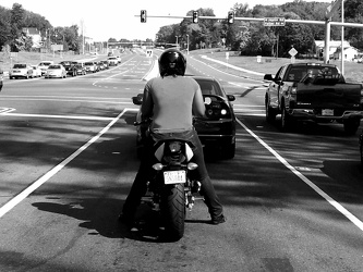
-
Traffic backup on Interstate 64
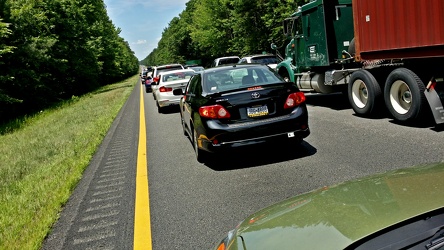
-
Georgia Avenue and Dennis Avenue
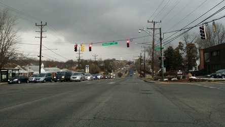
-
Skyline Drive [01]
![Skyline Drive [01] (5459 visits) Southern end of Skyline Drive at Rockfish Gap, facing north. Due to snow conditions, this section o... Skyline Drive [01]](../../../i/upload/2024/07/17/20240717224204-be6fd01b-cu_s9999x250.jpg)
-
Interstate 64 at Rockfish Gap [01]
![Interstate 64 at Rockfish Gap [01] (2081 visits) Interstate 64 at Rockfish Gap, viewed from the bridge to Skyline Drive at milepost 99, facing east.
... Interstate 64 at Rockfish Gap [01]](../../../i/upload/2024/07/17/20240717224207-b7307f80-cu_s9999x250.jpg)
-
Interstate 64 at Rockfish Gap [02]
![Interstate 64 at Rockfish Gap [02] (1955 visits) Interstate 64 at Rockfish Gap, viewed from the bridge to Skyline Drive at milepost 99, facing east.
... Interstate 64 at Rockfish Gap [02]](../../../i/upload/2024/07/17/20240717224209-142db162-cu_s9999x250.jpg)
-
Skyline Drive [02]
![Skyline Drive [02] (2988 visits) Southern end of Skyline Drive at Rockfish Gap, facing north. Due to snow conditions, this section o... Skyline Drive [02]](../../../i/upload/2024/07/17/20240717224212-6e52dad3-cu_s9999x250.jpg)
-
Footprints on Skyline Drive bridge [01]
![Footprints on Skyline Drive bridge [01] (3093 visits) Footprints in the snow on the bridge carrying Skyline Drive over Interstate 64 at Rockfish Gap.
Ben... Footprints on Skyline Drive bridge [01]](../../../i/upload/2024/07/17/20240717224215-a9df1920-cu_s9999x250.jpg)
-
Footprints on Skyline Drive bridge [02]
![Footprints on Skyline Drive bridge [02] (3087 visits) Footprints in the snow on the bridge carrying Skyline Drive over Interstate 64 at Rockfish Gap.
Ben... Footprints on Skyline Drive bridge [02]](../../../i/upload/2024/07/17/20240717224219-2c9361e4-cu_s9999x250.jpg)
-
Interstate 64 at Rockfish Gap [02]
![Interstate 64 at Rockfish Gap [02] (1936 visits) Interstate 64 at Rockfish Gap, viewed from the bridge to Skyline Drive at milepost 99, facing west.
... Interstate 64 at Rockfish Gap [02]](../../../i/upload/2024/07/17/20240717224221-105e5513-cu_s9999x250.jpg)
-
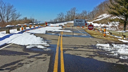
Skyline Drive barricade
-
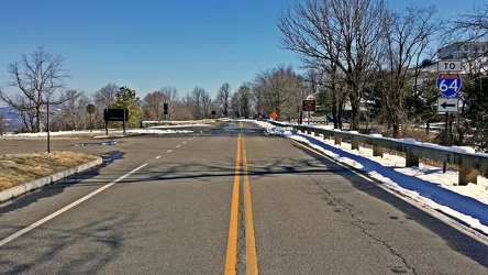
Road between Skyline Drive and the Blue Ridge Parkway
-
Speed camera on Olney Laytonsville Road [01]
![Speed camera on Olney Laytonsville Road [01] (1617 visits) Speed camera box, one of several styles used for revenue collection in the name of "speed enfor... Speed camera on Olney Laytonsville Road [01]](../../../i/upload/2024/07/17/20240717224945-b0f121a5-cu_s9999x250.jpg)
-
Speed camera on Olney Laytonsville Road [02]
![Speed camera on Olney Laytonsville Road [02] (1272 visits) Speed camera box, one of several styles used for revenue collection in the name of "speed enfor... Speed camera on Olney Laytonsville Road [02]](../../../i/upload/2024/07/17/20240717224948-71fb5395-cu_s9999x250.jpg)
-
Speed camera on Olney Laytonsville Road [03]
![Speed camera on Olney Laytonsville Road [03] (1225 visits) Camera unit inside a speed camera box used for revenue collection in the name of "speed enforce... Speed camera on Olney Laytonsville Road [03]](../../../i/upload/2024/07/17/20240717224951-e6a90150-cu_s9999x250.jpg)
-
Speed camera on Olney Laytonsville Road [04]
![Speed camera on Olney Laytonsville Road [04] (1318 visits) Camera unit inside a speed camera box used for revenue collection in the name of "speed enforce... Speed camera on Olney Laytonsville Road [04]](../../../i/upload/2024/07/17/20240717224954-5eaa42f2-cu_s9999x250.jpg)
-
Brighton Dam Road [01]
![Brighton Dam Road [01] (7219 visits) Low view along the double line down the middle of Brighton Dam Road, which runs across the top of Br... Brighton Dam Road [01]](../../../i/upload/2024/07/17/20240717225049-0f96c3b6-cu_s9999x250.jpg)
-
Brighton Dam Road [02]
![Brighton Dam Road [02] (6819 visits) Low view along the double line down the middle of Brighton Dam Road, which runs across the top of Br... Brighton Dam Road [02]](../../../i/upload/2024/07/17/20240717225052-1b323317-cu_s9999x250.jpg)
-
Brighton Dam Road [03]
![Brighton Dam Road [03] (7206 visits) Low view along the double line down the middle of Brighton Dam Road, which runs across the top of Br... Brighton Dam Road [03]](../../../i/upload/2024/07/17/20240717225056-ac7d70e4-cu_s9999x250.jpg)
-
Brighton Dam Road [04]
![Brighton Dam Road [04] (7219 visits) Low view along the double line down the middle of Brighton Dam Road, which runs across the top of Br... Brighton Dam Road [04]](../../../i/upload/2024/07/17/20240717225100-7f927d75-cu_s9999x250.jpg)
-
Traffic signal communication splicing box along Great Seneca Highway [01]
![Traffic signal communication splicing box along Great Seneca Highway [01] (2393 visits) Traffic signal communication splicing box along Great Seneca Highway (MD 119) in Germantown, Marylan... Traffic signal communication splicing box along Great Seneca Highway [01]](../../../i/upload/2024/07/17/20240717225201-c9532446-cu_s9999x250.jpg)
-
Traffic signal communication splicing box along Great Seneca Highway [02]
![Traffic signal communication splicing box along Great Seneca Highway [02] (2443 visits) Traffic signal communication splicing box along Great Seneca Highway (MD 119) in Germantown, Marylan... Traffic signal communication splicing box along Great Seneca Highway [02]](../../../i/upload/2024/07/17/20240717225205-bb6762c9-cu_s9999x250.jpg)
-
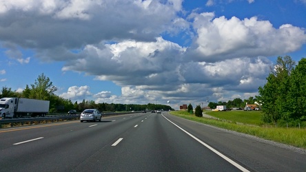
Interstate 95 near Fredericksburg
-
Intersection of Main Street, Liberty Street, and Railroad Avenue [02]
![Intersection of Main Street, Liberty Street, and Railroad Avenue [02] (2409 visits) The intersection of Main Street, Liberty Street, and Railroad Avenue in downtown Westminster, Maryla... Intersection of Main Street, Liberty Street, and Railroad Avenue [02]](../../../i/upload/2024/07/19/20240719183015-8f871209-cu_s9999x250.jpg)
-
Intersection of Main Street, Liberty Street, and Railroad Avenue [03]
![Intersection of Main Street, Liberty Street, and Railroad Avenue [03] (2326 visits) The intersection of Main Street, Liberty Street, and Railroad Avenue in downtown Westminster, Maryla... Intersection of Main Street, Liberty Street, and Railroad Avenue [03]](../../../i/upload/2024/07/19/20240719183012-725b0f5e-cu_s9999x250.jpg)
-
Maryland Midland Railway track [07]
![Maryland Midland Railway track [07] (2544 visits) Track for the Maryland Midland Railway through downtown Westminster, Maryland. The Maryland Midland... Maryland Midland Railway track [07]](../../../i/upload/2024/07/19/20240719182951-755cbc7f-cu_s9999x250.jpg)
-
Intersection of Main Street, Liberty Street, and Railroad Avenue [06]
![Intersection of Main Street, Liberty Street, and Railroad Avenue [06] (2647 visits) The intersection of Main Street, Liberty Street, and Railroad Avenue in downtown Westminster, Maryla... Intersection of Main Street, Liberty Street, and Railroad Avenue [06]](../../../i/upload/2024/07/19/20240719182901-1fc173ca-cu_s9999x250.jpg)
-
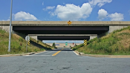
Bridges for Maryland Route 100
-
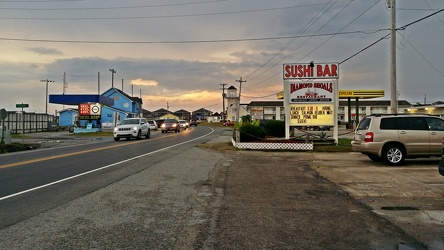
North Carolina Highway 12 in Buxton
-
Irvin Garrish Highway [01]
![Irvin Garrish Highway [01] (1544 visits) Irvin Garrish Highway, which also carries the North Carolina Highway 12 designation, in Ocracoke Vil... Irvin Garrish Highway [01]](../../../i/upload/2024/07/19/20240719183508-e914659f-cu_s9999x250.jpg)
-
Irvin Garrish Highway [02]
![Irvin Garrish Highway [02] (1406 visits) Irvin Garrish Highway, which also carries the North Carolina Highway 12 designation, in Ocracoke Vil... Irvin Garrish Highway [02]](../../../i/upload/2024/07/19/20240719183511-591b2a41-cu_s9999x250.jpg)
-
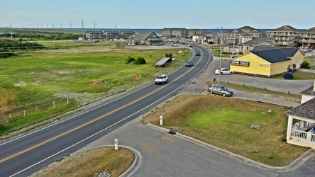
North Carolina Route 12 in Buxton
-
Hatteras Island Beach Access 38 [01]
![Hatteras Island Beach Access 38 [01] (3126 visits) Hatteras Island Beach Access 38, at the south end of Avon, North Carolina. The access consists of a... Hatteras Island Beach Access 38 [01]](../../../i/upload/2024/07/17/20240717230623-ac88eb70-cu_s9999x250.jpg)
-
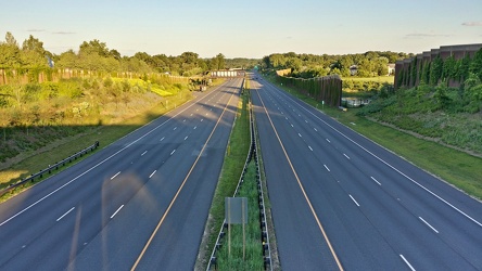
Intercounty Connector at Longmead Crossing Drive
-
Intercounty Connector bike trail [01]
![Intercounty Connector bike trail [01] (1328 visits) Bike trail paralleling the Intercounty Connector and Wintergate Drive, facing westbound.
Ben Schumi... Intercounty Connector bike trail [01]](../../../i/upload/2024/07/17/20240717230853-3f3f70f4-cu_s9999x250.jpg)
-
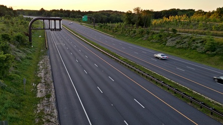
Intercounty Connector at Norbeck Road
-
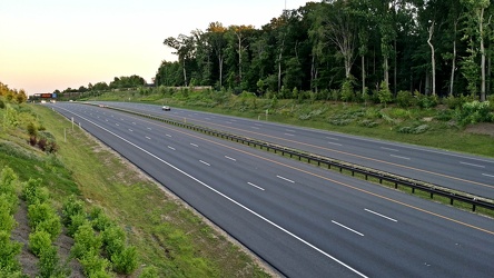
Intercounty Connector
-
Intercounty Connector bike trail [02]
![Intercounty Connector bike trail [02] (1493 visits) Bike trail paralleling the Intercounty Connector, facing westbound.
Ben Schumin is a professional p... Intercounty Connector bike trail [02]](../../../i/upload/2024/07/17/20240717230902-e4af2704-cu_s9999x250.jpg)
-
Intercounty Connector bike trail [03]
![Intercounty Connector bike trail [03] (1350 visits) Bike trail paralleling the Intercounty Connector, facing eastbound.
Ben Schumin is a professional p... Intercounty Connector bike trail [03]](../../../i/upload/2024/07/17/20240717230905-fd85639a-cu_s9999x250.jpg)
-
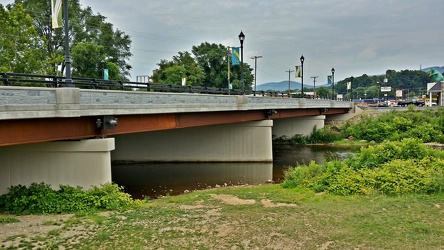
Broad Street bridge
-
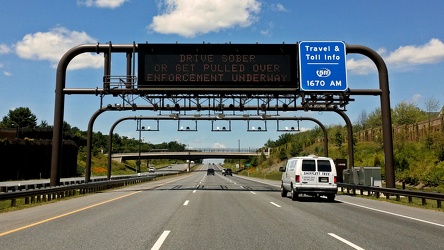
Intercounty Connector toll gantry
-
View from Glenmont West Garage [01]
![View from Glenmont West Garage [01] (2932 visits) View from the west parking garage for Glenmont Metro station, off of Georgia Avenue in Silver Spring... View from Glenmont West Garage [01]](../../../i/upload/2024/07/17/20240717231502-4a1c5dea-cu_s9999x250.jpg)
-
View from Glenmont West Garage [02]
![View from Glenmont West Garage [02] (1604 visits) View from the west parking garage for Glenmont Metro station, off of Georgia Avenue in Silver Spring... View from Glenmont West Garage [02]](../../../i/upload/2024/07/17/20240717231505-b9c562cf-cu_s9999x250.jpg)
-
Interstate 68 through Sideling Hill [02]
![Interstate 68 through Sideling Hill [02] (970 visits) Interstate 68 as it passes through a cut in Sideling Hill in Washington County, Maryland.
More at T... Interstate 68 through Sideling Hill [02]](../../../i/upload/2024/07/19/20240719185655-e23d0b1a-cu_s9999x250.jpg)
-
Interstate 68 through Sideling Hill [01]
![Interstate 68 through Sideling Hill [01] (942 visits) Interstate 68 as it passes through a cut in Sideling Hill in Washington County, Maryland.
More at T... Interstate 68 through Sideling Hill [01]](../../../i/upload/2024/07/19/20240719185659-39bfbedd-cu_s9999x250.jpg)
-
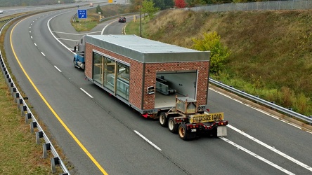
Sheetz car wash being transported by truck
-
Interstate 68 through Sideling Hill [04]
![Interstate 68 through Sideling Hill [04] (947 visits) Interstate 68 as it passes through a cut in Sideling Hill in Washington County, Maryland.
More at T... Interstate 68 through Sideling Hill [04]](../../../i/upload/2024/07/19/20240719185649-93be4705-cu_s9999x250.jpg)
-
Interstate 68 through Sideling Hill [03]
![Interstate 68 through Sideling Hill [03] (991 visits) Interstate 68 as it passes through a cut in Sideling Hill in Washington County, Maryland.
More at T... Interstate 68 through Sideling Hill [03]](../../../i/upload/2024/07/19/20240719185652-298e7b1c-cu_s9999x250.jpg)
-
Interstate 68 through Sideling Hill [05]
![Interstate 68 through Sideling Hill [05] (911 visits) Interstate 68 as it passes through a cut in Sideling Hill in Washington County, Maryland.
More at T... Interstate 68 through Sideling Hill [05]](../../../i/upload/2024/07/19/20240719185645-66143f4e-cu_s9999x250.jpg)
-
Interstate 68 through Sideling Hill [06]
![Interstate 68 through Sideling Hill [06] (929 visits) Interstate 68 as it passes through a cut in Sideling Hill in Washington County, Maryland.
More at T... Interstate 68 through Sideling Hill [06]](../../../i/upload/2024/07/19/20240719185642-d31a5f32-cu_s9999x250.jpg)
-
Interstate 68 through Sideling Hill [07]
![Interstate 68 through Sideling Hill [07] (897 visits) Interstate 68 as it passes through a cut in Sideling Hill in Washington County, Maryland.
More at T... Interstate 68 through Sideling Hill [07]](../../../i/upload/2024/07/19/20240719185636-d7e51d92-cu_s9999x250.jpg)
-
Footbridge over Interstate 68 at Sideling Hill [01]
![Footbridge over Interstate 68 at Sideling Hill [01] (2159 visits) Footbridge over Interstate 68 at the Sideling Hill rest area and overlook. This bridge connects the... Footbridge over Interstate 68 at Sideling Hill [01]](../../../i/upload/2024/07/19/20240719185639-81ae6791-cu_s9999x250.jpg)
-
Interstate 68 through Sideling Hill [09]
![Interstate 68 through Sideling Hill [09] (1134 visits) Interstate 68 as it passes through a cut in Sideling Hill in Washington County, Maryland.
More at T... Interstate 68 through Sideling Hill [09]](../../../i/upload/2024/07/19/20240719185623-cbc17363-cu_s9999x250.jpg)
-
Footbridge over Interstate 68 at Sideling Hill [02]
![Footbridge over Interstate 68 at Sideling Hill [02] (2260 visits) Footbridge over Interstate 68 at the Sideling Hill rest area and overlook. This bridge connects the... Footbridge over Interstate 68 at Sideling Hill [02]](../../../i/upload/2024/07/19/20240719185616-2813b6d0-cu_s9999x250.jpg)
-
Interstate 68 through Sideling Hill [10]
![Interstate 68 through Sideling Hill [10] (905 visits) Interstate 68 as it passes through a cut in Sideling Hill in Washington County, Maryland.
More at T... Interstate 68 through Sideling Hill [10]](../../../i/upload/2024/07/19/20240719185557-640c945f-cu_s9999x250.jpg)
-
Interstate 68 through Sideling Hill [11]
![Interstate 68 through Sideling Hill [11] (919 visits) Interstate 68 as it passes through a cut in Sideling Hill in Washington County, Maryland.
More at T... Interstate 68 through Sideling Hill [11]](../../../i/upload/2024/07/19/20240719185554-18184114-cu_s9999x250.jpg)
-
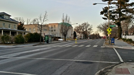
16th and Buchanan Streets NW
-
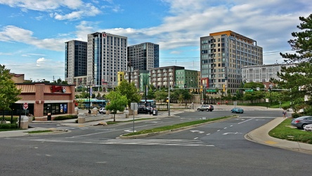
Skyline of Wheaton, Maryland
