-
Interstate 64 in Hampton, Virginia [04]
![Interstate 64 in Hampton, Virginia [04] (1555 visits) Aerial view of Interstate 64, a major highway that runs through Hampton, Virginia.
More at The Schu... Interstate 64 in Hampton, Virginia [04]](../../../../../i/upload/2025/02/17/20250217085415-4cb12081-cu_s9999x250.jpg)
-
Intersection of US 50 and MD 213 [01]
![Intersection of US 50 and MD 213 [01] (1556 visits) Intersection of US 50 (top left to bottom right) and MD 213 (bottom left to top right) in Wye Mills,... Intersection of US 50 and MD 213 [01]](../../../../../i/upload/2025/02/16/20250216003332-e7ac1a6b-cu_s9999x250.jpg)
-
Speed hump sign
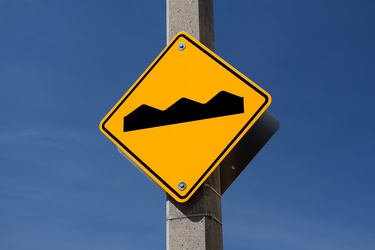
-
Interchange between Layhill Road and MD 200
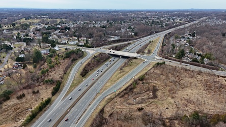
-
Interstate 64 in Hampton, Virginia [02]
![Interstate 64 in Hampton, Virginia [02] (1575 visits) Aerial view of Interstate 64, a major highway that runs through Hampton, Virginia.
More at The Schu... Interstate 64 in Hampton, Virginia [02]](../../../../../i/upload/2025/02/17/20250217085501-e9021d57-cu_s9999x250.jpg)
-
Green streak down Barristers Row
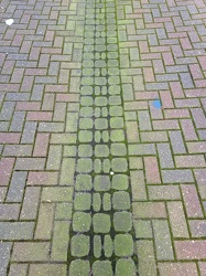
-
Interstate 81 near Verona, Virginia [03]
![Interstate 81 near Verona, Virginia [03] (1591 visits) Interstate 81, as it passes through Verona, Virginia. View facing southbound.
More at The Schumin ... Interstate 81 near Verona, Virginia [03]](../../../../../i/upload/2024/11/28/20241128103757-213af6d5-cu_s9999x250.jpg)
-
Street signs at Church Street and Commercial Avenue
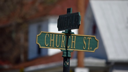
-
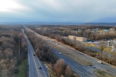
Route 7 in Purcellville, Virginia
-
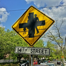
Sign on Aspen Street NW
-
Intersection of US 50 and MD 213 [02]
![Intersection of US 50 and MD 213 [02] (1659 visits) Intersection of US 50 (left to right) and MD 213 (top to bottom) in Wye Mills, Maryland.
More at Th... Intersection of US 50 and MD 213 [02]](../../../../../i/upload/2025/02/16/20250216003338-82427ee4-cu_s9999x250.jpg)
-
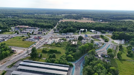
Aerial view of Thornburg, Virginia
-
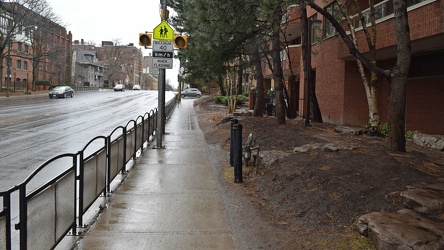
Sidewalk on Avenue Road
-
Smoky conditions along I-95 [01]
![Smoky conditions along I-95 [01] (1680 visits) Smoky atmospheric conditions along Interstate 95 southbound near the northern interchange with the B... Smoky conditions along I-95 [01]](../../../../../i/upload/2024/07/29/20240729110741-d798b31f-cu_s9999x250.jpg)
-
Downtown Waynesboro, facing west [02]
![Downtown Waynesboro, facing west [02] (1686 visits) West Main Street in downtown Waynesboro, Virginia, facing west.
Ben Schumin is a professional photo... Downtown Waynesboro, facing west [02]](../../../../../i/upload/2024/07/15/20240715141245-a64ec632-cu_s9999x250.jpg)
-
Signage for Maryland Route 418 [01]
![Signage for Maryland Route 418 [01] (1693 visits) Signage for Maryland Route 418 at the intersection with Maryland Route 64 in Ringgold.
Ben Schumin ... Signage for Maryland Route 418 [01]](../../../../../i/upload/2024/07/19/20240719104816-bdac4667-cu_s9999x250.jpg)
-
Signage for Maryland Route 418 [03]
![Signage for Maryland Route 418 [03] (1696 visits) Signage for Maryland Route 418 at the intersection with Maryland Route 64 in Ringgold.
Ben Schumin ... Signage for Maryland Route 418 [03]](../../../../../i/upload/2024/07/19/20240719104810-b8c9b800-cu_s9999x250.jpg)
-
"DO NOT ENTER" and "ONE WAY" signs [02]
!["DO NOT ENTER" and "ONE WAY" signs [02] (1703 visits) "DO NOT ENTER" and "ONE WAY" signs at the intersection of Columbus Avenue and Me... "DO NOT ENTER" and "ONE WAY" signs [02]](../../../../../i/upload/2024/07/20/20240720101903-51f9dbdd-cu_s9999x250.jpg)
-
Thornburg interchange on Interstate 95 [01]
![Thornburg interchange on Interstate 95 [01] (1703 visits) Thornburg interchange (exit 118) on Interstate 95 in Virginia. This interchange interacts with Mudd... Thornburg interchange on Interstate 95 [01]](../../../../../i/upload/2025/02/22/20250222022415-31ccb499-cu_s9999x250.jpg)
-
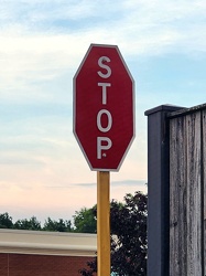
Stop sign with vertical text
-
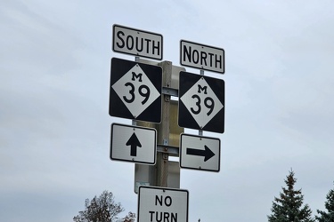
Shields for trunkline highway M-39
-
Downtown Waynesboro, facing west [01]
![Downtown Waynesboro, facing west [01] (1721 visits) West Main Street in downtown Waynesboro, Virginia, facing west.
Ben Schumin is a professional photo... Downtown Waynesboro, facing west [01]](../../../../../i/upload/2024/07/15/20240715141249-3c569b80-cu_s9999x250.jpg)
-
Signage for Maryland Route 64 [01]
![Signage for Maryland Route 64 [01] (1724 visits) Signage for Maryland Route 64 at the intersection with Maryland Route 418 in Ringgold.
Alternate ... Signage for Maryland Route 64 [01]](../../../../../i/upload/2024/07/19/20240719104825-f479389a-cu_s9999x250.jpg)
-
Traffic circle under construction [03]
![Traffic circle under construction [03] (1748 visits) Traffic circle under construction north of Mudd Tavern Road (VA 606) in Thornburg, Virginia.
More a... Traffic circle under construction [03]](../../../../../i/upload/2025/02/22/20250222022342-e895dd00-cu_s9999x250.jpg)
-
Interstate 68 through Sideling Hill [06]
![Interstate 68 through Sideling Hill [06] (1749 visits) Interstate 68 as it passes through a cut in Sideling Hill in Washington County, Maryland.
More at T... Interstate 68 through Sideling Hill [06]](../../../../../i/upload/2024/07/19/20240719185642-d31a5f32-cu_s9999x250.jpg)
-
Interstate 68 through Sideling Hill [07]
![Interstate 68 through Sideling Hill [07] (1749 visits) Interstate 68 as it passes through a cut in Sideling Hill in Washington County, Maryland.
More at T... Interstate 68 through Sideling Hill [07]](../../../../../i/upload/2024/07/19/20240719185636-d7e51d92-cu_s9999x250.jpg)
-
Speed limit and low ground clearance signs [01]
![Speed limit and low ground clearance signs [01] (1750 visits) Speed limit and low ground clearance signs on Mountville Road in Frederick County, Maryland.
Ben Sc... Speed limit and low ground clearance signs [01]](../../../../../i/upload/2024/07/19/20240719093423-402fb975-cu_s9999x250.jpg)
-
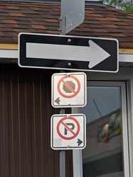
One way sign on Palace Street
-
Thornburg interchange on Interstate 95 [02]
![Thornburg interchange on Interstate 95 [02] (1754 visits) Thornburg interchange (exit 118) on Interstate 95 in Virginia. This interchange interacts with Mudd... Thornburg interchange on Interstate 95 [02]](../../../../../i/upload/2025/02/22/20250222022420-229d3507-cu_s9999x250.jpg)
-
Traffic circle under construction [01]
![Traffic circle under construction [01] (1762 visits) Traffic circle under construction north of Mudd Tavern Road (VA 606) in Thornburg, Virginia.
More a... Traffic circle under construction [01]](../../../../../i/upload/2025/02/22/20250222022330-4bbf063c-cu_s9999x250.jpg)
-
Street signs at intersection of US 15 and Lucketts Road [02]
![Street signs at intersection of US 15 and Lucketts Road [02] (1765 visits) Street signs at the intersection of US 15 and Lucketts Road in Loudoun County, Virginia.
Ben Schumi... Street signs at intersection of US 15 and Lucketts Road [02]](../../../../../i/upload/2024/07/19/20240719161623-789e37f5-cu_s9999x250.jpg)
-
Street signs at intersection of US 15 and Lucketts Road [01]
![Street signs at intersection of US 15 and Lucketts Road [01] (1776 visits) Street signs at the intersection of US 15 and Lucketts Road in Loudoun County, Virginia.
Ben Schumi... Street signs at intersection of US 15 and Lucketts Road [01]](../../../../../i/upload/2024/07/19/20240719161537-a75c3dac-cu_s9999x250.jpg)
-
No parking sign on Gathright Dam [02]
![No parking sign on Gathright Dam [02] (1778 visits) No parking sign on the road across Gathright Dam, an embankment dam in Alleghany County, Virginia th... No parking sign on Gathright Dam [02]](../../../../../i/upload/2025/01/02/20250102213928-b14b8899-cu_s9999x250.jpg)
-
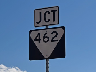
Sign for Tennessee State Route 462
-
Interstate 68 through Sideling Hill [11]
![Interstate 68 through Sideling Hill [11] (1783 visits) Interstate 68 as it passes through a cut in Sideling Hill in Washington County, Maryland.
More at T... Interstate 68 through Sideling Hill [11]](../../../../../i/upload/2024/07/19/20240719185554-18184114-cu_s9999x250.jpg)
-
Brink and Wightman Roads [02]
![Brink and Wightman Roads [02] (1787 visits) Street signs at the intersection of Brink and Wightman Roads near Montgomery Village, Maryland. Thi... Brink and Wightman Roads [02]](../../../../../i/upload/2024/07/19/20240719114750-44efa94d-cu_s9999x250.jpg)
-
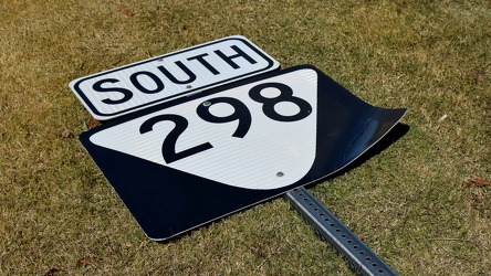
Sign for Tennessee State Route 298
-
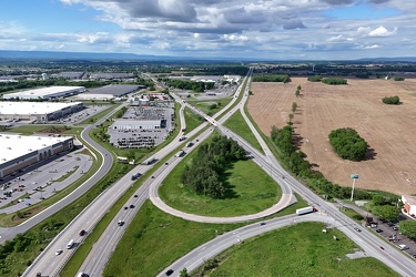
Interchange between I-81 and US 11 in Greencastle, Pennsylvania
-
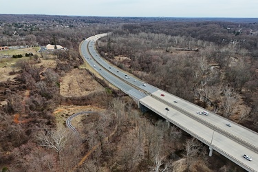
MD 200 east of Layhill Road interchange
-
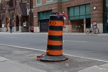
Construction barrel on Metcalfe Street
-
Interstate 68 through Sideling Hill [10]
![Interstate 68 through Sideling Hill [10] (1804 visits) Interstate 68 as it passes through a cut in Sideling Hill in Washington County, Maryland.
More at T... Interstate 68 through Sideling Hill [10]](../../../../../i/upload/2024/07/19/20240719185557-640c945f-cu_s9999x250.jpg)
-
Interstate 68 through Sideling Hill [01]
![Interstate 68 through Sideling Hill [01] (1805 visits) Interstate 68 as it passes through a cut in Sideling Hill in Washington County, Maryland.
More at T... Interstate 68 through Sideling Hill [01]](../../../../../i/upload/2024/07/19/20240719185659-39bfbedd-cu_s9999x250.jpg)
-
Interstate 68 through Sideling Hill [05]
![Interstate 68 through Sideling Hill [05] (1805 visits) Interstate 68 as it passes through a cut in Sideling Hill in Washington County, Maryland.
More at T... Interstate 68 through Sideling Hill [05]](../../../../../i/upload/2024/07/19/20240719185645-66143f4e-cu_s9999x250.jpg)
-
Pennsylvania State Capitol from the northeast [01]
![Pennsylvania State Capitol from the northeast [01] (1810 visits) The Pennsylvania State Capitol, viewed from the northeast about half a mile away, up State Street.
... Pennsylvania State Capitol from the northeast [01]](../../../../../i/upload/2024/07/19/20240719212029-da55021b-cu_s9999x250.jpg)
-
Interstate 68 through Sideling Hill [04]
![Interstate 68 through Sideling Hill [04] (1817 visits) Interstate 68 as it passes through a cut in Sideling Hill in Washington County, Maryland.
More at T... Interstate 68 through Sideling Hill [04]](../../../../../i/upload/2024/07/19/20240719185649-93be4705-cu_s9999x250.jpg)
-
View down East Beverley Street
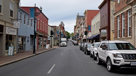
-
16th and Buchanan Streets NW
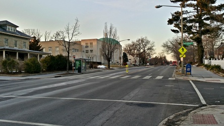
-
Interstate 68 through Sideling Hill [02]
![Interstate 68 through Sideling Hill [02] (1823 visits) Interstate 68 as it passes through a cut in Sideling Hill in Washington County, Maryland.
More at T... Interstate 68 through Sideling Hill [02]](../../../../../i/upload/2024/07/19/20240719185655-e23d0b1a-cu_s9999x250.jpg)
-
Reassurance markers for Interstate 95 business loop and US 301
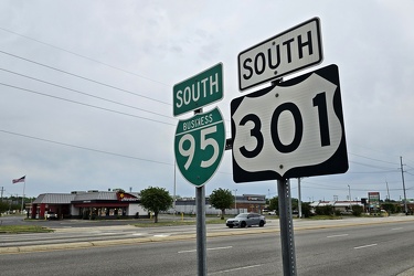
-
Interstate 68 through Sideling Hill [03]
![Interstate 68 through Sideling Hill [03] (1826 visits) Interstate 68 as it passes through a cut in Sideling Hill in Washington County, Maryland.
More at T... Interstate 68 through Sideling Hill [03]](../../../../../i/upload/2024/07/19/20240719185652-298e7b1c-cu_s9999x250.jpg)
-
Brink and Wightman Roads [03]
![Brink and Wightman Roads [03] (1835 visits) Street signs at the intersection of Brink and Wightman Roads near Montgomery Village, Maryland. Thi... Brink and Wightman Roads [03]](../../../../../i/upload/2024/07/19/20240719114723-c9ce5756-cu_s9999x250.jpg)
-
Brink and Goshen Roads [02]
![Brink and Goshen Roads [02] (1836 visits) Street signs at the intersection of Brink and Goshen Roads near Montgomery Village, Maryland. This ... Brink and Goshen Roads [02]](../../../../../i/upload/2024/07/19/20240719114755-96e78db3-cu_s9999x250.jpg)
-
Pennsylvania Route 581 [01]
![Pennsylvania Route 581 [01] (1836 visits) Pennsylvania Route 581, a divided highway forming part of a beltway route around Harrisburg.
Ben Sc... Pennsylvania Route 581 [01]](../../../../../i/upload/2024/07/19/20240719212109-654fb778-cu_s9999x250.jpg)
-
One way sign in Altoona
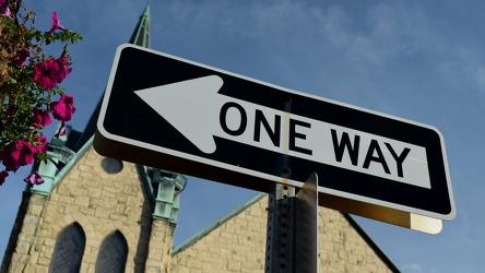
-
Southbound approach to the Fort Duquesne Bridge [02]
![Southbound approach to the Fort Duquesne Bridge [02] (1839 visits) Lower level approach to the Fort Duquesne Bridge on Interstate 279 southbound in Pittsburgh, Pennsyl... Southbound approach to the Fort Duquesne Bridge [02]](../../../../../i/upload/2024/07/20/20240720161211-30c57c41-cu_s9999x250.jpg)
-
East Village Avenue [02]
![East Village Avenue [02] (1841 visits) East Village Avenue, near the intersection with Tyndal Springs Drive and Fulks Farm Road, in Montgom... East Village Avenue [02]](../../../../../i/upload/2024/07/19/20240719122836-3d056d6c-cu_s9999x250.jpg)
-
Pennsylvania Route 581 [02]
![Pennsylvania Route 581 [02] (1844 visits) Pennsylvania Route 581, a divided highway forming part of a beltway route around Harrisburg.
Ben Sc... Pennsylvania Route 581 [02]](../../../../../i/upload/2024/07/19/20240719212119-dd0675d8-cu_s9999x250.jpg)
-
Signage for Maryland Route 64 [03]
![Signage for Maryland Route 64 [03] (1845 visits) Signage for Maryland Route 64 at the intersection with Maryland Route 418 in Ringgold.
Ben Schumin ... Signage for Maryland Route 64 [03]](../../../../../i/upload/2024/07/19/20240719104750-3ae2140a-cu_s9999x250.jpg)
-
Intersection of Western Avenue, West Summit Hill Drive, Henley Street, and Broadway [03]
![Intersection of Western Avenue, West Summit Hill Drive, Henley Street, and Broadway [03] (1845 visits) The intersection of Western Avenue, West Summit Hill Drive, Henley Street, and Broadway, viewed from... Intersection of Western Avenue, West Summit Hill Drive, Henley Street, and Broadway [03]](../../../../../i/upload/2024/07/20/20240720114058-5a0ed76f-cu_s9999x250.jpg)
-
Brink and Wightman Roads [01]
![Brink and Wightman Roads [01] (1848 visits) Street signs at the intersection of Brink and Wightman Roads near Montgomery Village, Maryland. Thi... Brink and Wightman Roads [01]](../../../../../i/upload/2024/07/19/20240719114814-00630fe7-cu_s9999x250.jpg)
-
Temporary street signs [04]
![Temporary street signs [04] (1850 visits) Temporary street signs at the intersection of Ashford Circle and Haymarket Street in Fredericksburg,... Temporary street signs [04]](../../../../../i/upload/2024/07/19/20240719105008-d8d93701-cu_s9999x250.jpg)
-
"Caution: Uncompleted road not publicly maintained" [01]
!["Caution: Uncompleted road not publicly maintained" [01] (1852 visits) Sign on Gosnell Farm Drive in Clarksburg, Maryland warning drivers that the road is uncompleted and ... "Caution: Uncompleted road not publicly maintained" [01]](../../../../../i/upload/2024/07/19/20240719163632-fc09f3a3-cu_s9999x250.jpg)
-
"Caution: Uncompleted road not publicly maintained" [02]
!["Caution: Uncompleted road not publicly maintained" [02] (1853 visits) Sign on Gosnell Farm Drive in Clarksburg, Maryland warning drivers that the road is uncompleted and ... "Caution: Uncompleted road not publicly maintained" [02]](../../../../../i/upload/2024/07/19/20240719163609-d3323e61-cu_s9999x250.jpg)
-
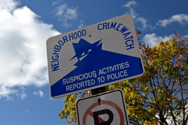
Neighborhood watch sign on Montrose Avenue SE
-
Brink and Goshen Roads [06]
![Brink and Goshen Roads [06] (1854 visits) Street signs at the intersection of Brink and Goshen Roads near Montgomery Village, Maryland. This ... Brink and Goshen Roads [06]](../../../../../i/upload/2024/07/19/20240719114740-26c54d48-cu_s9999x250.jpg)
-
"DO NOT ENTER" and "ONE WAY" signs [01]
!["DO NOT ENTER" and "ONE WAY" signs [01] (1855 visits) "DO NOT ENTER" and "ONE WAY" signs at the intersection of Columbus Avenue and Me... "DO NOT ENTER" and "ONE WAY" signs [01]](../../../../../i/upload/2024/07/20/20240720101859-20d5443c-cu_s9999x250.jpg)
-
Traffic circle under construction [02]
![Traffic circle under construction [02] (1857 visits) Traffic circle under construction north of Mudd Tavern Road (VA 606) in Thornburg, Virginia.
More a... Traffic circle under construction [02]](../../../../../i/upload/2025/02/22/20250222022336-e9f87960-cu_s9999x250.jpg)
-
Brink and Goshen Roads [01]
![Brink and Goshen Roads [01] (1864 visits) Street signs at the intersection of Brink and Goshen Roads near Montgomery Village, Maryland. This ... Brink and Goshen Roads [01]](../../../../../i/upload/2024/07/19/20240719114734-e7a24e73-cu_s9999x250.jpg)
-
Pedestrian signal call sensor at Metcalfe and Nepean Streets [02]
![Pedestrian signal call sensor at Metcalfe and Nepean Streets [02] (1867 visits) Pedestrian signal call sensor at the intersection of Metcalfe and Nepean Streets in Ottawa, Ontario.... Pedestrian signal call sensor at Metcalfe and Nepean Streets [02]](../../../../../i/upload/2024/07/20/20240720154353-ba583a21-cu_s9999x250.jpg)
-
Brink and Goshen Roads [04]
![Brink and Goshen Roads [04] (1869 visits) Street signs at the intersection of Brink and Goshen Roads near Montgomery Village, Maryland. This ... Brink and Goshen Roads [04]](../../../../../i/upload/2024/07/19/20240719114820-366f383a-cu_s9999x250.jpg)
-
Temporary street signs [02]
![Temporary street signs [02] (1871 visits) Temporary street signs at the intersection of Carl D. Silver Parkway and Haymarket Street in Frederi... Temporary street signs [02]](../../../../../i/upload/2024/07/19/20240719105017-67fb0e16-cu_s9999x250.jpg)
-
Southbound approach to the Fort Duquesne Bridge [01]
![Southbound approach to the Fort Duquesne Bridge [01] (1875 visits) Lower level approach to the Fort Duquesne Bridge on Interstate 279 southbound in Pittsburgh, Pennsyl... Southbound approach to the Fort Duquesne Bridge [01]](../../../../../i/upload/2024/07/20/20240720161046-ec5ee6a1-cu_s9999x250.jpg)
-
Brink and Goshen Roads [07]
![Brink and Goshen Roads [07] (1876 visits) Street signs at the intersection of Brink and Goshen Roads near Montgomery Village, Maryland. This ... Brink and Goshen Roads [07]](../../../../../i/upload/2024/07/19/20240719114800-f7779954-cu_s9999x250.jpg)
-
Downtown Waynesboro, facing west [03]
![Downtown Waynesboro, facing west [03] (1878 visits) West Main Street in downtown Waynesboro, Virginia, facing west.
Ben Schumin is a professional photo... Downtown Waynesboro, facing west [03]](../../../../../i/upload/2024/07/15/20240715141241-78ca2bee-cu_s9999x250.jpg)
-
Brink and Goshen Roads [05]
![Brink and Goshen Roads [05] (1882 visits) Street signs at the intersection of Brink and Goshen Roads near Montgomery Village, Maryland. This ... Brink and Goshen Roads [05]](../../../../../i/upload/2024/07/19/20240719114825-4168906a-cu_s9999x250.jpg)
-
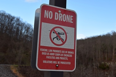
Anti-drone sign at Gathright Dam
-
"WRONG WAY" sign at Devil's Den [01]
!["WRONG WAY" sign at Devil's Den [01] (1893 visits) "WRONG WAY" sign on the parking loop for Devil's Den, near Gettysburg, Pennsylvania.
Ben ... "WRONG WAY" sign at Devil's Den [01]](../../../../../i/upload/2024/07/19/20240719112651-9d21816c-cu_s9999x250.jpg)
-
Temporary street signs [05]
![Temporary street signs [05] (1894 visits) Temporary street signs at the intersection of Ashford Circle and Haymarket Street in Fredericksburg,... Temporary street signs [05]](../../../../../i/upload/2024/07/19/20240719105003-68ab3da4-cu_s9999x250.jpg)
-
Signage for Maryland Route 64 [02]
![Signage for Maryland Route 64 [02] (1897 visits) Signage for Maryland Route 64 at the intersection with Maryland Route 418 in Ringgold.
Alternate ... Signage for Maryland Route 64 [02]](../../../../../i/upload/2024/07/19/20240719104820-3e6fadc3-cu_s9999x250.jpg)
-
Springer Road and Forest Springs Drive [05]
![Springer Road and Forest Springs Drive [05] (1898 visits) Street signs for Springer Road and Forest Springs Drive in Stuarts Draft, Virginia, following the re... Springer Road and Forest Springs Drive [05]](../../../../../i/upload/2024/07/17/20240717161703-a98a0f92-cu_s9999x250.jpg)