-
Sign for JCPenney in Hagerstown, Maryland

-
Blinker signals in Ringgold, Maryland [02]
![Blinker signals in Ringgold, Maryland [02] (3038 visits) Blinker signals supplementing a four-way stop at the intersection of Maryland Routes 64 and 418 in R... Blinker signals in Ringgold, Maryland [02]](../../../../../../../i/upload/2024/07/19/20240719104829-0c02a370-cu_s9999x250.jpg)
-
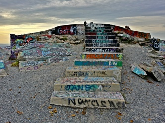
Steps to main overlook at High Rock
-
Abandoned house [02]
![Abandoned house [02] (3001 visits) Abandoned house along Harpers Ferry Road, adjacent to Maryland Heights and the CSX railroad bridge.
... Abandoned house [02]](../../../../../../../i/upload/2024/07/17/20240717230058-5d1cb340-cu_s9999x250.jpg)
-
Blinker signals in Ringgold, Maryland [03]
![Blinker signals in Ringgold, Maryland [03] (2981 visits) Blinker signals supplementing a four-way stop at the intersection of Maryland Routes 64 and 418 in R... Blinker signals in Ringgold, Maryland [03]](../../../../../../../i/upload/2024/07/19/20240719104805-6afa45cc-cu_s9999x250.jpg)
-
Intersection of Routes 64 and 418 [04]
![Intersection of Routes 64 and 418 [04] (2979 visits) Intersection of Routes 64 and 418 in Ringgold, Maryland. The two roads meet at a four-way stop, gov... Intersection of Routes 64 and 418 [04]](../../../../../../../i/upload/2024/07/19/20240719114443-599ce985-cu_s9999x250.jpg)
-
Blinker signals in Ringgold, Maryland [04]
![Blinker signals in Ringgold, Maryland [04] (2960 visits) Blinker signals supplementing a four-way stop at the intersection of Maryland Routes 64 and 418 in R... Blinker signals in Ringgold, Maryland [04]](../../../../../../../i/upload/2024/07/19/20240719104800-95af76d6-cu_s9999x250.jpg)
-
People standing on High Rock [02]
![People standing on High Rock [02] (2959 visits) People standing on and around High Rock, a rock outcropping on South Mountain in Pen Mar, Maryland, ... People standing on High Rock [02]](../../../../../../../i/upload/2024/07/18/20240718125509-fb973c54-cu_s9999x250.jpg)
-
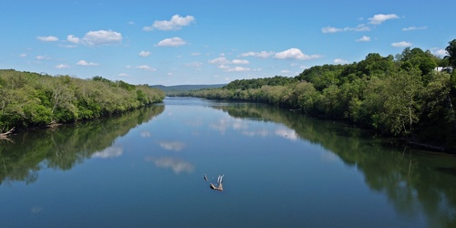
Potomac River near Shepherdstown, West Virginia
-
View from High Rock around sunset [06]
![View from High Rock around sunset [06] (2946 visits) View from High Rock, a rock outcropping on South Mountain in Pen Mar, Maryland, in Washington County... View from High Rock around sunset [06]](../../../../../../../i/upload/2024/07/18/20240718125449-9904b382-cu_s9999x250.jpg)
 Sideling Hill rest area [06]
![Sideling Hill rest area [06] (2935 visits) Stairs to a raised viewing area on the eastbound side of the Sideling Hill rest area, located along ... Sideling Hill rest area [06]](../../../../../../../i/upload/2024/07/17/20240717233527-43e4656c-cu_s9999x250.jpg)
-
Maryland 68 vs. Interstate 68 sign [02]
![Maryland 68 vs. Interstate 68 sign [02] (2935 visits) Sign on westbound Interstate 70 ahead of exit 18, indicating that the next exit is for Maryland Rout... Maryland 68 vs. Interstate 68 sign [02]](../../../../../../../i/upload/2024/07/19/20240719004125-0cff4906-cu_s9999x250.jpg)
-
Intersection of Routes 64 and 418 [02]
![Intersection of Routes 64 and 418 [02] (2932 visits) Intersection of Routes 64 and 418 in Ringgold, Maryland. The two roads meet at a four-way stop, gov... Intersection of Routes 64 and 418 [02]](../../../../../../../i/upload/2024/07/19/20240719114434-f7b1a6bf-cu_s9999x250.jpg)
 Sideling Hill rest area [03]
![Sideling Hill rest area [03] (2929 visits) Footbridge across Interstate 68, allowing views of the cut through the mountain, at the Sideling Hil... Sideling Hill rest area [03]](../../../../../../../i/upload/2024/07/17/20240717233511-e61616ff-cu_s9999x250.jpg)
-
Blinker signals in Ringgold, Maryland [01]
![Blinker signals in Ringgold, Maryland [01] (2920 visits) Blinker signals supplementing a four-way stop at the intersection of Maryland Routes 64 and 418 in R... Blinker signals in Ringgold, Maryland [01]](../../../../../../../i/upload/2024/07/19/20240719104834-c83d81b6-cu_s9999x250.jpg)
-
Blinker signals in Ringgold, Maryland [05]
![Blinker signals in Ringgold, Maryland [05] (2905 visits) Blinker signals supplementing a four-way stop at the intersection of Maryland Routes 64 and 418 in R... Blinker signals in Ringgold, Maryland [05]](../../../../../../../i/upload/2024/07/19/20240719104755-52af4492-cu_s9999x250.jpg)
-
Graffiti-covered stone at High Rock [02]
![Graffiti-covered stone at High Rock [02] (2873 visits) Graffiti-covered stone at High Rock, a rock outcropping on South Mountain in Pen Mar, Maryland, in W... Graffiti-covered stone at High Rock [02]](../../../../../../../i/upload/2024/07/18/20240718125456-e62dc4ce-cu_s9999x250.jpg)
-
View from High Rock around sunset [07]
![View from High Rock around sunset [07] (2866 visits) View from High Rock, a rock outcropping on South Mountain in Pen Mar, Maryland, in Washington County... View from High Rock around sunset [07]](../../../../../../../i/upload/2024/07/18/20240718125452-a060fd82-cu_s9999x250.jpg)
-
Graffiti-covered stone at High Rock [04]
![Graffiti-covered stone at High Rock [04] (2841 visits) Graffiti-covered stone at High Rock, a rock outcropping on South Mountain in Pen Mar, Maryland, in W... Graffiti-covered stone at High Rock [04]](../../../../../../../i/upload/2024/07/18/20240718125505-6e88d549-cu_s9999x250.jpg)
-
Cellular tower in Smithsburg, Maryland [06]
![Cellular tower in Smithsburg, Maryland [06] (2840 visits) Cellular tower owned by American Towers, Inc. along Mapleville Road in Smithsburg, Maryland.
Ben Sc... Cellular tower in Smithsburg, Maryland [06]](../../../../../../../i/upload/2024/07/19/20240719114602-9b9e41ce-cu_s9999x250.jpg)
-
View from High Rock around sunset [04]
![View from High Rock around sunset [04] (2836 visits) View from High Rock, a rock outcropping on South Mountain in Pen Mar, Maryland, in Washington County... View from High Rock around sunset [04]](../../../../../../../i/upload/2024/07/18/20240718125433-8a060ae7-cu_s9999x250.jpg)
-
View from High Rock around sunset [05]
![View from High Rock around sunset [05] (2835 visits) View from High Rock, a rock outcropping on South Mountain in Pen Mar, Maryland, in Washington County... View from High Rock around sunset [05]](../../../../../../../i/upload/2024/07/18/20240718125445-9b7d8206-cu_s9999x250.jpg)
-
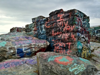
Graffiti-covered stones at High Rock
-
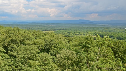
View from Sideling Hill Welcome Center
-
Abandoned house [01]
![Abandoned house [01] (2819 visits) Abandoned house along Harpers Ferry Road, adjacent to Maryland Heights and the CSX railroad bridge.
... Abandoned house [01]](../../../../../../../i/upload/2024/07/17/20240717230055-c63c5bfc-cu_s9999x250.jpg)
-
Graffiti-covered stone at High Rock [03]
![Graffiti-covered stone at High Rock [03] (2791 visits) Graffiti-covered stone at High Rock, a rock outcropping on South Mountain in Pen Mar, Maryland, in W... Graffiti-covered stone at High Rock [03]](../../../../../../../i/upload/2024/07/18/20240718125500-5ab7b0f5-cu_s9999x250.jpg)
-
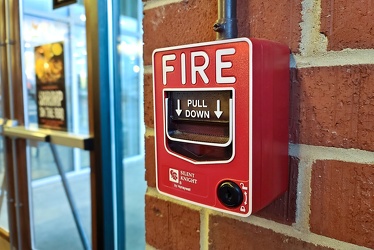
Fire alarm pull station at Mission BBQ in Hagerstown
-
Pizza from Rad Pies

-
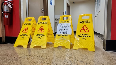
"Restroom close for cleaning"
-
Aerial view of Smithsburg, Maryland [01]
![Aerial view of Smithsburg, Maryland [01] (2669 visits) Aerial view of Smithsburg, Maryland.
Ben Schumin is a professional photographer who captures the in... Aerial view of Smithsburg, Maryland [01]](../../../../../../../i/upload/2024/07/20/20240720155756-7d354d6c-cu_s9999x250.jpg)
-
Hilltop House, viewed from Maryland Heights [02]
![Hilltop House, viewed from Maryland Heights [02] (2658 visits) The abandoned Hilltop House hotel in Harpers Ferry, West Virginia, viewed from the Maryland Heights ... Hilltop House, viewed from Maryland Heights [02]](../../../../../../../i/upload/2024/07/17/20240717230019-8dca72a0-cu_s9999x250.jpg)
-
Woomy tries to drive a Jeep

-
Cellular tower in Smithsburg, Maryland [04]
![Cellular tower in Smithsburg, Maryland [04] (2604 visits) Cellular tower owned by American Towers, Inc. along Mapleville Road in Smithsburg, Maryland.
Ben Sc... Cellular tower in Smithsburg, Maryland [04]](../../../../../../../i/upload/2024/07/19/20240719114554-16372506-cu_s9999x250.jpg)
-
Interstate 68 cut through Sideling Hill [04]
![Interstate 68 cut through Sideling Hill [04] (2573 visits) Cut in Sideling Hill, carrying Interstate 68 between Washington and Allegany Counties in Maryland.
... Interstate 68 cut through Sideling Hill [04]](../../../../../../../i/upload/2024/07/18/20240718220107-eeb97b29-cu_s9999x250.jpg)
-
Cellular tower in Smithsburg, Maryland [05]
![Cellular tower in Smithsburg, Maryland [05] (2571 visits) Cellular tower owned by American Towers, Inc. along Mapleville Road in Smithsburg, Maryland.
Ben Sc... Cellular tower in Smithsburg, Maryland [05]](../../../../../../../i/upload/2024/07/19/20240719114558-024680ac-cu_s9999x250.jpg)
-
Footbridge over Interstate 68 at Sideling Hill [06]
![Footbridge over Interstate 68 at Sideling Hill [06] (2562 visits) Footbridge over Interstate 68 at the Sideling Hill rest area and overlook. This bridge connects the... Footbridge over Interstate 68 at Sideling Hill [06]](../../../../../../../i/upload/2024/07/19/20240719185550-ad4c16ff-cu_s9999x250.jpg)
-
Cellular tower in Smithsburg, Maryland [07]
![Cellular tower in Smithsburg, Maryland [07] (2557 visits) Cellular tower owned by American Towers, Inc. along Mapleville Road in Smithsburg, Maryland.
Ben Sc... Cellular tower in Smithsburg, Maryland [07]](../../../../../../../i/upload/2024/07/19/20240719114606-4c08f8f7-cu_s9999x250.jpg)
-
Footbridge over Interstate 68 at Sideling Hill [03]
![Footbridge over Interstate 68 at Sideling Hill [03] (2551 visits) Footbridge over Interstate 68 at the Sideling Hill rest area and overlook. This bridge connects the... Footbridge over Interstate 68 at Sideling Hill [03]](../../../../../../../i/upload/2024/07/19/20240719185610-547a3ae0-cu_s9999x250.jpg)
-
View of the sunset from High Rock [03]
![View of the sunset from High Rock [03] (2551 visits) View of the sunset from High Rock, a rock outcropping on South Mountain in Pen Mar, Maryland, in Was... View of the sunset from High Rock [03]](../../../../../../../i/upload/2024/07/18/20240718125601-a2d71104-cu_s9999x250.jpg)
-
View of the sunset from High Rock [01]
![View of the sunset from High Rock [01] (2541 visits) View of the sunset from High Rock, a rock outcropping on South Mountain in Pen Mar, Maryland, in Was... View of the sunset from High Rock [01]](../../../../../../../i/upload/2024/07/18/20240718125553-1df4c653-cu_s9999x250.jpg)
-
Cellular tower in Smithsburg, Maryland [02]
![Cellular tower in Smithsburg, Maryland [02] (2527 visits) Cellular tower owned by American Towers, Inc. along Mapleville Road in Smithsburg, Maryland.
Ben Sc... Cellular tower in Smithsburg, Maryland [02]](../../../../../../../i/upload/2024/07/19/20240719114546-41047adf-cu_s9999x250.jpg)
-
Footbridge over Interstate 68 at Sideling Hill [04]
![Footbridge over Interstate 68 at Sideling Hill [04] (2521 visits) Footbridge over Interstate 68 at the Sideling Hill rest area and overlook. This bridge connects the... Footbridge over Interstate 68 at Sideling Hill [04]](../../../../../../../i/upload/2024/07/19/20240719185606-500553a9-cu_s9999x250.jpg)
-
Aerial view of Smithsburg, Maryland [02]
![Aerial view of Smithsburg, Maryland [02] (2521 visits) Aerial view of Smithsburg, Maryland.
Ben Schumin is a professional photographer who captures the in... Aerial view of Smithsburg, Maryland [02]](../../../../../../../i/upload/2024/07/20/20240720155800-cb15da92-cu_s9999x250.jpg)
-
Footbridge over Interstate 68 at Sideling Hill [05]
![Footbridge over Interstate 68 at Sideling Hill [05] (2511 visits) Footbridge over Interstate 68 at the Sideling Hill rest area and overlook. This bridge connects the... Footbridge over Interstate 68 at Sideling Hill [05]](../../../../../../../i/upload/2024/07/19/20240719185600-5a4b8c8c-cu_s9999x250.jpg)
-
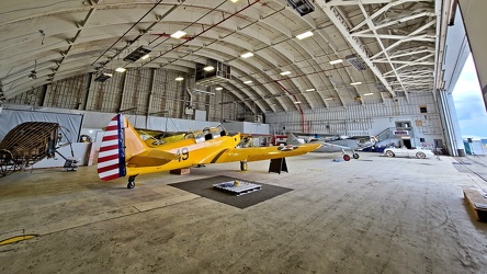
Hangar at Hagerstown airport
-
Cellular tower in Smithsburg, Maryland [03]
![Cellular tower in Smithsburg, Maryland [03] (2487 visits) Cellular tower owned by American Towers, Inc. along Mapleville Road in Smithsburg, Maryland.
Ben Sc... Cellular tower in Smithsburg, Maryland [03]](../../../../../../../i/upload/2024/07/19/20240719114550-50205a85-cu_s9999x250.jpg)
-
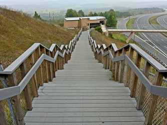
Stairs from Sideling Hill overlook
-
View of the sunset from High Rock [02]
![View of the sunset from High Rock [02] (2478 visits) View of the sunset from High Rock, a rock outcropping on South Mountain in Pen Mar, Maryland, in Was... View of the sunset from High Rock [02]](../../../../../../../i/upload/2024/07/18/20240718125557-d168466e-cu_s9999x250.jpg)
-
Elyse holds Woomy by the arm

-
View from High Rock around sunset [11]
![View from High Rock around sunset [11] (2469 visits) View from High Rock, a rock outcropping on South Mountain in Pen Mar, Maryland, in Washington County... View from High Rock around sunset [11]](../../../../../../../i/upload/2024/07/18/20240718125550-f940cb2a-cu_s9999x250.jpg)
-
Former A.C. Moore in Hagerstown, Maryland [04]
![Former A.C. Moore in Hagerstown, Maryland [04] (2459 visits) Interior of the former A.C. Moore Arts & Crafts store in the Centre at Hagerstown shopping cente... Former A.C. Moore in Hagerstown, Maryland [04]](../../../../../../../i/upload/2024/07/19/20240719104730-686b8c43-cu_s9999x250.jpg)
-
Former A.C. Moore in Hagerstown, Maryland [05]
![Former A.C. Moore in Hagerstown, Maryland [05] (2456 visits) Interior of the former A.C. Moore Arts & Crafts store in the Centre at Hagerstown shopping cente... Former A.C. Moore in Hagerstown, Maryland [05]](../../../../../../../i/upload/2024/07/19/20240719104859-16106fd3-cu_s9999x250.jpg)
-
Former A.C. Moore in Hagerstown, Maryland [06]
![Former A.C. Moore in Hagerstown, Maryland [06] (2421 visits) Interior of the former A.C. Moore Arts & Crafts store in the Centre at Hagerstown shopping cente... Former A.C. Moore in Hagerstown, Maryland [06]](../../../../../../../i/upload/2024/07/19/20240719104724-804726ef-cu_s9999x250.jpg)
-
Hilltop House, viewed from Maryland Heights [01]
![Hilltop House, viewed from Maryland Heights [01] (2404 visits) The abandoned Hilltop House hotel in Harpers Ferry, West Virginia, viewed from the Maryland Heights ... Hilltop House, viewed from Maryland Heights [01]](../../../../../../../i/upload/2024/07/17/20240717230016-2313c799-cu_s9999x250.jpg)
-
Interstate 68 cut through Sideling Hill [03]
![Interstate 68 cut through Sideling Hill [03] (2371 visits) Cut in Sideling Hill, carrying Interstate 68 between Washington and Allegany Counties in Maryland.
... Interstate 68 cut through Sideling Hill [03]](../../../../../../../i/upload/2024/07/18/20240718220111-2f9132e9-cu_s9999x250.jpg)
-
View from High Rock around sunset [10]
![View from High Rock around sunset [10] (2343 visits) View from High Rock, a rock outcropping on South Mountain in Pen Mar, Maryland, in Washington County... View from High Rock around sunset [10]](../../../../../../../i/upload/2024/07/18/20240718125546-0de77111-cu_s9999x250.jpg)
-
Former A.C. Moore in Hagerstown, Maryland [03]
![Former A.C. Moore in Hagerstown, Maryland [03] (2337 visits) Interior of the former A.C. Moore Arts & Crafts store in the Centre at Hagerstown shopping cente... Former A.C. Moore in Hagerstown, Maryland [03]](../../../../../../../i/upload/2024/07/19/20240719104735-6744ff7b-cu_s9999x250.jpg)
-
Sideling Hill cut
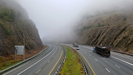
-
View from High Rock around sunset [09]
![View from High Rock around sunset [09] (2293 visits) View from High Rock, a rock outcropping on South Mountain in Pen Mar, Maryland, in Washington County... View from High Rock around sunset [09]](../../../../../../../i/upload/2024/07/18/20240718125542-d5f04008-cu_s9999x250.jpg)
-
View from High Rock around sunset [03]
![View from High Rock around sunset [03] (2259 visits) View from High Rock, a rock outcropping on South Mountain in Pen Mar, Maryland, in Washington County... View from High Rock around sunset [03]](../../../../../../../i/upload/2024/07/18/20240718125422-7938edf7-cu_s9999x250.jpg)
-
Marty robot wearing a mask [02]
![Marty robot wearing a mask [02] (2257 visits) "Marty", an autonomous robot used to perform a variety of tasks, is decorated with a face ... Marty robot wearing a mask [02]](../../../../../../../i/upload/2024/07/19/20240719162002-09258239-cu_s9999x250.jpg)
-
Marty robot wearing a mask [01]
![Marty robot wearing a mask [01] (2242 visits) "Marty", an autonomous robot used to perform a variety of tasks, is decorated with a face ... Marty robot wearing a mask [01]](../../../../../../../i/upload/2024/07/19/20240719161916-6b77823d-cu_s9999x250.jpg)
-
View from High Rock around sunset [02]
![View from High Rock around sunset [02] (2238 visits) View from High Rock, a rock outcropping on South Mountain in Pen Mar, Maryland, in Washington County... View from High Rock around sunset [02]](../../../../../../../i/upload/2024/07/18/20240718125419-06cd22f4-cu_s9999x250.jpg)
-
View from High Rock around sunset [08]
![View from High Rock around sunset [08] (2229 visits) View from High Rock, a rock outcropping on South Mountain in Pen Mar, Maryland, in Washington County... View from High Rock around sunset [08]](../../../../../../../i/upload/2024/07/18/20240718125539-68d743dd-cu_s9999x250.jpg)
-
Potomac River from US 340 bridge [05]
![Potomac River from US 340 bridge [05] (2223 visits) The Potomac River, viewed from the US 340 bridge between Maryland and Virginia.
Ben Schumin is a pr... Potomac River from US 340 bridge [05]](../../../../../../../i/upload/2024/07/19/20240719103412-5b42c5b9-cu_s9999x250.jpg)
-
Potomac River from US 340 bridge [04]
![Potomac River from US 340 bridge [04] (2203 visits) The Potomac River, viewed from the US 340 bridge between Maryland and Virginia.
Ben Schumin is a pr... Potomac River from US 340 bridge [04]](../../../../../../../i/upload/2024/07/19/20240719103405-18d26a8b-cu_s9999x250.jpg)
-
Rocks in the Potomac River [01]
![Rocks in the Potomac River [01] (2147 visits) Rocks in the Potomac River near Harpers Ferry. Viewed from the US 340 bridge.
Ben Schumin is a pro... Rocks in the Potomac River [01]](../../../../../../../i/upload/2024/07/19/20240719103333-6083493b-cu_s9999x250.jpg)
-
Former A.C. Moore in Hagerstown, Maryland [09]
![Former A.C. Moore in Hagerstown, Maryland [09] (2145 visits) Interior of the former A.C. Moore Arts & Crafts store in the Centre at Hagerstown shopping cente... Former A.C. Moore in Hagerstown, Maryland [09]](../../../../../../../i/upload/2024/07/19/20240719104714-67879769-cu_s9999x250.jpg)
-
Potomac River from US 340 bridge [03]
![Potomac River from US 340 bridge [03] (2140 visits) The Potomac River, viewed from the US 340 bridge between Maryland and Virginia.
Ben Schumin is a pr... Potomac River from US 340 bridge [03]](../../../../../../../i/upload/2024/07/19/20240719103359-b66380e8-cu_s9999x250.jpg)
-
View across Potomac River
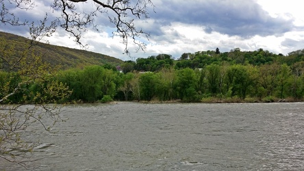
-
Drainage pipe
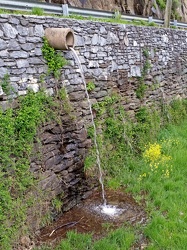
-
Rocks in the Potomac River [05]
![Rocks in the Potomac River [05] (2107 visits) Rocks in the Potomac River near Harpers Ferry. Viewed from the US 340 bridge.
Ben Schumin is a pro... Rocks in the Potomac River [05]](../../../../../../../i/upload/2024/07/19/20240719103353-ea395458-cu_s9999x250.jpg)
-
Rocks in the Potomac River [04]
![Rocks in the Potomac River [04] (2100 visits) Rocks in the Potomac River near Harpers Ferry. Viewed from the US 340 bridge.
Ben Schumin is a pro... Rocks in the Potomac River [04]](../../../../../../../i/upload/2024/07/19/20240719103348-1a3aef78-cu_s9999x250.jpg)
-
Cushwa Brewing Company

-
Former A.C. Moore in Hagerstown, Maryland [07]
![Former A.C. Moore in Hagerstown, Maryland [07] (2077 visits) Interior of the former A.C. Moore Arts & Crafts store in the Centre at Hagerstown shopping cente... Former A.C. Moore in Hagerstown, Maryland [07]](../../../../../../../i/upload/2024/07/19/20240719104719-a568bdb2-cu_s9999x250.jpg)
-
Rocks in the Potomac River [02]
![Rocks in the Potomac River [02] (2074 visits) Rocks in the Potomac River near Harpers Ferry. Viewed from the US 340 bridge.
Ben Schumin is a pro... Rocks in the Potomac River [02]](../../../../../../../i/upload/2024/07/19/20240719103338-04e1c1e1-cu_s9999x250.jpg)
-
Rocks in the Potomac River [03]
![Rocks in the Potomac River [03] (2067 visits) Rocks in the Potomac River near Harpers Ferry. Viewed from the US 340 bridge.
Ben Schumin is a pro... Rocks in the Potomac River [03]](../../../../../../../i/upload/2024/07/19/20240719103343-404e77e5-cu_s9999x250.jpg)
-
Hagerstown Reservoir
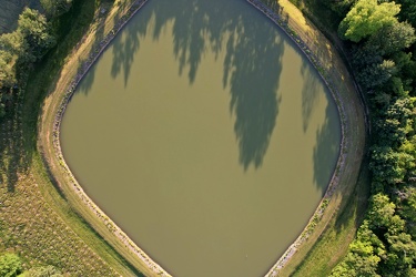
-
Gallon jugs of Turkey Hill milk

-
Former A.C. Moore in Hagerstown, Maryland [08]
![Former A.C. Moore in Hagerstown, Maryland [08] (2000 visits) Interior of the former A.C. Moore Arts & Crafts store in the Centre at Hagerstown shopping cente... Former A.C. Moore in Hagerstown, Maryland [08]](../../../../../../../i/upload/2024/07/19/20240719104854-97e9ac50-cu_s9999x250.jpg)