-
Garden State Parkway milepost 10 southbound [02]
![Garden State Parkway milepost 10 southbound [02] (593 visits) Sign assembly for milepost 10 southbound on the Garden State Parkway in Middle Township, New Jersey.... Garden State Parkway milepost 10 southbound [02]](../../i/upload/2025/01/09/20250109192436-7167312f-cu_s9999x250.jpg)
-
Garden State Parkway milepost 10 southbound [01]
![Garden State Parkway milepost 10 southbound [01] (605 visits) Sign assembly for milepost 10 southbound on the Garden State Parkway in Middle Township, New Jersey.... Garden State Parkway milepost 10 southbound [01]](../../i/upload/2025/01/09/20250109192431-f1398b04-cu_s9999x250.jpg)
-
Aerial view of Myrtle Beach, South Carolina [04]
![Aerial view of Myrtle Beach, South Carolina [04] (611 visits) Aerial view of Myrtle Beach, South Carolina. This photo depicts the coastline, facing approximately... Aerial view of Myrtle Beach, South Carolina [04]](../../i/upload/2025/01/16/20250116011543-c0352f82-cu_s9999x250.jpg)
-
Aerial view of Myrtle Beach, South Carolina [05]
![Aerial view of Myrtle Beach, South Carolina [05] (630 visits) Aerial view of Myrtle Beach, South Carolina. This photo depicts the coastline, facing approximately... Aerial view of Myrtle Beach, South Carolina [05]](../../i/upload/2025/01/16/20250116011549-fb2ac6b0-cu_s9999x250.jpg)
-
Aerial view of Myrtle Beach, South Carolina [10]
![Aerial view of Myrtle Beach, South Carolina [10] (646 visits) Aerial view of Myrtle Beach, South Carolina. This photo depicts the coastline, facing approximately... Aerial view of Myrtle Beach, South Carolina [10]](../../i/upload/2025/01/16/20250116011622-c227f7d2-cu_s9999x250.jpg)
-
Aerial view of Myrtle Beach, South Carolina [08]
![Aerial view of Myrtle Beach, South Carolina [08] (663 visits) Aerial view of Myrtle Beach, South Carolina. This photo depicts the coastline, facing approximately... Aerial view of Myrtle Beach, South Carolina [08]](../../i/upload/2025/01/16/20250116011610-80555640-cu_s9999x250.jpg)
-
Aerial view of Myrtle Beach, South Carolina [06]
![Aerial view of Myrtle Beach, South Carolina [06] (665 visits) Aerial view of Myrtle Beach, South Carolina. This photo depicts the coastline, facing approximately... Aerial view of Myrtle Beach, South Carolina [06]](../../i/upload/2025/01/16/20250116011556-58eeb392-cu_s9999x250.jpg)
-
Aerial view of Myrtle Beach, South Carolina [14]
![Aerial view of Myrtle Beach, South Carolina [14] (670 visits) Aerial view of Myrtle Beach, South Carolina. This photo depicts Pier 14, one of several fishing pie... Aerial view of Myrtle Beach, South Carolina [14]](../../i/upload/2025/01/16/20250116011649-2b82761b-cu_s9999x250.jpg)
-
Aerial view of Myrtle Beach, South Carolina [09]
![Aerial view of Myrtle Beach, South Carolina [09] (674 visits) Aerial view of Myrtle Beach, South Carolina. This photo depicts the coastline, facing approximately... Aerial view of Myrtle Beach, South Carolina [09]](../../i/upload/2025/01/16/20250116011616-86a3a1ed-cu_s9999x250.jpg)
-
Aerial view of Myrtle Beach, South Carolina [12]
![Aerial view of Myrtle Beach, South Carolina [12] (675 visits) Aerial view of Myrtle Beach, South Carolina. This photo depicts Pier 14, one of several fishing pie... Aerial view of Myrtle Beach, South Carolina [12]](../../i/upload/2025/01/16/20250116011635-e2f59869-cu_s9999x250.jpg)
-
Aerial view of Myrtle Beach, South Carolina [15]
![Aerial view of Myrtle Beach, South Carolina [15] (689 visits) Aerial view of Myrtle Beach, South Carolina. This photo depicts the city from approximately 16th Av... Aerial view of Myrtle Beach, South Carolina [15]](../../i/upload/2025/01/16/20250116011655-ed58c149-cu_s9999x250.jpg)
-
Aerial view of Myrtle Beach, South Carolina [16]
![Aerial view of Myrtle Beach, South Carolina [16] (698 visits) Aerial view of Myrtle Beach, South Carolina. This photo depicts the city from approximately 16th Av... Aerial view of Myrtle Beach, South Carolina [16]](../../i/upload/2025/01/16/20250116011701-1e30b28a-cu_s9999x250.jpg)
-
Aerial view of Myrtle Beach, South Carolina [13]
![Aerial view of Myrtle Beach, South Carolina [13] (699 visits) Aerial view of Myrtle Beach, South Carolina. This photo depicts Pier 14, one of several fishing pie... Aerial view of Myrtle Beach, South Carolina [13]](../../i/upload/2025/01/16/20250116011642-eaad0007-cu_s9999x250.jpg)
-
Aerial view of Myrtle Beach, South Carolina [11]
![Aerial view of Myrtle Beach, South Carolina [11] (712 visits) Aerial view of Myrtle Beach, South Carolina. This photo depicts Pier 14, one of several fishing pie... Aerial view of Myrtle Beach, South Carolina [11]](../../i/upload/2025/01/16/20250116011628-3f5529d7-cu_s9999x250.jpg)
-
Aerial view of Myrtle Beach, South Carolina [17]
![Aerial view of Myrtle Beach, South Carolina [17] (716 visits) Aerial view of Myrtle Beach, South Carolina. This photo depicts a vacant lot between 17th and 18th ... Aerial view of Myrtle Beach, South Carolina [17]](../../i/upload/2025/01/16/20250116011708-700a2aeb-cu_s9999x250.jpg)
-
Aerial view of Myrtle Beach, South Carolina [01]
![Aerial view of Myrtle Beach, South Carolina [01] (730 visits) Aerial view of Myrtle Beach, South Carolina. This photo depicts a surface parking lot between Ocean... Aerial view of Myrtle Beach, South Carolina [01]](../../i/upload/2025/01/16/20250116011517-f8bb6ab8-cu_s9999x250.jpg)
-
Holiday Inn Charleston-Riverview [10]
![Holiday Inn Charleston-Riverview [10] (779 visits) The Holiday Inn Charleston-Riverview, a 14-story hotel located between the two sides of US 17 across... Holiday Inn Charleston-Riverview [10]](../../i/upload/2025/01/13/20250113161207-77059b16-cu_s9999x250.jpg)
-
Aerial view of Myrtle Beach, South Carolina [18]
![Aerial view of Myrtle Beach, South Carolina [18] (802 visits) Aerial view of Myrtle Beach, South Carolina. This photo depicts the Hilton Grand Vacations facility... Aerial view of Myrtle Beach, South Carolina [18]](../../i/upload/2025/01/16/20250116011716-7718fc67-cu_s9999x250.jpg)
-
Reassurance markers for Interstate 95 business loop and US 301
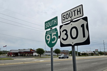
-
Aerial view of Myrtle Beach, South Carolina [07]
![Aerial view of Myrtle Beach, South Carolina [07] (815 visits) Aerial view of Myrtle Beach, South Carolina. This photo depicts the coastline, facing approximately... Aerial view of Myrtle Beach, South Carolina [07]](../../i/upload/2025/01/16/20250116011602-0271fcdd-cu_s9999x250.jpg)
-
Aerial view of Myrtle Beach, South Carolina [02]
![Aerial view of Myrtle Beach, South Carolina [02] (819 visits) Aerial view of Myrtle Beach, South Carolina. This photo depicts the city from approximately 16th Av... Aerial view of Myrtle Beach, South Carolina [02]](../../i/upload/2025/01/16/20250116011527-f000c002-cu_s9999x250.jpg)
-
Aerial view of Myrtle Beach, South Carolina [03]
![Aerial view of Myrtle Beach, South Carolina [03] (835 visits) Aerial view of Myrtle Beach, South Carolina. This photo depicts the Hilton Grand Vacations facility... Aerial view of Myrtle Beach, South Carolina [03]](../../i/upload/2025/01/16/20250116011535-e4909d01-cu_s9999x250.jpg)
-
View from above the Port of Charleston
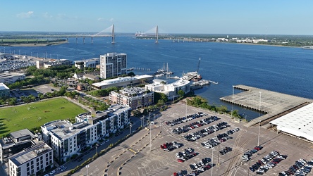
-
Aerial view of Myrtle Beach, South Carolina [19]
![Aerial view of Myrtle Beach, South Carolina [19] (880 visits) Aerial view of Myrtle Beach, South Carolina. This photo depicts the Hilton Grand Vacations facility... Aerial view of Myrtle Beach, South Carolina [19]](../../i/upload/2025/01/16/20250116011723-729e4cea-cu_s9999x250.jpg)
-
Aerial view of Myrtle Beach, South Carolina [20]
![Aerial view of Myrtle Beach, South Carolina [20] (935 visits) Aerial view of Myrtle Beach, South Carolina. This photo depicts the city from approximately 16th Av... Aerial view of Myrtle Beach, South Carolina [20]](../../i/upload/2025/01/16/20250116011730-cd564b26-cu_s9999x250.jpg)
-
Toilet Bowl Building
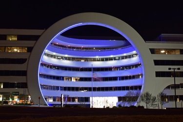
-
Honda HR-V in a ferry boarding lane
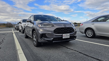
-
Interstate 264 after Midtown Tunnel [02]
![Interstate 264 after Midtown Tunnel [02] (1120 visits) Interstate 264 westbound in Portsmouth, Virginia, just after traffic exits the Midtown Tunnel.
More... Interstate 264 after Midtown Tunnel [02]](../../i/upload/2024/07/19/20240719101945-e18e6752-cu_s9999x250.jpg)
-
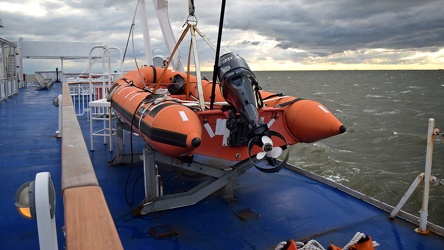
Rescue boat on the MV New Jersey
-
Sunset over the Delaware Bay [04]
![Sunset over the Delaware Bay [04] (1220 visits) Sunset over the Delaware Bay, as viewed from the MV New Jersey, a vessel operating the Cape May-Lewe... Sunset over the Delaware Bay [04]](../../i/upload/2025/01/10/20250110223500-173ccd0f-cu_s9999x250.jpg)
-
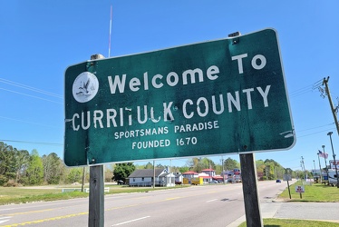
Welcome to Currituck County
-
Sunset over the Delaware Bay [03]
![Sunset over the Delaware Bay [03] (1259 visits) Sunset over the Delaware Bay, as viewed from the MV New Jersey, a vessel operating the Cape May-Lewe... Sunset over the Delaware Bay [03]](../../i/upload/2025/01/10/20250110223358-aafe77b6-cu_s9999x250.jpg)
-
Interstate 85 and US 460 reassurance markers [02]
![Interstate 85 and US 460 reassurance markers [02] (1265 visits) Reassurance markers for Interstate 85 southbound and US 460 westbound, about three miles from the sp... Interstate 85 and US 460 reassurance markers [02]](../../i/upload/2024/07/20/20240720092125-c916fd33-cu_s9999x250.jpg)
-
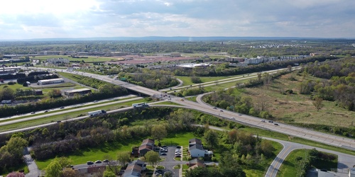
Intersection of US 340 and West Virginia Routes 9 and 51
-
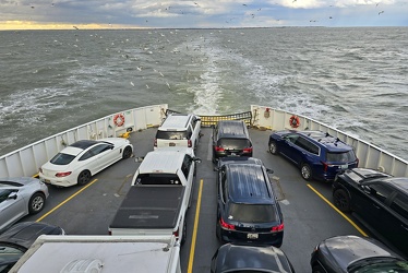
Fantail of the MV New Jersey
-
Interstate 85 and US 460 reassurance markers [03]
![Interstate 85 and US 460 reassurance markers [03] (1289 visits) Reassurance markers for Interstate 85 southbound and US 460 westbound, about three miles from the sp... Interstate 85 and US 460 reassurance markers [03]](../../i/upload/2024/07/20/20240720092209-42a70fc2-cu_s9999x250.jpg)
-
Sunset over the Delaware Bay [02]
![Sunset over the Delaware Bay [02] (1304 visits) Sunset over the Delaware Bay, as viewed from the MV New Jersey, a vessel operating the Cape May-Lewe... Sunset over the Delaware Bay [02]](../../i/upload/2025/01/10/20250110223300-3c549975-cu_s9999x250.jpg)
-
Eastern terminus of US 60 [01]
![Eastern terminus of US 60 [01] (1323 visits) "END" signage on a lamppost at the eastern terminus of US 60 in Virginia Beach, Virginia. ... Eastern terminus of US 60 [01]](../../i/upload/2024/07/19/20240719101721-73bf3c40-cu_s9999x250.jpg)
-
Sunset over the Delaware Bay [05]
![Sunset over the Delaware Bay [05] (1333 visits) Sunset over the Delaware Bay, as viewed from the MV New Jersey, a vessel operating the Cape May-Lewe... Sunset over the Delaware Bay [05]](../../i/upload/2025/01/10/20250110223536-a69b79d5-cu_s9999x250.jpg)
-
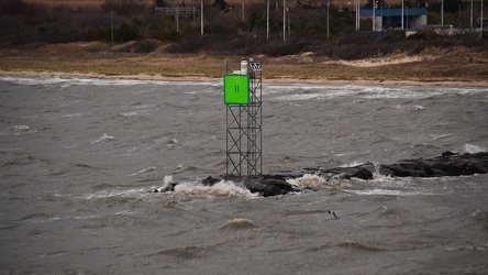
Navigational beacon on Cape May-Lewes Ferry route
-
Sunset over the Delaware Bay [01]
![Sunset over the Delaware Bay [01] (1366 visits) Sunset over the Delaware Bay, as viewed from the MV New Jersey, a vessel operating the Cape May-Lewe... Sunset over the Delaware Bay [01]](../../i/upload/2025/01/10/20250110223154-eadac849-cu_s9999x250.jpg)
-
Eastern terminus of US 60 [02]
![Eastern terminus of US 60 [02] (1371 visits) "END" signage on a lamppost at the eastern terminus of US 60 in Virginia Beach, Virginia. ... Eastern terminus of US 60 [02]](../../i/upload/2024/07/19/20240719101751-9221fd2b-cu_s9999x250.jpg)
-
Signage for Exit 49 on Interstate 295 [02]
![Signage for Exit 49 on Interstate 295 [02] (1398 visits) Overhead sign for Exit 49 (US 33) on Interstate 295 eastbound in Glen Allen, Virginia.
More at The ... Signage for Exit 49 on Interstate 295 [02]](../../i/upload/2024/07/19/20240719092939-b220cdd7-cu_s9999x250.jpg)
-
Sea gull over the Delaware Bay

-
Interstate 264 after Midtown Tunnel [01]
![Interstate 264 after Midtown Tunnel [01] (1468 visits) Interstate 264 westbound in Portsmouth, Virginia, just after traffic exits the Midtown Tunnel.
More... Interstate 264 after Midtown Tunnel [01]](../../i/upload/2024/07/19/20240719101939-87dbaa40-cu_s9999x250.jpg)
-
Signage for Exit 49 on Interstate 295 [06]
![Signage for Exit 49 on Interstate 295 [06] (1477 visits) Overhead sign for Exit 49 (US 33) on Interstate 295 eastbound in Glen Allen, Virginia.
More at The ... Signage for Exit 49 on Interstate 295 [06]](../../i/upload/2024/07/19/20240719092924-a67ffbc2-cu_s9999x250.jpg)
-
Road flare on Maine Avenue SW [02]
![Road flare on Maine Avenue SW [02] (1496 visits) A road flare burns in the rightmost lane of Maine Avenue SW during the National Cherry Blossom Festi... Road flare on Maine Avenue SW [02]](../../i/upload/2024/07/17/20240717225359-e216a1f4-cu_s9999x250.jpg)
-
Signage for Exit 49 on Interstate 295 [05]
![Signage for Exit 49 on Interstate 295 [05] (1504 visits) Overhead sign for Exit 49 (US 33) on Interstate 295 eastbound in Glen Allen, Virginia.
More at The ... Signage for Exit 49 on Interstate 295 [05]](../../i/upload/2024/07/19/20240719092857-ab204ec0-cu_s9999x250.jpg)
-
Road flare on Maine Avenue SW [01]
![Road flare on Maine Avenue SW [01] (1507 visits) A road flare burns in the rightmost lane of Maine Avenue SW during the National Cherry Blossom Festi... Road flare on Maine Avenue SW [01]](../../i/upload/2024/07/17/20240717225356-2886a729-cu_s9999x250.jpg)
-
Mileage sign on US 1 near Fredericksburg [01]
![Mileage sign on US 1 near Fredericksburg [01] (1521 visits) Mileage sign on southbound US 1 near Fredericksburg, Virginia, giving distances to Thornburg, Ashlan... Mileage sign on US 1 near Fredericksburg [01]](../../i/upload/2024/07/19/20240719093650-38b7882f-cu_s9999x250.jpg)
-
Aerial view of Glen Burnie, Maryland [01]
![Aerial view of Glen Burnie, Maryland [01] (1574 visits) Aerial view of Glen Burnie, Maryland, taken near Marley Station Mall.
Ben Schumin is a professional... Aerial view of Glen Burnie, Maryland [01]](../../i/upload/2024/07/19/20240719162345-6a1470e1-cu_s9999x250.jpg)
-
Interstate 85 and US 460 reassurance markers [01]
![Interstate 85 and US 460 reassurance markers [01] (1589 visits) Reassurance markers for Interstate 85 southbound and US 460 westbound, about three miles from the sp... Interstate 85 and US 460 reassurance markers [01]](../../i/upload/2024/07/20/20240720092044-46d8955e-cu_s9999x250.jpg)
-
Purple streetlight at Jennings Chapel Road and Route 97 [02]
![Purple streetlight at Jennings Chapel Road and Route 97 [02] (1630 visits) Streetlight at the intersection of Jennings Chapel Road and Maryland Route 97 in Howard County, Mary... Purple streetlight at Jennings Chapel Road and Route 97 [02]](../../i/upload/2024/07/20/20240720091726-02de12bb-cu_s9999x250.jpg)
-
Goochland rest area, westbound [02]
![Goochland rest area, westbound [02] (1669 visits) Restroom building at the Goochland Safety Rest Area on Interstate 64 westbound in Manakin-Sabot, Vir... Goochland rest area, westbound [02]](../../i/upload/2024/07/19/20240719093125-c06aafb1-cu_s9999x250.jpg)
-
Aerial view of Glen Burnie, Maryland [02]
![Aerial view of Glen Burnie, Maryland [02] (1677 visits) Aerial view of Glen Burnie, Maryland, taken near Marley Station Mall.
Ben Schumin is a professional... Aerial view of Glen Burnie, Maryland [02]](../../i/upload/2024/07/19/20240719162350-5a3dcd0c-cu_s9999x250.jpg)
-
Goochland rest area, westbound [01]
![Goochland rest area, westbound [01] (1696 visits) Restroom building at the Goochland Safety Rest Area on Interstate 64 westbound in Manakin-Sabot, Vir... Goochland rest area, westbound [01]](../../i/upload/2024/07/19/20240719093130-dbdf3bb4-cu_s9999x250.jpg)
-
Goochland rest area, westbound [03]
![Goochland rest area, westbound [03] (1714 visits) Restroom building at the Goochland Safety Rest Area on Interstate 64 westbound in Manakin-Sabot, Vir... Goochland rest area, westbound [03]](../../i/upload/2024/07/19/20240719093121-0aeca88a-cu_s9999x250.jpg)
-
Purple streetlight at Jennings Chapel Road and Route 97 [03]
![Purple streetlight at Jennings Chapel Road and Route 97 [03] (1756 visits) Streetlight at the intersection of Jennings Chapel Road and Maryland Route 97 in Howard County, Mary... Purple streetlight at Jennings Chapel Road and Route 97 [03]](../../i/upload/2024/07/20/20240720091742-8c826bcc-cu_s9999x250.jpg)
-
Purple streetlight at Jennings Chapel Road and Route 97 [05]
![Purple streetlight at Jennings Chapel Road and Route 97 [05] (1774 visits) Streetlight at the intersection of Jennings Chapel Road and Maryland Route 97 in Howard County, Mary... Purple streetlight at Jennings Chapel Road and Route 97 [05]](../../i/upload/2024/07/20/20240720091736-aa316a72-cu_s9999x250.jpg)
-
Interchange between US 17 and SC 703 [02]
![Interchange between US 17 and SC 703 [02] (1777 visits) Interchange between US Route 17 and South Carolina Highway 703 in Mount Pleasant, South Carolina, ju... Interchange between US 17 and SC 703 [02]](../../i/upload/2025/01/14/20250114144626-3f25bd82-cu_s9999x250.jpg)
-
Interchange between US 17 and SC 703 [01]
![Interchange between US 17 and SC 703 [01] (1830 visits) Interchange between US Route 17 and South Carolina Highway 703 in Mount Pleasant, South Carolina, ju... Interchange between US 17 and SC 703 [01]](../../i/upload/2025/01/14/20250114144620-bfc59b91-cu_s9999x250.jpg)
-
Purple streetlight at Jennings Chapel Road and Route 97 [06]
![Purple streetlight at Jennings Chapel Road and Route 97 [06] (1839 visits) Streetlight at the intersection of Jennings Chapel Road and Maryland Route 97 in Howard County, Mary... Purple streetlight at Jennings Chapel Road and Route 97 [06]](../../i/upload/2024/07/20/20240720091731-6756ae29-cu_s9999x250.jpg)
-
Purple streetlight at Jennings Chapel Road and Route 97 [04]
![Purple streetlight at Jennings Chapel Road and Route 97 [04] (1843 visits) Streetlight at the intersection of Jennings Chapel Road and Maryland Route 97 in Howard County, Mary... Purple streetlight at Jennings Chapel Road and Route 97 [04]](../../i/upload/2024/07/20/20240720091715-4db229fd-cu_s9999x250.jpg)
-
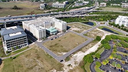
Undeveloped land in Mount Pleasant
-
Holiday Inn Charleston-Riverview [02]
![Holiday Inn Charleston-Riverview [02] (1869 visits) The Holiday Inn Charleston-Riverview, a 14-story hotel located between the two sides of US 17 across... Holiday Inn Charleston-Riverview [02]](../../i/upload/2025/01/13/20250113161036-e6190fc3-cu_s9999x250.jpg)
-
Holiday Inn Charleston-Riverview [05]
![Holiday Inn Charleston-Riverview [05] (1884 visits) The Holiday Inn Charleston-Riverview, a 14-story hotel located between the two sides of US 17 across... Holiday Inn Charleston-Riverview [05]](../../i/upload/2025/01/13/20250113161108-548ee18e-cu_s9999x250.jpg)
-
Holiday Inn Charleston-Riverview [07]
![Holiday Inn Charleston-Riverview [07] (1897 visits) The Holiday Inn Charleston-Riverview, a 14-story hotel located between the two sides of US 17 across... Holiday Inn Charleston-Riverview [07]](../../i/upload/2025/01/13/20250113161136-79ac2225-cu_s9999x250.jpg)
-
Holiday Inn Charleston-Riverview [06]
![Holiday Inn Charleston-Riverview [06] (1919 visits) The Holiday Inn Charleston-Riverview, a 14-story hotel located between the two sides of US 17 across... Holiday Inn Charleston-Riverview [06]](../../i/upload/2025/01/13/20250113161122-eb862ee6-cu_s9999x250.jpg)
-
Holiday Inn Charleston-Riverview [08]
![Holiday Inn Charleston-Riverview [08] (1922 visits) The Holiday Inn Charleston-Riverview, a 14-story hotel located between the two sides of US 17 across... Holiday Inn Charleston-Riverview [08]](../../i/upload/2025/01/13/20250113161143-a756fbce-cu_s9999x250.jpg)
-
Holiday Inn Charleston-Riverview [04]
![Holiday Inn Charleston-Riverview [04] (1923 visits) The Holiday Inn Charleston-Riverview, a 14-story hotel located between the two sides of US 17 across... Holiday Inn Charleston-Riverview [04]](../../i/upload/2025/01/13/20250113161101-968baa6c-cu_s9999x250.jpg)
-
Holiday Inn Charleston-Riverview [03]
![Holiday Inn Charleston-Riverview [03] (1947 visits) The Holiday Inn Charleston-Riverview, a 14-story hotel located between the two sides of US 17 across... Holiday Inn Charleston-Riverview [03]](../../i/upload/2025/01/13/20250113161047-d90cb4c4-cu_s9999x250.jpg)
-
Ashley River Memorial Bridge [01]
![Ashley River Memorial Bridge [01] (1957 visits) The Ashley River Memorial Bridge, a drawbridge that carries southbound US 17 across the Ashley River... Ashley River Memorial Bridge [01]](../../i/upload/2025/01/13/20250113131052-6a290a68-cu_s9999x250.jpg)
-
Robert B. Scarborough Bridge [01]
![Robert B. Scarborough Bridge [01] (1958 visits) The Robert B. Scarborough Bridge, which carries South Carolina Highway 30 (James Island Expressway) ... Robert B. Scarborough Bridge [01]](../../i/upload/2025/01/13/20250113163905-15e6b872-cu_s9999x250.jpg)
-
US 17 bridges over the Ashley River [01]
![US 17 bridges over the Ashley River [01] (1965 visits) The Ashley River Memorial Bridge (left) and the T. Allen Legare Bridge (right), two drawbridges whic... US 17 bridges over the Ashley River [01]](../../i/upload/2025/01/13/20250113131022-ab9773de-cu_s9999x250.jpg)
-
Ashley River Memorial Bridge [03]
![Ashley River Memorial Bridge [03] (1965 visits) The Ashley River Memorial Bridge, a drawbridge that carries southbound US 17 across the Ashley River... Ashley River Memorial Bridge [03]](../../i/upload/2025/01/13/20250113131114-a540a428-cu_s9999x250.jpg)
-
US 17 bridges over the Ashley River [02]
![US 17 bridges over the Ashley River [02] (1970 visits) The T. Allen Legare Bridge (left) and the Ashley River Memorial Bridge (right), two drawbridges whic... US 17 bridges over the Ashley River [02]](../../i/upload/2025/01/13/20250113131029-e37a9c74-cu_s9999x250.jpg)
-
T. Allen Legare Bridge [02]
![T. Allen Legare Bridge [02] (1971 visits) The T. Allen Legare Bridge, a drawbridge that carries northbound US 17 across the Ashley River in Ch... T. Allen Legare Bridge [02]](../../i/upload/2025/01/13/20250113131136-219b63e5-cu_s9999x250.jpg)
-
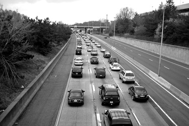
Westbound Interstate 66 near Nutley Street
-
Ashley River Memorial Bridge [04]
![Ashley River Memorial Bridge [04] (1983 visits) The Ashley River Memorial Bridge, a drawbridge that carries southbound US 17 across the Ashley River... Ashley River Memorial Bridge [04]](../../i/upload/2025/01/13/20250113131121-529aadcc-cu_s9999x250.jpg)
-
Robert B. Scarborough Bridge [02]
![Robert B. Scarborough Bridge [02] (1988 visits) The Robert B. Scarborough Bridge, which carries South Carolina Highway 30 (James Island Expressway) ... Robert B. Scarborough Bridge [02]](../../i/upload/2025/01/13/20250113163918-5b7c57a3-cu_s9999x250.jpg)