-
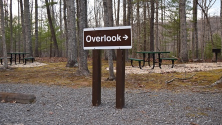
Sign for Gathright Dam overlook trail
-
Blaze on Gathright Dam overlook trail [01]
![Blaze on Gathright Dam overlook trail [01] (468 visits) Trail blaze on a tree along the Gathright Dam overlook trail in Alleghany County, Virginia.
More at... Blaze on Gathright Dam overlook trail [01]](../../i/upload/2025/01/02/20250102221138-452681e6-cu_s9999x250.jpg)
-
Blaze on Gathright Dam overlook trail [02]
![Blaze on Gathright Dam overlook trail [02] (472 visits) Trail blaze on a tree along the Gathright Dam overlook trail in Alleghany County, Virginia.
More at... Blaze on Gathright Dam overlook trail [02]](../../i/upload/2025/01/02/20250102221143-6e07712f-cu_s9999x250.jpg)
-
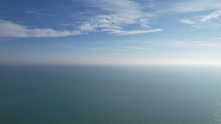
Aerial view over Lake Michigan, facing east
-
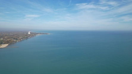
Aerial view of northern Evanston and Wilmette
-
Clark Street Beach [01]
![Clark Street Beach [01] (695 visits) Overhead view of Clark Street Beach, a public beach along the shore of Lake Michigan in Evanston, Il... Clark Street Beach [01]](../../i/upload/2024/11/09/20241109111108-ba883fe6-cu_s9999x250.jpg)
-
Clark Street Beach [02]
![Clark Street Beach [02] (698 visits) Clark Street Beach, a public beach along the shore of Lake Michigan in Evanston, Illinois.
More at ... Clark Street Beach [02]](../../i/upload/2024/11/09/20241109111115-aca79503-cu_s9999x250.jpg)
-
View from Sounding Knob Fire Tower [10]
![View from Sounding Knob Fire Tower [10] (711 visits) The view from Sounding Knob Fire Tower, a restored fire watch tower on Jack Mountain near Monterey, ... View from Sounding Knob Fire Tower [10]](../../i/upload/2024/12/31/20241231010300-69dbc3a3-cu_s9999x250.jpg)
-
View from Sounding Knob Fire Tower [11]
![View from Sounding Knob Fire Tower [11] (711 visits) The view from Sounding Knob Fire Tower, a restored fire watch tower on Jack Mountain near Monterey, ... View from Sounding Knob Fire Tower [11]](../../i/upload/2024/12/31/20241231010304-2a3f3c22-cu_s9999x250.jpg)
-
View from Sounding Knob Fire Tower [15]
![View from Sounding Knob Fire Tower [15] (725 visits) The view from Sounding Knob Fire Tower, a restored fire watch tower on Jack Mountain near Monterey, ... View from Sounding Knob Fire Tower [15]](../../i/upload/2024/12/31/20241231010323-27db6902-cu_s9999x250.jpg)
-
View from Sounding Knob Fire Tower [14]
![View from Sounding Knob Fire Tower [14] (729 visits) The view from Sounding Knob Fire Tower, a restored fire watch tower on Jack Mountain near Monterey, ... View from Sounding Knob Fire Tower [14]](../../i/upload/2024/12/31/20241231010319-c5fd58fd-cu_s9999x250.jpg)
-
View from Sounding Knob Fire Tower [13]
![View from Sounding Knob Fire Tower [13] (763 visits) The view from Sounding Knob Fire Tower, a restored fire watch tower on Jack Mountain near Monterey, ... View from Sounding Knob Fire Tower [13]](../../i/upload/2024/12/31/20241231010313-399c7c4e-cu_s9999x250.jpg)
-
View from Sounding Knob Fire Tower [11]
![View from Sounding Knob Fire Tower [11] (802 visits) The view from Sounding Knob Fire Tower, a restored fire watch tower on Jack Mountain near Monterey, ... View from Sounding Knob Fire Tower [11]](../../i/upload/2024/12/31/20241231010309-138441d9-cu_s9999x250.jpg)
-
Aerial view from Clark Street Beach, facing south [02]
![Aerial view from Clark Street Beach, facing south [02] (815 visits) Aerial view over Lake Michigan from near Clark Street Beach in Evanston, Illinois. View facing appr... Aerial view from Clark Street Beach, facing south [02]](../../i/upload/2024/11/09/20241109111017-9276cd78-cu_s9999x250.jpg)
-
Aerial view from Clark Street Beach, facing south [05]
![Aerial view from Clark Street Beach, facing south [05] (828 visits) Aerial view over Lake Michigan from near Clark Street Beach in Evanston, Illinois. View facing appr... Aerial view from Clark Street Beach, facing south [05]](../../i/upload/2024/11/09/20241109111030-e05630ba-cu_s9999x250.jpg)
-
Aerial view from Clark Street Beach, facing south [01]
![Aerial view from Clark Street Beach, facing south [01] (848 visits) Aerial view over Lake Michigan from near Clark Street Beach in Evanston, Illinois. View facing appr... Aerial view from Clark Street Beach, facing south [01]](../../i/upload/2024/11/09/20241109111014-d364cdbf-cu_s9999x250.jpg)
-
Myersville, Maryland and vicinity [02]
![Myersville, Maryland and vicinity [02] (903 visits) Myersville, Maryland and the immediate surrounding area, viewed from above the Myersville Volunteer ... Myersville, Maryland and vicinity [02]](../../i/upload/2024/07/19/20240719114533-7da9ff27-cu_s9999x250.jpg)
-
Smithsburg, Maryland and vicinity [01]
![Smithsburg, Maryland and vicinity [01] (980 visits) Aerial view of Smithsburg, Maryland and vicinity.
Ben Schumin is a professional photographer who ca... Smithsburg, Maryland and vicinity [01]](../../i/upload/2024/07/19/20240719114610-c1a5ac24-cu_s9999x250.jpg)
-
Myersville, Maryland and vicinity [01]
![Myersville, Maryland and vicinity [01] (986 visits) Myersville, Maryland and the immediate surrounding area, viewed from above the Myersville Volunteer ... Myersville, Maryland and vicinity [01]](../../i/upload/2024/07/19/20240719114529-b09266dc-cu_s9999x250.jpg)
-
Smithsburg, Maryland and vicinity [02]
![Smithsburg, Maryland and vicinity [02] (1015 visits) Aerial view of Smithsburg, Maryland and vicinity.
Ben Schumin is a professional photographer who ca... Smithsburg, Maryland and vicinity [02]](../../i/upload/2024/07/19/20240719114614-27b7e477-cu_s9999x250.jpg)
-
Mountains near Cashtown, Pennsylvania [01]
![Mountains near Cashtown, Pennsylvania [01] (1116 visits) Aerial view of mountains near Cashtown, Pennsylvania.
Ben Schumin is a professional photographer wh... Mountains near Cashtown, Pennsylvania [01]](../../i/upload/2024/07/20/20240720151845-6b49a240-cu_s9999x250.jpg)
-
Field off of Buchanan Valley Road [01]
![Field off of Buchanan Valley Road [01] (1137 visits) Field off of Buchanan Valley Road near Cashtown, Pennsylvania.
Ben Schumin is a professional photog... Field off of Buchanan Valley Road [01]](../../i/upload/2024/07/20/20240720151904-0d791d12-cu_s9999x250.jpg)
-
Field off of Buchanan Valley Road [02]
![Field off of Buchanan Valley Road [02] (1158 visits) Field off of Buchanan Valley Road near Cashtown, Pennsylvania.
Ben Schumin is a professional photog... Field off of Buchanan Valley Road [02]](../../i/upload/2024/07/20/20240720151916-e473a17f-cu_s9999x250.jpg)
-
View from Ravens Roost overlook [01]
![View from Ravens Roost overlook [01] (1160 visits) View from Ravens Roost overlook on the Blue Ridge Parkway in Virginia.
More at The Schumin Web:
www... View from Ravens Roost overlook [01]](../../i/upload/2024/07/20/20240720111047-eedd86a4-cu_s9999x250.jpg)
-
Mountains near Cashtown, Pennsylvania [02]
![Mountains near Cashtown, Pennsylvania [02] (1171 visits) Aerial view of mountains near Cashtown, Pennsylvania.
Ben Schumin is a professional photographer wh... Mountains near Cashtown, Pennsylvania [02]](../../i/upload/2024/07/20/20240720151852-1fb730a3-cu_s9999x250.jpg)
-
View from Ravens Roost overlook [03]
![View from Ravens Roost overlook [03] (1186 visits) View from Ravens Roost overlook on the Blue Ridge Parkway in Virginia.
More at The Schumin Web:
www... View from Ravens Roost overlook [03]](../../i/upload/2024/07/20/20240720111242-329db50f-cu_s9999x250.jpg)
-
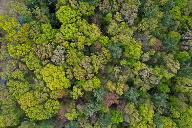
Trees near Cashtown, Pennsylvania
-
View from Ravens Roost overlook [02]
![View from Ravens Roost overlook [02] (1197 visits) View from Ravens Roost overlook on the Blue Ridge Parkway in Virginia.
More at The Schumin Web:
www... View from Ravens Roost overlook [02]](../../i/upload/2024/07/20/20240720111052-9d9ea25e-cu_s9999x250.jpg)
-
View from Shenandoah Mountain [01]
![View from Shenandoah Mountain [01] (1257 visits) View of Highland County, Virginia from Shenandoah Mountain.
Ben Schumin is a professional photograp... View from Shenandoah Mountain [01]](../../i/upload/2024/07/20/20240720093931-b1561721-cu_s9999x250.jpg)
-
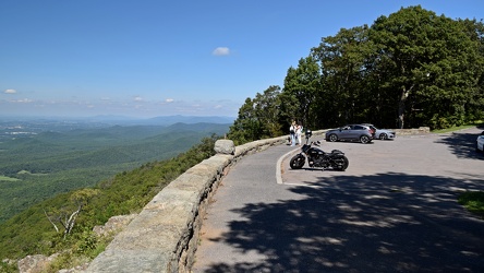
Ravens Roost overlook
-
Place where a plaque used to be at Ravens Roost overlook [02]
![Place where a plaque used to be at Ravens Roost overlook [02] (1287 visits) The place where a National Park Service plaque used to be located atop a raised portion of the retai... Place where a plaque used to be at Ravens Roost overlook [02]](../../i/upload/2024/07/20/20240720111248-a6c2e1fa-cu_s9999x250.jpg)
-
View from Shenandoah Mountain [02]
![View from Shenandoah Mountain [02] (1293 visits) View of Highland County, Virginia from Shenandoah Mountain.
Ben Schumin is a professional photograp... View from Shenandoah Mountain [02]](../../i/upload/2024/07/20/20240720094312-c9f54fe4-cu_s9999x250.jpg)
-
View from High Rock around sunset [02]
![View from High Rock around sunset [02] (1298 visits) View from High Rock, a rock outcropping on South Mountain in Pen Mar, Maryland, in Washington County... View from High Rock around sunset [02]](../../i/upload/2024/07/18/20240718125419-06cd22f4-cu_s9999x250.jpg)
-
Verona, Virginia over Mill Place Commerce Park [04]
![Verona, Virginia over Mill Place Commerce Park [04] (1306 visits) Aerial view of Verona, Virginia from above the Mill Place Commerce Park. This photo shows a hairpin... Verona, Virginia over Mill Place Commerce Park [04]](../../i/upload/2024/07/20/20240720110729-83e0c1ca-cu_s9999x250.jpg)
-
Place where a plaque used to be at Ravens Roost overlook [03]
![Place where a plaque used to be at Ravens Roost overlook [03] (1310 visits) The place where a National Park Service plaque used to be located atop a raised portion of the retai... Place where a plaque used to be at Ravens Roost overlook [03]](../../i/upload/2024/07/20/20240720111008-7c125d7a-cu_s9999x250.jpg)
-
Aerial view of downtown Crossville, Tennessee [02]
![Aerial view of downtown Crossville, Tennessee [02] (1310 visits) Aerial view of downtown Crossville, Tennessee.
More at The Schumin Web:
www.schuminweb.com/life-and... Aerial view of downtown Crossville, Tennessee [02]](../../i/upload/2024/07/20/20240720113738-e7992a54-cu_s9999x250.jpg)
-
Place where a plaque used to be at Ravens Roost overlook [01]
![Place where a plaque used to be at Ravens Roost overlook [01] (1315 visits) The place where a National Park Service plaque used to be located atop a raised portion of the retai... Place where a plaque used to be at Ravens Roost overlook [01]](../../i/upload/2024/07/20/20240720111142-228a886f-cu_s9999x250.jpg)
-
View from High Rock around sunset [03]
![View from High Rock around sunset [03] (1325 visits) View from High Rock, a rock outcropping on South Mountain in Pen Mar, Maryland, in Washington County... View from High Rock around sunset [03]](../../i/upload/2024/07/18/20240718125422-7938edf7-cu_s9999x250.jpg)
-
View from 20-Minute Cliff overlook [03]
![View from 20-Minute Cliff overlook [03] (1333 visits) View from 20-Minute Cliff, an overlook on the Blue Ridge Parkway near Vesuvius, Virginia.
Ben Schum... View from 20-Minute Cliff overlook [03]](../../i/upload/2024/07/15/20240715141705-52871955-cu_s9999x250.jpg)
-
View from Shenandoah Mountain [03]
![View from Shenandoah Mountain [03] (1334 visits) View of Highland County, Virginia from Shenandoah Mountain.
Ben Schumin is a professional photograp... View from Shenandoah Mountain [03]](../../i/upload/2024/07/20/20240720094136-fc1446fb-cu_s9999x250.jpg)
-
View from High Rock around sunset [08]
![View from High Rock around sunset [08] (1341 visits) View from High Rock, a rock outcropping on South Mountain in Pen Mar, Maryland, in Washington County... View from High Rock around sunset [08]](../../i/upload/2024/07/18/20240718125539-68d743dd-cu_s9999x250.jpg)
 The Quarry Overlook [03]
![The Quarry Overlook [03] (1355 visits) The Quarry Overlook, at milepost 101 on the Blue Ridge Parkway in Botetourt County, Virginia.
Ben S... The Quarry Overlook [03]](../../i/upload/2024/07/17/20240717233036-cf4a8757-cu_s9999x250.jpg)
-
Verona, Virginia over Mill Place Commerce Park [03]
![Verona, Virginia over Mill Place Commerce Park [03] (1355 visits) Aerial view of Verona, Virginia from above the Mill Place Commerce Park. This view faces west, show... Verona, Virginia over Mill Place Commerce Park [03]](../../i/upload/2024/07/20/20240720110718-2e216a1d-cu_s9999x250.jpg)
-
Verona, Virginia over Mill Place Commerce Park [01]
![Verona, Virginia over Mill Place Commerce Park [01] (1365 visits) Aerial view of Verona, Virginia from above the Mill Place Commerce Park. This photo shows a view fa... Verona, Virginia over Mill Place Commerce Park [01]](../../i/upload/2024/07/20/20240720110653-ef33b991-cu_s9999x250.jpg)
-
View from 20-Minute Cliff overlook [04]
![View from 20-Minute Cliff overlook [04] (1386 visits) View from 20-Minute Cliff, an overlook on the Blue Ridge Parkway near Vesuvius, Virginia.
Ben Schum... View from 20-Minute Cliff overlook [04]](../../i/upload/2024/07/15/20240715204738-5eb438f6-cu_s9999x250.jpg)
-
View from High Rock around sunset [09]
![View from High Rock around sunset [09] (1410 visits) View from High Rock, a rock outcropping on South Mountain in Pen Mar, Maryland, in Washington County... View from High Rock around sunset [09]](../../i/upload/2024/07/18/20240718125542-d5f04008-cu_s9999x250.jpg)
-
Stream at Yankee Horse Ridge [01]
![Stream at Yankee Horse Ridge [01] (1418 visits) Stream with small waterfall at the Yankee Horse Ridge overlook, on the Blue Ridge Parkway near Monte... Stream at Yankee Horse Ridge [01]](../../i/upload/2024/07/15/20240715141709-62daf30c-cu_s9999x250.jpg)
-
View from High Rock around sunset [10]
![View from High Rock around sunset [10] (1425 visits) View from High Rock, a rock outcropping on South Mountain in Pen Mar, Maryland, in Washington County... View from High Rock around sunset [10]](../../i/upload/2024/07/18/20240718125546-0de77111-cu_s9999x250.jpg)
-
Verona, Virginia over Mill Place Commerce Park [05]
![Verona, Virginia over Mill Place Commerce Park [05] (1475 visits) Aerial view of Verona, Virginia from above the Mill Place Commerce Park. This photo shows a view fa... Verona, Virginia over Mill Place Commerce Park [05]](../../i/upload/2024/07/20/20240720110734-c309d24d-cu_s9999x250.jpg)
-
Main entrance to Washington Crown Center [02]
![Main entrance to Washington Crown Center [02] (1525 visits) Main entrance to Washington Crown Center, a shopping mall in Washington, Pennsylvania.
More at The ... Main entrance to Washington Crown Center [02]](../../i/upload/2024/07/20/20240720160253-35d6a588-cu_s9999x250.jpg)
-
Stream at Yankee Horse Ridge [01]
![Stream at Yankee Horse Ridge [01] (1527 visits) Stream with small waterfall at the Yankee Horse Ridge overlook, on the Blue Ridge Parkway near Monte... Stream at Yankee Horse Ridge [01]](../../i/upload/2024/07/15/20240715141706-0b231326-cu_s9999x250.jpg)
-
Stream at Yankee Horse Ridge [01]
![Stream at Yankee Horse Ridge [01] (1532 visits) Stream with small waterfall at the Yankee Horse Ridge overlook, on the Blue Ridge Parkway near Monte... Stream at Yankee Horse Ridge [01]](../../i/upload/2024/07/15/20240715141708-6e96c46a-cu_s9999x250.jpg)
-
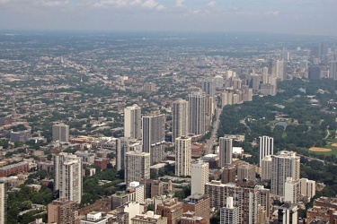
View from John Hancock Center, facing northwest
-
View of the sunset from High Rock [02]
![View of the sunset from High Rock [02] (1543 visits) View of the sunset from High Rock, a rock outcropping on South Mountain in Pen Mar, Maryland, in Was... View of the sunset from High Rock [02]](../../i/upload/2024/07/18/20240718125557-d168466e-cu_s9999x250.jpg)
-
View from Dirt Farm Brewing [02]
![View from Dirt Farm Brewing [02] (1548 visits) View from the patio at Dirt Farm Brewing in Bluemont, Virginia, facing approximately east. On a cle... View from Dirt Farm Brewing [02]](../../i/upload/2024/07/18/20240718230423-b1ac8dea-cu_s9999x250.jpg)
-
View from 20-Minute Cliff overlook [02]
![View from 20-Minute Cliff overlook [02] (1551 visits) View from 20-Minute Cliff, an overlook on the Blue Ridge Parkway near Vesuvius, Virginia.
Ben Schum... View from 20-Minute Cliff overlook [02]](../../i/upload/2024/07/14/20240714235012-88ae934f-cu_s9999x250.jpg)
-
View from Buena Vista overlook [01]
![View from Buena Vista overlook [01] (1557 visits) View from the Buena Vista overlook, on the Blue Ridge Parkway near the intersection with US 60.
Ben... View from Buena Vista overlook [01]](../../i/upload/2024/07/14/20240714235011-28c0ddbc-cu_s9999x250.jpg)
-
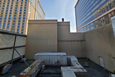
View from room 797 at Caesars
-
View from High Rock around sunset [11]
![View from High Rock around sunset [11] (1588 visits) View from High Rock, a rock outcropping on South Mountain in Pen Mar, Maryland, in Washington County... View from High Rock around sunset [11]](../../i/upload/2024/07/18/20240718125550-f940cb2a-cu_s9999x250.jpg)
-
View from Buena Vista overlook [02]
![View from Buena Vista overlook [02] (1592 visits) View from the Buena Vista overlook, on the Blue Ridge Parkway near the intersection with US 60.
Ben... View from Buena Vista overlook [02]](../../i/upload/2024/07/14/20240714235013-b233053d-cu_s9999x250.jpg)
-
Forest Springs Estates [06]
![Forest Springs Estates [06] (1599 visits) Aerial view of the Forest Springs Estates neighborhood in Stuarts Draft, Virginia, facing south.
Be... Forest Springs Estates [06]](../../i/upload/2024/07/20/20240720103705-68728b22-cu_s9999x250.jpg)
-
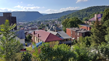
View of Cumberland, Maryland
-
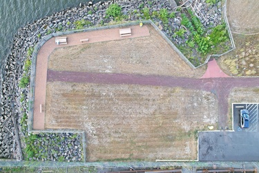
Aerial view of Phoenix Park
-
Sunset from I-64 overlook [04]
![Sunset from I-64 overlook [04] (1609 visits) Sunset, viewed from the scenic overlook at milepost 103 on Interstate 64 eastbound in Albemarle Coun... Sunset from I-64 overlook [04]](../../i/upload/2024/07/13/20240713234251-97a8e10e-cu_s9999x250.jpg)
-
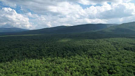
George Washington National Forest from above
-
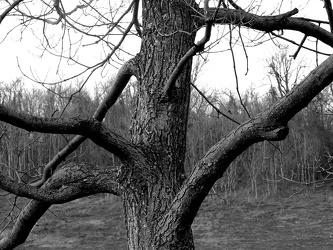
Tree at scenic overlook
-
Sunset from I-64 overlook [01]
![Sunset from I-64 overlook [01] (1632 visits) Sunset, viewed from the scenic overlook at milepost 103 on Interstate 64 eastbound in Albemarle Coun... Sunset from I-64 overlook [01]](../../i/upload/2024/07/13/20240713234248-69674cad-cu_s9999x250.jpg)
-
Stream at Yankee Horse Ridge [01]
![Stream at Yankee Horse Ridge [01] (1632 visits) Stream with small waterfall at the Yankee Horse Ridge overlook, on the Blue Ridge Parkway near Monte... Stream at Yankee Horse Ridge [01]](../../i/upload/2024/07/15/20240715141714-3facf0fc-cu_s9999x250.jpg)
-
View of the sunset from High Rock [01]
![View of the sunset from High Rock [01] (1635 visits) View of the sunset from High Rock, a rock outcropping on South Mountain in Pen Mar, Maryland, in Was... View of the sunset from High Rock [01]](../../i/upload/2024/07/18/20240718125553-1df4c653-cu_s9999x250.jpg)
-
Evanston, Illinois from over Lake Michigan [01]
![Evanston, Illinois from over Lake Michigan [01] (1637 visits) Aerial view of Evanston, Illinois from just offshore over Lake Michigan.
More at The Schumin Web:
w... Evanston, Illinois from over Lake Michigan [01]](../../i/upload/2024/11/09/20241109111034-667fc1be-cu_s9999x250.jpg)
-
Sunset from I-64 overlook [03]
![Sunset from I-64 overlook [03] (1649 visits) Sunset, viewed from the scenic overlook at milepost 103 on Interstate 64 eastbound in Albemarle Coun... Sunset from I-64 overlook [03]](../../i/upload/2024/07/13/20240713234247-066d4e9b-cu_s9999x250.jpg)
-
Sunset from I-64 overlook [02]
![Sunset from I-64 overlook [02] (1652 visits) Sunset, viewed from the scenic overlook at milepost 103 on Interstate 64 eastbound in Albemarle Coun... Sunset from I-64 overlook [02]](../../i/upload/2024/07/13/20240713234249-3f6e970a-cu_s9999x250.jpg)
-
View from 20-Minute Cliff overlook [01]
![View from 20-Minute Cliff overlook [01] (1673 visits) View from 20-Minute Cliff, an overlook on the Blue Ridge Parkway near Vesuvius, Virginia.
Ben Schum... View from 20-Minute Cliff overlook [01]](../../i/upload/2024/07/14/20240714235015-5d347656-cu_s9999x250.jpg)
-
Verona, Virginia over Mill Place Commerce Park [02]
![Verona, Virginia over Mill Place Commerce Park [02] (1673 visits) Aerial view of Verona, Virginia from above the Mill Place Commerce Park. This view faces approximat... Verona, Virginia over Mill Place Commerce Park [02]](../../i/upload/2024/07/20/20240720110708-9b94d246-cu_s9999x250.jpg)
-
Forest Springs Estates [10]
![Forest Springs Estates [10] (1674 visits) Aerial view of the Forest Springs Estates neighborhood in Stuarts Draft, Virginia, taken from above ... Forest Springs Estates [10]](../../i/upload/2024/07/20/20240720103726-e7eeb2c5-cu_s9999x250.jpg)
-
View of the sunset from High Rock [03]
![View of the sunset from High Rock [03] (1681 visits) View of the sunset from High Rock, a rock outcropping on South Mountain in Pen Mar, Maryland, in Was... View of the sunset from High Rock [03]](../../i/upload/2024/07/18/20240718125601-a2d71104-cu_s9999x250.jpg)
-
View from Dirt Farm Brewing [01]
![View from Dirt Farm Brewing [01] (1702 visits) View from the patio at Dirt Farm Brewing in Bluemont, Virginia, facing approximately east. On a cle... View from Dirt Farm Brewing [01]](../../i/upload/2024/07/18/20240718230427-e0fe1b23-cu_s9999x250.jpg)
-
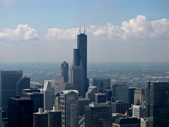
View from John Hancock Center, facing southwest
-
Graffiti-covered stone at High Rock [03]
![Graffiti-covered stone at High Rock [03] (1727 visits) Graffiti-covered stone at High Rock, a rock outcropping on South Mountain in Pen Mar, Maryland, in W... Graffiti-covered stone at High Rock [03]](../../i/upload/2024/07/18/20240718125500-5ab7b0f5-cu_s9999x250.jpg)
-
Forest Springs Estates [05]
![Forest Springs Estates [05] (1730 visits) Aerial view of the Forest Springs Estates neighborhood in Stuarts Draft, Virginia, taken above the i... Forest Springs Estates [05]](../../i/upload/2024/07/20/20240720103700-12ed86ac-cu_s9999x250.jpg)