-
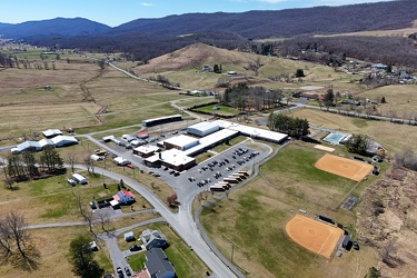
Former Kmart and Gold's Gym in Charlottesville, Virginia


-
DJI_20250326172037_0052_D MOD


-
Aerial view of downtown Culpeper, Virginia [02]

![Aerial view of downtown Culpeper, Virginia [02] (3 visits) Aerial view of downtown Culpeper, Virginia from above the intersection of South Main Street and West... Aerial view of downtown Culpeper, Virginia [02]](../../../i/upload/2025/07/27/20250727175038-2ded6746-cu_s9999x250.jpg)
-
Clock tower on Culpeper County Courthouse


-
Aerial view of downtown Culpeper, Virginia [01]

![Aerial view of downtown Culpeper, Virginia [01] (3 visits) Aerial view of downtown Culpeper, Virginia from above East Cameron Street between North Main Street ... Aerial view of downtown Culpeper, Virginia [01]](../../../i/upload/2025/07/27/20250727175001-65de4991-cu_s9999x250.jpg)
-
Blue Ridge Mountains near Rockfish Gap


-
Scott Castle [07]

![Scott Castle [07] (31 visits) Scott Castle, also known as Royal Orchard, a century-old estate in the Blue Ridge Mountains off of S... Scott Castle [07]](../../../i/upload/2025/07/25/20250725190022-a11dd29a-cu_s9999x250.jpg)
-
Scott Castle [06]

![Scott Castle [06] (30 visits) Scott Castle, also known as Royal Orchard, a century-old estate in the Blue Ridge Mountains off of S... Scott Castle [06]](../../../i/upload/2025/07/25/20250725190058-12e92651-cu_s9999x250.jpg)
-
Scott Castle [05]

![Scott Castle [05] (25 visits) Scott Castle, also known as Royal Orchard, a century-old estate in the Blue Ridge Mountains off of S... Scott Castle [05]](../../../i/upload/2025/07/25/20250725190135-483d55e1-cu_s9999x250.jpg)
-
Scott Castle [04]

![Scott Castle [04] (22 visits) Scott Castle, also known as Royal Orchard, a century-old estate in the Blue Ridge Mountains off of S... Scott Castle [04]](../../../i/upload/2025/07/25/20250725190212-b549a19c-cu_s9999x250.jpg)
-
Scott Castle [03]

![Scott Castle [03] (27 visits) Scott Castle, also known as Royal Orchard, a century-old estate in the Blue Ridge Mountains off of S... Scott Castle [03]](../../../i/upload/2025/07/25/20250725190249-78534bde-cu_s9999x250.jpg)
-
Scott Castle [02]

![Scott Castle [02] (26 visits) Scott Castle, also known as Royal Orchard, a century-old estate in the Blue Ridge Mountains off of S... Scott Castle [02]](../../../i/upload/2025/07/25/20250725190327-b488068b-cu_s9999x250.jpg)
-
Scott Castle [01]

![Scott Castle [01] (27 visits) Scott Castle, also known as Royal Orchard, a century-old estate in the Blue Ridge Mountains off of S... Scott Castle [01]](../../../i/upload/2025/07/25/20250725190404-f44dc816-cu_s9999x250.jpg)
-
State Route F182 bridge

-
Interstate 64 at State Route F182 [02]
![Interstate 64 at State Route F182 [02] (6 visits) Interstate 64 at the State Route F182 overpass, just east of Rockfish Gap in Nelson County, Virginia... Interstate 64 at State Route F182 [02]](../../../i/upload/2025/07/10/20250710145503-3dd8f977-cu_s9999x250.jpg)
-
Interstate 64 at State Route F182 [03]
![Interstate 64 at State Route F182 [03] (4 visits) Interstate 64 at the State Route F182 overpass, just east of Rockfish Gap in Nelson County, Virginia... Interstate 64 at State Route F182 [03]](../../../i/upload/2025/07/10/20250710145511-fd5b9f84-cu_s9999x250.jpg)
-
Interstate 64 at State Route F182 [04]
![Interstate 64 at State Route F182 [04] (9 visits) Interstate 64 at the State Route F182 overpass, just east of Rockfish Gap in Nelson County, Virginia... Interstate 64 at State Route F182 [04]](../../../i/upload/2025/07/10/20250710145527-79133bcd-cu_s9999x250.jpg)
-
Interstate 64 at State Route F182 [01]
![Interstate 64 at State Route F182 [01] (6 visits) Interstate 64 at the State Route F182 overpass, just east of Rockfish Gap in Nelson County, Virginia... Interstate 64 at State Route F182 [01]](../../../i/upload/2025/07/10/20250710145453-bbc92c0e-cu_s9999x250.jpg)
-
Aerial view of Buena Vista, Virginia [03]
![Aerial view of Buena Vista, Virginia [03] (12 visits) Aerial view of Buena Vista, Virginia, a small city at the foot of the Blue Ridge Mountains, seen her... Aerial view of Buena Vista, Virginia [03]](../../../i/upload/2025/07/10/20250710104340-2712e07e-cu_s9999x250.jpg)
-
Aerial view of Buena Vista, Virginia [04]
![Aerial view of Buena Vista, Virginia [04] (19 visits) Aerial view of Buena Vista, Virginia, a small city at the foot of the Blue Ridge Mountains, seen her... Aerial view of Buena Vista, Virginia [04]](../../../i/upload/2025/07/10/20250710104348-32eaef4b-cu_s9999x250.jpg)
-
Aerial view of Buena Vista, Virginia [01]
![Aerial view of Buena Vista, Virginia [01] (12 visits) Aerial view of Buena Vista, Virginia, a small city at the foot of the Blue Ridge Mountains, seen her... Aerial view of Buena Vista, Virginia [01]](../../../i/upload/2025/07/10/20250710104322-bac17f71-cu_s9999x250.jpg)
-
Aerial view of Buena Vista, Virginia [02]
![Aerial view of Buena Vista, Virginia [02] (9 visits) Aerial view of Buena Vista, Virginia, a small city at the foot of the Blue Ridge Mountains, seen her... Aerial view of Buena Vista, Virginia [02]](../../../i/upload/2025/07/10/20250710104332-b655becf-cu_s9999x250.jpg)
-
Aerial view of Blue Ridge Summit, Pennsylvania

-
Black Dog Salvage

-
Roanoke from above Main Street SW

-
Susquehanna River between Dauphin and Marysville, Pennsylvania [04]
![Susquehanna River between Dauphin and Marysville, Pennsylvania [04] (776 visits) The Susquehanna River, between the towns of Dauphin and Marysville, Pennsylvania. View facing upstr... Susquehanna River between Dauphin and Marysville, Pennsylvania [04]](../../../i/upload/2025/03/06/20250306045933-5ace4d8b-cu_s9999x250.jpg)
-
Roanoke Industrial Center [02]
![Roanoke Industrial Center [02] (1206 visits) Aerial view of the Roanoke Industrial Center, an industrial park in southeast Roanoke, Virginia.
... Roanoke Industrial Center [02]](../../../i/upload/2025/03/03/20250303105736-0686e504-cu_s9999x250.jpg)
-
Aerial view of the Roanoke Star [10]
![Aerial view of the Roanoke Star [10] (2040 visits) Aerial view of the Roanoke Star, a landmark atop Mill Mountain in Roanoke, Virginia.
Ben Schumin is... Aerial view of the Roanoke Star [10]](../../../i/upload/2025/03/03/20250303104127-fefb7546-cu_s9999x250.jpg)
-
Aerial view of the Roanoke Star [11]
![Aerial view of the Roanoke Star [11] (2081 visits) Aerial view of the Roanoke Star, a landmark atop Mill Mountain in Roanoke, Virginia.
Ben Schumin is... Aerial view of the Roanoke Star [11]](../../../i/upload/2025/03/03/20250303104133-3d023ab1-cu_s9999x250.jpg)
-
Aerial view of the Roanoke Star [12]
![Aerial view of the Roanoke Star [12] (2441 visits) Aerial view of the Roanoke Star, a landmark atop Mill Mountain in Roanoke, Virginia.
Ben Schumin is... Aerial view of the Roanoke Star [12]](../../../i/upload/2025/03/03/20250303104139-be18f38c-cu_s9999x250.jpg)
-
Aerial view of the Roanoke Star [13]
![Aerial view of the Roanoke Star [13] (2099 visits) Aerial view of the Roanoke Star, a landmark atop Mill Mountain in Roanoke, Virginia.
Ben Schumin is... Aerial view of the Roanoke Star [13]](../../../i/upload/2025/03/03/20250303104145-f725aaf6-cu_s9999x250.jpg)
-
Aerial view of the Roanoke Star [09]
![Aerial view of the Roanoke Star [09] (1961 visits) Aerial view of the Roanoke Star, a landmark atop Mill Mountain in Roanoke, Virginia.
Ben Schumin is... Aerial view of the Roanoke Star [09]](../../../i/upload/2025/03/03/20250303104122-0547d183-cu_s9999x250.jpg)
-
Aerial view of the Roanoke Star [07]
![Aerial view of the Roanoke Star [07] (1996 visits) Aerial view of the Roanoke Star, a landmark atop Mill Mountain in Roanoke, Virginia.
Ben Schumin is... Aerial view of the Roanoke Star [07]](../../../i/upload/2025/03/03/20250303104109-3e9db85e-cu_s9999x250.jpg)
-
Aerial view of the Roanoke Star [08]
![Aerial view of the Roanoke Star [08] (2022 visits) Aerial view of the Roanoke Star, a landmark atop Mill Mountain in Roanoke, Virginia.
Ben Schumin is... Aerial view of the Roanoke Star [08]](../../../i/upload/2025/03/03/20250303104116-72f4bf50-cu_s9999x250.jpg)
-
Aerial view of the Roanoke Star [06]
![Aerial view of the Roanoke Star [06] (2021 visits) Aerial view of the Roanoke Star, a landmark atop Mill Mountain in Roanoke, Virginia.
Ben Schumin is... Aerial view of the Roanoke Star [06]](../../../i/upload/2025/03/03/20250303104103-f82a90f2-cu_s9999x250.jpg)
-
Aerial view of the Roanoke Star [02]
![Aerial view of the Roanoke Star [02] (2233 visits) Aerial view of the Roanoke Star, a landmark atop Mill Mountain in Roanoke, Virginia.
Ben Schumin is... Aerial view of the Roanoke Star [02]](../../../i/upload/2025/03/03/20250303104038-bfb5c40b-cu_s9999x250.jpg)
-
Aerial view of the Roanoke Star [03]
![Aerial view of the Roanoke Star [03] (2220 visits) Aerial view of the Roanoke Star, a landmark atop Mill Mountain in Roanoke, Virginia.
Ben Schumin is... Aerial view of the Roanoke Star [03]](../../../i/upload/2025/03/03/20250303104044-0107081b-cu_s9999x250.jpg)
-
Aerial view of the Roanoke Star [04]
![Aerial view of the Roanoke Star [04] (2186 visits) Aerial view of the Roanoke Star, a landmark atop Mill Mountain in Roanoke, Virginia.
Ben Schumin is... Aerial view of the Roanoke Star [04]](../../../i/upload/2025/03/03/20250303104050-2b9f8ca3-cu_s9999x250.jpg)
-
Aerial view of the Roanoke Star [05]
![Aerial view of the Roanoke Star [05] (1998 visits) Aerial view of the Roanoke Star, a landmark atop Mill Mountain in Roanoke, Virginia.
Ben Schumin is... Aerial view of the Roanoke Star [05]](../../../i/upload/2025/03/03/20250303104057-ffa64f72-cu_s9999x250.jpg)
-
Aerial view of the Roanoke Star [01]
![Aerial view of the Roanoke Star [01] (2077 visits) Aerial view of the Roanoke Star, a landmark atop Mill Mountain in Roanoke, Virginia.
Ben Schumin is... Aerial view of the Roanoke Star [01]](../../../i/upload/2025/03/03/20250303104030-b2af10f4-cu_s9999x250.jpg)
-
Roanoke Industrial Center [01]
![Roanoke Industrial Center [01] (1138 visits) Aerial view of the Roanoke Industrial Center, an industrial park in southeast Roanoke, Virginia.
... Roanoke Industrial Center [01]](../../../i/upload/2025/03/03/20250303061242-c4450e31-cu_s9999x250.jpg)
-
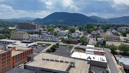
Downtown Roanoke facing Mill Mountain
-
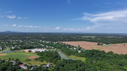
Aerial view of Poolesville, Maryland
-
Buffalo Gap [02]
![Buffalo Gap [02] (1739 visits) Buffalo Gap, a mountain pass through Little North Mountain, near Swoope, Virginia.
More at The Sc... Buffalo Gap [02]](../../../i/upload/2025/01/03/20250103200607-1abe8192-cu_s9999x250.jpg)
-
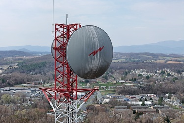
Radio tower on Mary Gray
-
No parking sign on Gathright Dam [02]
![No parking sign on Gathright Dam [02] (1778 visits) No parking sign on the road across Gathright Dam, an embankment dam in Alleghany County, Virginia th... No parking sign on Gathright Dam [02]](../../../i/upload/2025/01/02/20250102213928-b14b8899-cu_s9999x250.jpg)
-
Jackson River beyond Gathright Dam
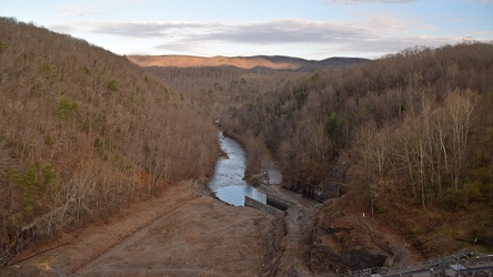
-
Monopine-style cell tower in Hot Springs, Virginia [05]
![Monopine-style cell tower in Hot Springs, Virginia [05] (2752 visits) Monopine-style cell phone tower in Hot Springs, Virginia. The tower is designed to resemble a pine ... Monopine-style cell tower in Hot Springs, Virginia [05]](../../../i/upload/2025/01/02/20250102180804-651fb2e5-cu_s9999x250.jpg)
-
Monopine-style cell tower in Hot Springs, Virginia [06]
![Monopine-style cell tower in Hot Springs, Virginia [06] (2832 visits) Monopine-style cell phone tower in Hot Springs, Virginia. The tower is designed to resemble a pine ... Monopine-style cell tower in Hot Springs, Virginia [06]](../../../i/upload/2025/01/02/20250102180810-ab89514c-cu_s9999x250.jpg)
-
Monopine-style cell tower in Hot Springs, Virginia [03]
![Monopine-style cell tower in Hot Springs, Virginia [03] (2876 visits) Monopine-style cell phone tower in Hot Springs, Virginia. The tower is designed to resemble a pine ... Monopine-style cell tower in Hot Springs, Virginia [03]](../../../i/upload/2025/01/02/20250102180751-95c7a9be-cu_s9999x250.jpg)
-
Monopine-style cell tower in Hot Springs, Virginia [04]
![Monopine-style cell tower in Hot Springs, Virginia [04] (2757 visits) Monopine-style cell phone tower in Hot Springs, Virginia. The tower is designed to resemble a pine ... Monopine-style cell tower in Hot Springs, Virginia [04]](../../../i/upload/2025/01/02/20250102180757-98a25cf6-cu_s9999x250.jpg)
-
Monopine-style cell tower in Hot Springs, Virginia [01]
![Monopine-style cell tower in Hot Springs, Virginia [01] (2797 visits) Monopine-style cell phone tower in Hot Springs, Virginia. The tower is designed to resemble a pine ... Monopine-style cell tower in Hot Springs, Virginia [01]](../../../i/upload/2025/01/02/20250102180740-cc90582a-cu_s9999x250.jpg)
-
Monopine-style cell tower in Hot Springs, Virginia [02]
![Monopine-style cell tower in Hot Springs, Virginia [02] (2760 visits) Monopine-style cell phone tower in Hot Springs, Virginia. The tower is designed to resemble a pine ... Monopine-style cell tower in Hot Springs, Virginia [02]](../../../i/upload/2025/01/02/20250102180745-dc321558-cu_s9999x250.jpg)
-
The Omni Homestead Resort [11]
![The Omni Homestead Resort [11] (1231 visits) The Omni Homestead Resort, a luxury resort in Hot Springs, Virginia. A resort has existed on this s... The Omni Homestead Resort [11]](../../../i/upload/2025/01/02/20250102172203-12769421-cu_s9999x250.jpg)
-
The Omni Homestead Resort [08]
![The Omni Homestead Resort [08] (1179 visits) The Omni Homestead Resort, a luxury resort in Hot Springs, Virginia. A resort has existed on this s... The Omni Homestead Resort [08]](../../../i/upload/2025/01/02/20250102172135-68e04d5f-cu_s9999x250.jpg)
-
The Omni Homestead Resort [09]
![The Omni Homestead Resort [09] (1232 visits) The Omni Homestead Resort, a luxury resort in Hot Springs, Virginia. A resort has existed on this s... The Omni Homestead Resort [09]](../../../i/upload/2025/01/02/20250102172144-c2ab1157-cu_s9999x250.jpg)
-
The Omni Homestead Resort [10]
![The Omni Homestead Resort [10] (1252 visits) The Omni Homestead Resort, a luxury resort in Hot Springs, Virginia. A resort has existed on this s... The Omni Homestead Resort [10]](../../../i/upload/2025/01/02/20250102172154-8245efbc-cu_s9999x250.jpg)
-
The Omni Homestead Resort [07]
![The Omni Homestead Resort [07] (1158 visits) The Omni Homestead Resort, a luxury resort in Hot Springs, Virginia. A resort has existed on this s... The Omni Homestead Resort [07]](../../../i/upload/2025/01/02/20250102172124-b2c0333a-cu_s9999x250.jpg)
-
The Omni Homestead Resort [05]
![The Omni Homestead Resort [05] (1199 visits) The Omni Homestead Resort, a luxury resort in Hot Springs, Virginia. A resort has existed on this s... The Omni Homestead Resort [05]](../../../i/upload/2025/01/02/20250102172103-d298a7de-cu_s9999x250.jpg)
-
The Omni Homestead Resort [06]
![The Omni Homestead Resort [06] (1231 visits) The Omni Homestead Resort, a luxury resort in Hot Springs, Virginia. A resort has existed on this s... The Omni Homestead Resort [06]](../../../i/upload/2025/01/02/20250102172114-5d27f186-cu_s9999x250.jpg)
-
The Omni Homestead Resort [03]
![The Omni Homestead Resort [03] (1171 visits) The Omni Homestead Resort, a luxury resort in Hot Springs, Virginia. A resort has existed on this s... The Omni Homestead Resort [03]](../../../i/upload/2025/01/02/20250102172043-b68b6cc5-cu_s9999x250.jpg)
-
The Omni Homestead Resort [04]
![The Omni Homestead Resort [04] (1282 visits) The Omni Homestead Resort, a luxury resort in Hot Springs, Virginia. A resort has existed on this s... The Omni Homestead Resort [04]](../../../i/upload/2025/01/02/20250102172052-3201f11d-cu_s9999x250.jpg)
-
The Omni Homestead Resort [01]
![The Omni Homestead Resort [01] (1268 visits) The Omni Homestead Resort, a luxury resort in Hot Springs, Virginia. A resort has existed on this s... The Omni Homestead Resort [01]](../../../i/upload/2025/01/02/20250102172024-3e42b9fd-cu_s9999x250.jpg)
-
The Omni Homestead Resort [02]
![The Omni Homestead Resort [02] (1213 visits) The Omni Homestead Resort, a luxury resort in Hot Springs, Virginia. A resort has existed on this s... The Omni Homestead Resort [02]](../../../i/upload/2025/01/02/20250102172033-f93e9991-cu_s9999x250.jpg)
-
View along US 220 northbound in Hot Springs, Virginia
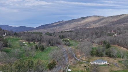
-
Aerial view of Hot Springs, Virginia
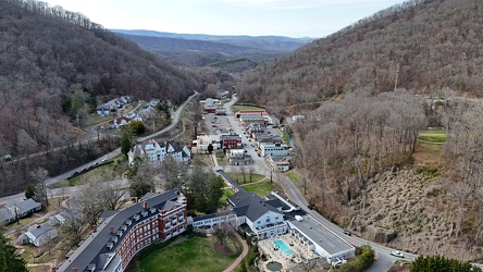
-
Routes 220 and 39 in Warm Springs, Virginia [02]
![Routes 220 and 39 in Warm Springs, Virginia [02] (2790 visits) US 220 and VA 39 in Warm Springs, Virginia, facing southwest. In this shot, US 220 is the road to t... Routes 220 and 39 in Warm Springs, Virginia [02]](../../../i/upload/2025/01/02/20250102141319-a5501ace-cu_s9999x250.jpg)
-
Routes 220 and 39 in Warm Springs, Virginia [01]
![Routes 220 and 39 in Warm Springs, Virginia [01] (2720 visits) US 220 and VA 39 in Warm Springs, Virginia, facing southwest. In this shot, US 220 runs top to bott... Routes 220 and 39 in Warm Springs, Virginia [01]](../../../i/upload/2025/01/02/20250102141310-79aa8afd-cu_s9999x250.jpg)
-
US 220 north of Monterey, Virginia
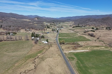
-
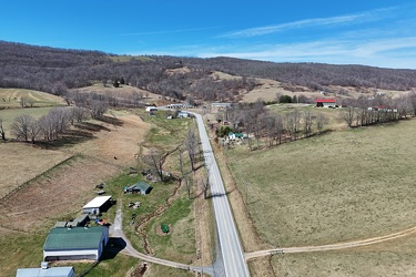
US 250 west of Monterey, Virginia
-
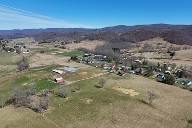
North end of Monterey, Virginia
-
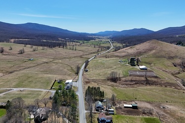
US 220 south of Monterey, Virginia
-
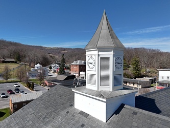
Cupola on Highland County Courthouse
-
Aerial view of Monterey, Virginia [06]
![Aerial view of Monterey, Virginia [06] (2675 visits) Aerial view of Monterey, Virginia, a small town comprising the seat of Highland County.
More at The... Aerial view of Monterey, Virginia [06]](../../../i/upload/2025/01/02/20250102005956-29786301-cu_s9999x250.jpg)
-
Aerial view of Monterey, Virginia [04]
![Aerial view of Monterey, Virginia [04] (2739 visits) Aerial view of Monterey, Virginia, a small town comprising the seat of Highland County.
More at The... Aerial view of Monterey, Virginia [04]](../../../i/upload/2025/01/02/20250102005937-281fae65-cu_s9999x250.jpg)
-
Aerial view of Monterey, Virginia [05]
![Aerial view of Monterey, Virginia [05] (2815 visits) Aerial view of Monterey, Virginia, a small town comprising the seat of Highland County.
More at The... Aerial view of Monterey, Virginia [05]](../../../i/upload/2025/01/02/20250102005946-79efaa38-cu_s9999x250.jpg)
-
Aerial view of Monterey, Virginia [02]
![Aerial view of Monterey, Virginia [02] (2750 visits) Aerial view of Monterey, Virginia, a small town comprising the seat of Highland County.
More at The... Aerial view of Monterey, Virginia [02]](../../../i/upload/2025/01/02/20250102005923-7f7b9b83-cu_s9999x250.jpg)
-
Aerial view of Monterey, Virginia [03]
![Aerial view of Monterey, Virginia [03] (2704 visits) Aerial view of Monterey, Virginia, a small town comprising the seat of Highland County.
More at The... Aerial view of Monterey, Virginia [03]](../../../i/upload/2025/01/02/20250102005929-2e84a9d0-cu_s9999x250.jpg)
-
Aerial view of Monterey, Virginia [01]
![Aerial view of Monterey, Virginia [01] (2762 visits) Aerial view of Monterey, Virginia, a small town comprising the seat of Highland County.
More at The... Aerial view of Monterey, Virginia [01]](../../../i/upload/2025/01/02/20250102005918-685606f9-cu_s9999x250.jpg)
-
Highland County Schools
