-
Sudley Road just south of I-66

-
"I'm am Morgan"

-
Brake fault lights on WMATA railcar 6128 [02]
![Brake fault lights on WMATA railcar 6128 [02] (30 visits) Blue and amber brake fault lights on the right side of WMATA railcar 6128, manufactured by Alstom. ... Brake fault lights on WMATA railcar 6128 [02]](../../i/upload/2025/06/23/20250623095330-14fe41fc-cu_s9999x250.jpg)
-
Brake fault lights on WMATA railcar 6128 [01]
![Brake fault lights on WMATA railcar 6128 [01] (35 visits) Blue and amber brake fault lights on the right side of WMATA railcar 6128, manufactured by Alstom. ... Brake fault lights on WMATA railcar 6128 [01]](../../i/upload/2025/06/23/20250623095320-2194df0c-cu_s9999x250.jpg)
-
Temporary restroom signage at Branch Avenue

-
Aurora Borealis in Ringgold, Maryland [06]
![Aurora Borealis in Ringgold, Maryland [06] (27 visits) The Aurora Borealis, viewed from near the intersection of Maryland Routes 64 and 418 in Ringgold, Ma... Aurora Borealis in Ringgold, Maryland [06]](../../i/upload/2025/06/22/20250622202707-22a813d0-cu_s9999x250.jpg)
-
Aurora Borealis in Ringgold, Maryland [05]
![Aurora Borealis in Ringgold, Maryland [05] (21 visits) The Aurora Borealis, viewed from near the intersection of Maryland Routes 64 and 418 in Ringgold, Ma... Aurora Borealis in Ringgold, Maryland [05]](../../i/upload/2025/06/22/20250622202656-f23cac80-cu_s9999x250.jpg)
-
Aurora Borealis in Ringgold, Maryland [04]
![Aurora Borealis in Ringgold, Maryland [04] (32 visits) The Aurora Borealis, viewed from near the intersection of Maryland Routes 64 and 418 in Ringgold, Ma... Aurora Borealis in Ringgold, Maryland [04]](../../i/upload/2025/06/22/20250622202648-68a9301c-cu_s9999x250.jpg)
-
Aurora Borealis in Ringgold, Maryland [03]
![Aurora Borealis in Ringgold, Maryland [03] (24 visits) The Aurora Borealis, viewed from near the intersection of Maryland Routes 64 and 418 in Ringgold, Ma... Aurora Borealis in Ringgold, Maryland [03]](../../i/upload/2025/06/22/20250622202640-a2b69060-cu_s9999x250.jpg)
-
Aurora Borealis in Ringgold, Maryland [02]
![Aurora Borealis in Ringgold, Maryland [02] (27 visits) The Aurora Borealis, viewed from near the intersection of Maryland Routes 64 and 418 in Ringgold, Ma... Aurora Borealis in Ringgold, Maryland [02]](../../i/upload/2025/06/22/20250622202633-ac645217-cu_s9999x250.jpg)
-
Aurora Borealis in Ringgold, Maryland [01]
![Aurora Borealis in Ringgold, Maryland [01] (25 visits) The Aurora Borealis, viewed from near the intersection of Maryland Routes 64 and 418 in Ringgold, Ma... Aurora Borealis in Ringgold, Maryland [01]](../../i/upload/2025/06/22/20250622202621-86ae9709-cu_s9999x250.jpg)
-
Returning a Jeep Grand Cherokee to Enterprise

-
Discarded pack of Camel cigarettes [02]
![Discarded pack of Camel cigarettes [02] (35 visits) A discarded pack of Camel Crush cigarettes on the pavement at the Liberty gas station on South Frede... Discarded pack of Camel cigarettes [02]](../../i/upload/2025/06/22/20250622110942-76264069-cu_s9999x250.jpg)
-
Discarded pack of Camel cigarettes [01]
![Discarded pack of Camel cigarettes [01] (26 visits) A discarded pack of Camel Crush cigarettes on the pavement at the Liberty gas station on South Frede... Discarded pack of Camel cigarettes [01]](../../i/upload/2025/06/22/20250622110844-1cb44852-cu_s9999x250.jpg)
-
Traffic circle at intersection of Drs. Bruce and Lee Foundation Blvd and Dr. Johnny Bruce Road

-
Political signs in North Charleston, South Carolina

-
Arthur Ravenel Jr. Bridge [16]
![Arthur Ravenel Jr. Bridge [16] (44 visits) The Arthur Ravenel Jr. Bridge, a cable-stayed bridge that carries traffic on US 17 across the Cooper... Arthur Ravenel Jr. Bridge [16]](../../i/upload/2025/06/22/20250622012519-7e2f6d64-cu_s9999x250.jpg)
-
Aerial view of the Cooper River between Charleston and Mount Pleasant

-
Former CARTA bus 3426 broken down on Dorchester Road [01]
![Former CARTA bus 3426 broken down on Dorchester Road [01] (35 visits) Former CARTA bus 3426 is parked on the side of Dorchester Road with triangles out in North Charlesto... Former CARTA bus 3426 broken down on Dorchester Road [01]](../../i/upload/2025/06/10/20250610105211-936d8813-cu_s9999x250.jpg)
-
Elyse pulls vinyl wrap off of former CARTA bus 3426 [02]
![Elyse pulls vinyl wrap off of former CARTA bus 3426 [02] (51 visits) Elyse Horvath pulls more of the vinyl advertising wrap off of the window frame on former CARTA bus 3... Elyse pulls vinyl wrap off of former CARTA bus 3426 [02]](../../i/upload/2025/06/10/20250610105235-3fe3f6fb-cu_s9999x250.jpg)
-
Elyse pulls vinyl wrap off of former CARTA bus 3426 [01]
![Elyse pulls vinyl wrap off of former CARTA bus 3426 [01] (55 visits) Elyse Horvath pulls more of the vinyl advertising wrap off of the window frame on former CARTA bus 3... Elyse pulls vinyl wrap off of former CARTA bus 3426 [01]](../../i/upload/2025/06/10/20250610105226-5c42c52a-cu_s9999x250.jpg)
-
Former CARTA bus 3426 broken down on Dorchester Road [02]
![Former CARTA bus 3426 broken down on Dorchester Road [02] (59 visits) Former CARTA bus 3426 is parked on the side of Dorchester Road with triangles out in North Charlesto... Former CARTA bus 3426 broken down on Dorchester Road [02]](../../i/upload/2025/06/10/20250610105220-65049e6d-cu_s9999x250.jpg)
-
Former CARTA bus 3426 on Interstate 26

-
Arthur Ravenel Jr. Bridge [15]
![Arthur Ravenel Jr. Bridge [15] (232 visits) The Arthur Ravenel Jr. Bridge, a cable-stayed bridge that carries traffic on US 17 across the Cooper... Arthur Ravenel Jr. Bridge [15]](../../i/upload/2025/06/04/20250604104506-500b2a94-cu_s9999x250.jpg)
-
View towards the Cooper River

-
Aerial view of downtown Charleston, South Carolina [09]
![Aerial view of downtown Charleston, South Carolina [09] (257 visits) Aerial view of downtown Charleston, South Carolina, from above the intersection of Meeting and John ... Aerial view of downtown Charleston, South Carolina [09]](../../i/upload/2025/05/24/20250524005756-e84d9c06-cu_s9999x250.jpg)
-
Cars at the Port of Charleston [02]
![Cars at the Port of Charleston [02] (213 visits) Hundreds of recently imported cars, trucks, and SUVs wait on a lot at the Port of Charleston, South ... Cars at the Port of Charleston [02]](../../i/upload/2025/05/24/20250524005846-ae512086-cu_s9999x250.jpg)
-
Aerial view of downtown Charleston, South Carolina [05]
![Aerial view of downtown Charleston, South Carolina [05] (311 visits) Aerial view of downtown Charleston, South Carolina, from above the intersection of King and Ann Stre... Aerial view of downtown Charleston, South Carolina [05]](../../i/upload/2025/05/24/20250524005405-6d254e98-cu_s9999x250.jpg)
-
Eastern terminus of Interstate 26 [03]
![Eastern terminus of Interstate 26 [03] (876 visits) The eastern terminus of Interstate 26 in Charleston, South Carolina. I-26 ends at a signalized inte... Eastern terminus of Interstate 26 [03]](../../i/upload/2025/05/23/20250523172453-291afe72-cu_s9999x250.jpg)
-
Eastern terminus of Interstate 26 [02]
![Eastern terminus of Interstate 26 [02] (503 visits) The eastern terminus of Interstate 26 in Charleston, South Carolina. I-26 ends at a signalized inte... Eastern terminus of Interstate 26 [02]](../../i/upload/2025/05/23/20250523172431-321f5bc1-cu_s9999x250.jpg)
-
Eastern terminus of Interstate 26 [01]
![Eastern terminus of Interstate 26 [01] (1018 visits) The eastern terminus of Interstate 26 in Charleston, South Carolina. I-26 ends at a signalized inte... Eastern terminus of Interstate 26 [01]](../../i/upload/2025/05/23/20250523172345-9b22a449-cu_s9999x250.jpg)
-
Clouds over downtown Charleston

-
Aerial view of downtown Charleston, South Carolina [01]
![Aerial view of downtown Charleston, South Carolina [01] (376 visits) Aerial view of downtown Charleston, South Carolina, from above the intersection of King and Reid Str... Aerial view of downtown Charleston, South Carolina [01]](../../i/upload/2025/05/23/20250523172204-ea3abf92-cu_s9999x250.jpg)
-
Traffic signals at King and Cannon Streets [02]
![Traffic signals at King and Cannon Streets [02] (450 visits) Traffic signals at the intersection of King and Cannon Streets in downtown Charleston, South Carolin... Traffic signals at King and Cannon Streets [02]](../../i/upload/2025/05/23/20250523224859-225bcebc-cu_s9999x250.jpg)
-
Traffic signals at King and Cannon Streets [01]
![Traffic signals at King and Cannon Streets [01] (311 visits) Traffic signals at the intersection of King and Cannon Streets in downtown Charleston, South Carolin... Traffic signals at King and Cannon Streets [01]](../../i/upload/2025/05/23/20250523134012-59105e2a-cu_s9999x250.jpg)
-
Signage at the corner of Spring and King Streets

-
Dukes Barbecue

-
Folly Road bridge over a waterway [05]
![Folly Road bridge over a waterway [05] (542 visits) Bridge carrying South Carolina Highway 171 (Folly Road) across a waterway between Charleston and Fol... Folly Road bridge over a waterway [05]](../../i/upload/2025/05/23/20250523015734-a60eb9cc-cu_s9999x250.jpg)
-
Folly Road bridge over a waterway [04]
![Folly Road bridge over a waterway [04] (400 visits) Bridge carrying South Carolina Highway 171 (Folly Road) across a waterway between Charleston and Fol... Folly Road bridge over a waterway [04]](../../i/upload/2025/05/23/20250523015708-37d71c5a-cu_s9999x250.jpg)
-
Folly Road bridge over a waterway [03]
![Folly Road bridge over a waterway [03] (570 visits) Bridge carrying South Carolina Highway 171 (Folly Road) across a waterway between Charleston and Fol... Folly Road bridge over a waterway [03]](../../i/upload/2025/05/23/20250523015655-f9e58897-cu_s9999x250.jpg)
-
Folly Road bridge over a waterway [02]
![Folly Road bridge over a waterway [02] (693 visits) Bridge carrying South Carolina Highway 171 (Folly Road) across a waterway between Charleston and Fol... Folly Road bridge over a waterway [02]](../../i/upload/2025/05/23/20250523015618-d369d849-cu_s9999x250.jpg)
-
Folly Road bridge over a waterway [01]
![Folly Road bridge over a waterway [01] (552 visits) Bridge carrying South Carolina Highway 171 (Folly Road) across a waterway between Charleston and Fol... Folly Road bridge over a waterway [01]](../../i/upload/2025/05/23/20250523015608-7dd97814-cu_s9999x250.jpg)
-
Pedestrian call button at Center Street and Ashley Avenue

-
Traffic signal at Center Street and Ashley Avenue [03]
![Traffic signal at Center Street and Ashley Avenue [03] (299 visits) Traffic signal mounted above the intersection of Center Street and Ashley Avenue in Folly Beach, Sou... Traffic signal at Center Street and Ashley Avenue [03]](../../i/upload/2025/05/23/20250523011935-5f3c6de5-cu_s9999x250.jpg)
-
Traffic signal at Center Street and Ashley Avenue [02]
![Traffic signal at Center Street and Ashley Avenue [02] (258 visits) Traffic signal mounted above the intersection of Center Street and Ashley Avenue in Folly Beach, Sou... Traffic signal at Center Street and Ashley Avenue [02]](../../i/upload/2025/05/23/20250523011915-ec459398-cu_s9999x250.jpg)
-
Traffic signal at Center Street and Ashley Avenue [01]
![Traffic signal at Center Street and Ashley Avenue [01] (238 visits) Traffic signal mounted above the intersection of Center Street and Ashley Avenue in Folly Beach, Sou... Traffic signal at Center Street and Ashley Avenue [01]](../../i/upload/2025/05/23/20250523011856-4e7c16b7-cu_s9999x250.jpg)
-
Aerial view of Folly Beach, South Carolina [05]
![Aerial view of Folly Beach, South Carolina [05] (599 visits) Aerial view of Folly Beach, South Carolina, roughly centered on the fishing pier, facing approximate... Aerial view of Folly Beach, South Carolina [05]](../../i/upload/2025/05/15/20250515155646-ff4d6f07-cu_s9999x250.jpg)
-
Aerial view of Folly Beach, South Carolina [03]
![Aerial view of Folly Beach, South Carolina [03] (427 visits) Aerial view of Folly Beach, South Carolina, roughly centered on Center Street, facing approximately ... Aerial view of Folly Beach, South Carolina [03]](../../i/upload/2025/05/14/20250514110312-219b9712-cu_s9999x250.jpg)
-
Intersection of Center Street and Hudson Avenue

-
Aerial view of Folly Beach, South Carolina [04]
![Aerial view of Folly Beach, South Carolina [04] (490 visits) Aerial view of Folly Beach, South Carolina, roughly centered on Center Street, facing approximately ... Aerial view of Folly Beach, South Carolina [04]](../../i/upload/2025/05/14/20250514110319-69d4f7ad-cu_s9999x250.jpg)
-
Aerial view of Folly Beach, South Carolina [02]
![Aerial view of Folly Beach, South Carolina [02] (297 visits) Aerial view of Folly Beach, South Carolina, roughly centered on Center Street, facing approximately ... Aerial view of Folly Beach, South Carolina [02]](../../i/upload/2025/05/14/20250514110306-1f7c3170-cu_s9999x250.jpg)
-
Aerial view of Folly Beach, South Carolina [01]
![Aerial view of Folly Beach, South Carolina [01] (334 visits) Aerial view of Folly Beach, South Carolina, roughly centered on Center Street, facing approximately ... Aerial view of Folly Beach, South Carolina [01]](../../i/upload/2025/05/14/20250514110300-74440381-cu_s9999x250.jpg)
-
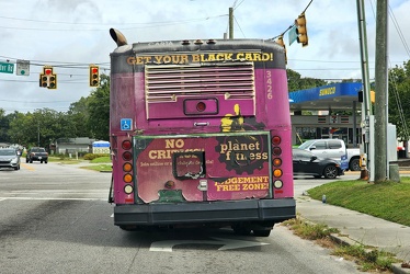
Former CARTA bus 3246 at Leeds Avenue and Dorchester Road
-
Elm Avenue interchange [01]
![Elm Avenue interchange [01] (4239 visits) Interchange between Interstate 581/US 220 and Elm Avenue (SR 24) in Roanoke, Virginia, viewed from M... Elm Avenue interchange [01]](../../i/upload/2024/07/20/20240720122015-70544823-cu_s9999x250.jpg)
-
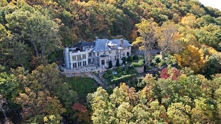
1801 Prospect Road SE
-
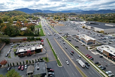
Electric Road
-
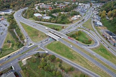
Franklin Road interchange
-
Elm Avenue interchange [02]
![Elm Avenue interchange [02] (4143 visits) Interchange between Interstate 581/US 220 and Elm Avenue (SR 24) in Roanoke, Virginia. The I-581 de... Elm Avenue interchange [02]](../../i/upload/2024/07/20/20240720121652-6267da79-cu_s9999x250.jpg)
-
North end of Tanglewood Mall property
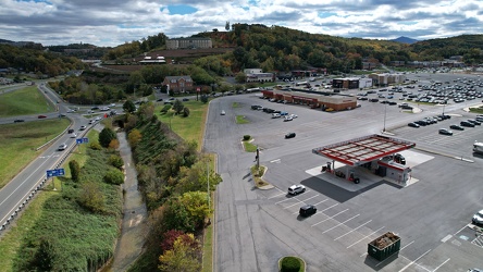
-
View south on Franklin Road
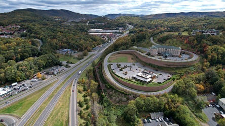
-
Bristol sign [03]
![Bristol sign [03] (10271 visits) Sign over State Street in Bristol, which straddles the border between Virginia and Tennessee.
More ... Bristol sign [03]](../../i/upload/2024/07/20/20240720121545-f24f5478-cu_s9999x250.jpg)
-
Bristol sign [02]
![Bristol sign [02] (10110 visits) Sign over State Street in Bristol, which straddles the border between Virginia and Tennessee.
More ... Bristol sign [02]](../../i/upload/2024/07/20/20240720121538-801acaf1-cu_s9999x250.jpg)
-
Bristol sign [01]
![Bristol sign [01] (10044 visits) Sign over State Street in Bristol, which straddles the border between Virginia and Tennessee.
More ... Bristol sign [01]](../../i/upload/2024/07/20/20240720121533-067b0659-cu_s9999x250.jpg)
-
Stop sign embedded in concrete

-
Sevierville interchange on I-40 [10]
![Sevierville interchange on I-40 [10] (3532 visits) Exit 407 on Interstate 40 in Sevierville, Tennessee, which serves State Route 66 via a diverging dia... Sevierville interchange on I-40 [10]](../../i/upload/2024/07/20/20240720120752-d23a6ab4-cu_s9999x250.jpg)
-
Sevierville interchange on I-40 [09]
![Sevierville interchange on I-40 [09] (3482 visits) Exit 407 on Interstate 40 in Sevierville, Tennessee, which serves State Route 66 via a diverging dia... Sevierville interchange on I-40 [09]](../../i/upload/2024/07/20/20240720120738-ef566a00-cu_s9999x250.jpg)
-
Sevierville interchange on I-40 [08]
![Sevierville interchange on I-40 [08] (3619 visits) Exit 407 on Interstate 40 in Sevierville, Tennessee, which serves State Route 66 via a diverging dia... Sevierville interchange on I-40 [08]](../../i/upload/2024/07/20/20240720120724-702a7a27-cu_s9999x250.jpg)
-
Sevierville interchange on I-40 [07]
![Sevierville interchange on I-40 [07] (3417 visits) Exit 407 on Interstate 40 in Sevierville, Tennessee, which serves State Route 66 via a diverging dia... Sevierville interchange on I-40 [07]](../../i/upload/2024/07/20/20240720120710-59444977-cu_s9999x250.jpg)
-
Sevierville interchange on I-40 [06]
![Sevierville interchange on I-40 [06] (3432 visits) Exit 407 on Interstate 40 in Sevierville, Tennessee, which serves State Route 66 via a diverging dia... Sevierville interchange on I-40 [06]](../../i/upload/2024/07/20/20240720120655-3bce0910-cu_s9999x250.jpg)
-
Sevierville interchange on I-40 [05]
![Sevierville interchange on I-40 [05] (3409 visits) Exit 407 on Interstate 40 in Sevierville, Tennessee, which serves State Route 66 via a diverging dia... Sevierville interchange on I-40 [05]](../../i/upload/2024/07/20/20240720120640-6a74e50b-cu_s9999x250.jpg)
-
Sevierville interchange on I-40 [04]
![Sevierville interchange on I-40 [04] (3345 visits) Exit 407 on Interstate 40 in Sevierville, Tennessee, which serves State Route 66 via a diverging dia... Sevierville interchange on I-40 [04]](../../i/upload/2024/07/20/20240720120625-f4320cb9-cu_s9999x250.jpg)
-
Sevierville interchange on I-40 [03]
![Sevierville interchange on I-40 [03] (3675 visits) Exit 407 on Interstate 40 in Sevierville, Tennessee, which serves State Route 66 via a diverging dia... Sevierville interchange on I-40 [03]](../../i/upload/2024/07/20/20240720120542-b2b4f0ef-cu_s9999x250.jpg)
-
Sign for US Route 11E northbound [03]
![Sign for US Route 11E northbound [03] (2409 visits) Reassurance marker for northbound US 11E in Hawkins County, Tennessee. US Route 11 is split into tw... Sign for US Route 11E northbound [03]](../../i/upload/2024/07/20/20240720120558-0519ccde-cu_s9999x250.jpg)
-
Sign for US Route 11E northbound [02]
![Sign for US Route 11E northbound [02] (2312 visits) Reassurance marker for northbound US 11E in Hawkins County, Tennessee. US Route 11 is split into tw... Sign for US Route 11E northbound [02]](../../i/upload/2024/07/20/20240720120527-a89e4f34-cu_s9999x250.jpg)
-
Sevierville interchange on I-40 [02]
![Sevierville interchange on I-40 [02] (3566 visits) Exit 407 on Interstate 40 in Sevierville, Tennessee, which serves State Route 66 via a diverging dia... Sevierville interchange on I-40 [02]](../../i/upload/2024/07/20/20240720120537-6016faa3-cu_s9999x250.jpg)
-
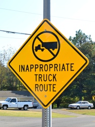
"Inappropriate truck route"
-
Former Eagle Springs Winery [02]
![Former Eagle Springs Winery [02] (2121 visits) The former Eagle Springs Winery, on West Dumplin Valley Road in Sevierville, Tennessee. The facilit... Former Eagle Springs Winery [02]](../../i/upload/2024/07/20/20240720120233-9e6f6e35-cu_s9999x250.jpg)
-
West Dumplin Valley Road [03]
![West Dumplin Valley Road [03] (4126 visits) Businesses along West Dumplin Valley Road, which runs just south of Interstate 40, in Sevierville, T... West Dumplin Valley Road [03]](../../i/upload/2024/07/20/20240720120238-68c626bc-cu_s9999x250.jpg)
-
On the ground at Eagle Springs Winery
-
West Dumplin Valley Road [02]
![West Dumplin Valley Road [02] (3829 visits) Businesses along West Dumplin Valley Road, which runs just south of Interstate 40, in Sevierville, T... West Dumplin Valley Road [02]](../../i/upload/2024/07/20/20240720120306-846e6bb2-cu_s9999x250.jpg)