-
150 Sudbury Street [01]
![150 Sudbury Street [01] (1274 visits) 150 Sudbury Street, an apartment building at the corner of Sudbury and Abell Streets.
More at The S... 150 Sudbury Street [01]](../../i/upload/2024/07/19/20240719003122-02962f52-cu_s9999x250.jpg)
-
150 Sudbury Street [02]
![150 Sudbury Street [02] (1252 visits) 150 Sudbury Street, an apartment building at the corner of Sudbury and Abell Streets.
More at The S... 150 Sudbury Street [02]](../../i/upload/2024/07/19/20240719003125-80db5da5-cu_s9999x250.jpg)
-
170 Laurier Avenue West
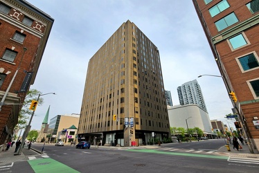
-
1815 North Fort Myer Drive and Turnberry Tower [01]
![1815 North Fort Myer Drive and Turnberry Tower [01] (5033 visits) 1815 North Fort Myer Drive undergoes demolition in the foreground while the new Turnberry Tower cond... 1815 North Fort Myer Drive and Turnberry Tower [01]](../../i/upload/2024/07/15/20240715215222-a731559a-cu_s9999x250.jpg)
-
1815 North Fort Myer Drive and Turnberry Tower [02]
![1815 North Fort Myer Drive and Turnberry Tower [02] (2874 visits) 1815 North Fort Myer Drive undergoes demolition in the foreground while the new Turnberry Tower cond... 1815 North Fort Myer Drive and Turnberry Tower [02]](../../i/upload/2024/07/15/20240715215300-820bfb90-cu_s9999x250.jpg)
-
2 Eaton Street [01]
![2 Eaton Street [01] (2215 visits) 2 Eaton Street, an office building in Hampton, Virginia.
More at The Schumin Web:
www.schuminweb.co... 2 Eaton Street [01]](../../i/upload/2024/07/19/20240719210610-dccc3ada-cu_s9999x250.jpg)
-
2 Eaton Street [02]
![2 Eaton Street [02] (2316 visits) 2 Eaton Street, an office building in Hampton, Virginia.
More at The Schumin Web:
www.schuminweb.co... 2 Eaton Street [02]](../../i/upload/2024/07/19/20240719210401-8364ea14-cu_s9999x250.jpg)
-
2 Eaton Street [03]
![2 Eaton Street [03] (2619 visits) Lobby for 2 Eaton Street, an office building in Hampton, Virginia.
More at The Schumin Web:
www.sch... 2 Eaton Street [03]](../../i/upload/2024/07/19/20240719210625-7dcc5404-cu_s9999x250.jpg)
-
277 Fifth Avenue
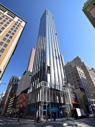
-
481 North Frederick Avenue
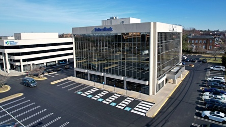
-
500 Fifth Avenue [01]
![500 Fifth Avenue [01] (2140 visits) 500 Fifth Avenue, an art deco office building at the intersection of Fifth Avenue and West 42nd Stre... 500 Fifth Avenue [01]](../../i/upload/2024/07/20/20240720150639-50162d3c-cu_s9999x250.jpg)
-
500 Fifth Avenue [02]
![500 Fifth Avenue [02] (2190 visits) 500 Fifth Avenue, an art deco office building at the intersection of Fifth Avenue and West 42nd Stre... 500 Fifth Avenue [02]](../../i/upload/2024/07/20/20240720150657-ca81ec88-cu_s9999x250.jpg)
-
500 Fifth Avenue [03]
![500 Fifth Avenue [03] (2207 visits) 500 Fifth Avenue, an art deco office building at the intersection of Fifth Avenue and West 42nd Stre... 500 Fifth Avenue [03]](../../i/upload/2024/07/20/20240720150651-ec0e8a1d-cu_s9999x250.jpg)
-
500 Fifth Avenue [04]
![500 Fifth Avenue [04] (2351 visits) 500 Fifth Avenue, an art deco office building at the intersection of Fifth Avenue and West 42nd Stre... 500 Fifth Avenue [04]](../../i/upload/2024/07/20/20240720150645-39a05a65-cu_s9999x250.jpg)
-
500 Fifth Avenue [05]
![500 Fifth Avenue [05] (2339 visits) 500 Fifth Avenue, an art deco office building at the intersection of Fifth Avenue and West 42nd Stre... 500 Fifth Avenue [05]](../../i/upload/2024/07/20/20240720150634-67318be6-cu_s9999x250.jpg)
-
500 Fifth Avenue [06]
![500 Fifth Avenue [06] (2454 visits) 500 Fifth Avenue, an art deco office building at the intersection of Fifth Avenue and West 42nd Stre... 500 Fifth Avenue [06]](../../i/upload/2024/07/20/20240720150714-89f9a482-cu_s9999x250.jpg)
-
7900 Sudley Road
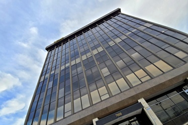
-
875 North Michigan Avenue [01]
![875 North Michigan Avenue [01] (2463 visits) 875 North Michigan Avenue, formerly the John Hancock Center, and surrounding buildings, viewed from ... 875 North Michigan Avenue [01]](../../i/upload/2024/11/13/20241113234733-9c97174a-cu_s9999x250.jpg)
-
875 North Michigan Avenue [02]
![875 North Michigan Avenue [02] (2561 visits) 875 North Michigan Avenue, formerly the John Hancock Center, and surrounding buildings, viewed from ... 875 North Michigan Avenue [02]](../../i/upload/2024/11/13/20241113234842-573a8acd-cu_s9999x250.jpg)
-
875 North Michigan Avenue [03]
![875 North Michigan Avenue [03] (2583 visits) 875 North Michigan Avenue, formerly the John Hancock Center, and surrounding buildings, viewed from ... 875 North Michigan Avenue [03]](../../i/upload/2024/11/13/20241113234939-496d3d09-cu_s9999x250.jpg)
-
875 North Michigan Avenue [04]
![875 North Michigan Avenue [04] (2679 visits) West facade of 875 North Michigan Avenue, formerly the John Hancock Center, a mixed-use skyscraper i... 875 North Michigan Avenue [04]](../../i/upload/2024/11/13/20241113235039-3685a309-cu_s9999x250.jpg)
-
900 North Michigan Avenue
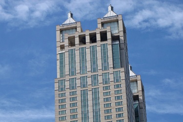
-
Adaire apartment building [01]
![Adaire apartment building [01] (1629 visits) Nighttime view of the Adaire apartment building in Tysons Corner, Virginia.
Ben Schumin is a profes... Adaire apartment building [01]](../../i/upload/2024/07/19/20240719004159-db9a17c2-cu_s9999x250.jpg)
-
Adaire apartment building [02]
![Adaire apartment building [02] (1674 visits) Nighttime view of the Adaire apartment building in Tysons Corner, Virginia.
Ben Schumin is a profes... Adaire apartment building [02]](../../i/upload/2024/07/19/20240719004206-e8c55e7c-cu_s9999x250.jpg)
-
Adaire apartment building [03]
![Adaire apartment building [03] (1633 visits) Nighttime view of the Adaire apartment building in Tysons Corner, Virginia.
Ben Schumin is a profes... Adaire apartment building [03]](../../i/upload/2024/07/19/20240719004203-018e76a4-cu_s9999x250.jpg)
-
Adaire apartment building [04]
![Adaire apartment building [04] (1593 visits) Nighttime view of the Adaire apartment building in Tysons Corner, Virginia.
Ben Schumin is a profes... Adaire apartment building [04]](../../i/upload/2024/07/19/20240719004209-d4247ee1-cu_s9999x250.jpg)
-
Adaire apartment building [05]
![Adaire apartment building [05] (1626 visits) Nighttime view of the Adaire apartment building in Tysons Corner, Virginia.
Ben Schumin is a profes... Adaire apartment building [05]](../../i/upload/2024/07/19/20240719004215-fcc3dff8-cu_s9999x250.jpg)
-
Adaire apartment building [06]
![Adaire apartment building [06] (1623 visits) Nighttime view of the Adaire apartment building in Tysons Corner, Virginia.
Ben Schumin is a profes... Adaire apartment building [06]](../../i/upload/2024/07/19/20240719004212-12d083a9-cu_s9999x250.jpg)
-
Adaire apartment building [07]
![Adaire apartment building [07] (1524 visits) Nighttime view of the Adaire apartment building in Tysons Corner, Virginia.
Ben Schumin is a profes... Adaire apartment building [07]](../../i/upload/2024/07/19/20240719004219-5c3de320-cu_s9999x250.jpg)
-
Adaire apartment building [08]
![Adaire apartment building [08] (1739 visits) Nighttime view of the Adaire apartment building in Tysons Corner, Virginia.
More at The Schumin Web... Adaire apartment building [08]](../../i/upload/2024/07/19/20240719101105-3ae9d8d2-cu_s9999x250.jpg)
-
Aerial view from Clark Street Beach, facing south [01]
![Aerial view from Clark Street Beach, facing south [01] (2274 visits) Aerial view over Lake Michigan from near Clark Street Beach in Evanston, Illinois. View facing appr... Aerial view from Clark Street Beach, facing south [01]](../../i/upload/2024/11/09/20241109111014-d364cdbf-cu_s9999x250.jpg)
-
Aerial view from Clark Street Beach, facing south [02]
![Aerial view from Clark Street Beach, facing south [02] (2210 visits) Aerial view over Lake Michigan from near Clark Street Beach in Evanston, Illinois. View facing appr... Aerial view from Clark Street Beach, facing south [02]](../../i/upload/2024/11/09/20241109111017-9276cd78-cu_s9999x250.jpg)
-
Aerial view from Clark Street Beach, facing south [03]
![Aerial view from Clark Street Beach, facing south [03] (3596 visits) Aerial view over Lake Michigan from near Clark Street Beach in Evanston, Illinois. View facing appr... Aerial view from Clark Street Beach, facing south [03]](../../i/upload/2024/11/09/20241109111021-2a94ef25-cu_s9999x250.jpg)
-
Aerial view from Clark Street Beach, facing south [04]
![Aerial view from Clark Street Beach, facing south [04] (3793 visits) Aerial view over Lake Michigan from near Clark Street Beach in Evanston, Illinois. View facing appr... Aerial view from Clark Street Beach, facing south [04]](../../i/upload/2024/11/09/20241109111026-85a83874-cu_s9999x250.jpg)
-
Aerial view from Clark Street Beach, facing south [05]
![Aerial view from Clark Street Beach, facing south [05] (2266 visits) Aerial view over Lake Michigan from near Clark Street Beach in Evanston, Illinois. View facing appr... Aerial view from Clark Street Beach, facing south [05]](../../i/upload/2024/11/09/20241109111030-e05630ba-cu_s9999x250.jpg)
-
Aerial view of downtown Charleston, South Carolina [01]

![Aerial view of downtown Charleston, South Carolina [01] (70 visits) Aerial view of downtown Charleston, South Carolina, from above the intersection of King and Reid Str... Aerial view of downtown Charleston, South Carolina [01]](../../i/upload/2025/05/23/20250523172204-ea3abf92-cu_s9999x250.jpg)
-
Aerial view of downtown Charleston, South Carolina [05]

![Aerial view of downtown Charleston, South Carolina [05] (32 visits) Aerial view of downtown Charleston, South Carolina, from above the intersection of King and Ann Stre... Aerial view of downtown Charleston, South Carolina [05]](../../i/upload/2025/05/24/20250524005405-6d254e98-cu_s9999x250.jpg)
-
Aerial view of East Liberty Presbyterian Church [01]
![Aerial view of East Liberty Presbyterian Church [01] (3425 visits) Aerial view of East Liberty Presbyterian Church, also known as the Cathedral of Hope, a large church... Aerial view of East Liberty Presbyterian Church [01]](../../i/upload/2024/07/20/20240720161117-a77350d6-cu_s9999x250.jpg)
-
Aerial view of East Liberty Presbyterian Church [02]
![Aerial view of East Liberty Presbyterian Church [02] (3380 visits) Aerial view of East Liberty Presbyterian Church, also known as the Cathedral of Hope, a large church... Aerial view of East Liberty Presbyterian Church [02]](../../i/upload/2024/07/20/20240720160925-113a640a-cu_s9999x250.jpg)
-
Aerial view of East Liberty Presbyterian Church [03]
![Aerial view of East Liberty Presbyterian Church [03] (3417 visits) Aerial view of East Liberty Presbyterian Church, also known as the Cathedral of Hope, a large church... Aerial view of East Liberty Presbyterian Church [03]](../../i/upload/2024/07/20/20240720161105-e2137cac-cu_s9999x250.jpg)
-
Aerial view of East Liberty Presbyterian Church [04]
![Aerial view of East Liberty Presbyterian Church [04] (3402 visits) Aerial view of East Liberty Presbyterian Church, also known as the Cathedral of Hope, a large church... Aerial view of East Liberty Presbyterian Church [04]](../../i/upload/2024/07/20/20240720160929-16fd7e34-cu_s9999x250.jpg)
-
Aerial view of East Liberty Presbyterian Church [05]
![Aerial view of East Liberty Presbyterian Church [05] (3523 visits) Aerial view of East Liberty Presbyterian Church, also known as the Cathedral of Hope, a large church... Aerial view of East Liberty Presbyterian Church [05]](../../i/upload/2024/07/20/20240720161109-bae1d6d3-cu_s9999x250.jpg)
-
Aerial view of East Liberty Presbyterian Church [06]
![Aerial view of East Liberty Presbyterian Church [06] (3380 visits) Aerial view of East Liberty Presbyterian Church, also known as the Cathedral of Hope, a large church... Aerial view of East Liberty Presbyterian Church [06]](../../i/upload/2024/07/20/20240720160933-a6419b30-cu_s9999x250.jpg)
-
Aerial view of East Liberty Presbyterian Church [07]
![Aerial view of East Liberty Presbyterian Church [07] (3364 visits) Aerial view of East Liberty Presbyterian Church, also known as the Cathedral of Hope, a large church... Aerial view of East Liberty Presbyterian Church [07]](../../i/upload/2024/07/20/20240720161134-5af0a002-cu_s9999x250.jpg)
-
Aerial view of East Liberty Presbyterian Church [08]
![Aerial view of East Liberty Presbyterian Church [08] (3415 visits) Aerial view of East Liberty Presbyterian Church, also known as the Cathedral of Hope, a large church... Aerial view of East Liberty Presbyterian Church [08]](../../i/upload/2024/07/20/20240720161021-d331e071-cu_s9999x250.jpg)
-
Aerial view of East Liberty Presbyterian Church [09]
![Aerial view of East Liberty Presbyterian Church [09] (3421 visits) Aerial view of East Liberty Presbyterian Church, also known as the Cathedral of Hope, a large church... Aerial view of East Liberty Presbyterian Church [09]](../../i/upload/2024/07/20/20240720161129-5fb4069e-cu_s9999x250.jpg)
-
Aerial view of East Liberty Presbyterian Church [10]
![Aerial view of East Liberty Presbyterian Church [10] (3398 visits) Aerial view of East Liberty Presbyterian Church, also known as the Cathedral of Hope, a large church... Aerial view of East Liberty Presbyterian Church [10]](../../i/upload/2024/07/20/20240720161000-0209603e-cu_s9999x250.jpg)
-
Aerial view of East Liberty Presbyterian Church [11]
![Aerial view of East Liberty Presbyterian Church [11] (3367 visits) Aerial view of East Liberty Presbyterian Church, also known as the Cathedral of Hope, a large church... Aerial view of East Liberty Presbyterian Church [11]](../../i/upload/2024/07/20/20240720160938-8f5a529e-cu_s9999x250.jpg)
-
Aerial view of East Liberty Presbyterian Church [12]
![Aerial view of East Liberty Presbyterian Church [12] (3434 visits) Aerial view of East Liberty Presbyterian Church, also known as the Cathedral of Hope, a large church... Aerial view of East Liberty Presbyterian Church [12]](../../i/upload/2024/07/20/20240720160942-7f513a92-cu_s9999x250.jpg)
-
Aerial view of East Liberty Presbyterian Church [13]
![Aerial view of East Liberty Presbyterian Church [13] (3355 visits) Aerial view of East Liberty Presbyterian Church, also known as the Cathedral of Hope, a large church... Aerial view of East Liberty Presbyterian Church [13]](../../i/upload/2024/07/20/20240720161004-3f71162c-cu_s9999x250.jpg)
-
Aerial view of East Liberty Presbyterian Church [14]
![Aerial view of East Liberty Presbyterian Church [14] (3464 visits) Aerial view of East Liberty Presbyterian Church, also known as the Cathedral of Hope, a large church... Aerial view of East Liberty Presbyterian Church [14]](../../i/upload/2024/07/20/20240720161121-2f08111b-cu_s9999x250.jpg)
-
Aerial view of East Liberty Presbyterian Church [15]
![Aerial view of East Liberty Presbyterian Church [15] (3338 visits) Aerial view of East Liberty Presbyterian Church, also known as the Cathedral of Hope, a large church... Aerial view of East Liberty Presbyterian Church [15]](../../i/upload/2024/07/20/20240720161034-6b35469d-cu_s9999x250.jpg)
-
Aerial view of East Liberty Presbyterian Church [16]
![Aerial view of East Liberty Presbyterian Church [16] (3386 visits) Aerial view of East Liberty Presbyterian Church, also known as the Cathedral of Hope, a large church... Aerial view of East Liberty Presbyterian Church [16]](../../i/upload/2024/07/20/20240720161125-66b55a4b-cu_s9999x250.jpg)
-
Aerial view of East Liberty Presbyterian Church [17]
![Aerial view of East Liberty Presbyterian Church [17] (3374 visits) Aerial view of East Liberty Presbyterian Church, also known as the Cathedral of Hope, a large church... Aerial view of East Liberty Presbyterian Church [17]](../../i/upload/2024/07/20/20240720161026-6ad4630b-cu_s9999x250.jpg)
-
Aerial view of East Liberty Presbyterian Church [18]
![Aerial view of East Liberty Presbyterian Church [18] (3423 visits) Aerial view of East Liberty Presbyterian Church, also known as the Cathedral of Hope, a large church... Aerial view of East Liberty Presbyterian Church [18]](../../i/upload/2024/07/20/20240720161008-f23a38fa-cu_s9999x250.jpg)
-
Aerial view of East Liberty Presbyterian Church [19]
![Aerial view of East Liberty Presbyterian Church [19] (3493 visits) Aerial view of East Liberty Presbyterian Church, also known as the Cathedral of Hope, a large church... Aerial view of East Liberty Presbyterian Church [19]](../../i/upload/2024/07/20/20240720161030-5a181c2c-cu_s9999x250.jpg)
-
Aerial view of East Liberty Presbyterian Church [20]
![Aerial view of East Liberty Presbyterian Church [20] (3431 visits) Aerial view of East Liberty Presbyterian Church, also known as the Cathedral of Hope, a large church... Aerial view of East Liberty Presbyterian Church [20]](../../i/upload/2024/07/20/20240720160946-69e2d66b-cu_s9999x250.jpg)
-
Aerial view of East Liberty Presbyterian Church [21]
![Aerial view of East Liberty Presbyterian Church [21] (3388 visits) Aerial view of East Liberty Presbyterian Church, also known as the Cathedral of Hope, a large church... Aerial view of East Liberty Presbyterian Church [21]](../../i/upload/2024/07/20/20240720161013-99e0adfe-cu_s9999x250.jpg)
-
Aerial view of East Liberty Presbyterian Church [22]
![Aerial view of East Liberty Presbyterian Church [22] (3447 visits) Aerial view of East Liberty Presbyterian Church, also known as the Cathedral of Hope, a large church... Aerial view of East Liberty Presbyterian Church [22]](../../i/upload/2024/07/20/20240720161113-6de998b7-cu_s9999x250.jpg)
-
Aerial view of East Liberty Presbyterian Church [23]
![Aerial view of East Liberty Presbyterian Church [23] (3457 visits) Aerial view of East Liberty Presbyterian Church, also known as the Cathedral of Hope, a large church... Aerial view of East Liberty Presbyterian Church [23]](../../i/upload/2024/07/20/20240720160950-71281329-cu_s9999x250.jpg)
-
Aerial view of Roanoke, Virginia [01]
![Aerial view of Roanoke, Virginia [01] (2440 visits) Aerial view of Roanoke, Virginia.
More at The Schumin Web:
www.schuminweb.com/life-and-times/advent... Aerial view of Roanoke, Virginia [01]](../../i/upload/2024/07/20/20240720121757-bb58476c-cu_s9999x250.jpg)
-
Aerial view of Roanoke, Virginia [02]
![Aerial view of Roanoke, Virginia [02] (2344 visits) Aerial view of Roanoke, Virginia.
More at The Schumin Web:
www.schuminweb.com/life-and-times/advent... Aerial view of Roanoke, Virginia [02]](../../i/upload/2024/07/20/20240720121808-dccb83a0-cu_s9999x250.jpg)
-
Aerial view of Roanoke, Virginia [03]
![Aerial view of Roanoke, Virginia [03] (2345 visits) Aerial view of Roanoke, Virginia.
More at The Schumin Web:
www.schuminweb.com/life-and-times/advent... Aerial view of Roanoke, Virginia [03]](../../i/upload/2024/07/20/20240720121837-3c6bbb13-cu_s9999x250.jpg)
-
Aerial view of Roanoke, Virginia [04]
![Aerial view of Roanoke, Virginia [04] (2431 visits) Aerial view of Roanoke, Virginia.
More at The Schumin Web:
www.schuminweb.com/life-and-times/advent... Aerial view of Roanoke, Virginia [04]](../../i/upload/2024/07/20/20240720121854-34748718-cu_s9999x250.jpg)
-
Aerial view of Roanoke, Virginia [05]
![Aerial view of Roanoke, Virginia [05] (2323 visits) Aerial view of Roanoke, Virginia.
More at The Schumin Web:
www.schuminweb.com/life-and-times/advent... Aerial view of Roanoke, Virginia [05]](../../i/upload/2024/07/20/20240720121906-5f802cee-cu_s9999x250.jpg)
-
Aerial view of Roanoke, Virginia [06]
![Aerial view of Roanoke, Virginia [06] (2225 visits) Aerial view of Roanoke, Virginia.
More at The Schumin Web:
www.schuminweb.com/life-and-times/advent... Aerial view of Roanoke, Virginia [06]](../../i/upload/2024/07/20/20240720121917-3d4a6311-cu_s9999x250.jpg)
-
Aerial view of the Roanoke Star [01]
![Aerial view of the Roanoke Star [01] (1770 visits) Aerial view of the Roanoke Star, a landmark atop Mill Mountain in Roanoke, Virginia.
Ben Schumin is... Aerial view of the Roanoke Star [01]](../../i/upload/2025/03/03/20250303104030-b2af10f4-cu_s9999x250.jpg)
-
Aerial view of the Roanoke Star [02]
![Aerial view of the Roanoke Star [02] (1840 visits) Aerial view of the Roanoke Star, a landmark atop Mill Mountain in Roanoke, Virginia.
Ben Schumin is... Aerial view of the Roanoke Star [02]](../../i/upload/2025/03/03/20250303104038-bfb5c40b-cu_s9999x250.jpg)
-
Aerial view of the Roanoke Star [03]
![Aerial view of the Roanoke Star [03] (1779 visits) Aerial view of the Roanoke Star, a landmark atop Mill Mountain in Roanoke, Virginia.
Ben Schumin is... Aerial view of the Roanoke Star [03]](../../i/upload/2025/03/03/20250303104044-0107081b-cu_s9999x250.jpg)
-
Aerial view of the Roanoke Star [04]
![Aerial view of the Roanoke Star [04] (1760 visits) Aerial view of the Roanoke Star, a landmark atop Mill Mountain in Roanoke, Virginia.
Ben Schumin is... Aerial view of the Roanoke Star [04]](../../i/upload/2025/03/03/20250303104050-2b9f8ca3-cu_s9999x250.jpg)
-
Aerial view of the Roanoke Star [05]
![Aerial view of the Roanoke Star [05] (1721 visits) Aerial view of the Roanoke Star, a landmark atop Mill Mountain in Roanoke, Virginia.
Ben Schumin is... Aerial view of the Roanoke Star [05]](../../i/upload/2025/03/03/20250303104057-ffa64f72-cu_s9999x250.jpg)
-
Aerial view of the Roanoke Star [06]
![Aerial view of the Roanoke Star [06] (1762 visits) Aerial view of the Roanoke Star, a landmark atop Mill Mountain in Roanoke, Virginia.
Ben Schumin is... Aerial view of the Roanoke Star [06]](../../i/upload/2025/03/03/20250303104103-f82a90f2-cu_s9999x250.jpg)
-
Aerial view of the Roanoke Star [07]
![Aerial view of the Roanoke Star [07] (1739 visits) Aerial view of the Roanoke Star, a landmark atop Mill Mountain in Roanoke, Virginia.
Ben Schumin is... Aerial view of the Roanoke Star [07]](../../i/upload/2025/03/03/20250303104109-3e9db85e-cu_s9999x250.jpg)
-
Aerial view of the Roanoke Star [08]
![Aerial view of the Roanoke Star [08] (1735 visits) Aerial view of the Roanoke Star, a landmark atop Mill Mountain in Roanoke, Virginia.
Ben Schumin is... Aerial view of the Roanoke Star [08]](../../i/upload/2025/03/03/20250303104116-72f4bf50-cu_s9999x250.jpg)
-
Aerial view of the Roanoke Star [09]
![Aerial view of the Roanoke Star [09] (1733 visits) Aerial view of the Roanoke Star, a landmark atop Mill Mountain in Roanoke, Virginia.
Ben Schumin is... Aerial view of the Roanoke Star [09]](../../i/upload/2025/03/03/20250303104122-0547d183-cu_s9999x250.jpg)
-
Aerial view of the Roanoke Star [10]
![Aerial view of the Roanoke Star [10] (1712 visits) Aerial view of the Roanoke Star, a landmark atop Mill Mountain in Roanoke, Virginia.
Ben Schumin is... Aerial view of the Roanoke Star [10]](../../i/upload/2025/03/03/20250303104127-fefb7546-cu_s9999x250.jpg)
-
Aerial view of the Roanoke Star [11]
![Aerial view of the Roanoke Star [11] (1800 visits) Aerial view of the Roanoke Star, a landmark atop Mill Mountain in Roanoke, Virginia.
Ben Schumin is... Aerial view of the Roanoke Star [11]](../../i/upload/2025/03/03/20250303104133-3d023ab1-cu_s9999x250.jpg)
-
Aerial view of the Roanoke Star [12]
![Aerial view of the Roanoke Star [12] (2166 visits) Aerial view of the Roanoke Star, a landmark atop Mill Mountain in Roanoke, Virginia.
Ben Schumin is... Aerial view of the Roanoke Star [12]](../../i/upload/2025/03/03/20250303104139-be18f38c-cu_s9999x250.jpg)
-
Aerial view of the Roanoke Star [13]
![Aerial view of the Roanoke Star [13] (1758 visits) Aerial view of the Roanoke Star, a landmark atop Mill Mountain in Roanoke, Virginia.
Ben Schumin is... Aerial view of the Roanoke Star [13]](../../i/upload/2025/03/03/20250303104145-f725aaf6-cu_s9999x250.jpg)
-
Aerial view of the Sunsphere [01]
![Aerial view of the Sunsphere [01] (3435 visits) Aerial view of the Sunsphere, at the World's Fair Park in downtown Knoxville. The Sunsphere, along ... Aerial view of the Sunsphere [01]](../../i/upload/2024/07/20/20240720114014-b8be4381-cu_s9999x250.jpg)