
Ben Schumin Photography Portfolio
Ben Schumin is a professional photographer who captures the intricacies of daily life.
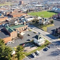
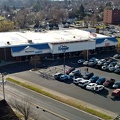
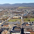
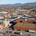
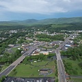
Aerial view of downtown Waynesboro, Virginia, facing approximately west.

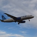
![N128HQ departing Washington National Airport [01]](../../../../i/upload/2024/07/18/20240718220930-7a13660c-sq.jpg)
![N128HQ departing Washington National Airport [02]](../../../../i/upload/2024/07/18/20240718220935-f8b94e75-sq.jpg)
![N128HQ departing Washington National Airport [03]](../../../../i/upload/2024/07/18/20240718220940-1138744a-sq.jpg)
![N131HQ departing Washington National Airport [01]](../../../../i/upload/2024/07/18/20240718220944-692659f7-sq.jpg)
![N131HQ departing Washington National Airport [02]](../../../../i/upload/2024/07/18/20240718220948-7bbdfa71-sq.jpg)


![N302DN departing Washington National Airport [01]](../../../../i/upload/2024/07/18/20240718221000-f2a2ed74-sq.jpg)
![N302DN departing Washington National Airport [02]](../../../../i/upload/2024/07/18/20240718221004-36c6c73e-sq.jpg)
![N302DN departing Washington National Airport [03]](../../../../i/upload/2024/07/18/20240718221008-745c7469-sq.jpg)


![N512AE departing Washington National Airport [01]](../../../../i/upload/2024/07/18/20240718221032-6479a512-sq.jpg)
![N512AE departing Washington National Airport [02]](../../../../i/upload/2024/07/18/20240718221036-255ff340-sq.jpg)
![N591NN departing Washington National Airport [01]](../../../../i/upload/2024/07/18/20240718221040-78bbc1a1-sq.jpg)
![N591NN departing Washington National Airport [02]](../../../../i/upload/2024/07/18/20240718221043-9c17816d-sq.jpg)


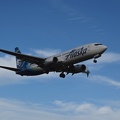
![N720PS departing Washington National Airport [01]](../../../../i/upload/2024/07/18/20240718221057-6b1a04d8-sq.jpg)
![N720PS departing Washington National Airport [02]](../../../../i/upload/2024/07/18/20240718221101-89067315-sq.jpg)
![N720PS departing Washington National Airport [03]](../../../../i/upload/2024/07/18/20240718221106-76b801f0-sq.jpg)

![N858RW departing Washington National Airport [01]](../../../../i/upload/2024/07/18/20240718221115-4597fb98-sq.jpg)
![N858RW departing Washington National Airport [02]](../../../../i/upload/2024/07/18/20240718221119-a750bfb7-sq.jpg)
![N858RW departing Washington National Airport [03]](../../../../i/upload/2024/07/18/20240718221123-c76705cf-sq.jpg)
![N932AN departing Washington National Airport [01]](../../../../i/upload/2024/07/18/20240718221127-493ec2c4-sq.jpg)
![N932AN departing Washington National Airport [02]](../../../../i/upload/2024/07/18/20240718221131-2f1cf9b5-sq.jpg)
![N932AN departing Washington National Airport [03]](../../../../i/upload/2024/07/18/20240718221135-f680b3a4-sq.jpg)
![N932AN departing Washington National Airport [04]](../../../../i/upload/2024/07/18/20240718221138-960bda66-sq.jpg)
![N7812G departing Washington National Airport [01]](../../../../i/upload/2024/07/18/20240718221142-abe21590-sq.jpg)
![N7812G departing Washington National Airport [02]](../../../../i/upload/2024/07/18/20240718221146-6bf0df8c-sq.jpg)
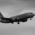
![N74856 departing Washington National Airport [01]](../../../../i/upload/2024/07/18/20240718221150-5f244a3f-sq.jpg)
![N74856 departing Washington National Airport [02]](../../../../i/upload/2024/07/18/20240718221153-39aa250f-sq.jpg)
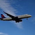
![Delta Connection airliner departs Washington National Airport [02]](../../../../i/upload/2024/07/18/20240718221157-eb219915-sq.jpg)
![Delta Connection airliner departs Washington National Airport [01]](../../../../i/upload/2024/07/18/20240718221201-f12d7569-sq.jpg)
![Delta Connection airliner departs Washington National Airport [03]](../../../../i/upload/2024/07/18/20240718221204-ec4dd28c-sq.jpg)


![Sea gull in flight [06]](../../../../i/upload/2024/07/18/20240718224228-745e0673-sq.jpg)
![Sea gull in flight [07]](../../../../i/upload/2024/07/18/20240718224235-f506c072-sq.jpg)
![Sea gull in flight [04]](../../../../i/upload/2024/07/18/20240718224238-09445754-sq.jpg)
![Sea gull in flight [01]](../../../../i/upload/2024/07/18/20240718224241-b54f1e3a-sq.jpg)
![Sea gull in flight [05]](../../../../i/upload/2024/07/18/20240718224243-b53ef532-sq.jpg)
![Sea gull in flight [03]](../../../../i/upload/2024/07/18/20240718224247-05e09086-sq.jpg)
![Sea gull in flight [02]](../../../../i/upload/2024/07/18/20240718224250-836c37ca-sq.jpg)
![Sea gull flying over the Ocean City boardwalk [02]](../../../../i/upload/2024/07/18/20240718224422-001216b6-sq.jpg)
![Sea gull flying over the Ocean City boardwalk [01]](../../../../i/upload/2024/07/18/20240718224425-70877083-sq.jpg)
![Sea gull flying over the Ocean City boardwalk [03]](../../../../i/upload/2024/07/18/20240718224428-c7065cac-sq.jpg)
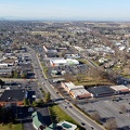
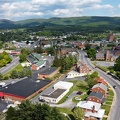
![Downtown Waynesboro, Virginia, looking toward Invista [01]](../../../../i/upload/2024/07/19/20240719125947-ee92c8f8-sq.jpg)

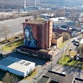
![Satellite dish on former News Virginian building [03]](../../../../i/upload/2024/07/19/20240719130207-0d430d13-sq.jpg)
![Satellite dish on former News Virginian building [02]](../../../../i/upload/2024/07/19/20240719130212-08c06a14-sq.jpg)
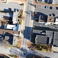
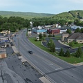
![West Main Street in Waynesboro, Virginia [03]](../../../../i/upload/2024/07/19/20240719130237-f1099710-sq.jpg)
![Satellite dish on former News Virginian building [04]](../../../../i/upload/2024/07/19/20240719130246-90d2803d-sq.jpg)
![Downtown Waynesboro, Virginia, looking toward Invista [02]](../../../../i/upload/2024/07/19/20240719130254-ae1aac9d-sq.jpg)
![Family feeding sea gulls [01]](../../../../i/upload/2024/07/19/20240719183356-bd7e8eae-sq.jpg)

![Family feeding sea gulls [02]](../../../../i/upload/2024/07/19/20240719183424-6e3fac8e-sq.jpg)
![Family feeding sea gulls [03]](../../../../i/upload/2024/07/19/20240719183429-01d40e9a-sq.jpg)
![Former Waynesboro landfill [05]](../../../../i/upload/2024/07/20/20240720022052-404098bb-sq.jpg)
![Former Waynesboro landfill [06]](../../../../i/upload/2024/07/20/20240720022103-94f9d9c0-sq.jpg)

![View from the former Waynesboro landfill site [01]](../../../../i/upload/2024/07/20/20240720022125-9939a1e4-sq.jpg)
![Former Waynesboro landfill [01]](../../../../i/upload/2024/07/20/20240720022152-d28a5b47-sq.jpg)
![Former Waynesboro landfill [02]](../../../../i/upload/2024/07/20/20240720022157-bd554d77-sq.jpg)
![View from the former Waynesboro landfill site [02]](../../../../i/upload/2024/07/20/20240720022202-6dbdc9cd-sq.jpg)
![Former Waynesboro landfill [07]](../../../../i/upload/2024/07/20/20240720022235-0b076c4d-sq.jpg)
![Former Waynesboro landfill [04]](../../../../i/upload/2024/07/20/20240720022246-d1709cd4-sq.jpg)
![Former Waynesboro landfill [03]](../../../../i/upload/2024/07/20/20240720022301-95eea6ae-sq.jpg)

![Former Waynesboro landfill [14]](../../../../i/upload/2024/07/20/20240720093828-02ad7faf-sq.jpg)
![Former Waynesboro landfill [13]](../../../../i/upload/2024/07/20/20240720093833-a61587fb-sq.jpg)
![Former Waynesboro landfill [12]](../../../../i/upload/2024/07/20/20240720093837-0bdc45c2-sq.jpg)
![Former Waynesboro landfill [11]](../../../../i/upload/2024/07/20/20240720093841-016077c0-sq.jpg)
![Former Waynesboro landfill [10]](../../../../i/upload/2024/07/20/20240720093846-8d8a5d2f-sq.jpg)
![View from the former Waynesboro landfill site [03]](../../../../i/upload/2024/07/20/20240720093850-16fb4945-sq.jpg)
![Former Waynesboro landfill [09]](../../../../i/upload/2024/07/20/20240720093855-fe2b3370-sq.jpg)
![Former Waynesboro landfill [08]](../../../../i/upload/2024/07/20/20240720093859-e02bc883-sq.jpg)


![N604EC arriving at Washington National Airport [01]](../../../../i/upload/2024/07/20/20240720144514-577b1635-sq.jpg)

![N604EC arriving at Washington National Airport [02]](../../../../i/upload/2024/07/20/20240720144529-cb792d59-sq.jpg)

Information
- Author
- Ben Schumin
- Copyright
- All Rights Reserved
- Created on
- Friday 11 December 2020
- Dimensions
- 4000*2000
Powered by Piwigo