
Ben Schumin Photography Portfolio
Ben Schumin is a professional photographer who captures the intricacies of daily life.
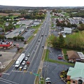
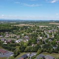
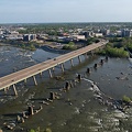
Aerial view of downtown Waynesboro, Virginia, facing approximately west.
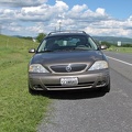
![Ford Taurus SHO [02]](../../../../../i/upload/2024/07/15/20240715141647-951bf292-sq.jpg)
![Ford Taurus SHO [01]](../../../../../i/upload/2024/07/15/20240715141649-e3b3e90e-sq.jpg)


![Signage for Exit 49 on Interstate 295 [05]](../../../../../i/upload/2024/07/19/20240719092857-ab204ec0-sq.jpg)
![Signage for Exit 49 on Interstate 295 [06]](../../../../../i/upload/2024/07/19/20240719092924-a67ffbc2-sq.jpg)
![Signage for Exit 49 on Interstate 295 [04]](../../../../../i/upload/2024/07/19/20240719092929-00e8a658-sq.jpg)
![Signage for Exit 49 on Interstate 295 [03]](../../../../../i/upload/2024/07/19/20240719092934-ceaf9b98-sq.jpg)
![Signage for Exit 49 on Interstate 295 [02]](../../../../../i/upload/2024/07/19/20240719092939-b220cdd7-sq.jpg)
![Signage for Exit 49 on Interstate 295 [01]](../../../../../i/upload/2024/07/19/20240719093116-72eb08f8-sq.jpg)
![Mileage sign on US 1 near Fredericksburg [01]](../../../../../i/upload/2024/07/19/20240719093650-38b7882f-sq.jpg)
![Mileage sign on US 1 near Fredericksburg [02]](../../../../../i/upload/2024/07/19/20240719093655-959f4e08-sq.jpg)
![Eastern terminus of US 60 [01]](../../../../../i/upload/2024/07/19/20240719101721-73bf3c40-sq.jpg)
![Eastern terminus of US 60 [02]](../../../../../i/upload/2024/07/19/20240719101751-9221fd2b-sq.jpg)
![Rocks in the Potomac River [01]](../../../../../i/upload/2024/07/19/20240719103333-6083493b-sq.jpg)
![Rocks in the Potomac River [02]](../../../../../i/upload/2024/07/19/20240719103338-04e1c1e1-sq.jpg)
![Rocks in the Potomac River [03]](../../../../../i/upload/2024/07/19/20240719103343-404e77e5-sq.jpg)
![Rocks in the Potomac River [04]](../../../../../i/upload/2024/07/19/20240719103348-1a3aef78-sq.jpg)
![Rocks in the Potomac River [05]](../../../../../i/upload/2024/07/19/20240719103353-ea395458-sq.jpg)
![Potomac River from US 340 bridge [03]](../../../../../i/upload/2024/07/19/20240719103359-b66380e8-sq.jpg)
![Potomac River from US 340 bridge [04]](../../../../../i/upload/2024/07/19/20240719103405-18d26a8b-sq.jpg)
![Potomac River from US 340 bridge [05]](../../../../../i/upload/2024/07/19/20240719103412-5b42c5b9-sq.jpg)
![Interstate 64 in Nelson County, Virginia [01]](../../../../../i/upload/2024/07/19/20240719115200-c8a2ce39-sq.jpg)
![Interstate 64 in Nelson County, Virginia [02]](../../../../../i/upload/2024/07/19/20240719115847-184fa12a-sq.jpg)
![Interstate 64 in Nelson County, Virginia [03]](../../../../../i/upload/2024/07/19/20240719115902-ff5fb9e1-sq.jpg)
![Intersection of US 340 and VA 608 [01]](../../../../../i/upload/2024/07/19/20240719120550-1673ec68-sq.jpg)
![Interstate 64 near Rockfish Gap [01]](../../../../../i/upload/2024/07/19/20240719120555-d0d3c2ce-sq.jpg)
![Intersection of US 340 and VA 608 [02]](../../../../../i/upload/2024/07/19/20240719120559-2af4c901-sq.jpg)
![Interstate 64 near Rockfish Gap [02]](../../../../../i/upload/2024/07/19/20240719120604-e2ad25dd-sq.jpg)
![Interstate 64 near Rockfish Gap [03]](../../../../../i/upload/2024/07/19/20240719120613-6e2190f6-sq.jpg)

![Interstate 64 near Rockfish Gap [04]](../../../../../i/upload/2024/07/19/20240719120620-49d9b327-sq.jpg)
![Interstate 64 near Rockfish Gap [05]](../../../../../i/upload/2024/07/19/20240719120629-90e00218-sq.jpg)
![Point of Rocks Bridge [03]](../../../../../i/upload/2024/07/19/20240719121604-b7b9e112-sq.jpg)
![Point of Rocks Bridge [05]](../../../../../i/upload/2024/07/19/20240719121622-d2dfa3a8-sq.jpg)
![Point of Rocks Bridge [02]](../../../../../i/upload/2024/07/19/20240719121627-117c91a4-sq.jpg)
![Point of Rocks Bridge [01]](../../../../../i/upload/2024/07/19/20240719121631-a890c001-sq.jpg)
![Point of Rocks Bridge [04]](../../../../../i/upload/2024/07/19/20240719122649-6c75d4bd-sq.jpg)
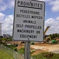
!["Littering is illegal" sign [01]](../../../../../i/upload/2024/07/19/20240719124007-1b4f030c-sq.jpg)

![US 29 Business in Culpeper, Virginia [01]](../../../../../i/upload/2024/07/19/20240719155959-cf1d0444-sq.jpg)
![Shield for State Route 254 [01]](../../../../../i/upload/2024/07/19/20240719160500-1fdaedc1-sq.jpg)
![Shield for State Route 254 [02]](../../../../../i/upload/2024/07/19/20240719160516-e72119d6-sq.jpg)
![Richmond Avenue in Staunton, Virginia [01]](../../../../../i/upload/2024/07/19/20240719161158-ddf9fe35-sq.jpg)
![Richmond Avenue in Staunton, Virginia [02]](../../../../../i/upload/2024/07/19/20240719161203-233bb776-sq.jpg)
![Richmond Avenue in Staunton, Virginia [03]](../../../../../i/upload/2024/07/19/20240719161212-297c1b53-sq.jpg)

![Point of Rocks Bridge [06]](../../../../../i/upload/2024/07/19/20240719161609-122bd90b-sq.jpg)
![Point of Rocks Bridge [07]](../../../../../i/upload/2024/07/19/20240719161650-2c49391d-sq.jpg)
![Point of Rocks Bridge [08]](../../../../../i/upload/2024/07/19/20240719161700-351af3cd-sq.jpg)
![Point of Rocks Bridge [09]](../../../../../i/upload/2024/07/19/20240719161708-5ce37e28-sq.jpg)
![Point of Rocks Bridge [10]](../../../../../i/upload/2024/07/19/20240719161717-6572a682-sq.jpg)
![Point of Rocks Bridge [11]](../../../../../i/upload/2024/07/19/20240719161730-4f51193a-sq.jpg)
![Commercial area south of Interstate 81 in Harrisonburg [01]](../../../../../i/upload/2024/07/19/20240719163715-46af96f9-sq.jpg)
![Vintage Seagrave fire truck at Churchville Volunteer Fire Department [01]](../../../../../i/upload/2024/07/19/20240719164407-74f7e276-sq.jpg)
![Vintage Seagrave fire truck at Churchville Volunteer Fire Department [02]](../../../../../i/upload/2024/07/19/20240719164413-0b8113ea-sq.jpg)
![Vintage Seagrave fire truck at Churchville Volunteer Fire Department [03]](../../../../../i/upload/2024/07/19/20240719164419-a2eacc42-sq.jpg)
![Churchville Volunteer Fire Department [01]](../../../../../i/upload/2024/07/19/20240719164426-c1be3535-sq.jpg)
![Churchville Volunteer Fire Department [02]](../../../../../i/upload/2024/07/19/20240719164431-2ab245f9-sq.jpg)
![Buffalo Gap [01]](../../../../../i/upload/2024/07/19/20240719164455-62064f1c-sq.jpg)
![Buffalo Gap High School [01]](../../../../../i/upload/2024/07/19/20240719164459-267a0d43-sq.jpg)
![Buffalo Gap High School [02]](../../../../../i/upload/2024/07/19/20240719164505-bdd29e59-sq.jpg)
![Buffalo Gap High School [03]](../../../../../i/upload/2024/07/19/20240719164509-fab8ad49-sq.jpg)
![Buffalo Gap High School [04]](../../../../../i/upload/2024/07/19/20240719164514-e0a1e82e-sq.jpg)
![Buffalo Gap High School [05]](../../../../../i/upload/2024/07/19/20240719164519-518a0909-sq.jpg)
![Buffalo Gap High School [06]](../../../../../i/upload/2024/07/19/20240719164523-e9a7db09-sq.jpg)
![West Main Street in Waynesboro, Virginia [01]](../../../../../i/upload/2024/07/19/20240719164545-b5a50599-sq.jpg)
![West Main Street in Waynesboro, Virginia [02]](../../../../../i/upload/2024/07/19/20240719164551-0b8407a8-sq.jpg)
![West Main Street in Waynesboro, Virginia [03]](../../../../../i/upload/2024/07/19/20240719164555-f7feeafe-sq.jpg)
![West Main Street in Waynesboro, Virginia [04]](../../../../../i/upload/2024/07/19/20240719164600-4379cef1-sq.jpg)
![US Route 1 and CSX bridges over the Occoquan River [04]](../../../../../i/upload/2024/07/19/20240719165015-7daa0318-sq.jpg)
![AT&T Long Lines tower in Dumfries, Virginia [01]](../../../../../i/upload/2024/07/19/20240719165018-181b846f-sq.jpg)
![AT&T Long Lines tower in Dumfries, Virginia [11]](../../../../../i/upload/2024/07/19/20240719165024-3f54a696-sq.jpg)
![AT&T Long Lines tower in Dumfries, Virginia [12]](../../../../../i/upload/2024/07/19/20240719165028-a8de306f-sq.jpg)
![AT&T Long Lines tower in Dumfries, Virginia [18]](../../../../../i/upload/2024/07/19/20240719165033-46ecd2ea-sq.jpg)
![AT&T Long Lines tower in Dumfries, Virginia [19]](../../../../../i/upload/2024/07/19/20240719165037-6aedec05-sq.jpg)
![AT&T Long Lines tower in Dumfries, Virginia [26]](../../../../../i/upload/2024/07/19/20240719165042-05809431-sq.jpg)
![AT&T Long Lines tower in Dumfries, Virginia [28]](../../../../../i/upload/2024/07/19/20240719165046-236b9515-sq.jpg)
![AT&T Long Lines tower in Dumfries, Virginia [32]](../../../../../i/upload/2024/07/19/20240719165051-b8547ba1-sq.jpg)
![AT&T Long Lines tower in Dumfries, Virginia [08]](../../../../../i/upload/2024/07/19/20240719165100-70693200-sq.jpg)
![US Route 1 and CSX bridges over the Occoquan River [02]](../../../../../i/upload/2024/07/19/20240719165109-05002e7d-sq.jpg)
![AT&T Long Lines tower in Dumfries, Virginia [15]](../../../../../i/upload/2024/07/19/20240719165113-dd2b92c6-sq.jpg)
![AT&T Long Lines tower in Dumfries, Virginia [17]](../../../../../i/upload/2024/07/19/20240719165117-9cc4e109-sq.jpg)
![AT&T Long Lines tower in Dumfries, Virginia [27]](../../../../../i/upload/2024/07/19/20240719165122-4f0c71b5-sq.jpg)
![AT&T Long Lines tower in Dumfries, Virginia [02]](../../../../../i/upload/2024/07/19/20240719165130-484d2461-sq.jpg)
![AT&T Long Lines tower in Dumfries, Virginia [05]](../../../../../i/upload/2024/07/19/20240719165135-b79f8f02-sq.jpg)
![AT&T Long Lines tower in Dumfries, Virginia [06]](../../../../../i/upload/2024/07/19/20240719165140-2a22b342-sq.jpg)
![AT&T Long Lines tower in Dumfries, Virginia [30]](../../../../../i/upload/2024/07/19/20240719165144-01db27aa-sq.jpg)
![US Route 1 and CSX bridges over the Occoquan River [01]](../../../../../i/upload/2024/07/19/20240719165202-fbc052c5-sq.jpg)
![AT&T Long Lines tower in Dumfries, Virginia [04]](../../../../../i/upload/2024/07/19/20240719165206-0661e0b6-sq.jpg)
![AT&T Long Lines tower in Dumfries, Virginia [14]](../../../../../i/upload/2024/07/19/20240719165211-2717f6ed-sq.jpg)
![AT&T Long Lines tower in Dumfries, Virginia [24]](../../../../../i/upload/2024/07/19/20240719165215-4b689ca2-sq.jpg)
![AT&T Long Lines tower in Dumfries, Virginia [25]](../../../../../i/upload/2024/07/19/20240719165220-7414049f-sq.jpg)
![US Route 1 and CSX bridges over the Occoquan River [03]](../../../../../i/upload/2024/07/19/20240719165233-1c08fb03-sq.jpg)
![AT&T Long Lines tower in Dumfries, Virginia [03]](../../../../../i/upload/2024/07/19/20240719165243-ff40438f-sq.jpg)
![AT&T Long Lines tower in Dumfries, Virginia [07]](../../../../../i/upload/2024/07/19/20240719165247-05d912d2-sq.jpg)
![AT&T Long Lines tower in Dumfries, Virginia [09]](../../../../../i/upload/2024/07/19/20240719165252-71e4c207-sq.jpg)
![AT&T Long Lines tower in Dumfries, Virginia [10]](../../../../../i/upload/2024/07/19/20240719165256-4dd53aad-sq.jpg)
![AT&T Long Lines tower in Dumfries, Virginia [13]](../../../../../i/upload/2024/07/19/20240719165300-ab24e332-sq.jpg)
![AT&T Long Lines tower in Dumfries, Virginia [16]](../../../../../i/upload/2024/07/19/20240719165305-96fece69-sq.jpg)
![AT&T Long Lines tower in Dumfries, Virginia [20]](../../../../../i/upload/2024/07/19/20240719165309-3fcea68b-sq.jpg)
![AT&T Long Lines tower in Dumfries, Virginia [21]](../../../../../i/upload/2024/07/19/20240719165314-ee2dc38f-sq.jpg)
![AT&T Long Lines tower in Dumfries, Virginia [22]](../../../../../i/upload/2024/07/19/20240719165319-4f23c361-sq.jpg)
![AT&T Long Lines tower in Dumfries, Virginia [23]](../../../../../i/upload/2024/07/19/20240719165323-e69e47be-sq.jpg)
![AT&T Long Lines tower in Dumfries, Virginia [29]](../../../../../i/upload/2024/07/19/20240719165327-5e6a211e-sq.jpg)
![AT&T Long Lines tower in Dumfries, Virginia [31]](../../../../../i/upload/2024/07/19/20240719165332-7037db10-sq.jpg)
![US 29 Business in Culpeper, Virginia [02]](../../../../../i/upload/2024/07/19/20240719165937-abc06307-sq.jpg)
![Ashburn station [01]](../../../../../i/upload/2024/07/19/20240719171124-6279b207-sq.jpg)
![Ashburn station [02]](../../../../../i/upload/2024/07/19/20240719171130-884487b5-sq.jpg)
![US 29 North, near Hilton Heights Road [01]](../../../../../i/upload/2024/07/19/20240719171702-b12048d7-sq.jpg)
![US 29 North, near Hilton Heights Road [02]](../../../../../i/upload/2024/07/19/20240719171717-5729f873-sq.jpg)
![DoubleTree Hotel in Charlottesville, Virginia [01]](../../../../../i/upload/2024/07/19/20240719171742-a365fe34-sq.jpg)
![US 29 near Woodbrook Drive [01]](../../../../../i/upload/2024/07/19/20240719171851-a0a055c4-sq.jpg)
![US 29 near Woodbrook Drive [02]](../../../../../i/upload/2024/07/19/20240719171856-fdca65ff-sq.jpg)
![Eastbound lanes of the Dulles Toll Road [01]](../../../../../i/upload/2024/07/19/20240719172133-f8942cdc-sq.jpg)
![Eastbound lanes of the Dulles Toll Road [02]](../../../../../i/upload/2024/07/19/20240719172138-8dd3f9d9-sq.jpg)
![Reassurance marker for US 460 Business westbound [01]](../../../../../i/upload/2024/07/19/20240719195429-a75b711e-sq.jpg)
![Reassurance marker for US 460 Business westbound [02]](../../../../../i/upload/2024/07/19/20240719195435-3d345c43-sq.jpg)
![Reassurance marker for US 301 northbound [03]](../../../../../i/upload/2024/07/19/20240719195440-449b690e-sq.jpg)
![Reassurance marker for US 301 northbound [01]](../../../../../i/upload/2024/07/19/20240719195705-7a645bac-sq.jpg)
![Reassurance marker for US 301 northbound [02]](../../../../../i/upload/2024/07/19/20240719195710-a9f10711-sq.jpg)
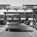
![Signs for Interstates 95 and 85 [01]](../../../../../i/upload/2024/07/19/20240719195718-f7bfccaa-sq.jpg)
![Signs for Interstates 95 and 85 [02]](../../../../../i/upload/2024/07/19/20240719195727-ba3b1d90-sq.jpg)
![James River Bridge [04]](../../../../../i/upload/2024/07/19/20240719202325-4257c4a3-sq.jpg)
![James River Bridge [05]](../../../../../i/upload/2024/07/19/20240719202330-be52e801-sq.jpg)
![James River Bridge [03]](../../../../../i/upload/2024/07/19/20240719202529-b0e807ab-sq.jpg)
![James River Bridge [08]](../../../../../i/upload/2024/07/19/20240719202534-7843f0b6-sq.jpg)
![James River Bridge [09]](../../../../../i/upload/2024/07/19/20240719202539-877160be-sq.jpg)
![James River Bridge [06]](../../../../../i/upload/2024/07/19/20240719202642-04c26af8-sq.jpg)
![James River Bridge [07]](../../../../../i/upload/2024/07/19/20240719202647-27533348-sq.jpg)
![James River Bridge [11]](../../../../../i/upload/2024/07/19/20240719202653-8658db60-sq.jpg)
![James River Bridge [02]](../../../../../i/upload/2024/07/19/20240719202733-9fb73a13-sq.jpg)
![James River Bridge [10]](../../../../../i/upload/2024/07/19/20240719202742-6238cd7f-sq.jpg)
![James River Bridge [01]](../../../../../i/upload/2024/07/19/20240719202759-cb89473a-sq.jpg)
![James River Bridge from afar [01]](../../../../../i/upload/2024/07/19/20240719203153-0a034e64-sq.jpg)
![James River Bridge from afar [02]](../../../../../i/upload/2024/07/19/20240719203158-427c0626-sq.jpg)
![Shields for US 60 and US 220 [01]](../../../../../i/upload/2024/07/19/20240719212745-19a5aed3-sq.jpg)
![Shields for US 60 and US 220 [02]](../../../../../i/upload/2024/07/19/20240719212957-8c65dc71-sq.jpg)
![Interstate 81 at Route 796 [02]](../../../../../i/upload/2024/07/20/20240720020830-706bf71d-sq.jpg)
![Interstate 81 at Route 796 [01]](../../../../../i/upload/2024/07/20/20240720020902-02c4ce7b-sq.jpg)
![Sign for State Route 188 [01]](../../../../../i/upload/2024/07/20/20240720021810-3e9b4232-sq.jpg)
![Sign for State Route 188 [02]](../../../../../i/upload/2024/07/20/20240720021827-a0810db1-sq.jpg)
![Sign for State Route 188 [03]](../../../../../i/upload/2024/07/20/20240720021833-b69f59a5-sq.jpg)
![Sign for State Route 188 [04]](../../../../../i/upload/2024/07/20/20240720021852-b244dda6-sq.jpg)
![Sign for State Route 188 [05]](../../../../../i/upload/2024/07/20/20240720021903-7bd9cd82-sq.jpg)
![Sign for State Route 188 [06]](../../../../../i/upload/2024/07/20/20240720021915-40479437-sq.jpg)

![West Broad Street at Staples Mill Road [01]](../../../../../i/upload/2024/07/20/20240720091824-c8526d69-sq.jpg)
![Interstate 85 split [01]](../../../../../i/upload/2024/07/20/20240720091907-16be82a7-sq.jpg)
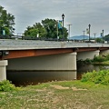
![Route 10 bridge over the Appomattox River [01]](../../../../../i/upload/2024/07/20/20240720091917-bb5ff714-sq.jpg)
![Interstate 85 split [02]](../../../../../i/upload/2024/07/20/20240720091956-f8385ec8-sq.jpg)
![Route 10 bridge over the Appomattox River [02]](../../../../../i/upload/2024/07/20/20240720092007-a0dcf942-sq.jpg)
![West Broad Street at Staples Mill Road [02]](../../../../../i/upload/2024/07/20/20240720092012-1df12de7-sq.jpg)
![Interstate 85 and US 460 reassurance markers [01]](../../../../../i/upload/2024/07/20/20240720092044-46d8955e-sq.jpg)
![Route 10 bridge over the Appomattox River [03]](../../../../../i/upload/2024/07/20/20240720092059-2caba99d-sq.jpg)
![Interstate 85 and US 460 reassurance markers [02]](../../../../../i/upload/2024/07/20/20240720092125-c916fd33-sq.jpg)
![Interstate 85 and US 460 reassurance markers [03]](../../../../../i/upload/2024/07/20/20240720092209-42a70fc2-sq.jpg)
![Rapids on the James River [01]](../../../../../i/upload/2024/07/20/20240720093011-a767724e-sq.jpg)
![Richmond skyline from the James River [02]](../../../../../i/upload/2024/07/20/20240720093043-34fedc56-sq.jpg)
![Richmond skyline from the James River [01]](../../../../../i/upload/2024/07/20/20240720093109-1fb6414b-sq.jpg)
![Rapids on the James River [02]](../../../../../i/upload/2024/07/20/20240720093135-219eaaa3-sq.jpg)
![Federal Reserve and Riverfront Plaza [02]](../../../../../i/upload/2024/07/20/20240720093206-5733a975-sq.jpg)
!["Littering is illegal" sign [02]](../../../../../i/upload/2024/07/20/20240720094020-cdd34053-sq.jpg)

![Hairpin turn on US 250 [01]](../../../../../i/upload/2024/07/20/20240720094126-511d5875-sq.jpg)
![Hairpin turn on US 250 [02]](../../../../../i/upload/2024/07/20/20240720094131-dc588684-sq.jpg)
![Farm on the Virginia-West Virginia border [01]](../../../../../i/upload/2024/07/20/20240720094156-2b1215da-sq.jpg)
![Sign for B&R Grocery [02]](../../../../../i/upload/2024/07/20/20240720094727-ec616e81-sq.jpg)
![Sign for B&R Grocery [01]](../../../../../i/upload/2024/07/20/20240720094732-3f67b536-sq.jpg)
![Verona, Virginia over Mill Place Commerce Park [01]](../../../../../i/upload/2024/07/20/20240720110653-ef33b991-sq.jpg)
![Verona, Virginia over Mill Place Commerce Park [02]](../../../../../i/upload/2024/07/20/20240720110708-9b94d246-sq.jpg)
![Verona, Virginia over Mill Place Commerce Park [05]](../../../../../i/upload/2024/07/20/20240720110734-c309d24d-sq.jpg)
![Mailbox atop a tall pole [01]](../../../../../i/upload/2024/07/20/20240720111236-5a5f8770-sq.jpg)
![Mailbox atop a tall pole [02]](../../../../../i/upload/2024/07/20/20240720111331-bfad7d41-sq.jpg)
![Mailbox atop a tall pole [03]](../../../../../i/upload/2024/07/20/20240720111523-2a1c7bfb-sq.jpg)


![Elm Avenue interchange [02]](../../../../../i/upload/2024/07/20/20240720121652-6267da79-sq.jpg)

![Elm Avenue interchange [01]](../../../../../i/upload/2024/07/20/20240720122015-70544823-sq.jpg)
![Interchange between US 11 and VA 262 [01]](../../../../../i/upload/2024/07/20/20240720124538-a29a1018-sq.jpg)

![Exit 225 on Interstate 81 [01]](../../../../../i/upload/2024/08/24/20240824104647-af96033b-sq.jpg)
![Exit 225 on Interstate 81 [02]](../../../../../i/upload/2024/08/24/20240824104650-f35998e0-sq.jpg)
![Exit 225 on Interstate 81 [03]](../../../../../i/upload/2024/08/24/20240824104656-4dd28daf-sq.jpg)
![Exit 225 on Interstate 81 [04]](../../../../../i/upload/2024/08/24/20240824104700-45b5b9b6-sq.jpg)
![Woodrow Wilson Parkway at Churchville Avenue [01]](../../../../../i/upload/2024/11/26/20241126004148-6fb2b2e4-sq.jpg)
![Woodrow Wilson Parkway at Churchville Avenue [02]](../../../../../i/upload/2024/11/26/20241126004154-6decce28-sq.jpg)
![Woodrow Wilson Parkway at Churchville Avenue [03]](../../../../../i/upload/2024/11/26/20241126004159-ac6ca342-sq.jpg)
![Woodrow Wilson Parkway at Churchville Avenue [04]](../../../../../i/upload/2024/11/26/20241126004205-1752c829-sq.jpg)
![Woodrow Wilson Parkway at Churchville Avenue [05]](../../../../../i/upload/2024/11/26/20241126004211-954cdd71-sq.jpg)
![Woodrow Wilson Parkway at Churchville Avenue [06]](../../../../../i/upload/2024/11/26/20241126004217-db5f3f5c-sq.jpg)
![Interstate 81 near Verona, Virginia [01]](../../../../../i/upload/2024/11/28/20241128103749-b97fb29f-sq.jpg)
![Interstate 81 near Verona, Virginia [02]](../../../../../i/upload/2024/11/28/20241128103753-ff030609-sq.jpg)
![Interstate 81 near Verona, Virginia [03]](../../../../../i/upload/2024/11/28/20241128103757-213af6d5-sq.jpg)
![Interstate 81 near Verona, Virginia [04]](../../../../../i/upload/2024/11/28/20241128103802-c0bab98c-sq.jpg)
![Interstate 81 near Verona, Virginia [05]](../../../../../i/upload/2024/11/28/20241128103806-21947d95-sq.jpg)
![Starbucks in Stuarts Draft, Virginia [01]](../../../../../i/upload/2024/11/29/20241129000921-0ecbb40d-sq.jpg)
![Starbucks in Stuarts Draft, Virginia [02]](../../../../../i/upload/2024/11/29/20241129000932-60d6cf61-sq.jpg)
![Starbucks in Stuarts Draft, Virginia [03]](../../../../../i/upload/2024/11/29/20241129000941-0e5747bb-sq.jpg)
![Starbucks in Stuarts Draft, Virginia [04]](../../../../../i/upload/2024/11/29/20241129000958-29fbcb86-sq.jpg)
![Starbucks in Stuarts Draft, Virginia [05]](../../../../../i/upload/2024/11/29/20241129001014-ce46bdd4-sq.jpg)
![Aerial view of Monterey, Virginia [01]](../../../../../i/upload/2025/01/02/20250102005918-685606f9-sq.jpg)
![Aerial view of Monterey, Virginia [02]](../../../../../i/upload/2025/01/02/20250102005923-7f7b9b83-sq.jpg)
![Aerial view of Monterey, Virginia [03]](../../../../../i/upload/2025/01/02/20250102005929-2e84a9d0-sq.jpg)
![Aerial view of Monterey, Virginia [04]](../../../../../i/upload/2025/01/02/20250102005937-281fae65-sq.jpg)
![Aerial view of Monterey, Virginia [05]](../../../../../i/upload/2025/01/02/20250102005946-79efaa38-sq.jpg)
![Aerial view of Monterey, Virginia [06]](../../../../../i/upload/2025/01/02/20250102005956-29786301-sq.jpg)


![Routes 220 and 39 in Warm Springs, Virginia [01]](../../../../../i/upload/2025/01/02/20250102141310-79aa8afd-sq.jpg)
![Routes 220 and 39 in Warm Springs, Virginia [02]](../../../../../i/upload/2025/01/02/20250102141319-a5501ace-sq.jpg)


![Interchange between US 11 and VA 262 [02]](../../../../../i/upload/2025/01/03/20250103172559-5c2ee040-sq.jpg)
![Interchange between VA 262 and Old Greenville Road [01]](../../../../../i/upload/2025/01/03/20250103172609-68b43692-sq.jpg)
![Interchange between VA 262 and Old Greenville Road [02]](../../../../../i/upload/2025/01/03/20250103172620-c2bd2a46-sq.jpg)
![Buffalo Gap [02]](../../../../../i/upload/2025/01/03/20250103200607-1abe8192-sq.jpg)
![Buffalo Gap Middle and High Schools [01]](../../../../../i/upload/2025/01/03/20250103202026-5cdc496f-sq.jpg)
![Buffalo Gap Middle and High Schools [02]](../../../../../i/upload/2025/01/03/20250103202032-55e71413-sq.jpg)
![Buffalo Gap Middle and High Schools [03]](../../../../../i/upload/2025/01/03/20250103202038-0ede0383-sq.jpg)
![Buffalo Gap Middle and High Schools [04]](../../../../../i/upload/2025/01/03/20250103202044-b8863daf-sq.jpg)
![Buffalo Gap Middle and High Schools [05]](../../../../../i/upload/2025/01/03/20250103202050-4b55d57a-sq.jpg)
![Buffalo Gap Middle and High Schools [06]](../../../../../i/upload/2025/01/03/20250103202056-3a028545-sq.jpg)
![Buffalo Gap Middle and High Schools [07]](../../../../../i/upload/2025/01/03/20250103202103-2963fcc1-sq.jpg)
![Buffalo Gap Middle and High Schools [08]](../../../../../i/upload/2025/01/03/20250103202111-0d42bedb-sq.jpg)
![Buffalo Gap Middle and High Schools [09]](../../../../../i/upload/2025/01/03/20250103202117-3e1c51f7-sq.jpg)
![Buffalo Gap Middle and High Schools [10]](../../../../../i/upload/2025/01/03/20250103202123-a70709f6-sq.jpg)

![Traffic circle under construction [01]](../../../../../i/upload/2025/02/22/20250222022330-4bbf063c-sq.jpg)
![Traffic circle under construction [02]](../../../../../i/upload/2025/02/22/20250222022336-e9f87960-sq.jpg)
![Traffic circle under construction [03]](../../../../../i/upload/2025/02/22/20250222022342-e895dd00-sq.jpg)

![Thornburg interchange on Interstate 95 [01]](../../../../../i/upload/2025/02/22/20250222022415-31ccb499-sq.jpg)
![Thornburg interchange on Interstate 95 [02]](../../../../../i/upload/2025/02/22/20250222022420-229d3507-sq.jpg)
![Elm Avenue interchange [03]](../../../../../i/upload/2025/03/03/20250303170720-a5bd3de6-sq.jpg)
![Elm Avenue interchange [04]](../../../../../i/upload/2025/03/03/20250303170729-c4512aea-sq.jpg)
![Tunnel under Roanoke-Blacksburg Regional Airport [01]](../../../../../i/upload/2025/03/07/20250307082638-881970da-sq.jpg)
![Tunnel under Roanoke-Blacksburg Regional Airport [02]](../../../../../i/upload/2025/03/07/20250307082646-1ee32362-sq.jpg)
![Tunnel under Roanoke-Blacksburg Regional Airport [03]](../../../../../i/upload/2025/03/07/20250307082655-ed6dde73-sq.jpg)
![Tunnel under Roanoke-Blacksburg Regional Airport [04]](../../../../../i/upload/2025/03/07/20250307082705-95dbd6b4-sq.jpg)

Information
- Author
- Ben Schumin
- Copyright
- All Rights Reserved
- Created on
- Friday 11 December 2020
- Dimensions
- 4000*2000
Powered by Piwigo