Ben Schumin Photography Portfolio
Ben Schumin is a professional photographer who captures the intricacies of daily life.

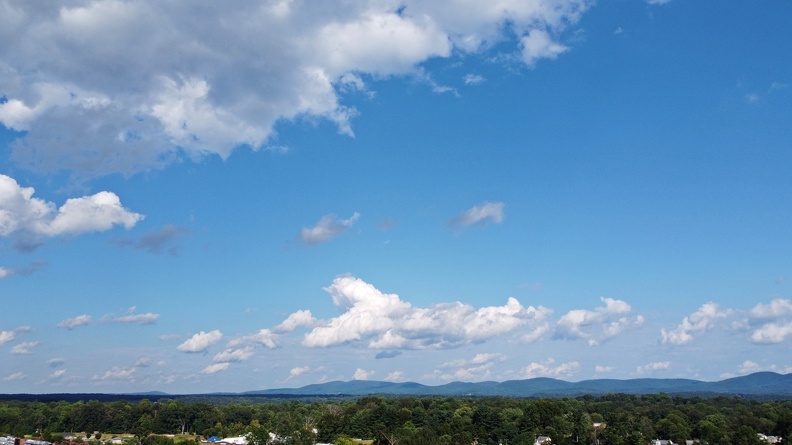
The sky above the Rio Hill shopping center, near Charlottesville, Virginia.
Information
- Author
- Ben Schumin
- Copyright
- All Rights Reserved
- Created on
- Thursday 9 September 2021
- Dimensions
- 4000*2250
Powered by Piwigo
![Sunset from I-64 overlook [03]](../../../i/upload/2024/07/13/20240713234247-066d4e9b-sq.jpg)
![Sunset from I-64 overlook [01]](../../../i/upload/2024/07/13/20240713234248-69674cad-sq.jpg)
![Sunset from I-64 overlook [02]](../../../i/upload/2024/07/13/20240713234249-3f6e970a-sq.jpg)
![Sunset from I-64 overlook [04]](../../../i/upload/2024/07/13/20240713234251-97a8e10e-sq.jpg)
![Full moon over Afton Overlook [02]](../../../i/upload/2024/07/14/20240714171102-67a435ab-sq.jpg)
![Full moon over Afton Overlook [01]](../../../i/upload/2024/07/14/20240714171103-4f67ea32-sq.jpg)


![The Vietnam Veterans Memorial [13]](../../../i/upload/2024/07/16/20240716011319-061aa90e-sq.jpg)
![Rainbow over Federal Plaza [01]](../../../i/upload/2024/07/17/20240717103248-d558c784-sq.jpg)
![Rainbow over Federal Plaza [02]](../../../i/upload/2024/07/17/20240717103252-8e428e17-sq.jpg)


![Cloudy skies over Lake Michigan [03]](../../../i/upload/2024/07/17/20240717160708-fc8bdc4b-sq.jpg)
![Cloudy skies over Lake Michigan [04]](../../../i/upload/2024/07/17/20240717160714-d52fcd77-sq.jpg)
![Cloudy skies over Lake Michigan [01]](../../../i/upload/2024/07/17/20240717160729-6487d45c-sq.jpg)
![Cloudy skies over Lake Michigan [02]](../../../i/upload/2024/07/17/20240717160732-1bfdf43d-sq.jpg)
![Clouds over the Asbury Park beach [02]](../../../i/upload/2024/07/17/20240717165259-1e894f6a-sq.jpg)


![Clouds over the Asbury Park beach [01]](../../../i/upload/2024/07/17/20240717165315-1b15278b-sq.jpg)


![Power transmission lines in Germantown [01]](../../../i/upload/2024/07/17/20240717225114-40c6c2af-sq.jpg)
![Power transmission lines in Germantown [02]](../../../i/upload/2024/07/17/20240717225117-fae3d047-sq.jpg)
![Power transmission lines in Germantown [03]](../../../i/upload/2024/07/17/20240717225120-841bafe5-sq.jpg)
![Power transmission lines in Germantown [04]](../../../i/upload/2024/07/17/20240717225123-5e98802e-sq.jpg)
![Power transmission lines in Germantown [05]](../../../i/upload/2024/07/17/20240717225127-41e5bb25-sq.jpg)
![Power transmission lines in Germantown [06]](../../../i/upload/2024/07/17/20240717225130-189c0f10-sq.jpg)
![Power transmission lines in Germantown [07]](../../../i/upload/2024/07/17/20240717225133-5b5cec73-sq.jpg)
![Power transmission lines in Germantown [08]](../../../i/upload/2024/07/17/20240717225139-bb5ff0d6-sq.jpg)
![Power transmission lines in Germantown [09]](../../../i/upload/2024/07/17/20240717225143-bd72b33e-sq.jpg)
![Power transmission lines in Germantown [10]](../../../i/upload/2024/07/17/20240717225146-7a42bd11-sq.jpg)
![Power transmission lines in Germantown [11]](../../../i/upload/2024/07/17/20240717225149-2db00737-sq.jpg)
![Power transmission lines in Germantown [12]](../../../i/upload/2024/07/17/20240717225152-4a7801c4-sq.jpg)
![Power transmission lines in Germantown [13]](../../../i/upload/2024/07/17/20240717225155-35b6ce1e-sq.jpg)
![Cloud over Lake Artemesia [01]](../../../i/upload/2024/07/17/20240717225625-c1f513c9-sq.jpg)
![Cloud over Lake Artemesia [02]](../../../i/upload/2024/07/17/20240717225628-b4880a1f-sq.jpg)


![Clouds over Bretton Woods Recreation Center [01]](../../../i/upload/2024/07/17/20240717231051-ce691452-sq.jpg)
![Clouds over Bretton Woods Recreation Center [02]](../../../i/upload/2024/07/17/20240717231053-dd51ba69-sq.jpg)
![The Roanoke Star [01]](../../../i/upload/2024/07/17/20240717232323-3abdab6e-sq.jpg)
![The Roanoke Star [02]](../../../i/upload/2024/07/17/20240717232326-b34d321f-sq.jpg)
![The Roanoke Star [03]](../../../i/upload/2024/07/17/20240717232329-c6f0486e-sq.jpg)


![One World Trade Center [01]](../../../i/upload/2024/07/18/20240718124752-de2c9bd6-sq.jpg)
![One World Trade Center [02]](../../../i/upload/2024/07/18/20240718124755-db8ceab3-sq.jpg)
![One World Trade Center [03]](../../../i/upload/2024/07/18/20240718124758-f49d490e-sq.jpg)
![One World Trade Center [04]](../../../i/upload/2024/07/18/20240718124802-3b50f133-sq.jpg)
![One World Trade Center [05]](../../../i/upload/2024/07/18/20240718124805-0e5f5323-sq.jpg)
![One World Trade Center [06]](../../../i/upload/2024/07/18/20240718124809-373a6fd0-sq.jpg)
![One World Trade Center [07]](../../../i/upload/2024/07/18/20240718124812-d6f1c202-sq.jpg)
![One World Trade Center [08]](../../../i/upload/2024/07/18/20240718124815-04727544-sq.jpg)
![One World Trade Center [09]](../../../i/upload/2024/07/18/20240718124818-7ddf736b-sq.jpg)
![One World Trade Center [10]](../../../i/upload/2024/07/18/20240718124825-a7fce152-sq.jpg)
![One World Trade Center [11]](../../../i/upload/2024/07/18/20240718124828-fc118915-sq.jpg)
![One World Trade Center [12]](../../../i/upload/2024/07/18/20240718124832-bb8709de-sq.jpg)
![One World Trade Center [13]](../../../i/upload/2024/07/18/20240718124835-78f9b19a-sq.jpg)
![One World Trade Center [14]](../../../i/upload/2024/07/18/20240718124839-6cad6ebc-sq.jpg)
![One World Trade Center [15]](../../../i/upload/2024/07/18/20240718124842-72d83f39-sq.jpg)
![One World Trade Center [16]](../../../i/upload/2024/07/18/20240718124845-46a1f99e-sq.jpg)

![Clouds over Philadelphia [03]](../../../i/upload/2024/07/18/20240718220300-653ddf7c-sq.jpg)
![Clouds over Philadelphia [02]](../../../i/upload/2024/07/18/20240718220304-d1ba0cf4-sq.jpg)
![Clouds over Philadelphia [01]](../../../i/upload/2024/07/18/20240718220307-82fcad3f-sq.jpg)
![Power transmission lines in Montgomery Village [06]](../../../i/upload/2024/07/19/20240719002542-992b6062-sq.jpg)
![Power transmission lines in Montgomery Village [05]](../../../i/upload/2024/07/19/20240719002545-bbd1ae24-sq.jpg)
![Power transmission lines in Montgomery Village [04]](../../../i/upload/2024/07/19/20240719002552-1698394d-sq.jpg)
![Power transmission lines in Montgomery Village [03]](../../../i/upload/2024/07/19/20240719002555-701edc67-sq.jpg)
![Power transmission lines in Montgomery Village [02]](../../../i/upload/2024/07/19/20240719002558-88e3b55e-sq.jpg)
![Power transmission lines in Montgomery Village [01]](../../../i/upload/2024/07/19/20240719002602-f6056c42-sq.jpg)
![Approaching storm at Rio Washingtonian Centre [02]](../../../i/upload/2024/07/19/20240719003819-8fc96d20-sq.jpg)
![Approaching storm at Rio Washingtonian Centre [03]](../../../i/upload/2024/07/19/20240719003822-d0a16303-sq.jpg)
![Approaching storm at Rio Washingtonian Centre [04]](../../../i/upload/2024/07/19/20240719003825-d580007f-sq.jpg)
![Approaching storm at Rio Washingtonian Centre [01]](../../../i/upload/2024/07/19/20240719003828-e61e52a4-sq.jpg)
![Sky over Williamsburg, Virginia [02]](../../../i/upload/2024/07/19/20240719092949-5463fdb3-sq.jpg)
![Sky over Williamsburg, Virginia [01]](../../../i/upload/2024/07/19/20240719092953-3cabf58d-sq.jpg)
![Platform pylon at West Falls Church station [01]](../../../i/upload/2024/07/19/20240719093237-32cc7f9a-sq.jpg)
![Platform pylon at West Falls Church station [02]](../../../i/upload/2024/07/19/20240719093243-8507b49e-sq.jpg)
![Platform pylon at West Falls Church station [03]](../../../i/upload/2024/07/19/20240719093249-093357b5-sq.jpg)
![Platform pylon at West Falls Church station [04]](../../../i/upload/2024/07/19/20240719093255-6bd9cf26-sq.jpg)
![Platform pylon at West Falls Church station [05]](../../../i/upload/2024/07/19/20240719093300-b3fdcc26-sq.jpg)
![Platform pylon at West Falls Church station [06]](../../../i/upload/2024/07/19/20240719093305-6be3d2bb-sq.jpg)
![Power transmission lines in Frederick County [02]](../../../i/upload/2024/07/19/20240719093429-9f31f834-sq.jpg)
![Power transmission lines in Frederick County [01]](../../../i/upload/2024/07/19/20240719093435-6cd9373f-sq.jpg)
![Lightning storm over Fredericksburg [02]](../../../i/upload/2024/07/19/20240719105031-868aab50-sq.jpg)
![Lightning storm over Fredericksburg [01]](../../../i/upload/2024/07/19/20240719105035-834fe4d8-sq.jpg)

![Rays of sun over Gaithersburg, Maryland [01]](../../../i/upload/2024/07/19/20240719111653-37b3fafc-sq.jpg)
![Rays of sun over Gaithersburg, Maryland [02]](../../../i/upload/2024/07/19/20240719111657-17f2fc78-sq.jpg)
![Rays of sun over Gaithersburg, Maryland [03]](../../../i/upload/2024/07/19/20240719111701-673e8285-sq.jpg)
![Rays of sun over Gaithersburg, Maryland [04]](../../../i/upload/2024/07/19/20240719111706-41c07d2f-sq.jpg)

![Platform pylon at East Falls Church station [03]](../../../i/upload/2024/07/19/20240719123821-7d9daea8-sq.jpg)
![Platform pylon at East Falls Church station [02]](../../../i/upload/2024/07/19/20240719123830-32f805f8-sq.jpg)
![Platform pylon at East Falls Church station [01]](../../../i/upload/2024/07/19/20240719123835-c706ee80-sq.jpg)


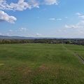
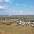
![Field south of Waynesboro Town Center [02]](../../../i/upload/2024/07/19/20240719164011-bfef621f-sq.jpg)
![Field south of Waynesboro Town Center [03]](../../../i/upload/2024/07/19/20240719164113-3872f41a-sq.jpg)
![Field south of Waynesboro Town Center [01]](../../../i/upload/2024/07/19/20240719164131-8c6e4a64-sq.jpg)
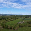
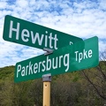

![Montgomery Village, facing approximately west [01]](../../../i/upload/2024/07/19/20240719165409-be458691-sq.jpg)
![Montgomery Village, facing approximately west [02]](../../../i/upload/2024/07/19/20240719165500-7c01f836-sq.jpg)

![Sunset near Gettysburg, Pennsylvania [01]](../../../i/upload/2024/07/19/20240719170930-530c41ea-sq.jpg)
![Sunset near Gettysburg, Pennsylvania [02]](../../../i/upload/2024/07/19/20240719170934-9483611c-sq.jpg)


![Sunset near Enfield, North Carolina [01]](../../../i/upload/2024/07/19/20240719200004-755a08c5-sq.jpg)
![Sunset near Enfield, North Carolina [02]](../../../i/upload/2024/07/19/20240719200013-a94fdb0a-sq.jpg)


![Montgomery Village, facing approximately west [03]](../../../i/upload/2024/07/20/20240720014535-43915a8f-sq.jpg)
![Montgomery Village, facing approximately west [04]](../../../i/upload/2024/07/20/20240720014545-c32fb66e-sq.jpg)
![Jetty in the Absecon Inlet [01]](../../../i/upload/2024/07/20/20240720015214-49471561-sq.jpg)
![Jetty in the Absecon Inlet [02]](../../../i/upload/2024/07/20/20240720015259-77520d58-sq.jpg)
![View of Waynesboro, Virginia from above Waynesboro Town Center shopping center [03]](../../../i/upload/2024/07/20/20240720022141-14db0e51-sq.jpg)
![View of Waynesboro, Virginia from above Waynesboro Town Center shopping center [01]](../../../i/upload/2024/07/20/20240720022218-a2b43c3a-sq.jpg)
![View of Waynesboro, Virginia from above Waynesboro Town Center shopping center [04]](../../../i/upload/2024/07/20/20240720022223-952ce9d3-sq.jpg)
![View of Waynesboro, Virginia from above Waynesboro Town Center shopping center [02]](../../../i/upload/2024/07/20/20240720022311-1d27171b-sq.jpg)
![Sign for Beacon Theatre [01]](../../../i/upload/2024/07/20/20240720092516-3af0117e-sq.jpg)
![Sign for Beacon Theatre [02]](../../../i/upload/2024/07/20/20240720092532-5634d1ac-sq.jpg)
![Sign for Krispy Kreme in Richmond, Virginia [01]](../../../i/upload/2024/07/20/20240720092641-f7684be0-sq.jpg)
![Sign for Krispy Kreme in Richmond, Virginia [02]](../../../i/upload/2024/07/20/20240720092647-7853f848-sq.jpg)
![Sign for Krispy Kreme in Richmond, Virginia [03]](../../../i/upload/2024/07/20/20240720092652-9fcb1a77-sq.jpg)
![Storm at New Carrollton station [01]](../../../i/upload/2024/07/20/20240720093653-9243335f-sq.jpg)
![Storm at New Carrollton station [02]](../../../i/upload/2024/07/20/20240720093657-627b661e-sq.jpg)
![Storm at New Carrollton station [03]](../../../i/upload/2024/07/20/20240720093702-138c9e1c-sq.jpg)
![Former Kmart in Charlottesville, Virginia [01]](../../../i/upload/2024/07/20/20240720093729-ec9ad03b-sq.jpg)
![Former Kmart in Charlottesville, Virginia [02]](../../../i/upload/2024/07/20/20240720093734-d8f8d1ca-sq.jpg)
![Former Kmart in Charlottesville, Virginia [03]](../../../i/upload/2024/07/20/20240720093740-95a526e2-sq.jpg)
![Former Kmart in Charlottesville, Virginia [04]](../../../i/upload/2024/07/20/20240720093745-ab234bd7-sq.jpg)
![Carved graffiti inside Sounding Knob Fire Tower [01]](../../../i/upload/2024/07/20/20240720093907-c2a6b3b1-sq.jpg)
![View from Sounding Knob Fire Tower [05]](../../../i/upload/2024/07/20/20240720093912-7eeb9b2a-sq.jpg)
![Sounding Knob Fire Tower [03]](../../../i/upload/2024/07/20/20240720093917-2dda7f6c-sq.jpg)
![Sounding Knob Fire Tower [04]](../../../i/upload/2024/07/20/20240720093921-fd96734a-sq.jpg)

![View from Shenandoah Mountain [01]](../../../i/upload/2024/07/20/20240720093931-b1561721-sq.jpg)
![View from Sounding Knob Fire Tower [01]](../../../i/upload/2024/07/20/20240720094042-38692d7b-sq.jpg)
![Interior of Sounding Knob Fire Tower [02]](../../../i/upload/2024/07/20/20240720094046-230d5185-sq.jpg)
![Sounding Knob Fire Tower [05]](../../../i/upload/2024/07/20/20240720094050-d2f1afab-sq.jpg)
![Sounding Knob Fire Tower [07]](../../../i/upload/2024/07/20/20240720094055-8426f53d-sq.jpg)
![View from Sounding Knob Fire Tower [07]](../../../i/upload/2024/07/20/20240720094100-2ebefa3a-sq.jpg)
![View from Sounding Knob Fire Tower [02]](../../../i/upload/2024/07/20/20240720094106-3da79801-sq.jpg)
![Mountain with a bare patch [02]](../../../i/upload/2024/07/20/20240720094112-5450497c-sq.jpg)
![Carved graffiti inside Sounding Knob Fire Tower [02]](../../../i/upload/2024/07/20/20240720094121-df5d8474-sq.jpg)
![View from Shenandoah Mountain [03]](../../../i/upload/2024/07/20/20240720094136-fc1446fb-sq.jpg)
![Sounding Knob Fire Tower [02]](../../../i/upload/2024/07/20/20240720094141-6025ceed-sq.jpg)
![View from Sounding Knob Fire Tower [08]](../../../i/upload/2024/07/20/20240720094146-d06641af-sq.jpg)
![Interior of Sounding Knob Fire Tower [01]](../../../i/upload/2024/07/20/20240720094151-4486776f-sq.jpg)
![Farm on the Virginia-West Virginia border [01]](../../../i/upload/2024/07/20/20240720094156-2b1215da-sq.jpg)
![Mountain with a bare patch [01]](../../../i/upload/2024/07/20/20240720094201-2326a710-sq.jpg)
![View from Sounding Knob Fire Tower [03]](../../../i/upload/2024/07/20/20240720094217-426249c3-sq.jpg)
![Sounding Knob Fire Tower [01]](../../../i/upload/2024/07/20/20240720094223-ac770f80-sq.jpg)
![View from Sounding Knob Fire Tower [04]](../../../i/upload/2024/07/20/20240720094227-c4df3b1c-sq.jpg)
![Sounding Knob Fire Tower [06]](../../../i/upload/2024/07/20/20240720094232-481cf4de-sq.jpg)
![View from Sounding Knob Fire Tower [09]](../../../i/upload/2024/07/20/20240720094237-fbdf1303-sq.jpg)
![Sounding Knob Fire Tower [08]](../../../i/upload/2024/07/20/20240720094241-f87d7eb4-sq.jpg)
![View from Sounding Knob Fire Tower [06]](../../../i/upload/2024/07/20/20240720094246-3a374853-sq.jpg)
![Farm on the Virginia-West Virginia border [02]](../../../i/upload/2024/07/20/20240720094251-b9fab9db-sq.jpg)

![View from Shenandoah Mountain [02]](../../../i/upload/2024/07/20/20240720094312-c9f54fe4-sq.jpg)
![Bus stop on Nicholson Lane [01]](../../../i/upload/2024/07/20/20240720101838-387ee2d0-sq.jpg)
![Bus stop on Nicholson Lane [01]](../../../i/upload/2024/07/20/20240720101843-1c1bfd02-sq.jpg)
![Bus stop on Nicholson Lane [01]](../../../i/upload/2024/07/20/20240720101848-136e7761-sq.jpg)
![Bus stop on Nicholson Lane [01]](../../../i/upload/2024/07/20/20240720101853-91ba7ba7-sq.jpg)
!["DO NOT ENTER" and "ONE WAY" signs [01]](../../../i/upload/2024/07/20/20240720101859-20d5443c-sq.jpg)
!["DO NOT ENTER" and "ONE WAY" signs [02]](../../../i/upload/2024/07/20/20240720101903-51f9dbdd-sq.jpg)
![Traffic signals in Derwood, Maryland [01]](../../../i/upload/2024/07/20/20240720101908-de0aad1a-sq.jpg)
![Traffic signals in Derwood, Maryland [02]](../../../i/upload/2024/07/20/20240720101912-698b18e1-sq.jpg)
![Traffic signals in Derwood, Maryland [03]](../../../i/upload/2024/07/20/20240720101918-d2aa492d-sq.jpg)

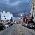

![Sunset over Sterling, Virginia [01]](../../../i/upload/2024/07/20/20240720103300-a3e8d662-sq.jpg)
![Sunset over Sterling, Virginia [02]](../../../i/upload/2024/07/20/20240720103305-c0323525-sq.jpg)
![Sunset over Sterling, Virginia [03]](../../../i/upload/2024/07/20/20240720103310-9c2855e8-sq.jpg)
![Sunset over Sterling, Virginia [04]](../../../i/upload/2024/07/20/20240720103316-027f54cd-sq.jpg)
![Aerial view of Charles Town, West Virginia [01]](../../../i/upload/2024/07/20/20240720103949-f4346f4c-sq.jpg)
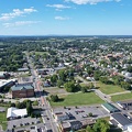
![Aerial view of Charles Town, West Virginia [03]](../../../i/upload/2024/07/20/20240720104008-7857c00b-sq.jpg)
![Aerial view of Charles Town, West Virginia [02]](../../../i/upload/2024/07/20/20240720104018-5b8b2fcf-sq.jpg)
![Clouds over Waynesboro, Virginia [01]](../../../i/upload/2024/07/20/20240720111926-e95c8b35-sq.jpg)
![Clouds over Waynesboro, Virginia [02]](../../../i/upload/2024/07/20/20240720111930-78edff55-sq.jpg)

![Aerial view of downtown Crossville, Tennessee [01]](../../../i/upload/2024/07/20/20240720113721-1bd631e7-sq.jpg)
![Aerial view of downtown Crossville, Tennessee [02]](../../../i/upload/2024/07/20/20240720113738-e7992a54-sq.jpg)
![Aerial view of downtown Crossville, Tennessee [03]](../../../i/upload/2024/07/20/20240720113748-d1062940-sq.jpg)

![Empire State Building from West 34th Street, facing southeast [01]](../../../i/upload/2024/07/20/20240720143531-e4520deb-sq.jpg)
![Empire State Building from West 34th Street, facing southeast [02]](../../../i/upload/2024/07/20/20240720143853-94062ec8-sq.jpg)
![Empire State Building from West 34th Street, facing southeast [03]](../../../i/upload/2024/07/20/20240720143930-990f5e3f-sq.jpg)
![Empire State Building from West 34th Street, facing southeast [04]](../../../i/upload/2024/07/20/20240720143955-1d6f5f97-sq.jpg)
![Top of the Empire State Building [01]](../../../i/upload/2024/07/20/20240720150721-8ecf28e7-sq.jpg)
![Top of the Empire State Building [02]](../../../i/upload/2024/07/20/20240720151222-9611302b-sq.jpg)
![Top of the Empire State Building [03]](../../../i/upload/2024/07/20/20240720151233-d2f8c9ac-sq.jpg)
![Top of the Empire State Building [04]](../../../i/upload/2024/07/20/20240720151239-958b240d-sq.jpg)
![Top of the Empire State Building [05]](../../../i/upload/2024/07/20/20240720151245-580369e9-sq.jpg)
![Empire State Building with nearby buildings [01]](../../../i/upload/2024/07/20/20240720151251-f86dc545-sq.jpg)
![Empire State Building with nearby buildings [02]](../../../i/upload/2024/07/20/20240720151256-733646c3-sq.jpg)
![Empire State Building with nearby buildings [03]](../../../i/upload/2024/07/20/20240720151302-aeaeb4bf-sq.jpg)
![Empire State Building with nearby buildings [04]](../../../i/upload/2024/07/20/20240720151308-b57075b5-sq.jpg)
![Snowy Mountain Lookout [02]](../../../i/upload/2024/07/20/20240720152552-b679c9e9-sq.jpg)
![Snowy Mountain Lookout [03]](../../../i/upload/2024/07/20/20240720152556-87abac54-sq.jpg)
![Snowy Mountain Lookout [04]](../../../i/upload/2024/07/20/20240720152559-85f0a643-sq.jpg)
![Snowy Mountain Lookout [05]](../../../i/upload/2024/07/20/20240720152603-975fe683-sq.jpg)
![Communications tower in Michaux State Forest [03]](../../../i/upload/2024/07/20/20240720152644-331599e0-sq.jpg)
![Communications tower in Michaux State Forest [04]](../../../i/upload/2024/07/20/20240720152648-5d9ba563-sq.jpg)
![Snowy Mountain Lookout [01]](../../../i/upload/2024/07/20/20240720152721-391247d0-sq.jpg)
![Communications tower in Michaux State Forest [02]](../../../i/upload/2024/07/20/20240720152729-882b79dd-sq.jpg)
![Communications tower in Michaux State Forest [01]](../../../i/upload/2024/07/20/20240720152732-3989e68d-sq.jpg)

![Aerial view of Smithsburg, Maryland [01]](../../../i/upload/2024/07/20/20240720155756-7d354d6c-sq.jpg)
![Aerial view of Smithsburg, Maryland [02]](../../../i/upload/2024/07/20/20240720155800-cb15da92-sq.jpg)
![Aerial view of Smithsburg, Maryland [03]](../../../i/upload/2024/07/20/20240720155805-a9f3e7ed-sq.jpg)
![Smoky conditions along I-95 [03]](../../../i/upload/2024/07/29/20240729110726-ebbb4d73-sq.jpg)
![Smoky conditions along I-95 [02]](../../../i/upload/2024/07/29/20240729110733-8e03dcdb-sq.jpg)
![Smoky conditions along I-95 [01]](../../../i/upload/2024/07/29/20240729110741-d798b31f-sq.jpg)

![Smoke over Baltimore [01]](../../../i/upload/2024/07/31/20240731143828-95bd632b-sq.jpg)
![Smoke over Baltimore [02]](../../../i/upload/2024/07/31/20240731143832-19f77318-sq.jpg)
![Smoke over Baltimore [03]](../../../i/upload/2024/07/31/20240731143837-692f8dc6-sq.jpg)
![Smoke over Baltimore [04]](../../../i/upload/2024/07/31/20240731143842-0834b574-sq.jpg)
![Smoke over Baltimore [05]](../../../i/upload/2024/07/31/20240731143848-1ea91103-sq.jpg)
![Smoke over Baltimore [06]](../../../i/upload/2024/07/31/20240731143853-8c09f298-sq.jpg)
![Smoke over Baltimore [07]](../../../i/upload/2024/07/31/20240731143858-b87324cb-sq.jpg)
![Smoke over Baltimore [08]](../../../i/upload/2024/07/31/20240731143904-d8053015-sq.jpg)
![Smoke over Baltimore [09]](../../../i/upload/2024/07/31/20240731143908-394c9c7a-sq.jpg)
![Smoke over Baltimore [10]](../../../i/upload/2024/07/31/20240731143913-c0023f80-sq.jpg)
![Smoke over Baltimore [11]](../../../i/upload/2024/07/31/20240731143917-72a4d164-sq.jpg)
![Smoke over Baltimore [12]](../../../i/upload/2024/07/31/20240731143922-f169836f-sq.jpg)
![Smoke over Baltimore [13]](../../../i/upload/2024/07/31/20240731143928-e8d821c4-sq.jpg)
![Smoke over Baltimore [14]](../../../i/upload/2024/07/31/20240731143932-d92eaa05-sq.jpg)
![Smoke over Baltimore [15]](../../../i/upload/2024/07/31/20240731143937-f18aaf4e-sq.jpg)
![Smoke over Baltimore [16]](../../../i/upload/2024/07/31/20240731143941-0ca37e1b-sq.jpg)
![Smoke over Baltimore [17]](../../../i/upload/2024/07/31/20240731143948-4f6c4ad2-sq.jpg)
![Smoke over Baltimore [18]](../../../i/upload/2024/07/31/20240731143952-bc67a7cf-sq.jpg)
![Smoke over Baltimore [19]](../../../i/upload/2024/07/31/20240731143956-ca74623b-sq.jpg)
![Smoke over Baltimore [20]](../../../i/upload/2024/07/31/20240731144000-b5aebcca-sq.jpg)
![Smoke over Baltimore [21]](../../../i/upload/2024/07/31/20240731144005-50aa3739-sq.jpg)
![Smoke over Baltimore [22]](../../../i/upload/2024/07/31/20240731144009-b0c2f0be-sq.jpg)
![Smoke over Baltimore [23]](../../../i/upload/2024/07/31/20240731144016-6e284cb4-sq.jpg)
![Smoke over Baltimore [24]](../../../i/upload/2024/07/31/20240731144020-ea42a34e-sq.jpg)
![Smoke over Baltimore [25]](../../../i/upload/2024/07/31/20240731144024-5ebedc8b-sq.jpg)
![Smoke over Baltimore [26]](../../../i/upload/2024/07/31/20240731144028-a95c3a02-sq.jpg)
![Smoke over Baltimore [27]](../../../i/upload/2024/07/31/20240731144032-a64f54e6-sq.jpg)
![Smoke over Baltimore [28]](../../../i/upload/2024/07/31/20240731144036-c150486b-sq.jpg)
![Smoke over Baltimore [29]](../../../i/upload/2024/07/31/20240731144043-53057fbc-sq.jpg)
![Smoke over Baltimore [30]](../../../i/upload/2024/07/31/20240731144047-51ca49f4-sq.jpg)
![Smoke over Baltimore [31]](../../../i/upload/2024/07/31/20240731144052-0effad86-sq.jpg)
![Smoke over Baltimore [32]](../../../i/upload/2024/07/31/20240731144057-7af6a721-sq.jpg)
![Smoke over Baltimore [33]](../../../i/upload/2024/07/31/20240731144101-4f4f83f2-sq.jpg)
![Smoke over Baltimore [34]](../../../i/upload/2024/07/31/20240731144105-253d3079-sq.jpg)
![Smoke over Baltimore [35]](../../../i/upload/2024/07/31/20240731144112-ff880802-sq.jpg)
![Smoke over Baltimore [36]](../../../i/upload/2024/07/31/20240731144116-1af825a7-sq.jpg)
![Smoke over Baltimore [37]](../../../i/upload/2024/07/31/20240731144120-6170e412-sq.jpg)
![Smoke over Baltimore [38]](../../../i/upload/2024/07/31/20240731144124-ca548be9-sq.jpg)
![Smoke over Baltimore [39]](../../../i/upload/2024/07/31/20240731144129-a90dbf61-sq.jpg)
![Smoke over Baltimore [40]](../../../i/upload/2024/07/31/20240731144133-8073fcc5-sq.jpg)
![Smoke over Baltimore [41]](../../../i/upload/2024/07/31/20240731144136-d3d8a3d8-sq.jpg)
![Smoke over Baltimore [42]](../../../i/upload/2024/07/31/20240731144140-fb7de82f-sq.jpg)
![Smoke over Baltimore [43]](../../../i/upload/2024/07/31/20240731144144-363848be-sq.jpg)
![Smoke over Baltimore [44]](../../../i/upload/2024/07/31/20240731144148-9c7c4db8-sq.jpg)
![Smoke over Baltimore [45]](../../../i/upload/2024/07/31/20240731144154-669c2fa8-sq.jpg)
![Smoke over Baltimore [46]](../../../i/upload/2024/07/31/20240731144200-b5669e2f-sq.jpg)
![Smoke over Baltimore [47]](../../../i/upload/2024/07/31/20240731144204-fe012b89-sq.jpg)
![Smoke over Baltimore [48]](../../../i/upload/2024/07/31/20240731144208-5c1a33e4-sq.jpg)
![Smoke over Baltimore [49]](../../../i/upload/2024/07/31/20240731144213-20085a76-sq.jpg)
![Smoke over Baltimore [50]](../../../i/upload/2024/07/31/20240731144220-547045ec-sq.jpg)
![Smoke over Baltimore [51]](../../../i/upload/2024/07/31/20240731144224-9113799c-sq.jpg)
![Smoke over Baltimore [52]](../../../i/upload/2024/07/31/20240731144229-7ab5fbb7-sq.jpg)
![Smoke over Baltimore [53]](../../../i/upload/2024/07/31/20240731144235-1111827e-sq.jpg)
![Smoke over Baltimore [54]](../../../i/upload/2024/07/31/20240731144243-fbffb542-sq.jpg)
![Smoke over Baltimore [55]](../../../i/upload/2024/07/31/20240731144250-206889fa-sq.jpg)

![Sunset over Montgomery Village [01]](../../../i/upload/2024/11/20/20241120093359-6e4a8f21-sq.jpg)
![Sunset over Montgomery Village [02]](../../../i/upload/2024/11/20/20241120093408-5c11a279-sq.jpg)
