
Ben Schumin Photography Portfolio
Ben Schumin is a professional photographer who captures the intricacies of daily life.
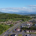
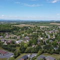
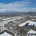
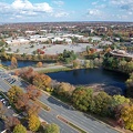
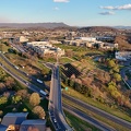
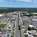
Aerial view of Roanoke, Virginia.

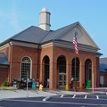
![Fat Jimmy's Outfitters [02]](../../../../i/upload/2024/07/15/20240715141309-4a6e065b-sq.jpg)

![Fat Jimmy's Outfitters [01]](../../../../i/upload/2024/07/15/20240715141332-8389ed44-sq.jpg)
![View from Sears Tower [02]](../../../../i/upload/2024/07/15/20240715204845-15d40122-sq.jpg)
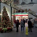
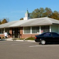
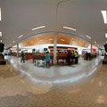
![Delaware House main entrance [03]](../../../../i/upload/2024/07/16/20240716225722-6bd63242-sq.jpg)
![Delaware House main entrance [02]](../../../../i/upload/2024/07/16/20240716225726-73c527ba-sq.jpg)
![Delaware House main entrance [01]](../../../../i/upload/2024/07/16/20240716225729-cee96da8-sq.jpg)
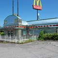
![Howard Johnson's on Afton Mountain [05]](../../../../i/upload/2024/07/16/20240716231800-43dd8433-sq.jpg)
![Howard Johnson's on Afton Mountain [04]](../../../../i/upload/2024/07/16/20240716231804-1d3d8627-sq.jpg)
![Howard Johnson's on Afton Mountain [03]](../../../../i/upload/2024/07/16/20240716231808-a2be3985-sq.jpg)
![Howard Johnson's on Afton Mountain [02]](../../../../i/upload/2024/07/16/20240716231812-8186c8e4-sq.jpg)
![Howard Johnson's on Afton Mountain [01]](../../../../i/upload/2024/07/16/20240716231818-82bc5da0-sq.jpg)

![Howard Johnson's on Afton Mountain [06]](../../../../i/upload/2024/07/17/20240717161722-919c91b5-sq.jpg)

![Beltway Motel guest building [01]](../../../../i/upload/2024/07/17/20240717231219-0d35a46b-sq.jpg)
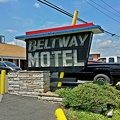
![Beltway Motel guest building [02]](../../../../i/upload/2024/07/17/20240717231226-81d0ce3b-sq.jpg)
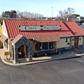
![Burger King in Charles Town, West Virginia [01]](../../../../i/upload/2024/07/17/20240717232555-c1e43281-sq.jpg)
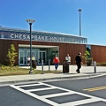
![Exterior of Chesapeake House [01]](../../../../i/upload/2024/07/17/20240717233339-1b7a5173-sq.jpg)
![Exterior of Chesapeake House [02]](../../../../i/upload/2024/07/17/20240717233344-3f2d2282-sq.jpg)
![Exterior of Chesapeake House [03]](../../../../i/upload/2024/07/17/20240717233350-be5b06b9-sq.jpg)
![Delaware House, September 2014 [01]](../../../../i/upload/2024/07/17/20240717233400-3fea9dad-sq.jpg)
![Delaware House, September 2014 [02]](../../../../i/upload/2024/07/17/20240717233405-3278cdb7-sq.jpg)
![Delaware House, September 2014 [03]](../../../../i/upload/2024/07/17/20240717233410-9ae8515f-sq.jpg)
![Delaware House, September 2014 [04]](../../../../i/upload/2024/07/17/20240717233415-0926b98c-sq.jpg)
![Delaware House, September 2014 [05]](../../../../i/upload/2024/07/17/20240717233420-9938e0b3-sq.jpg)
![Delaware House, September 2014 [06]](../../../../i/upload/2024/07/17/20240717233425-6275f05a-sq.jpg)
![Delaware House, September 2014 [07]](../../../../i/upload/2024/07/17/20240717233430-e09d0a82-sq.jpg)
![South Mountain rest area, westbound [01]](../../../../i/upload/2024/07/17/20240717233435-e2f89cc0-sq.jpg)
![South Mountain rest area, westbound [02]](../../../../i/upload/2024/07/17/20240717233440-268e200a-sq.jpg)
![South Mountain rest area, westbound [03]](../../../../i/upload/2024/07/17/20240717233445-c0e160fc-sq.jpg)
![South Mountain rest area, westbound [04]](../../../../i/upload/2024/07/17/20240717233450-8d5d68a3-sq.jpg)
![South Mountain rest area, westbound [05]](../../../../i/upload/2024/07/17/20240717233455-aa6194ef-sq.jpg)
![Sideling Hill rest area [01]](../../../../i/upload/2024/07/17/20240717233459-e7ba195c-sq.jpg)
![Sideling Hill rest area [02]](../../../../i/upload/2024/07/17/20240717233505-c4590774-sq.jpg)
![Sideling Hill rest area [08]](../../../../i/upload/2024/07/17/20240717233537-4406b863-sq.jpg)
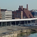
![Western Maryland Scenic Railroad station [05]](../../../../i/upload/2024/07/17/20240717233553-3b21af47-sq.jpg)
![Western Maryland Scenic Railroad station [06]](../../../../i/upload/2024/07/17/20240717233558-d030848d-sq.jpg)
![Western Maryland Scenic Railroad tracks [03]](../../../../i/upload/2024/07/17/20240717233606-3c9ba6bb-sq.jpg)
![Western Maryland Scenic Railroad tracks [04]](../../../../i/upload/2024/07/17/20240717233611-ca37197a-sq.jpg)


![Abandoned Days Inn near Warfordsburg, Pennsylvania [24]](../../../../i/upload/2024/07/19/20240719091046-1f6c2ec2-sq.jpg)
![Abandoned Days Inn near Warfordsburg, Pennsylvania [26]](../../../../i/upload/2024/07/19/20240719091055-4c9414dd-sq.jpg)
![Abandoned Days Inn near Warfordsburg, Pennsylvania [25]](../../../../i/upload/2024/07/19/20240719091100-5bc7dd63-sq.jpg)
![Second Blessings [01]](../../../../i/upload/2024/07/19/20240719091336-e8ef281a-sq.jpg)
![Second Blessings [02]](../../../../i/upload/2024/07/19/20240719091339-c55e76e4-sq.jpg)
![Second Blessings [03]](../../../../i/upload/2024/07/19/20240719091345-5d6326c2-sq.jpg)
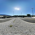
![Goochland rest area, westbound [03]](../../../../i/upload/2024/07/19/20240719093121-0aeca88a-sq.jpg)
![Goochland rest area, westbound [02]](../../../../i/upload/2024/07/19/20240719093125-c06aafb1-sq.jpg)
![Goochland rest area, westbound [01]](../../../../i/upload/2024/07/19/20240719093130-dbdf3bb4-sq.jpg)
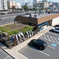
![Express Food Mart [01]](../../../../i/upload/2024/07/19/20240719093622-0ee29536-sq.jpg)
![Express Food Mart [02]](../../../../i/upload/2024/07/19/20240719093626-e15f57ee-sq.jpg)
![Express Food Mart [03]](../../../../i/upload/2024/07/19/20240719093631-4bf195fc-sq.jpg)
![LoanMax in former Wendy's [01]](../../../../i/upload/2024/07/19/20240719093700-69f477c9-sq.jpg)
![LoanMax in former Wendy's [02]](../../../../i/upload/2024/07/19/20240719093705-d597deaf-sq.jpg)

![King Pollo in Woodbridge, Virginia [01]](../../../../i/upload/2024/07/19/20240719093746-13a6ace7-sq.jpg)
![Captain D's in Fredericksburg, Virginia [01]](../../../../i/upload/2024/07/19/20240719093750-210b7059-sq.jpg)
![Captain D's in Fredericksburg, Virginia [02]](../../../../i/upload/2024/07/19/20240719093754-51e52bde-sq.jpg)

![Sloppy Mama's BBQ [02]](../../../../i/upload/2024/07/19/20240719103305-9f7239c5-sq.jpg)
![Sloppy Mama's BBQ [01]](../../../../i/upload/2024/07/19/20240719103310-7934ea25-sq.jpg)
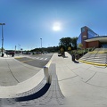
![South Mountain rest area and welcome center, westbound [02]](../../../../i/upload/2024/07/19/20240719104930-9f63ecbf-sq.jpg)
![South Mountain rest area and welcome center, westbound [01]](../../../../i/upload/2024/07/19/20240719104934-09257e0d-sq.jpg)
![Delaware House main entrance [04]](../../../../i/upload/2024/07/19/20240719153150-424738b3-sq.jpg)
![US 29 Business in Culpeper, Virginia [01]](../../../../i/upload/2024/07/19/20240719155959-cf1d0444-sq.jpg)
![Richmond Avenue in Staunton, Virginia [01]](../../../../i/upload/2024/07/19/20240719161158-ddf9fe35-sq.jpg)
![Richmond Avenue in Staunton, Virginia [02]](../../../../i/upload/2024/07/19/20240719161203-233bb776-sq.jpg)
![Richmond Avenue in Staunton, Virginia [03]](../../../../i/upload/2024/07/19/20240719161212-297c1b53-sq.jpg)
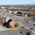
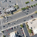
![Commercial area south of Interstate 81 in Harrisonburg [01]](../../../../i/upload/2024/07/19/20240719163715-46af96f9-sq.jpg)
![Harrisonburg Crossing [01]](../../../../i/upload/2024/07/19/20240719163753-972e0345-sq.jpg)
![Harrisonburg Crossing [02]](../../../../i/upload/2024/07/19/20240719163758-5453496b-sq.jpg)
![Commercial area south of University Boulevard [01]](../../../../i/upload/2024/07/19/20240719163821-e0603027-sq.jpg)
![Commercial area south of University Boulevard [02]](../../../../i/upload/2024/07/19/20240719163825-5d4964e5-sq.jpg)
![Commercial area south of Interstate 81 in Harrisonburg [02]](../../../../i/upload/2024/07/19/20240719163830-45dce8e7-sq.jpg)
![Churchville Volunteer Fire Department [01]](../../../../i/upload/2024/07/19/20240719164426-c1be3535-sq.jpg)
![Churchville Volunteer Fire Department [02]](../../../../i/upload/2024/07/19/20240719164431-2ab245f9-sq.jpg)
![Buffalo Gap High School [01]](../../../../i/upload/2024/07/19/20240719164459-267a0d43-sq.jpg)
![Buffalo Gap High School [02]](../../../../i/upload/2024/07/19/20240719164505-bdd29e59-sq.jpg)
![Buffalo Gap High School [03]](../../../../i/upload/2024/07/19/20240719164509-fab8ad49-sq.jpg)
![Buffalo Gap High School [04]](../../../../i/upload/2024/07/19/20240719164514-e0a1e82e-sq.jpg)
![Buffalo Gap High School [05]](../../../../i/upload/2024/07/19/20240719164519-518a0909-sq.jpg)
![Buffalo Gap High School [06]](../../../../i/upload/2024/07/19/20240719164523-e9a7db09-sq.jpg)
![West Main Street in Waynesboro, Virginia [01]](../../../../i/upload/2024/07/19/20240719164545-b5a50599-sq.jpg)
![West Main Street in Waynesboro, Virginia [02]](../../../../i/upload/2024/07/19/20240719164551-0b8407a8-sq.jpg)
![West Main Street in Waynesboro, Virginia [03]](../../../../i/upload/2024/07/19/20240719164555-f7feeafe-sq.jpg)
![West Main Street in Waynesboro, Virginia [04]](../../../../i/upload/2024/07/19/20240719164600-4379cef1-sq.jpg)
![AT&T Long Lines tower in Dumfries, Virginia [32]](../../../../i/upload/2024/07/19/20240719165051-b8547ba1-sq.jpg)
![AT&T Long Lines tower in Dumfries, Virginia [31]](../../../../i/upload/2024/07/19/20240719165332-7037db10-sq.jpg)
![US 29 Business in Culpeper, Virginia [02]](../../../../i/upload/2024/07/19/20240719165937-abc06307-sq.jpg)
![Downtown Gettysburg, Pennsylvania [02]](../../../../i/upload/2024/07/19/20240719170259-27d78ed8-sq.jpg)
![Downtown Gettysburg, Pennsylvania [01]](../../../../i/upload/2024/07/19/20240719170318-2077237a-sq.jpg)
![US 29 North, near Hilton Heights Road [01]](../../../../i/upload/2024/07/19/20240719171702-b12048d7-sq.jpg)
![US 29 North, near Hilton Heights Road [02]](../../../../i/upload/2024/07/19/20240719171717-5729f873-sq.jpg)
![DoubleTree Hotel in Charlottesville, Virginia [01]](../../../../i/upload/2024/07/19/20240719171742-a365fe34-sq.jpg)
![US 29 near Woodbrook Drive [01]](../../../../i/upload/2024/07/19/20240719171851-a0a055c4-sq.jpg)
![US 29 near Woodbrook Drive [02]](../../../../i/upload/2024/07/19/20240719171856-fdca65ff-sq.jpg)
![Squisito in Glen Burnie, Maryland [01]](../../../../i/upload/2024/07/19/20240719185737-f5d614eb-sq.jpg)
![Squisito in Glen Burnie, Maryland [02]](../../../../i/upload/2024/07/19/20240719185740-aefbc001-sq.jpg)
![Squisito in Glen Burnie, Maryland [03]](../../../../i/upload/2024/07/19/20240719185744-a9f8c4e2-sq.jpg)
![Squisito in Glen Burnie, Maryland [04]](../../../../i/upload/2024/07/19/20240719185747-43707c8c-sq.jpg)
![Gabriel Brothers in Glen Burnie, Maryland [01]](../../../../i/upload/2024/07/19/20240719185750-9cb8788d-sq.jpg)
![Gabriel Brothers in Glen Burnie, Maryland [02]](../../../../i/upload/2024/07/19/20240719185804-2609667a-sq.jpg)

![Windward Towers and Leeward Marina [02]](../../../../i/upload/2024/07/19/20240719202335-9d3149ac-sq.jpg)
![Windward Towers and Leeward Marina [01]](../../../../i/upload/2024/07/19/20240719202747-251158fb-sq.jpg)
![Interstate 95 in Woodbridge, Virginia [02]](../../../../i/upload/2024/07/19/20240719212229-ff1f3c31-sq.jpg)
![Howard Johnson's in Lexington, Virginia [02]](../../../../i/upload/2024/07/19/20240719212605-64571a6d-sq.jpg)
![Howard Johnson's in Lexington, Virginia [03]](../../../../i/upload/2024/07/19/20240719212611-078ba0a9-sq.jpg)
![Howard Johnson's in Lexington, Virginia [01]](../../../../i/upload/2024/07/19/20240719212820-bf48d91d-sq.jpg)

![Howard Johnson's in Lexington, Virginia [04]](../../../../i/upload/2024/07/19/20240719213002-a6770059-sq.jpg)

![West Broad Street at Staples Mill Road [01]](../../../../i/upload/2024/07/20/20240720091824-c8526d69-sq.jpg)
![West Broad Street at Staples Mill Road [02]](../../../../i/upload/2024/07/20/20240720092012-1df12de7-sq.jpg)
![Church Hill neighborhood [01]](../../../../i/upload/2024/07/20/20240720092724-5ad8079d-sq.jpg)
![Church Hill neighborhood [02]](../../../../i/upload/2024/07/20/20240720092729-c1c95489-sq.jpg)
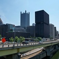
![Interstate 95 through downtown Richmond [04]](../../../../i/upload/2024/07/20/20240720092805-0fe0379c-sq.jpg)
![Clock tower on Richmond Main Street Station [01]](../../../../i/upload/2024/07/20/20240720092945-196e9f26-sq.jpg)
![Interstate 95 through downtown Richmond [02]](../../../../i/upload/2024/07/20/20240720093017-3f2bee68-sq.jpg)
![Clock tower on Richmond Main Street Station [02]](../../../../i/upload/2024/07/20/20240720093156-e35dc707-sq.jpg)
![Interstate 95 through downtown Richmond [03]](../../../../i/upload/2024/07/20/20240720093212-fa09ec51-sq.jpg)
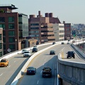
![Interstate 95 through downtown Richmond [01]](../../../../i/upload/2024/07/20/20240720093319-14a1e75d-sq.jpg)
![Farm on the Virginia-West Virginia border [01]](../../../../i/upload/2024/07/20/20240720094156-2b1215da-sq.jpg)
![Edwards Integrity at Delaware House [02]](../../../../i/upload/2024/07/20/20240720103236-0f95f322-sq.jpg)
![Edwards Integrity at Delaware House [01]](../../../../i/upload/2024/07/20/20240720103242-c362ff93-sq.jpg)
![Roses store at the former Ocean Plaza Mall [01]](../../../../i/upload/2024/07/20/20240720104311-fea608fc-sq.jpg)
![Roses store at the former Ocean Plaza Mall [02]](../../../../i/upload/2024/07/20/20240720104318-38f7cf7a-sq.jpg)
![Ocean City from 94th Street, facing north [01]](../../../../i/upload/2024/07/20/20240720104406-80df0a79-sq.jpg)
![Ocean City from 94th Street, facing north [02]](../../../../i/upload/2024/07/20/20240720104427-c73095ad-sq.jpg)
![Ocean City from 94th Street, facing north [03]](../../../../i/upload/2024/07/20/20240720104448-80806e9c-sq.jpg)
![Ocean City from 94th Street, facing south [01]](../../../../i/upload/2024/07/20/20240720104509-718c78fb-sq.jpg)
![Ocean City from 94th Street, facing south [02]](../../../../i/upload/2024/07/20/20240720104525-1dff6c8d-sq.jpg)

![Aerial view of downtown Knoxville [02]](../../../../i/upload/2024/07/20/20240720114531-474df7df-sq.jpg)
![Elm Avenue interchange [02]](../../../../i/upload/2024/07/20/20240720121652-6267da79-sq.jpg)
![Aerial view of Roanoke, Virginia [01]](../../../../i/upload/2024/07/20/20240720121757-bb58476c-sq.jpg)
![Aerial view of Roanoke, Virginia [02]](../../../../i/upload/2024/07/20/20240720121808-dccb83a0-sq.jpg)
![Aerial view of Roanoke, Virginia [03]](../../../../i/upload/2024/07/20/20240720121837-3c6bbb13-sq.jpg)
![Aerial view of Roanoke, Virginia [04]](../../../../i/upload/2024/07/20/20240720121854-34748718-sq.jpg)
![Aerial view of Roanoke, Virginia [05]](../../../../i/upload/2024/07/20/20240720121906-5f802cee-sq.jpg)
![Aerial view of Roanoke, Virginia [06]](../../../../i/upload/2024/07/20/20240720121917-3d4a6311-sq.jpg)
![Elm Avenue interchange [01]](../../../../i/upload/2024/07/20/20240720122015-70544823-sq.jpg)
![Intersection of Montgomery Village Avenue and Russell Avenue [06]](../../../../i/upload/2024/07/20/20240720122441-10e038b9-sq.jpg)
![Intersection of Montgomery Village Avenue and Russell Avenue [07]](../../../../i/upload/2024/07/20/20240720122447-6bad3f44-sq.jpg)
![Retention ponds along Russell Avenue and Montgomery Village Avenue [01]](../../../../i/upload/2024/07/20/20240720122458-18ef0a9d-sq.jpg)
![Retention ponds along Russell Avenue and Montgomery Village Avenue [02]](../../../../i/upload/2024/07/20/20240720122504-bb41851d-sq.jpg)
![Intersection of Montgomery Village Avenue and Frederick Avenue [01]](../../../../i/upload/2024/07/20/20240720122535-944c870b-sq.jpg)
![Intersection of Montgomery Village Avenue and Frederick Avenue [03]](../../../../i/upload/2024/07/20/20240720122556-24460d91-sq.jpg)
![Intersection of Montgomery Village Avenue and Frederick Avenue [04]](../../../../i/upload/2024/07/20/20240720122602-b6ea0f87-sq.jpg)
![Intersection of Montgomery Village Avenue and Frederick Avenue [05]](../../../../i/upload/2024/07/20/20240720122608-4a4e3dfe-sq.jpg)
![Intersection of Montgomery Village Avenue and Frederick Avenue [06]](../../../../i/upload/2024/07/20/20240720122615-c5e58b7b-sq.jpg)
![Intersection of Montgomery Village Avenue and Frederick Avenue [07]](../../../../i/upload/2024/07/20/20240720122622-a14d072e-sq.jpg)
![Intersection of Montgomery Village Avenue and Frederick Avenue [08]](../../../../i/upload/2024/07/20/20240720122629-b6c3ffa5-sq.jpg)
![Intersection of Montgomery Village Avenue and Frederick Avenue [09]](../../../../i/upload/2024/07/20/20240720122635-e4aabe5a-sq.jpg)
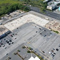
![Construction of Progress Labs [01]](../../../../i/upload/2024/07/20/20240720122640-8dc8f02f-sq.jpg)
![Construction of Progress Labs [02]](../../../../i/upload/2024/07/20/20240720122646-9f5697a6-sq.jpg)

![Intersection of Montgomery Village Avenue and Frederick Avenue [02]](../../../../i/upload/2024/07/20/20240720142751-f6e6a599-sq.jpg)

![View of Gatineau from Parliament Hill [02]](../../../../i/upload/2024/07/20/20240720154447-8a6b0258-sq.jpg)
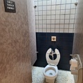
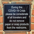
![Composting toilet at Whitney Point rest area [02]](../../../../i/upload/2024/07/20/20240720155544-1b6ccee9-sq.jpg)
![Composting toilet at Whitney Point rest area [01]](../../../../i/upload/2024/07/20/20240720155548-d9419fd3-sq.jpg)


![Fort Pitt Bridge [01]](../../../../i/upload/2024/07/20/20240720160848-94f396df-sq.jpg)
![Fort Pitt Bridge [02]](../../../../i/upload/2024/07/20/20240720160856-8c4cf883-sq.jpg)
![Southbound approach to the Fort Duquesne Bridge [01]](../../../../i/upload/2024/07/20/20240720161046-ec5ee6a1-sq.jpg)
![Fort Duquesne Bridge [01]](../../../../i/upload/2024/07/20/20240720161050-098d3868-sq.jpg)
![Southbound approach to the Fort Duquesne Bridge [02]](../../../../i/upload/2024/07/20/20240720161211-30c57c41-sq.jpg)
![Roberto Clemente Bridge [01]](../../../../i/upload/2024/07/20/20240720161306-2ba7a48e-sq.jpg)
![Roberto Clemente Bridge [02]](../../../../i/upload/2024/07/20/20240720161340-c598682d-sq.jpg)
![Roberto Clemente Bridge [03]](../../../../i/upload/2024/07/20/20240720161356-15e15812-sq.jpg)
![Andy Warhol Bridge [01]](../../../../i/upload/2024/07/20/20240720161418-5c7d3634-sq.jpg)
![Andy Warhol Bridge [02]](../../../../i/upload/2024/07/20/20240720161426-0a05c0dd-sq.jpg)
![Fort Duquesne Bridge [02]](../../../../i/upload/2024/07/20/20240720161434-45983a3e-sq.jpg)
![Smoke over Baltimore [01]](../../../../i/upload/2024/07/31/20240731143828-95bd632b-sq.jpg)
![Smoke over Baltimore [02]](../../../../i/upload/2024/07/31/20240731143832-19f77318-sq.jpg)
![Smoke over Baltimore [03]](../../../../i/upload/2024/07/31/20240731143837-692f8dc6-sq.jpg)
![Smoke over Baltimore [04]](../../../../i/upload/2024/07/31/20240731143842-0834b574-sq.jpg)
![Smoke over Baltimore [05]](../../../../i/upload/2024/07/31/20240731143848-1ea91103-sq.jpg)
![Smoke over Baltimore [06]](../../../../i/upload/2024/07/31/20240731143853-8c09f298-sq.jpg)
![Smoke over Baltimore [07]](../../../../i/upload/2024/07/31/20240731143858-b87324cb-sq.jpg)
![Smoke over Baltimore [08]](../../../../i/upload/2024/07/31/20240731143904-d8053015-sq.jpg)
![Smoke over Baltimore [09]](../../../../i/upload/2024/07/31/20240731143908-394c9c7a-sq.jpg)
![Smoke over Baltimore [10]](../../../../i/upload/2024/07/31/20240731143913-c0023f80-sq.jpg)
![Smoke over Baltimore [11]](../../../../i/upload/2024/07/31/20240731143917-72a4d164-sq.jpg)
![Smoke over Baltimore [12]](../../../../i/upload/2024/07/31/20240731143922-f169836f-sq.jpg)
![Smoke over Baltimore [13]](../../../../i/upload/2024/07/31/20240731143928-e8d821c4-sq.jpg)
![Smoke over Baltimore [14]](../../../../i/upload/2024/07/31/20240731143932-d92eaa05-sq.jpg)
![Smoke over Baltimore [15]](../../../../i/upload/2024/07/31/20240731143937-f18aaf4e-sq.jpg)
![Smoke over Baltimore [16]](../../../../i/upload/2024/07/31/20240731143941-0ca37e1b-sq.jpg)
![Smoke over Baltimore [17]](../../../../i/upload/2024/07/31/20240731143948-4f6c4ad2-sq.jpg)
![Smoke over Baltimore [18]](../../../../i/upload/2024/07/31/20240731143952-bc67a7cf-sq.jpg)
![Smoke over Baltimore [19]](../../../../i/upload/2024/07/31/20240731143956-ca74623b-sq.jpg)
![Smoke over Baltimore [20]](../../../../i/upload/2024/07/31/20240731144000-b5aebcca-sq.jpg)
![Smoke over Baltimore [21]](../../../../i/upload/2024/07/31/20240731144005-50aa3739-sq.jpg)
![Smoke over Baltimore [22]](../../../../i/upload/2024/07/31/20240731144009-b0c2f0be-sq.jpg)
![Smoke over Baltimore [23]](../../../../i/upload/2024/07/31/20240731144016-6e284cb4-sq.jpg)
![Smoke over Baltimore [24]](../../../../i/upload/2024/07/31/20240731144020-ea42a34e-sq.jpg)
![Smoke over Baltimore [25]](../../../../i/upload/2024/07/31/20240731144024-5ebedc8b-sq.jpg)
![Smoke over Baltimore [26]](../../../../i/upload/2024/07/31/20240731144028-a95c3a02-sq.jpg)
![Smoke over Baltimore [27]](../../../../i/upload/2024/07/31/20240731144032-a64f54e6-sq.jpg)
![Smoke over Baltimore [28]](../../../../i/upload/2024/07/31/20240731144036-c150486b-sq.jpg)
![Smoke over Baltimore [29]](../../../../i/upload/2024/07/31/20240731144043-53057fbc-sq.jpg)
![Smoke over Baltimore [30]](../../../../i/upload/2024/07/31/20240731144047-51ca49f4-sq.jpg)
![Smoke over Baltimore [31]](../../../../i/upload/2024/07/31/20240731144052-0effad86-sq.jpg)
![Smoke over Baltimore [32]](../../../../i/upload/2024/07/31/20240731144057-7af6a721-sq.jpg)
![Smoke over Baltimore [33]](../../../../i/upload/2024/07/31/20240731144101-4f4f83f2-sq.jpg)
![Smoke over Baltimore [34]](../../../../i/upload/2024/07/31/20240731144105-253d3079-sq.jpg)
![Smoke over Baltimore [35]](../../../../i/upload/2024/07/31/20240731144112-ff880802-sq.jpg)
![Smoke over Baltimore [36]](../../../../i/upload/2024/07/31/20240731144116-1af825a7-sq.jpg)
![Smoke over Baltimore [37]](../../../../i/upload/2024/07/31/20240731144120-6170e412-sq.jpg)
![Smoke over Baltimore [38]](../../../../i/upload/2024/07/31/20240731144124-ca548be9-sq.jpg)
![Smoke over Baltimore [39]](../../../../i/upload/2024/07/31/20240731144129-a90dbf61-sq.jpg)
![Smoke over Baltimore [40]](../../../../i/upload/2024/07/31/20240731144133-8073fcc5-sq.jpg)
![Smoke over Baltimore [41]](../../../../i/upload/2024/07/31/20240731144136-d3d8a3d8-sq.jpg)
![Smoke over Baltimore [42]](../../../../i/upload/2024/07/31/20240731144140-fb7de82f-sq.jpg)
![Smoke over Baltimore [43]](../../../../i/upload/2024/07/31/20240731144144-363848be-sq.jpg)
![Smoke over Baltimore [44]](../../../../i/upload/2024/07/31/20240731144148-9c7c4db8-sq.jpg)
![Smoke over Baltimore [45]](../../../../i/upload/2024/07/31/20240731144154-669c2fa8-sq.jpg)
![Smoke over Baltimore [46]](../../../../i/upload/2024/07/31/20240731144200-b5669e2f-sq.jpg)
![Smoke over Baltimore [47]](../../../../i/upload/2024/07/31/20240731144204-fe012b89-sq.jpg)
![Smoke over Baltimore [48]](../../../../i/upload/2024/07/31/20240731144208-5c1a33e4-sq.jpg)
![Smoke over Baltimore [49]](../../../../i/upload/2024/07/31/20240731144213-20085a76-sq.jpg)
![Smoke over Baltimore [50]](../../../../i/upload/2024/07/31/20240731144220-547045ec-sq.jpg)
![Smoke over Baltimore [51]](../../../../i/upload/2024/07/31/20240731144224-9113799c-sq.jpg)
![Smoke over Baltimore [52]](../../../../i/upload/2024/07/31/20240731144229-7ab5fbb7-sq.jpg)
![Smoke over Baltimore [53]](../../../../i/upload/2024/07/31/20240731144235-1111827e-sq.jpg)
![Smoke over Baltimore [54]](../../../../i/upload/2024/07/31/20240731144243-fbffb542-sq.jpg)
![Smoke over Baltimore [55]](../../../../i/upload/2024/07/31/20240731144250-206889fa-sq.jpg)
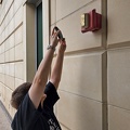
![Fire alarm pull station at 4405 East-West Highway [01]](../../../../i/upload/2024/08/10/20240810115512-5b824516-sq.jpg)
![Fire alarm pull station at 4405 East-West Highway [02]](../../../../i/upload/2024/08/10/20240810115517-dee94f49-sq.jpg)
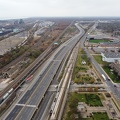
![Interstate 95 viaduct through North Philadelphia [01]](../../../../i/upload/2024/11/29/20241129133408-0d3a7d7b-sq.jpg)
![Interstate 95 viaduct through North Philadelphia [02]](../../../../i/upload/2024/11/29/20241129133426-2b130176-sq.jpg)
![Interstate 95 viaduct through North Philadelphia [03]](../../../../i/upload/2024/11/29/20241129133518-1517dc6a-sq.jpg)
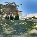
![Paint Branch High School [01]](../../../../i/upload/2024/12/22/20241222233144-0183c8e4-sq.jpg)
![Paint Branch High School [02]](../../../../i/upload/2024/12/22/20241222233150-8fe398b9-sq.jpg)
![Paint Branch High School [05]](../../../../i/upload/2024/12/22/20241222233206-d3bf483b-sq.jpg)
![Paint Branch High School [06]](../../../../i/upload/2024/12/22/20241222233211-7e20b805-sq.jpg)
![Paint Branch High School [07]](../../../../i/upload/2024/12/22/20241222233218-3031714a-sq.jpg)
![Paint Branch High School [10]](../../../../i/upload/2024/12/22/20241222233232-f68847fd-sq.jpg)

![Aerial view of Monterey, Virginia [01]](../../../../i/upload/2025/01/02/20250102005918-685606f9-sq.jpg)
![Aerial view of Monterey, Virginia [02]](../../../../i/upload/2025/01/02/20250102005923-7f7b9b83-sq.jpg)
![Aerial view of Monterey, Virginia [03]](../../../../i/upload/2025/01/02/20250102005929-2e84a9d0-sq.jpg)
![Aerial view of Monterey, Virginia [04]](../../../../i/upload/2025/01/02/20250102005937-281fae65-sq.jpg)
![Aerial view of Monterey, Virginia [05]](../../../../i/upload/2025/01/02/20250102005946-79efaa38-sq.jpg)
![Aerial view of Monterey, Virginia [06]](../../../../i/upload/2025/01/02/20250102005956-29786301-sq.jpg)

![Buffalo Gap Middle and High Schools [01]](../../../../i/upload/2025/01/03/20250103202026-5cdc496f-sq.jpg)
![Buffalo Gap Middle and High Schools [02]](../../../../i/upload/2025/01/03/20250103202032-55e71413-sq.jpg)
![Buffalo Gap Middle and High Schools [03]](../../../../i/upload/2025/01/03/20250103202038-0ede0383-sq.jpg)
![Buffalo Gap Middle and High Schools [04]](../../../../i/upload/2025/01/03/20250103202044-b8863daf-sq.jpg)
![Buffalo Gap Middle and High Schools [05]](../../../../i/upload/2025/01/03/20250103202050-4b55d57a-sq.jpg)
![Buffalo Gap Middle and High Schools [06]](../../../../i/upload/2025/01/03/20250103202056-3a028545-sq.jpg)
![Buffalo Gap Middle and High Schools [07]](../../../../i/upload/2025/01/03/20250103202103-2963fcc1-sq.jpg)
![Buffalo Gap Middle and High Schools [08]](../../../../i/upload/2025/01/03/20250103202111-0d42bedb-sq.jpg)
![Buffalo Gap Middle and High Schools [09]](../../../../i/upload/2025/01/03/20250103202117-3e1c51f7-sq.jpg)
![Buffalo Gap Middle and High Schools [10]](../../../../i/upload/2025/01/03/20250103202123-a70709f6-sq.jpg)

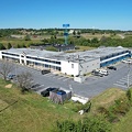
![Walmart distribution center in Greencastle, Pennsylvania [01]](../../../../i/upload/2025/02/06/20250206012522-6053edf8-sq.jpg)
![Walmart distribution center in Greencastle, Pennsylvania [02]](../../../../i/upload/2025/02/06/20250206012528-da6072b3-sq.jpg)
![Walmart distribution center in Greencastle, Pennsylvania [03]](../../../../i/upload/2025/02/06/20250206012533-e29666ff-sq.jpg)
![Monitor-Merrimac Memorial Bridge-Tunnel [01]](../../../../i/upload/2025/02/18/20250218235632-5aef878d-sq.jpg)
![Monitor-Merrimac Memorial Bridge-Tunnel [02]](../../../../i/upload/2025/02/18/20250218235637-581fbcca-sq.jpg)
![Monitor-Merrimac Memorial Bridge-Tunnel [03]](../../../../i/upload/2025/02/18/20250218235642-270961d8-sq.jpg)
![Monitor-Merrimac Memorial Bridge-Tunnel [04]](../../../../i/upload/2025/02/18/20250218235648-fca8ade5-sq.jpg)
![Monitor-Merrimac Memorial Bridge-Tunnel [05]](../../../../i/upload/2025/02/18/20250218235653-19c3fdef-sq.jpg)
![Monitor-Merrimac Memorial Bridge-Tunnel [06]](../../../../i/upload/2025/02/18/20250218235658-5bb810e5-sq.jpg)
![Monitor-Merrimac Memorial Bridge-Tunnel [07]](../../../../i/upload/2025/02/18/20250218235704-55afa576-sq.jpg)
![Monitor-Merrimac Memorial Bridge-Tunnel [08]](../../../../i/upload/2025/02/18/20250218235709-560750da-sq.jpg)
![Monitor-Merrimac Memorial Bridge-Tunnel [09]](../../../../i/upload/2025/02/18/20250218235714-45502513-sq.jpg)
![Monitor-Merrimac Memorial Bridge-Tunnel [10]](../../../../i/upload/2025/02/18/20250218235719-11c76977-sq.jpg)
![Monitor-Merrimac Memorial Bridge-Tunnel [11]](../../../../i/upload/2025/02/18/20250218235725-ef9b2fb8-sq.jpg)
![Monitor-Merrimac Memorial Bridge-Tunnel [12]](../../../../i/upload/2025/02/18/20250218235731-5172cc89-sq.jpg)
![Traffic circle under construction [01]](../../../../i/upload/2025/02/22/20250222022330-4bbf063c-sq.jpg)
![Traffic circle under construction [02]](../../../../i/upload/2025/02/22/20250222022336-e9f87960-sq.jpg)
![Traffic circle under construction [03]](../../../../i/upload/2025/02/22/20250222022342-e895dd00-sq.jpg)

![Elm Avenue interchange [03]](../../../../i/upload/2025/03/03/20250303170720-a5bd3de6-sq.jpg)
![Elm Avenue interchange [04]](../../../../i/upload/2025/03/03/20250303170729-c4512aea-sq.jpg)
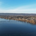
![Skyline of Harrisburg, Pennsylvania [01]](../../../../i/upload/2025/03/06/20250306111358-d7aca47c-sq.jpg)
![Skyline of Harrisburg, Pennsylvania [02]](../../../../i/upload/2025/03/06/20250306111433-9c50fbcd-sq.jpg)
![Skyline of Harrisburg, Pennsylvania [03]](../../../../i/upload/2025/03/06/20250306111539-504a5ae0-sq.jpg)
![Skyline of Harrisburg, Pennsylvania [04]](../../../../i/upload/2025/03/06/20250306111610-2800b7ec-sq.jpg)
Information
- Author
- Ben Schumin
- Copyright
- All Rights Reserved
- Created on
- Tuesday 18 October 2022
- Dimensions
- 5472*3078
Powered by Piwigo