
Ben Schumin Photography Portfolio
Ben Schumin is a professional photographer who captures the intricacies of daily life.
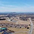
Aerial view of a wildfire in Wheatfield, Virginia.


![Woman looking at her phone on the Metro [01]](../../../../i/upload/2025/01/04/20250104025341-165479df-sq.jpg)
![Woman looking at her phone on the Metro [02]](../../../../i/upload/2025/01/04/20250104025355-ae4e68f8-sq.jpg)
![Woman looking at her phone on the Metro [03]](../../../../i/upload/2025/01/04/20250104025431-cb432292-sq.jpg)
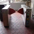
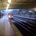
![Metro Center station, March 2024 [03]](../../../../i/upload/2025/01/04/20250104025330-9114ef00-sq.jpg)
![Metro Center station, March 2024 [01]](../../../../i/upload/2025/01/04/20250104025259-c1977d00-sq.jpg)
![Metro Center station, March 2024 [02]](../../../../i/upload/2025/01/04/20250104025315-38842e3a-sq.jpg)
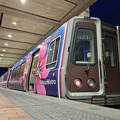
![Fleet of the Future Expo [25]](../../../../i/upload/2025/01/04/20250104013013-ca9be243-sq.jpg)
![Fleet of the Future Expo [26]](../../../../i/upload/2025/01/04/20250104013020-c14b3b60-sq.jpg)
![Fleet of the Future Expo [27]](../../../../i/upload/2025/01/04/20250104013031-496930bf-sq.jpg)
![Fleet of the Future Expo [28]](../../../../i/upload/2025/01/04/20250104013041-7e356fe1-sq.jpg)
![Fleet of the Future Expo [29]](../../../../i/upload/2025/01/04/20250104013047-ed4e782d-sq.jpg)
![Fleet of the Future Expo [30]](../../../../i/upload/2025/01/04/20250104013055-87ae8bd5-sq.jpg)
![Fleet of the Future Expo [22]](../../../../i/upload/2025/01/04/20250104012944-ce12dcbe-sq.jpg)
![Fleet of the Future Expo [23]](../../../../i/upload/2025/01/04/20250104012953-975361a0-sq.jpg)
![Fleet of the Future Expo [24]](../../../../i/upload/2025/01/04/20250104013005-e2eacbe6-sq.jpg)
![Fleet of the Future Expo [20]](../../../../i/upload/2025/01/04/20250104012924-50baddb7-sq.jpg)
![Fleet of the Future Expo [21]](../../../../i/upload/2025/01/04/20250104012934-ce83c158-sq.jpg)
![Fleet of the Future Expo [19]](../../../../i/upload/2025/01/04/20250104012915-50bfe26e-sq.jpg)
![Fleet of the Future Expo [18]](../../../../i/upload/2025/01/04/20250104012906-55521e4f-sq.jpg)
![Fleet of the Future Expo [17]](../../../../i/upload/2025/01/04/20250104012854-e448ec40-sq.jpg)
![Fleet of the Future Expo [14]](../../../../i/upload/2025/01/04/20250104012822-fd324a75-sq.jpg)
![Fleet of the Future Expo [15]](../../../../i/upload/2025/01/04/20250104012834-be2fbf2b-sq.jpg)
![Fleet of the Future Expo [16]](../../../../i/upload/2025/01/04/20250104012844-cedbf159-sq.jpg)
![Fleet of the Future Expo [13]](../../../../i/upload/2025/01/04/20250104012813-3b3b5816-sq.jpg)
![Fleet of the Future Expo [11]](../../../../i/upload/2025/01/04/20250104012755-873f7c27-sq.jpg)
![Fleet of the Future Expo [12]](../../../../i/upload/2025/01/04/20250104012803-7aa9b8e6-sq.jpg)
![Fleet of the Future Expo [10]](../../../../i/upload/2025/01/04/20250104012747-f48932dd-sq.jpg)
![Fleet of the Future Expo [09]](../../../../i/upload/2025/01/04/20250104012738-71227db3-sq.jpg)
![Fleet of the Future Expo [07]](../../../../i/upload/2025/01/04/20250104012719-94431eac-sq.jpg)
![Fleet of the Future Expo [08]](../../../../i/upload/2025/01/04/20250104012728-21ac8228-sq.jpg)
![Fleet of the Future Expo [05]](../../../../i/upload/2025/01/04/20250104012700-17b88f0f-sq.jpg)
![Fleet of the Future Expo [06]](../../../../i/upload/2025/01/04/20250104012711-7afb0f47-sq.jpg)
![Fleet of the Future Expo [03]](../../../../i/upload/2025/01/04/20250104012641-9b388abc-sq.jpg)
![Fleet of the Future Expo [04]](../../../../i/upload/2025/01/04/20250104012649-67ba4f8b-sq.jpg)
![Fleet of the Future Expo [01]](../../../../i/upload/2025/01/04/20250104012613-c96ba4e1-sq.jpg)
![Fleet of the Future Expo [02]](../../../../i/upload/2025/01/04/20250104012631-c65887a7-sq.jpg)
![Former Fairfax Connector bus 7754 [06]](../../../../i/upload/2025/01/03/20250103235711-a94b0c7b-sq.jpg)
![Buffalo Gap [02]](../../../../i/upload/2025/01/03/20250103200607-1abe8192-sq.jpg)
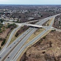
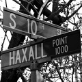
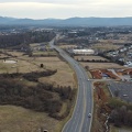
![Interchange between VA 262 and Old Greenville Road [01]](../../../../i/upload/2025/01/03/20250103172609-68b43692-sq.jpg)
![Interchange between VA 262 and Old Greenville Road [02]](../../../../i/upload/2025/01/03/20250103172620-c2bd2a46-sq.jpg)
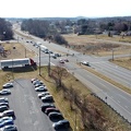
![Interchange between US 11 and VA 262 [02]](../../../../i/upload/2025/01/03/20250103172559-5c2ee040-sq.jpg)
![No parking sign on Gathright Dam [02]](../../../../i/upload/2025/01/02/20250102213928-b14b8899-sq.jpg)


![Routes 220 and 39 in Warm Springs, Virginia [02]](../../../../i/upload/2025/01/02/20250102141319-a5501ace-sq.jpg)
![Routes 220 and 39 in Warm Springs, Virginia [01]](../../../../i/upload/2025/01/02/20250102141310-79aa8afd-sq.jpg)


![Aerial view of Monterey, Virginia [06]](../../../../i/upload/2025/01/02/20250102005956-29786301-sq.jpg)
![Aerial view of Monterey, Virginia [04]](../../../../i/upload/2025/01/02/20250102005937-281fae65-sq.jpg)
![Aerial view of Monterey, Virginia [05]](../../../../i/upload/2025/01/02/20250102005946-79efaa38-sq.jpg)
![Aerial view of Monterey, Virginia [02]](../../../../i/upload/2025/01/02/20250102005923-7f7b9b83-sq.jpg)
![Aerial view of Monterey, Virginia [03]](../../../../i/upload/2025/01/02/20250102005929-2e84a9d0-sq.jpg)
![Aerial view of Monterey, Virginia [01]](../../../../i/upload/2025/01/02/20250102005918-685606f9-sq.jpg)


![Wildfire in Wheatfield, Virginia [20]](../../../../i/upload/2024/12/26/20241226113603-cc8e09d4-sq.jpg)
![Wildfire in Wheatfield, Virginia [19]](../../../../i/upload/2024/12/26/20241226113557-e900887b-sq.jpg)
![Wildfire in Wheatfield, Virginia [17]](../../../../i/upload/2024/12/26/20241226113535-464ef6f3-sq.jpg)
![Wildfire in Wheatfield, Virginia [18]](../../../../i/upload/2024/12/26/20241226113546-653ce2b4-sq.jpg)
![Wildfire in Wheatfield, Virginia [14]](../../../../i/upload/2024/12/26/20241226113504-f310b6be-sq.jpg)
![Wildfire in Wheatfield, Virginia [15]](../../../../i/upload/2024/12/26/20241226113515-58af561f-sq.jpg)
![Wildfire in Wheatfield, Virginia [16]](../../../../i/upload/2024/12/26/20241226113524-b6ae32b2-sq.jpg)
![Wildfire in Wheatfield, Virginia [11]](../../../../i/upload/2024/12/26/20241226113433-bbfde6c6-sq.jpg)
![Wildfire in Wheatfield, Virginia [12]](../../../../i/upload/2024/12/26/20241226113443-8c6bc962-sq.jpg)
![Wildfire in Wheatfield, Virginia [13]](../../../../i/upload/2024/12/26/20241226113455-f989b84b-sq.jpg)
![Wildfire in Wheatfield, Virginia [09]](../../../../i/upload/2024/12/26/20241226113414-261ee473-sq.jpg)
![Wildfire in Wheatfield, Virginia [10]](../../../../i/upload/2024/12/26/20241226113424-ef021110-sq.jpg)
![Wildfire in Wheatfield, Virginia [07]](../../../../i/upload/2024/12/26/20241226113355-bdc9fea6-sq.jpg)
![Wildfire in Wheatfield, Virginia [08]](../../../../i/upload/2024/12/26/20241226113404-8540af70-sq.jpg)
![Wildfire in Wheatfield, Virginia [06]](../../../../i/upload/2024/12/26/20241226113345-0e08706d-sq.jpg)
![Wildfire in Wheatfield, Virginia [05]](../../../../i/upload/2024/12/26/20241226113335-8685ba7b-sq.jpg)
![Wildfire in Wheatfield, Virginia [04]](../../../../i/upload/2024/12/26/20241226113325-158b68f2-sq.jpg)
![Wildfire in Wheatfield, Virginia [03]](../../../../i/upload/2024/12/26/20241226113316-fc2f1e85-sq.jpg)
![Wildfire in Wheatfield, Virginia [02]](../../../../i/upload/2024/12/26/20241226095727-426cf00c-sq.jpg)
![Wildfire in Wheatfield, Virginia [01]](../../../../i/upload/2024/12/26/20241226095723-0924c1da-sq.jpg)
![Fire at Aggregate Industries quarry [18]](../../../../i/upload/2024/12/25/20241225003230-9cc5b4d8-sq.jpg)
![Fire at Aggregate Industries quarry [17]](../../../../i/upload/2024/12/25/20241225003221-553c3485-sq.jpg)
![Fire at Aggregate Industries quarry [14]](../../../../i/upload/2024/12/25/20241225003152-bb2adfeb-sq.jpg)
![Fire at Aggregate Industries quarry [15]](../../../../i/upload/2024/12/25/20241225003201-9c9796ad-sq.jpg)
![Fire at Aggregate Industries quarry [16]](../../../../i/upload/2024/12/25/20241225003212-9fa6bddb-sq.jpg)
![Fire at Aggregate Industries quarry [10]](../../../../i/upload/2024/12/25/20241225003109-05f02075-sq.jpg)
![Fire at Aggregate Industries quarry [11]](../../../../i/upload/2024/12/25/20241225003120-121dc2e6-sq.jpg)
![Fire at Aggregate Industries quarry [12]](../../../../i/upload/2024/12/25/20241225003131-a180fa10-sq.jpg)
![Fire at Aggregate Industries quarry [13]](../../../../i/upload/2024/12/25/20241225003140-877ad120-sq.jpg)
![Fire at Aggregate Industries quarry [08]](../../../../i/upload/2024/12/25/20241225003049-74b14b99-sq.jpg)
![Fire at Aggregate Industries quarry [09]](../../../../i/upload/2024/12/25/20241225003059-a1a180c5-sq.jpg)
![Fire at Aggregate Industries quarry [04]](../../../../i/upload/2024/12/25/20241225003009-8b569132-sq.jpg)
![Fire at Aggregate Industries quarry [05]](../../../../i/upload/2024/12/25/20241225003018-cee46523-sq.jpg)
![Fire at Aggregate Industries quarry [06]](../../../../i/upload/2024/12/25/20241225003029-dbba04bc-sq.jpg)
![Fire at Aggregate Industries quarry [07]](../../../../i/upload/2024/12/25/20241225003039-43d93ed2-sq.jpg)
![Fire at Aggregate Industries quarry [02]](../../../../i/upload/2024/12/25/20241225002950-4ff900f3-sq.jpg)
![Fire at Aggregate Industries quarry [03]](../../../../i/upload/2024/12/25/20241225002959-22d28c07-sq.jpg)
![Fire at Aggregate Industries quarry [01]](../../../../i/upload/2024/12/25/20241225002941-9f8a343a-sq.jpg)

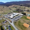
![Paint Branch High School [10]](../../../../i/upload/2024/12/22/20241222233232-f68847fd-sq.jpg)
![Paint Branch High School [07]](../../../../i/upload/2024/12/22/20241222233218-3031714a-sq.jpg)
![Paint Branch High School [05]](../../../../i/upload/2024/12/22/20241222233206-d3bf483b-sq.jpg)
![Paint Branch High School [06]](../../../../i/upload/2024/12/22/20241222233211-7e20b805-sq.jpg)
![Paint Branch High School [01]](../../../../i/upload/2024/12/22/20241222233144-0183c8e4-sq.jpg)
![Paint Branch High School [02]](../../../../i/upload/2024/12/22/20241222233150-8fe398b9-sq.jpg)

![Panda Express fortune slip [04]](../../../../i/upload/2024/07/20/20240720145359-66a5d5fd-sq.jpg)

![Blue Ridge Tunnel [16]](../../../../i/upload/2024/07/20/20240720144824-fe9d4abd-sq.jpg)
![Blue Ridge Tunnel [15]](../../../../i/upload/2024/07/20/20240720144651-6fd9392c-sq.jpg)
![Blue Ridge Tunnel [14]](../../../../i/upload/2024/07/20/20240720144751-ae0e4ca1-sq.jpg)
![Blue Ridge Tunnel [13]](../../../../i/upload/2024/07/20/20240720144804-bc9e7dc8-sq.jpg)
![Blue Ridge Tunnel [12]](../../../../i/upload/2024/07/20/20240720144818-8e5bbd5c-sq.jpg)
![Blue Ridge Tunnel [11]](../../../../i/upload/2024/07/20/20240720144723-1e7c34bf-sq.jpg)
![Blue Ridge Tunnel [10]](../../../../i/upload/2024/07/20/20240720144758-38e59beb-sq.jpg)
![Blue Ridge Tunnel [09]](../../../../i/upload/2024/07/20/20240720144710-7ab1d7c8-sq.jpg)
![Blue Ridge Tunnel [08]](../../../../i/upload/2024/07/20/20240720144716-42807dae-sq.jpg)
![Blue Ridge Tunnel [07]](../../../../i/upload/2024/07/20/20240720144740-6c95fb19-sq.jpg)
![Blue Ridge Tunnel [06]](../../../../i/upload/2024/07/20/20240720144746-c53c4054-sq.jpg)
![Blue Ridge Tunnel [05]](../../../../i/upload/2024/07/20/20240720144657-e1250c4d-sq.jpg)
![Blue Ridge Tunnel [04]](../../../../i/upload/2024/07/20/20240720144703-da172605-sq.jpg)
![Blue Ridge Tunnel [03]](../../../../i/upload/2024/07/20/20240720144728-9e74f1bb-sq.jpg)
![Blue Ridge Tunnel [02]](../../../../i/upload/2024/07/20/20240720144734-129eb4a4-sq.jpg)
![Blue Ridge Tunnel [01]](../../../../i/upload/2024/07/20/20240720144812-60655c76-sq.jpg)


![Train at East Falls Church station [01]](../../../../i/upload/2024/07/20/20240720022340-77f6c236-sq.jpg)
![Wenonah Elementary School [01]](../../../../i/upload/2024/07/20/20240720022130-0d6d5971-sq.jpg)


![Scott Hill Retirement Community [02]](../../../../i/upload/2024/07/20/20240720022019-7ad47a06-sq.jpg)

![CSX Clifton Forge rail yard [11]](../../../../i/upload/2024/07/20/20240720022009-c1f85353-sq.jpg)
![Scott Hill Retirement Community [01]](../../../../i/upload/2024/07/20/20240720022014-a14a5661-sq.jpg)
![CSX Clifton Forge rail yard [10]](../../../../i/upload/2024/07/20/20240720022004-482675e4-sq.jpg)
![CSX Clifton Forge rail yard [07]](../../../../i/upload/2024/07/20/20240720021948-08d5158c-sq.jpg)
![CSX Clifton Forge rail yard [08]](../../../../i/upload/2024/07/20/20240720021954-821b5e8e-sq.jpg)
![CSX Clifton Forge rail yard [09]](../../../../i/upload/2024/07/20/20240720021959-2698dacc-sq.jpg)
![Sign for State Route 188 [05]](../../../../i/upload/2024/07/20/20240720021903-7bd9cd82-sq.jpg)
![Sign for State Route 188 [06]](../../../../i/upload/2024/07/20/20240720021915-40479437-sq.jpg)
![Sign for State Route 188 [01]](../../../../i/upload/2024/07/20/20240720021810-3e9b4232-sq.jpg)
![Sign for State Route 188 [02]](../../../../i/upload/2024/07/20/20240720021827-a0810db1-sq.jpg)
![Sign for State Route 188 [03]](../../../../i/upload/2024/07/20/20240720021833-b69f59a5-sq.jpg)
![Sign for State Route 188 [04]](../../../../i/upload/2024/07/20/20240720021852-b244dda6-sq.jpg)
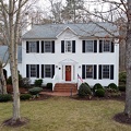
![Neighborhood in Clifton Forge, Virginia [02]](../../../../i/upload/2024/07/20/20240720021736-578bac29-sq.jpg)

![Neighborhood in Clifton Forge, Virginia [01]](../../../../i/upload/2024/07/20/20240720021719-e5828a4e-sq.jpg)
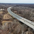
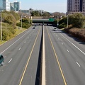
![Interstate 81 at Route 796 [02]](../../../../i/upload/2024/07/20/20240720020830-706bf71d-sq.jpg)
![Interstate 81 at Route 796 [01]](../../../../i/upload/2024/07/20/20240720020902-02c4ce7b-sq.jpg)
![US 29 Business in Culpeper, Virginia [02]](../../../../i/upload/2024/07/19/20240719165937-abc06307-sq.jpg)
![Montgomery County police car on Walker House Road [01]](../../../../i/upload/2024/07/19/20240719161838-0781267e-sq.jpg)
![Montgomery County police car on Walker House Road [02]](../../../../i/upload/2024/07/19/20240719161844-67fa4055-sq.jpg)
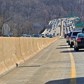
![Point of Rocks Bridge [11]](../../../../i/upload/2024/07/19/20240719161730-4f51193a-sq.jpg)
![Point of Rocks Bridge [10]](../../../../i/upload/2024/07/19/20240719161717-6572a682-sq.jpg)
![Point of Rocks Bridge [08]](../../../../i/upload/2024/07/19/20240719161700-351af3cd-sq.jpg)
![Point of Rocks Bridge [09]](../../../../i/upload/2024/07/19/20240719161708-5ce37e28-sq.jpg)
![Point of Rocks Bridge [06]](../../../../i/upload/2024/07/19/20240719161609-122bd90b-sq.jpg)
![Point of Rocks Bridge [07]](../../../../i/upload/2024/07/19/20240719161650-2c49391d-sq.jpg)
![Street signs at intersection of US 15 and Lucketts Road [02]](../../../../i/upload/2024/07/19/20240719161623-789e37f5-sq.jpg)
![Street signs at intersection of US 15 and Lucketts Road [01]](../../../../i/upload/2024/07/19/20240719161537-a75c3dac-sq.jpg)
![Traffic signals at US 15 and Lucketts Road [02]](../../../../i/upload/2024/07/19/20240719161422-d1e94014-sq.jpg)
![Traffic signals at US 15 and Lucketts Road [01]](../../../../i/upload/2024/07/19/20240719161531-79fec9f3-sq.jpg)
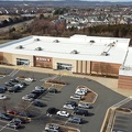
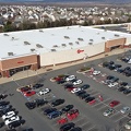

![Former Walmart store in Leesburg, Virginia [32]](../../../../i/upload/2024/07/19/20240719161511-f7619180-sq.jpg)
![Former Walmart store in Leesburg, Virginia [31]](../../../../i/upload/2024/07/19/20240719161426-3aad1cb4-sq.jpg)
![Former Walmart store in Leesburg, Virginia [30]](../../../../i/upload/2024/07/19/20240719161506-5e1aaadc-sq.jpg)
![Former Walmart store in Leesburg, Virginia [29]](../../../../i/upload/2024/07/19/20240719161501-e3ee3fa3-sq.jpg)
![Former Walmart store in Leesburg, Virginia [28]](../../../../i/upload/2024/07/19/20240719161604-d62ba6a6-sq.jpg)
![Former Walmart store in Leesburg, Virginia [27]](../../../../i/upload/2024/07/19/20240719161456-a81b50ec-sq.jpg)
![Former Walmart store in Leesburg, Virginia [26]](../../../../i/upload/2024/07/19/20240719161632-97d78dd5-sq.jpg)
![Former Walmart store in Leesburg, Virginia [25]](../../../../i/upload/2024/07/19/20240719161545-fe7c5dc9-sq.jpg)
![Former Walmart store in Leesburg, Virginia [24]](../../../../i/upload/2024/07/19/20240719161450-7741118a-sq.jpg)
![Former Walmart store in Leesburg, Virginia [23]](../../../../i/upload/2024/07/19/20240719161446-c526f472-sq.jpg)
![Former Walmart store in Leesburg, Virginia [22]](../../../../i/upload/2024/07/19/20240719161637-af71b3a4-sq.jpg)
![Former Walmart store in Leesburg, Virginia [21]](../../../../i/upload/2024/07/19/20240719161516-d1788f60-sq.jpg)
![Former Walmart store in Leesburg, Virginia [20]](../../../../i/upload/2024/07/19/20240719161627-947d67b6-sq.jpg)
![Former Walmart store in Leesburg, Virginia [19]](../../../../i/upload/2024/07/19/20240719161558-6075aaa2-sq.jpg)
![Former Walmart store in Leesburg, Virginia [18]](../../../../i/upload/2024/07/19/20240719161553-e28ae8be-sq.jpg)
![Former Walmart store in Leesburg, Virginia [17]](../../../../i/upload/2024/07/19/20240719161441-dd4b1109-sq.jpg)

![Springer Road and Sugarcamp Lane [02]](../../../../i/upload/2024/07/19/20240719160920-a73a3b63-sq.jpg)
![Springer Road and Sugarcamp Lane [01]](../../../../i/upload/2024/07/19/20240719160916-bbfef2f3-sq.jpg)
![Forest Springs Drive [04]](../../../../i/upload/2024/07/19/20240719160944-be5023e1-sq.jpg)
![Vintage US&S railroad signals [06]](../../../../i/upload/2024/07/19/20240719160833-ce5d8ee2-sq.jpg)
![Vintage US&S railroad signals [05]](../../../../i/upload/2024/07/19/20240719160844-8e4042ee-sq.jpg)


![Richmond Avenue in Staunton, Virginia [03]](../../../../i/upload/2024/07/19/20240719161212-297c1b53-sq.jpg)
![Richmond Avenue in Staunton, Virginia [01]](../../../../i/upload/2024/07/19/20240719161158-ddf9fe35-sq.jpg)
![Richmond Avenue in Staunton, Virginia [02]](../../../../i/upload/2024/07/19/20240719161203-233bb776-sq.jpg)
![Former MARC locomotive 57 [01]](../../../../i/upload/2024/07/19/20240719161024-c66b41b1-sq.jpg)


![Shield for State Route 254 [02]](../../../../i/upload/2024/07/19/20240719160516-e72119d6-sq.jpg)
![Shield for State Route 254 [01]](../../../../i/upload/2024/07/19/20240719160500-1fdaedc1-sq.jpg)
![US 29 Business in Culpeper, Virginia [01]](../../../../i/upload/2024/07/19/20240719155959-cf1d0444-sq.jpg)

![Glenmont station [03]](../../../../i/upload/2024/07/16/20240716002017-429988f6-sq.jpg)
![Grosvenor-Strathmore station [02]](../../../../i/upload/2024/07/15/20240715141133-7f96c275-sq.jpg)
![Arlington Cemetery station [01]](../../../../i/upload/2024/07/14/20240714170844-39ee5ee3-sq.jpg)

![Road over Gathright Dam [02]](../../../../i/upload/2024/07/14/20240714102132-396c8a23-sq.jpg)


![Forest Springs Drive [01]](../../../../i/upload/2024/07/17/20240717154858-173a58a4-sq.jpg)

![Payphone at New Market rest area [02]](../../../../i/upload/2024/07/17/20240717101528-9876c113-sq.jpg)
![Payphone at New Market rest area [01]](../../../../i/upload/2024/07/17/20240717101532-2c8ed3e3-sq.jpg)
![Interstate 70 Park and Ride [08]](../../../../i/upload/2024/07/17/20240717101415-dad1f17f-sq.jpg)
![Interstate 70 Park and Ride [07]](../../../../i/upload/2024/07/17/20240717101418-cb3d0cab-sq.jpg)
![Ballston station late at night [09]](../../../../i/upload/2024/07/15/20240715204503-cd071c1b-sq.jpg)
![Ballston station late at night [11]](../../../../i/upload/2024/07/15/20240715204504-fe9d105a-sq.jpg)
![Ballston station late at night [10]](../../../../i/upload/2024/07/15/20240715204506-38c59656-sq.jpg)
![Ballston station late at night [08]](../../../../i/upload/2024/07/15/20240715204501-bd54477a-sq.jpg)


![Cliff over the Blue Ridge Parkway [02]](../../../../i/upload/2024/07/15/20240715141127-8869144a-sq.jpg)
![Cliff over the Blue Ridge Parkway [01]](../../../../i/upload/2024/07/15/20240715141130-0117e715-sq.jpg)
![US 29 shield on Rhode Island Avenue NW [02]](../../../../i/upload/2024/07/14/20240714234553-282ce97c-sq.jpg)
![US 29 shield on Rhode Island Avenue NW [01]](../../../../i/upload/2024/07/14/20240714234551-7fead61b-sq.jpg)


![Road over Gathright Dam [01]](../../../../i/upload/2024/07/14/20240714102138-0aa862c7-sq.jpg)
![No parking sign on Gathright Dam [01]](../../../../i/upload/2024/07/14/20240714102141-459f947d-sq.jpg)


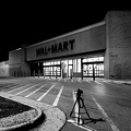
![Former Walmart in Leesburg, Virginia at night [02]](../../../../i/upload/2024/07/19/20240719101035-6d269816-sq.jpg)
![Former Walmart in Leesburg, Virginia at night [01]](../../../../i/upload/2024/07/19/20240719101040-7d8e67d9-sq.jpg)
![Point of Rocks [04]](../../../../i/upload/2024/07/19/20240719101050-da7edd4a-sq.jpg)
![Point of Rocks [01]](../../../../i/upload/2024/07/19/20240719101023-a2888aa2-sq.jpg)
![Abandoned Days Inn near Warfordsburg, Pennsylvania [26]](../../../../i/upload/2024/07/19/20240719091055-4c9414dd-sq.jpg)
![Abandoned Days Inn near Warfordsburg, Pennsylvania [25]](../../../../i/upload/2024/07/19/20240719091100-5bc7dd63-sq.jpg)
![Abandoned Days Inn near Warfordsburg, Pennsylvania [24]](../../../../i/upload/2024/07/19/20240719091046-1f6c2ec2-sq.jpg)
![Power transmission lines in Montgomery Village [06]](../../../../i/upload/2024/07/19/20240719002542-992b6062-sq.jpg)
![Power transmission lines in Montgomery Village [05]](../../../../i/upload/2024/07/19/20240719002545-bbd1ae24-sq.jpg)
![Power transmission lines in Montgomery Village [04]](../../../../i/upload/2024/07/19/20240719002552-1698394d-sq.jpg)
![Power transmission lines in Montgomery Village [03]](../../../../i/upload/2024/07/19/20240719002555-701edc67-sq.jpg)
![Power transmission lines in Montgomery Village [02]](../../../../i/upload/2024/07/19/20240719002558-88e3b55e-sq.jpg)
![Power transmission lines in Montgomery Village [01]](../../../../i/upload/2024/07/19/20240719002602-f6056c42-sq.jpg)

![Halethorpe MARC station [02]](../../../../i/upload/2024/07/18/20240718213546-29a94f5b-sq.jpg)

![Halethorpe MARC station [01]](../../../../i/upload/2024/07/18/20240718213543-f424dc01-sq.jpg)

![Railroad signal at Patapsco Valley State Park [01]](../../../../i/upload/2024/07/18/20240718213526-eaf789a7-sq.jpg)
![Railroad signal at Patapsco Valley State Park [02]](../../../../i/upload/2024/07/18/20240718213530-75fc4d73-sq.jpg)
![Dunkin Donuts in Rockville, Maryland [02]](../../../../i/upload/2024/07/18/20240718213623-3196bc98-sq.jpg)
![Dunkin Donuts in Rockville, Maryland [01]](../../../../i/upload/2024/07/18/20240718213626-b778e85e-sq.jpg)
![Interstate 64 at Rockfish Gap [02]](../../../../i/upload/2024/07/17/20240717224221-105e5513-sq.jpg)
![Footprints on Skyline Drive bridge [01]](../../../../i/upload/2024/07/17/20240717224215-a9df1920-sq.jpg)
![Footprints on Skyline Drive bridge [02]](../../../../i/upload/2024/07/17/20240717224219-2c9361e4-sq.jpg)
![Interstate 64 at Rockfish Gap [02]](../../../../i/upload/2024/07/17/20240717224209-142db162-sq.jpg)
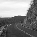
![Skyline Drive [02]](../../../../i/upload/2024/07/17/20240717224212-6e52dad3-sq.jpg)
![Skyline Drive [01]](../../../../i/upload/2024/07/17/20240717224204-be6fd01b-sq.jpg)
![Interstate 64 at Rockfish Gap [01]](../../../../i/upload/2024/07/17/20240717224207-b7307f80-sq.jpg)
![March on Crystal City [40]](../../../../i/upload/2024/07/16/20240716002045-d9f8f4b7-sq.jpg)
![Glenmont station [02]](../../../../i/upload/2024/07/16/20240716002015-55cf0f50-sq.jpg)
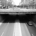
![Ramp to Downtown Expressway [02]](../../../../i/upload/2024/07/17/20240717155008-eff88bf6-sq.jpg)
![Railroad bridge [05]](../../../../i/upload/2024/07/17/20240717155011-55bc146d-sq.jpg)
![Railroad bridge [04]](../../../../i/upload/2024/07/17/20240717155013-784d7c58-sq.jpg)
![Ramp to Downtown Expressway [01]](../../../../i/upload/2024/07/17/20240717155016-33eaba18-sq.jpg)
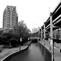
![Canal Walk through Shockoe Bottom [05]](../../../../i/upload/2024/07/17/20240717155021-9a708136-sq.jpg)
![Canal Walk through Shockoe Bottom [04]](../../../../i/upload/2024/07/17/20240717155024-693f8160-sq.jpg)
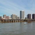
![Richmond skyline [12]](../../../../i/upload/2024/07/17/20240717155057-1b70ebec-sq.jpg)
![Richmond skyline [11]](../../../../i/upload/2024/07/17/20240717155100-1121e622-sq.jpg)
![Richmond skyline [10]](../../../../i/upload/2024/07/17/20240717155103-0850cb89-sq.jpg)
![Richmond skyline [09]](../../../../i/upload/2024/07/17/20240717155106-9423a503-sq.jpg)
![Richmond skyline [08]](../../../../i/upload/2024/07/17/20240717155110-33b853b1-sq.jpg)
![Richmond skyline [07]](../../../../i/upload/2024/07/17/20240717155113-cec25ff6-sq.jpg)
![Richmond skyline [06]](../../../../i/upload/2024/07/17/20240717155116-d4983983-sq.jpg)
![Richmond skyline [05]](../../../../i/upload/2024/07/17/20240717155118-d2e7b5b2-sq.jpg)
![Richmond skyline [04]](../../../../i/upload/2024/07/17/20240717155122-17d9c4b8-sq.jpg)
![Robert E. Lee Memorial Bridge and Belle Isle pedestrian bridge [02]](../../../../i/upload/2024/07/17/20240717155125-6acbde52-sq.jpg)
![Robert E. Lee Memorial Bridge and Belle Isle pedestrian bridge [01]](../../../../i/upload/2024/07/17/20240717155128-6aa706b6-sq.jpg)
![Richmond skyline [03]](../../../../i/upload/2024/07/17/20240717155130-cfb4a095-sq.jpg)


![Richmond skyline [02]](../../../../i/upload/2024/07/17/20240717155153-fa296849-sq.jpg)
![Railroad bridge [03]](../../../../i/upload/2024/07/17/20240717155156-fb77e508-sq.jpg)
![Railroad bridge [02]](../../../../i/upload/2024/07/17/20240717155159-48af8847-sq.jpg)

![Richmond skyline [01]](../../../../i/upload/2024/07/17/20240717155204-034e37ba-sq.jpg)
![Canal Walk through Shockoe Bottom [03]](../../../../i/upload/2024/07/17/20240717155332-20a25b99-sq.jpg)
![Canal Walk through Shockoe Bottom [02]](../../../../i/upload/2024/07/17/20240717155340-89b9c324-sq.jpg)

![Canal Walk through Shockoe Bottom [01]](../../../../i/upload/2024/07/17/20240717155345-29a96509-sq.jpg)

![Triple Crossing area [02]](../../../../i/upload/2024/07/17/20240717155355-a9821d17-sq.jpg)
![Triple Crossing area [01]](../../../../i/upload/2024/07/17/20240717155358-ef286524-sq.jpg)

![Railroad bridge [01]](../../../../i/upload/2024/07/17/20240717155406-0a79de93-sq.jpg)
![Interstate 70 Park and Ride [20]](../../../../i/upload/2024/07/17/20240717101455-55518c25-sq.jpg)
![Interstate 70 Park and Ride [19]](../../../../i/upload/2024/07/17/20240717101452-5353f937-sq.jpg)
![Interstate 70 Park and Ride [18]](../../../../i/upload/2024/07/17/20240717101449-12511c6d-sq.jpg)
![Interstate 70 Park and Ride [16]](../../../../i/upload/2024/07/17/20240717101443-659a724a-sq.jpg)
![Interstate 70 Park and Ride [17]](../../../../i/upload/2024/07/17/20240717101446-ebe1b286-sq.jpg)
![Interstate 70 Park and Ride [15]](../../../../i/upload/2024/07/17/20240717101440-5e188a30-sq.jpg)
![Interstate 70 Park and Ride [13]](../../../../i/upload/2024/07/17/20240717101434-be44361c-sq.jpg)
![Interstate 70 Park and Ride [14]](../../../../i/upload/2024/07/17/20240717101437-d335b061-sq.jpg)
![Interstate 70 Park and Ride [12]](../../../../i/upload/2024/07/17/20240717101431-6682ec6e-sq.jpg)
![Interstate 70 Park and Ride [11]](../../../../i/upload/2024/07/17/20240717101428-609261b3-sq.jpg)
![Interstate 70 Park and Ride [06]](../../../../i/upload/2024/07/17/20240717101411-4c7a473d-sq.jpg)
![Interstate 70 Park and Ride [09]](../../../../i/upload/2024/07/17/20240717101421-2cdea903-sq.jpg)
![Interstate 70 Park and Ride [10]](../../../../i/upload/2024/07/17/20240717101425-522ea9fe-sq.jpg)
![Interstate 70 Park and Ride [05]](../../../../i/upload/2024/07/17/20240717101408-de75e730-sq.jpg)
![Interstate 70 Park and Ride [04]](../../../../i/upload/2024/07/17/20240717101405-2a4b47e8-sq.jpg)
![Interstate 70 Park and Ride [02]](../../../../i/upload/2024/07/17/20240717101400-9f6381f5-sq.jpg)
![Interstate 70 Park and Ride [03]](../../../../i/upload/2024/07/17/20240717101402-96437861-sq.jpg)
![Interstate 70 Park and Ride [01]](../../../../i/upload/2024/07/17/20240717101356-92c4631a-sq.jpg)
Information
- Author
- Ben Schumin
- Copyright
- All Rights Reserved
- Created on
- Wednesday 20 March 2024
- Dimensions
- 8064*5376
EXIF Metadata
DJI FC8282
f/170/100
1/2000
100
0/10
0
- DateTimeOriginal
- 2024:03:20 17:04:27
- Make
- DJI
- Model
- FC8282
- ExposureProgram
- 2
- FocalLengthIn35mmFilm
- 24
- FNumber
- 170/100
- ExposureTime
- 1/2000
- ISOSpeedRatings
- 100
- Flash
- 0
- WhiteBalance
- 0
- XResolution
- 300/1
- YResolution
- 300/1
- Orientation
- 1
- ExposureBiasValue
- 0/10
- MaxApertureValue
- 153/100
- MeteringMode
- 1
- LightSource
- 1
Powered by Piwigo