
Ben Schumin Photography Portfolio
Ben Schumin is a professional photographer who captures the intricacies of daily life.
Aerial view of a wildfire in Wheatfield, Virginia.
!["No Swearing" sign at Virginia Beach [01]](../../../../i/upload/2024/07/13/20240713211638-c9d34b2f-sq.jpg)

![Fire hydrant on the Downtown Mall [02]](../../../../i/upload/2024/07/13/20240713234256-b5c33cfa-sq.jpg)


![Vienna station entrance pylon [02]](../../../../i/upload/2024/07/14/20240714101913-1fee6aa5-sq.jpg)

![RCA Building [01]](../../../../i/upload/2024/07/14/20240714101955-50d1842e-sq.jpg)

![Vienna station entrance pylon [01]](../../../../i/upload/2024/07/14/20240714102008-0ed574f7-sq.jpg)
![Pentagon City station entrance pylon [01]](../../../../i/upload/2024/07/14/20240714102012-c98e7ffa-sq.jpg)
![Old Town Alexandria [01]](../../../../i/upload/2024/07/14/20240714102020-cc1e9d11-sq.jpg)
![Old Town Alexandria [03]](../../../../i/upload/2024/07/14/20240714102049-bca34b25-sq.jpg)
![Old Town Alexandria [02]](../../../../i/upload/2024/07/14/20240714102050-6aa56370-sq.jpg)
![1801 North Lynn Street, viewed from Rosslyn Center parking garage [02]](../../../../i/upload/2024/07/14/20240714102056-13050ec8-sq.jpg)
![1801 North Lynn Street, viewed from Rosslyn Center parking garage [01]](../../../../i/upload/2024/07/14/20240714102104-1f137175-sq.jpg)


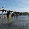
![Road over Gathright Dam [02]](../../../../i/upload/2024/07/14/20240714102132-396c8a23-sq.jpg)
![Road over Gathright Dam [01]](../../../../i/upload/2024/07/14/20240714102138-0aa862c7-sq.jpg)
![No parking sign on Gathright Dam [01]](../../../../i/upload/2024/07/14/20240714102141-459f947d-sq.jpg)


![Rosslyn Center [01]](../../../../i/upload/2024/07/14/20240714102228-4872f84b-sq.jpg)
![1801 North Lynn Street, viewed from close by [01]](../../../../i/upload/2024/07/14/20240714102229-482ea670-sq.jpg)

![1801 North Lynn Street, viewed from close by [02]](../../../../i/upload/2024/07/14/20240714102241-0c139685-sq.jpg)

![Vienna station entrance pylon [03]](../../../../i/upload/2024/07/14/20240714170840-9663f724-sq.jpg)
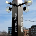
![King Street station entrance pylon [01]](../../../../i/upload/2024/07/14/20240714170904-339f077c-sq.jpg)
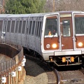
![Van Dorn Street station [01]](../../../../i/upload/2024/07/14/20240714170912-a79d03da-sq.jpg)
![Downtown Waynesboro, Virginia [01]](../../../../i/upload/2024/07/14/20240714171043-04dcc319-sq.jpg)

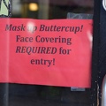
!["No Swearing" sign at Virginia Beach [02]](../../../../i/upload/2024/07/14/20240714171154-7f19fe75-sq.jpg)
!["No Swearing" sign at Virginia Beach [03]](../../../../i/upload/2024/07/14/20240714171155-25cceaee-sq.jpg)

![Entrance to Omni Charlottesville Hotel [01]](../../../../i/upload/2024/07/14/20240714171252-3f6e5155-sq.jpg)
![Entrance to Omni Charlottesville Hotel [03]](../../../../i/upload/2024/07/14/20240714171253-9551e8ea-sq.jpg)
![Entrance to Omni Charlottesville Hotel [02]](../../../../i/upload/2024/07/14/20240714171255-a6252f62-sq.jpg)
![Pentagon City station entrance pylon [02]](../../../../i/upload/2024/07/14/20240714234340-7cd2b005-sq.jpg)
![Demolition of 1117 North 19th Street [02]](../../../../i/upload/2024/07/14/20240714234453-bdd3fcad-sq.jpg)
![Demolition of 1117 North 19th Street [01]](../../../../i/upload/2024/07/14/20240714234455-3ed3f7f8-sq.jpg)
![1801 North Lynn Street, viewed from close by [03]](../../../../i/upload/2024/07/14/20240714234456-d23af8a7-sq.jpg)
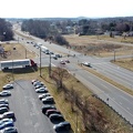
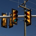
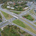
![Trafflc signals over Bluestone Drive and Duke Drive [02]](../../../../i/upload/2024/07/14/20240714234526-087fb6dd-sq.jpg)
![Trafflc signals over Bluestone Drive and Duke Drive [03]](../../../../i/upload/2024/07/14/20240714234528-aa7a3e5b-sq.jpg)
![Trafflc signals over Bluestone Drive and Duke Drive [01]](../../../../i/upload/2024/07/14/20240714234529-21493df4-sq.jpg)

![Allied Arts Building [01]](../../../../i/upload/2024/07/14/20240714234612-86b3f62f-sq.jpg)

![1801 North Lynn Street, viewed from close by [04]](../../../../i/upload/2024/07/14/20240714234624-7d012224-sq.jpg)
![Van Dorn Street station [02]](../../../../i/upload/2024/07/14/20240714234649-786f91f8-sq.jpg)

![Van Dorn Street station [03]](../../../../i/upload/2024/07/14/20240714234701-ae153731-sq.jpg)
![McDonald's wrap on Metro railcars [01]](../../../../i/upload/2024/07/14/20240714234711-6c3461cd-sq.jpg)
![McDonald's wrap on Metro railcars [03]](../../../../i/upload/2024/07/14/20240714234713-ac306489-sq.jpg)
![McDonald's wrap on Metro railcars [02]](../../../../i/upload/2024/07/14/20240714234715-d8a8ae3c-sq.jpg)

![McDonald's wrap on Metro railcars [04]](../../../../i/upload/2024/07/14/20240714234723-8b321b7d-sq.jpg)


![Rosslyn station entrance pylon [03]](../../../../i/upload/2024/07/14/20240714234842-2f9f4f09-sq.jpg)


![King Street station entrance pylon [02]](../../../../i/upload/2024/07/14/20240714235144-df535872-sq.jpg)
![Huntsville Festival of Fine Arts banner [01]](../../../../i/upload/2024/07/15/20240715141224-7b1b895e-sq.jpg)
![Wayne Theater [01]](../../../../i/upload/2024/07/15/20240715141226-1694fd67-sq.jpg)
![Wayne Theater [03]](../../../../i/upload/2024/07/15/20240715141227-1a665aee-sq.jpg)
![Wayne Theater [02]](../../../../i/upload/2024/07/15/20240715141228-f9339202-sq.jpg)
![Wayne Theater [04]](../../../../i/upload/2024/07/15/20240715141230-deaddc2f-sq.jpg)

![Press room at the former News Virginian building [01]](../../../../i/upload/2024/07/15/20240715141233-e75f9bf6-sq.jpg)
![Downtown Waynesboro, facing west [03]](../../../../i/upload/2024/07/15/20240715141241-78ca2bee-sq.jpg)
![Waynesboro, Virginia historical marker [01]](../../../../i/upload/2024/07/15/20240715141244-1885c150-sq.jpg)
![Downtown Waynesboro, facing west [02]](../../../../i/upload/2024/07/15/20240715141245-a64ec632-sq.jpg)
![Waynesboro, Virginia historical marker [02]](../../../../i/upload/2024/07/15/20240715141246-0ba894a5-sq.jpg)
![Huntsville Festival of Fine Arts banner [02]](../../../../i/upload/2024/07/15/20240715141248-1ff1b026-sq.jpg)
![Downtown Waynesboro, facing west [01]](../../../../i/upload/2024/07/15/20240715141249-3c569b80-sq.jpg)
![Trees with fake blossoms [02]](../../../../i/upload/2024/07/15/20240715141250-c0a554b0-sq.jpg)
![Former News Virginian building [01]](../../../../i/upload/2024/07/15/20240715141252-e2c4adc5-sq.jpg)
![Trees with fake blossoms [01]](../../../../i/upload/2024/07/15/20240715141253-1aced3a4-sq.jpg)
![Downtown Waynesboro, Virginia [02]](../../../../i/upload/2024/07/15/20240715141255-6a81b88f-sq.jpg)
![Former News Virginian building [02]](../../../../i/upload/2024/07/15/20240715141257-3cdcf1ac-sq.jpg)
![Zocalo sign [02]](../../../../i/upload/2024/07/15/20240715141909-2277ee26-sq.jpg)
![Five Guys sign [02]](../../../../i/upload/2024/07/15/20240715141911-0dedcb5e-sq.jpg)

![March on the Pentagon [05]](../../../../i/upload/2024/07/15/20240715204512-a5245af1-sq.jpg)
![March on the Pentagon [03]](../../../../i/upload/2024/07/15/20240715204515-d7df920a-sq.jpg)
![March on the Pentagon [04]](../../../../i/upload/2024/07/15/20240715204517-e95dc0a3-sq.jpg)

![Asbestos abatement work at 1815 North Fort Myer Drive [01]](../../../../i/upload/2024/07/15/20240715214704-e2c6e559-sq.jpg)
![Asbestos abatement work at 1815 North Fort Myer Drive [02]](../../../../i/upload/2024/07/15/20240715214725-e36cade6-sq.jpg)
![Facade removal at 1815 North Fort Myer Drive [01]](../../../../i/upload/2024/07/15/20240715215057-4fdb8677-sq.jpg)
![Facade removal at 1815 North Fort Myer Drive [02]](../../../../i/upload/2024/07/15/20240715215101-f9239fd1-sq.jpg)
![Facade removal at 1815 North Fort Myer Drive [03]](../../../../i/upload/2024/07/15/20240715215103-a550ce91-sq.jpg)

![Sidewalk shelter in front of 1815 North Fort Myer Drive [01]](../../../../i/upload/2024/07/15/20240715215216-50c3c034-sq.jpg)
![1801 North Lynn Street, viewed from close by [05]](../../../../i/upload/2024/07/15/20240715215218-05f6f453-sq.jpg)
![RCA Building [02]](../../../../i/upload/2024/07/15/20240715215220-6ad114bc-sq.jpg)
![1815 North Fort Myer Drive and Turnberry Tower [01]](../../../../i/upload/2024/07/15/20240715215222-a731559a-sq.jpg)
![RCA Building [03]](../../../../i/upload/2024/07/15/20240715215224-c6ab740d-sq.jpg)
![1801 North Lynn Street, viewed from close by [06]](../../../../i/upload/2024/07/15/20240715215226-74822916-sq.jpg)
![Mini excavator at 1815 Fort Myer Drive [03]](../../../../i/upload/2024/07/15/20240715215240-2d72e28c-sq.jpg)
![Mini excavator at 1815 Fort Myer Drive [02]](../../../../i/upload/2024/07/15/20240715215242-cf4c2ce5-sq.jpg)
![Mini excavator at 1815 Fort Myer Drive [01]](../../../../i/upload/2024/07/15/20240715215244-f9ce1051-sq.jpg)
![Mini excavator at 1815 Fort Myer Drive [04]](../../../../i/upload/2024/07/15/20240715215246-8939270f-sq.jpg)
![Long-reach excavator [05]](../../../../i/upload/2024/07/15/20240715215250-bb4753b3-sq.jpg)
![Long-reach excavator [04]](../../../../i/upload/2024/07/15/20240715215252-05eb1fff-sq.jpg)
![Long-reach excavator [03]](../../../../i/upload/2024/07/15/20240715215254-2e5d6660-sq.jpg)
![Long-reach excavator [02]](../../../../i/upload/2024/07/15/20240715215255-1581ee1a-sq.jpg)
![Long-reach excavator [01]](../../../../i/upload/2024/07/15/20240715215257-d1c55424-sq.jpg)
![1815 North Fort Myer Drive and Turnberry Tower [02]](../../../../i/upload/2024/07/15/20240715215300-820bfb90-sq.jpg)

![Long-reach excavator [15]](../../../../i/upload/2024/07/15/20240715215304-6826c345-sq.jpg)
![Long-reach excavator [16]](../../../../i/upload/2024/07/15/20240715215306-d68c548d-sq.jpg)
![Long-reach excavator [13]](../../../../i/upload/2024/07/15/20240715215308-00e5afa8-sq.jpg)
![Long-reach excavator [12]](../../../../i/upload/2024/07/15/20240715215310-077d4a0e-sq.jpg)
![Long-reach excavator [14]](../../../../i/upload/2024/07/15/20240715215312-8db1a7d1-sq.jpg)
![Long-reach excavator [11]](../../../../i/upload/2024/07/15/20240715215314-fe80ca02-sq.jpg)
![Long-reach excavator [10]](../../../../i/upload/2024/07/15/20240715215316-d34b0f92-sq.jpg)
![Long-reach excavator [09]](../../../../i/upload/2024/07/15/20240715215318-fc19a3d1-sq.jpg)
![Long-reach excavator [08]](../../../../i/upload/2024/07/15/20240715215320-be6c6b9f-sq.jpg)
![Long-reach excavator [07]](../../../../i/upload/2024/07/15/20240715215322-a1728cfa-sq.jpg)
![Long-reach excavator [06]](../../../../i/upload/2024/07/15/20240715215324-03eda33b-sq.jpg)
![Man holding hose during demolition work [03]](../../../../i/upload/2024/07/15/20240715215327-c8a23cf7-sq.jpg)
![Man holding hose during demolition work [02]](../../../../i/upload/2024/07/15/20240715215331-dc1ec0b8-sq.jpg)
![Man holding hose during demolition work [01]](../../../../i/upload/2024/07/15/20240715215333-91014268-sq.jpg)
![Rebar and steel beams at 1815 North Fort Myer Drive [02]](../../../../i/upload/2024/07/15/20240715215339-edfdb53d-sq.jpg)
![Rebar and steel beams at 1815 North Fort Myer Drive [01]](../../../../i/upload/2024/07/15/20240715215341-a890a092-sq.jpg)
![Recovery of scrap metal at 1815 North Fort Myer Drive site [01]](../../../../i/upload/2024/07/15/20240715215347-e8a640d8-sq.jpg)
![Sidewalk shelter in front of 1815 North Fort Myer Drive [02]](../../../../i/upload/2024/07/15/20240715215349-35e609b9-sq.jpg)
![Recovery of scrap metal at 1815 North Fort Myer Drive site [09]](../../../../i/upload/2024/07/15/20240715215351-05351869-sq.jpg)
![Recovery of scrap metal at 1815 North Fort Myer Drive site [08]](../../../../i/upload/2024/07/15/20240715215352-754a9e16-sq.jpg)
![Recovery of scrap metal at 1815 North Fort Myer Drive site [07]](../../../../i/upload/2024/07/15/20240715215354-665a5caa-sq.jpg)
![Recovery of scrap metal at 1815 North Fort Myer Drive site [06]](../../../../i/upload/2024/07/15/20240715215356-b08b6065-sq.jpg)
![Recovery of scrap metal at 1815 North Fort Myer Drive site [05]](../../../../i/upload/2024/07/15/20240715215358-f6419f2e-sq.jpg)
![Recovery of scrap metal at 1815 North Fort Myer Drive site [03]](../../../../i/upload/2024/07/15/20240715215400-acf12bb6-sq.jpg)
![Recovery of scrap metal at 1815 North Fort Myer Drive site [04]](../../../../i/upload/2024/07/15/20240715215402-a6b154b8-sq.jpg)
![Recovery of scrap metal at 1815 North Fort Myer Drive site [02]](../../../../i/upload/2024/07/15/20240715215404-c03b97eb-sq.jpg)
![Completed demolition at 1815 North Fort Myer Drive [01]](../../../../i/upload/2024/07/15/20240715215503-fac04a15-sq.jpg)
![Completed demolition at 1815 North Fort Myer Drive [02]](../../../../i/upload/2024/07/15/20240715215505-909ea371-sq.jpg)
![Completed demolition at 1815 North Fort Myer Drive [03]](../../../../i/upload/2024/07/15/20240715215508-39b58b8b-sq.jpg)
![Completed demolition at 1815 North Fort Myer Drive [11]](../../../../i/upload/2024/07/15/20240715215512-06908b83-sq.jpg)
![Completed demolition at 1815 North Fort Myer Drive [10]](../../../../i/upload/2024/07/15/20240715215514-8f084649-sq.jpg)
![Completed demolition at 1815 North Fort Myer Drive [09]](../../../../i/upload/2024/07/15/20240715215516-1cf8fd1e-sq.jpg)
![Completed demolition at 1815 North Fort Myer Drive [08]](../../../../i/upload/2024/07/15/20240715215518-17832cfd-sq.jpg)
![Completed demolition at 1815 North Fort Myer Drive [07]](../../../../i/upload/2024/07/15/20240715215520-29cd46a8-sq.jpg)
![Completed demolition at 1815 North Fort Myer Drive [06]](../../../../i/upload/2024/07/15/20240715215522-18650e5f-sq.jpg)
![Completed demolition at 1815 North Fort Myer Drive [05]](../../../../i/upload/2024/07/15/20240715215524-8df45bea-sq.jpg)
![Completed demolition at 1815 North Fort Myer Drive [04]](../../../../i/upload/2024/07/15/20240715215526-ff8fb60b-sq.jpg)
![Completed demolition at 1815 North Fort Myer Drive [12]](../../../../i/upload/2024/07/15/20240715223129-2b2d675b-sq.jpg)
![Escalators at Rosslyn station [01]](../../../../i/upload/2024/07/16/20240716001928-dfe1a681-sq.jpg)

![RCA Building [04]](../../../../i/upload/2024/07/16/20240716002006-ef683b4f-sq.jpg)

![March on Crystal City [53]](../../../../i/upload/2024/07/16/20240716002103-b2c22cea-sq.jpg)
![Plumb House [01]](../../../../i/upload/2024/07/16/20240716003154-0ab33a14-sq.jpg)
![Plumb House [02]](../../../../i/upload/2024/07/16/20240716003156-c47d241e-sq.jpg)


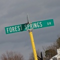
![Forest Springs Drive [01]](../../../../i/upload/2024/07/17/20240717154858-173a58a4-sq.jpg)


![Springer Road and Forest Springs Drive [01]](../../../../i/upload/2024/07/17/20240717154906-f43d5dea-sq.jpg)
![Houses in Stuarts Draft, Virginia [04]](../../../../i/upload/2024/07/17/20240717154909-0ee83883-sq.jpg)

![Houses in Stuarts Draft, Virginia [03]](../../../../i/upload/2024/07/17/20240717154913-79e1c9c0-sq.jpg)
![Houses in Stuarts Draft, Virginia [02]](../../../../i/upload/2024/07/17/20240717154915-1abfd924-sq.jpg)
![Houses in Stuarts Draft, Virginia [01]](../../../../i/upload/2024/07/17/20240717154917-a2142e0a-sq.jpg)


![Farmers and Merchants' Bank clock [02]](../../../../i/upload/2024/07/17/20240717160430-e382e5e0-sq.jpg)

![Farmers and Merchants' Bank clock [01]](../../../../i/upload/2024/07/17/20240717160443-b5e2d9d5-sq.jpg)


![Springer Road and Forest Springs Drive [04]](../../../../i/upload/2024/07/17/20240717161635-9a8677de-sq.jpg)
![Springer Road and Forest Springs Drive [03]](../../../../i/upload/2024/07/17/20240717161639-d3eaf32c-sq.jpg)
![Springer Road and Forest Springs Drive [02]](../../../../i/upload/2024/07/17/20240717161642-b483b881-sq.jpg)
![Springer Road and Forest Springs Drive [05]](../../../../i/upload/2024/07/17/20240717161703-a98a0f92-sq.jpg)
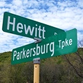
![Street signs in Mount Crawford, Virginia [01]](../../../../i/upload/2024/07/17/20240717230433-374aad7a-sq.jpg)
![Street signs in Mount Crawford, Virginia [02]](../../../../i/upload/2024/07/17/20240717230436-08b6c2b4-sq.jpg)

![Ford Model T Street Rod [01]](../../../../i/upload/2024/07/17/20240717231610-2e0e9bda-sq.jpg)
![Ford Model T Street Rod [02]](../../../../i/upload/2024/07/17/20240717231613-821d0df5-sq.jpg)

![State Theatre, Culpeper, Virginia [01]](../../../../i/upload/2024/07/17/20240717231706-da6c6781-sq.jpg)
![State Theatre, Culpeper, Virginia [02]](../../../../i/upload/2024/07/17/20240717231710-809834d9-sq.jpg)
![State Theatre, Culpeper, Virginia [03]](../../../../i/upload/2024/07/17/20240717231713-b98d2218-sq.jpg)

![Fire alarm pull station at New Street parking garage [01]](../../../../i/upload/2024/07/17/20240717231752-468f336b-sq.jpg)


![Charlottesville Downtown Mall, September 2014 [01]](../../../../i/upload/2024/07/17/20240717233151-da30e294-sq.jpg)
![Charlottesville Downtown Mall, September 2014 [02]](../../../../i/upload/2024/07/17/20240717233157-f4506c19-sq.jpg)
![Charlottesville Downtown Mall, September 2014 [03]](../../../../i/upload/2024/07/17/20240717233202-5bcfe442-sq.jpg)
![Charlottesville Downtown Mall, September 2014 [04]](../../../../i/upload/2024/07/17/20240717233208-7cb62018-sq.jpg)
![Charlottesville Downtown Mall, September 2014 [05]](../../../../i/upload/2024/07/17/20240717233214-3acd5113-sq.jpg)
![Charlottesville Downtown Mall, September 2014 [06]](../../../../i/upload/2024/07/17/20240717233219-d2124f9c-sq.jpg)
![Charlottesville Downtown Mall, September 2014 [07]](../../../../i/upload/2024/07/17/20240717233226-ee2052f8-sq.jpg)

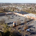
![Walmart Neighborhood Market, Waynesboro, Virginia [01]](../../../../i/upload/2024/07/18/20240718220905-ff18789a-sq.jpg)
![Walmart Neighborhood Market, Waynesboro, Virginia [04]](../../../../i/upload/2024/07/18/20240718220912-09ffa620-sq.jpg)
![Walmart Neighborhood Market, Waynesboro, Virginia [03]](../../../../i/upload/2024/07/18/20240718220915-fdfe85cb-sq.jpg)
![Walmart Neighborhood Market, Waynesboro, Virginia [02]](../../../../i/upload/2024/07/18/20240718220918-adab7520-sq.jpg)
![Norge ball at BZ Laundromat [02]](../../../../i/upload/2024/07/18/20240718222902-83d1f493-sq.jpg)
![Norge ball at BZ Laundromat [01]](../../../../i/upload/2024/07/18/20240718222909-0b355e86-sq.jpg)
![Norge ball at BZ Laundromat [03]](../../../../i/upload/2024/07/18/20240718222921-2b0b174e-sq.jpg)
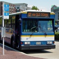
![Former Royal Street bus division [03]](../../../../i/upload/2024/07/18/20240718223659-ada769ee-sq.jpg)
![Former Royal Street bus division [04]](../../../../i/upload/2024/07/18/20240718223702-46e84144-sq.jpg)
![Former Royal Street bus division [02]](../../../../i/upload/2024/07/18/20240718223705-2f90819d-sq.jpg)
![Former Royal Street bus division [01]](../../../../i/upload/2024/07/18/20240718223708-5b0c3fae-sq.jpg)

![Masonic Building [01]](../../../../i/upload/2024/07/18/20240718223829-3beebb91-sq.jpg)


![Captain D's in Fredericksburg, Virginia [01]](../../../../i/upload/2024/07/19/20240719093750-210b7059-sq.jpg)
![Captain D's in Fredericksburg, Virginia [02]](../../../../i/upload/2024/07/19/20240719093754-51e52bde-sq.jpg)


![Abandoned book on a table [01]](../../../../i/upload/2024/07/19/20240719103202-db7c8be9-sq.jpg)
![Abandoned book on a table [02]](../../../../i/upload/2024/07/19/20240719103207-2cdfcfa2-sq.jpg)
![Abandoned book on a table [03]](../../../../i/upload/2024/07/19/20240719103212-4309cc98-sq.jpg)
![Rosslyn Center [02]](../../../../i/upload/2024/07/19/20240719103223-e4c5c1f0-sq.jpg)
![Rosslyn station entrance pylon [04]](../../../../i/upload/2024/07/19/20240719103233-e247a443-sq.jpg)
![Rosslyn station entrance pylon [05]](../../../../i/upload/2024/07/19/20240719103238-988947f0-sq.jpg)
![Photographing 1750 Crystal Drive [02]](../../../../i/upload/2024/07/19/20240719104132-158c0089-sq.jpg)
![Photographing 1750 Crystal Drive [01]](../../../../i/upload/2024/07/19/20240719104135-a21ab6ce-sq.jpg)
![Tally Ho Theater [01]](../../../../i/upload/2024/07/19/20240719104245-0818b71e-sq.jpg)
![Tally Ho Theater [02]](../../../../i/upload/2024/07/19/20240719104254-b8a3c731-sq.jpg)

![3101 Wilson Boulevard [02]](../../../../i/upload/2024/07/19/20240719104351-2ba8b934-sq.jpg)
![3101 Wilson Boulevard [01]](../../../../i/upload/2024/07/19/20240719104355-bee57a4b-sq.jpg)
![Street sign at Backlick Road and Brookfield Plaza [02]](../../../../i/upload/2024/07/19/20240719104619-1bd22298-sq.jpg)
![Street sign at Backlick Road and Brookfield Plaza [01]](../../../../i/upload/2024/07/19/20240719104624-32193b87-sq.jpg)
![Temporary street signs [06]](../../../../i/upload/2024/07/19/20240719104958-7b56eb56-sq.jpg)
![Temporary street signs [05]](../../../../i/upload/2024/07/19/20240719105003-68ab3da4-sq.jpg)
![Temporary street signs [04]](../../../../i/upload/2024/07/19/20240719105008-d8d93701-sq.jpg)
![Temporary street signs [03]](../../../../i/upload/2024/07/19/20240719105012-b7d8d845-sq.jpg)
![Temporary street signs [02]](../../../../i/upload/2024/07/19/20240719105017-67fb0e16-sq.jpg)
![Temporary street signs [01]](../../../../i/upload/2024/07/19/20240719105021-ee37d376-sq.jpg)
![George M. Cochran Judicial Center [01]](../../../../i/upload/2024/07/19/20240719115214-7e18aace-sq.jpg)
![Charlottesville Community Chalkboard, October 15, 2020 [06]](../../../../i/upload/2024/07/19/20240719115234-468f01de-sq.jpg)
![Charlottesville Community Chalkboard, October 15, 2020 [25]](../../../../i/upload/2024/07/19/20240719115240-9699a75a-sq.jpg)
![Charlottesville Community Chalkboard, October 15, 2020 [15]](../../../../i/upload/2024/07/19/20240719115245-43c58991-sq.jpg)
![Charlottesville Community Chalkboard, October 15, 2020 [17]](../../../../i/upload/2024/07/19/20240719115250-6306ee3e-sq.jpg)
![Zocalo sign [05]](../../../../i/upload/2024/07/19/20240719115310-3577b3d8-sq.jpg)

![Charlottesville Community Chalkboard, October 15, 2020 [04]](../../../../i/upload/2024/07/19/20240719115320-299d30d9-sq.jpg)
![Charlottesville Community Chalkboard, October 15, 2020 [08]](../../../../i/upload/2024/07/19/20240719115325-b4c08fb3-sq.jpg)
![Charlottesville Community Chalkboard, October 15, 2020 [22]](../../../../i/upload/2024/07/19/20240719115330-06283742-sq.jpg)
![Charlottesville Community Chalkboard, October 15, 2020 [05]](../../../../i/upload/2024/07/19/20240719115336-f4b0fd5e-sq.jpg)
![Charlottesville Community Chalkboard, October 15, 2020 [26]](../../../../i/upload/2024/07/19/20240719115341-5d7a961b-sq.jpg)
![Charlottesville Community Chalkboard, October 15, 2020 [01]](../../../../i/upload/2024/07/19/20240719115346-8e901d8f-sq.jpg)
![Charlottesville Community Chalkboard, October 15, 2020 [13]](../../../../i/upload/2024/07/19/20240719115353-f4ea5647-sq.jpg)
![Charlottesville Community Chalkboard, October 15, 2020 [31]](../../../../i/upload/2024/07/19/20240719115359-3a576977-sq.jpg)
![Charlottesville Community Chalkboard, October 15, 2020 [02]](../../../../i/upload/2024/07/19/20240719115404-83b30894-sq.jpg)
![Charlottesville Community Chalkboard, October 15, 2020 [19]](../../../../i/upload/2024/07/19/20240719115409-78cab008-sq.jpg)
![Charlottesville Community Chalkboard, October 15, 2020 [24]](../../../../i/upload/2024/07/19/20240719115415-13683b3b-sq.jpg)
![Charlottesville Community Chalkboard, October 15, 2020 [10]](../../../../i/upload/2024/07/19/20240719115420-7210211c-sq.jpg)
![Charlottesville Community Chalkboard, October 15, 2020 [12]](../../../../i/upload/2024/07/19/20240719115425-6c432c91-sq.jpg)
![Charlottesville Community Chalkboard, October 15, 2020 [29]](../../../../i/upload/2024/07/19/20240719115431-c5f1a587-sq.jpg)

![Entrance to Omni Charlottesville Hotel [04]](../../../../i/upload/2024/07/19/20240719115445-df7873a0-sq.jpg)
![Entrance to Omni Charlottesville Hotel [08]](../../../../i/upload/2024/07/19/20240719115449-562db7cf-sq.jpg)
![Sign for Pawprints Boutique [01]](../../../../i/upload/2024/07/19/20240719115453-c8ee9b3d-sq.jpg)
![Sign for Pawprints Boutique [02]](../../../../i/upload/2024/07/19/20240719115457-f0039817-sq.jpg)

![Downtown Charlottesville from Market Street garage [01]](../../../../i/upload/2024/07/19/20240719115507-cfb820d4-sq.jpg)
![Zocalo sign [03]](../../../../i/upload/2024/07/19/20240719115511-b5adcd87-sq.jpg)
![Interior of 316 East Main Street [01]](../../../../i/upload/2024/07/19/20240719115516-34ec9ded-sq.jpg)
![Charlottesville Community Chalkboard, October 15, 2020 [07]](../../../../i/upload/2024/07/19/20240719115526-0087311c-sq.jpg)
![Charlottesville Community Chalkboard, October 15, 2020 [20]](../../../../i/upload/2024/07/19/20240719115532-a0a7d260-sq.jpg)
![Charlottesville Community Chalkboard, October 15, 2020 [23]](../../../../i/upload/2024/07/19/20240719115537-42f16f4a-sq.jpg)
![Charlottesville Community Chalkboard, October 15, 2020 [27]](../../../../i/upload/2024/07/19/20240719115543-7549e656-sq.jpg)
![Charlottesville Community Chalkboard, October 15, 2020 [11]](../../../../i/upload/2024/07/19/20240719115550-15d56459-sq.jpg)
![Charlottesville Community Chalkboard, October 15, 2020 [14]](../../../../i/upload/2024/07/19/20240719115555-17c74976-sq.jpg)
![Charlottesville Community Chalkboard, October 15, 2020 [03]](../../../../i/upload/2024/07/19/20240719115600-680da8b9-sq.jpg)
![Zocalo sign [07]](../../../../i/upload/2024/07/19/20240719115610-e0634685-sq.jpg)

![Entrance to Omni Charlottesville Hotel [07]](../../../../i/upload/2024/07/19/20240719115619-d7172b54-sq.jpg)
![Downtown Charlottesville from Market Street garage [02]](../../../../i/upload/2024/07/19/20240719115624-37df67fa-sq.jpg)
![Zocalo sign [06]](../../../../i/upload/2024/07/19/20240719115642-2b8c899c-sq.jpg)

![Hand sanitizer station on the Downtown Mall [01]](../../../../i/upload/2024/07/19/20240719115652-7929d35d-sq.jpg)
![Paramount Theater marquee [02]](../../../../i/upload/2024/07/19/20240719115656-fba362d6-sq.jpg)

![Hand sanitizer station on the Downtown Mall [02]](../../../../i/upload/2024/07/19/20240719115720-3c27d0e7-sq.jpg)
![Zocalo sign [08]](../../../../i/upload/2024/07/19/20240719115725-250fd0d8-sq.jpg)
![Charlottesville Community Chalkboard, October 15, 2020 [09]](../../../../i/upload/2024/07/19/20240719115735-8effc69e-sq.jpg)
![Charlottesville Community Chalkboard, October 15, 2020 [18]](../../../../i/upload/2024/07/19/20240719115741-3580064a-sq.jpg)
![Charlottesville Community Chalkboard, October 15, 2020 [21]](../../../../i/upload/2024/07/19/20240719115747-836683db-sq.jpg)
![Charlottesville Community Chalkboard, October 15, 2020 [16]](../../../../i/upload/2024/07/19/20240719115753-03520fcb-sq.jpg)
![Charlottesville Community Chalkboard, October 15, 2020 [28]](../../../../i/upload/2024/07/19/20240719115758-ef11fb8c-sq.jpg)
![Charlottesville Community Chalkboard, October 15, 2020 [30]](../../../../i/upload/2024/07/19/20240719115804-07b97b14-sq.jpg)
![Zocalo sign [04]](../../../../i/upload/2024/07/19/20240719115809-f903d657-sq.jpg)

![Entrance to Omni Charlottesville Hotel [05]](../../../../i/upload/2024/07/19/20240719115818-68848870-sq.jpg)
![Entrance to Omni Charlottesville Hotel [06]](../../../../i/upload/2024/07/19/20240719115823-1607bd7f-sq.jpg)

![Staunton Clock Tower [01]](../../../../i/upload/2024/07/19/20240719115857-a88dc372-sq.jpg)
![Staunton Clock Tower [02]](../../../../i/upload/2024/07/19/20240719115915-2d83ab3f-sq.jpg)
![Staunton Clock Tower [03]](../../../../i/upload/2024/07/19/20240719115934-d5879976-sq.jpg)
![Floor indicator on Johnson Street parking garage elevator [01]](../../../../i/upload/2024/07/19/20240719115943-1835bb92-sq.jpg)
![Floor indicator on Johnson Street parking garage elevator [02]](../../../../i/upload/2024/07/19/20240719115948-18ad328e-sq.jpg)
![Fire department tape in the Johnson Street parking garage [01]](../../../../i/upload/2024/07/19/20240719120001-6c684aad-sq.jpg)
![Fire department tape in the Johnson Street parking garage [02]](../../../../i/upload/2024/07/19/20240719120011-bdc793fe-sq.jpg)
!["DO NOT ENTER" sign on North Central Avenue [01]](../../../../i/upload/2024/07/19/20240719120016-255808e6-sq.jpg)
!["DO NOT ENTER" sign on North Central Avenue [02]](../../../../i/upload/2024/07/19/20240719120026-21151527-sq.jpg)


![Fire alarm pull station at New Street parking garage [02]](../../../../i/upload/2024/07/19/20240719120154-1a82ec02-sq.jpg)
![Fire alarm pull station at New Street parking garage [04]](../../../../i/upload/2024/07/19/20240719120159-6c1cbf8a-sq.jpg)

![Statue on the Augusta County Courthouse [02]](../../../../i/upload/2024/07/19/20240719120227-c80b58ce-sq.jpg)
![Augusta County Courthouse [05]](../../../../i/upload/2024/07/19/20240719120232-ef6900ef-sq.jpg)
![Statue on the Augusta County Courthouse [03]](../../../../i/upload/2024/07/19/20240719120237-cb8191b9-sq.jpg)
![New Street parking garage [01]](../../../../i/upload/2024/07/19/20240719120241-2cde60a8-sq.jpg)
![Augusta County Courthouse [06]](../../../../i/upload/2024/07/19/20240719120246-38149e85-sq.jpg)
![Augusta County Courthouse [07]](../../../../i/upload/2024/07/19/20240719120251-b12fa7bc-sq.jpg)
![Statue on the Augusta County Courthouse [05]](../../../../i/upload/2024/07/19/20240719120255-65e2c43c-sq.jpg)
![Statue on the Augusta County Courthouse [01]](../../../../i/upload/2024/07/19/20240719120300-97c4f6ff-sq.jpg)
![Fire alarm bell at 1 East Beverley Street [01]](../../../../i/upload/2024/07/19/20240719120310-539f8047-sq.jpg)
![Fire alarm bell at 1 East Beverley Street [03]](../../../../i/upload/2024/07/19/20240719120315-85414b50-sq.jpg)
![Fire alarm bell at 1 East Beverley Street [04]](../../../../i/upload/2024/07/19/20240719120320-c7f54296-sq.jpg)
![Augusta County Sheriff cruiser [01]](../../../../i/upload/2024/07/19/20240719120326-5840bd99-sq.jpg)
![New Street parking garage [02]](../../../../i/upload/2024/07/19/20240719120331-1084f3a8-sq.jpg)

![Cupola on the Augusta County Courthouse [01]](../../../../i/upload/2024/07/19/20240719120341-69e16f0d-sq.jpg)

![Fire alarm pull station at New Street parking garage [03]](../../../../i/upload/2024/07/19/20240719120404-60624577-sq.jpg)
![Fire alarm bell at 1 East Beverley Street [02]](../../../../i/upload/2024/07/19/20240719120409-a22db44d-sq.jpg)
![Fire alarm bell at 1 East Beverley Street [05]](../../../../i/upload/2024/07/19/20240719120414-64fd6b2b-sq.jpg)
![Augusta County Sheriff cruiser [02]](../../../../i/upload/2024/07/19/20240719120419-caf3b000-sq.jpg)
![Augusta County Courthouse [03]](../../../../i/upload/2024/07/19/20240719120428-28fa1569-sq.jpg)
![Augusta County Courthouse [04]](../../../../i/upload/2024/07/19/20240719120433-ec456024-sq.jpg)
![Statue on the Augusta County Courthouse [04]](../../../../i/upload/2024/07/19/20240719120438-72e70c8b-sq.jpg)
![Intersection of US 340 and VA 608 [01]](../../../../i/upload/2024/07/19/20240719120550-1673ec68-sq.jpg)
![Intersection of US 340 and VA 608 [02]](../../../../i/upload/2024/07/19/20240719120559-2af4c901-sq.jpg)

![Traffic light gantry at Fairfax County Parkway and Sunrise Valley Drive [01]](../../../../i/upload/2024/07/19/20240719123304-52d5c28f-sq.jpg)
![Traffic light gantry at Fairfax County Parkway and Sunrise Valley Drive [02]](../../../../i/upload/2024/07/19/20240719123309-f3f6006f-sq.jpg)
![Traffic light gantry at Fairfax County Parkway and Sunrise Valley Drive [03]](../../../../i/upload/2024/07/19/20240719123315-55b30c24-sq.jpg)
![Traffic light gantry at Fairfax County Parkway and Sunrise Valley Drive [04]](../../../../i/upload/2024/07/19/20240719123320-fcfd3e9c-sq.jpg)
![Traffic light gantry at Fairfax County Parkway and Sunrise Valley Drive [05]](../../../../i/upload/2024/07/19/20240719123325-5e2bb623-sq.jpg)
![Traffic light gantry at Fairfax County Parkway and Sunrise Valley Drive [06]](../../../../i/upload/2024/07/19/20240719123330-d3464033-sq.jpg)
!["Littering is illegal" sign [01]](../../../../i/upload/2024/07/19/20240719124007-1b4f030c-sq.jpg)
![Mitsubishi 3000GT in New Street parking garage [03]](../../../../i/upload/2024/07/19/20240719124546-d6438aff-sq.jpg)
![Mitsubishi 3000GT in New Street parking garage [01]](../../../../i/upload/2024/07/19/20240719124646-0729520b-sq.jpg)
![Mitsubishi 3000GT in New Street parking garage [02]](../../../../i/upload/2024/07/19/20240719124650-a10e80a9-sq.jpg)
![Downtown Waynesboro, Virginia, looking toward Invista [01]](../../../../i/upload/2024/07/19/20240719125947-ee92c8f8-sq.jpg)
![Press room at the former News Virginian building [02]](../../../../i/upload/2024/07/19/20240719130010-8199c8bb-sq.jpg)
![Former News Virginian building [05]](../../../../i/upload/2024/07/19/20240719130015-6a296284-sq.jpg)
![Forest Springs Drive [02]](../../../../i/upload/2024/07/19/20240719130110-e8de25d6-sq.jpg)
![Forest Springs Drive [03]](../../../../i/upload/2024/07/19/20240719130115-cc787080-sq.jpg)
![Former News Virginian building [03]](../../../../i/upload/2024/07/19/20240719130147-ff7dfff7-sq.jpg)
![West Main Street in Waynesboro, Virginia [02]](../../../../i/upload/2024/07/19/20240719130153-2ee52d33-sq.jpg)

![Satellite dish on former News Virginian building [03]](../../../../i/upload/2024/07/19/20240719130207-0d430d13-sq.jpg)
![Satellite dish on former News Virginian building [02]](../../../../i/upload/2024/07/19/20240719130212-08c06a14-sq.jpg)
![Former News Virginian building [04]](../../../../i/upload/2024/07/19/20240719130225-0e147685-sq.jpg)
![West Main Street in Waynesboro, Virginia [01]](../../../../i/upload/2024/07/19/20240719130232-6088860d-sq.jpg)
![West Main Street in Waynesboro, Virginia [03]](../../../../i/upload/2024/07/19/20240719130237-f1099710-sq.jpg)
![Satellite dish on former News Virginian building [04]](../../../../i/upload/2024/07/19/20240719130246-90d2803d-sq.jpg)
![Downtown Waynesboro, Virginia, looking toward Invista [02]](../../../../i/upload/2024/07/19/20240719130254-ae1aac9d-sq.jpg)
![Satellite dish on former News Virginian building [01]](../../../../i/upload/2024/07/19/20240719130309-f15f8dfb-sq.jpg)

![US 29 Business in Culpeper, Virginia [01]](../../../../i/upload/2024/07/19/20240719155959-cf1d0444-sq.jpg)
![Staunton Clock Tower [10]](../../../../i/upload/2024/07/19/20240719160058-dd43b1e1-sq.jpg)

![Staunton Clock Tower [04]](../../../../i/upload/2024/07/19/20240719160116-c9540996-sq.jpg)
![Masonic Building [05]](../../../../i/upload/2024/07/19/20240719160120-458e9cfe-sq.jpg)
![Staunton Clock Tower [13]](../../../../i/upload/2024/07/19/20240719160124-669a56d5-sq.jpg)
![Staunton Clock Tower [09]](../../../../i/upload/2024/07/19/20240719160128-bed95bb6-sq.jpg)
![Staunton Clock Tower [05]](../../../../i/upload/2024/07/19/20240719160137-3608ac98-sq.jpg)
![Masonic Building [03]](../../../../i/upload/2024/07/19/20240719160141-ce3fe26d-sq.jpg)
![Staunton Clock Tower [11]](../../../../i/upload/2024/07/19/20240719160145-6b3f0140-sq.jpg)
![Staunton Clock Tower [08]](../../../../i/upload/2024/07/19/20240719160150-5519befb-sq.jpg)
![Staunton Clock Tower [06]](../../../../i/upload/2024/07/19/20240719160154-c78fc755-sq.jpg)
![Masonic Building [04]](../../../../i/upload/2024/07/19/20240719160158-09811827-sq.jpg)
![Waynesboro Commons shopping center [02]](../../../../i/upload/2024/07/19/20240719160202-fa69f3f2-sq.jpg)
![Waynesboro Commons shopping center [03]](../../../../i/upload/2024/07/19/20240719160220-f8e167cb-sq.jpg)
![Waynesboro Plaza shopping center [02]](../../../../i/upload/2024/07/19/20240719160225-accc21bf-sq.jpg)
![Waynesboro Commons shopping center [01]](../../../../i/upload/2024/07/19/20240719160229-ef940787-sq.jpg)
![Staunton Clock Tower [07]](../../../../i/upload/2024/07/19/20240719160232-5fccc12c-sq.jpg)
![Masonic Building [02]](../../../../i/upload/2024/07/19/20240719160240-ade51368-sq.jpg)
![Staunton Clock Tower [12]](../../../../i/upload/2024/07/19/20240719160244-284b4f43-sq.jpg)
![Pumping gas at an Exxon station in Waynesboro, Virginia [01]](../../../../i/upload/2024/07/19/20240719160319-edcd2718-sq.jpg)
![Waynesboro Plaza shopping center [03]](../../../../i/upload/2024/07/19/20240719160323-71218c6b-sq.jpg)
![Waynesboro Commons shopping center [04]](../../../../i/upload/2024/07/19/20240719160328-087e674f-sq.jpg)
![Waynesboro Plaza shopping center [04]](../../../../i/upload/2024/07/19/20240719160336-e05e1cd9-sq.jpg)
![Pumping gas at an Exxon station in Waynesboro, Virginia [02]](../../../../i/upload/2024/07/19/20240719160340-1e0fba3f-sq.jpg)
![Renovation of former Kmart in Waynesboro, Virginia [03]](../../../../i/upload/2024/07/19/20240719160348-fa932856-sq.jpg)

![Waynesboro Plaza shopping center [01]](../../../../i/upload/2024/07/19/20240719160357-51b54bf8-sq.jpg)
![Renovation of former Kmart in Waynesboro, Virginia [04]](../../../../i/upload/2024/07/19/20240719160401-2ff7f586-sq.jpg)
![Renovation of former Kmart in Waynesboro, Virginia [02]](../../../../i/upload/2024/07/19/20240719160406-4d270fa8-sq.jpg)

![Shield for State Route 254 [01]](../../../../i/upload/2024/07/19/20240719160500-1fdaedc1-sq.jpg)
![Shield for State Route 254 [02]](../../../../i/upload/2024/07/19/20240719160516-e72119d6-sq.jpg)
![101 West Frederick Street [01]](../../../../i/upload/2024/07/19/20240719160520-2e5171eb-sq.jpg)
![101 West Frederick Street [02]](../../../../i/upload/2024/07/19/20240719160530-e9f7df3a-sq.jpg)

![Fire alarm pull station at New Street parking garage [05]](../../../../i/upload/2024/07/19/20240719160829-75004f9d-sq.jpg)
![Springer Road and Sugarcamp Lane [01]](../../../../i/upload/2024/07/19/20240719160916-bbfef2f3-sq.jpg)
![Springer Road and Sugarcamp Lane [02]](../../../../i/upload/2024/07/19/20240719160920-a73a3b63-sq.jpg)
![Forest Springs Drive [04]](../../../../i/upload/2024/07/19/20240719160944-be5023e1-sq.jpg)


![Richmond Avenue in Staunton, Virginia [01]](../../../../i/upload/2024/07/19/20240719161158-ddf9fe35-sq.jpg)
![Richmond Avenue in Staunton, Virginia [02]](../../../../i/upload/2024/07/19/20240719161203-233bb776-sq.jpg)
![Richmond Avenue in Staunton, Virginia [03]](../../../../i/upload/2024/07/19/20240719161212-297c1b53-sq.jpg)

![Traffic signals at US 15 and Lucketts Road [02]](../../../../i/upload/2024/07/19/20240719161422-d1e94014-sq.jpg)
![Traffic signals at US 15 and Lucketts Road [01]](../../../../i/upload/2024/07/19/20240719161531-79fec9f3-sq.jpg)
![Street signs at intersection of US 15 and Lucketts Road [01]](../../../../i/upload/2024/07/19/20240719161537-a75c3dac-sq.jpg)
![Street signs at intersection of US 15 and Lucketts Road [02]](../../../../i/upload/2024/07/19/20240719161623-789e37f5-sq.jpg)

![Commercial area south of Interstate 81 in Harrisonburg [01]](../../../../i/upload/2024/07/19/20240719163715-46af96f9-sq.jpg)

![Harrisonburg Crossing [01]](../../../../i/upload/2024/07/19/20240719163753-972e0345-sq.jpg)
![Harrisonburg Crossing [02]](../../../../i/upload/2024/07/19/20240719163758-5453496b-sq.jpg)
![Commercial area south of University Boulevard [01]](../../../../i/upload/2024/07/19/20240719163821-e0603027-sq.jpg)
![Commercial area south of University Boulevard [02]](../../../../i/upload/2024/07/19/20240719163825-5d4964e5-sq.jpg)
![Commercial area south of Interstate 81 in Harrisonburg [02]](../../../../i/upload/2024/07/19/20240719163830-45dce8e7-sq.jpg)
![George M. Cochran Judicial Center [02]](../../../../i/upload/2024/07/19/20240719163913-6cc71b22-sq.jpg)
![Statue on the Augusta County Courthouse [06]](../../../../i/upload/2024/07/19/20240719164005-6b7f1b35-sq.jpg)
![Plumb House [03]](../../../../i/upload/2024/07/19/20240719164101-ec4c7484-sq.jpg)
![Statue on the Augusta County Courthouse [07]](../../../../i/upload/2024/07/19/20240719164134-1e6e08b0-sq.jpg)
![Statue on the Augusta County Courthouse [08]](../../../../i/upload/2024/07/19/20240719164139-5dab421f-sq.jpg)
![Statue on the Augusta County Courthouse [09]](../../../../i/upload/2024/07/19/20240719164144-f62c5861-sq.jpg)
![Statue on the Augusta County Courthouse [10]](../../../../i/upload/2024/07/19/20240719164148-14c06314-sq.jpg)
![Statue on the Augusta County Courthouse [11]](../../../../i/upload/2024/07/19/20240719164153-c53e0bf7-sq.jpg)

![Augusta County Courthouse [08]](../../../../i/upload/2024/07/19/20240719164254-e387e937-sq.jpg)
![Statue on the Augusta County Courthouse [12]](../../../../i/upload/2024/07/19/20240719164259-3ac21b0d-sq.jpg)
![Statue on the Augusta County Courthouse [13]](../../../../i/upload/2024/07/19/20240719164304-e677afdc-sq.jpg)
![Statue on the Augusta County Courthouse [14]](../../../../i/upload/2024/07/19/20240719164310-8f8f294e-sq.jpg)
![Statue on the Augusta County Courthouse [15]](../../../../i/upload/2024/07/19/20240719164315-1873d4ab-sq.jpg)
![Fire alarm horn/strobe at New Street parking garage [01]](../../../../i/upload/2024/07/19/20240719164321-62b6055b-sq.jpg)
![Fire alarm horn/strobe at New Street parking garage [02]](../../../../i/upload/2024/07/19/20240719164327-e8943344-sq.jpg)
![Fire alarm pull station at New Street parking garage [06]](../../../../i/upload/2024/07/19/20240719164332-aa5a1b22-sq.jpg)
![Fire alarm pull station at New Street parking garage [07]](../../../../i/upload/2024/07/19/20240719164337-469dc59f-sq.jpg)
![Fire alarm pull station at New Street parking garage [08]](../../../../i/upload/2024/07/19/20240719164342-61629227-sq.jpg)

![West Main Street in Waynesboro, Virginia [01]](../../../../i/upload/2024/07/19/20240719164545-b5a50599-sq.jpg)
![West Main Street in Waynesboro, Virginia [02]](../../../../i/upload/2024/07/19/20240719164551-0b8407a8-sq.jpg)
![West Main Street in Waynesboro, Virginia [03]](../../../../i/upload/2024/07/19/20240719164555-f7feeafe-sq.jpg)
![West Main Street in Waynesboro, Virginia [04]](../../../../i/upload/2024/07/19/20240719164600-4379cef1-sq.jpg)
![Out of gas at the Exxon on West Main Street [01]](../../../../i/upload/2024/07/19/20240719164615-0b7eaac6-sq.jpg)
![Out of gas at the Exxon on West Main Street [02]](../../../../i/upload/2024/07/19/20240719164622-88aa90be-sq.jpg)
![Out of gas at the Exxon on West Main Street [03]](../../../../i/upload/2024/07/19/20240719164628-99d21be9-sq.jpg)
![Faded stop sign [01]](../../../../i/upload/2024/07/19/20240719164633-3746ed7c-sq.jpg)
![Faded stop sign [02]](../../../../i/upload/2024/07/19/20240719164638-c40f7dea-sq.jpg)
![ADT version of Fire-Lite BG-10L [02]](../../../../i/upload/2024/07/19/20240719165851-a1d3c09a-sq.jpg)
![Shenandoah Garden Spot [01]](../../../../i/upload/2024/07/19/20240719165856-a683db8f-sq.jpg)
![Shenandoah Garden Spot [02]](../../../../i/upload/2024/07/19/20240719165912-03b15b0a-sq.jpg)
![ADT version of Fire-Lite BG-10L [01]](../../../../i/upload/2024/07/19/20240719165917-44552222-sq.jpg)
![US 29 Business in Culpeper, Virginia [02]](../../../../i/upload/2024/07/19/20240719165937-abc06307-sq.jpg)
![Staunton, Virginia from above Sears Hill [01]](../../../../i/upload/2024/07/19/20240719170157-81396bfe-sq.jpg)
![Staunton, Virginia from above Sears Hill [04]](../../../../i/upload/2024/07/19/20240719170206-26a0cea4-sq.jpg)
![Staunton, Virginia from above Sears Hill [03]](../../../../i/upload/2024/07/19/20240719170210-52003e52-sq.jpg)
![Staunton, Virginia from above Sears Hill [02]](../../../../i/upload/2024/07/19/20240719170215-6698e5b6-sq.jpg)
![1812 North Moore Street [01]](../../../../i/upload/2024/07/19/20240719190152-380dd4b3-sq.jpg)
![1812 North Moore Street [02]](../../../../i/upload/2024/07/19/20240719190212-6c5cc98a-sq.jpg)
![1812 North Moore Street [03]](../../../../i/upload/2024/07/19/20240719190215-f82de9f1-sq.jpg)
![Reassurance marker for US 460 Business westbound [01]](../../../../i/upload/2024/07/19/20240719195429-a75b711e-sq.jpg)
![Reassurance marker for US 460 Business westbound [02]](../../../../i/upload/2024/07/19/20240719195435-3d345c43-sq.jpg)
![Reassurance marker for US 301 northbound [03]](../../../../i/upload/2024/07/19/20240719195440-449b690e-sq.jpg)
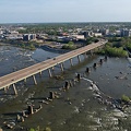
![Aerial view of downtown Petersburg, Virginia [03]](../../../../i/upload/2024/07/19/20240719195444-cebbe66d-sq.jpg)
![Aerial view of downtown Petersburg, Virginia [02]](../../../../i/upload/2024/07/19/20240719195644-d8ed4c09-sq.jpg)
![Trinity United Methodist Church [01]](../../../../i/upload/2024/07/19/20240719195653-0b011d32-sq.jpg)
![Aerial view of downtown Petersburg, Virginia [01]](../../../../i/upload/2024/07/19/20240719195657-18bb1adc-sq.jpg)
![Reassurance marker for US 301 northbound [01]](../../../../i/upload/2024/07/19/20240719195705-7a645bac-sq.jpg)
![Reassurance marker for US 301 northbound [02]](../../../../i/upload/2024/07/19/20240719195710-a9f10711-sq.jpg)
![Trinity United Methodist Church [02]](../../../../i/upload/2024/07/19/20240719195714-8b37cce5-sq.jpg)
![Signs for Interstates 95 and 85 [01]](../../../../i/upload/2024/07/19/20240719195718-f7bfccaa-sq.jpg)
![Trinity United Methodist Church [03]](../../../../i/upload/2024/07/19/20240719195722-aee12481-sq.jpg)
![Signs for Interstates 95 and 85 [02]](../../../../i/upload/2024/07/19/20240719195727-ba3b1d90-sq.jpg)
![River Park Tower Apartments [01]](../../../../i/upload/2024/07/19/20240719202723-ab15e198-sq.jpg)
![2 Eaton Street [02]](../../../../i/upload/2024/07/19/20240719210401-8364ea14-sq.jpg)

![2 Eaton Street [01]](../../../../i/upload/2024/07/19/20240719210610-dccc3ada-sq.jpg)
![2 Eaton Street [03]](../../../../i/upload/2024/07/19/20240719210625-7dcc5404-sq.jpg)
![Overhead view of Virginia Beach boardwalk [01]](../../../../i/upload/2024/07/19/20240719210712-6cff7cb4-sq.jpg)
![Overhead view of Virginia Beach boardwalk [02]](../../../../i/upload/2024/07/19/20240719210810-63eca44b-sq.jpg)
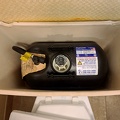
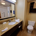
![Room 506 at the Hampton Inn in Newport News [02]](../../../../i/upload/2024/07/19/20240719211047-498590fa-sq.jpg)
![Room 506 at the Hampton Inn in Newport News [01]](../../../../i/upload/2024/07/19/20240719211312-9c3d071d-sq.jpg)
![Room 506 at the Hampton Inn in Newport News [03]](../../../../i/upload/2024/07/19/20240719211317-40ee7e29-sq.jpg)

![Interstate 95 in Woodbridge, Virginia [01]](../../../../i/upload/2024/07/19/20240719212225-da0fa73f-sq.jpg)
![Interstate 95 in Woodbridge, Virginia [02]](../../../../i/upload/2024/07/19/20240719212229-ff1f3c31-sq.jpg)
![Escalators at Rosslyn station [02]](../../../../i/upload/2024/07/20/20240720014529-22989af6-sq.jpg)


![Neighborhood in Clifton Forge, Virginia [01]](../../../../i/upload/2024/07/20/20240720021719-e5828a4e-sq.jpg)
![Neighborhood in Clifton Forge, Virginia [02]](../../../../i/upload/2024/07/20/20240720021736-578bac29-sq.jpg)
![Sign for State Route 188 [01]](../../../../i/upload/2024/07/20/20240720021810-3e9b4232-sq.jpg)
![Sign for State Route 188 [02]](../../../../i/upload/2024/07/20/20240720021827-a0810db1-sq.jpg)
![Sign for State Route 188 [03]](../../../../i/upload/2024/07/20/20240720021833-b69f59a5-sq.jpg)
![Sign for State Route 188 [04]](../../../../i/upload/2024/07/20/20240720021852-b244dda6-sq.jpg)
![Sign for State Route 188 [05]](../../../../i/upload/2024/07/20/20240720021903-7bd9cd82-sq.jpg)
![Sign for State Route 188 [06]](../../../../i/upload/2024/07/20/20240720021915-40479437-sq.jpg)


![CSX Clifton Forge rail yard [10]](../../../../i/upload/2024/07/20/20240720022004-482675e4-sq.jpg)
![Scott Hill Retirement Community [01]](../../../../i/upload/2024/07/20/20240720022014-a14a5661-sq.jpg)
![Scott Hill Retirement Community [02]](../../../../i/upload/2024/07/20/20240720022019-7ad47a06-sq.jpg)


![Wenonah Elementary School [01]](../../../../i/upload/2024/07/20/20240720022130-0d6d5971-sq.jpg)
![West Broad Street at Staples Mill Road [01]](../../../../i/upload/2024/07/20/20240720091824-c8526d69-sq.jpg)
![Rejected Krispy Kreme donut [01]](../../../../i/upload/2024/07/20/20240720091829-99d9062e-sq.jpg)
![Aerial view of downtown Petersburg, Virginia [04]](../../../../i/upload/2024/07/20/20240720091856-35107304-sq.jpg)
![Rejected Krispy Kreme donut [02]](../../../../i/upload/2024/07/20/20240720091930-8fd827e1-sq.jpg)
![West Broad Street at Staples Mill Road [02]](../../../../i/upload/2024/07/20/20240720092012-1df12de7-sq.jpg)
![Holiday Inn Express on Staples Mill Road [01]](../../../../i/upload/2024/07/20/20240720092024-05d8fbae-sq.jpg)

![Holiday Inn Express on Staples Mill Road [02]](../../../../i/upload/2024/07/20/20240720092149-d50c6216-sq.jpg)
![Fire alarm pull station at 224 North Main Street [01]](../../../../i/upload/2024/07/20/20240720092350-88e56449-sq.jpg)
![Fire alarm pull station at 224 North Main Street [02]](../../../../i/upload/2024/07/20/20240720092359-d046c4e4-sq.jpg)
![Weathered railroad crossing sign [01]](../../../../i/upload/2024/07/20/20240720092404-75f37dc7-sq.jpg)
![Weathered railroad crossing sign [02]](../../../../i/upload/2024/07/20/20240720092450-4233285b-sq.jpg)
![Weathered railroad crossing sign [03]](../../../../i/upload/2024/07/20/20240720092522-caa8a39b-sq.jpg)
![Weathered railroad crossing sign [04]](../../../../i/upload/2024/07/20/20240720092538-3440adb0-sq.jpg)
!["Visit Downtown" [01]](../../../../i/upload/2024/07/20/20240720092548-ec8c56a1-sq.jpg)
!["Visit Downtown" [02]](../../../../i/upload/2024/07/20/20240720092601-915230a9-sq.jpg)
![Marquee at the Byrd Theatre [01]](../../../../i/upload/2024/07/20/20240720092625-e9fff3f4-sq.jpg)
![Sign for Krispy Kreme in Richmond, Virginia [01]](../../../../i/upload/2024/07/20/20240720092641-f7684be0-sq.jpg)
![Sign for Krispy Kreme in Richmond, Virginia [02]](../../../../i/upload/2024/07/20/20240720092647-7853f848-sq.jpg)
![Sign for Krispy Kreme in Richmond, Virginia [03]](../../../../i/upload/2024/07/20/20240720092652-9fcb1a77-sq.jpg)
![CoStar Richmond office [02]](../../../../i/upload/2024/07/20/20240720092713-e39a0b00-sq.jpg)
![Church Hill neighborhood [01]](../../../../i/upload/2024/07/20/20240720092724-5ad8079d-sq.jpg)
![Church Hill neighborhood [02]](../../../../i/upload/2024/07/20/20240720092729-c1c95489-sq.jpg)
![Interstate 95 through downtown Richmond [04]](../../../../i/upload/2024/07/20/20240720092805-0fe0379c-sq.jpg)


![Nissan Maxima with booted wheel [04]](../../../../i/upload/2024/07/20/20240720092832-41ca2def-sq.jpg)
![Marquee at the Byrd Theatre [02]](../../../../i/upload/2024/07/20/20240720092838-f92c4aed-sq.jpg)
![CoStar Richmond office [01]](../../../../i/upload/2024/07/20/20240720092854-506a1cc9-sq.jpg)
![Clock tower on Richmond Main Street Station [03]](../../../../i/upload/2024/07/20/20240720092936-746da014-sq.jpg)
![Clock tower on Richmond Main Street Station [01]](../../../../i/upload/2024/07/20/20240720092945-196e9f26-sq.jpg)
![Rapids on the James River [01]](../../../../i/upload/2024/07/20/20240720093011-a767724e-sq.jpg)
![Interstate 95 through downtown Richmond [02]](../../../../i/upload/2024/07/20/20240720093017-3f2bee68-sq.jpg)

![Nissan Maxima with booted wheel [02]](../../../../i/upload/2024/07/20/20240720093038-41040e0c-sq.jpg)
![Richmond skyline from the James River [02]](../../../../i/upload/2024/07/20/20240720093043-34fedc56-sq.jpg)
![Richmond skyline from the James River [01]](../../../../i/upload/2024/07/20/20240720093109-1fb6414b-sq.jpg)
![Nissan Maxima with booted wheel [01]](../../../../i/upload/2024/07/20/20240720093119-16a6fd77-sq.jpg)
![Nissan Maxima with booted wheel [03]](../../../../i/upload/2024/07/20/20240720093125-9bfc42b3-sq.jpg)

![Rapids on the James River [02]](../../../../i/upload/2024/07/20/20240720093135-219eaaa3-sq.jpg)
![Clock tower on Richmond Main Street Station [02]](../../../../i/upload/2024/07/20/20240720093156-e35dc707-sq.jpg)
![Federal Reserve and Riverfront Plaza [02]](../../../../i/upload/2024/07/20/20240720093206-5733a975-sq.jpg)
![Interstate 95 through downtown Richmond [03]](../../../../i/upload/2024/07/20/20240720093212-fa09ec51-sq.jpg)
![CoStar Richmond office [03]](../../../../i/upload/2024/07/20/20240720093234-91d038ef-sq.jpg)
![CoStar Richmond office [04]](../../../../i/upload/2024/07/20/20240720093239-a22e968a-sq.jpg)
![CoStar Richmond office [05]](../../../../i/upload/2024/07/20/20240720093244-45f5b31e-sq.jpg)
![Interstate 95 through downtown Richmond [01]](../../../../i/upload/2024/07/20/20240720093319-14a1e75d-sq.jpg)

![View from Shenandoah Mountain [01]](../../../../i/upload/2024/07/20/20240720093931-b1561721-sq.jpg)
!["Littering is illegal" sign [02]](../../../../i/upload/2024/07/20/20240720094020-cdd34053-sq.jpg)
![Hairpin turn on US 250 [01]](../../../../i/upload/2024/07/20/20240720094126-511d5875-sq.jpg)
![Hairpin turn on US 250 [02]](../../../../i/upload/2024/07/20/20240720094131-dc588684-sq.jpg)
![View from Shenandoah Mountain [03]](../../../../i/upload/2024/07/20/20240720094136-fc1446fb-sq.jpg)
![View from Shenandoah Mountain [02]](../../../../i/upload/2024/07/20/20240720094312-c9f54fe4-sq.jpg)
![Signs at the end of Gerties Lane [02]](../../../../i/upload/2024/07/20/20240720094432-141f6144-sq.jpg)
![Signs at the end of Gerties Lane [01]](../../../../i/upload/2024/07/20/20240720094659-1845364e-sq.jpg)

![Signs at the end of Gerties Lane [03]](../../../../i/upload/2024/07/20/20240720094801-f4a57465-sq.jpg)

![DASH Orion V farewell [18]](../../../../i/upload/2024/07/20/20240720101244-966d3d4b-sq.jpg)
![DASH Orion V farewell [19]](../../../../i/upload/2024/07/20/20240720101441-9b87dab9-sq.jpg)
![DASH Orion V farewell [20]](../../../../i/upload/2024/07/20/20240720101452-3e5d6c2c-sq.jpg)
![DASH Orion V farewell [21]](../../../../i/upload/2024/07/20/20240720101503-69ae7f96-sq.jpg)
![DASH Orion V farewell [22]](../../../../i/upload/2024/07/20/20240720101513-4367d6c3-sq.jpg)
![DASH Orion V farewell [23]](../../../../i/upload/2024/07/20/20240720101525-8b037707-sq.jpg)
![DASH Orion V farewell [24]](../../../../i/upload/2024/07/20/20240720101543-ce3b817b-sq.jpg)
![DASH Orion V farewell [25]](../../../../i/upload/2024/07/20/20240720101548-3897bc1e-sq.jpg)
![DASH Orion V farewell [26]](../../../../i/upload/2024/07/20/20240720101559-20a65dc9-sq.jpg)
![DASH Orion V farewell [27]](../../../../i/upload/2024/07/20/20240720101628-0e667874-sq.jpg)
![DASH Orion V farewell [28]](../../../../i/upload/2024/07/20/20240720101636-fda3efa8-sq.jpg)

![Forest Springs Estates [01]](../../../../i/upload/2024/07/20/20240720103408-ac9f7d40-sq.jpg)
![Forest Springs Estates [02]](../../../../i/upload/2024/07/20/20240720103645-80215d0c-sq.jpg)
![Forest Springs Estates [03]](../../../../i/upload/2024/07/20/20240720103650-60296a18-sq.jpg)
![Forest Springs Estates [04]](../../../../i/upload/2024/07/20/20240720103655-f8465d58-sq.jpg)
![Forest Springs Estates [05]](../../../../i/upload/2024/07/20/20240720103700-12ed86ac-sq.jpg)
![Forest Springs Estates [06]](../../../../i/upload/2024/07/20/20240720103705-68728b22-sq.jpg)
![Forest Springs Estates [07]](../../../../i/upload/2024/07/20/20240720103710-4e810037-sq.jpg)
![Forest Springs Estates [08]](../../../../i/upload/2024/07/20/20240720103715-d25d2920-sq.jpg)
![Forest Springs Estates [09]](../../../../i/upload/2024/07/20/20240720103720-56045695-sq.jpg)
![Forest Springs Estates [10]](../../../../i/upload/2024/07/20/20240720103726-e7eeb2c5-sq.jpg)
![Fire alarm strobe at Ballston Metro Center [01]](../../../../i/upload/2024/07/20/20240720110549-d834db9d-sq.jpg)
![Fire alarm strobe at Ballston Metro Center [02]](../../../../i/upload/2024/07/20/20240720110553-19f9caa6-sq.jpg)
![Elyse eats a quesadilla [02]](../../../../i/upload/2024/07/20/20240720110624-75de3d07-sq.jpg)
![Elyse eats a quesadilla [01]](../../../../i/upload/2024/07/20/20240720110643-9b6130ea-sq.jpg)

![Mailbox atop a tall pole [01]](../../../../i/upload/2024/07/20/20240720111236-5a5f8770-sq.jpg)
![Mailbox atop a tall pole [02]](../../../../i/upload/2024/07/20/20240720111331-bfad7d41-sq.jpg)

![Mailbox atop a tall pole [03]](../../../../i/upload/2024/07/20/20240720111523-2a1c7bfb-sq.jpg)

![Vintage exit sign at Kroger [03]](../../../../i/upload/2024/07/20/20240720111535-e23937fb-sq.jpg)
![Vintage exit sign at Kroger [02]](../../../../i/upload/2024/07/20/20240720111540-61efa18a-sq.jpg)
![Abandoned vehicle in New Street parking garage with writing in the dirt [01]](../../../../i/upload/2024/07/20/20240720111713-a69211da-sq.jpg)
![Vintage exit sign at Kroger [01]](../../../../i/upload/2024/07/20/20240720111723-a260cc83-sq.jpg)
![Abandoned vehicle in New Street parking garage with writing in the dirt [02]](../../../../i/upload/2024/07/20/20240720111744-1f611817-sq.jpg)


![Stop sign at Apple Valley Marketplace [05]](../../../../i/upload/2024/07/20/20240720112441-3b653164-sq.jpg)
![Stop sign at Apple Valley Marketplace [06]](../../../../i/upload/2024/07/20/20240720112518-ae1ca7dc-sq.jpg)
![Stop sign at Apple Valley Marketplace [04]](../../../../i/upload/2024/07/20/20240720112524-89e59f0e-sq.jpg)
![Stop sign at Apple Valley Marketplace [02]](../../../../i/upload/2024/07/20/20240720112531-a9d663a4-sq.jpg)
![Stop sign at Apple Valley Marketplace [07]](../../../../i/upload/2024/07/20/20240720112550-820af92e-sq.jpg)
![Stop sign at Apple Valley Marketplace [03]](../../../../i/upload/2024/07/20/20240720112603-dd7e4488-sq.jpg)
![Stop sign at Apple Valley Marketplace [01]](../../../../i/upload/2024/07/20/20240720112609-300b7fa1-sq.jpg)
![Stop sign at Apple Valley Marketplace [08]](../../../../i/upload/2024/07/20/20240720112622-ca7bcfba-sq.jpg)
![Walmart in Marion, Virginia [06]](../../../../i/upload/2024/07/20/20240720121153-589efd7d-sq.jpg)
![Walmart in Marion, Virginia [07]](../../../../i/upload/2024/07/20/20240720121158-4864ba4f-sq.jpg)
![Walmart in Marion, Virginia [05]](../../../../i/upload/2024/07/20/20240720121208-fb7b6a06-sq.jpg)
![Walmart in Marion, Virginia [03]](../../../../i/upload/2024/07/20/20240720121214-2b9cd185-sq.jpg)
![Walmart in Marion, Virginia [09]](../../../../i/upload/2024/07/20/20240720121240-5392b9de-sq.jpg)
![Walmart in Marion, Virginia [10]](../../../../i/upload/2024/07/20/20240720121254-20971ded-sq.jpg)
![Walmart in Marion, Virginia [08]](../../../../i/upload/2024/07/20/20240720121300-db7b6f45-sq.jpg)
![Walmart in Marion, Virginia [01]](../../../../i/upload/2024/07/20/20240720121304-d1b19d1d-sq.jpg)
![Walmart in Marion, Virginia [02]](../../../../i/upload/2024/07/20/20240720121309-ff4081de-sq.jpg)
![Walmart in Marion, Virginia [04]](../../../../i/upload/2024/07/20/20240720121314-18a51dd7-sq.jpg)
![Bristol sign [01]](../../../../i/upload/2024/07/20/20240720121533-067b0659-sq.jpg)
![Bristol sign [02]](../../../../i/upload/2024/07/20/20240720121538-801acaf1-sq.jpg)
![Bristol sign [03]](../../../../i/upload/2024/07/20/20240720121545-f24f5478-sq.jpg)

![Wilkes Street Tunnel [01]](../../../../i/upload/2024/07/20/20240720123636-36813fe8-sq.jpg)
![Wilkes Street Tunnel [02]](../../../../i/upload/2024/07/20/20240720123641-bf49c8ee-sq.jpg)
![Wilkes Street Tunnel [03]](../../../../i/upload/2024/07/20/20240720123646-a6b594ca-sq.jpg)
![Wilkes Street Tunnel [04]](../../../../i/upload/2024/07/20/20240720123651-dace2839-sq.jpg)
![Wilkes Street Tunnel [05]](../../../../i/upload/2024/07/20/20240720123656-19239647-sq.jpg)
![Wilkes Street Tunnel [06]](../../../../i/upload/2024/07/20/20240720123701-ec858293-sq.jpg)
![Wilkes Street Tunnel [07]](../../../../i/upload/2024/07/20/20240720123706-2138b8e8-sq.jpg)
![Abandoned vehicle in New Street parking garage with writing in the dirt [03]](../../../../i/upload/2024/07/20/20240720123930-42430a4a-sq.jpg)
![Abandoned vehicle in New Street parking garage with writing in the dirt [04]](../../../../i/upload/2024/07/20/20240720124022-16f471a1-sq.jpg)
![Abandoned vehicle in New Street parking garage with writing in the dirt [05]](../../../../i/upload/2024/07/20/20240720124028-07cf865f-sq.jpg)
![Interchange between US 11 and VA 262 [01]](../../../../i/upload/2024/07/20/20240720124538-a29a1018-sq.jpg)
![Wilkes Street Tunnel [11]](../../../../i/upload/2024/07/20/20240720144306-d5f8426e-sq.jpg)
![Wilkes Street Tunnel [15]](../../../../i/upload/2024/07/20/20240720144340-d1f55bb8-sq.jpg)
![Wilkes Street Tunnel [13]](../../../../i/upload/2024/07/20/20240720144346-ea938883-sq.jpg)
![Wilkes Street Tunnel [14]](../../../../i/upload/2024/07/20/20240720144352-b8aed1e3-sq.jpg)
![Wilkes Street Tunnel [12]](../../../../i/upload/2024/07/20/20240720144420-81ccf027-sq.jpg)
![Wilkes Street Tunnel [10]](../../../../i/upload/2024/07/20/20240720144428-4df30985-sq.jpg)
![Wilkes Street Tunnel [08]](../../../../i/upload/2024/07/20/20240720144434-13d339f6-sq.jpg)
![Wilkes Street Tunnel [09]](../../../../i/upload/2024/07/20/20240720144535-55b665b6-sq.jpg)


![Whole Foods on West Broad Street [01]](../../../../i/upload/2024/07/20/20240720145233-85d198b0-sq.jpg)

![Whole Foods on West Broad Street [02]](../../../../i/upload/2024/07/20/20240720145516-57869293-sq.jpg)
![CoStar Richmond office [06]](../../../../i/upload/2024/07/20/20240720145520-4232126b-sq.jpg)
![CoStar Richmond office [07]](../../../../i/upload/2024/07/20/20240720145545-adafb656-sq.jpg)
![CoStar Richmond office [08]](../../../../i/upload/2024/07/20/20240720145601-423a28f4-sq.jpg)
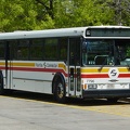
![Former CARTA bus 3424 [04]](../../../../i/upload/2024/07/31/20240731130620-73cdd8ad-sq.jpg)
![Fire alarm at Market Parking Garage [02]](../../../../i/upload/2024/07/31/20240731130732-de8da55c-sq.jpg)
![Fire alarm at Market Parking Garage [01]](../../../../i/upload/2024/07/31/20240731130736-59b2863a-sq.jpg)
![Lynchburg Public Elevator [01]](../../../../i/upload/2024/07/31/20240731131343-56cad301-sq.jpg)
![Lynchburg Public Elevator [02]](../../../../i/upload/2024/07/31/20240731131348-e8577cca-sq.jpg)
![Lynchburg Public Elevator [03]](../../../../i/upload/2024/07/31/20240731131352-16d64327-sq.jpg)
![Lynchburg Public Elevator [04]](../../../../i/upload/2024/07/31/20240731131356-5c6860ed-sq.jpg)
![Aerial view of downtown Fredericksburg [01]](../../../../i/upload/2024/08/10/20240810113605-aeeec139-sq.jpg)
![Aerial view of downtown Fredericksburg [02]](../../../../i/upload/2024/08/10/20240810113610-a8d79889-sq.jpg)


![Paramount Theater marquee [03]](../../../../i/upload/2024/08/19/20240819095017-6e0c9706-sq.jpg)
![Interior of 316 East Main Street [02]](../../../../i/upload/2024/08/19/20240819095022-8923d3f5-sq.jpg)
![Fly stuck in a cup of iced coffee [01]](../../../../i/upload/2024/08/24/20240824094426-eb9b053f-sq.jpg)
![Fly stuck in a cup of iced coffee [02]](../../../../i/upload/2024/08/24/20240824094429-55131c39-sq.jpg)
![Fly stuck in a cup of iced coffee [03]](../../../../i/upload/2024/08/24/20240824094434-77e3ac65-sq.jpg)
![Fly stuck in a cup of iced coffee [04]](../../../../i/upload/2024/08/24/20240824094439-b41116d5-sq.jpg)
![Paramount Theater marquee [04]](../../../../i/upload/2024/08/24/20240824094444-57d1fbe9-sq.jpg)
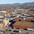
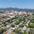
![Aerial view of downtown Staunton, Virginia [01]](../../../../i/upload/2024/08/24/20240824104621-87f086a2-sq.jpg)
![Aerial view of downtown Staunton, Virginia [02]](../../../../i/upload/2024/08/24/20240824104624-5fe809bd-sq.jpg)
![Aerial view of downtown Staunton, Virginia [03]](../../../../i/upload/2024/08/24/20240824104631-e5b2dd3d-sq.jpg)
![Aerial view of downtown Staunton, Virginia [04]](../../../../i/upload/2024/08/24/20240824104635-29b54f55-sq.jpg)
![Aerial view of downtown Staunton, Virginia [05]](../../../../i/upload/2024/08/24/20240824104639-d3696cc9-sq.jpg)
![Aerial view of downtown Staunton, Virginia [06]](../../../../i/upload/2024/08/24/20240824104643-1e970880-sq.jpg)
![US 29 in Bealeton, Virginia [01]](../../../../i/upload/2024/11/23/20241123123538-63213966-sq.jpg)
![US 29 in Bealeton, Virginia [02]](../../../../i/upload/2024/11/23/20241123123638-a6fb6231-sq.jpg)


![Honda HR-V at Sunset Park [01]](../../../../i/upload/2024/11/28/20241128154956-21bc726b-sq.jpg)
![Honda HR-V at Sunset Park [02]](../../../../i/upload/2024/11/28/20241128155042-d72ae2b1-sq.jpg)
![Pelham Finale [01]](../../../../i/upload/2024/11/28/20241128224732-fc800638-sq.jpg)
![Pelham Finale [02]](../../../../i/upload/2024/11/28/20241128224735-cba74b8f-sq.jpg)
![Pelham Finale [03]](../../../../i/upload/2024/11/28/20241128224738-d4c27cd0-sq.jpg)
![Wildfire in Wheatfield, Virginia [01]](../../../../i/upload/2024/12/26/20241226095723-0924c1da-sq.jpg)
![Wildfire in Wheatfield, Virginia [02]](../../../../i/upload/2024/12/26/20241226095727-426cf00c-sq.jpg)
![Wildfire in Wheatfield, Virginia [03]](../../../../i/upload/2024/12/26/20241226113316-fc2f1e85-sq.jpg)
![Wildfire in Wheatfield, Virginia [04]](../../../../i/upload/2024/12/26/20241226113325-158b68f2-sq.jpg)
![Wildfire in Wheatfield, Virginia [05]](../../../../i/upload/2024/12/26/20241226113335-8685ba7b-sq.jpg)
![Wildfire in Wheatfield, Virginia [06]](../../../../i/upload/2024/12/26/20241226113345-0e08706d-sq.jpg)
![Wildfire in Wheatfield, Virginia [07]](../../../../i/upload/2024/12/26/20241226113355-bdc9fea6-sq.jpg)
![Wildfire in Wheatfield, Virginia [08]](../../../../i/upload/2024/12/26/20241226113404-8540af70-sq.jpg)
![Wildfire in Wheatfield, Virginia [09]](../../../../i/upload/2024/12/26/20241226113414-261ee473-sq.jpg)
![Wildfire in Wheatfield, Virginia [10]](../../../../i/upload/2024/12/26/20241226113424-ef021110-sq.jpg)
![Wildfire in Wheatfield, Virginia [11]](../../../../i/upload/2024/12/26/20241226113433-bbfde6c6-sq.jpg)
![Wildfire in Wheatfield, Virginia [12]](../../../../i/upload/2024/12/26/20241226113443-8c6bc962-sq.jpg)
![Wildfire in Wheatfield, Virginia [13]](../../../../i/upload/2024/12/26/20241226113455-f989b84b-sq.jpg)
![Wildfire in Wheatfield, Virginia [14]](../../../../i/upload/2024/12/26/20241226113504-f310b6be-sq.jpg)
![Wildfire in Wheatfield, Virginia [15]](../../../../i/upload/2024/12/26/20241226113515-58af561f-sq.jpg)
![Wildfire in Wheatfield, Virginia [16]](../../../../i/upload/2024/12/26/20241226113524-b6ae32b2-sq.jpg)
![Wildfire in Wheatfield, Virginia [17]](../../../../i/upload/2024/12/26/20241226113535-464ef6f3-sq.jpg)
![Wildfire in Wheatfield, Virginia [18]](../../../../i/upload/2024/12/26/20241226113546-653ce2b4-sq.jpg)
![Wildfire in Wheatfield, Virginia [19]](../../../../i/upload/2024/12/26/20241226113557-e900887b-sq.jpg)
![Wildfire in Wheatfield, Virginia [20]](../../../../i/upload/2024/12/26/20241226113603-cc8e09d4-sq.jpg)

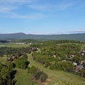
![Aerial view of Monterey, Virginia [01]](../../../../i/upload/2025/01/02/20250102005918-685606f9-sq.jpg)
![Aerial view of Monterey, Virginia [02]](../../../../i/upload/2025/01/02/20250102005923-7f7b9b83-sq.jpg)
![Aerial view of Monterey, Virginia [03]](../../../../i/upload/2025/01/02/20250102005929-2e84a9d0-sq.jpg)
![Aerial view of Monterey, Virginia [04]](../../../../i/upload/2025/01/02/20250102005937-281fae65-sq.jpg)
![Aerial view of Monterey, Virginia [05]](../../../../i/upload/2025/01/02/20250102005946-79efaa38-sq.jpg)
![Aerial view of Monterey, Virginia [06]](../../../../i/upload/2025/01/02/20250102005956-29786301-sq.jpg)


![Routes 220 and 39 in Warm Springs, Virginia [01]](../../../../i/upload/2025/01/02/20250102141310-79aa8afd-sq.jpg)
![Routes 220 and 39 in Warm Springs, Virginia [02]](../../../../i/upload/2025/01/02/20250102141319-a5501ace-sq.jpg)

![Interchange between US 11 and VA 262 [02]](../../../../i/upload/2025/01/03/20250103172559-5c2ee040-sq.jpg)
![Interchange between VA 262 and Old Greenville Road [01]](../../../../i/upload/2025/01/03/20250103172609-68b43692-sq.jpg)
![Interchange between VA 262 and Old Greenville Road [02]](../../../../i/upload/2025/01/03/20250103172620-c2bd2a46-sq.jpg)
![Former Fairfax Connector bus 7754 [05]](../../../../i/upload/2025/01/03/20250103235706-f9e09b71-sq.jpg)
![River Park Tower Apartments [02]](../../../../i/upload/2025/02/18/20250218102157-99fbbb4b-sq.jpg)

![View of the Lafayette River from the Granby Street Bridge [01]](../../../../i/upload/2025/02/20/20250220214605-6d779439-sq.jpg)
![View of the Lafayette River from the Granby Street Bridge [02]](../../../../i/upload/2025/02/20/20250220214608-1d603c9f-sq.jpg)
![Traffic circle under construction [01]](../../../../i/upload/2025/02/22/20250222022330-4bbf063c-sq.jpg)
![Traffic circle under construction [02]](../../../../i/upload/2025/02/22/20250222022336-e9f87960-sq.jpg)
![Traffic circle under construction [03]](../../../../i/upload/2025/02/22/20250222022342-e895dd00-sq.jpg)
![Allied Arts Building [02]](../../../../i/upload/2025/02/28/20250228215231-6b669c5e-sq.jpg)
![Allied Arts Building [03]](../../../../i/upload/2025/02/28/20250228215236-7f0b55fb-sq.jpg)
![Carilion Administrative Services Building [01]](../../../../i/upload/2025/03/02/20250302134801-6477a7f8-sq.jpg)
![Carilion Administrative Services Building [02]](../../../../i/upload/2025/03/02/20250302134813-241abfec-sq.jpg)

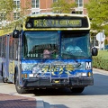
![Former Texas A&M bus 1123 [02]](../../../../i/upload/2025/03/03/20250303175443-4f9c52aa-sq.jpg)
![Former Texas A&M bus 1123 [03]](../../../../i/upload/2025/03/03/20250303175447-d0f20eaf-sq.jpg)
![Sheetz on University Boulevard [01]](../../../../i/upload/2025/03/06/20250306190208-89c28070-sq.jpg)
![Sheetz on University Boulevard [02]](../../../../i/upload/2025/03/06/20250306190212-6cf6e513-sq.jpg)
![Sheetz on University Boulevard [03]](../../../../i/upload/2025/03/06/20250306190216-03c4881d-sq.jpg)


Information
- Author
- Ben Schumin
- Copyright
- All Rights Reserved
- Created on
- Wednesday 20 March 2024
- Dimensions
- 8064*5376
EXIF Metadata
DJI FC8282
f/170/100
1/2000
100
0/10
0
- DateTimeOriginal
- 2024:03:20 17:04:27
- Make
- DJI
- Model
- FC8282
- ExposureProgram
- 2
- FocalLengthIn35mmFilm
- 24
- FNumber
- 170/100
- ExposureTime
- 1/2000
- ISOSpeedRatings
- 100
- Flash
- 0
- WhiteBalance
- 0
- XResolution
- 300/1
- YResolution
- 300/1
- Orientation
- 1
- ExposureBiasValue
- 0/10
- MaxApertureValue
- 153/100
- MeteringMode
- 1
- LightSource
- 1
Powered by Piwigo