Ben Schumin Photography Portfolio
Ben Schumin is a professional photographer who captures the intricacies of daily life.

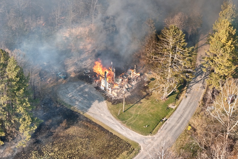
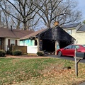
Aerial view of a wildfire in Wheatfield, Virginia. Here, the house at 1429 Coal Mine Road burns to the ground after the flames reached the structure.
Information
- Author
- Ben Schumin
- Copyright
- All Rights Reserved
- Created on
- Wednesday 20 March 2024
- Dimensions
- 8064*5376
Powered by Piwigo


![Monticello [02]](../../../i/upload/2024/07/14/20240714102206-08a96935-sq.jpg)
![Monticello [01]](../../../i/upload/2024/07/14/20240714102208-5a02f3e0-sq.jpg)
![Monticello [03]](../../../i/upload/2024/07/14/20240714102212-24b32eeb-sq.jpg)




![Colorful rowhouses at 25th and M Streets NW [02]](../../../i/upload/2024/07/15/20240715141845-197ba4aa-sq.jpg)
![Colorful rowhouses at 25th and M Streets NW [01]](../../../i/upload/2024/07/15/20240715141847-0ba32eb7-sq.jpg)


![Plumb House [01]](../../../i/upload/2024/07/16/20240716003154-0ab33a14-sq.jpg)
![Plumb House [02]](../../../i/upload/2024/07/16/20240716003156-c47d241e-sq.jpg)


![Damaged gutter system hanging from building [01]](../../../i/upload/2024/07/16/20240716010414-2bec2ad6-sq.jpg)
![Damaged gutter system hanging from building [02]](../../../i/upload/2024/07/16/20240716010417-c5e68847-sq.jpg)
![Ice on balcony railing [01]](../../../i/upload/2024/07/16/20240716010419-8635b2d8-sq.jpg)
![Ice on balcony railing [02]](../../../i/upload/2024/07/16/20240716010420-ff6692f3-sq.jpg)
![Damaged gutter system hanging from building [03]](../../../i/upload/2024/07/16/20240716010422-c0b62027-sq.jpg)
![Damaged gutter system hanging from building [04]](../../../i/upload/2024/07/16/20240716010424-d2d89171-sq.jpg)
![Damaged gutter system hanging from building [05]](../../../i/upload/2024/07/16/20240716010426-64a63e08-sq.jpg)
![Damaged gutter system hanging from building [06]](../../../i/upload/2024/07/16/20240716010432-eed1258e-sq.jpg)



![Fraser Mansion [05]](../../../i/upload/2024/07/16/20240716231142-c9dd59a2-sq.jpg)
![Fraser Mansion [06]](../../../i/upload/2024/07/16/20240716231148-c4017a61-sq.jpg)
![Fraser Mansion [16]](../../../i/upload/2024/07/16/20240716231153-80f561eb-sq.jpg)
![Fraser Mansion [15]](../../../i/upload/2024/07/16/20240716231158-a8b87582-sq.jpg)
![Fraser Mansion [14]](../../../i/upload/2024/07/16/20240716231204-995d30b9-sq.jpg)
![Fraser Mansion [13]](../../../i/upload/2024/07/16/20240716231211-69010cf0-sq.jpg)
![Fraser Mansion [12]](../../../i/upload/2024/07/16/20240716231216-ea549816-sq.jpg)
![Fraser Mansion [11]](../../../i/upload/2024/07/16/20240716231220-26536de7-sq.jpg)
![Fraser Mansion [10]](../../../i/upload/2024/07/16/20240716231226-fa47ee5f-sq.jpg)
![Fraser Mansion [09]](../../../i/upload/2024/07/16/20240716231231-15dc596c-sq.jpg)
![Fraser Mansion [08]](../../../i/upload/2024/07/16/20240716231237-060e6f56-sq.jpg)
![Fraser Mansion [07]](../../../i/upload/2024/07/16/20240716231242-04d445f8-sq.jpg)
![Fraser Mansion [04]](../../../i/upload/2024/07/16/20240716231247-a62efe80-sq.jpg)
![Fraser Mansion [03]](../../../i/upload/2024/07/16/20240716231253-ed153db5-sq.jpg)
![Fraser Mansion [02]](../../../i/upload/2024/07/16/20240716231258-6b13dbe0-sq.jpg)
![Fraser Mansion [01]](../../../i/upload/2024/07/16/20240716231303-9e709f84-sq.jpg)
![Fraser Mansion [18]](../../../i/upload/2024/07/16/20240716231312-979d0729-sq.jpg)
![Fraser Mansion [21]](../../../i/upload/2024/07/16/20240716231316-0c406d67-sq.jpg)
![Fraser Mansion [20]](../../../i/upload/2024/07/16/20240716231321-22e12f2e-sq.jpg)
![Fraser Mansion [19]](../../../i/upload/2024/07/16/20240716231331-0094d1b9-sq.jpg)
![Fraser Mansion [17]](../../../i/upload/2024/07/16/20240716231341-e72627cf-sq.jpg)



![2012 Kia Soul [01]](../../../i/upload/2024/07/17/20240717101506-d1fe2695-sq.jpg)
![2012 Kia Soul [02]](../../../i/upload/2024/07/17/20240717101508-6acec5c8-sq.jpg)
![2012 Kia Soul [03]](../../../i/upload/2024/07/17/20240717101511-cf7fea31-sq.jpg)
![2012 Kia Soul [04]](../../../i/upload/2024/07/17/20240717101515-5e2e56e6-sq.jpg)
![2012 Kia Soul [05]](../../../i/upload/2024/07/17/20240717101518-193786c3-sq.jpg)
![2012 Kia Soul [06]](../../../i/upload/2024/07/17/20240717101520-9e317baf-sq.jpg)
![2012 Kia Soul [07]](../../../i/upload/2024/07/17/20240717101523-f204fe75-sq.jpg)
![2012 Kia Soul [08]](../../../i/upload/2024/07/17/20240717101525-110beac1-sq.jpg)
![Fire alarm photo shoot [05]](../../../i/upload/2024/07/17/20240717102133-d3dc56c3-sq.jpg)
![Fire alarm photo shoot [04]](../../../i/upload/2024/07/17/20240717102137-7ff2333f-sq.jpg)
![Fire alarm photo shoot [03]](../../../i/upload/2024/07/17/20240717102139-f0d3c4df-sq.jpg)
![Fire alarm photo shoot [02]](../../../i/upload/2024/07/17/20240717102142-4b2871d0-sq.jpg)
![Fire alarm photo shoot [01]](../../../i/upload/2024/07/17/20240717102146-be767d48-sq.jpg)


![Sandy Point State Park [04]](../../../i/upload/2024/07/17/20240717153940-ac2c2370-sq.jpg)
![Sandy Point State Park [15]](../../../i/upload/2024/07/17/20240717154009-e59a81d9-sq.jpg)


![Forest Springs Drive [01]](../../../i/upload/2024/07/17/20240717154858-173a58a4-sq.jpg)


![Springer Road and Forest Springs Drive [01]](../../../i/upload/2024/07/17/20240717154906-f43d5dea-sq.jpg)
![Houses in Stuarts Draft, Virginia [04]](../../../i/upload/2024/07/17/20240717154909-0ee83883-sq.jpg)

![Houses in Stuarts Draft, Virginia [03]](../../../i/upload/2024/07/17/20240717154913-79e1c9c0-sq.jpg)
![Houses in Stuarts Draft, Virginia [02]](../../../i/upload/2024/07/17/20240717154915-1abfd924-sq.jpg)
![Houses in Stuarts Draft, Virginia [01]](../../../i/upload/2024/07/17/20240717154917-a2142e0a-sq.jpg)
![Vistas on the James [01]](../../../i/upload/2024/07/17/20240717155337-72f312c6-sq.jpg)

![Painted houses on Bedford Street [01]](../../../i/upload/2024/07/17/20240717155535-b4ea2874-sq.jpg)
![Painted houses on Bedford Street [02]](../../../i/upload/2024/07/17/20240717155538-19e06137-sq.jpg)
![Painted houses on Bedford Street [03]](../../../i/upload/2024/07/17/20240717155540-a8ec7127-sq.jpg)





![Hilltop House [01]](../../../i/upload/2024/07/17/20240717160537-85f4b955-sq.jpg)
![Hilltop House [02]](../../../i/upload/2024/07/17/20240717160544-b789ecf8-sq.jpg)
![Hilltop House [03]](../../../i/upload/2024/07/17/20240717160547-c866104e-sq.jpg)
![Home Alone house [01]](../../../i/upload/2024/07/17/20240717161122-ad83c769-sq.jpg)
![Home Alone house [02]](../../../i/upload/2024/07/17/20240717161128-bc03c7ca-sq.jpg)
![Springer Road and Forest Springs Drive [04]](../../../i/upload/2024/07/17/20240717161635-9a8677de-sq.jpg)
![Springer Road and Forest Springs Drive [03]](../../../i/upload/2024/07/17/20240717161639-d3eaf32c-sq.jpg)
![Springer Road and Forest Springs Drive [02]](../../../i/upload/2024/07/17/20240717161642-b483b881-sq.jpg)
![Springer Road and Forest Springs Drive [05]](../../../i/upload/2024/07/17/20240717161703-a98a0f92-sq.jpg)


![Federated FAPW Warehouse, former Staunton Walmart [01]](../../../i/upload/2024/07/17/20240717174407-3a2671bf-sq.jpg)
![Federated FAPW Warehouse, former Staunton Walmart [02]](../../../i/upload/2024/07/17/20240717174413-f02b04b7-sq.jpg)
![Former Rack & Sack building [01]](../../../i/upload/2024/07/17/20240717174419-ece0ac88-sq.jpg)
![Former Rack & Sack building [02]](../../../i/upload/2024/07/17/20240717174425-be1e69eb-sq.jpg)


![Face on Glen Echo carousel [01]](../../../i/upload/2024/07/17/20240717224309-b342bb66-sq.jpg)
![Face on Glen Echo carousel [02]](../../../i/upload/2024/07/17/20240717224312-d06f12fb-sq.jpg)
![Birdhouse at Lake Artemesia [01]](../../../i/upload/2024/07/17/20240717225611-350c1301-sq.jpg)
![Birdhouse at Lake Artemesia [02]](../../../i/upload/2024/07/17/20240717225614-155ec568-sq.jpg)

![Abandoned house [01]](../../../i/upload/2024/07/17/20240717230055-c63c5bfc-sq.jpg)
![Abandoned house [02]](../../../i/upload/2024/07/17/20240717230058-5d1cb340-sq.jpg)
![House move on Oramar Drive [01]](../../../i/upload/2024/07/17/20240717230607-a282790a-sq.jpg)


![Hatteras Island Beach Access 38 [01]](../../../i/upload/2024/07/17/20240717230623-ac88eb70-sq.jpg)
![House move on Oramar Drive [02]](../../../i/upload/2024/07/17/20240717230749-ded95d30-sq.jpg)
![House move on Oramar Drive [03]](../../../i/upload/2024/07/17/20240717230753-f93e4d68-sq.jpg)
![House move on Oramar Drive [04]](../../../i/upload/2024/07/17/20240717230756-e46554b2-sq.jpg)
![Bodie Island Lighthouse [01]](../../../i/upload/2024/07/17/20240717230812-3677a3b1-sq.jpg)
![Bodie Island Lighthouse [02]](../../../i/upload/2024/07/17/20240717230815-9f8a3c85-sq.jpg)
![Bodie Island Lighthouse [03]](../../../i/upload/2024/07/17/20240717230817-8afc73fc-sq.jpg)
![Bodie Island Lighthouse [04]](../../../i/upload/2024/07/17/20240717230820-6c573e58-sq.jpg)
![Bodie Island Lighthouse [05]](../../../i/upload/2024/07/17/20240717230823-832bf0a9-sq.jpg)
![Bodie Island Lighthouse [06]](../../../i/upload/2024/07/17/20240717230826-b82cb1d8-sq.jpg)

![Bodie Island Lighthouse [07]](../../../i/upload/2024/07/17/20240717230832-271462ed-sq.jpg)
![Bodie Island Lighthouse [08]](../../../i/upload/2024/07/17/20240717230835-bae7c227-sq.jpg)
![Bodie Island Lighthouse [09]](../../../i/upload/2024/07/17/20240717230838-49dff001-sq.jpg)
![Bodie Island Lighthouse [10]](../../../i/upload/2024/07/17/20240717230841-410a1048-sq.jpg)
![Couch on a tree stump [01]](../../../i/upload/2024/07/17/20240717230925-f9e3f5be-sq.jpg)
![Couch on a tree stump [02]](../../../i/upload/2024/07/17/20240717230928-5c104178-sq.jpg)
![Mailbox with "NO FREE PAPERS" sign [02]](../../../i/upload/2024/07/17/20240717231056-6351e7e3-sq.jpg)
![Abandoned rowhouse at North Calvert and East Read Streets [01]](../../../i/upload/2024/07/17/20240717231156-4875201d-sq.jpg)
![Abandoned rowhouse at North Calvert and East Read Streets [02]](../../../i/upload/2024/07/17/20240717231200-c1bee20f-sq.jpg)
![Abandoned rowhouse at North Calvert and East Read Streets [03]](../../../i/upload/2024/07/17/20240717231204-3ffcc48a-sq.jpg)
![Park Place [01]](../../../i/upload/2024/07/17/20240717231311-417d895d-sq.jpg)
![Cape Hatteras Visitor Center [01]](../../../i/upload/2024/07/17/20240717231341-fe325eec-sq.jpg)
![Lighthouse keeper's quarters at Cape Hatteras [01]](../../../i/upload/2024/07/17/20240717231345-d0d474a0-sq.jpg)
![Lighthouse keeper's quarters at Cape Hatteras [02]](../../../i/upload/2024/07/17/20240717231348-8d846f83-sq.jpg)
![Lighthouse keeper's quarters at Cape Hatteras [03]](../../../i/upload/2024/07/17/20240717231351-e5411a95-sq.jpg)
![Lighthouse keeper's quarters at Cape Hatteras [04]](../../../i/upload/2024/07/17/20240717231354-38227515-sq.jpg)
![Cape Hatteras Lighthouse [01]](../../../i/upload/2024/07/17/20240717231357-8fe14237-sq.jpg)
![Cape Hatteras Lighthouse [02]](../../../i/upload/2024/07/17/20240717231400-020b4478-sq.jpg)
![Base of the Cape Hatteras Lighthouse [01]](../../../i/upload/2024/07/17/20240717231403-9e96fe21-sq.jpg)
![Cape Hatteras Lighthouse [03]](../../../i/upload/2024/07/17/20240717231407-b2b32878-sq.jpg)
![View from the Cape Hatteras Lighthouse [01]](../../../i/upload/2024/07/17/20240717231410-bba81ca5-sq.jpg)
![View from the Cape Hatteras Lighthouse [02]](../../../i/upload/2024/07/17/20240717231413-bb32f6c8-sq.jpg)
![View from the Cape Hatteras Lighthouse [03]](../../../i/upload/2024/07/17/20240717231416-b4999cec-sq.jpg)
![View from the Cape Hatteras Lighthouse [04]](../../../i/upload/2024/07/17/20240717231419-6902648c-sq.jpg)
![View from the Cape Hatteras Lighthouse [05]](../../../i/upload/2024/07/17/20240717231423-57302c12-sq.jpg)
![View from the Cape Hatteras Lighthouse [06]](../../../i/upload/2024/07/17/20240717231426-9fd6c959-sq.jpg)
![View from the Cape Hatteras Lighthouse [07]](../../../i/upload/2024/07/17/20240717231429-d312ff70-sq.jpg)
![View from the Cape Hatteras Lighthouse [08]](../../../i/upload/2024/07/17/20240717231432-6fc70293-sq.jpg)
![View from the Cape Hatteras Lighthouse [09]](../../../i/upload/2024/07/17/20240717231436-b079695d-sq.jpg)
![View from Glenmont West Garage [02]](../../../i/upload/2024/07/17/20240717231505-b9c562cf-sq.jpg)
![Fleetwood Church [01]](../../../i/upload/2024/07/17/20240717231652-50ddb246-sq.jpg)
![Fleetwood Church [02]](../../../i/upload/2024/07/17/20240717231656-4c53f4bf-sq.jpg)
![Fleetwood Church [03]](../../../i/upload/2024/07/17/20240717231659-564ede34-sq.jpg)
![Fleetwood Church [04]](../../../i/upload/2024/07/17/20240717231703-963b77a1-sq.jpg)

![Longshots Bar and Grill [01]](../../../i/upload/2024/07/17/20240717232542-28d6d45f-sq.jpg)
![Longshots Bar and Grill [02]](../../../i/upload/2024/07/17/20240717232545-0e9d0f2a-sq.jpg)


![Charlottesville Downtown Mall, September 2014 [01]](../../../i/upload/2024/07/17/20240717233151-da30e294-sq.jpg)
![WTBO [01]](../../../i/upload/2024/07/17/20240717233638-86b8fb7c-sq.jpg)
![WTBO [02]](../../../i/upload/2024/07/17/20240717233644-def667dd-sq.jpg)
![WTBO [03]](../../../i/upload/2024/07/17/20240717233650-40f8f696-sq.jpg)
![4601 16th Street NW [01]](../../../i/upload/2024/07/18/20240718124355-7c21be92-sq.jpg)
![4601 16th Street NW [02]](../../../i/upload/2024/07/18/20240718124359-5ed60f99-sq.jpg)
![Dandelion [01]](../../../i/upload/2024/07/18/20240718124556-5447297c-sq.jpg)
![Dandelion [02]](../../../i/upload/2024/07/18/20240718124559-c6d52fbe-sq.jpg)
![Dandelion [03]](../../../i/upload/2024/07/18/20240718124602-cc11bb41-sq.jpg)

![The All American Steakhouse & Sports Theater [01]](../../../i/upload/2024/07/18/20240718124730-5859d9a7-sq.jpg)
![The All American Steakhouse & Sports Theater [02]](../../../i/upload/2024/07/18/20240718124734-1e0db135-sq.jpg)
![The Cosby Show house [01]](../../../i/upload/2024/07/18/20240718124848-9f41a08f-sq.jpg)
![The Cosby Show house [02]](../../../i/upload/2024/07/18/20240718124851-1fdf365f-sq.jpg)
![The Cosby Show house [03]](../../../i/upload/2024/07/18/20240718124854-4002155c-sq.jpg)
![Interior of Owings Mills Mall [05]](../../../i/upload/2024/07/18/20240718125920-0fa74d8b-sq.jpg)
![Scott's House [01]](../../../i/upload/2024/07/18/20240718213053-bcf8de57-sq.jpg)
![Scott's House [02]](../../../i/upload/2024/07/18/20240718213058-b2fc1fbf-sq.jpg)
![Scott's House [03]](../../../i/upload/2024/07/18/20240718213103-57e30bee-sq.jpg)
![Scott's House [04]](../../../i/upload/2024/07/18/20240718213107-a2ea94e3-sq.jpg)
![Scott's House [05]](../../../i/upload/2024/07/18/20240718213112-4ad95bd3-sq.jpg)
![Scott's House [06]](../../../i/upload/2024/07/18/20240718213116-51ee78cf-sq.jpg)
![Scott's House [07]](../../../i/upload/2024/07/18/20240718213120-6cde1f98-sq.jpg)
![Scott's House [08]](../../../i/upload/2024/07/18/20240718213125-e28890b4-sq.jpg)
![Scott's House [09]](../../../i/upload/2024/07/18/20240718213130-ce1d3c06-sq.jpg)
![Scott's House [10]](../../../i/upload/2024/07/18/20240718213134-f6b09bdf-sq.jpg)
![Scott's House [11]](../../../i/upload/2024/07/18/20240718213138-c02a5b5b-sq.jpg)
![Scott's House [12]](../../../i/upload/2024/07/18/20240718213143-5bc254ed-sq.jpg)
![Scott's House [13]](../../../i/upload/2024/07/18/20240718213148-b3687b30-sq.jpg)
![Scott's House [14]](../../../i/upload/2024/07/18/20240718213152-cb8e596b-sq.jpg)
![Scott's House [15]](../../../i/upload/2024/07/18/20240718213156-a6f32c76-sq.jpg)
![Scott's House [16]](../../../i/upload/2024/07/18/20240718213201-c39952cb-sq.jpg)
![Scott's House [17]](../../../i/upload/2024/07/18/20240718213205-70e137a5-sq.jpg)
![Scott's House [18]](../../../i/upload/2024/07/18/20240718213210-44a96605-sq.jpg)
![Scott's House [19]](../../../i/upload/2024/07/18/20240718213214-e97155f2-sq.jpg)
![Scott's House [20]](../../../i/upload/2024/07/18/20240718213218-7ee0f1b3-sq.jpg)
![Scott's House [21]](../../../i/upload/2024/07/18/20240718213223-21f8558f-sq.jpg)
![Scott's House [22]](../../../i/upload/2024/07/18/20240718213227-53e5cb6e-sq.jpg)
![Scott's House [23]](../../../i/upload/2024/07/18/20240718213232-4c8a8c3c-sq.jpg)
![Scott's House [24]](../../../i/upload/2024/07/18/20240718213236-c74000eb-sq.jpg)
![Scott's House [25]](../../../i/upload/2024/07/18/20240718213240-d92e7e31-sq.jpg)
![Scott's House [26]](../../../i/upload/2024/07/18/20240718213244-6e3ac8fa-sq.jpg)
![Scott's House [27]](../../../i/upload/2024/07/18/20240718213248-8bdda52f-sq.jpg)
![Scott's House [28]](../../../i/upload/2024/07/18/20240718213251-c1de740f-sq.jpg)
![Scott's House [29]](../../../i/upload/2024/07/18/20240718213255-955cb5dd-sq.jpg)
![Scott's House [30]](../../../i/upload/2024/07/18/20240718213259-3e5c1f96-sq.jpg)
![Scott's House [31]](../../../i/upload/2024/07/18/20240718213303-92863500-sq.jpg)
![Scott's House [32]](../../../i/upload/2024/07/18/20240718213307-cc1e694c-sq.jpg)
![Scott's House [33]](../../../i/upload/2024/07/18/20240718213311-216e06aa-sq.jpg)
![Scott's House [34]](../../../i/upload/2024/07/18/20240718213315-a74c8236-sq.jpg)
![Scott's House [35]](../../../i/upload/2024/07/18/20240718213321-8d4459a0-sq.jpg)
![Scott's House [36]](../../../i/upload/2024/07/18/20240718213325-7e1b0997-sq.jpg)
![Scott's House [37]](../../../i/upload/2024/07/18/20240718213330-09734cfc-sq.jpg)
![Scott's House [38]](../../../i/upload/2024/07/18/20240718213334-0e74d1fc-sq.jpg)
![Scott's House [39]](../../../i/upload/2024/07/18/20240718213338-101e625c-sq.jpg)
![Scott's House [40]](../../../i/upload/2024/07/18/20240718213342-ed0d276b-sq.jpg)
![Scott's House [41]](../../../i/upload/2024/07/18/20240718213347-503f4d1d-sq.jpg)
![Scott's House [42]](../../../i/upload/2024/07/18/20240718213351-aaf5777b-sq.jpg)
![Scott's House [43]](../../../i/upload/2024/07/18/20240718213354-a6956911-sq.jpg)
![Scott's House [44]](../../../i/upload/2024/07/18/20240718213357-2acf1874-sq.jpg)
![Scott's House [45]](../../../i/upload/2024/07/18/20240718213401-f4c41845-sq.jpg)
![Scott's House [46]](../../../i/upload/2024/07/18/20240718213405-0a15579a-sq.jpg)
![Scott's House [47]](../../../i/upload/2024/07/18/20240718213409-50d1b0b3-sq.jpg)
![Scott's House [48]](../../../i/upload/2024/07/18/20240718213412-a6ed52d3-sq.jpg)
![Scott's House [49]](../../../i/upload/2024/07/18/20240718213416-80006b74-sq.jpg)
![Scott's House [50]](../../../i/upload/2024/07/18/20240718213420-1481f463-sq.jpg)
![Scott's House [51]](../../../i/upload/2024/07/18/20240718213424-015f6517-sq.jpg)
![Scott's House [52]](../../../i/upload/2024/07/18/20240718213427-0afcfe0c-sq.jpg)
![Scott's House [53]](../../../i/upload/2024/07/18/20240718213431-4a722abb-sq.jpg)
![Scott's House [54]](../../../i/upload/2024/07/18/20240718213435-b7c10c08-sq.jpg)
![Scott's House [55]](../../../i/upload/2024/07/18/20240718213438-a3417d0a-sq.jpg)
![Scott's House [56]](../../../i/upload/2024/07/18/20240718213442-1d6abd6e-sq.jpg)
![Scott's House [57]](../../../i/upload/2024/07/18/20240718213445-c9e07d91-sq.jpg)
![Scott's House [58]](../../../i/upload/2024/07/18/20240718213449-d5b68f82-sq.jpg)
![Scott's House [59]](../../../i/upload/2024/07/18/20240718213452-0e05070f-sq.jpg)
![Scott's House [60]](../../../i/upload/2024/07/18/20240718213456-83bed503-sq.jpg)
![Scott's House [61]](../../../i/upload/2024/07/18/20240718213500-2410cf53-sq.jpg)
![Scott's House [62]](../../../i/upload/2024/07/18/20240718213504-0f772d1d-sq.jpg)
![Scott's House [63]](../../../i/upload/2024/07/18/20240718213509-7de1483e-sq.jpg)
![2931 Weisman Road [01]](../../../i/upload/2024/07/18/20240718213856-45ee5c74-sq.jpg)
![2931 Weisman Road [02]](../../../i/upload/2024/07/18/20240718213900-04ce2433-sq.jpg)
![2931 Weisman Road [03]](../../../i/upload/2024/07/18/20240718213903-820db127-sq.jpg)
![304 Cornell Road [05]](../../../i/upload/2024/07/18/20240718214058-16b18a13-sq.jpg)
![304 Cornell Road [04]](../../../i/upload/2024/07/18/20240718214101-a429c747-sq.jpg)
![304 Cornell Road [03]](../../../i/upload/2024/07/18/20240718214104-6674adc7-sq.jpg)
![304 Cornell Road [02]](../../../i/upload/2024/07/18/20240718214107-46cca478-sq.jpg)
![304 Cornell Road [01]](../../../i/upload/2024/07/18/20240718214110-841cafda-sq.jpg)
![10 West Springettsbury Avenue [02]](../../../i/upload/2024/07/18/20240718215228-ac5e12ba-sq.jpg)
![10 West Springettsbury Avenue [01]](../../../i/upload/2024/07/18/20240718215231-270cef40-sq.jpg)
![Glenmont Metrocentre construction [02]](../../../i/upload/2024/07/18/20240718215424-6aabe67d-sq.jpg)
![Glenmont Metrocentre construction [01]](../../../i/upload/2024/07/18/20240718215428-a61993bf-sq.jpg)





![Former Bauer residence [02]](../../../i/upload/2024/07/18/20240718221526-1994063c-sq.jpg)
![Former Bauer residence [01]](../../../i/upload/2024/07/18/20240718221530-462cd183-sq.jpg)
![Bodie Island Lighthouse [02]](../../../i/upload/2024/07/18/20240718223054-4260931f-sq.jpg)
![Park Place [02]](../../../i/upload/2024/07/18/20240718223058-9b18502e-sq.jpg)
![Bodie Island Lighthouse [01]](../../../i/upload/2024/07/18/20240718223104-a0430892-sq.jpg)
![Bodie Island Lighthouse [05]](../../../i/upload/2024/07/18/20240718223107-e29c5477-sq.jpg)
![Bodie Island Lighthouse [03]](../../../i/upload/2024/07/18/20240718223111-cf8e150b-sq.jpg)
![Bodie Island Lighthouse [04]](../../../i/upload/2024/07/18/20240718223115-c7801f27-sq.jpg)
![Bodie Island Lighthouse [06]](../../../i/upload/2024/07/18/20240718223118-1479928d-sq.jpg)

![Bodie Island Lighthouse [09]](../../../i/upload/2024/07/18/20240718223125-a59ec680-sq.jpg)
![Bodie Island Lighthouse [08]](../../../i/upload/2024/07/18/20240718223129-b84209db-sq.jpg)
![Bodie Island Lighthouse [07]](../../../i/upload/2024/07/18/20240718223132-9a76022b-sq.jpg)
![Bodie Island Lighthouse [11]](../../../i/upload/2024/07/18/20240718223136-d6cee7ff-sq.jpg)
![Bodie Island Lighthouse [10]](../../../i/upload/2024/07/18/20240718223139-01f9e27a-sq.jpg)
![Bodie Island Lighthouse [13]](../../../i/upload/2024/07/18/20240718223143-61ba8525-sq.jpg)
![Bodie Island Lighthouse [12]](../../../i/upload/2024/07/18/20240718223146-5cc497a8-sq.jpg)
![Beach houses in Hatteras Village [01]](../../../i/upload/2024/07/18/20240718223215-aaf6e390-sq.jpg)
![Beach houses in Hatteras Village [02]](../../../i/upload/2024/07/18/20240718223218-3ab7105f-sq.jpg)
![Beach houses in Hatteras Village [03]](../../../i/upload/2024/07/18/20240718223222-76464f5c-sq.jpg)


![Cape Hatteras Lighthouse on a cloudy morning [02]](../../../i/upload/2024/07/18/20240718223422-efc8872a-sq.jpg)
![Cape Hatteras Lighthouse on a cloudy morning [01]](../../../i/upload/2024/07/18/20240718223426-bfb04162-sq.jpg)
![Currituck Beach Lighthouse [03]](../../../i/upload/2024/07/18/20240718223528-1cb65ddb-sq.jpg)
![Currituck Beach Lighthouse [02]](../../../i/upload/2024/07/18/20240718223531-8f522035-sq.jpg)
![Currituck Beach Lighthouse [01]](../../../i/upload/2024/07/18/20240718223535-05207130-sq.jpg)

![Former Playhouse Theatre [02]](../../../i/upload/2024/07/19/20240719003521-c2861ee1-sq.jpg)
![Former Playhouse Theatre [04]](../../../i/upload/2024/07/19/20240719003525-6873daaa-sq.jpg)
![Former Playhouse Theatre [03]](../../../i/upload/2024/07/19/20240719003529-3c1b8cf9-sq.jpg)
![Former Playhouse Theatre [01]](../../../i/upload/2024/07/19/20240719003551-0fd52cdc-sq.jpg)
![Baltimore's Miracle on 34th Street [04]](../../../i/upload/2024/07/19/20240719004614-32e1c35e-sq.jpg)
![Baltimore's Miracle on 34th Street [05]](../../../i/upload/2024/07/19/20240719004618-b9accb09-sq.jpg)
![Baltimore's Miracle on 34th Street [03]](../../../i/upload/2024/07/19/20240719004622-fcac0155-sq.jpg)
![Baltimore's Miracle on 34th Street [01]](../../../i/upload/2024/07/19/20240719004625-5225535a-sq.jpg)
![Baltimore's Miracle on 34th Street [02]](../../../i/upload/2024/07/19/20240719004629-2514eae0-sq.jpg)
![Blue paintbrush [01]](../../../i/upload/2024/07/19/20240719090555-320ed2e0-sq.jpg)
![Blue paintbrush [02]](../../../i/upload/2024/07/19/20240719090600-e4e83e6c-sq.jpg)
![Icon Norfolk [05]](../../../i/upload/2024/07/19/20240719092601-25487cc3-sq.jpg)
![Icon Norfolk [04]](../../../i/upload/2024/07/19/20240719092608-70e91670-sq.jpg)
![Icon Norfolk [03]](../../../i/upload/2024/07/19/20240719092613-0490460c-sq.jpg)
![Icon Norfolk [02]](../../../i/upload/2024/07/19/20240719092618-7c8e622c-sq.jpg)
![Icon Norfolk [09]](../../../i/upload/2024/07/19/20240719092836-994177ff-sq.jpg)
![Icon Norfolk [01]](../../../i/upload/2024/07/19/20240719092841-cd101c82-sq.jpg)
![Townhouses in Montgomery Village, Maryland [02]](../../../i/upload/2024/07/19/20240719093455-06b2935a-sq.jpg)

![Townhouses in Montgomery Village, Maryland [01]](../../../i/upload/2024/07/19/20240719100846-f958f6d0-sq.jpg)
![Icon Norfolk [08]](../../../i/upload/2024/07/19/20240719102045-2b56c13a-sq.jpg)
![Icon Norfolk [07]](../../../i/upload/2024/07/19/20240719102050-f4a652cc-sq.jpg)
![Icon Norfolk [06]](../../../i/upload/2024/07/19/20240719102055-5db38dbb-sq.jpg)
![Temporary street signs [06]](../../../i/upload/2024/07/19/20240719104958-7b56eb56-sq.jpg)
![Temporary street signs [05]](../../../i/upload/2024/07/19/20240719105003-68ab3da4-sq.jpg)
![Temporary street signs [04]](../../../i/upload/2024/07/19/20240719105008-d8d93701-sq.jpg)
![Temporary street signs [03]](../../../i/upload/2024/07/19/20240719105012-b7d8d845-sq.jpg)
![Temporary street signs [02]](../../../i/upload/2024/07/19/20240719105017-67fb0e16-sq.jpg)
![Temporary street signs [01]](../../../i/upload/2024/07/19/20240719105021-ee37d376-sq.jpg)
![Boss's 2 On the Level Entertainment [01]](../../../i/upload/2024/07/19/20240719105228-1feb1896-sq.jpg)
![Boss's 2 On the Level Entertainment [02]](../../../i/upload/2024/07/19/20240719105234-092a0546-sq.jpg)
![Boss's 2 On the Level Entertainment [03]](../../../i/upload/2024/07/19/20240719105601-e28fae94-sq.jpg)
![Boss's 2 On the Level Entertainment [04]](../../../i/upload/2024/07/19/20240719105606-51113ca3-sq.jpg)
![Boss's 2 On the Level Entertainment [05]](../../../i/upload/2024/07/19/20240719105611-62b9050a-sq.jpg)
![Pentagon Row center courtyard [08]](../../../i/upload/2024/07/19/20240719111905-b44fe550-sq.jpg)
![Pentagon Row center courtyard [07]](../../../i/upload/2024/07/19/20240719111911-e846f11a-sq.jpg)
![Pentagon Row center courtyard [06]](../../../i/upload/2024/07/19/20240719111916-ebdd2aab-sq.jpg)
![Pentagon Row center courtyard [05]](../../../i/upload/2024/07/19/20240719111921-b56b2e33-sq.jpg)
![Pentagon Row center courtyard [04]](../../../i/upload/2024/07/19/20240719111926-8ee0e7a7-sq.jpg)
![Pentagon Row center courtyard [03]](../../../i/upload/2024/07/19/20240719111931-3cc249b5-sq.jpg)
![Pentagon Row center courtyard [02]](../../../i/upload/2024/07/19/20240719111935-b9d94132-sq.jpg)
![Pentagon Row center courtyard [01]](../../../i/upload/2024/07/19/20240719111940-17c864a2-sq.jpg)
![Flying over the house [01]](../../../i/upload/2024/07/19/20240719113251-2a1445f2-sq.jpg)
![Flying over the house [02]](../../../i/upload/2024/07/19/20240719113256-094cde6b-sq.jpg)
![Flying over the house [06]](../../../i/upload/2024/07/19/20240719113300-4c86d964-sq.jpg)
![Flying over the house [05]](../../../i/upload/2024/07/19/20240719113305-b3c0f788-sq.jpg)
![Flying over the house [04]](../../../i/upload/2024/07/19/20240719113309-11215bef-sq.jpg)
![Flying over the house [03]](../../../i/upload/2024/07/19/20240719113314-4d3d3923-sq.jpg)
![Smithsburg, Maryland and vicinity [01]](../../../i/upload/2024/07/19/20240719114610-c1a5ac24-sq.jpg)
![George M. Cochran Judicial Center [01]](../../../i/upload/2024/07/19/20240719115214-7e18aace-sq.jpg)
![Augusta County Courthouse [02]](../../../i/upload/2024/07/19/20240719120054-3727bc73-sq.jpg)
![Statue on the Augusta County Courthouse [02]](../../../i/upload/2024/07/19/20240719120227-c80b58ce-sq.jpg)
![Augusta County Courthouse [05]](../../../i/upload/2024/07/19/20240719120232-ef6900ef-sq.jpg)
![Statue on the Augusta County Courthouse [03]](../../../i/upload/2024/07/19/20240719120237-cb8191b9-sq.jpg)
![Augusta County Courthouse [06]](../../../i/upload/2024/07/19/20240719120246-38149e85-sq.jpg)
![Augusta County Courthouse [07]](../../../i/upload/2024/07/19/20240719120251-b12fa7bc-sq.jpg)
![Statue on the Augusta County Courthouse [05]](../../../i/upload/2024/07/19/20240719120255-65e2c43c-sq.jpg)
![Statue on the Augusta County Courthouse [01]](../../../i/upload/2024/07/19/20240719120300-97c4f6ff-sq.jpg)
![Visulite marquee [02]](../../../i/upload/2024/07/19/20240719120305-ef5ba2f3-sq.jpg)
![Cupola on the Augusta County Courthouse [01]](../../../i/upload/2024/07/19/20240719120341-69e16f0d-sq.jpg)
![Visulite marquee [01]](../../../i/upload/2024/07/19/20240719120351-f97470bb-sq.jpg)
![Augusta County Courthouse [03]](../../../i/upload/2024/07/19/20240719120428-28fa1569-sq.jpg)
![Augusta County Courthouse [04]](../../../i/upload/2024/07/19/20240719120433-ec456024-sq.jpg)
![Statue on the Augusta County Courthouse [04]](../../../i/upload/2024/07/19/20240719120438-72e70c8b-sq.jpg)


![Forest Springs Drive [02]](../../../i/upload/2024/07/19/20240719130110-e8de25d6-sq.jpg)
![Forest Springs Drive [03]](../../../i/upload/2024/07/19/20240719130115-cc787080-sq.jpg)
![Swannanoa [02]](../../../i/upload/2024/07/19/20240719130119-e80cb47a-sq.jpg)
![Swannanoa [03]](../../../i/upload/2024/07/19/20240719130133-b66c03ef-sq.jpg)
![Swannanoa [01]](../../../i/upload/2024/07/19/20240719130142-abb6a9c1-sq.jpg)

![First snowfall of winter 2020-2021 [01]](../../../i/upload/2024/07/19/20240719130542-6fc5675f-sq.jpg)
![First snowfall of winter 2020-2021 [02]](../../../i/upload/2024/07/19/20240719130548-9218345f-sq.jpg)
![Townhouses in Montgomery Village, Maryland [03]](../../../i/upload/2024/07/19/20240719130552-46c34bae-sq.jpg)
![Townhouses in Montgomery Village, Maryland [04]](../../../i/upload/2024/07/19/20240719130557-cff37dd8-sq.jpg)
![Townhouses in Montgomery Village, Maryland [05]](../../../i/upload/2024/07/19/20240719130601-ac6ec4cf-sq.jpg)
![Ellicott City Lights, 2020 [01]](../../../i/upload/2024/07/19/20240719130620-9b19da47-sq.jpg)
![Ellicott City Lights, 2020 [02]](../../../i/upload/2024/07/19/20240719130625-cdda7d11-sq.jpg)

![Absecon Lighthouse [01]](../../../i/upload/2024/07/19/20240719154752-491062e3-sq.jpg)
![Absecon Lighthouse [02]](../../../i/upload/2024/07/19/20240719154756-b894520e-sq.jpg)
![Flagpole at the Absecon Lighthouse [02]](../../../i/upload/2024/07/19/20240719154801-b9faa390-sq.jpg)
![Flagpole at the Absecon Lighthouse [04]](../../../i/upload/2024/07/19/20240719154830-dde45523-sq.jpg)
![Flagpole at the Absecon Lighthouse [03]](../../../i/upload/2024/07/19/20240719154953-5a64ed83-sq.jpg)
![Absecon Lighthouse [03]](../../../i/upload/2024/07/19/20240719155039-4f02eef8-sq.jpg)
![Flagpole at the Absecon Lighthouse [01]](../../../i/upload/2024/07/19/20240719155200-9309a662-sq.jpg)
![US 29 Business in Culpeper, Virginia [01]](../../../i/upload/2024/07/19/20240719155959-cf1d0444-sq.jpg)
![Springer Road and Sugarcamp Lane [01]](../../../i/upload/2024/07/19/20240719160916-bbfef2f3-sq.jpg)
![Springer Road and Sugarcamp Lane [02]](../../../i/upload/2024/07/19/20240719160920-a73a3b63-sq.jpg)
![Forest Springs Drive [04]](../../../i/upload/2024/07/19/20240719160944-be5023e1-sq.jpg)

![Federated FAPW Warehouse, former Staunton Walmart [03]](../../../i/upload/2024/07/19/20240719161034-502977db-sq.jpg)


![Sandy Point Shoal Light [04]](../../../i/upload/2024/07/19/20240719162323-73076452-sq.jpg)
![Sandy Point Shoal Light [03]](../../../i/upload/2024/07/19/20240719162328-0e1a4ebd-sq.jpg)
![Aerial view of Glen Burnie, Maryland [01]](../../../i/upload/2024/07/19/20240719162345-6a1470e1-sq.jpg)
![Aerial view of Glen Burnie, Maryland [02]](../../../i/upload/2024/07/19/20240719162350-5a3dcd0c-sq.jpg)
![Sign for Mike's Country Store [01]](../../../i/upload/2024/07/19/20240719162354-073539d4-sq.jpg)
![Sandy Point Shoal Light [05]](../../../i/upload/2024/07/19/20240719162406-267c63db-sq.jpg)
![Sandy Point Shoal Light [01]](../../../i/upload/2024/07/19/20240719162410-1250af50-sq.jpg)
![Sandy Point Shoal Light [09]](../../../i/upload/2024/07/19/20240719162414-8ba70891-sq.jpg)
![Sandy Point Shoal Light [10]](../../../i/upload/2024/07/19/20240719162418-d1e29a27-sq.jpg)
![Sandy Point Shoal Light [06]](../../../i/upload/2024/07/19/20240719162450-71d7a4db-sq.jpg)
![Sandy Point Shoal Light [08]](../../../i/upload/2024/07/19/20240719162459-4d01b2a8-sq.jpg)
![Sandy Point Shoal Light [07]](../../../i/upload/2024/07/19/20240719162531-badec1f6-sq.jpg)
![Sandy Point Shoal Light [02]](../../../i/upload/2024/07/19/20240719162535-d27a11a8-sq.jpg)

![Sign for Mike's Country Store [02]](../../../i/upload/2024/07/19/20240719162617-a18a3534-sq.jpg)

![George M. Cochran Judicial Center [02]](../../../i/upload/2024/07/19/20240719163913-6cc71b22-sq.jpg)
![Statue on the Augusta County Courthouse [06]](../../../i/upload/2024/07/19/20240719164005-6b7f1b35-sq.jpg)
![Plumb House [03]](../../../i/upload/2024/07/19/20240719164101-ec4c7484-sq.jpg)
![Statue on the Augusta County Courthouse [07]](../../../i/upload/2024/07/19/20240719164134-1e6e08b0-sq.jpg)
![Statue on the Augusta County Courthouse [08]](../../../i/upload/2024/07/19/20240719164139-5dab421f-sq.jpg)
![Statue on the Augusta County Courthouse [09]](../../../i/upload/2024/07/19/20240719164144-f62c5861-sq.jpg)
![Statue on the Augusta County Courthouse [10]](../../../i/upload/2024/07/19/20240719164148-14c06314-sq.jpg)
![Statue on the Augusta County Courthouse [11]](../../../i/upload/2024/07/19/20240719164153-c53e0bf7-sq.jpg)
![Augusta County Courthouse [08]](../../../i/upload/2024/07/19/20240719164254-e387e937-sq.jpg)
![Statue on the Augusta County Courthouse [12]](../../../i/upload/2024/07/19/20240719164259-3ac21b0d-sq.jpg)
![Statue on the Augusta County Courthouse [13]](../../../i/upload/2024/07/19/20240719164304-e677afdc-sq.jpg)
![Statue on the Augusta County Courthouse [14]](../../../i/upload/2024/07/19/20240719164310-8f8f294e-sq.jpg)
![Statue on the Augusta County Courthouse [15]](../../../i/upload/2024/07/19/20240719164315-1873d4ab-sq.jpg)

![Essex Place, Candle Ridge, and Picton of Birlstone [02]](../../../i/upload/2024/07/19/20240719165355-16cfcb21-sq.jpg)
![Ravenglass Way [02]](../../../i/upload/2024/07/19/20240719165400-daa550de-sq.jpg)
![Montgomery Village, facing approximately west [01]](../../../i/upload/2024/07/19/20240719165409-be458691-sq.jpg)
![Essex Place, Candle Ridge, and Picton of Birlstone [03]](../../../i/upload/2024/07/19/20240719165413-01ec57b3-sq.jpg)
![Ravenglass Way [06]](../../../i/upload/2024/07/19/20240719165418-83524ec4-sq.jpg)
![Ravenglass Way [04]](../../../i/upload/2024/07/19/20240719165443-3e6bc6d8-sq.jpg)
![Ravenglass Way [03]](../../../i/upload/2024/07/19/20240719165447-3df0a484-sq.jpg)
![Ravenglass Way [01]](../../../i/upload/2024/07/19/20240719165451-c6237496-sq.jpg)
![Essex Place, Candle Ridge, and Picton of Birlstone [01]](../../../i/upload/2024/07/19/20240719165455-a51c05df-sq.jpg)
![Montgomery Village, facing approximately west [02]](../../../i/upload/2024/07/19/20240719165500-7c01f836-sq.jpg)
![Ravenglass Way [05]](../../../i/upload/2024/07/19/20240719165505-1a967166-sq.jpg)
![US 29 Business in Culpeper, Virginia [02]](../../../i/upload/2024/07/19/20240719165937-abc06307-sq.jpg)
![Staunton Mall with fence [11]](../../../i/upload/2024/07/19/20240719170111-2d8ed1f8-sq.jpg)
![Staunton Mall with fence [12]](../../../i/upload/2024/07/19/20240719170117-13c54ad3-sq.jpg)
![Downtown Gettysburg, Pennsylvania [02]](../../../i/upload/2024/07/19/20240719170259-27d78ed8-sq.jpg)
![Downtown Gettysburg, Pennsylvania [01]](../../../i/upload/2024/07/19/20240719170318-2077237a-sq.jpg)
![Walmart in Waynesboro, Pennsylvania [01]](../../../i/upload/2024/07/19/20240719170322-ca342905-sq.jpg)
![Walmart in Waynesboro, Pennsylvania [02]](../../../i/upload/2024/07/19/20240719170444-d7cb8b44-sq.jpg)
![Walmart in Waynesboro, Pennsylvania [03]](../../../i/upload/2024/07/19/20240719170503-857368b8-sq.jpg)
![Walmart in Waynesboro, Pennsylvania [04]](../../../i/upload/2024/07/19/20240719170515-aa8da127-sq.jpg)
![Walmart in Waynesboro, Pennsylvania [05]](../../../i/upload/2024/07/19/20240719170540-1199504f-sq.jpg)
![Walmart in Waynesboro, Pennsylvania [06]](../../../i/upload/2024/07/19/20240719170545-57f6a1eb-sq.jpg)
![Walmart in Waynesboro, Pennsylvania [07]](../../../i/upload/2024/07/19/20240719170554-82451f1a-sq.jpg)
![Walmart in Waynesboro, Pennsylvania [08]](../../../i/upload/2024/07/19/20240719170605-697cf653-sq.jpg)
![Walmart in Waynesboro, Pennsylvania [09]](../../../i/upload/2024/07/19/20240719170614-e200f5ff-sq.jpg)
![Walmart in Waynesboro, Pennsylvania [10]](../../../i/upload/2024/07/19/20240719170624-be732e98-sq.jpg)
![Walmart in Waynesboro, Pennsylvania [11]](../../../i/upload/2024/07/19/20240719170634-fad1de7e-sq.jpg)
![Walmart in Waynesboro, Pennsylvania [12]](../../../i/upload/2024/07/19/20240719170643-0e69b889-sq.jpg)
![Walmart in Waynesboro, Pennsylvania [13]](../../../i/upload/2024/07/19/20240719170653-cb0f0e81-sq.jpg)
![Walmart in Waynesboro, Pennsylvania [14]](../../../i/upload/2024/07/19/20240719170702-4fcbcaa5-sq.jpg)
![Walmart in Waynesboro, Pennsylvania [15]](../../../i/upload/2024/07/19/20240719170716-f026a57d-sq.jpg)
![Walmart in Waynesboro, Pennsylvania [16]](../../../i/upload/2024/07/19/20240719170721-88317835-sq.jpg)
![Walmart in Waynesboro, Pennsylvania [17]](../../../i/upload/2024/07/19/20240719170729-fc8e4d1d-sq.jpg)
![Walmart in Waynesboro, Pennsylvania [18]](../../../i/upload/2024/07/19/20240719170738-629c7da0-sq.jpg)
![West Main Street in Fairfield, Pennsylvania [02]](../../../i/upload/2024/07/19/20240719170840-c2db35da-sq.jpg)
![West Main Street in Fairfield, Pennsylvania [01]](../../../i/upload/2024/07/19/20240719170843-1e4117b0-sq.jpg)
![Fairfield, Pennsylvania [04]](../../../i/upload/2024/07/19/20240719170847-3476ba0d-sq.jpg)
![Fairfield, Pennsylvania [03]](../../../i/upload/2024/07/19/20240719170851-b2637bb8-sq.jpg)
![Fairfield, Pennsylvania [02]](../../../i/upload/2024/07/19/20240719170855-9f47cc5b-sq.jpg)
![Fairfield, Pennsylvania [01]](../../../i/upload/2024/07/19/20240719170859-7a4b7262-sq.jpg)
![Gaithersburg, Maryland near Summit and Diamond Avenues [01]](../../../i/upload/2024/07/19/20240719170939-b6228236-sq.jpg)
![Gaithersburg, Maryland near Summit and Diamond Avenues [02]](../../../i/upload/2024/07/19/20240719170943-06a2a87f-sq.jpg)

![Sign advertising one-bedroom apartments [02]](../../../i/upload/2024/07/19/20240719175042-eef18deb-sq.jpg)

![Sign advertising one-bedroom apartments [03]](../../../i/upload/2024/07/19/20240719175138-98d3e95c-sq.jpg)
![Sign advertising one-bedroom apartments [04]](../../../i/upload/2024/07/19/20240719175200-6ed4c4b1-sq.jpg)
![Sign advertising one-bedroom apartments [01]](../../../i/upload/2024/07/19/20240719175211-f57e0b8c-sq.jpg)
![Mailbox with "NO FREE PAPERS" sign [01]](../../../i/upload/2024/07/19/20240719182852-3e2ba02b-sq.jpg)
![Cape Hatteras Lighthouse [04]](../../../i/upload/2024/07/19/20240719183037-2f6cb43a-sq.jpg)
![Base of the Cape Hatteras Lighthouse [02]](../../../i/upload/2024/07/19/20240719183041-4112730b-sq.jpg)
![Lighthouse keeper's quarters at Cape Hatteras [05]](../../../i/upload/2024/07/19/20240719183044-8451ff3e-sq.jpg)
![Cape Hatteras Lighthouse [05]](../../../i/upload/2024/07/19/20240719183049-751af381-sq.jpg)
![Lighthouse keeper's quarters at Cape Hatteras [06]](../../../i/upload/2024/07/19/20240719183054-8e4d98cb-sq.jpg)
![Lighthouse keeper's quarters at Cape Hatteras [07]](../../../i/upload/2024/07/19/20240719183057-bab86a48-sq.jpg)
![Cape Hatteras Lighthouse from move path [01]](../../../i/upload/2024/07/19/20240719183107-8f43796a-sq.jpg)
![Base of the Cape Hatteras Lighthouse [03]](../../../i/upload/2024/07/19/20240719183112-97c2882a-sq.jpg)
![Cape Hatteras Lighthouse from move path [02]](../../../i/upload/2024/07/19/20240719183117-12e94939-sq.jpg)
![Cape Hatteras Lighthouse from move path [03]](../../../i/upload/2024/07/19/20240719183121-622f72c2-sq.jpg)

![Cape Hatteras Visitor Center [02]](../../../i/upload/2024/07/19/20240719183128-06a33a9d-sq.jpg)
![Cape Hatteras Visitor Center [03]](../../../i/upload/2024/07/19/20240719183132-d3906f88-sq.jpg)
![Cape Hatteras Lighthouse from move path [04]](../../../i/upload/2024/07/19/20240719183135-c42b91b6-sq.jpg)
![Cape Hatteras Lighthouse from move path [05]](../../../i/upload/2024/07/19/20240719183139-0d95f109-sq.jpg)
![Lighthouse keeper's quarters at Cape Hatteras [08]](../../../i/upload/2024/07/19/20240719183143-5ecaf78e-sq.jpg)
![Lighthouse keeper's quarters at Cape Hatteras [09]](../../../i/upload/2024/07/19/20240719183147-86a589f4-sq.jpg)
![Cape Hatteras Lighthouse from move path [06]](../../../i/upload/2024/07/19/20240719183150-a76c67ac-sq.jpg)

![Lighthouse relocation path [01]](../../../i/upload/2024/07/19/20240719183204-0178f7f6-sq.jpg)
![Lighthouse relocation path [02]](../../../i/upload/2024/07/19/20240719183211-3a56b8e6-sq.jpg)


![Ocracoke Lighthouse [01]](../../../i/upload/2024/07/19/20240719183538-eee22162-sq.jpg)
![Ocracoke Lighthouse [02]](../../../i/upload/2024/07/19/20240719183540-25aadd1d-sq.jpg)

![Petersburg Courthouse [01]](../../../i/upload/2024/07/19/20240719195700-631f7634-sq.jpg)
![Petersburg Courthouse [02]](../../../i/upload/2024/07/19/20240719195741-2cf6d012-sq.jpg)
![Petersburg Courthouse [03]](../../../i/upload/2024/07/19/20240719195809-568f531d-sq.jpg)
![Petersburg Courthouse [04]](../../../i/upload/2024/07/19/20240719195842-98f5f485-sq.jpg)
![Petersburg Courthouse [05]](../../../i/upload/2024/07/19/20240719195856-983eac1f-sq.jpg)
![Petersburg Courthouse [06]](../../../i/upload/2024/07/19/20240719195915-b431afc0-sq.jpg)
![Petersburg Courthouse [07]](../../../i/upload/2024/07/19/20240719195931-7db88a4b-sq.jpg)
![Petersburg Courthouse [08]](../../../i/upload/2024/07/19/20240719195945-efffd86d-sq.jpg)
![Petersburg Courthouse [09]](../../../i/upload/2024/07/19/20240719195959-4d1856bf-sq.jpg)
![Petersburg Courthouse [10]](../../../i/upload/2024/07/19/20240719200009-6e3dfb68-sq.jpg)
![Petersburg Courthouse [11]](../../../i/upload/2024/07/19/20240719200018-10e69e51-sq.jpg)
![Petersburg Courthouse [12]](../../../i/upload/2024/07/19/20240719200028-fafa0e39-sq.jpg)
![Petersburg Courthouse [13]](../../../i/upload/2024/07/19/20240719200032-5a57e8b3-sq.jpg)
![Petersburg Courthouse [14]](../../../i/upload/2024/07/19/20240719200036-71de1305-sq.jpg)
![Petersburg Courthouse [15]](../../../i/upload/2024/07/19/20240719200041-61a09bdf-sq.jpg)
![Petersburg Courthouse [16]](../../../i/upload/2024/07/19/20240719200045-3d5a5302-sq.jpg)
![Petersburg Courthouse [17]](../../../i/upload/2024/07/19/20240719200050-15ad5113-sq.jpg)
![Petersburg Courthouse [18]](../../../i/upload/2024/07/19/20240719200056-af3ff35d-sq.jpg)
![Petersburg Courthouse [19]](../../../i/upload/2024/07/19/20240719200101-617baed7-sq.jpg)
![Petersburg Courthouse [20]](../../../i/upload/2024/07/19/20240719200107-1ccfd505-sq.jpg)
![Petersburg Courthouse [21]](../../../i/upload/2024/07/19/20240719200112-9ed5a03b-sq.jpg)
![Windward Towers and Leeward Marina [02]](../../../i/upload/2024/07/19/20240719202335-9d3149ac-sq.jpg)

![Windward Towers and Leeward Marina [01]](../../../i/upload/2024/07/19/20240719202747-251158fb-sq.jpg)
![North bank of the James River [01]](../../../i/upload/2024/07/19/20240719203203-43675d31-sq.jpg)
![North bank of the James River [02]](../../../i/upload/2024/07/19/20240719203208-f0ca844f-sq.jpg)
![North bank of the James River [03]](../../../i/upload/2024/07/19/20240719203213-033820a2-sq.jpg)
![24 Museum Drive [01]](../../../i/upload/2024/07/19/20240719203218-370040ec-sq.jpg)
![24 Museum Drive [02]](../../../i/upload/2024/07/19/20240719203223-adde7d22-sq.jpg)

![Townhouses in Hampton, Virginia [01]](../../../i/upload/2024/07/19/20240719210529-496ba42d-sq.jpg)
![Townhouses in Hampton, Virginia [02]](../../../i/upload/2024/07/19/20240719210604-7ad53839-sq.jpg)
![Icon Norfolk [10]](../../../i/upload/2024/07/19/20240719211004-bb5718bc-sq.jpg)


![Lake Whetstone [01]](../../../i/upload/2024/07/19/20240719212509-f00f0226-sq.jpg)
![Lake Whetstone [02]](../../../i/upload/2024/07/19/20240719212514-30bc8c95-sq.jpg)
![Lookout Place [01]](../../../i/upload/2024/07/19/20240719212518-17d93411-sq.jpg)
![Lookout Place [02]](../../../i/upload/2024/07/19/20240719212523-0f397961-sq.jpg)


![Montgomery Village, facing approximately west [03]](../../../i/upload/2024/07/20/20240720014535-43915a8f-sq.jpg)
![Montgomery Village, facing approximately west [04]](../../../i/upload/2024/07/20/20240720014545-c32fb66e-sq.jpg)
![Picton of Birlstone [01]](../../../i/upload/2024/07/20/20240720014557-458fdd1e-sq.jpg)
![Picton of Birlstone [02]](../../../i/upload/2024/07/20/20240720014602-7b63dd35-sq.jpg)
![Absecon Lighthouse [06]](../../../i/upload/2024/07/20/20240720014754-b4d458e2-sq.jpg)

![Absecon Lighthouse [10]](../../../i/upload/2024/07/20/20240720014943-6f103d65-sq.jpg)
![Absecon Lighthouse [08]](../../../i/upload/2024/07/20/20240720014950-cfc2753c-sq.jpg)
![Absecon Lighthouse [09]](../../../i/upload/2024/07/20/20240720014955-b5cd4461-sq.jpg)
![Absecon Lighthouse [11]](../../../i/upload/2024/07/20/20240720015000-a523b6bd-sq.jpg)
![Atlantic City, near Pacific and Delaware Avenues [01]](../../../i/upload/2024/07/20/20240720015005-32dbb969-sq.jpg)
![Absecon Lighthouse [04]](../../../i/upload/2024/07/20/20240720015105-9a5671d6-sq.jpg)
![Absecon Lighthouse [05]](../../../i/upload/2024/07/20/20240720015111-4eac8051-sq.jpg)

![Atlantic City, near Pacific and Delaware Avenues [02]](../../../i/upload/2024/07/20/20240720015226-8493c623-sq.jpg)


![Absecon Lighthouse [07]](../../../i/upload/2024/07/20/20240720015316-7f702525-sq.jpg)
![Atlantic City from near the Tropicana, facing west [01]](../../../i/upload/2024/07/20/20240720015355-cd8667e5-sq.jpg)
![Atlantic City from Pacific and MLK, facing east [01]](../../../i/upload/2024/07/20/20240720015517-fbb883e1-sq.jpg)
![Atlantic City from Pacific and MLK, facing east [02]](../../../i/upload/2024/07/20/20240720015522-ed55cdc5-sq.jpg)


![Neighborhood in Clifton Forge, Virginia [01]](../../../i/upload/2024/07/20/20240720021719-e5828a4e-sq.jpg)
![Neighborhood in Clifton Forge, Virginia [02]](../../../i/upload/2024/07/20/20240720021736-578bac29-sq.jpg)
![Sign for State Route 188 [02]](../../../i/upload/2024/07/20/20240720021827-a0810db1-sq.jpg)
![Sign for State Route 188 [03]](../../../i/upload/2024/07/20/20240720021833-b69f59a5-sq.jpg)
![Sign for State Route 188 [04]](../../../i/upload/2024/07/20/20240720021852-b244dda6-sq.jpg)
![Sign for State Route 188 [05]](../../../i/upload/2024/07/20/20240720021903-7bd9cd82-sq.jpg)
![Sign for State Route 188 [06]](../../../i/upload/2024/07/20/20240720021915-40479437-sq.jpg)

![CSX Clifton Forge rail yard [10]](../../../i/upload/2024/07/20/20240720022004-482675e4-sq.jpg)
![Scott Hill Retirement Community [01]](../../../i/upload/2024/07/20/20240720022014-a14a5661-sq.jpg)
![Scott Hill Retirement Community [02]](../../../i/upload/2024/07/20/20240720022019-7ad47a06-sq.jpg)


![West Broad Street at Staples Mill Road [01]](../../../i/upload/2024/07/20/20240720091824-c8526d69-sq.jpg)
![Petersburg Courthouse [22]](../../../i/upload/2024/07/20/20240720091839-684adb9f-sq.jpg)
![Petersburg Courthouse [23]](../../../i/upload/2024/07/20/20240720091939-7648d807-sq.jpg)
![West Broad Street at Staples Mill Road [02]](../../../i/upload/2024/07/20/20240720092012-1df12de7-sq.jpg)
![Petersburg Courthouse [24]](../../../i/upload/2024/07/20/20240720092029-6c77edaa-sq.jpg)
![Petersburg Courthouse [25]](../../../i/upload/2024/07/20/20240720092114-8ecf7e75-sq.jpg)
![Petersburg Courthouse [26]](../../../i/upload/2024/07/20/20240720092159-687c6725-sq.jpg)
![Petersburg Courthouse [27]](../../../i/upload/2024/07/20/20240720092239-59bf4caf-sq.jpg)
![Petersburg Courthouse [28]](../../../i/upload/2024/07/20/20240720092306-d84be516-sq.jpg)
![Petersburg Courthouse [29]](../../../i/upload/2024/07/20/20240720092330-f1a981aa-sq.jpg)
![Petersburg Courthouse [30]](../../../i/upload/2024/07/20/20240720092419-8506e752-sq.jpg)
![Petersburg Courthouse [31]](../../../i/upload/2024/07/20/20240720092434-24597060-sq.jpg)
![Marquee at the Byrd Theatre [01]](../../../i/upload/2024/07/20/20240720092625-e9fff3f4-sq.jpg)
![Marquee at the Byrd Theatre [02]](../../../i/upload/2024/07/20/20240720092838-f92c4aed-sq.jpg)
![Mountain with a bare patch [02]](../../../i/upload/2024/07/20/20240720094112-5450497c-sq.jpg)

![Farm on the Virginia-West Virginia border [01]](../../../i/upload/2024/07/20/20240720094156-2b1215da-sq.jpg)
![Mountain with a bare patch [01]](../../../i/upload/2024/07/20/20240720094201-2326a710-sq.jpg)
![Stuarts Draft, Virginia above Wayne Avenue [02]](../../../i/upload/2024/07/20/20240720094514-88dd2f1e-sq.jpg)
![Stuarts Draft, Virginia above Wayne Avenue [03]](../../../i/upload/2024/07/20/20240720094705-d02b94dc-sq.jpg)
![Ravenglass Way [07]](../../../i/upload/2024/07/20/20240720095503-d67a39a0-sq.jpg)
![Ravenglass Way [09]](../../../i/upload/2024/07/20/20240720095518-d5c71399-sq.jpg)
![Ravenglass Way [08]](../../../i/upload/2024/07/20/20240720095523-39780d00-sq.jpg)
![Fort Carroll [07]](../../../i/upload/2024/07/20/20240720100329-7ced8933-sq.jpg)
![Fort Carroll [05]](../../../i/upload/2024/07/20/20240720100340-b17d75db-sq.jpg)
![Fort Carroll [06]](../../../i/upload/2024/07/20/20240720100355-29275956-sq.jpg)

![Aerial view of Pennsville Township, New Jersey [02]](../../../i/upload/2024/07/20/20240720103102-6366e404-sq.jpg)
![Aerial view of Pennsville Township, New Jersey [01]](../../../i/upload/2024/07/20/20240720103107-bd3ed35a-sq.jpg)
![Sunset over Sterling, Virginia [01]](../../../i/upload/2024/07/20/20240720103300-a3e8d662-sq.jpg)
![Sunset over Sterling, Virginia [02]](../../../i/upload/2024/07/20/20240720103305-c0323525-sq.jpg)
![Sunset over Sterling, Virginia [03]](../../../i/upload/2024/07/20/20240720103310-9c2855e8-sq.jpg)
![Sunset over Sterling, Virginia [04]](../../../i/upload/2024/07/20/20240720103316-027f54cd-sq.jpg)
![Forest Springs Estates [01]](../../../i/upload/2024/07/20/20240720103408-ac9f7d40-sq.jpg)
![Forest Springs Estates [02]](../../../i/upload/2024/07/20/20240720103645-80215d0c-sq.jpg)
![Forest Springs Estates [03]](../../../i/upload/2024/07/20/20240720103650-60296a18-sq.jpg)
![Forest Springs Estates [04]](../../../i/upload/2024/07/20/20240720103655-f8465d58-sq.jpg)
![Forest Springs Estates [05]](../../../i/upload/2024/07/20/20240720103700-12ed86ac-sq.jpg)
![Forest Springs Estates [06]](../../../i/upload/2024/07/20/20240720103705-68728b22-sq.jpg)
![Forest Springs Estates [07]](../../../i/upload/2024/07/20/20240720103710-4e810037-sq.jpg)
![Forest Springs Estates [08]](../../../i/upload/2024/07/20/20240720103715-d25d2920-sq.jpg)
![Forest Springs Estates [09]](../../../i/upload/2024/07/20/20240720103720-56045695-sq.jpg)
![Forest Springs Estates [10]](../../../i/upload/2024/07/20/20240720103726-e7eeb2c5-sq.jpg)
![Aerial view of Shenandoah Acres [01]](../../../i/upload/2024/07/20/20240720103740-ebc9c8eb-sq.jpg)
![Aerial view of Shenandoah Acres [02]](../../../i/upload/2024/07/20/20240720103746-be0c8296-sq.jpg)
![Grosvenor Tower [01]](../../../i/upload/2024/07/20/20240720103850-03d439dd-sq.jpg)
![Grosvenor Tower [02]](../../../i/upload/2024/07/20/20240720103856-2cdc75f0-sq.jpg)
![Grosvenor Tower [03]](../../../i/upload/2024/07/20/20240720103902-fa63d831-sq.jpg)
![Grosvenor Tower [04]](../../../i/upload/2024/07/20/20240720103906-f8c7ae81-sq.jpg)
![Aerial view of Charles Town, West Virginia [01]](../../../i/upload/2024/07/20/20240720103949-f4346f4c-sq.jpg)
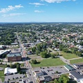
![Aerial view of Charles Town, West Virginia [03]](../../../i/upload/2024/07/20/20240720104008-7857c00b-sq.jpg)
![Aerial view of Charles Town, West Virginia [02]](../../../i/upload/2024/07/20/20240720104018-5b8b2fcf-sq.jpg)

![Cumberland County Courthouse [01]](../../../i/upload/2024/07/20/20240720113539-4581fbf8-sq.jpg)
![Cumberland County Courthouse [02]](../../../i/upload/2024/07/20/20240720113555-162ad090-sq.jpg)
![Cumberland County Courthouse [03]](../../../i/upload/2024/07/20/20240720113618-74683676-sq.jpg)
![Cumberland County Courthouse [04]](../../../i/upload/2024/07/20/20240720113645-e8961c77-sq.jpg)
![Cumberland County Courthouse [05]](../../../i/upload/2024/07/20/20240720113710-ce68e296-sq.jpg)
![Aerial view of downtown Crossville, Tennessee [01]](../../../i/upload/2024/07/20/20240720113721-1bd631e7-sq.jpg)
![Aerial view of downtown Crossville, Tennessee [02]](../../../i/upload/2024/07/20/20240720113738-e7992a54-sq.jpg)
![Aerial view of downtown Crossville, Tennessee [03]](../../../i/upload/2024/07/20/20240720113748-d1062940-sq.jpg)

![Aerial view of downtown Knoxville [01]](../../../i/upload/2024/07/20/20240720114522-2fed5282-sq.jpg)
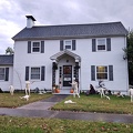

![Marquee Cinemas Pinnacle 12 [01]](../../../i/upload/2024/07/20/20240720121442-16193cd2-sq.jpg)
![Marquee Cinemas Pinnacle 12 [02]](../../../i/upload/2024/07/20/20240720121451-f0b28a96-sq.jpg)
![Marquee Cinemas Pinnacle 12 [03]](../../../i/upload/2024/07/20/20240720121456-dbea578f-sq.jpg)
![Marquee Cinemas Pinnacle 12 [04]](../../../i/upload/2024/07/20/20240720121507-f39a31c8-sq.jpg)
![Marquee Cinemas Pinnacle 12 [05]](../../../i/upload/2024/07/20/20240720121513-68a164ef-sq.jpg)
![The Pinnacle [01]](../../../i/upload/2024/07/20/20240720121518-8b92cbea-sq.jpg)
![The Pinnacle [02]](../../../i/upload/2024/07/20/20240720121523-56e6e879-sq.jpg)
![House in Belmont [01]](../../../i/upload/2024/07/20/20240720121631-c3e23ae1-sq.jpg)
![House in Belmont [02]](../../../i/upload/2024/07/20/20240720121752-e4abc76f-sq.jpg)
![Aerial view of Roanoke, Virginia [01]](../../../i/upload/2024/07/20/20240720121757-bb58476c-sq.jpg)
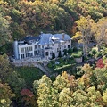
![Aerial view of Roanoke, Virginia [02]](../../../i/upload/2024/07/20/20240720121808-dccb83a0-sq.jpg)
![House in Belmont [03]](../../../i/upload/2024/07/20/20240720121814-c2af82f0-sq.jpg)
![Aerial view of Roanoke, Virginia [03]](../../../i/upload/2024/07/20/20240720121837-3c6bbb13-sq.jpg)
![House in Belmont [04]](../../../i/upload/2024/07/20/20240720121849-d834dd26-sq.jpg)
![Aerial view of Roanoke, Virginia [04]](../../../i/upload/2024/07/20/20240720121854-34748718-sq.jpg)
![Aerial view of Roanoke, Virginia [05]](../../../i/upload/2024/07/20/20240720121906-5f802cee-sq.jpg)
![Aerial view of Roanoke, Virginia [06]](../../../i/upload/2024/07/20/20240720121917-3d4a6311-sq.jpg)
![Intersection of Montgomery Village Avenue and Midcounty Highway [03]](../../../i/upload/2024/07/20/20240720122313-30dc7995-sq.jpg)
![Intersection of Montgomery Village Avenue and Midcounty Highway [04]](../../../i/upload/2024/07/20/20240720122318-8f69eabc-sq.jpg)
![Intersection of Montgomery Village Avenue and Midcounty Highway [05]](../../../i/upload/2024/07/20/20240720122324-2a205409-sq.jpg)


![Staunton Mall demolition progress, December 2022 [16]](../../../i/upload/2024/07/20/20240720124352-032f9b4d-sq.jpg)
![Staunton Mall demolition progress, December 2022 [17]](../../../i/upload/2024/07/20/20240720124358-33b9fc26-sq.jpg)
![Staunton Mall demolition progress, December 2022 [18]](../../../i/upload/2024/07/20/20240720124404-40931f10-sq.jpg)
![Staunton Mall demolition progress, December 2022 [19]](../../../i/upload/2024/07/20/20240720124410-34bd22f3-sq.jpg)
![Staunton Mall demolition progress, December 2022 [20]](../../../i/upload/2024/07/20/20240720124416-9b3f7fe7-sq.jpg)
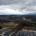
![10 St. Luke's Place [05]](../../../i/upload/2024/07/20/20240720143706-fa65e3ce-sq.jpg)
![10 St. Luke's Place [04]](../../../i/upload/2024/07/20/20240720143746-8a56410b-sq.jpg)
![10 St. Luke's Place [07]](../../../i/upload/2024/07/20/20240720143751-11a89f4f-sq.jpg)
![10 St. Luke's Place [03]](../../../i/upload/2024/07/20/20240720143800-20bb1d72-sq.jpg)

![10 St. Luke's Place [01]](../../../i/upload/2024/07/20/20240720143815-c5023705-sq.jpg)
![10 St. Luke's Place [08]](../../../i/upload/2024/07/20/20240720143834-e0ca2fe5-sq.jpg)
![10 St. Luke's Place [06]](../../../i/upload/2024/07/20/20240720143838-f8dd5719-sq.jpg)
![10 St. Luke's Place [02]](../../../i/upload/2024/07/20/20240720143842-764f4050-sq.jpg)


![Vistas on the James [02]](../../../i/upload/2024/07/20/20240720145223-218dc7fa-sq.jpg)
![The Italianate [08]](../../../i/upload/2024/07/20/20240720145325-16a3e8ba-sq.jpg)
![The Italianate [09]](../../../i/upload/2024/07/20/20240720145330-24fa7644-sq.jpg)
![The Italianate [10]](../../../i/upload/2024/07/20/20240720145414-97048344-sq.jpg)
![The Italianate [11]](../../../i/upload/2024/07/20/20240720145420-c5340847-sq.jpg)
![The Italianate [07]](../../../i/upload/2024/07/20/20240720145455-ba7ce657-sq.jpg)


![High rises east of Duffield Street [01]](../../../i/upload/2024/07/20/20240720150910-544dbb2e-sq.jpg)
![High rises east of Duffield Street [02]](../../../i/upload/2024/07/20/20240720150916-1568aed9-sq.jpg)
![Willett Street Industries [05]](../../../i/upload/2024/07/20/20240720151328-1a0ff066-sq.jpg)
![Willett Street Industries [04]](../../../i/upload/2024/07/20/20240720151334-3e0900cc-sq.jpg)
![Willett Street Industries [02]](../../../i/upload/2024/07/20/20240720151344-4f1cdc6b-sq.jpg)
![Willett Street Industries [01]](../../../i/upload/2024/07/20/20240720151409-4e0be522-sq.jpg)
![Willett Street Industries [06]](../../../i/upload/2024/07/20/20240720151414-1706282b-sq.jpg)
![Willett Street Industries [03]](../../../i/upload/2024/07/20/20240720151520-1f1390da-sq.jpg)
![35 Newman Road [01]](../../../i/upload/2024/07/20/20240720152023-6341c6a5-sq.jpg)
![35 Newman Road [02]](../../../i/upload/2024/07/20/20240720152028-a0920d8a-sq.jpg)
![35 Newman Road [03]](../../../i/upload/2024/07/20/20240720152037-5324c9aa-sq.jpg)
![Parliament Hill viewed from the Canadian Museum of History [03]](../../../i/upload/2024/07/20/20240720153205-0ed4bb97-sq.jpg)
![Parliament Hill viewed from the Canadian Museum of History [04]](../../../i/upload/2024/07/20/20240720153433-5c535764-sq.jpg)
![Parliament Hill viewed from the Canadian Museum of History [02]](../../../i/upload/2024/07/20/20240720153545-9d416a4d-sq.jpg)
![Parliament Hill viewed from the Canadian Museum of History [01]](../../../i/upload/2024/07/20/20240720153642-acef43b1-sq.jpg)

![Speed limit sign on Palace Street [01]](../../../i/upload/2024/07/20/20240720154918-2b2aab86-sq.jpg)
![Speed limit sign on Palace Street [02]](../../../i/upload/2024/07/20/20240720154937-2d589d46-sq.jpg)
![Speed limit sign on Palace Street [03]](../../../i/upload/2024/07/20/20240720154944-6fa30364-sq.jpg)
![Upended car at Hyattstown Volunteer Fire Department [01]](../../../i/upload/2024/07/20/20240720155816-961e5e10-sq.jpg)
![Upended car at Hyattstown Volunteer Fire Department [02]](../../../i/upload/2024/07/20/20240720155820-4367cc5d-sq.jpg)
![Upended car at Hyattstown Volunteer Fire Department [03]](../../../i/upload/2024/07/20/20240720155824-f0fdb1c9-sq.jpg)


![View from Hatteras Island Inn observation tower [01]](../../../i/upload/2024/08/08/20240808004554-4fa2ebea-sq.jpg)
![Aerial view of downtown Fredericksburg [01]](../../../i/upload/2024/08/10/20240810113605-aeeec139-sq.jpg)
![Aerial view of downtown Fredericksburg [02]](../../../i/upload/2024/08/10/20240810113610-a8d79889-sq.jpg)

![View from Hatteras Island Inn observation tower [02]](../../../i/upload/2024/10/23/20241023091029-ed2672cb-sq.jpg)
![Alley between North Claremont and North Oakley Avenues [01]](../../../i/upload/2024/11/05/20241105002932-b7be2cfb-sq.jpg)
![Alley between North Claremont and North Oakley Avenues [02]](../../../i/upload/2024/11/05/20241105002951-b8ca015a-sq.jpg)
![Alley between North Claremont and North Oakley Avenues [03]](../../../i/upload/2024/11/05/20241105003005-82016820-sq.jpg)
![Justice Robert D. Rucker Superior Courthouse [01]](../../../i/upload/2024/11/16/20241116012351-b4a5ec3a-sq.jpg)
![Justice Robert D. Rucker Superior Courthouse [02]](../../../i/upload/2024/11/16/20241116012406-e58c758a-sq.jpg)
![420 Adams Street [01]](../../../i/upload/2024/11/16/20241116012429-437c4088-sq.jpg)
![420 Adams Street [02]](../../../i/upload/2024/11/16/20241116012440-f8420b76-sq.jpg)
![420 Adams Street [03]](../../../i/upload/2024/11/16/20241116012453-40df7236-sq.jpg)
![Ravenglass Way [10]](../../../i/upload/2024/11/20/20241120093351-250cbe61-sq.jpg)
![Sunset over Montgomery Village [01]](../../../i/upload/2024/11/20/20241120093359-6e4a8f21-sq.jpg)
![Sunset over Montgomery Village [02]](../../../i/upload/2024/11/20/20241120093408-5c11a279-sq.jpg)
![Ravenglass Way [11]](../../../i/upload/2024/11/20/20241120095538-f7c081d2-sq.jpg)
![Ravenglass Way [12]](../../../i/upload/2024/11/20/20241120095547-36a4979e-sq.jpg)
![First snowfall of winter 2023-2024 [01]](../../../i/upload/2024/11/23/20241123001002-d06f1992-sq.jpg)
![First snowfall of winter 2023-2024 [02]](../../../i/upload/2024/11/23/20241123001014-41dedab9-sq.jpg)

![Aerial view of Fort Defiance, Virginia [01]](../../../i/upload/2024/11/27/20241127094250-78a7561d-sq.jpg)

![Aerial view of Swatara Township, Pennsylvania [01]](../../../i/upload/2024/12/05/20241205132651-54649c3c-sq.jpg)
![Aerial view of Swatara Township, Pennsylvania [02]](../../../i/upload/2024/12/05/20241205132702-f1c8677f-sq.jpg)
![Aerial view of Swatara Township, Pennsylvania [03]](../../../i/upload/2024/12/05/20241205132711-8707ae71-sq.jpg)
![Aerial view of downtown Allentown, Pennsylvania [01]](../../../i/upload/2024/12/05/20241205152258-8cb47c2c-sq.jpg)
![Aerial view of downtown Allentown, Pennsylvania [02]](../../../i/upload/2024/12/05/20241205152303-a5220735-sq.jpg)
![Aerial view of downtown Allentown, Pennsylvania [03]](../../../i/upload/2024/12/05/20241205152311-d410f9ac-sq.jpg)
![Aerial view of downtown Allentown, Pennsylvania [04]](../../../i/upload/2024/12/05/20241205152319-fffe3eee-sq.jpg)
![Aerial view of downtown Allentown, Pennsylvania [05]](../../../i/upload/2024/12/05/20241205152327-815fe120-sq.jpg)
![Aerial view of downtown Allentown, Pennsylvania [06]](../../../i/upload/2024/12/05/20241205152337-79613431-sq.jpg)
![Aerial view of downtown Allentown, Pennsylvania [07]](../../../i/upload/2024/12/05/20241205152346-1298cc9b-sq.jpg)
![Aerial view of downtown Allentown, Pennsylvania [08]](../../../i/upload/2024/12/05/20241205152353-01ae4f03-sq.jpg)
![PPL Building [01]](../../../i/upload/2024/12/05/20241205152403-552d8a41-sq.jpg)
![PPL Building [02]](../../../i/upload/2024/12/05/20241205152413-98a88313-sq.jpg)
![PPL Building [03]](../../../i/upload/2024/12/05/20241205152422-cfa19ea6-sq.jpg)
![PPL Building [04]](../../../i/upload/2024/12/05/20241205152433-533d6657-sq.jpg)
![PPL Building [05]](../../../i/upload/2024/12/05/20241205152442-88222485-sq.jpg)
![PPL Building [06]](../../../i/upload/2024/12/05/20241205152452-f8b18c2d-sq.jpg)
![PPL Building [07]](../../../i/upload/2024/12/05/20241205152501-4e9517d4-sq.jpg)
![Wildfire in Wheatfield, Virginia [01]](../../../i/upload/2024/12/26/20241226095723-0924c1da-sq.jpg)
![Wildfire in Wheatfield, Virginia [02]](../../../i/upload/2024/12/26/20241226095727-426cf00c-sq.jpg)
![Wildfire in Wheatfield, Virginia [20]](../../../i/upload/2024/12/26/20241226113603-cc8e09d4-sq.jpg)

![Aerial view of Monterey, Virginia [01]](../../../i/upload/2025/01/02/20250102005918-685606f9-sq.jpg)
![Aerial view of Monterey, Virginia [02]](../../../i/upload/2025/01/02/20250102005923-7f7b9b83-sq.jpg)
![Aerial view of Monterey, Virginia [03]](../../../i/upload/2025/01/02/20250102005929-2e84a9d0-sq.jpg)
![Aerial view of Monterey, Virginia [04]](../../../i/upload/2025/01/02/20250102005937-281fae65-sq.jpg)
![Aerial view of Monterey, Virginia [05]](../../../i/upload/2025/01/02/20250102005946-79efaa38-sq.jpg)
![Aerial view of Monterey, Virginia [06]](../../../i/upload/2025/01/02/20250102005956-29786301-sq.jpg)
