
Ben Schumin Photography Portfolio
Ben Schumin is a professional photographer who captures the intricacies of daily life.
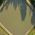
Aerial view of an area around US 13 in Pocomoke City, Maryland in late afternoon.
![Poseidon sectional barge in Newport News [01]](../../../i/upload/2025/02/19/20250219005623-e16ae508-sq.jpg)
![Poseidon sectional barge in Newport News [05]](../../../i/upload/2025/02/19/20250219005643-28c36042-sq.jpg)
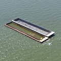
![Poseidon sectional barge in Newport News [06]](../../../i/upload/2025/02/19/20250219005648-1ee27e19-sq.jpg)
![Poseidon sectional barge in Newport News [04]](../../../i/upload/2025/02/19/20250219005638-3571628c-sq.jpg)
![Poseidon sectional barge in Newport News [03]](../../../i/upload/2025/02/19/20250219005633-aca8afd8-sq.jpg)
![Poseidon sectional barge in Newport News [02]](../../../i/upload/2025/02/19/20250219005627-f08178cc-sq.jpg)

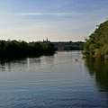
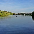
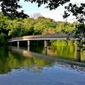
![Monitor-Merrimac Memorial Bridge-Tunnel [05]](../../../i/upload/2025/02/18/20250218235653-19c3fdef-sq.jpg)
![Monitor-Merrimac Memorial Bridge-Tunnel [12]](../../../i/upload/2025/02/18/20250218235731-5172cc89-sq.jpg)
![Monitor-Merrimac Memorial Bridge-Tunnel [11]](../../../i/upload/2025/02/18/20250218235725-ef9b2fb8-sq.jpg)
![Monitor-Merrimac Memorial Bridge-Tunnel [10]](../../../i/upload/2025/02/18/20250218235719-11c76977-sq.jpg)
![Monitor-Merrimac Memorial Bridge-Tunnel [09]](../../../i/upload/2025/02/18/20250218235714-45502513-sq.jpg)
![Monitor-Merrimac Memorial Bridge-Tunnel [08]](../../../i/upload/2025/02/18/20250218235709-560750da-sq.jpg)
![Monitor-Merrimac Memorial Bridge-Tunnel [07]](../../../i/upload/2025/02/18/20250218235704-55afa576-sq.jpg)
![Monitor-Merrimac Memorial Bridge-Tunnel [06]](../../../i/upload/2025/02/18/20250218235658-5bb810e5-sq.jpg)
![Monitor-Merrimac Memorial Bridge-Tunnel [04]](../../../i/upload/2025/02/18/20250218235648-fca8ade5-sq.jpg)
![Monitor-Merrimac Memorial Bridge-Tunnel [03]](../../../i/upload/2025/02/18/20250218235642-270961d8-sq.jpg)
![Monitor-Merrimac Memorial Bridge-Tunnel [02]](../../../i/upload/2025/02/18/20250218235637-581fbcca-sq.jpg)
![Monitor-Merrimac Memorial Bridge-Tunnel [01]](../../../i/upload/2025/02/18/20250218235632-5aef878d-sq.jpg)

![Barge traveling up the James River [07]](../../../i/upload/2025/02/18/20250218111339-ecb3eac3-sq.jpg)
![Barge traveling up the James River [06]](../../../i/upload/2025/02/18/20250218111333-f0b7149a-sq.jpg)
![Barge traveling up the James River [05]](../../../i/upload/2025/02/18/20250218111324-a2034c26-sq.jpg)
![Barge traveling up the James River [04]](../../../i/upload/2025/02/18/20250218111317-821ae692-sq.jpg)
![Barge traveling up the James River [03]](../../../i/upload/2025/02/18/20250218111310-4e93444f-sq.jpg)
![Barge traveling up the James River [02]](../../../i/upload/2025/02/18/20250218111302-0b684bd9-sq.jpg)
![Barge traveling up the James River [01]](../../../i/upload/2025/02/18/20250218111256-50646edb-sq.jpg)


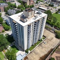
![River Park Tower Apartments [02]](../../../i/upload/2025/02/18/20250218102157-99fbbb4b-sq.jpg)
![DJI Air 3 in flight [02]](../../../i/upload/2025/02/18/20250218095305-d9f6b829-sq.jpg)
![DJI Air 3 in flight [01]](../../../i/upload/2025/02/18/20250218095302-6d80f3ec-sq.jpg)
![Interstate 64 in Hampton, Virginia [04]](../../../i/upload/2025/02/17/20250217085415-4cb12081-sq.jpg)
![Interstate 64 in Hampton, Virginia [01]](../../../i/upload/2025/02/17/20250217090951-2400e489-sq.jpg)
![Interstate 64 in Hampton, Virginia [03]](../../../i/upload/2025/02/17/20250217085436-66a19491-sq.jpg)
![Interstate 64 in Hampton, Virginia [02]](../../../i/upload/2025/02/17/20250217085501-e9021d57-sq.jpg)
![Aerial view of Hampton Coliseum [02]](../../../i/upload/2025/02/17/20250217085700-fbcac1cc-sq.jpg)
![Aerial view of Hampton Coliseum [01]](../../../i/upload/2025/02/17/20250217085721-26ccc815-sq.jpg)
![Hampton Roads Bridge-Tunnel, westbound [02]](../../../i/upload/2025/02/17/20250217012521-81ed217b-sq.jpg)
![Hampton Roads Bridge-Tunnel, westbound [01]](../../../i/upload/2025/02/17/20250217012510-5b2ab7ac-sq.jpg)
![Birdsnest Lookout [04]](../../../i/upload/2025/02/17/20250217005810-218c7f41-sq.jpg)
![Birdsnest Lookout [03]](../../../i/upload/2025/02/17/20250217005804-343b9ffb-sq.jpg)
![Birdsnest Lookout [02]](../../../i/upload/2025/02/17/20250217005759-caf88839-sq.jpg)
![Birdsnest Lookout [06]](../../../i/upload/2025/02/17/20250217005823-259e9098-sq.jpg)
![Birdsnest Lookout [05]](../../../i/upload/2025/02/17/20250217005817-b3e6d468-sq.jpg)
![Birdsnest Lookout [01]](../../../i/upload/2025/02/17/20250217005755-4434f494-sq.jpg)

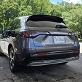
![Honda HR-V along US 13 [02]](../../../i/upload/2025/02/16/20250216105404-a22075b0-sq.jpg)
![Honda HR-V along US 13 [01]](../../../i/upload/2025/02/16/20250216105309-52b06bb0-sq.jpg)
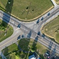
![Junction with US 13 Business [02]](../../../i/upload/2025/02/16/20250216105236-6f438cfb-sq.jpg)
![Junction with US 13 Business [01]](../../../i/upload/2025/02/16/20250216105227-05f505b7-sq.jpg)
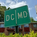
![Area around US 13 in Pocomoke City, Maryland [02]](../../../i/upload/2025/02/16/20250216105020-45970493-sq.jpg)
![Area around US 13 in Pocomoke City, Maryland [01]](../../../i/upload/2025/02/16/20250216104958-9cfd679e-sq.jpg)
![Water tower at Eastern Shore Forest Products [02]](../../../i/upload/2025/02/16/20250216104851-53db0227-sq.jpg)
![Water tower at Eastern Shore Forest Products [01]](../../../i/upload/2025/02/16/20250216104828-1da2e8f2-sq.jpg)
![Choptank River Bridge [03]](../../../i/upload/2025/02/16/20250216101126-5e453b53-sq.jpg)
![Choptank River Bridge [02]](../../../i/upload/2025/02/16/20250216101120-5c3d2aaf-sq.jpg)
![Choptank River Bridge [08]](../../../i/upload/2025/02/16/20250216101153-3a9fcb7d-sq.jpg)
![Choptank River Bridge [07]](../../../i/upload/2025/02/16/20250216101147-f4d3c81d-sq.jpg)
![Choptank River Bridge [06]](../../../i/upload/2025/02/16/20250216101141-257983d7-sq.jpg)
![Choptank River Bridge [05]](../../../i/upload/2025/02/16/20250216101136-cbe956a7-sq.jpg)
![Choptank River Bridge [04]](../../../i/upload/2025/02/16/20250216101131-08475973-sq.jpg)
![Choptank River Bridge [01]](../../../i/upload/2025/02/16/20250216101115-1f995023-sq.jpg)
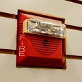
![Sirens at Easton Volunteer Fire Department [03]](../../../i/upload/2025/02/16/20250216092258-17226c32-sq.jpg)
![Sirens at Easton Volunteer Fire Department [02]](../../../i/upload/2025/02/16/20250216092246-6e4740d5-sq.jpg)
![Sirens at Easton Volunteer Fire Department [01]](../../../i/upload/2025/02/16/20250216092233-42eae054-sq.jpg)
![AT&T Long Lines Wye Mills site [06]](../../../i/upload/2025/02/16/20250216005658-f86e877e-sq.jpg)
![AT&T Long Lines Wye Mills site [05]](../../../i/upload/2025/02/16/20250216005653-96b21c6d-sq.jpg)
![AT&T Long Lines Wye Mills site [04]](../../../i/upload/2025/02/16/20250216005647-5d170521-sq.jpg)
![AT&T Long Lines Wye Mills site [03]](../../../i/upload/2025/02/16/20250216005642-9dfa25f7-sq.jpg)
![AT&T Long Lines Wye Mills site [02]](../../../i/upload/2025/02/16/20250216005637-21345428-sq.jpg)
![AT&T Long Lines Wye Mills site [01]](../../../i/upload/2025/02/16/20250216005632-3276ba44-sq.jpg)
![Intersection of US 50 and MD 213 [02]](../../../i/upload/2025/02/16/20250216003338-82427ee4-sq.jpg)
![Intersection of US 50 and MD 213 [01]](../../../i/upload/2025/02/16/20250216003332-e7ac1a6b-sq.jpg)

![Signage for eastern US 50/US 301 split [02]](../../../i/upload/2025/02/07/20250207212412-a7ff650a-sq.jpg)
![Signage for eastern US 50/US 301 split [01]](../../../i/upload/2025/02/07/20250207212407-b5a2955a-sq.jpg)
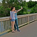
![Drone selfie at Terrapin Nature Park [03]](../../../i/upload/2025/02/07/20250207143425-6d37f384-sq.jpg)
![Drone selfie at Terrapin Nature Park [02]](../../../i/upload/2025/02/07/20250207143421-5873969c-sq.jpg)
![Drone selfie at Terrapin Nature Park [01]](../../../i/upload/2025/02/07/20250207143416-fd1da95f-sq.jpg)
![Water tower off of Bateau Drive [02]](../../../i/upload/2025/02/07/20250207143410-f2a4ee8a-sq.jpg)
![Water tower off of Bateau Drive [01]](../../../i/upload/2025/02/07/20250207143405-d60bbf88-sq.jpg)
![Eastern end of the Chesapeake Bay Bridge [04]](../../../i/upload/2025/02/07/20250207140003-1549325d-sq.jpg)
![Eastern end of the Chesapeake Bay Bridge [02]](../../../i/upload/2025/02/07/20250207135805-4b074040-sq.jpg)
![Eastern end of the Chesapeake Bay Bridge [03]](../../../i/upload/2025/02/07/20250207135903-c1f151c4-sq.jpg)
![Eastern end of the Chesapeake Bay Bridge [01]](../../../i/upload/2025/02/07/20250207135752-9d02b521-sq.jpg)
![Upended car at Hyattstown Volunteer Fire Department [03]](../../../i/upload/2024/07/20/20240720155824-f0fdb1c9-sq.jpg)
![Upended car at Hyattstown Volunteer Fire Department [01]](../../../i/upload/2024/07/20/20240720155816-961e5e10-sq.jpg)
![Upended car at Hyattstown Volunteer Fire Department [02]](../../../i/upload/2024/07/20/20240720155820-4367cc5d-sq.jpg)
![Aerial view of Smithsburg, Maryland [03]](../../../i/upload/2024/07/20/20240720155805-a9f3e7ed-sq.jpg)
![Aerial view of Smithsburg, Maryland [02]](../../../i/upload/2024/07/20/20240720155800-cb15da92-sq.jpg)
![Aerial view of Smithsburg, Maryland [01]](../../../i/upload/2024/07/20/20240720155756-7d354d6c-sq.jpg)
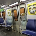
![New Carrollton station, May 2023 [01]](../../../i/upload/2024/07/20/20240720155748-8b7e4748-sq.jpg)
![New Carrollton station, May 2023 [02]](../../../i/upload/2024/07/20/20240720155744-b7d4ce8a-sq.jpg)
![Wheelock Eluxa horn/strobe at Crumbl Cookies [03]](../../../i/upload/2024/07/20/20240720093720-3becb7a0-sq.jpg)
![Wheelock Eluxa horn/strobe at Crumbl Cookies [02]](../../../i/upload/2024/07/20/20240720093715-ee3bee7c-sq.jpg)
![Wheelock Eluxa horn/strobe at Crumbl Cookies [01]](../../../i/upload/2024/07/20/20240720093711-fff08b4b-sq.jpg)
![Storm at New Carrollton station [03]](../../../i/upload/2024/07/20/20240720093702-138c9e1c-sq.jpg)
![Storm at New Carrollton station [02]](../../../i/upload/2024/07/20/20240720093657-627b661e-sq.jpg)
![Storm at New Carrollton station [01]](../../../i/upload/2024/07/20/20240720093653-9243335f-sq.jpg)

![Clarksburg Road bridge over Little Seneca Lake [05]](../../../i/upload/2024/07/19/20240719164946-4e860e8a-sq.jpg)
![Little Seneca Dam [05]](../../../i/upload/2024/07/19/20240719164943-54bff3e5-sq.jpg)
![Little Seneca Dam [07]](../../../i/upload/2024/07/19/20240719164939-c938727e-sq.jpg)
![Little Seneca Dam [04]](../../../i/upload/2024/07/19/20240719164935-04afdc7e-sq.jpg)
![Little Seneca Dam [09]](../../../i/upload/2024/07/19/20240719164932-bb3678b5-sq.jpg)
![Clarksburg Road bridge over Little Seneca Lake [02]](../../../i/upload/2024/07/19/20240719164928-43aa6e0f-sq.jpg)
![Little Seneca Dam [03]](../../../i/upload/2024/07/19/20240719164924-90339ea5-sq.jpg)
![Little Seneca Lake [03]](../../../i/upload/2024/07/19/20240719164921-f37b3e1f-sq.jpg)
![Clarksburg Road bridge over Little Seneca Lake [01]](../../../i/upload/2024/07/19/20240719164917-35ced0ed-sq.jpg)
![Clarksburg Road bridge over Little Seneca Lake [03]](../../../i/upload/2024/07/19/20240719164913-53b65146-sq.jpg)
![Clarksburg Road bridge over Little Seneca Lake [04]](../../../i/upload/2024/07/19/20240719164909-eab2208d-sq.jpg)
![Little Seneca Dam [02]](../../../i/upload/2024/07/19/20240719164905-4f22f45b-sq.jpg)
![Little Seneca Dam [06]](../../../i/upload/2024/07/19/20240719164901-310db068-sq.jpg)
![Little Seneca Dam [01]](../../../i/upload/2024/07/19/20240719164857-c0b348d8-sq.jpg)
![Little Seneca Dam [08]](../../../i/upload/2024/07/19/20240719164853-d8db1427-sq.jpg)
![Springfield Executive Building [03]](../../../i/upload/2024/07/19/20240719104641-a3016d90-sq.jpg)
![Springfield Executive Building [02]](../../../i/upload/2024/07/19/20240719104637-ea98597c-sq.jpg)
![Interior of former Nobody Beats the Wiz in Springfield, Virginia [02]](../../../i/upload/2024/07/19/20240719104633-3f865116-sq.jpg)
![Street sign at Backlick Road and Brookfield Plaza [01]](../../../i/upload/2024/07/19/20240719104624-32193b87-sq.jpg)
![Street sign at Backlick Road and Brookfield Plaza [02]](../../../i/upload/2024/07/19/20240719104619-1bd22298-sq.jpg)
![Springfield Executive Building [01]](../../../i/upload/2024/07/19/20240719104614-e4e726ec-sq.jpg)
![Former Nobody Beats the Wiz in Springfield, Virginia [01]](../../../i/upload/2024/07/19/20240719104608-d1d72f2f-sq.jpg)
![Former Nobody Beats the Wiz in Springfield, Virginia [02]](../../../i/upload/2024/07/19/20240719104603-38f96eae-sq.jpg)
![Former Nobody Beats the Wiz in Springfield, Virginia [03]](../../../i/upload/2024/07/19/20240719104558-c4c794c4-sq.jpg)
![Former Nobody Beats the Wiz in Springfield, Virginia [04]](../../../i/upload/2024/07/19/20240719104553-c4c0fa9b-sq.jpg)
![Former Nobody Beats the Wiz in Springfield, Virginia [05]](../../../i/upload/2024/07/19/20240719104548-e73703c7-sq.jpg)
![Former Nobody Beats the Wiz in Springfield, Virginia [06]](../../../i/upload/2024/07/19/20240719104543-4ad296fe-sq.jpg)
![Former Nobody Beats the Wiz in Springfield, Virginia [07]](../../../i/upload/2024/07/19/20240719104538-c3034974-sq.jpg)
![Former Nobody Beats the Wiz in Springfield, Virginia [08]](../../../i/upload/2024/07/19/20240719104533-8f6095ac-sq.jpg)
![Interior of former Nobody Beats the Wiz in Springfield, Virginia [01]](../../../i/upload/2024/07/19/20240719104528-dd6ca3cf-sq.jpg)
![Former Nobody Beats the Wiz in Springfield, Virginia [09]](../../../i/upload/2024/07/19/20240719104523-8869e836-sq.jpg)
![Former Nobody Beats the Wiz in Springfield, Virginia [10]](../../../i/upload/2024/07/19/20240719104518-761eea9c-sq.jpg)
![Former Nobody Beats the Wiz in Springfield, Virginia [11]](../../../i/upload/2024/07/19/20240719104513-af9d3524-sq.jpg)
![Former Nobody Beats the Wiz in Springfield, Virginia [12]](../../../i/upload/2024/07/19/20240719104507-99c0b3c0-sq.jpg)
![Former Nobody Beats the Wiz in Springfield, Virginia [13]](../../../i/upload/2024/07/19/20240719104502-c0673a4c-sq.jpg)
![Former Nobody Beats the Wiz in Springfield, Virginia [14]](../../../i/upload/2024/07/19/20240719104457-50a62084-sq.jpg)
![Former Nobody Beats the Wiz in Springfield, Virginia [15]](../../../i/upload/2024/07/19/20240719104452-799242e2-sq.jpg)
![Former Nobody Beats the Wiz in Springfield, Virginia [16]](../../../i/upload/2024/07/19/20240719104447-dec16db0-sq.jpg)
![Demolition of Spring Mall Building [01]](../../../i/upload/2024/07/19/20240719104443-d741e6e4-sq.jpg)
![Demolition of Spring Mall Building [02]](../../../i/upload/2024/07/19/20240719104438-abe1ae41-sq.jpg)
![Demolition of Spring Mall Building [03]](../../../i/upload/2024/07/19/20240719104433-b95d6e21-sq.jpg)
![Demolition of Spring Mall Building [04]](../../../i/upload/2024/07/19/20240719104428-5e18ec0c-sq.jpg)
![Demolition of Spring Mall Building [05]](../../../i/upload/2024/07/19/20240719104423-919aa2c5-sq.jpg)
![Demolition of Spring Mall Building [06]](../../../i/upload/2024/07/19/20240719104418-a3d15191-sq.jpg)
![Demolition of Spring Mall Building [07]](../../../i/upload/2024/07/19/20240719104413-45e5418b-sq.jpg)
![Demolition of Spring Mall Building [08]](../../../i/upload/2024/07/19/20240719104406-ebaefbb4-sq.jpg)
![3101 Wilson Boulevard [01]](../../../i/upload/2024/07/19/20240719104355-bee57a4b-sq.jpg)
![3101 Wilson Boulevard [02]](../../../i/upload/2024/07/19/20240719104351-2ba8b934-sq.jpg)
![Sign for Bar Bao [02]](../../../i/upload/2024/07/19/20240719104347-648caf7b-sq.jpg)
![Sign for Bar Bao [01]](../../../i/upload/2024/07/19/20240719104343-72c27829-sq.jpg)

![Debris after power washing [01]](../../../i/upload/2024/07/19/20240719104334-3ea9b5db-sq.jpg)
![Debris after power washing [02]](../../../i/upload/2024/07/19/20240719104330-31610c4b-sq.jpg)


![Double rainbow over Roanoke [01]](../../../i/upload/2024/07/18/20240718230344-e2d6208f-sq.jpg)
![Double rainbow over Roanoke [02]](../../../i/upload/2024/07/18/20240718230335-fd45b1d6-sq.jpg)


![Construction on Esperanza site [03]](../../../i/upload/2024/07/18/20240718223028-21aac1e9-sq.jpg)
![Construction on Esperanza site [02]](../../../i/upload/2024/07/18/20240718223025-d599848c-sq.jpg)
![Middle section of the Asbury Park Casino [02]](../../../i/upload/2024/07/18/20240718223017-65a92eb1-sq.jpg)
![Construction on Esperanza site [01]](../../../i/upload/2024/07/18/20240718223021-165982e2-sq.jpg)

![Middle section of the Asbury Park Casino [01]](../../../i/upload/2024/07/18/20240718223014-0e02ca3e-sq.jpg)
![Asbury Park Casino [02]](../../../i/upload/2024/07/18/20240718223003-cbf63bd1-sq.jpg)
![Asbury Park Casino [03]](../../../i/upload/2024/07/18/20240718223007-9a540824-sq.jpg)
![Asbury Park Casino [01]](../../../i/upload/2024/07/18/20240718222955-a76ae304-sq.jpg)

![Asbury Park beach [02]](../../../i/upload/2024/07/18/20240718222950-a52979d4-sq.jpg)
![Asbury Park beach [01]](../../../i/upload/2024/07/18/20240718222952-0b539ccb-sq.jpg)
![Van Ness-UDC station [03]](../../../i/upload/2024/07/18/20240718213929-5e9da6a3-sq.jpg)
![Van Ness-UDC station [02]](../../../i/upload/2024/07/18/20240718213925-8facba77-sq.jpg)

![Unfinished store at Burtonsville Town Square [01]](../../../i/upload/2024/07/17/20240717230249-5e04bf26-sq.jpg)
![Lazy river at SplashDown Waterpark [03]](../../../i/upload/2024/07/19/20240719182810-a294cf77-sq.jpg)
![Lazy river at SplashDown Waterpark [04]](../../../i/upload/2024/07/19/20240719182803-097ab847-sq.jpg)

![Rosslyn skyline [03]](../../../i/upload/2024/07/17/20240717230307-ad97916d-sq.jpg)
![Rosslyn skyline [02]](../../../i/upload/2024/07/17/20240717230304-8f412681-sq.jpg)
![Rosslyn skyline [01]](../../../i/upload/2024/07/17/20240717230300-9294fc8d-sq.jpg)
![Pirate ship Fearless [01]](../../../i/upload/2024/07/17/20240717101747-bed91083-sq.jpg)
![Pirate ship Fearless [04]](../../../i/upload/2024/07/17/20240717101745-52199156-sq.jpg)
![Pirate ship Fearless [03]](../../../i/upload/2024/07/17/20240717101743-479229c0-sq.jpg)
![Pirate ship Fearless [02]](../../../i/upload/2024/07/17/20240717101740-ba467b84-sq.jpg)
![The Black Eyed Susan [02]](../../../i/upload/2024/07/17/20240717101735-7f59ddac-sq.jpg)
![The Black Eyed Susan [01]](../../../i/upload/2024/07/17/20240717101733-e99f5dfa-sq.jpg)
![The Black Eyed Susan [03]](../../../i/upload/2024/07/17/20240717101730-11dc54f1-sq.jpg)
![Boston Megaraid [08]](../../../i/upload/2024/07/16/20240716011001-d00e0002-sq.jpg)
![Boston Megaraid [07]](../../../i/upload/2024/07/16/20240716010959-899fba8b-sq.jpg)
![Boston Megaraid [06]](../../../i/upload/2024/07/16/20240716010957-60037c9d-sq.jpg)
![Boston Megaraid [05]](../../../i/upload/2024/07/16/20240716010953-0981d6bf-sq.jpg)
![Boston Zombie Walk [04]](../../../i/upload/2024/07/16/20240716010955-b29b84bd-sq.jpg)

![Boston Zombie Walk [03]](../../../i/upload/2024/07/16/20240716010952-23df6530-sq.jpg)
![Boston Megaraid [04]](../../../i/upload/2024/07/16/20240716010946-937be04d-sq.jpg)
![Boston Zombie Walk [02]](../../../i/upload/2024/07/16/20240716010948-ca5af0d9-sq.jpg)
![Boston Megaraid [03]](../../../i/upload/2024/07/16/20240716010942-9818d969-sq.jpg)
![Boston Zombie Walk [01]](../../../i/upload/2024/07/16/20240716010944-69e59618-sq.jpg)
![Boston Megaraid [02]](../../../i/upload/2024/07/16/20240716010939-8f871e06-sq.jpg)
![Boston Megaraid [01]](../../../i/upload/2024/07/16/20240716010934-e81271bf-sq.jpg)
![Remodel of Walmart Supercenter in Lexington, Virginia [04]](../../../i/upload/2024/07/14/20240714234733-a50317b6-sq.jpg)

![West Hyattsville station [01]](../../../i/upload/2024/07/14/20240714170930-1621bf95-sq.jpg)


Information
EXIF Metadata
DJI FC8282
f/170/100
1/8000
200
0/10
0
- DateTimeOriginal
- 2024:05:30 19:04:33
- DateTimeDigitized
- 2024:05:30 19:04:33
- Make
- DJI
- Model
- FC8282
- ExposureProgram
- 2
- FocalLengthIn35mmFilm
- 24
- FNumber
- 170/100
- ExposureTime
- 1/8000
- ISOSpeedRatings
- 200
- Flash
- 0
- WhiteBalance
- 0
- XResolution
- 720000/10000
- YResolution
- 720000/10000
- ImageWidth
- 8064
- ImageLength
- 4536
- Orientation
- 1
- SamplesPerPixel
- 3
- ExposureBiasValue
- 0/10
- MaxApertureValue
- 153/100
- MeteringMode
- 1
- LightSource
- 1
Powered by Piwigo