
Ben Schumin Photography Portfolio
Ben Schumin is a professional photographer who captures the intricacies of daily life.
My DJI Air 3 in flight over Hampton, Virginia.
![Hop N Shop [02]](../../../i/upload/2025/02/20/20250220223107-6b96c5bd-sq.jpg)
![Hop N Shop [01]](../../../i/upload/2025/02/20/20250220223102-57a9af8f-sq.jpg)
![View of the Lafayette River from the Granby Street Bridge [02]](../../../i/upload/2025/02/20/20250220214608-1d603c9f-sq.jpg)
![View of the Lafayette River from the Granby Street Bridge [01]](../../../i/upload/2025/02/20/20250220214605-6d779439-sq.jpg)

![Former Bon Secours DePaul Medical Center [02]](../../../i/upload/2025/02/20/20250220205019-b7263634-sq.jpg)
![Former Bon Secours DePaul Medical Center [01]](../../../i/upload/2025/02/20/20250220205014-215296f7-sq.jpg)


![Greenbrier Mall [05]](../../../i/upload/2025/02/20/20250220013439-7d9c3deb-sq.jpg)
![Greenbrier Mall [04]](../../../i/upload/2025/02/20/20250220013435-44293040-sq.jpg)
![Greenbrier Mall [03]](../../../i/upload/2025/02/20/20250220013430-8990444f-sq.jpg)
![Greenbrier Mall [02]](../../../i/upload/2025/02/20/20250220013425-97d6e0e9-sq.jpg)
![Greenbrier Mall [01]](../../../i/upload/2025/02/20/20250220013420-e4df8d4e-sq.jpg)

![Liberty Executive Park [06]](../../../i/upload/2025/02/19/20250219223234-b286ccff-sq.jpg)
![Liberty Executive Park [05]](../../../i/upload/2025/02/19/20250219223144-7357dda8-sq.jpg)
![Liberty Executive Park [04]](../../../i/upload/2025/02/19/20250219223057-320de988-sq.jpg)
![Liberty Executive Park [03]](../../../i/upload/2025/02/19/20250219223009-037b6ca0-sq.jpg)
![Liberty Executive Park [02]](../../../i/upload/2025/02/19/20250219222906-b05ca734-sq.jpg)
![Liberty Executive Park [01]](../../../i/upload/2025/02/19/20250219222850-50fd69b0-sq.jpg)
![Dollar Tree Distribution Center [01]](../../../i/upload/2025/02/19/20250219213220-027384f8-sq.jpg)
![Dollar Tree Distribution Center [02]](../../../i/upload/2025/02/19/20250219213312-a7b16848-sq.jpg)
![Dollar Tree Distribution Center [03]](../../../i/upload/2025/02/19/20250219213415-89bfe7f9-sq.jpg)
![Dollar Tree Corporate Office [04]](../../../i/upload/2025/02/19/20250219213027-6b87d89c-sq.jpg)
![Dollar Tree Corporate Office [05]](../../../i/upload/2025/02/19/20250219213153-7311378c-sq.jpg)
![Dollar Tree Corporate Office [03]](../../../i/upload/2025/02/19/20250219213004-a8f5a593-sq.jpg)
![Dollar Tree Corporate Office [02]](../../../i/upload/2025/02/19/20250219212859-e02df95f-sq.jpg)
![Dollar Tree Corporate Office [01]](../../../i/upload/2025/02/19/20250219212847-eeb88fc3-sq.jpg)
![Poseidon sectional barge in Newport News [01]](../../../i/upload/2025/02/19/20250219005623-e16ae508-sq.jpg)
![Poseidon sectional barge in Newport News [05]](../../../i/upload/2025/02/19/20250219005643-28c36042-sq.jpg)
![Poseidon sectional barge in Newport News [06]](../../../i/upload/2025/02/19/20250219005648-1ee27e19-sq.jpg)
![Poseidon sectional barge in Newport News [04]](../../../i/upload/2025/02/19/20250219005638-3571628c-sq.jpg)
![Poseidon sectional barge in Newport News [03]](../../../i/upload/2025/02/19/20250219005633-aca8afd8-sq.jpg)
![Poseidon sectional barge in Newport News [02]](../../../i/upload/2025/02/19/20250219005627-f08178cc-sq.jpg)

![Monitor-Merrimac Memorial Bridge-Tunnel [05]](../../../i/upload/2025/02/18/20250218235653-19c3fdef-sq.jpg)
![Monitor-Merrimac Memorial Bridge-Tunnel [12]](../../../i/upload/2025/02/18/20250218235731-5172cc89-sq.jpg)
![Monitor-Merrimac Memorial Bridge-Tunnel [11]](../../../i/upload/2025/02/18/20250218235725-ef9b2fb8-sq.jpg)
![Monitor-Merrimac Memorial Bridge-Tunnel [10]](../../../i/upload/2025/02/18/20250218235719-11c76977-sq.jpg)
![Monitor-Merrimac Memorial Bridge-Tunnel [09]](../../../i/upload/2025/02/18/20250218235714-45502513-sq.jpg)
![Monitor-Merrimac Memorial Bridge-Tunnel [08]](../../../i/upload/2025/02/18/20250218235709-560750da-sq.jpg)
![Monitor-Merrimac Memorial Bridge-Tunnel [07]](../../../i/upload/2025/02/18/20250218235704-55afa576-sq.jpg)
![Monitor-Merrimac Memorial Bridge-Tunnel [06]](../../../i/upload/2025/02/18/20250218235658-5bb810e5-sq.jpg)
![Monitor-Merrimac Memorial Bridge-Tunnel [04]](../../../i/upload/2025/02/18/20250218235648-fca8ade5-sq.jpg)
![Monitor-Merrimac Memorial Bridge-Tunnel [03]](../../../i/upload/2025/02/18/20250218235642-270961d8-sq.jpg)
![Monitor-Merrimac Memorial Bridge-Tunnel [02]](../../../i/upload/2025/02/18/20250218235637-581fbcca-sq.jpg)
![Monitor-Merrimac Memorial Bridge-Tunnel [01]](../../../i/upload/2025/02/18/20250218235632-5aef878d-sq.jpg)

![Barge traveling up the James River [07]](../../../i/upload/2025/02/18/20250218111339-ecb3eac3-sq.jpg)
![Barge traveling up the James River [06]](../../../i/upload/2025/02/18/20250218111333-f0b7149a-sq.jpg)
![Barge traveling up the James River [05]](../../../i/upload/2025/02/18/20250218111324-a2034c26-sq.jpg)
![Barge traveling up the James River [04]](../../../i/upload/2025/02/18/20250218111317-821ae692-sq.jpg)
![Barge traveling up the James River [03]](../../../i/upload/2025/02/18/20250218111310-4e93444f-sq.jpg)
![Barge traveling up the James River [02]](../../../i/upload/2025/02/18/20250218111302-0b684bd9-sq.jpg)
![Barge traveling up the James River [01]](../../../i/upload/2025/02/18/20250218111256-50646edb-sq.jpg)


![River Park Tower Apartments [02]](../../../i/upload/2025/02/18/20250218102157-99fbbb4b-sq.jpg)
![DJI Air 3 in flight [02]](../../../i/upload/2025/02/18/20250218095305-d9f6b829-sq.jpg)
![DJI Air 3 in flight [01]](../../../i/upload/2025/02/18/20250218095302-6d80f3ec-sq.jpg)
![Interstate 64 in Hampton, Virginia [04]](../../../i/upload/2025/02/17/20250217085415-4cb12081-sq.jpg)
![Interstate 64 in Hampton, Virginia [01]](../../../i/upload/2025/02/17/20250217090951-2400e489-sq.jpg)
![Interstate 64 in Hampton, Virginia [03]](../../../i/upload/2025/02/17/20250217085436-66a19491-sq.jpg)
![Interstate 64 in Hampton, Virginia [02]](../../../i/upload/2025/02/17/20250217085501-e9021d57-sq.jpg)
![Aerial view of Hampton Coliseum [02]](../../../i/upload/2025/02/17/20250217085700-fbcac1cc-sq.jpg)
![Aerial view of Hampton Coliseum [01]](../../../i/upload/2025/02/17/20250217085721-26ccc815-sq.jpg)
![Upended car at Hyattstown Volunteer Fire Department [03]](../../../i/upload/2024/07/20/20240720155824-f0fdb1c9-sq.jpg)
![Upended car at Hyattstown Volunteer Fire Department [01]](../../../i/upload/2024/07/20/20240720155816-961e5e10-sq.jpg)
![Upended car at Hyattstown Volunteer Fire Department [02]](../../../i/upload/2024/07/20/20240720155820-4367cc5d-sq.jpg)
![Aerial view of Smithsburg, Maryland [03]](../../../i/upload/2024/07/20/20240720155805-a9f3e7ed-sq.jpg)
![Aerial view of Smithsburg, Maryland [02]](../../../i/upload/2024/07/20/20240720155800-cb15da92-sq.jpg)
![Aerial view of Smithsburg, Maryland [01]](../../../i/upload/2024/07/20/20240720155756-7d354d6c-sq.jpg)
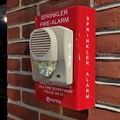
![Wheelock Eluxa horn/strobe at Crumbl Cookies [03]](../../../i/upload/2024/07/20/20240720093720-3becb7a0-sq.jpg)
![Wheelock Eluxa horn/strobe at Crumbl Cookies [02]](../../../i/upload/2024/07/20/20240720093715-ee3bee7c-sq.jpg)
![Wheelock Eluxa horn/strobe at Crumbl Cookies [01]](../../../i/upload/2024/07/20/20240720093711-fff08b4b-sq.jpg)
![Pirate ship Fearless [01]](../../../i/upload/2024/07/17/20240717101747-bed91083-sq.jpg)
![Pirate ship Fearless [04]](../../../i/upload/2024/07/17/20240717101745-52199156-sq.jpg)
![Pirate ship Fearless [03]](../../../i/upload/2024/07/17/20240717101743-479229c0-sq.jpg)
![Pirate ship Fearless [02]](../../../i/upload/2024/07/17/20240717101740-ba467b84-sq.jpg)
![The Black Eyed Susan [02]](../../../i/upload/2024/07/17/20240717101735-7f59ddac-sq.jpg)
![The Black Eyed Susan [01]](../../../i/upload/2024/07/17/20240717101733-e99f5dfa-sq.jpg)
![The Black Eyed Susan [03]](../../../i/upload/2024/07/17/20240717101730-11dc54f1-sq.jpg)
Information
EXIF Metadata
NIKON CORPORATION NIKON D5300
f/80/10
10/2500
400
0/6
16
- DateTimeOriginal
- 2024:05:31 10:37:15
- DateTimeDigitized
- 2024:05:31 10:37:15
- Make
- NIKON CORPORATION
- Model
- NIKON D5300
- ExposureProgram
- 0
- FocalLengthIn35mmFilm
- 60
- FNumber
- 80/10
- ExposureTime
- 10/2500
- ISOSpeedRatings
- 400
- Flash
- 16
- WhiteBalance
- 0
- XResolution
- 3000000/10000
- YResolution
- 3000000/10000
- ImageWidth
- 5700
- ImageLength
- 3206
- Orientation
- 1
- SamplesPerPixel
- 3
- ExposureBiasValue
- 0/6
- MaxApertureValue
- 45/10
- MeteringMode
- 5
- LightSource
- 0
- UserComment
- ASCII
Powered by Piwigo