, facing west.
More at The Schumin Web:
www.schuminweb.com/2024/06/12/a-weekend-loop-trip/
Ben Schumin is a professional photographer who captures the intricacies of daily life. This image is all rights reserved. Contact me directly for licensing information.")
Ben Schumin Photography Portfolio
Ben Schumin is a professional photographer who captures the intricacies of daily life.
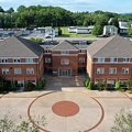
Aerial view of Thornburg, Virginia from just north of Mudd Tavern Road (VA 606), facing west.
![14th Street Bridge [02]](../../../i/upload/2024/07/13/20240713230555-6251844b-sq.jpg)
![14th Street Bridge [01]](../../../i/upload/2024/07/13/20240713230556-69b00670-sq.jpg)

![Vienna station entrance pylon [01]](../../../i/upload/2024/07/14/20240714102008-0ed574f7-sq.jpg)
![Vienna station entrance pylon [03]](../../../i/upload/2024/07/14/20240714170840-9663f724-sq.jpg)


![March on Crystal City [40]](../../../i/upload/2024/07/16/20240716002045-d9f8f4b7-sq.jpg)

![Bradley Manning rally [01]](../../../i/upload/2024/07/16/20240716231002-b2b608e9-sq.jpg)
![Bradley Manning rally [17]](../../../i/upload/2024/07/16/20240716231007-6e507a7d-sq.jpg)
![Bradley Manning rally [02]](../../../i/upload/2024/07/16/20240716231012-593a37f1-sq.jpg)
![Bradley Manning rally [18]](../../../i/upload/2024/07/16/20240716231021-82dc4e8f-sq.jpg)
![Bradley Manning rally [03]](../../../i/upload/2024/07/16/20240716231025-6e5199d7-sq.jpg)
![Bradley Manning rally [19]](../../../i/upload/2024/07/16/20240716231030-5a52ecc1-sq.jpg)
![Bradley Manning rally [04]](../../../i/upload/2024/07/16/20240716231040-67306437-sq.jpg)
![Bradley Manning rally [20]](../../../i/upload/2024/07/16/20240716231044-7e978885-sq.jpg)
![Bradley Manning rally [05]](../../../i/upload/2024/07/16/20240716231048-d346a008-sq.jpg)
![Bradley Manning rally [21]](../../../i/upload/2024/07/16/20240716231053-97ca21f7-sq.jpg)
![Bradley Manning rally [06]](../../../i/upload/2024/07/16/20240716231058-01ebbb5d-sq.jpg)
![Bradley Manning rally [07]](../../../i/upload/2024/07/16/20240716231102-da173da4-sq.jpg)
![Bradley Manning rally [08]](../../../i/upload/2024/07/16/20240716231106-38efa176-sq.jpg)
![Bradley Manning rally [09]](../../../i/upload/2024/07/16/20240716231110-431317f6-sq.jpg)
![Bradley Manning rally [10]](../../../i/upload/2024/07/16/20240716231113-9cabd302-sq.jpg)
![Bradley Manning rally [11]](../../../i/upload/2024/07/16/20240716231117-b215197a-sq.jpg)
![Bradley Manning rally [12]](../../../i/upload/2024/07/16/20240716231121-880f5fd4-sq.jpg)
![Bradley Manning rally [13]](../../../i/upload/2024/07/16/20240716231125-0166646a-sq.jpg)
![Bradley Manning rally [14]](../../../i/upload/2024/07/16/20240716231129-960f2fdb-sq.jpg)
![Bradley Manning rally [15]](../../../i/upload/2024/07/16/20240716231133-3029498b-sq.jpg)
![Bradley Manning rally [16]](../../../i/upload/2024/07/16/20240716231137-22332404-sq.jpg)
![Silver Spring Zombie Walk 2011 [23]](../../../i/upload/2024/07/16/20240716234522-90eda298-sq.jpg)


![Ford F-1 pickup truck [01]](../../../i/upload/2024/07/17/20240717225332-a29606f9-sq.jpg)
![Ford F-1 pickup truck [02]](../../../i/upload/2024/07/17/20240717225335-67ce1cb0-sq.jpg)
![Ford F-1 pickup truck [03]](../../../i/upload/2024/07/17/20240717225338-1da4340a-sq.jpg)
![Ford F-1 pickup truck [04]](../../../i/upload/2024/07/17/20240717225342-e35b749c-sq.jpg)
![Shell on Route 1 in Laurel, Maryland [Alternate]](../../../i/upload/2024/07/17/20240717225907-9c8ec928-sq.jpg)

![Beltway Motel guest building [01]](../../../i/upload/2024/07/17/20240717231219-0d35a46b-sq.jpg)
![Beltway Motel guest building [02]](../../../i/upload/2024/07/17/20240717231226-81d0ce3b-sq.jpg)

![Weis gas station [01]](../../../i/upload/2024/07/17/20240717231234-022b8afd-sq.jpg)
![Weis gas station [02]](../../../i/upload/2024/07/17/20240717231237-50a415f5-sq.jpg)

![Taco Bell in Beltsville, Maryland [01]](../../../i/upload/2024/07/17/20240717231511-1285a363-sq.jpg)
![Taco Bell in Beltsville, Maryland [02]](../../../i/upload/2024/07/17/20240717231514-1c3728de-sq.jpg)
![Marker graffiti in Harpers Ferry train station tunnel [01]](../../../i/upload/2024/07/17/20240717232500-b88dbefb-sq.jpg)
![One World Trade Center [01]](../../../i/upload/2024/07/18/20240718124752-de2c9bd6-sq.jpg)
![One World Trade Center [02]](../../../i/upload/2024/07/18/20240718124755-db8ceab3-sq.jpg)
![One World Trade Center [03]](../../../i/upload/2024/07/18/20240718124758-f49d490e-sq.jpg)
![One World Trade Center [04]](../../../i/upload/2024/07/18/20240718124802-3b50f133-sq.jpg)
![One World Trade Center [05]](../../../i/upload/2024/07/18/20240718124805-0e5f5323-sq.jpg)
![One World Trade Center [06]](../../../i/upload/2024/07/18/20240718124809-373a6fd0-sq.jpg)
![One World Trade Center [07]](../../../i/upload/2024/07/18/20240718124812-d6f1c202-sq.jpg)
![One World Trade Center [08]](../../../i/upload/2024/07/18/20240718124815-04727544-sq.jpg)
![One World Trade Center [09]](../../../i/upload/2024/07/18/20240718124818-7ddf736b-sq.jpg)

![One World Trade Center [10]](../../../i/upload/2024/07/18/20240718124825-a7fce152-sq.jpg)
![One World Trade Center [11]](../../../i/upload/2024/07/18/20240718124828-fc118915-sq.jpg)
![One World Trade Center [12]](../../../i/upload/2024/07/18/20240718124832-bb8709de-sq.jpg)
![One World Trade Center [13]](../../../i/upload/2024/07/18/20240718124835-78f9b19a-sq.jpg)
![One World Trade Center [14]](../../../i/upload/2024/07/18/20240718124839-6cad6ebc-sq.jpg)
![One World Trade Center [15]](../../../i/upload/2024/07/18/20240718124842-72d83f39-sq.jpg)
![One World Trade Center [16]](../../../i/upload/2024/07/18/20240718124845-46a1f99e-sq.jpg)

![Milepost 153 [01]](../../../i/upload/2024/07/18/20240718223813-89a4b0f9-sq.jpg)
![Milepost 153 [02]](../../../i/upload/2024/07/18/20240718223818-48abc44e-sq.jpg)

![Platforms at Rosedale station [02]](../../../i/upload/2024/07/19/20240719003251-c146e77b-sq.jpg)


![Entrance to Rosedale station [02]](../../../i/upload/2024/07/19/20240719003436-37f8f0ad-sq.jpg)
![Entrance to Rosedale station [01]](../../../i/upload/2024/07/19/20240719003443-eed5259a-sq.jpg)
![Platforms at Rosedale station [01]](../../../i/upload/2024/07/19/20240719003446-84ca2ab4-sq.jpg)


![Entrance to Rosedale station [03]](../../../i/upload/2024/07/19/20240719003459-8cff3eb1-sq.jpg)
![Entrance to Rosedale station [04]](../../../i/upload/2024/07/19/20240719003502-9d770a6f-sq.jpg)
![Signage at Times Square-42nd Street station [02]](../../../i/upload/2024/07/19/20240719003853-4c958cf9-sq.jpg)
![Signage at Times Square-42nd Street station [01]](../../../i/upload/2024/07/19/20240719003901-4d6d5caf-sq.jpg)
![Signage at Times Square-42nd Street station [03]](../../../i/upload/2024/07/19/20240719003908-38f40de8-sq.jpg)
![Signage for Exit 49 on Interstate 295 [05]](../../../i/upload/2024/07/19/20240719092857-ab204ec0-sq.jpg)
![Signage for Exit 49 on Interstate 295 [06]](../../../i/upload/2024/07/19/20240719092924-a67ffbc2-sq.jpg)
![Signage for Exit 49 on Interstate 295 [04]](../../../i/upload/2024/07/19/20240719092929-00e8a658-sq.jpg)
![Signage for Exit 49 on Interstate 295 [03]](../../../i/upload/2024/07/19/20240719092934-ceaf9b98-sq.jpg)
![Signage for Exit 49 on Interstate 295 [02]](../../../i/upload/2024/07/19/20240719092939-b220cdd7-sq.jpg)
![Signage for Exit 49 on Interstate 295 [01]](../../../i/upload/2024/07/19/20240719093116-72eb08f8-sq.jpg)
![Express Food Mart [01]](../../../i/upload/2024/07/19/20240719093622-0ee29536-sq.jpg)
![Express Food Mart [02]](../../../i/upload/2024/07/19/20240719093626-e15f57ee-sq.jpg)
![Express Food Mart [03]](../../../i/upload/2024/07/19/20240719093631-4bf195fc-sq.jpg)
![Mileage sign on US 1 near Fredericksburg [01]](../../../i/upload/2024/07/19/20240719093650-38b7882f-sq.jpg)
![Mileage sign on US 1 near Fredericksburg [02]](../../../i/upload/2024/07/19/20240719093655-959f4e08-sq.jpg)
![LoanMax in former Wendy's [01]](../../../i/upload/2024/07/19/20240719093700-69f477c9-sq.jpg)
![LoanMax in former Wendy's [02]](../../../i/upload/2024/07/19/20240719093705-d597deaf-sq.jpg)

![King Pollo in Woodbridge, Virginia [01]](../../../i/upload/2024/07/19/20240719093746-13a6ace7-sq.jpg)
![Captain D's in Fredericksburg, Virginia [01]](../../../i/upload/2024/07/19/20240719093750-210b7059-sq.jpg)
![Captain D's in Fredericksburg, Virginia [02]](../../../i/upload/2024/07/19/20240719093754-51e52bde-sq.jpg)

![Ondura water tower [01]](../../../i/upload/2024/07/19/20240719093801-c95e94f9-sq.jpg)
![Ondura water tower [02]](../../../i/upload/2024/07/19/20240719093821-34fffbd8-sq.jpg)
![Water tower in Savage, Maryland [04]](../../../i/upload/2024/07/19/20240719103806-deb626cd-sq.jpg)
![Water tower in Savage, Maryland [03]](../../../i/upload/2024/07/19/20240719103811-1a1ca0df-sq.jpg)
![Water tower in Savage, Maryland [02]](../../../i/upload/2024/07/19/20240719103815-c8856494-sq.jpg)
![Water tower in Savage, Maryland [01]](../../../i/upload/2024/07/19/20240719103821-63a6197c-sq.jpg)
![Neon sign at Giant Food in Laurel, Maryland [05]](../../../i/upload/2024/07/19/20240719103854-6056903e-sq.jpg)
![Neon sign at Giant Food in Laurel, Maryland [12]](../../../i/upload/2024/07/19/20240719103904-318215f7-sq.jpg)
![Neon sign at Giant Food in Laurel, Maryland [11]](../../../i/upload/2024/07/19/20240719103909-64e9c191-sq.jpg)
![Neon sign at Giant Food in Laurel, Maryland [10]](../../../i/upload/2024/07/19/20240719103914-98743bec-sq.jpg)
![Neon sign at Giant Food in Laurel, Maryland [09]](../../../i/upload/2024/07/19/20240719103919-da9d88cc-sq.jpg)
![Neon sign at Giant Food in Laurel, Maryland [08]](../../../i/upload/2024/07/19/20240719103924-8bb1061e-sq.jpg)
![Neon sign at Giant Food in Laurel, Maryland [07]](../../../i/upload/2024/07/19/20240719103929-4009fcd8-sq.jpg)
![Neon sign at Giant Food in Laurel, Maryland [06]](../../../i/upload/2024/07/19/20240719103934-84b3f041-sq.jpg)
![Neon sign at Giant Food in Laurel, Maryland [04]](../../../i/upload/2024/07/19/20240719103939-4e125380-sq.jpg)
![Neon sign at Giant Food in Laurel, Maryland [03]](../../../i/upload/2024/07/19/20240719103943-7135247e-sq.jpg)
![Neon sign at Giant Food in Laurel, Maryland [02]](../../../i/upload/2024/07/19/20240719103948-46cddff5-sq.jpg)
![Neon sign at Giant Food in Laurel, Maryland [01]](../../../i/upload/2024/07/19/20240719103953-25c5181a-sq.jpg)
![Dollar Tree in Waynesboro, Pennsylvania [01]](../../../i/upload/2024/07/19/20240719104646-c9486c56-sq.jpg)
![Dollar Tree in Waynesboro, Pennsylvania [02]](../../../i/upload/2024/07/19/20240719104746-088fd9e1-sq.jpg)
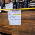
![Tip jar at Pike Kitchen [01]](../../../i/upload/2024/07/19/20240719111523-2b484501-sq.jpg)
![Tip jar at Pike Kitchen [02]](../../../i/upload/2024/07/19/20240719111528-5677c244-sq.jpg)
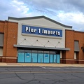
![Former Pier 1 Imports at Pike Center [01]](../../../i/upload/2024/07/19/20240719113201-2f3d7764-sq.jpg)
![Former Pier 1 Imports at Twinbrook Metro Center [02]](../../../i/upload/2024/07/19/20240719113206-c4842b4a-sq.jpg)
![Former Pier 1 Imports at Twinbrook Metro Center [03]](../../../i/upload/2024/07/19/20240719113211-1e40f9cc-sq.jpg)
![Former Pier 1 Imports at Twinbrook Metro Center [01]](../../../i/upload/2024/07/19/20240719113216-e70656b3-sq.jpg)
![Floor indicator on Johnson Street parking garage elevator [01]](../../../i/upload/2024/07/19/20240719115943-1835bb92-sq.jpg)
![Floor indicator on Johnson Street parking garage elevator [02]](../../../i/upload/2024/07/19/20240719115948-18ad328e-sq.jpg)
![Elevator panel at Hotel 24 South [01]](../../../i/upload/2024/07/19/20240719120103-cc227231-sq.jpg)
![Elevator panel at Hotel 24 South [02]](../../../i/upload/2024/07/19/20240719120112-212b6665-sq.jpg)
![Fire alarm bell at 1 East Beverley Street [01]](../../../i/upload/2024/07/19/20240719120310-539f8047-sq.jpg)
![Fire alarm bell at 1 East Beverley Street [03]](../../../i/upload/2024/07/19/20240719120315-85414b50-sq.jpg)
![Fire alarm bell at 1 East Beverley Street [04]](../../../i/upload/2024/07/19/20240719120320-c7f54296-sq.jpg)
![Fire alarm bell at 1 East Beverley Street [02]](../../../i/upload/2024/07/19/20240719120409-a22db44d-sq.jpg)
![Fire alarm bell at 1 East Beverley Street [05]](../../../i/upload/2024/07/19/20240719120414-64fd6b2b-sq.jpg)
![Former Pier 1 Imports at Pike Center [02]](../../../i/upload/2024/07/19/20240719153039-511c55e4-sq.jpg)
![Former Pier 1 Imports at Pike Center [03]](../../../i/upload/2024/07/19/20240719153043-6bbfb8f7-sq.jpg)
![Former Pier 1 Imports at Pike Center [04]](../../../i/upload/2024/07/19/20240719153105-e6d2066b-sq.jpg)
![US Route 1 and CSX bridges over the Occoquan River [04]](../../../i/upload/2024/07/19/20240719165015-7daa0318-sq.jpg)
![US Route 1 and CSX bridges over the Occoquan River [02]](../../../i/upload/2024/07/19/20240719165109-05002e7d-sq.jpg)
![US Route 1 and CSX bridges over the Occoquan River [01]](../../../i/upload/2024/07/19/20240719165202-fbc052c5-sq.jpg)
![US Route 1 and CSX bridges over the Occoquan River [03]](../../../i/upload/2024/07/19/20240719165233-1c08fb03-sq.jpg)
![Sign advertising one-bedroom apartments [02]](../../../i/upload/2024/07/19/20240719175042-eef18deb-sq.jpg)
![Sign advertising one-bedroom apartments [03]](../../../i/upload/2024/07/19/20240719175138-98d3e95c-sq.jpg)
![Sign advertising one-bedroom apartments [04]](../../../i/upload/2024/07/19/20240719175200-6ed4c4b1-sq.jpg)
![Sign advertising one-bedroom apartments [01]](../../../i/upload/2024/07/19/20240719175211-f57e0b8c-sq.jpg)
![Candy in a vending machine [01]](../../../i/upload/2024/07/19/20240719183543-4200f2c4-sq.jpg)
![Candy in a vending machine [02]](../../../i/upload/2024/07/19/20240719183547-9f54582d-sq.jpg)

![Stairwell at Zane Showker Hall [02]](../../../i/upload/2024/07/20/20240720021130-e6c89fb0-sq.jpg)
![Walmart in Covington, Virginia [02]](../../../i/upload/2024/07/20/20240720021510-d3497428-sq.jpg)
![Toilet at Sysco Discount Food Center [01]](../../../i/upload/2024/07/20/20240720091637-384363aa-sq.jpg)
![Toilet at Sysco Discount Food Center [02]](../../../i/upload/2024/07/20/20240720091645-32ad7114-sq.jpg)
![Selfie at Ward Plaza [02]](../../../i/upload/2024/07/20/20240720101023-f20b7a9f-sq.jpg)
![Selfie at Ward Plaza [01]](../../../i/upload/2024/07/20/20240720101120-92b8de4b-sq.jpg)


![Signs at intersection of TN 1/US 70 and TN 101/TN 392 [01]](../../../i/upload/2024/07/20/20240720113107-0500fd1e-sq.jpg)
![Signs at intersection of TN 1/US 70 and TN 101/TN 392 [02]](../../../i/upload/2024/07/20/20240720113333-addad014-sq.jpg)
![Signs at intersection of TN 1/US 70 and TN 101/TN 392 [03]](../../../i/upload/2024/07/20/20240720113359-3820c777-sq.jpg)


![One World Trade Center at night [01]](../../../i/upload/2024/07/20/20240720143735-61514de6-sq.jpg)
![One World Trade Center at night [02]](../../../i/upload/2024/07/20/20240720143904-56fec316-sq.jpg)
![One World Trade Center at night [03]](../../../i/upload/2024/07/20/20240720143920-2827cee2-sq.jpg)
![One World Trade Center at night [04]](../../../i/upload/2024/07/20/20240720143946-5cb01030-sq.jpg)

![High rises east of Duffield Street [01]](../../../i/upload/2024/07/20/20240720150910-544dbb2e-sq.jpg)
![High rises east of Duffield Street [02]](../../../i/upload/2024/07/20/20240720150916-1568aed9-sq.jpg)
![Clock on top of an information kiosk at Grand Central Terminal [01]](../../../i/upload/2024/07/20/20240720151030-16f228db-sq.jpg)
![Clock on top of an information kiosk at Grand Central Terminal [03]](../../../i/upload/2024/07/20/20240720151037-22f04a30-sq.jpg)
![Clock on top of an information kiosk at Grand Central Terminal [02]](../../../i/upload/2024/07/20/20240720151116-dd6aece3-sq.jpg)
![Thomas Jefferson School No. 1 [01]](../../../i/upload/2024/07/20/20240720151402-7377c838-sq.jpg)
![Thomas Jefferson School No. 1 [02]](../../../i/upload/2024/07/20/20240720151630-5714f697-sq.jpg)
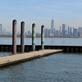
![Hudson River near New York City [01]](../../../i/upload/2024/07/20/20240720151646-3a0cca88-sq.jpg)
![Hudson River near New York City [02]](../../../i/upload/2024/07/20/20240720151717-5790e813-sq.jpg)
![Hudson River near New York City [03]](../../../i/upload/2024/07/20/20240720151734-d0ff4398-sq.jpg)
![Hudson River near New York City [04]](../../../i/upload/2024/07/20/20240720151745-040101e1-sq.jpg)
![View of I-395 from WMATA bridge [01]](../../../i/upload/2024/07/20/20240720152049-23fc29cb-sq.jpg)
![View of I-395 from WMATA bridge [02]](../../../i/upload/2024/07/20/20240720152054-84a76a6b-sq.jpg)

![Fire alarm at Lyon station [01]](../../../i/upload/2024/07/20/20240720154757-cc9a69fc-sq.jpg)
![Fire alarm at Lyon station [02]](../../../i/upload/2024/07/20/20240720154821-d52434ed-sq.jpg)
![Fire alarm at Lyon station [03]](../../../i/upload/2024/07/20/20240720154845-66e77f4f-sq.jpg)
![Fire alarm at Lyon station [04]](../../../i/upload/2024/07/20/20240720154858-dfc663a0-sq.jpg)


![Kwik Trip gas pump with mute button [01]](../../../i/upload/2024/11/15/20241115001512-3da54edd-sq.jpg)
![Elevator at Sherman Garden Apartments [02]](../../../i/upload/2024/11/16/20241116012112-9677f67e-sq.jpg)
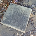
![Grave marker for Billy Critzer [01]](../../../i/upload/2024/11/28/20241128214845-6329a939-sq.jpg)
![Grave marker for Billy Critzer [02]](../../../i/upload/2024/11/28/20241128214850-cc157701-sq.jpg)

![Valley Supermarket IGA [01]](../../../i/upload/2025/01/02/20250102143517-49187aa6-sq.jpg)

Information
- Author
- Ben Schumin
- Copyright
- All Rights Reserved
- Created on
- Saturday 1 June 2024
- Dimensions
- 8064*4536
EXIF Metadata
DJI FC8282
f/170/100
1/2000
200
0/10
0
- DateTimeOriginal
- 2024:06:01 18:40:03
- DateTimeDigitized
- 2024:06:01 18:40:03
- Make
- DJI
- Model
- FC8282
- ExposureProgram
- 2
- FocalLengthIn35mmFilm
- 24
- FNumber
- 170/100
- ExposureTime
- 1/2000
- ISOSpeedRatings
- 200
- Flash
- 0
- WhiteBalance
- 0
- XResolution
- 720000/10000
- YResolution
- 720000/10000
- ImageWidth
- 8064
- ImageLength
- 4536
- Orientation
- 1
- SamplesPerPixel
- 3
- ExposureBiasValue
- 0/10
- MaxApertureValue
- 153/100
- MeteringMode
- 1
- LightSource
- 10
Powered by Piwigo